811 entries match your criteria. Entries 301 through 400 are listed.⊲ Previous 100 — Next 100 ⊳
Historical Markers and War Memorials in North Dakota
By Ruth VanSteenwyk, July 26, 2020
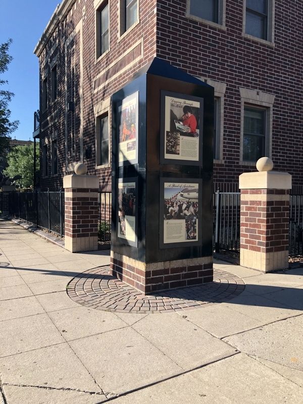
Flames and Flood Marker
301 ► North Dakota, Grand Forks County, Grand Forks — Flames and Flood —  |
| On North 3rd Street at 2nd Avenue North on North 3rd Street. | |||
| 302 ► North Dakota, Grand Forks County, Grand Forks — Grand Forks County Courthouse — National Register of Historic Places — |
| Near South 4th Street just north of Bruce Avenue, on the left when traveling north. | |||
| 303 ► North Dakota, Grand Forks County, Grand Forks — Grand Forks' First Post Office — |
| On Belmont Road. | |||
| 304 ► North Dakota, Grand Forks County, Grand Forks — Grand Forks Flood Protection Project — Dedicated April 22, 2007 — |
| On Demers Avenue at North 3rd Street on Demers Avenue. | |||
| 305 ► North Dakota, Grand Forks County, Grand Forks — Lincoln Drive - a neighborhood history — |
| On Euclid Avenue. | |||
| 306 ► North Dakota, Grand Forks County, Grand Forks — Lustron — |
| On Belmont Road. | |||
| 307 ► North Dakota, Grand Forks County, Grand Forks — New Hampshire Apartments — 105 North Third Street — 1904 - 1997 — |
| On North 3rd Street at 1st Avenue North on North 3rd Street. | |||
| 308 ► North Dakota, Grand Forks County, Grand Forks — North Dakota's Oldest Concrete Pavement — |
| On Belmont Road. | |||
| 309 ► North Dakota, Grand Forks County, Grand Forks — Oxcarts — |
| Near Belmont Road at 24th Avenue South, on the right when traveling north. | |||
| 310 ► North Dakota, Grand Forks County, Grand Forks — Rebuilding and Recovery — |
| On North 3rd Street near 2nd Avenue North. | |||
| 311 ► North Dakota, Grand Forks County, Grand Forks — Returning to Devastation — |
| On North 3rd Street at 2nd Avenue North on North 3rd Street. | |||
| 312 ► North Dakota, Grand Forks County, Grand Forks — Security Trust Company — 101 North Third Street — 1889 - 1997 — |
| On North 3rd Street at 1st Avenue North on North 3rd Street. | |||
| 313 ► North Dakota, Grand Forks County, Grand Forks — The Flood Fight Begins — |
| On North 3rd Street at 1st Avenue North on North 3rd Street. | |||
| 314 ► North Dakota, Grand Forks County, Grand Forks — The Flood of 1997 — |
| On 6th Avenue North at North 24th Street on 6th Avenue North. | |||
| 315 ► North Dakota, Grand Forks County, Grand Forks — The Old Red River Ox-Cart Trail — |
| On Belmont Road. | |||
| 316 ► North Dakota, Grand Forks County, Grand Forks — The River Wins — |
| On North 3rd Street at 1st Avenue North on North 3rd Street. | |||
| 317 ► North Dakota, Grand Forks County, Grand Forks — 15 — Votes For Women — Road to the 19th Amendment — National Votes for Women Trail — |
| Near Bruce Avenue at South 4th Street, on the left when traveling north. | |||
| 318 ► North Dakota, Grand Forks County, Grand Forks — Welcome to Memorial Park — |
| On 1st Avenue North at North 3rd Street on 1st Avenue North. | |||
| 319 ► North Dakota, Grand Forks County, Grand Forks Air Force Base — B-25J "Flo" — |
| On 19th Avenue near 25th Street North East. | |||
| 320 ► North Dakota, Grand Forks County, Grand Forks Air Force Base — Minuteman III ICBM — |
| On 19th Avenue at 25th Street North East on 19th Avenue. | |||
| 321 ► North Dakota, Grand Forks County, Grand Forks Air Force Base — Missile Transporter Erector — |
| On 19th Avenue at 25th Street North East on 19th Avenue. | |||
| 322 ► North Dakota, Grand Forks County, Larimore — Larimore City Hall — |
| On Tower Avenue (North Dakota Route 18). | |||
| 323 ► North Dakota, Grand Forks County, Niagara — Old Fort Totten Trail — |
| Near U.S. 2 at 21st Avenue Northeast, on the right when traveling west. | |||
| 324 ► North Dakota, Grant County, Carson — Bismarck-Deadwood Stage Trail — Cannonball Stage Station State Historic Site — |
| Near 53rd Avenue SW, on the right when traveling south. | |||
| 325 ► North Dakota, Grant County, Carson — Cannonball Stage Station — |
| On 53rd Avenue Southwest 1 mile south of 82nd Street Southwest, on the right when traveling south. | |||
| 326 ► North Dakota, Grant County, Carson — Passenger Coaches — Cannonball Stage Station State Historic Site — |
| Near 53rd Avenue SW, on the right when traveling south. | |||
| 327 ► North Dakota, Griggs County, Binford — Camp Atchison Historic Site — |
| On State Highway 1 0.4 miles south of 8th Street NE, on the left when traveling south. | |||
| 328 ► North Dakota, Griggs County, Binford — Lake Jessie Historic Site — |
| Near 9th Street Northeast near 107th Avenue Northeast. | |||
| 329 ► North Dakota, Griggs County, Binford — U.S. Army Wagoneers — Historic Site — |
| On North Dakota Route 65 near 106th Avenue Northwest, on the left when traveling west. | |||
| 330 ► North Dakota, Griggs County, Binford — Watne — Tvedte (Tweed) — |
| On North Dakota Route 65 near 106th Ave Northeast, on the left when traveling west. | |||
| 331 ► North Dakota, Griggs County, Cooperstown — Griggs County Court House — Erected - 1885 — |
| On Rollin Avenue Southwest just west of 9th Street Southeast (State Highway 45), on the left when traveling west. | |||
| 332 ► North Dakota, Griggs County, Cooperstown — Launch Facility Security — Ronald Reagan Minuteman Missile State Historic Site — November-33 Launch Facility — |
| Near 2nd Street NE (North Dakota Route 200) 0.2 miles east of 116th Avenue NE, on the right when traveling east. | |||
| 333 ► North Dakota, Griggs County, Cooperstown — Launcher Closure Door — Ronald Reagan Minuteman Missile State Historic Site — November-33 Launch Facility — |
| Near North Dakota Route 200 0.2 miles east of 116th Avenue NE, on the right when traveling east. | |||
| 334 ► North Dakota, Griggs County, Cooperstown — Missile Maintenance — Ronald Reagan Minuteman Missile State Historic Site - — November-33 Launch Facility — |
| Near North Dakota Route 200 0.2 miles 116th Avenue NE, on the right when traveling east. | |||
| 335 ► North Dakota, Griggs County, Cooperstown — Missile Transport — Ronald Reagan Minuteman Missile State Historic Site — November-33 Launch Facility — |
| Near 2nd Street NE (North Dakota Route 200) 0.2 miles east of 116th Avenue NE, on the right when traveling east. | |||
| 336 ► North Dakota, Griggs County, Cooperstown — More than Meets the Eye — Ronald Reagan Minuteman Missile State Historic Site — November-33 Launch Facility — |
| Near North Dakota Route 200 0.2 miles east of 116th Avenue NE, on the right when traveling east. | |||
| 337 ► North Dakota, Griggs County, Cooperstown — November-33: "Ace in the Hole" — Ronald Reagan Minuteman Missile State Historic Site — November-33 Launch Facility — |
| On 2nd Street NE (North Dakota Route 200) 0.2 miles east of 116th Avenue NE, on the right when traveling east. | |||
| 338 ► North Dakota, Griggs County, Cooperstown — Opheim Cabin — First Permanent Home in Griggs County — |
| On 9th Street Southeast (State Highway 45) just north of Odegard Avenue Southwest, on the left when traveling north. | |||
| 339 ► North Dakota, Griggs County, Cooperstown — Oscar-Zero: Command, Control and Support — |
| On 113th 1/2 Avenue Northeast near 113th Avenue Northeast (State Route 45), on the left when traveling north. | |||
| 340 ► North Dakota, Griggs County, Cooperstown — Strategic Arms Reduction Treaty (START) — Ronald Reagan Minuteman Missile State Historic Site — November-33 Launch Facility — |
| Near 2nd Street NE (North Dakota Route 200) 0.2 miles east of 116th Avenue NE, on the right when traveling east. | |||
| 341 ► North Dakota, Griggs County, Cooperstown — The Minuteman: America's "Ace in the Hole" — Ronald Reagan Minuteman Missile State Historic Site — November-33 Launch Facility — |
| Near 2nd Street NE (North Dakota Route 200) 0.2 miles east of 116th Avenue NE, on the right when traveling east. | |||
| 342 ► North Dakota, Hettinger County, Mott — Detachment One Company C — 141st Engineer Combat Battalion, Corps (Whl) — Mott, North Dakota — |
| On Brown Avenue just north of East 5th Street, on the right when traveling north. | |||
| 343 ► North Dakota, Kidder County, Dawson — Dawson Congregational Church Bell — |
| On Lake Avenue at Thompson Street South East, on the right when traveling north on Lake Avenue. | |||
| 344 ► North Dakota, Kidder County, Dawson — Dawson Veterans Memorial Park — |
| On Lake Avenue at Thompson Street, on the right when traveling north on Lake Avenue. | |||
| 345 ► North Dakota, Kidder County, Steele — The World's Largest Sandhill Crane — |
| On 5th Street North East 0.1 miles east of Mitchell Avenue North. | |||
| 346 ► North Dakota, Kidder County, Tappen — Dr. J.S. Weiser — |
| Near 27th Street SE 1 mile east of 40th Avenue SE. | |||
| 347 ► North Dakota, Kidder County, Tappen — Sibley Trail — |
| Near 30th Street Southeast near 39th Avenue Southeast. | |||
| 348 ► North Dakota, Lamoure County, Edgeley — Ray Schlosser — Aug 29, 1911 - April 22, 1995 — |
| Near U.S. 281 0.3 miles north of 65th St. SE. | |||
| 349 ► North Dakota, LaMoure County, Grand Rapids, Grand Rapids Township — Grand Rapids, North Dakota — The Chan SanSan Scenic Backway — James River Valley Scenic Backway — |
| On 7th Street North at Taylor Aveenue, on the right when traveling west on 7th Street North. | |||
| 350 ► North Dakota, LaMoure County, Grand Rapids, Grand Rapids Township — Lamoure County Museum — |
| On 66th Street Southeast. | |||
| 351 ► North Dakota, Lamoure County, Kulm — In Memory of the Sioux Indians — |
| Near 86th Street Southeast near 73rd Avenue Southeast. | |||
| 352 ► North Dakota, Lamoure County, Kulm — In Memory of the Soldiers — |
| Near 73rd Avenue Southeast near 86th Avenue Southeast. | |||
| 353 ► North Dakota, Lamoure County, Kulm — Whitestone Hill Battlefield State Historic Site — |
| Near 73rd Avenue Southeast near 86th Avenue Southeast. | |||
| 354 ► North Dakota, LaMoure County, LaMoure — Civilian Conservation Corps Project — |
| On State Highway 13 0.6 miles west of Main St, on the right when traveling east. | |||
| 355 ► North Dakota, LaMoure County, LaMoure — Honorable Milton R. Young — |
| On 3rd Avenue Southwest (State Highway 13) 0.2 miles west of Main St, on the left when traveling east. | |||
| 356 ► North Dakota, LaMoure County, LaMoure — LaMoure County Courthouse — |
| On 4th Avenue Northeast at 2nd St. NE, on the right when traveling west on 4th Avenue Northeast. | |||
| 357 ► North Dakota, LaMoure County, LaMoure — Steamboats on the River — |
| On State Highway 13 0.2 miles west of Main St, on the left when traveling east. | |||
| 358 ► North Dakota, LaMoure County, LaMoure — Symbol of Freedom — |
| On 3rd Avenue Southwest (State Highway 13) 0.2 miles west of Main St, on the left when traveling east. | |||
| 359 ► North Dakota, LaMoure County, LaMoure, Ryan Township — Early Settlers of the Valley — The Chan SanSan Scenic Backway — James River Valley Scenic Backway — |
| On County Road 60 0.3 miles south of 76 1/2 Street Southeast, on the left when traveling south. | |||
| 360 ► North Dakota, LaMoure County, Verona — 1916 Block — |
| On 4th Street north of 2nd Avenue, on the left when traveling north. | |||
| 361 ► North Dakota, Logan County, Napoleon — Oley T. Thompson — Historical Marker — |
| On North Dakota Route 3 at 65th Street SE on North Dakota Route 3. | |||
| 362 ► North Dakota, McHenry County, Granville — Gilbert Peterson Cabin — Built 1890 — |
| On McHenry Avenue north of 3rd Street, on the left when traveling north. | |||
| 363 ► North Dakota, McHenry County, Velva — Peterson Homestead Cabin — |
| Near 2nd Avenue West just west of 5th Street West, on the right when traveling west. | |||
| 364 ► North Dakota, McIntosh County, Ashley — Ashley Jewish Homesteaders Cemetery — |
| On 48th Ave. | |||
| 365 ► North Dakota, McIntosh County, Ashley — Ashley Jewish Homesteaders Cemetery — |
| On 48th Ave. | |||
| 366 ► North Dakota, McIntosh County, Ashley — Hoskins Settlement — 1884 - 1888 — |
| On County Highway 11 0.7 miles west of 45th Avenue SE. | |||
| 367 ► North Dakota, McIntosh County, Wishek — Wishek, North Dakota Veterans Memorial — |
| On 4th Avenue South at South 9th Street on 4th Avenue South. | |||
| 368 ► North Dakota, McKenzie County, Cartwright — Fairview Lift Bridge — |
| On Black Top Road near State Highway 200. | |||
| 369 ► North Dakota, McKenzie County, Cartwright — Hjalmer Nelson Memorial Bridge — 1955 - 1997 — |
| Near Black Top Road near Highway 200. | |||
| 370 ► North Dakota, McKenzie County, Cartwright — The Cartwright Tunnel — |
| Near Black Top Road near State Highway 200. | |||
| 371 ► North Dakota, McKenzie County, Cartwright — The Montana Eastern Railway Company — 1912 - 1935 — Great Northern's Second Main — |
| Near Black Top Road near State Highway 200. | |||
| 372 ► North Dakota, McKenzie County, Grassy Butte — Grassy Butte Post Office Museum — |
| On Museum Drive at Main Streett, on the right when traveling north on Museum Drive. | |||
| 373 ► North Dakota, McKenzie County, Grassy Butte — Longhorns |
| On Scenic Drive, on the left when traveling north. Reported permanently removed. | |||
| 374 ► North Dakota, McKenzie County, Grassy Butte — Work in Progress / Better Together — Theodore Roosevelt National Park — National Park Service, U.S. Department of the Interior — |
| On Scenic Drive west of CanAm Highway (U.S. 85), on the left when traveling west. | |||
| 375 ► North Dakota, McKenzie County, Schafer — The Schafer Jail — |
| Near 121st Avenue North West near State Highway 23, on the left when traveling north. | |||
| 376 ► North Dakota, McKenzie County, Schafer — The Schafer Jail — |
| Near 121st Avenue North West near State Highway 23, on the left when traveling south. | |||
| 377 ► North Dakota, McKenzie County, Watford City — “Cannon Ball” Concretions |
| On Scenic Drive, on the right when traveling north. Reported permanently removed. | |||
| 378 ► North Dakota, McKenzie County, Watford City — A Wild River / Growing Old / Cotton — |
| On Scenic Drive, on the right when traveling west. | |||
| 379 ► North Dakota, McKenzie County, Watford City — Badlands Panorama — |
| On Theodore Roosevelt Expressway (U.S. 85), on the right when traveling north. | |||
| 380 ► North Dakota, McKenzie County, Watford City — Bentonitic Clay — |
| On Scenic Drive, on the right when traveling north. | |||
| 381 ► North Dakota, McKenzie County, Watford City — Building From Hard Times |
| On Scenic Drive, on the left when traveling north. Reported permanently removed. | |||
| 382 ► North Dakota, McKenzie County, Watford City — Cannonball Mystery — |
| On Scenic Drive, on the right when traveling west. | |||
| 383 ► North Dakota, McKenzie County, Watford City — Edge of a Glacier |
| On Scenic Drive, on the right when traveling north. Reported permanently removed. | |||
| 384 ► North Dakota, McKenzie County, Watford City — Great Western Trail — |
| Near 2nd Avenue Southwest at Main Street South (State Highway 23), on the left when traveling west. | |||
| 385 ► North Dakota, McKenzie County, Watford City — Layers in Time / Portraits in Stone — |
| On Scenic Drive, on the left when traveling west. | |||
| 386 ► North Dakota, McKenzie County, Watford City — Long X Cattle Trail |
| On Scenic Drive, on the right when traveling north. Reported permanently removed. | |||
| 387 ► North Dakota, McKenzie County, Watford City — Man and Grass |
| On Scenic Drive, on the right when traveling north. Reported permanently removed. | |||
| 388 ► North Dakota, McKenzie County, Watford City — North Dakota Badlands — |
| On Scenic Drive. | |||
| 389 ► North Dakota, McKenzie County, Watford City — Ox Bow Bend Overlook — |
| Near Scenic Drive. | |||
| 390 ► North Dakota, McKenzie County, Watford City — Roosevelt and the Boat Thieves |
| On Scenic Drive. Reported permanently removed. | |||
| 391 ► North Dakota, McKenzie County, Watford City — Slump Formation |
| On Scenic Drive, on the right when traveling north. Reported permanently removed. | |||
| 392 ► North Dakota, McKenzie County, Watford City — The Long X Trail: A Dusty Trail to Greener Pastures — |
| On Scenic Drive, on the right when traveling west. | |||
| 393 ► North Dakota, McKenzie County, Watford City — The View that Launched a Park — Rebuilding a Nation - Building a Park — |
| On Cedar Canyon Road, aka Scenic Drive near Theodore Roosevelt Expressway (U.S. 85), on the left when traveling west. | |||
| 394 ► North Dakota, McKenzie County, Watford City — Theodore Roosevelt National Park — In Honor of our Convervation President — National Park Service, U.S. Department of the Interior — |
| On Scenic Drive west of CanAm Highway (U.S. 85), on the right when traveling west. | |||
| 395 ► North Dakota, McKenzie County, Watford City — Tilted — Slump Block Formation — |
| On Scenic Drive, on the right when traveling west. | |||
| 396 ► North Dakota, McKenzie County, Watford City — Tobacco Garden Bay — Wednesday, April 17, 1805 — |
| Near State Highway 1806 near Baywatch Lane, on the left when traveling north. | |||
| 397 ► North Dakota, McKenzie County, Watford City — Walter H. Chaloner — |
| On Theodore Roosevelt Expressway (U.S. 85), on the right when traveling north. | |||
| 398 ► North Dakota, McKenzie County, Williston — Lewis & Clark Wildlife Management Area — Sunday, April 21, 1805 — |
| Near Theodore Roosevelt Expressway (U.S. 85) near 46th Street North West, on the right when traveling north. | |||
| 399 ► North Dakota, McLean County, Coleharbor — Garrison Dam Overlook — Lewis and Clark in North Dakota — |
| On State Highway 200 near West Missouri Drive, on the right when traveling west. | |||
| 400 ► North Dakota, McLean County, Garrison — A Blank Canvas — Lewis and Clark in North Dakota — |
| Near 41st Avenue NW near Scooter Drive. | |||
811 entries matched your criteria. Entries 301 through 400 are listed above. ⊲ Previous 100 — Next 100 ⊳