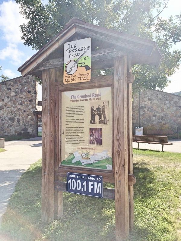
From the Blue Ridge Mountains to the Coalfields
region, Southwest Virginia is blessed with historic
and contemporary music venues, musicians, and
fretted instrument makers. Historically isolated, the
region retained its strong musical legacy by . . . — — Map (db m108225) HM
The community center was first known as Crab Orchard. The place became the county seat of Bland County when it was formed in 1861 under the name of Seddon, which was later changed to that of the county. At Rocky Gap a skirmish was fought in Crook’s . . . — — Map (db m44855) HM
1861-1865
Erected 1911 by Bland Chapter U.D.C.
as a lasting memorial
to the gallant sons of Bland County
who gave their lives in defense of
their beloved Southland
Our Heroes — — Map (db m228365) WM
This bell is a symbol of Bland County's rich history. In 1873, John M. Hicks was authorized to purchase the bell for the County's first courthouse. Weighing nearly 1,000 lbs., the bell was cast in solid
bronze by Kaye & Company, Inc.; Louisville, . . . — — Map (db m267920) HM
Here is the home of S.H. Newberry, who, with three others, composed the "Big Four" in the Virginia Senate. These four men united to defeat objectionable measures of the Readjuster movement. — — Map (db m176393) HM
Samuel H. Newberry, a captain in the Confederate army who represented Bland and Pulaski Counties in the Virginia House of Delegates from 1865 to 1867, lived here at Eagle Oak. Newberry served in the Senate of Virginia during the 1870s and 1880s and . . . — — Map (db m43138) HM
An great tribune of the people, noted orator and debater, and intellectual giant of powerful physique.
He interpreted the hopes and aspirations of the people as no man of his day and generation.
Lawyer - Patriot - Statesman
Member . . . — — Map (db m304943) HM
To the sacred memory of the men & women of Bland County who participated in the World War. Sponsored by the Miller T. Burton Post No 20 American Legion, J.R. Stafford, Commander; C.W. Taylor, Adjutant: in conjunction with the Board of Supervisors of . . . — — Map (db m228352) WM
Henry Casper Groseclose (1892–1950), a
native of Ceres, was one of the founders of
Future Farmers of Virginia (FFV). While teaching agricultural education at Virginia Polytechnic
Institute, Groseclose, Walter Newman, Edmund Magill, and . . . — — Map (db m44219) HM
William Elbert Munsey was born a few miles
east in the mountains of Giles (present-day Bland)
County on 13 July 1833. Despite little formal
schooling, Munsey possessed an insatiable
appetite for knowledge. He entered the ministry
of the . . . — — Map (db m44810) HM
In grateful recognition of James A. Williams, Jr., of Wytheville, an ardent supporter of safe, modern highways, has earned the gratitude of all citizens for his tireless efforts as president of the Great Lakes to Florida Highway Association, . . . — — Map (db m304942) HM
• One out of every three mouthfuls of food we eat is delivered to us by pollinators.
• Three-fourths of global crop plants grown for food, spices, beverages, condiments and medicines is pollinated by . . . — — Map (db m281198) HM
Constructed during Bristol's early twentieth-century commercial expansion, this building was developed for retail use along State Street, the principal thoroughfare of the twin cities of Bristol.
The structure is most notably associated with . . . — — Map (db m305053) HM
During the Korean War of 1950-1953, a young Korean became a houseboy for a group of American G.I's of the U.S. Army's 24th Division. One soldier, Sgt. Carl Powers, a school teacher from Dante, Virginia, felt compassion for the little fella and . . . — — Map (db m258051) HM
Bristol. In 1927 the Victor Talking Machine Company sent a portable studio to Bristol, and music publisher Ralph Peer advertised for traditional musicians wishing to try their hand at recording. The test pressings of the resulting “Bristol . . . — — Map (db m67275) HM
Landmark Bridge
between two states
Erected 1910
Placed on the
National Register of Historic Places
by the United States Department of the Interior
September 8, 1988
Marker in memory of Mattie and Jim Owens
Bristol Historical . . . — — Map (db m258841) HM
Presented by Col. J. M. Barker of Bristol, Tenn. to the Chapter of the U.D.C. in memory of the brave men and noble women of Tennessee and Virginia from 1861 to 1865. Erected 1920 — — Map (db m211078) WM
Bristol History
• The cities of Bristol, Virginia (originally Goodson, VA) and Bristol, Tennessee were created in 1856 when two separately built railroads met at the state line.
• The Southern Railway, a portion of which is now the . . . — — Map (db m305060) HM
The Rev. James King donated land for railroad facilities here in 1848, before the town of Bristol took root early in the 1850s. The first passenger train arrived on 1 Oct. 1856 on the railroad later known as the Norfolk and Western (N&W). In 1858, . . . — — Map (db m133882) HM
This Memorial, in remembrance of the Veterans of the Military Services of the United States, has been provided through the vision, perseverance and generosity of William W. Walling — — Map (db m258123) WM
The Sapling Grove tract (Bristol) was surveyed for John Tayloe, 1749. It was owned by Isaac Baker and Evan Shelby, who built a post about 1770. The Virginia tract was bought by John Goodson, whose son founded the town of Goodson, incorporated in . . . — — Map (db m210154) HM
Erected by friends in honor of V.N. “Bud” Phillips who came to Bristol as a total stranger on August 20, 1953 yet in time became one of her best known, highly respected and influential citizens…so much so that “Bud Phillips Day” was celebrated in . . . — — Map (db m67285) HM
Presented by Col. J.M.Barker of Bristol, Tenn. to the Chapter of the U.D.C. in memory of the brave men and noble women of Tennessee and Virginia from 1861 to 1865 — — Map (db m23143) WM
Charles S. Johnson, sociologist, author, and civil rights leader, was born in Bristol, son of a 42-year pastor of Lee Street Baptist Church. He attended Virginia Union University and the University of Chicago and served in combat during World War I. . . . — — Map (db m210163) HM
(West Facing Side)
This monument dedicated to the Confederate Veterans buried in this cemetery
Pvt. John H D Allen, Co. K, 9th Ga. Inf.* •
2nd Lt. William E. Allen Co. I, 60th Tn. Inf. •
Pvt. George W. Ambrose, Co. I, 63rd Tn. Inf. . . . — — Map (db m258823) WM
Emmanuel Episcopal Church was organized on January 26, 1862 with 16 charter members. Rev. Mowbray served as the first priest. For the first few years services were held in other local churches. The first building which housed the new church was . . . — — Map (db m258095) HM
In 1924, Ernest V. "Pop" Stoneman (1893-1968) of Galax, Va., first recorded his self-penned song, "The Sinking of the Titanic", in New York for Ralph Peer at Okeh Records. It was his early commercial and financial success that lured Ralph Peer, the . . . — — Map (db m258046) HM
This property has been placed on the
National Register
of Historic Places
First Baptist Church
Est. 1912
by the United States
Department of the Interior — — Map (db m258831) HM
This cemetery began late February 1857 with the burial here of 5-year-old Nellie Gaines. She was born in early January 1852, a daughter of tenant farmers who then lived on the Samuel Goodson plantation on Beaver Creek about two miles upstream from . . . — — Map (db m258780) HM
Evan Shelby, noted Indian fighter, settled here about 1765 on a tract called "Sapling Grove". His home was a neighborhood fort, the refuge of settlers in Indian attacks. Bristol grew around this place and became an early railroad center. — — Map (db m258191) HM
Evan Shelby settled here about 1770 on a tract called Sapling Grove and established a fort and trading post. By early in the 19th century. James King and Samuel E. Goodson owned hundreds of acres of farmland in this area. Anticipating the arrival of . . . — — Map (db m258192) HM
Johnson (originally named Johnston) Street was the first street to be laid out on Solar Hill in 1871. It was named for Joseph Johnston of Philadelphia, Pennsylvania who sold the land for development. The name evolved into Johnson Street through . . . — — Map (db m258122) HM
This house was built as the grand seat of Rev. James King's vast plantation, first known as Sapling Grove and later Mountain View. Two rooms of the original house built in 1816-17 remain in the present structure. The King family lived here from . . . — — Map (db m258100) HM
King's Alley and King Street were originally part of the Abingdon-Blountville division of the Old Stagecoach Road which was used from 1839-56. At one time four stagecoach runs per day were made. Andrew Johnson was injured here when a hornet flew . . . — — Map (db m258118) HM
In 1865, at the dawn of their freedom from slavery, 42 former members of the white-led Goodson (now First) Baptist Church organized the Anglo African Baptist Church. The congregation met in a series of buildings until, under the leadership of the . . . — — Map (db m210167) HM
Oak Street was named after a large grove of oak trees through which it passed. When the largest was felled in 1902 a fortune in gold coins was found in its hollow core. For a time Oak was known as Fortune Street in popular usage. In time the . . . — — Map (db m258113) HM
Dedicated to the hundreds of patriots from this area who fought in the American Revolution (1775 - 1783).
When the war in the north came to a stalemate by early 1780, the British turned their military strategy to the South. They believed . . . — — Map (db m32611) HM
Scott Street is an extension of an older Bristol, VA street named for General Winfield Scott. While the original structures no longer remain, at one time there were modest houses along its south side and extending a short distance down King's Alley . . . — — Map (db m258115) HM
This site was established in 1857 by Bristol founder Joseph Rhea Anderson for the purpose of a slave cemetery. Buried nearby are twelve slaves including Old Si Goodson, who died in 1862, purportedly at the age of 132, reputed to be the oldest man in . . . — — Map (db m67287) HM
Solar Hill was the first major residential expansion of Bristol/Goodson. Originally the hill was part of the vast James King plantation and was largely covered by upland pastures. In 1859 it was sold to Joseph Johnston who sold it to the town for . . . — — Map (db m258093) HM
Solar Hill was the first major residential expansion of Bristol/Goodson. It was named after an observatory was built to view the great solar eclipse of Aug. 7, 1869. An auction was held on July 5, 1871 to sell lots and development began immediately . . . — — Map (db m258112) HM
Along with several locations in eastern America this hill was chosen as an observation point from which astronomers sent from Washington, D.C. could view the great solar eclipse of August 7, 1869. For this reason the area, which had been known as . . . — — Map (db m258102) HM
Solar Street was named after an observation platform was erected here to view the great solar eclipse of August 7, 1869, The platform was located near the south end of the present street. In 1871 the street was laid out and development began at what . . . — — Map (db m258105) HM
The Crooked Road
Virginia’s Heritage Music Trail
From the Blue Ridge Mountains to the Coalfields region, southwest Virginia is blessed with historic and contemporary music venues, musicians, and fretted instrument makers. Historically . . . — — Map (db m211075) HM
The Crooked Road
Virginia's Heritage Music Trail
Old-time mountain music, bluegrass, and gospel can be enjoyed all year long. Several museums are devoted to showcasing the area's rich music heritage and historical influence. . . . — — Map (db m305052) HM
(lower sign)
Historic Landmark
Bristol
The Best of Two States Preservation Society
Sunrise House
1895
(upper framed plaque)
The Sunrise House 1985
The "Sunrise House" was built about 1895 as a wedding gift for . . . — — Map (db m258120) HM
Bristol resident J.C. Vance pioneered the concept of a Klondike Derby as a Scouting event in Bristol, Virginia, in 1968, and with his brother, Albert J. Vance, successfully launched the first event in 1970. Shortly before his death in 1975, J.C. . . . — — Map (db m135671) HM
Col. Robert Preston (1750-1833) acquired 720 acres here in the 1780s and established Walnut Grove. Preston had emigrated from Ireland in 1773 and worked as assistant surveyor under his relative William Preston, who laid out vast areas of western . . . — — Map (db m210159) HM
In December 1946, WCYB radio went on the air with a clear, high powered signal that could be heard for 100 miles away, or more, from Bristol. From the very launch of the station, one of its signature programs was the noon time show - "Farm and Fun . . . — — Map (db m258050) HM
Since World War I, more than 92,000 American soldiers are unaccounted for.
This unoccupied seat is dedicated to the memory of those brave men and women and to the sacrifices each made in serving this country.
God Bless You. God Bless . . . — — Map (db m304886) WM
Carroll County. Area 458 Square Miles. Formed in 1842 from Grayson, and named for Charles Carroll of Carrollton, signer of the Declaration of Independence. New River runs through this county.
Floyd County. Area 376 . . . — — Map (db m25470) HM
The white patch, dimly visible in the distance, is the Mt. Airy Granite Quarry, largest of its type in the United States. From it came the piece of granite below typically feldspar and quartz with a sprinkling of black biotite mica. This granite . . . — — Map (db m304870) HM
A 35 year veteran of
the Virginia Department of Transportation,
was the Resident Engineer
for Carroll and Floyd Counties
during the construction of
this award-winning section of Interstate 77.
He was: a decorated veteran of W.W. II, having . . . — — Map (db m210462) HM
The agricultural lease program More than 4,000 acres of Blue Ridge Parkway lands are leased to neighboring farmers who use the land for pasture and for crops such as cabbage, corn, oats and hay. The agricultural lease program began in the . . . — — Map (db m183036) HM
Grayson County Formed in 1792 from Wythe. Named for William Grayson, one of the first two United States senators from Virginia. Headwaters of New River are in this county.
Carroll County Formed in 1842 from Grayson, and named for . . . — — Map (db m228312) HM
All Gave Some
E G Akers
Joseph Bowman
Dickey L Cooley
Tommy E Dickerson
Raymond Harrell
Lonnie R Bates
Some Gave All
Clifford Earnhardt
Richard C Lundy
Myron Williams
Donald L Stoneman
Richard T Warner . . . — — Map (db m263403) WM
Caroll County. Carroll County has been richly productive of traditional musicians for generations. Legendary musical families have lived in Carroll since the late colonial period, including the Stonemans, Meyers, Meltons, and Edmonds families. . . . — — Map (db m104638) HM
This Hillsville residence gently and graciously recaptures its rightful position as an historical home that echoes the lives and periods of the three families who lived here. A pair of chimneys on the north and south sides balances the original . . . — — Map (db m173423) HM
This place became the county seat when Carroll County was formed. The first court was held here, 1842; A. W. C. Nowlin was the first judge. The courthouse, built in 1872, was remodeled some years ago. The town was incorporated in 1900 and . . . — — Map (db m65641) HM
West Face
Gettysburg
1861-1865
"Fate denied them victory but crowned them with
glorious immortality."
Erected 1908 by the Carroll Chapter Daughters of the Confederacy, as a lasting memorial to the gallant sons of Carroll . . . — — Map (db m181402) WM
During the 1842 session of the Virginia General Assembly, despite opposition, John Carroll successfully sponsored a bill partitioning Grayson County and forming a new county, thus fulfilling his campaign pledge. Local tradition holds that the . . . — — Map (db m190031) HM
Born in 1837, “Aunt” Orelena Hawks Puckett lived here during the latter of her 102 years. She was often heard to say, “The forest was green when I was a-born and I'm green yet.” A bride at 16, Puckett and her husband first farmed below nearby . . . — — Map (db m125194) HM
For centuries people have "taken the waters" of naturally heated sulphur springs to aid in a variety of ailments including digestive and pulmonary diseases and skin disorders. It was thought that something that tasted and smelled so bad had to do . . . — — Map (db m286704) HM
"Forged by mountains, river and America's desire for progress, the 57-mile New River Trail State Park provides you unparalleled opportunities for physical, intellectual and spiritual adventures."
Wythe County Area 479 square miles. Formed in 1789 from Montgomery, and named for George Wythe, signer of the Declaration of Independence. New River flows through this county.
Carroll County Area 458 square . . . — — Map (db m228315) HM
In grateful recognition of James A. Williams, Jr., of Wytheville,
an ardent supporter of safe, modern
highways, has earned the gratitude of
all citizens for his tireless efforts as
president of the Great Lakes to Florida
Highway Association, . . . — — Map (db m210488) HM
From the Blue Ridge Mountains to the Coalfields region, southwest Virginia is blessed with historic and contemporary music venues, musicians, and fretted instrument makers. Historically isolated, the region retained its strong musical legacy by . . . — — Map (db m140256) HM
is designated a Virginia Historic Landmark by the Virginia Department of Historic Resources and placed on the National Register of Historic Places by the U.S. Department of the Interior 2007 — — Map (db m181418) HM
Caroll County. Area 458 Square Miles. Formed in 1842 from Grayson, and named for Charles Caroll of Carrollton, signer of the Declaration of Independence. New River runs through this county.
Floyd County. Area 376 . . . — — Map (db m65640) HM
Ernest V. ‘Pop’ Stoneman (1893–1968) composer, musician and pioneer country music artist was reared near here. His 1924 hit song, “The Titanic” was among the earliest in country music. He and his wife, fiddler and singer Hattie . . . — — Map (db m104640) HM
Woodlawn. Woodlawn and adjacent areas of Carroll County have made a rich contribution to America’s traditional music. Ernest V. (Pop) Stoneman lived here. His recording career with his family began in 1924 and spanned decades of technology, . . . — — Map (db m104648) HM
Woodlawn Mate and Female Academy, a private
school, was Founded in 1878 and became the
Woodlawn Normal Institute in 1898, a preparatory
school for teachers. Named Woodlawn in 1907,
it became the first public high school in Carroll
County after . . . — — Map (db m104653) HM
This location was a former Milk House built in the late 1800’s by Albert Tappe Howard. Farmers brought their dairy products to the Milk House and kept them cold in the spring-fed creek routed through the Milk House. Town and county residents came to . . . — — Map (db m65634) HM
The Blue Ridge Parkway showcases some of America's best rural and natural landscapes. Rocky Knob is known for its pastoral, or agricultural, countryside. The topography of this plateau differs from much of the Parkway. Here generations of family . . . — — Map (db m140516) HM
Curtis Turner, stock car racer, was born here and
honed his driving skills hauling moonshine in these
mountains. After serving in the U.S. Navy during
World War II, he became a pioneering NASCAR
driver. He is credited with 360 career wins . . . — — Map (db m228265) HM
Floyd County is among the most welcoming of America's small places, honoring community traditions while incorporating cultural expressions from other regions. Its diverse population includes a traditional farming community, new organic growers, . . . — — Map (db m299108) HM
This place became the county seat when Floyd County was formed in 1831. First called Jacksonville for Andrew Jackson, its name was changed to that of the county. The courthouse was built on land given by the Phlegar family. The town was incorporated . . . — — Map (db m65633) HM
In Memory of our Fallen Braves, the Confederate Soldiers, from 1861 to 1865.
Stoop Angels, hither from the skies;
there is no holier spot of ground
Than where defeated valor lies,
By mourning beauty crowned.
Floyd County to the Army . . . — — Map (db m151901) WM
(front)
God Bless America
In memory & in honor of those who serve and protect our great country
(rear)
This monument is dedicated to the valiant people of Floyd County who's selfless patriotism and devotion to duty . . . — — Map (db m272209) WM
Army
American Revolution, 1775 - 1781
Civil War, 1861 - 1865
Operation Desert Storm, 1990 - 1991
Navy
War of 1812, 1812 - 1814
Spanish-American War, 1898
Air Force
World War I, 1917 - 1918
World War II, 1941 - . . . — — Map (db m152068) WM
The Jacksonville Presbyterian Church was established in this building in 1850 and was the first church built in the Town. The building was constructed by Henry Dillon using plans from an 1830’s book, “Practical House Carpenter,” by Asher . . . — — Map (db m151908) HM
On March 24, 1865, Union Gen. George Stoneman led 6,00 cavalrymen from Tennesse into southwestern Virginia and western North Carolina to disrupt the Confederate supply line by destroying sections of the Virginia and Tennessee Railroad, the . . . — — Map (db m299100) HM
One of Floyd's most impressive residences, this grand Georgian Revival mansion was built for the widow of Judge Waller Howard according to plans adapted and drawn by Lather Hylton. The home is outfitted in grand style with a sweeping center . . . — — Map (db m152042) HM
Stroll, sit, jump, laugh and sing with the birds. Enjoy yourself on this peaceful woodsy trail, forged by volunteer workers from our Floyd community in partnership with the Town of Floyd. A quiet walk or a bouncy jog will take you from the Warren . . . — — Map (db m299635) HM
The stone facing of the nearby mill dam
was built early in the 19th century by
one Jarman Rakes, miller. His operation
was notable for a scheme of advertising
that would credit a much later day.
Rakes we are told allowed his customers
the sole . . . — — Map (db m228306) HM
This was the site of "Aspen Hall", boyhood home of Navy hero Robley Dunglison Evans. Built by Henry Dillon for Robley's parents, Dr. Samuel Andrew Jackson Evans and wife, Sally Ann. It was completed shortly after Robley's birth on August 18, 1846. . . . — — Map (db m299097) HM
Old-time mountain music, bluegrass, and gospel can be enjoyed all year long. Several museums are devoted to showcasing the area's rich music heritage and historical influence. The Crooked Road winds over 330 miles through the mountains, connecting . . . — — Map (db m299107) HM
This park is dedicated to the memory of Warren C. Lineberry, a "country lawyer" who was instrumental in improving this community from 1962 until his death.
A native of Galax, VA and alumnus of the University of Richmond, he was a former . . . — — Map (db m299096) HM
This park is dedicated to the memory of Warren G. Lineberry, a "country lawyer" who was instrumental in improving this community from 1962 until his death.
A native of Galax, VA and alumnus of the University of Richmond, he was a former . . . — — Map (db m304964) HM
It is a spot just for you, whether you are five or eighty-five. Come on down and run and play, sit a spell, have a picnic or make some music - enjoy yourself and our community.
The park is a dream come true for many people in our community. . . . — — Map (db m299633) HM
Enjoy music or picnics, having fun, or just relaxing in our Town of Floyd on this patio, constructed in 2011 by Beegle Landscaping & Lawn Care for Warren G. Lineberry Community Park. A portion of the labor and materials was donated by Beegle . . . — — Map (db m304963) HM
This building has three sections. The center section houses a gristmill; the wing to your left contains a sawmill, while the section to your right houses a woodworking shop. Ed Mabry built the original mill and both additions about 1910. In the . . . — — Map (db m174585) HM
734 entries matched your criteria. The first 100 are listed above. Next 100 ⊳