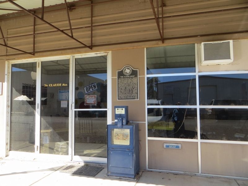
Established as the "Argus," Jan. 1, 1890, in the new railroad town of Claude. Later it merged with "Goodnight News" to become "Claude News." First publisher, W. S. Decker, sold paper to B. F. Hines, who sold to J. H. Hamner, in 1892. His daughter . . . — — Map (db m100448) HM
Created 1876. Name honors several Texas pioneers named Armstrong. Ranching became the chief industry when huge JA Ranch was established here in 1876.
Farming was introduced after the railroad came through, 1887. County was organized in 1890. . . . — — Map (db m96833) HM
Erected in 1953, this building is constructed of stone used to build the first masonry jail in Armstrong County, 1894. Stone for the structure (which replaced a primitive, frame "calaboose") was quarried 14 miles south at Dripping Springs in Palo . . . — — Map (db m96830) HM
One of the oldest Scout troops west of the Mississippi River, this group was organized in May 1912 by pioneer physician Dr. W. A. Warner (1864-1934). The first troop of about 30 boys met in a room above Dr. Warner's drugstore and office. Because of . . . — — Map (db m96837) HM
Winner, Congressional Medal of Honor for heroism during the Allied Forces’ invasion of Peleliu in the western Pacific in World War II. On July 21, 1945, he was decorated posthumously by presentation of his medal to his mother, Armstrong County . . . — — Map (db m62834) HM
Claude native Charles H. Roan volunteered for World War II service in the U.S. Marine Corps in December 1942. On active duty in the Pacific, he was killed in battle on Peleliu Island when he threw himself on a Japanese grenade, thereby saving the . . . — — Map (db m96839) HM
Dan Cavanagh settled here in 1885 and bought this land in 1888. In 1890 he gave a grave site for railroad worker Neal DeBerry. Settler C.C. Bates was buried in 1890, and early burials from the Fort Worth & Denver Railroad right-of-way were later . . . — — Map (db m100495) HM
Locomotive engineer piloting the first Fort Worth & Denver passenger train to reach here, 1887. Town was given his name. Recorded - 1971 — — Map (db m151614) HM
Two of the most admired and beloved pioneer citizens of Armstrong County, Dr. Warner (1864-1934) was a country physician and his wife Phebe (Kerrick) (1866-1935) was an ardent humanitarian.
Natives of Illinois, they were married in Claude in . . . — — Map (db m96834) HM
William Miles Dye was born in Kentucky in 1864 and moved to Texas with his parents in 1870. He settled in this area in 1891, one year after the organization of Armstrong County. By hauling rock from Palo Duro Canyon, Dye helped in the construction . . . — — Map (db m100511) HM
Inheriting peacekeeping duty from 1874-90 ranchers, the early sheriffs of Armstrong County (organized 1890) won great public regard. With their families, these men lived in jail quarters and fed the prisoners. There was no salary; fees were earned . . . — — Map (db m96831) HM
Organized on May 18, 1890, by 19 charter members, with the Rev. B. E. Hure as moderator. The Rev. Count C. Storts was the first resident pastor. The congregation worshipped in the Presbyterian church building until 1899, when a frame sanctuary was . . . — — Map (db m100492) HM
Named for William H. Hamblen (1878 - 1952), who in 1890s pioneered a crude road (about 6 mi. N) into Palo Duro Canyon along old Indian trails. This cut 120 miles off settlers' trips to the courthouse in Claude, but was steep and dangerous. Hamblen . . . — — Map (db m23982) HM
Born in Chester County, Tenn., son of Joseph Cyrus and Emily Kirk Carroll. Married Claudia Haltom, 1900. Graduated 1901 from University of Tennessee. Moved to Claude, 1914. In career of 54 years, delivered over 2500 babies.
A staunch Democrat; a . . . — — Map (db m100494) HM
Led by Francisco Vazquez de Coronado, this trail-blazing expedition set out from Mexico City in 1541 in search of Cibola, fabled 7 Cities of Gold. Finding only Indian pueblos, Coronado changed his course for Quivira, a supposedly wealthy Indian . . . — — Map (db m96835) HM
Although most Indians had left the Texas Panhandle by the 1880s, fear of Indian attacks was still prevalent among settlers who arrived in the next decade. On Jan. 29, 1891, rumors of approaching Indians spread throughout the entire region. For three . . . — — Map (db m96838) HM
Charles Howard Roan was born August 13, 1923 in Claude, Texas. He enlisted in the United States Marine Corps Reserve on December 12, 1942. He was killed in action on September 18, 1944 on Peleliu Island, Palau while serving with the Second . . . — — Map (db m287523) HM
Pioneered at this site, in dugout to the west. S.P. Hamblen (1846-1930) and wife Virginia (1861-1950) settled in Lakeview area (9 mi. S of Claude) in 1889. Hamblen helped establish Lakeview School, 1890. He engaged in farming and stockraising, and . . . — — Map (db m23990) HM
Founded when Fort Worth & Denver Railroad built into area (1887). Claude Ayers, engineer on first passenger train through here, suggested town be named for him — and citizens agreed.
Jerry Cavanaugh, first resident, gave land for town. . . . — — Map (db m96836) HM
Texas Ranger, Indian fighter. At age 19, on way to California gold fields, saw ranching possibilities. Settled and started ranch in Palo Pinto county, 230 miles southeast of here.
In Civil War, scout, guide and hunter for frontier regiment, . . . — — Map (db m49323) HM
Founded by first permanent Texas Panhandle ranchers, Col. and Mrs. Charles Goodnight. With 20 students, classes began in the Methodist church while donors' funds were being used to erect 3-story administration building, two dormitories, and dining . . . — — Map (db m298357) HM
The legacy of Quanah Parker and
Charles Goodnight is that former
enemies can become good friends
Arrow Sculptor: Charles A. Smith
— — Map (db m151421) HM
First ranch in the Texas panhandle
Established in 1876 by
Charles Goodnight
1836- 1929
Noted scout, Indian fighter, trail blazer
and rancher
The Burbank of the range — — Map (db m49328) HM
Planned by R. E. Montgomery, son-in-law of Fort Worth & Denver City Railway Builder-President Gen. G. M. Dodge. Named for family friend. Promoted 1887, Washburn for a time was F.W. & D.C. Line's terminus. It had first newspaper on Plains— . . . — — Map (db m96646) HM
1874 the Comanche, Kiowa & Cheyenne fought Col Mackenzie & 4th Cavalry Palo Duro Canyon 6 mi NW of Wayside
Arrow sculptor: Charles A. Smith — — Map (db m154185) HM
In the opening battle of the U.S. Army's 1874 Indian campaign against the Southern Plains Indian Tribes, a force of 744 soldiers under Col. Nerlson A. Miles fought a 5-hour running battle with the Cheyenne, Comanche and Kiowa 10 mi. E. of this . . . — — Map (db m100514) HM
Cotton farmers began settling in this area in 1903. A water well was dug in 1906, attracting more farmers and increasing crop production. Because the nearest cotton gin was ten miles away in Turkey, three partners (M.E. Tomson, J.H. Clack, and L.A. . . . — — Map (db m100058) HM
(Right Panel)
A Land of Plenty
People have occupied this rugged country for around 12,000 years. During the late Pleistocene age, small bands of nomadic hunters known as Paleo-Indians were attracted to the Caprock escarpment. Here they . . . — — Map (db m200456) HM
Stone tool fragments were discovered in 1965 and 1972 on the shores of Lake Theo, named for former landowner Theodore Geisler. Archeological testing in 1974 revealed a campsite and bison butchering and processing area dating back to the age of . . . — — Map (db m155170) HM
(Right Panel)
Thundering Hooves
The Texas Panhandle Plains were once home to the Southern Plains Bison Herd. According to famous cattleman Charles Goodnight, this great herd never roamed farther north than the Arkansas River or south . . . — — Map (db m200469) HM
Comanches traded with Comancheros
SW in the Valley of Tears between
Los Lingos and Cottonwood Creeks
Arrow Sculptor: Charles A Smith
— — Map (db m151468) HM
Comanche guides led early explorers Pedro Vial, Jose Mares & Francisco Armangual through this area 1787-1808
Arrow sculptor: Charles A. Smith — — Map (db m155175) HM
This burial ground has served Quitaque since the 1920s. Quitaque’s name may have come from Quitica Indians who came through this area on a 1683-84 expedition with Juan Mendoza and Juan Sabeata; it may mean “the land at the end of the . . . — — Map (db m100016) HM
Before this area was covered by Mackenzie Reservoir, evidence of human occupancy was found at 77 recorded archeological sites. The earliest artifacts date back 10,000 years to a bison kill. Prehistoric occupancy is indicated by burial sites, shallow . . . — — Map (db m241775) HM
Formed from Bexar Territory
Created August 21, 1876
Organized March 15, 1892
Named for Andrew Briscoe
1810-1849
Defender of Texan liberty
at the Battle of Concepcion,
the Capture of Bexar and the
Battle of San Jacinto.
Chief . . . — — Map (db m99865) HM
Built 1894 of handcut stone hauled here by horse-drawn wagons from Tule Canyon. Early day sheriff's families rented it as residence. Lower floor was used by Red Cross workers, for sewing, during World War I. This jail stands as the lasting . . . — — Map (db m201822) HM
In the fall of 1891, six months before the official founding of the town of Silverton, a group of citizens met together to form a non-denominational community Sunday school. Early meetings were held in a mercantile store and the county courthouse. . . . — — Map (db m99861) HM
Organized as a Sunday school in 1891, the First Methodist Church of Silverton has grown along with the community. The first pastor was the Rev. W.B. Ford, who conducted services here once a month while also serving other communities in the area. . . . — — Map (db m99862) HM
Francis School (Common School District No. 3) organized in 1898 for citizens of southwest Briscoe County. The school was named for J.L. Francis, who offered his land and took on much of the building expenses. Around 1915, the school was moved to a . . . — — Map (db m150752) HM
The Milo Community began in the late 19th century on the prairie between Palo Duro and Tule Canyons. Named for the favored area crop, the settlement had a store, post office, school, and scattered family dugouts and homes in the 1890s. When John . . . — — Map (db m99859) HM
In 1892, when Briscoe County was organized, won election as first sheriff; also later served single terms, 1913-1914 and 1921-1922.
First official act was arrest of two horse thieves from New Mexico; in last term he and two deputies waged a gun . . . — — Map (db m201823) HM
This Queen Anne style home, which features a wrap around porch, was built in 1904 by Civil War veteran, Pleasant Lafayette Crawford (1837-1912). After Crawford moved here from Arkansas in the late 1880's, he bought ranch land and opened a mercantile . . . — — Map (db m99864) HM
The first two post offices in the area were established at Celtic and Luther on May 2, 1891, eleven months before formal organization of Briscoe County. Celtic was named by pioneer E.R. Thomas, who operated the post office and a store in his home . . . — — Map (db m99857) HM
In 1913, G.C. Holt moved his wife and eight children to the Briscoe-Floyd county line. Because of the distance to the nearest school, Holt and neighbor E.M. Lawson organized the Holt school district, commissioned on September 7, 1920 with two . . . — — Map (db m150753) HM
Since the railroad was 60 miles from this sparsely populated prairie, the establishment of Reeves post office opened a communication link for the early pioneers. Begun July 13, 1899, in the front room of postmaster Joseph H. Reeves' two-story . . . — — Map (db m150755) HM
Briscoe County pioneer William E. Schott (1870-1941) was born in Ohio and moved to North Texas in 1885. Still legally a minor, he came to this area in 1890 and filed a claim for the first of his later extensive landholdings. In 1891 he overcame . . . — — Map (db m151696) HM
Born in Missouri. Served in Texas Rangers, 1860-61, and in Civil War, 1862-65. He was a Corporal in last Confederate Army surrendered east of the Mississippi. After the war, he lived in McLennan, Coryell, and Briscoe Counties. Married twice, he . . . — — Map (db m201824) HM
Founded 1902 by W. S. Wilkerson, local landowner, when Rock Island Railroad built west; named for Col. B. B. Groom, 1880s agent of Francklyn Land & Cattle Co.
Col. Groom was first to try power farming on Plains. Town is today hub of rich farming . . . — — Map (db m100361) HM
Prominent pioneer dentist and farmer. As a boy, cut wood to support mother widowed in Civil War. Worked as carpenter for money to attend dental school in Chicago. Licensed 1890.
Came to Canadian in 1903; Groom, 1916. Traveled at times to ranch . . . — — Map (db m100360) HM
Founded in 1904 as a private bank by John Walter Knorpp (1867-1952), member of an established banking family of Missouri, New Mexico, and Texas, and Eugene Sherwood Blasdel (1878-1930), oil and grain business developer of this region. In 1905 . . . — — Map (db m100358) HM
The 33rd Anniversary National Convention, Men's Garden Clubs of America, meeting at Amarillo, June 14-17, 1965, formally recognized and paid tribute to the significance of Thomas Cree's little tree and to the memory of this heroic early gardener . . . — — Map (db m149796) HM
Takes name from creek where noted buffalo hunter and scout Billy Dixon established first dugout home on High Plains, 1874.
Ranch founded, 1882, by Francklyn Land and Cattle Co., English firm backed by Cunard Steamship Co.
Fenced, 1884, . . . — — Map (db m93762) HM
The 1920s oil boom brought increased business to this railroad town, and a new depot was built here in 1928. The structure exhibits elements of the Prairie School, Mission, and Tudor styles of architecture. Prominent features include bracketed . . . — — Map (db m55888) HM
Named in honor of renowned pioneer family of Asbery A. Callaghan. Erected 1970 through bequest of local businessman H.J. "Friday" Hughes (1901-1968), son-in-law of Asbery Callaghan. In 1890 A.A. Callaghan came to Texas with his parents, the J.R. . . . — — Map (db m149696) HM
Created 1876. Organized 1888. Named for Samuel Price Carson, Secretary of State, Republic of Texas.
A pioneer county in oil and gas development.
Panhandle, county seat, promised main lines of 3 railroads, was by-passed for Amarillo, yet . . . — — Map (db m55891) HM
Formed from Young and Bexar territories; created August 21, 1876, organized June 29, 1888. Named in honor of Samuel P. Carson 1798-1840, statesman of the United States and the Republic of Texas. Wheat, oil and gas contribute to its wealth. . . . — — Map (db m149695) HM
Residents of Conway, established 9 miles south of here in 1905, attended non-denominational services in a relocated schoolhouse until this union church building was completed in 1912. It became an important gathering place for the Conway community . . . — — Map (db m55900) HM
George Tyng, White Deer Lands, drilled first water well 1887 near present townsite White Deer after unsuccessful attempt in 1886 by Col. B. B. Groom, Francklyn Land & Cattle Company.
Windmill indispensable factor in settlement plains of Texas. . . . — — Map (db m55896) HM
Cattle firm that had brought first Herefords to region — Lue Finch, W.H. Lord, O.H. Nelson — in 1887 promoted Panhandle City, as railroad line approached. They sent in ten cowboys to stake claims around city, which prospered as county . . . — — Map (db m55897) HM
First Baptist Church has served residents of Panhandle (originally Carson City later Panhandle City) Since the late 1800s. In 1897, the group at Baptist residences, under the direction of the Rev. William H. Younger, came together to organize a . . . — — Map (db m151530) HM
In October 1923, W. T. Willis, J. E. Trigg, and H. D. Lewis, partners in one of Texas' largest drilling firms, broke ground at the S. B. Burnett 6666 Ranch with the first rotary drilling rig used in the Texas Panhandle. Success of this drilling . . . — — Map (db m93760) HM
First tree Texas High Plains, set front dugout home by Thomas Cree 1888. Good luck symbol of settlers through drouth, blizzard and heat. Cree's bois d'arc tree died in the 1970s. County residents planted a new tree here in 1990 as a memorial to . . . — — Map (db m201795) HM
The Panhandle's first oil well, Gulf Burnett No. 2, was struck by the Gulf Production Company on May 2, 1921, on the 6666 Ranch of S. B. Burnett. The prediction of oil in this area by U.S. geologists in 1904 and the discovery of natural gas nearby . . . — — Map (db m93761) HM
Born in Mississippi; received law degree from University of Texas. Became county attorney of Roberts County. Elected district attorney of 31st Judicial District in 1922. In 1928, appointed district attorney of 84th District by Governor of Texas to . . . — — Map (db m150739) HM
After 1880, each spring and summer many Texas herds went up the trail to northern states, for fattening. The trail thrilled and challenged cowboys, who went hungry, thirsty and saddle sore; bridged or swam the rivers; forded quicksand streams; . . . — — Map (db m55898) HM
The town of Panhandle became an important stronghold for Methodism in this part of Texas in the late 19th century. The county's first congregation was the Northern Methodist, established in 1889. It was attended by residents of all faiths. A . . . — — Map (db m149697) HM
In use, 1938-1957. Based at the county library on this site. A bright red, visible for miles, this first bookmobile in Texas was called "The Library Bus". It stopped at ranches, schools, oil camps; circulated 2,000 books a month; served in era of . . . — — Map (db m149694) HM
Oldest in continuous service. Founded by James Christopher Paul, pupil of Sam Houston's son, lawyer Temple Houston. Early settlers throughout the High Plains area were among the first depositors. On May 6, 1927, during great oil boom, Judge Paul . . . — — Map (db m307861) HM
In 1880s, capital of Panhandle area. Settled when slaughter of buffalo sent Indians to live on reservations. Terminus of Santa Fe Railway, 1887. Here immigrant trains brought colonists, who plowed old Indian range into wheat fields and civilization. . . . — — Map (db m55889) HM
Published since 1887. Oldest newspaper in the Texas Panhandle, second oldest business in the area. Founded by H.H. Brookes. Principal owner 1926-58, David M. Warren, oil man, banker, a Regent of the University of Texas. Don and Norene Peoples . . . — — Map (db m150737) HM
The oldest documented graves in this cemetery date to 1889, three years after the founding of Carson City (later renamed Panhandle), the first town in the county. Among those buried here are Civil War veterans and area pioneer families. Gravestone . . . — — Map (db m150738) HM
In the 1874-1888 era the High Plains (a sea of grass) had no native timber, stone, or adobe building materials. Homes were dugouts, or, if settlers' wagons went some 300 miles for lumber, half-dugouts. Dugouts were warm in winter, cool in summer. . . . — — Map (db m55895) HM
Built 1906-08 in land of lumber scarcity by Carroll and Kate Purvines, (from Illinois) of cement blocks they made by hand, using local sand.
Recorded Texas Historic Landmark - 1964 — — Map (db m228345) HM
Quanah Parker Comanche Chief.
Honored in Red River war exhibit
Carson County Square House Museum
Arrow sculptor: Charles A. Smith — — Map (db m154107) HM
Born in the Texas Governor's Mansion, the eighth and last child of Sam Houston (1793-1863) and his wife Margaret; educated at Baylor University, Texas A&M, and in a law office, Temple Houston came in 1881 to this region as district attorney for the . . . — — Map (db m55899) HM
Originally “Carson City”, town name was changed 1887 when this site appeared to be the future metropolis of the Panhandle: it was to be at the junction of Santa Fe (under name “Southern Kansas”) and Fort Worth & Denver City . . . — — Map (db m55863) HM
During the height of Carson County's oil boom in the 1920s, the major oil field supply houses headquartered in Panhandle, and lodging was in great demand. In 1926, Clark B. (d. 1946) and Margaret (d. 1967) Downs opened the Downs Hotel to help meet . . . — — Map (db m55890) HM
Permanent citizens, forgers of local civilization. Walter Franklin (1869-1963), George Leonard (born 1875) and Dormer D. Simms (born 1884) moved to Texas in 1886 and to this county in the early 1900's. They arrived later than visiting hunters, . . . — — Map (db m55893) HM
Among first landowners in area. In 1898 started ranch 25 miles to the north. Ran country store, post office, phone exchange. Moved 1915 to Panhandle. The 1924 discovery of oil on their ranch led to the founding of Borger. They gave land to every . . . — — Map (db m150734) HM
The Niedringhaus brothers of St. Louis sent lumber by ox-cart from Dodge City and built this square house on their “N Bar N” Ranch here in Carson County in the mid-1880s. In 1887 a railroad official occupied the pioneer cottage while the . . . — — Map (db m55892) HM
After serving as a teamster in the Civil War (1861-65), Thadium (Thomas) B. Cree worked for the Union Pacific Railroad. In 1888 he and his wife came to the High Plains. They acquired this land and, with no trees for lumber, they built a dugout home. . . . — — Map (db m55938) HM
Baptists in White Deer first met in the Presbyterians’ house of worship, meeting twice a month and sharing a union Sunday School. On Jun. 16, 1912, several brothers and sisters met to organize a missionary Baptist Church, led by Bro. J. J. Baird . . . — — Map (db m149691) HM
First church building in White Deer. Dedicated July 4, 1909. Financed mainly through gifts from pioneer members' home churches; and donations by other denominations. Also used by Methodists and Baptists for 11 years, with circuit pastors for the . . . — — Map (db m55862) HM
The White Deer Land Company, a trustee for court-ordered land sales in this area, established the White Deer Demonstration Farm in the 1890s. About 1909 this frame four square structure was built to board prospective land buyers. Marvin Hughes . . . — — Map (db m55861) HM
This commercial structure was built at the original townsite of White Deer (0.5 mi. E). It was moved here in 1908, when the present townsite was established. It housed the general merchandise business of J. C. Jackson (d. 1966), a prominent leader . . . — — Map (db m55859) HM
Each Spring and Summer after 1880, many Texas herds went up the trail to Northern states for fattening. For the cowboys, trail drives meant hard work. They had to turn stampedes, ford rivers and quicksand streams, and fight Indians and cattle . . . — — Map (db m55858) HM
In 1854, 100 Polish families (800 persons) came to America in one small sailing ship–a voyage of 9 weeks. None spoke English. From Galveston they walked 200 miles to Panna Maria in South Texas, arriving for Christmas Eve Mass.
There they . . . — — Map (db m150748) HM
Surrounded by an iron picket fence with a brick entry, the Sacred Heart Catholic Cemetery is a reminder of those who have come before us. The White Deer Land Company donated five acres of land for a cemetery on March 4, 1913. The deed was recorded . . . — — Map (db m150750) HM
Name taken from nearby creek so called by an Indian legend of White Deer feeding there.
Site of county's first water well, drilled at N Bar N Ranch, 1887. Also headquarters for White Deer Land Co. (formerly Francklyn Land and Cattle Co., a . . . — — Map (db m55860) HM
In 1916, Mrs. Beulah V. Tillman, a “femme sole,” purchased 155 of the 160 acres that made up Block 7 of Survey 26 of the International and Great Northern Railroad Company. Because the remaining five acres were omitted from the . . . — — Map (db m150749) HM
In 1909, Henry Czerner and Ben Urbanczyk, both originally from the Polish colony of Panna Maria, Texas, came to the Panhandle and secured a block of land near the town of White Deer. By 1913, twelve Polish families had settled in White Deer. . . . — — Map (db m150746) HM
A Methodist Church was first formed in White Deer in 1911. The Rev. W.B. McKeown, who worked to form several panhandle Methodist congregations, organized the church’s seven charter members. The congregation shared the town’s school building with . . . — — Map (db m149689) HM
Among the early settlers in northeast Castro County were George and Jim Arney, two brothers from Missouri, for whom Arney community was named. A school was started in 1901 for the children of settlers and ranch hands. The first schoolhouse, a . . . — — Map (db m150401) HM
671 entries matched your criteria. The first 100 are listed above. Next 100 ⊳