61 entries match your criteria.
Historical Markers and War Memorials in Valkenburg
By Andrew Ruppenstein, May 28, 2024
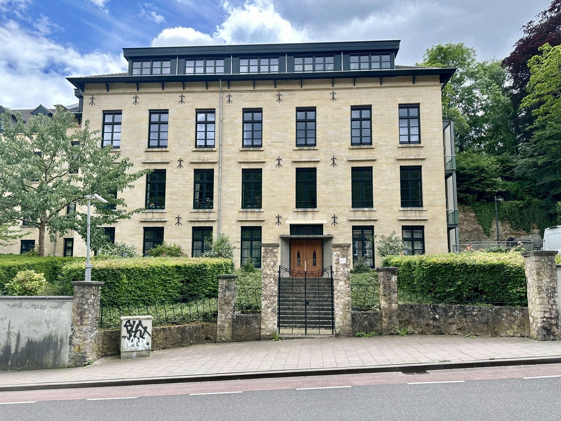
19e eeuws klooster / 19th Century Convent/Monastery and Marker
1 ► Netherlands, Limburg, Valkenburg aan de Geul, Valkenburg — 19e eeuws klooster / 19th Century Convent/Monastery —  |
| On Cauberg, on the right when traveling north. | |||
| 2 ► Netherlands, Limburg, Valkenburg aan de Geul, Valkenburg — 19/20 — 466th Bomb Group Plane Crash — 75 jaar Bevrijding fotoroute — |
| On Daalhemerweg at Dorpstraat, on the left when traveling north on Daalhemerweg. | |||
| 3 ► Netherlands, Limburg, Valkenburg aan de Geul, Valkenburg — 1946/12 — Berkelpoort (city gate) — Rijksmonument — |
| On Berkelstraat, on the left when traveling south. | |||
| 4 ► Netherlands, Limburg, Valkenburg aan de Geul, Valkenburg — 12/20 — Brug Opgeblazen - 13 September 1944 - Bridge Blown Up — 75 jaar Bevrijding fotoroute — |
| On Pelerinstraat at Grotestraat Centrum, on the left when traveling east on Pelerinstraat. | |||
| 5 ► Netherlands, Limburg, Valkenburg aan de Geul, Valkenburg — 10/20 — Bruggen opgeblazen - 13 September 1944 - Bridges Blown Up — 75 jaar Bevrijding fotoroute — |
| On Wilhelminalaan, on the right when traveling north. | |||
| 6 ► Netherlands, Limburg, Valkenburg aan de Geul, Valkenburg — Construction of the Valkenburg Castle / Opbouw Kasteel Valkenburg — |
| Near Grendelplein. | |||
| 7 ► Netherlands, Limburg, Valkenburg aan de Geul, Valkenburg — Crash Vliegtuig Kasteel Schaloen / Kasteel Schaloen Plane Crash — |
| Near Oosterfoetpad. | |||
| 8 ► Netherlands, Limburg, Valkenburg aan de Geul, Valkenburg — 268 — De Via Belgica — |
| On Plenkertstraat, on the right when traveling east. | |||
| 9 ► Netherlands, Limburg, Valkenburg aan de Geul, Valkenburg — De Vondst Van De Vuursteenmijnen / The Discovery of the Flint Mines — |
| On Plenkertstraat, on the right when traveling east. | |||
| 10 ► Netherlands, Limburg, Valkenburg aan de Geul, Valkenburg — 13/20 — Duitse invasie - May 10, 1940 - German Invasion — 75 jaar Bevrijding fotoroute — |
| On Berkelstraat, on the left when traveling north. | |||
| 11 ► Netherlands, Limburg, Valkenburg aan de Geul, Valkenburg — 1946/28 — Fransche Molen / French Mill — |
| On Lindenlaan, on the left when traveling north. | |||
| 12 ► Netherlands, Limburg, Valkenburg aan de Geul, Valkenburg — 1946/14 — Gemeentegrot / Municipal Cave — Rijksmonument — |
| On Cauberg, on the right when traveling south. | |||
| 13 ► Netherlands, Limburg, Valkenburg aan de Geul, Valkenburg — 05/20 — Gemeentegrot als schuilplaats / Municipal Cave as Shelter — 75 jaar Bevrijding fotoroute — |
| On Cauberg, on the right when traveling south. | |||
| 14 ► Netherlands, Limburg, Valkenburg aan de Geul, Valkenburg — Geologisch Monument Groeve Kasteel Oost / Kasteel Oost Quarry Geological Monument — |
| On Oosterweg, on the left when traveling east. | |||
| 15 ► Netherlands, Limburg, Valkenburg aan de Geul, Valkenburg — 03/20 — Grendelpoort - Tweede Wereldoorlog / Grendel Gate - WW II — 75 jaar Bevrijding fotoroute — |
| On Kerkstraat at Muntstraat, on the left when traveling north on Kerkstraat. | |||
| 16 ► Netherlands, Limburg, Valkenburg aan de Geul, Valkenburg — Grendelpoort / Grendel Gate — |
| On Muntstraat, on the left when traveling west. | |||
| 17 ► Netherlands, Limburg, Valkenburg aan de Geul, Valkenburg — 1946/22 — Grendelpoort (city gate) — Rijksmonument — |
| On Kerkstraat at Muntstraat, on the left when traveling north on Kerkstraat. | |||
| 18 ► Netherlands, Limburg, Valkenburg aan de Geul, Valkenburg, Sibbe — 1946/10 — H. Roza van Lima kerk / St. Rose of Lima church — Rijksmonument — |
| On Sibberkerkstraat, on the left when traveling south. | |||
| 19 ► Netherlands, Limburg, Valkenburg aan de Geul, Valkenburg — Haksporen / Tool Marks — |
| On Plenkertstraat, on the right when traveling east. | |||
| 20 ► Netherlands, Limburg, Valkenburg aan de Geul, Valkenburg — Halifax JB 907 Crash Memorial — |
| On Oostervoetpad, on the right when traveling east. | |||
| 21 ► Netherlands, Limburg, Valkenburg aan de Geul, Valkenburg — 11/20 — Hendrik Colijn — 75 jaar Bevrijding fotoroute — |
| On Wilhelminalaan at Koninginneweg, on the left when traveling south on Wilhelminalaan. | |||
| 22 ► Netherlands, Limburg, Valkenburg aan de Geul, Valkenburg — 1946/06 — H.H. Nicolaas en Barbara Kerk / St. Nicholas and St. Barbara Church — Rijksmonument — |
| On Pelerinstraat at Grotestraat Centrum, on the right when traveling east on Pelerinstraat. | |||
| 23 ► Netherlands, Limburg, Valkenburg aan de Geul, Valkenburg — Huis De Guasco — |
| On Grotestraat Centrum at De Guascostraat, on the left when traveling south on Grotestraat Centrum. | |||
| 24 ► Netherlands, Limburg, Valkenburg aan de Geul, Valkenburg — Jan Hubert Vrancken and Frans Alexander Cobbenhagen memorial — |
| On Lindenlaan at Poststraat, on the right when traveling north on Lindenlaan. | |||
| 25 ► Netherlands, Limburg, Valkenburg aan de Geul, Valkenburg — 00/20 — Joodse deportations / Jewish Deportations — 75 jaar Bevrijding fotoroute — |
| On Wehryweg at Wehryweg, on the right when traveling south on Wehryweg. | |||
| 26 ► Netherlands, Limburg, Valkenburg aan de Geul, Valkenburg — Kapsporen/ Cut Marks / Schlagspuren — |
| Near Grendelplein. | |||
| 27 ► Netherlands, Limburg, Valkenburg aan de Geul, Valkenburg — Karel Cahn — |
| On Daalhemerweg, on the left when traveling north. | |||
| 28 ► Netherlands, Limburg, Valkenburg aan de Geul, Valkenburg — Kasteel den Halder — |
| On Kerkstraat. | |||
| 29 ► Netherlands, Limburg, Valkenburg aan de Geul, Valkenburg — Kasteel Den Halder — Rijksmonument — |
| On Kerkstraat, on the left when traveling east. | |||
| 30 ► Netherlands, Limburg, Valkenburg aan de Geul, Valkenburg — Kasteel Oost — |
| On Oosterweg, on the right when traveling east. | |||
| 31 ► Netherlands, Limburg, Valkenburg aan de Geul, Valkenburg — 1946/07 — Kasteel Oost / Oost Castle — Rijksmonument — |
| On Oosterweg, on the right when traveling east. | |||
| 32 ► Netherlands, Limburg, Valkenburg aan de Geul, Valkenburg — 1946/15 — Kruitmolen/ Gunpowder Mill — Rijksmonument — |
| On De Leeuwhof, on the left when traveling west. | |||
| 33 ► Netherlands, Limburg, Valkenburg aan de Geul, Valkenburg — Louis Cahn — |
| On Daalhemerweg. | |||
| 34 ► Netherlands, Limburg, Valkenburg aan de Geul, Valkenburg — Mammoetboom Sequoiadendron Giganteum — |
| On Wehryweg, on the right when traveling north. | |||
| 35 ► Netherlands, Limburg, Valkenburg aan de Geul, Valkenburg — Mariakapel / Marian Chapel — |
| On Kerkstraat at Pelerinstraat, on the right when traveling north on Kerkstraat. | |||
| 36 ► Netherlands, Limburg, Valkenburg aan de Geul, Valkenburg — Middeleeuwse Walmuur / Medieval City Wall — |
| Near Wilelminalaan, on the right when traveling north. | |||
| 37 ► Netherlands, Limburg, Valkenburg aan de Geul, Valkenburg — Oud Stadhuis / Old Town Hall — |
| On Grotestraat Centrum, on the right when traveling north. | |||
| 38 ► Netherlands, Limburg, Valkenburg aan de Geul, Valkenburg — Oude pastorie / Former Parsonage — |
| On Kerkstraat, on the left when traveling north. | |||
| 39 ► Netherlands, Limburg, Valkenburg aan de Geul, Valkenburg — Oude School / Former School — |
| On Kerkstraat at Engelbertstraat, on the right when traveling north on Kerkstraat. | |||
| 40 ► Netherlands, Limburg, Valkenburg aan de Geul, Valkenburg — 09/20 — “Panzerabwehrkanone” (PAK-40) / “Anti-tank Gun” (PAK-40) — 75 jaar Bevrijding fotoroute — |
| On Geneindestraat. | |||
| 41 ► Netherlands, Limburg, Valkenburg aan de Geul, Valkenburg — 07/20 — Philips Fabriek / Philips Factory — 75 jaar Bevrijding fotoroute — |
| On Plenkertstraat, on the right when traveling west. | |||
| 42 ► Netherlands, Limburg, Valkenburg aan de Geul, Valkenburg — Plein 15 februari / February 15th Square — |
| On Plenkertstraat, on the right when traveling east. | |||
| 43 ► Netherlands, Limburg, Valkenburg aan de Geul, Valkenburg — Plenkertgroeve / Plenkert Quarry — |
| On Plenkertstraat, on the right when traveling east. | |||
| 44 ► Netherlands, Limburg, Valkenburg aan de Geul, Valkenburg — R.K. kerk H.H. Nicolaas en Barbara / Sts. Nicholas and Barbara Roman Catholic Church — |
| On Kerkstraat, on the right when traveling north. | |||
| 45 ► Netherlands, Limburg, Valkenburg aan de Geul, Valkenburg — 1946/11 — Romeinse Katakomben / Roman Catacombs — Rijksmonument — |
| On Plenkertstraat, on the right when traveling east. | |||
| 46 ► Netherlands, Limburg, Valkenburg aan de Geul, Valkenburg — Sam Jim Viviano — |
| On Kerkstraat at Pelerinstraat on Kerkstraat. | |||
| 47 ► Netherlands, Limburg, Valkenburg aan de Geul, Valkenburg — 16/20 — Schuilbunker / Air Raid Shelter — 75 jaar Bevrijding fotoroute — |
| On Broekhem, on the left when traveling east. | |||
| 48 ► Netherlands, Limburg, Valkenburg aan de Geul, Valkenburg — 1946/24 — Sint-Josephkerk / Saint Joseph Church — Rijksmonument — |
| On Koningswinkelstraat at Broekhem, on the right when traveling north on Koningswinkelstraat. | |||
| 49 ► Netherlands, Limburg, Valkenburg aan de Geul, Valkenburg — 1946/01 — Spaans Leenhof / Spanish Feudal Court — Rijksmonument — |
| On Theo Dorrenplein. | |||
| 50 ► Netherlands, Limburg, Valkenburg aan de Geul, Valkenburg — 08/20 — SS Reichschule / 91st Evacuation Hospital — 75 jaar Bevrijding fotoroute — |
| On Kloosterstraat at Seringestraat, on the right when traveling north on Kloosterstraat. | |||
| 51 ► Netherlands, Limburg, Valkenburg aan de Geul, Valkenburg — 1946/29 — Station Valkenburg / Valkenburg Railway Station — Rijksmonument — |
| On Stationsstraat at Wehryweg, on the right when traveling west on Stationsstraat. | |||
| 52 ► Netherlands, Limburg, Valkenburg aan de Geul, Valkenburg — 04/20 — Strijd om de bevrijding / Battle for Liberation — 75 jaar Bevrijding fotoroute — |
| On Daalhemmerweg at Konijnsgracht, on the right when traveling south on Daalhemmerweg. | |||
| 53 ► Netherlands, Limburg, Valkenburg aan de Geul, Valkenburg — 01/20 — Struikelstenen / “Stumbling Stones” — 75 jaar Bevrijding fotoroute — |
| On Walravenstraat, on the left when traveling east. | |||
| 54 ► Netherlands, Limburg, Valkenburg aan de Geul, Valkenburg — Theodoor Joseph Hubert Dorren — |
| On Bogaardlaan at Grotestraat Centrum, on the right when traveling east on Bogaardlaan. | |||
| 55 ► Netherlands, Limburg, Valkenburg aan de Geul, Valkenburg — Vaandeluitreiking Landstormkorps / Flag presentation of the Landstorm Corps — |
| On Oosterweg, on the right when traveling east. | |||
| 56 ► Netherlands, Limburg, Valkenburg aan de Geul, Valkenburg — 06A/20 — Valkenburg en Anton Mussert / Valkenburg and Anton Mussert — 75 jaar Bevrijding fotoroute — |
| On Plenkertstraat, on the right. | |||
| 57 ► Netherlands, Limburg, Valkenburg aan de Geul, Valkenburg — 06/20 — Valkenburg en de NSB / Valkenburg and the NSB — 75 jaar Bevrijding fotoroute — |
| On Plenkertstraat, on the right when traveling east. | |||
| 58 ► Netherlands, Limburg, Valkenburg aan de Geul, Valkenburg — Valkenburg Holocaust Memorial — |
| On N590, on the right when traveling east. | |||
| 59 ► Netherlands, Limburg, Valkenburg aan de Geul, Valkenburg — Valkenburg US Army 30th Division - 119th Regiment Monument — |
| On Geneindestraat, on the left when traveling east. | |||
| 60 ► Netherlands, Limburg, Valkenburg aan de Geul, Valkenburg — Vuurstijn-Mijnwerkers / Flint Miners — |
| On Plenkertstraat, on the right when traveling east. | |||
| 61 ► Netherlands, Limburg, Valkenburg aan de Geul, Valkenburg — Werktuigen van Vuursteen / Flint Tools — |
| On Plenkertstraat, on the right when traveling east. | |||