The old "Bowery" was the first place of worship used by the members of the Latter Day Saints Church who came to St. Johns in 1879-1880. The Assembly Hall, located on the northwest corner of the public square was erected in 1882. It was built of logs . . . — — Map (db m36586) HM
John D. Lee settled here in Dec. 1872 and established ferry service thirteen months later. After her husband's death, Warren M. Johnson ran the oar-driven ferry for Emma Lee, 1875 to 1879, when the Church of Jesus Christ of Latter-Day Saints . . . — — Map (db m41997) HM
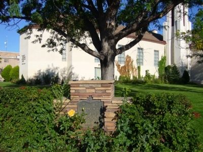
For nearly forty years, couples from Arizona settlements left their homes each fall after harvest and traveled 400 miles to St. George, Utah. Winding slowly through desert and steep canyons, crossing barren plateaus, and passing rivers and pools of . . . — — Map (db m27552) HM
Early in 1878 a hardy band of Mormon pioneers arrived on this mesa. With a straight edge and a spirit level they proved the feasibility of using the ancient Montezuma Canal to bring life-giving irrigation water from the Salt River to the desert . . . — — Map (db m27551) HM
Before 1875 hundreds of heroic women came to Arizona from the East and South. From this group came Arizona's first schoolteachers and the publisher of the first newspaper.
In 1876 a group of pioneer women and their families came from the north, . . . — — Map (db m27385) HM
A group of colonists called by Brigham Young, under the leadership of William C. Allen settled here March 24, 1876. They erected a fort of cottonwood logs and mud on this site. It was first known as Allen's Camp. In 1878 the name was changed to St. . . . — — Map (db m36386) HM
A pioneer wagon road came through this area and went to Fort Apache, established in 1870. Hay, which was delivered to the fort, was one of the few cash crops in those early days. The road is now covered by Rainbow Lake.
Early sheepmen first . . . — — Map (db m36741) HM
In 1870 Corydon E. Cooley, a government scout and Marion Clark entered this valley and located ranches. Cooley built a log house on the hill. By 1876 many families came, including Alfred Cluff, David E. Adams, Thomas W. Adair, Heber Dalton and . . . — — Map (db m36663) HM
The first members of The Church of Jesus Christ of Latter-day Saints to enter what is now Arizona were remnants of the Mormon Battalion. They arrived in the Valley of the Tucson Basin December 17, 1847, prepared for battle. However, the Mexican . . . — — Map (db m94443) HM
Approximately one mile west John M. Horner built the first American schoolhouse non-Catholic chapel in Centerville, Alameda County, 1850. Said to be the first Latter Day Saint Chapel in California. A small structure with three windows in the side . . . — — Map (db m26629) HM
[Side A:]
Mormon Pioneers
Mormon pioneers traveled far in search of a land where they could worship God in an environment of religious tolerance. Named below are some of the pioneers who settled in Washington Township. They sailed . . . — — Map (db m28707) HM
This campsite on the Kit Carson Emigrant Trail was a resting place for California settlers. It was named by members of the Mormon Battalion enroute to Salt Lake Valley. Three of their men, serving as advance trail scouts, were murdered here by . . . — — Map (db m21273) HM
On this site stood Fort Moore built by the
Mormon Battalion during the War with Mexico.
This memorial honors the troops who helped to win the South West.
The Flag of the United States was raised here on July 4th 1847 by United States . . . — — Map (db m128896) HM
Early in 1848 W. Sidney S. Willis (ES) and Wilford Hudson, members of the Mormon Battalion, set out from Sutter’s Fort to hunt deer. Stopping on the South Fork of the American River, they found gold. They told their story on returning to the Fort . . . — — Map (db m17637) HM
Thomas Rhoades (Rhoads) and others left Iowa as an exploring group with permission of Mormon authorities. Traveled with Donner Reed Party from Missouri to Hastings Cut-off. Rhoades, wife, 14 children arrived Sacramento Valley Oct. 1846, first . . . — — Map (db m209082) HM
(top-center plaque)
In March 1851 Charles C. Rich and Amasa M. Lyman, apostles of the Church of Jesus Christ of Latter-Day Saints, left Utah with 437 people "to establish a stronghold for the gathering of saints in California." Jefferson . . . — — Map (db m120645) HM
No. 7
Dedicated
in commemoration
the heroic sacrifice and
history-making achievements
of the
Mormon Battalion
"whose march over 2000 miles
from Council Bluffs, Iowa to San Diego
help to win California for the Union
and open a . . . — — Map (db m51992) HM
Commemorating the landing at this point of the ship Brooklyn, July 31, 1846. A 370 ton vessel, carrying Mormon Colonists and crew of nearly 300 under the leadership of Samuel Brannan.
In the hold was a printing press, 179 books for education . . . — — Map (db m72005) HM
First known sail launch to ascend San Joaquin River from San Francisco landed here autumn 1846. Carried 20 Mormon pioneers who founded New Hope agricultural project on the Stanislaus. Yoke of oxen and span of mules driven from Marsh’s Landing . . . — — Map (db m143445) HM
Approximately six miles west, 20 Mormon pioneers from ship Brooklyn founded first known agricultural colony in San Joaquin Valley. Planting first wheat; also crops they irrigated by the pole and bucket method. Erected three log houses, operated . . . — — Map (db m143447) HM
In 1846 the unsettled area that is now Parker, Colorado, consisted of wild open plains, inhabited only by local Indian tribes and passing trappers and traders. The Crosby-Brown Company, otherwise known as the Mississippi Saints, and detachments of . . . — — Map (db m97420) HM
Soon after the discovery of Gold in Northern Idaho (1862) the City of Boise was founded (1863). Its first people were the U.S. Cavalry, Merchants, Mining and Stockmen. Although a few Mormons from Utah had previously lived in this valley, it was not . . . — — Map (db m125829) HM
An act of Congress, approved April 1878, gave the Utah & Northern Railroad Co. permission to build a narrow gauge line through Marsh Valley. It reached Oneida by July of 1878, where the first station was built. The town attained a population of . . . — — Map (db m140074) HM
This cabin, one of the first built on the Nine Mile Creek in Marsh Valley, was erected by William Jackson and Cyrus Coffin before 1866. Later it was purchased by Abigail Coffin who with her sons, Nathan, Cyrus, and William were among the first . . . — — Map (db m140126) HM
In 1874 the Wells-Fargo stage line assigned Wm.A. Tillotson to operate a station in Marsh Valley. where the trail crossed Sage Creek (now Yago Creek). This route skirted the eastern side of the valley and extended from Franklin, Idaho to mining . . . — — Map (db m140075) HM
Fort Hall Indian Reservation was established by government order July 14, 1867. Following treaties made with the Shoshone Indians in July, 1902 a portion of the reservation was open for white settlement. Homesteaders moved into the beautiful Inkom . . . — — Map (db m140282) HM
Centuries ago the Bannock-Shoshone Indian tribes set aside these natural hot mineral springs as neutral ground for all tribes. Trapper Joseph Miller and party camped here in 1812. By 1863, it was a favorite stop for Oregon Trail travelers. Most . . . — — Map (db m140285) HM
The development of McCammon was closely associated with the transportation industry. William Murphy, in early 1863, built the first toll bridge, and McCammon became the nucleus of the Overland Stage Lines. H.O. Harkness acquired the toll bridge . . . — — Map (db m108262) HM
This monument marks the route of the first Idaho railroad. The Utah & Northern narrow gauge was started as a Mormon co-op at Ogden, Utah in 1871. It reached Franklin, Idaho in 1874. Union Pacific interests extended the line to Garrison, Montana . . . — — Map (db m125573) HM
In Spring 1864 Miranda Campbell and sons, Warren and David; John B. Dunn and family arrived here. Others followed, dug irrigation canals, surveyed townsites into 1 acre lots. By Fall, 40 one-room log homes, also 16 x 20 ft. log schoolhouse with huge . . . — — Map (db m140163) HM
The Bear Lake resort town of Fish Haven was founded in 1864. Most of the original settlers moved away, leaving Thomas and William Shirley, Henry Howell, John Stock and their families the first permanent settlers. Joseph C. Rich and John Bagley threw . . . — — Map (db m140164) HM
In the spring of 1871, Joseph C. Rich surveyed the Twin Creeks area, later called Georgetown. In 1874, logs were hauled from the mountains for this cabin built originally on the corner of the block across the street and one block east and used for . . . — — Map (db m140243) HM
In 1863 Charles C. Rich with others explored this valley. A group of settlers in eleven wagons traveled through Emigration Canyon in September and founded Paris. Log huts with dirt floors and roofs sheltered 48 men, 40 women, and 30 children during . . . — — Map (db m140162) HM
The pictures below reflect first views of the downtown entering Montpelier from the west in different times in history.
Brennan-Davis Building
The building was built for Edward Burgoyne by Jacob Tueller and Sons prior to 1899. The . . . — — Map (db m90920) HM
Strong Building and Stock Chevrolet
This red brick building, note the brickwork circles, was built for Lish Strong by the Tueller brothers of Paris, Idaho. It became known as the Strong Building. Part of the upper level was also used for . . . — — Map (db m90911) HM
On the hot afternoon of August 23, 1896, Butch Cassidy with two members of his Wild Bunch Gang, Elza Lay and Bob Meeks, robbed The Bank of Montpelier which was originally located in the building across the street from this sign.
The Bank of . . . — — Map (db m90877) HM
Schmid Building
Carl (Charles) Schmid, a tailor from Freienstein, Switzerland opened a tailor shop in Montpelier in 1892. He named his business Chas Schmid, The Tailor. He made men's suits and coats and did repairs, alterations and dry . . . — — Map (db m90910) HM
Welcome to the Historic Downtown Montpelier Business District on Washington Street!
Take a few minutes to enjoy a walking tour filled with interesting information about this area and its place in history. Also, spend a few minutes visiting . . . — — Map (db m90878) HM
Early sheriff and mayor Fred Cruikshank owned the first Model T Ford Agency in 1909.
Bear Lake Motors
Early sheriff and mayor Fred Locke Cruikshank was the owner of the first Model T Ford Agency in 1909 and closed it down in . . . — — Map (db m90908) HM
In 1895 the Church of Jesus Christ of Latter-Day Saints built this sandstone structure, consisting of three rooms and a basement, to serve the community as a tithing office. When the Montpelier First Ward was divided in 1916, meetings of the new . . . — — Map (db m140216) HM
In the spring of 1864, fifteen families of pioneers came from Paris, Idaho and settled Clover Creek, the name used until President Brigham Young changed it to Montpelier. After building crude homes the settlers erected a large building of logs, . . . — — Map (db m105874) HM
Early Montpelier was well known for its pine trees placed down the center of Washington Street. As U.S. Highway 89 became more popular to the traveling public, the trees were finally cut down amid much discussion throughout the town.
Rich . . . — — Map (db m90907) HM
The streetscape of Montpelier has changed through the years. The early years of this Oregon Trail town began with only horse power including wagons and horseback. Streets were packed dirt with hitching posts. With the advent of the horseless . . . — — Map (db m90880) HM
Bank of Montpelier's Impact on Local Banking History
Residents of Bear Lake county have discussed the Butch Cassidy bank robbery for years with varied endings. Not unlike fishermen's boastings, tales of the exact amount of Butch's loot will . . . — — Map (db m90879) HM
Paris, Idaho was settled in the fall of 1863. Two years later a building used for church, school and recreation was erected by James Nye and others, of logs hauled from George Sirrine's sawmill It was 20' X 60' with two large rooms and a stage at . . . — — Map (db m105873) HM
The Thomas Sleight Cabin was built in the fall of 1863 by Thomas Sleight and Charles Atkins, who with their wives, Marianne and Ann, occupied it together during the first winter of the settlement of Paris, Idaho.
It was first finished with . . . — — Map (db m105866) HM
In May, 1864 Brigham Young called Swan Arnell, Sr., Charles G. Keetch, Sr., Robert Pope, and Johh Windley with their families to settle here. Soon others followed. Charles Windley was the first child born in the village. The town site was surveyed . . . — — Map (db m105869) HM
In 1879 the U.&N. Railroad Co. named their water stop, Basalt. Henry R. Whitmill settled in Cedar Point in 1884. Andrew O. Inglestrom filed on land, 1885. Others followed, built canal, homes, L.D.S. church house, cheese factory, two stores, saloon, . . . — — Map (db m231263) HM
A log structure was erected one half mile north of this site in 1864, which served as a stage station. The Ben Holliday stages use it as a stopping place as did the freighters who passed this way. Mail was unofficially handled here for more than a . . . — — Map (db m124480) HM
The south part of this area, known as Presto, was settled in 1870 by the Burrell, Just and Shoemaker families. In 1883 the Pritchett family came to Cedar Hollow. Later the Goshen, and the Christensen Monson, Hansen, Jensen, Teeples, Stoddard . . . — — Map (db m140400) HM
Moreland, Bingham County, Idaho, was carved out of flat, sagebrush-covered land inhabited by snakes and jackrabbits. It received its name from a remark made by an apostle of the Church of Jesus Christ of Latter-day Saints While visiting the area he . . . — — Map (db m140398) HM
Before the close of 1885 the families of James Mitchell, A.T. Lawrence, Darius Allen, Joshua Adams, Felix, Heber, Frank and Ann Husband, Albert Christiansen and N.G. Mickelson settled here. Soon other followed. These settlers were organized into a . . . — — Map (db m140402) HM
This village, first called South Iona, was settled by Latter-day Saints. A branch of the Church was organized Nov. 26, 1889 with Arthur M. Rawson as presiding elder. He later became bishop. On Feb. 12, 1893, the ward name was changed to Ammon, . . . — — Map (db m140511) HM
Six men came to this area from Hooper, Utah, to homestead in the early spring of 1885: John, Edward and William Priest, Smith Johnson, and Edwin and Abiah Wadsworth Jr. They each built a log house on their claim before returning to Utah for their . . . — — Map (db m231554) HM
Marking the site of the first Latter-Day Saints meeting house, built in 1885.
This was the first building erected in this community for religious purposes. The building was 16 X 28 feet costing $450.00, money for which was obtained by donation.
. . . — — Map (db m109814) HM
On December 10, 1864 a franchise was granted to Edward M. Morgan, James M. (Matt) Taylor, and William F. Bartlett to operate a ferry one and one-half miles below Cedar Island and build a bridge over Snake River at Black Canyon. Mr. Taylor selected . . . — — Map (db m70571) HM
The fertile soil and abundance of water in this
valley lured pioneer settlers. With small slip
scrapers, hand plows, picks and shovels, they
cleared sagebrush, built log homes, made canals,
ditches and dams to put water on the land. One of . . . — — Map (db m239843) HM
which means "The Beautiful" was named by apostle W. Taylor in honor of a town in Palestine. It was originally known as Sand Creek and embraces a tract of country lying east of Eagle Rock (now Idaho Falls). The first settlement was made in 1883 by . . . — — Map (db m140538) HM
The Willow Creek pioneers established farms in this area in 1874, a school and irrigation canal in 1879, and early branch of the Latter-day Saints church in 1885
This portion of the East Willow Creek country became Shelton Ward on Aug. 14, 1892. . . . — — Map (db m140539) HM
In 1888 the first settlers of the Coltman Ward cleared the sage brush, dug canals and ditches, and built humble homes. At first it was a part of what was called Poverty Flat, later named Grant Ward. In 1896 Grant was divided and this, the south . . . — — Map (db m140544) HM
In the early 90's the Church of Jesus Christ of Latter Day Saints organized a branch in Lost Rover Valley. The people built a Church 1.03 miles south of this in 1898. It was 38 x 54 feet, four windows on each side, double doors in front and a stage . . . — — Map (db m140067) HM
The first L.D.S. church in Canyon County was purchased in 1910 from St. Paul's Congregation for $1000, and dragged with great difficulty through the mud from 1st St. and 14th Ave.S. to this site. It was remodeled, painted, and made ready for use as . . . — — Map (db m141314) HM
One block west from this site, in 1894, the pioneers of this area erected a school house built of red brick made and kilned by them. It was one room, twenty-five by forty feet. Cuss Erickson laid the brick, first teachers were Edith Townsend and . . . — — Map (db m124584) HM
This area, known as Ten Mile Sterrett and Ivins, was opened for homesteading in 1880. Emigrants from Utah and Iceland transformed sagebrush lands to productive livestock farms. They befriended the roaming Indians and Oregon Trail travelers. Jared . . . — — Map (db m140294) HM
After the arrival of the first settlers of Chesterfield in 1875, covered wagon trains continued to use the Old Oregon Traill of 1846 which passed this point. Tired discouraged and ill, travelers arrived here from early spring to late autumn. Local . . . — — Map (db m124580) HM
In 1880, several Latter-Day Saint families settled in this valley of the Portneuf, naming the area Chesterfield. Nov. 27, 1883, a branch of the Church was organized with Judson A. Tolman presiding Elder. Labor was donated, lumber came from nearby . . . — — Map (db m124581) HM
Two miles east is located the dam and headworks of the canal system. Incorporation was effected Feb. 4, 1899 for the purpose of irrigating this valley. First filing on Bear River to supply the canal was Mar. 4, 1897. To perfect the right it was . . . — — Map (db m140280) HM
On this site in 1870, the first house in Soda Springs, Uppertown was built under the direction of John Walmsley. It was a one room log cabin twenty-two by eighteen feet, with floor, windows, and shingle roof, known as the Brigham Young Summer Home. . . . — — Map (db m35466) HM
This spot of ground known as the Pioneer Cedar Cemetery was used from the time of the founding of Soda Springs "Upper Town" in 1871 to 1906. It contains over 42 marked graves and as many whose identification are unknown. Each plot was selected by . . . — — Map (db m140251) HM
The flow of emigrant traffic through City of Rocks ebbed after 1852 and virtually ceased following the completion of the Transcontinental Union Pacific Railroad. The City of Rocks remained an important transportation center, serving as a relay . . . — — Map (db m240524) HM
In the summer of 1880 George Starrh, a placer miner, established a ferry 4 miles west of the present city of Burley. Rich mineral mines had been discovered in the Wood River country and freight was hauled between the mines and Kelton, Utah, (the . . . — — Map (db m125404) HM
In 1811 the first white expedition to go through this area of the Snake River and the lower end of the Raft River Valley was the Wilson Price Hunt expedition from St. Louis to Astoria. However, the area was well known to the French and British . . . — — Map (db m123843) HM
The Raft River Valley was used by Native Americans as a place to hunt and winter because the snow didn't lie in the valley and there was good water and plenty of grass for the animals. British and American trappers, Peter Skene Ogden, Milton . . . — — Map (db m123881) HM
In April 1879 members of the Church of Jesus Christ of Latter-day Saints from Tooele, Utah, under direction of Wm. E. Martindale, arrived in Oakley where James Dayley and his two sons had staked claims and built cabins. On Sept. 24, 1882, the Saints . . . — — Map (db m138482) HM
In 1867 Joseph Chadwick and family settled on Five Mile Creek and built a log cabin. In one room he had a supply store to accommodate the few settlers and freighters. He was followed by Peter Poole, Robert Taylor, Stephen Callan, George Mendenhall, . . . — — Map (db m140159) HM
Franklin, the first permanent Anglo-Saxon settlement in Idaho, was settled in 1860 by a group of Mormon Pioneer families from Utah. The fort in which they first lived was erected for protection against Indians, men standing guard outside at night . . . — — Map (db m105697) HM
This marks the trail of the first communication between Cache Valley and Bear Lake Valley known as the Shoshone Indian Trail in 1864. Mail was carried to Bear Lake on snowshoes, a distance of 25 miles over steep and rugged mountains from Franklin . . . — — Map (db m140344) HM
July, 1864, a company of explorers were sent to Idaho by President Brigham Young to locate suitable places for settlements. The same year Noam Brimhall and John Boice built the first homes in Oxford. William G. Nelson, George D. Lake, and George D. . . . — — Map (db m140160) HM
Attacks by the Indians on the peaceful inhabitants in this vicinity led to the final battle here January 29, 1863. The conflict occurred in deep snow and bitter cold. Scores of wounded and frozen soldiers were taken from the battlefield to the . . . — — Map (db m105785) HM
Concrete shaft located one-half mile west on Bear River marks the site of the Nathan Williams Packer Toll Ferry and Bridge, one of the first on the river. The ferry operated with rope and carried equivalent of one team and wagon. In 1869 a bridge . . . — — Map (db m48977) HM
The Pass of the Standing Rock was held sacred by the ancient ones of the Shoshone and other Native American Tribes long before John C. Fremont's exploratory party came to Weston Canyon on August 29, 1843. Fremont's surveyors spent the entire day . . . — — Map (db m140345) HM
President Brigham Young directed Mariner W. Merrill to explore new town sites. Out of Merrill's survey, several families from Richmond, Utah crossed the Bear River on April 15, 1865, and settled in the Weston area. The first dugouts were constructed . . . — — Map (db m140136) HM
April 15, 1865 the following pioneers settled at Weston.
Christopher Funk, his wife Annie Kofoed and children.
John Maughan, his wife Marie Davenport and children.
Samuel Rodgers, and is wife Augusta.
Hanz Funk, his wife Christina . . . — — Map (db m140129) HM
Tall sagebrush and grass, wild animals, the beautiful Tetons and surrounding mountains greeted the first pioneers of this area. Joe and Mary Weaver Baker and their eight children drove their wagon and cattle from Nebraska and arrived in May of 1889. . . . — — Map (db m140744) HM
The Egin bench area settled in approximately 1880 is watered by subirrigation, a system rare in the world. Customary surface flooding irrigation did not work in this deep sandy soil. The pioneers found that a natural substratum barrier trapped . . . — — Map (db m142174) HM
The first house of worship erected in the Upper Snake River Valley, was located approximately five and three-fourths miles west, and one and three-fourths miles south of this marker. It was completed by members of the Egin Branch of the Cache Stake . . . — — Map (db m108988) HM
A group of pioneer men, members of The Church of Jesus Christ of Latter-day Saints, left Mendon, Cache, Utah, April 1883 and traveled to Idaho in search of new homes for their families. The company consisted of Henry Sorenson, John and Niles Peter . . . — — Map (db m108349) HM
In 1882, Richard F. Jardine, Edmund, Brigham, and John Ellsworth with their families founded Lewisville. It was named in honor of Lewis and Clark Expedition and was one of the first settlements in the Snake River Valley. They cleared sagebrush, dug . . . — — Map (db m124483) HM
Pooles Island, first settled 1879 by members of Church of Jesus Christ of Latter-day Saints, John R. Poole, presiding elder. Cedar Butte Ward organized 1884, Robert L. Bybee, Bishop. Long Island Canal water right decreed 1880; school began 1881; . . . — — Map (db m108994) HM
March, 1879, the first of many hardy, courageous pioneers to settle here were Mr. and Mrs. O.C. Fisher and son Will, Mr. and Mrs Albert Richardson and Joseph Fisher and family. First white child born, H.J. Fisher 16 December 1879. First public . . . — — Map (db m140581) HM
Bybee-Centerville, also known as Sayer, was located between Lewisville and Rigby, the Drybed Channel of the Snake River (Great Feeder Canal) and the Burgess Canal. It was settled 1883-84 by John A. Cuthbert, Alexander Kinghorn, Dan Adams, William . . . — — Map (db m140582) HM
In 1884 a group of Utah Mormons settled and pioneered this locality. The cleared sagebrush land, dug canals and erected humble log homes. The built a log room which was used for church, school and recreation. Daniel S. Robbins, a veteran, was made . . . — — Map (db m124386) HM
Prior to the Holt Ferry, mail and supplies could be sent across the South Fork of the Snake River in a heavy wire basket on a cable. In 1894, Richard C. Heise, who had read of the healing properties of the mineral springs, came from Pocatello and . . . — — Map (db m140543) HM
The Snake River shifted to the north bypassing the South Channel or Dry Bed and left canals along this route without water during most of the summer of 1894. The Great Feeder Headgate and Canal were built in the years 1894 and 1895 to supply . . . — — Map (db m140541) HM
Arriving at the headwaters of Lemhi River, a company of Latter-Day Saint men who had been called to establish a mission among the Indians proceeded approximately 30 miles downstream, selected a site for a fort and a tract of farming land, On June . . . — — Map (db m123675) HM
On April 7, 1855, at the conference of the Church of Jesus Christ of Latter-Day Saints, Pres. Brigham Young called 27 elders to found a mission among the Indians of the Salmon River Country, Oregon Territory, with Thomas S. Smith in charge. . . . — — Map (db m123676) HM
In the spring of 1883, a group of men led by Richard Hemsley and James Steel left Salt Lake City, by train, in search of a new place to live. They rode to the end of the railroad line, Market Lake, now Roberts, Idaho. Here they obtained horses and . . . — — Map (db m140739) HM
Settlement named in honor of Robert T. Burton, who laid out the townsite in 1882. Early settlers cleared the sagebrush, dug canals, ditches, planted crops, and built modest homes. A branch of the Church of Jesus Christ of Latter-Day Saints was . . . — — Map (db m140643) HM
Jenny Leigh, an Eastern Shoshone Indian of Chief Washakie's People, was born in 1849. She first married a French-Canadian trapper, who was later killed and despoiled of his furs by an Indian in Jackson Hole Country.
She later married . . . — — Map (db m140644) HM
In the summer of 1883, William F. Rigby purchased, dismantled and moved by oxen a mill to the new community of Rexburg, establishing the only mill in southern Idaho. The mill was reconstructed on the west side of Third East, between Second and Third . . . — — Map (db m42052) HM
431 entries matched your criteria. The first 100 are listed above. Next 100 ⊳