By Bill Kirchner, September 24, 2010
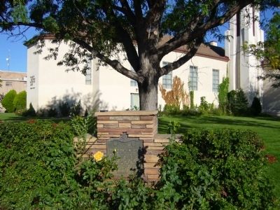
Pioneer Public Buildings Marker
| On North Washington Street (U.S. 180 at milepost 368.7), on the right when traveling west. |
| Near U.S. 89A at milepost 539. |
| Near Adams Street, 0.1 miles west of 15th Avenue. |
| On Main Street (Business Interstate 40) west of Allen Avenue, on the right when traveling west. |
| On Larson Road at Heritage Lane, on the right when traveling south on Larson Road. |
| On North 11th Street at East Cooley Street, on the left when traveling north on North 11th Street. |
| Near East Kleindale Road. |
| On Temple Way near Utah Way, on the right when traveling north. |
| On Walnut Avenue at Gallaudet Drive, on the right when traveling east on Walnut Avenue. |
| On Tragedy Springs Road near Carson Pass Scenic Byway (California Highway 88). |
| On North Hill Street, on the right when traveling north. |
| Near Folsom Point Road, 0.5 miles north of Natoma Street. |
| Near Meiss Road near The Jackson Highway (California Highway 16). |
| On North Arrowhead Avenue, on the right when traveling north. Reported missing. |
| On Broadway, on the left when traveling east. |
| On South Manthey Rd, on the right when traveling west. |
| On West Main Street east of South Acacia Avenue, on the right when traveling east. |
| Near East Valley Hi Drive at South Parker Road (State Highway 83). |
| Near South Cole Road near Brentwood Drive, on the left when traveling north. |
| On Henderson Road at High Street, on the left when traveling south on Henderson Road. |
| On East Center Street near 1st West Street, on the right when traveling west. |
| On South Olson Road near East Virginia Road, on the right when traveling north. |
| On North Rapid Creek Road near Echo Land, on the right when traveling west. |
| Near Main Street near unnamed Road, on the right when traveling west. |
| On Center Street near 7th Street, on the left when traveling south. |
| On 5th Avenue near East Terry Street, on the right when traveling west. |
| On West Canyon Street at West 1st Street, on the right when traveling west on West Canyon Street. |
| On U.S. 89 near Fish Haven Canyon Road, on the right when traveling south. |
| On West 3rd Street near U.S. 30, on the right when traveling west. |
| On State Highway 36 at Church Street, on the left when traveling south on State Highway 36. |
| On Washington Street (U.S. 89) near South 10th Street, on the left when traveling west. |
| On Washington Street (U.S. 89) near North 10th Street, on the right when traveling west. |
| On Washington Street (U.S. 89) near North 9th Street, on the right when traveling west. |
| On Washington Street (U.S. 89) near North 9th Street, on the right when traveling west. |
| On Washington Street (U.S. 89) near South 9th Street, on the left when traveling west. |
| On Washington Street (U.S. 89), on the right when traveling west. |
| On Clay Street near Kelle Street, on the left when traveling east. |
| On Washington Street (U.S. 89) near 5th Street, on the right when traveling east. |
| On Washington Street (U.S. 89) near South 8th Street, on the left when traveling west. |
| On Washington Street (U.S. 89) near South 9th Street, on the left when traveling west. |
| On Washington Street (U.S. 89) near South 9th Street, on the right when traveling west. |
| On South Main Street (U.S. 89) at East 1st South Street, on the right when traveling south on South Main Street. |
| On South Main Street (U.S. 89) near East 2nd South Street, on the left when traveling south. |
| On North Main Street (U.S. 89) near 100 North Street, on the right when traveling south. |
| On 675 East Street near 825 North, on the left when traveling north. |
| On West Bridge Street at South Meridian Street, on the left when traveling west on West Bridge Street. |
| On Russell Street at Cedar Street, on the left when traveling south on Russell Street. |
| On West 175 North (Center Street) near North 725 West, on the right when traveling west. |
| Near Such Milton Avenue near East Pine Street. |
| On Central Avenue at Molen Street, on the right when traveling south on Central Avenue. |
| On South 1st East at West 127th South, on the right when traveling south on South 1st East. |
| On Riverside Drive at Memorial Drive, on the right when traveling south on Riverside Drive. |
| On River Parkway, on the right when traveling north. |
| On Memorial Drive at Riverside Drive, on the left when traveling north on Memorial Drive. |
| On North Main Street/Old U.S. 30 at Rockwood Avenue on North Main Street/Old U.S. 30. |
| On North 105 East near U.S. 26. |
| Near North 5th East (Lewisville Highway) near East 113 North, on the right when traveling south. |
| On 3150 North near Main Street (3350 West), on the right when traveling south. |
| On 5th Street North at 11th Avenue North (Business U.S. 84) on 5th Street North. |
| On Main Street at 1st Street South, on the right when traveling north on Main Street. |
| On Rigby Road near Invins Road, on the right when traveling north. |
| On Chesterfield Road near 24 Mile Road. |
| Near Chesterfield Road near 24 Mile Road, on the left when traveling north. |
| On Main Street (State Highway 34) near 2nd Street North, on the left when traveling south. |
| On Main Street (U.S. 30), on the right when traveling east. |
| Near Pioneer Drive near railroad tracks, on the left when traveling east. |
| On U.S. 30 at milepost 253 near South 300 West, on the left when traveling west. |
| On Yale Road near Laynes Road, on the left when traveling south. |
| On Gamble Lane (County Highway 1700 S) at State Highway 77, on the right when traveling east on Gamble Lane. |
| On Blaine Avenue near West Main 2000 South, on the left when traveling south. |
| On North Westside Highway (County Highway D1) near West 900 North, on the left when traveling north. |
| On North State Street (U.S. 91) at Parkinson Road, on the left when traveling north on North State Street. |
| On Cub River Road near Birch Creek Road, on the left when traveling east. |
| On North Westside Highway (County Highway D1) at Main Street, on the right when traveling north on North Westside Highway. |
| On Highway 91 (State Highway 91) just south of Hot Spring Road, on the right when traveling north. |
| On State Highway 91, on the left when traveling north. |
| On Weston Canyon Road (State Highway 36) near West 300 South, on the left when traveling west. |
| On East 2nd South at South 3rd Street East on East 2nd South. |
| On West Depot Street near North Center Street, on the left when traveling south. |
| On North 3600 East near State Highway 47, on the right when traveling south. |
| On North Center Street at East Cedar Street on North Center Street. |
| On South Bridge Street near East 3rd Street, on the right when traveling north. |
| On East Main Street near South 1st Street West, on the right when traveling west. |
| On East 480 North near North 3450 East, on the left when traveling west. |
| On East Menan Lorenzo Highway near North 3530 East Street, on the right when traveling west. |
| Near East Menan Lorenzo Highway near North 3800 East. |
| On West 1st South (State Highway 48) at Church Street, on the right when traveling east on West 1st South. |
| On Centennial Lane near South State Street (Business U.S. 20), on the left when traveling south. |
| On North 5050 East near Heise Road, on the right when traveling north. |
| On Main Street near Smith Street, on the right when traveling north. |
| On Back Road (State Road 28) at Mule Shoe Road, on the left when traveling north on Back Road. |
| On Back Road (State Road 28) at Mule Shoe Road, on the left when traveling north on Back Road. |
| On North 5000 West at West 6000 North on North 5000 West. |
| On West 2000 South (Burton Oil Road) near South 4000 West(Burton Loop Road), on the right when traveling west. |
| On unnamed road near State Highway 33. |
| On East 1st North at North Millhollow Road, on the right when traveling west on East 1st North. |
435 entries matched your criteria. The first 100 are listed above.
Next 100 ⊳