305 entries match your criteria. Entries 201 through 300 are listed.⊲ Previous 100 — The final 5 ⊳
Maryland Civil War Trails Historical Markers
By Tom Fuchs, November 4, 2006
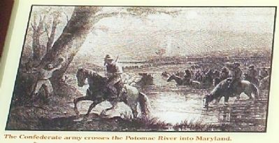
Detail of Photograph on Marker
| 201 ► Maryland, Montgomery County, Dickerson — White’s Ferry — Invasion or Liberation? — Antietam Campaign 1862 — |
| Near Whites Ferry Road, 0.1 miles south of River Road, on the right when traveling west. | |||
| 202 ► Maryland, Montgomery County, Dickerson — White’s Ford — Crossing the Potomac — Antietam Campaign 1862 |
| Near Martinsburg Road, 2.5 miles west of Darnestown Road (Maryland Route 28), on the right when traveling west. Reported permanently removed. | |||
| 203 ► Maryland, Montgomery County, Dickerson — White's Ford — Crossing the Potomac — Antietam Campaign 1862 — |
| Near Martinsburg Road, 1.2 miles west of Wasche Road, on the right when traveling west. | |||
| 204 ► Maryland, Montgomery County, Dickerson, Comus — Mt. Ephraim Crossroads — Sharpshooters Hold the Line — Antietam Campaign 1862 |
| Near Old Hundred Road (Maryland Route 109) at Comus Road (Maryland Route 95), on the left when traveling north. Reported missing. | |||
| 205 ► Maryland, Montgomery County, Gaithersburg — Gaithersburg — Summit Hall Farm — Gettysburg Campaign — |
| Near South Frederick Ave (Route 355) just north of Fairbanks Drive, on the left when traveling north. | |||
| 206 ► Maryland, Montgomery County, Hyattstown — Hyattstown — Uninvited Guests — Antietam Campaign 1862 |
| On Frederick Road (Maryland Route 355) at Hyattstown Mill Road, on the right when traveling north on Frederick Road. Reported missing. | |||
| 207 ► Maryland, Montgomery County, Poolesville — Edwards Ferry — Strategic Crossing — Gettysburg Campaign — |
| On Edward's Ferry Road, on the right. | |||
| 208 ► Maryland, Montgomery County, Poolesville — Poolesville — Warm Reception — Antietam Campaign 1862 — |
| On Fisher Avenue / Whites Ferry Road (Maryland Route 107) at Elgin Road / Beallsville Road (Route 109), on the right on Fisher Avenue / Whites Ferry Road. | |||
| 209 ► Maryland, Montgomery County, Poolesville — Poolesville — Strategic Union Encampment — Gettysburg Campaign — |
| Near Fisher Avenue / Whites Ferry Road (Maryland Route 107), on the right when traveling west. | |||
| 210 ► Maryland, Montgomery County, Rockville — Beall-Dawson House — Slavery in Rockville — Gettysburg Campaign |
| Near West Middle Lane west of North Adams Street, on the right when traveling east. Reported permanently removed. | |||
| 211 ► Maryland, Montgomery County, Rockville — Beall-Dawson House — Enslavement in Rockville — |
| On West Middle Lane just west of North Adams Street, on the left when traveling west. | |||
| 212 ► Maryland, Montgomery County, Rockville — Christ Episcopal Church — Vestrymen Arrested — Gettysburg Campaign — |
| On South Washington Street near Vinson Street, on the right when traveling south. | |||
| 213 ► Maryland, Montgomery County, Rockville — Court House Square — "Burning with Enthusiasm" — Gettysburg Campaign |
| On Maryland Avenue south of East Montgomery Avenue, on the right when traveling south. Reported permanently removed. | |||
| 214 ► Maryland, Montgomery County, Rockville — Dr. Stonestreet's Office — Country Doctor and Army Surgeon — |
| Near West Montgomery Avenue west of North Adams Street, on the right when traveling west. | |||
| 215 ► Maryland, Montgomery County, Rockville — Gettysburg Campaign — Invasion & Retreat — |
| On Maryland Avnue south of East Montgomery Avenue, on the right when traveling south. | |||
| 216 ► Maryland, Montgomery County, Rockville — Higgins House — Arresting Civilians — Gettysburg Campaign |
| On West Middle Lane at North Adams Street, on the right when traveling west on West Middle Lane. Reported missing. | |||
| 217 ► Maryland, Montgomery County, Rockville — Prettyman House — Confederates in Rockville — Gettysburg Campaign — |
| On West Jefferson Street (Maryland Route 28) near South Van Buren Street, on the right. | |||
| 218 ► Maryland, Montgomery County, Rockville — Stonestreet Medical Museum — Conflicting Loyalties |
| Near West Middle Lane near North Adams Street, on the right when traveling east. Reported damaged. | |||
| 219 ► Maryland, Montgomery County, Rockville — Witness to History — Montgomery County Courthouse — |
| On Maryland Avenue south of East Montgomery Avenue, on the right when traveling south. | |||
| 220 ► Maryland, Montgomery County, Seneca — Rowser’s Ford — 5,000 Confederate Cavalrymen Crossed — Gettysburg Campaign — |
| On Rileys Lock Road south of River Road, on the right when traveling south. | |||
| 221 ► Maryland, Prince George's County, Clinton — John Wilkes Booth — Escape of an Assassin — War on the Chesapeake — |
| On Brandywine Road at Woolyard Road (Maryland Highway 223) on Brandywine Road. | |||
| 222 ► Maryland, Prince George's County, Clinton — Surratt Tavern — Confederate Safe House — John Wilkes Booth - Escape of an Assassin |
| Near Brandywine Road (Maryland Route 381) 0.1 miles south of Woodyard Road (Maryland Road 223), on the left when traveling south. Reported permanently removed. | |||
| 223 ► Maryland, Prince George's County, Clinton — Surratt Tavern — Confederate Safe House — John Wilkes Booth - Escape of an Assassin — |
| On Brandywine Road, 0.1 miles north of Horseshoe Road, on the right when traveling north. | |||
| 224 ► Maryland, Queen Anne's County, Centreville — War Along the Chesapeake — A Divided Region — |
| On Hayden Road (Maryland Route 834) at Blue Star Memorial Highway (U.S. 301), on the left when traveling west on Hayden Road. | |||
| 225 ► Maryland, Queen Anne's County, Chester — Maryland's Eastern Shore — Hundreds of Enslaved and Free Black Men Enlisted |
| Near Piney Narrows Road, on the right when traveling north. Reported permanently removed. | |||
| 226 ► Maryland, Queen Anne's County, Chester — War Along the Chesapeake — A Divided Region — |
| On Piney Narrows Road, 0.1 miles east of Swan Cove Lane, on the left when traveling east. | |||
| 227 ► Maryland, Queen Anne's County, Queenstown — Queenstown — Divided Loyalties — |
| On Maryland Route 18 at Del Rhodes Avenue, on the left when traveling south on State Route 18. | |||
| 228 ► Maryland, St. Mary's County, Chaptico — Chaptico — A History of Rebellion — |
| On Maddox Road (Maryland Route 238) at Chaptico Hurry Road, on the left when traveling east on Maddox Road. | |||
| 229 ► Maryland, St. Mary's County, Coltons Point — Blackistone Lighthouse — Saved by Keeper's Pregnant Wife — |
| 230 ► Maryland, St. Mary's County, Coltons Point — St. Clement's Island Lighthouse — "None of the Lighthouses … are Safe" |
| On Point Breeze Road, 0.2 miles east of Colton Point Road (Route 242), on the left when traveling east. Reported permanently removed. | |||
| 231 ► Maryland, St. Mary's County, Coltons Point — The Black Diamond Incident — "Out of the frying pan into the fire" — |
| On Point Breeze Road, 0.1 miles east of Colton Point Road, on the left when traveling east. | |||
| 232 ► Maryland, St. Mary's County, Leonardtown — Leonardtown — Spies, Intriguers and Blockade Runners |
| On Courthouse Drive west of Washington Street (Maryland Route 326), on the right when traveling east. Reported missing. | |||
| 233 ► Maryland, St. Mary's County, Leonardtown — Leonardtown — Smugglers, Secessionists, & a Very Brave Man — |
| On Court House Drive east of Washington Street (Maryland Route 326), on the right when traveling east. | |||
| 234 ► Maryland, St. Mary's County, Lexington Park — Medals of Honor — St. Mary's County U.S. Colored Troops — |
| On Three Notch Road (Maryland Route 235) 0.1 miles north of Buse Road, on the left when traveling south. | |||
| 235 ► Maryland, St. Mary's County, Piney Point — Piney Point Lighthouse — The Potomac Flotilla |
| Near Lighthouse Road (County Route 498) 1.4 miles east of Piney Point Road (County Route 249), on the left when traveling east. Reported permanently removed. | |||
| 236 ► Maryland, St. Mary's County, Piney Point — Piney Point Lighthouse — The Potomac Flotilla — |
| Near Lighthouse Road (County Route 498) 1.4 miles east of Piney Point Road (County Route 249), on the left when traveling east. | |||
| 237 ► Maryland, St. Mary's County, Scotland — John Wilkes Booth — Escape of an Assassin — War on the Chesapeake Bay — |
| On Point Lookout Road, on its terminus loop (Maryland Route 5), on the right when traveling north. | |||
| 238 ► Maryland, St. Mary's County, Scotland — Point Lookout State Park — Hammond General Hospital — |
| On Point Lookout Road, on its terminus loop (Maryland Route 5), on the right when traveling north. | |||
| 239 ► Maryland, Talbot County, Oxford — Oxford Wharf — Recruiting United States Colored Troops — |
| On East Strand at North Morris Street (County Route 333), on the left when traveling east on East Strand. | |||
| 240 ► Maryland, Talbot County, Trappe — Nathaniel Hopkins — Soldier from Trappe — |
| On Main Street (Maryland Route 565) at Barber Road, on the right when traveling south on Main Street. | |||
| 241 ► Maryland, Talbot County, Unionville — Unionville — Founded to Honor their Service — |
| On Unionville Road, on the right when traveling north. | |||
| 242 ► Maryland, Washington County, Big Pool — Fort Frederick — A Witness to War — |
| On Fort Frederick Road south of Big Pool Road (Maryland Route 56), on the right when traveling south. | |||
| 243 ► Maryland, Washington County, Big Pool — Gettysburg Campaign — Invasion & Retreat |
| On Fort Frederick Road, on the right when traveling south. Reported permanently removed. | |||
| 244 ► Maryland, Washington County, Big Pool — Nathan Williams — A Prosperous Farm — |
| On Fort Frederick Road south of Big Pool Road (Maryland Route 56), on the right when traveling south. | |||
| 245 ► Maryland, Washington County, Big Pool — Western Maryland — At the Crossroads of Conflict — |
| On Fort Frederick Road, on the right when traveling south. | |||
| 246 ► Maryland, Washington County, Boonsboro — Battle of Boonsboro — Buying Time — Gettysburg Campaign — |
| On Old National Road (Alternate U.S. 40), on the right when traveling south. | |||
| 247 ► Maryland, Washington County, Boonsboro — Boonsboro — Lee's Headquarters — Antietam Campaign 1862 — |
| On Old National Pike (Alternate U.S. 40) 1.2 miles east of Gilardi Road, on the right when traveling east. | |||
| 248 ► Maryland, Washington County, Boonsboro — Deaths of Two Generals — “Hallo, Sam, I’m dead!” — Antietam Campaign 1862 — |
| On Reno Monument Road near the Appalachian Trail, on the left when traveling west. | |||
| 249 ► Maryland, Washington County, Boonsboro — Gettysburg Campaign — Invasion & Retreat — |
| On Old National Pike (Alternate U.S. 40) at Orchard Drive / Shafer Park Road, on the right when traveling east on Old National Pike. | |||
| 250 ► Maryland, Washington County, Boonsboro — The Battle for Fox’s Gap — “Hell is empty and all the devils are here.” — Antietam Campaign 1862 — |
| On Reno Monument Road at the Appalachian Trail, on the left when traveling west on Reno Monument Road. | |||
| 251 ► Maryland, Washington County, Boonsboro — Washington Monument — Signal Station — Antietam Campaign 1862 — |
| On North Main Street / Old National Road (Alternate U.S. 40), on the right when traveling south. | |||
| 252 ► Maryland, Washington County, Boonsboro — Washington Monument — Signal Station — Antietam Campaign 1862 — |
| On Washington Monument Road, on the right. | |||
| 253 ► Maryland, Washington County, Brownsville — Battle of Maryland Heights — Maryland's First Civil War Battle — Antietam Campaign 1862 — |
| On Rohrersville Road (State Highway 67), on the right when traveling north. | |||
| 254 ► Maryland, Washington County, Cearfoss — Crossing the Mason and Dixon — Pennsylvania, at Last! — Gettysburg Campaign — |
| On Fairview Road (County Route 494) at Greencastle Pike (Maryland Route 63), on the right when traveling east on Fairview Road. | |||
| 255 ► Maryland, Washington County, Cearfoss — Gettysburg Campaign — Invasion & Retreat — |
| On Fairview Road (County Route 494) at Greencastle Pike (Maryland Route 63), on the right when traveling east on Fairview Road. | |||
| 256 ► Maryland, Washington County, Clear Spring — Gettysburg Campaign — Invasion & Retreat |
| On Cumberland Street (U.S. 40) at Mill Street (Maryland Route 68), on the right when traveling west on Cumberland Street. Reported permanently removed. | |||
| 257 ► Maryland, Washington County, Clear Spring — Gettysburg Campaign — Invasion & Retreat — |
| On National Pike (US 40). | |||
| 258 ► Maryland, Washington County, Clear Spring — Vital Crossroads — Clear Spring in the Civil War — |
| On Cumberland Street (U.S. 40) at North Mill Street (Maryland Route 68), on the right when traveling west on Cumberland Street. | |||
| 259 ► Maryland, Washington County, Conococheague — Gettysburg Campaign — Invasion & Retreat — |
| On Rufus Wilson Road, on the right when traveling west. | |||
| 260 ► Maryland, Washington County, Dargan — Confederate Invasion — Five Years Later … — Early's 1864 Attack on Washington — |
| On Chestnut Grove Road, 0.3 miles east of McCoy Road, on the left when traveling east. | |||
| 261 ► Maryland, Washington County, Dargan — Kennedy Farm — Staging and Planning John Brown's Harpers Ferry Raid — |
| On Chestnut Grove Road, on the right when traveling south. | |||
| 262 ► Maryland, Washington County, Fairplay — Jones’s Crossroads — Forts Facing Forts — |
| On Shepherdstown Pike (Maryland Route 65) at Lappans Road (Route 68), on the right when traveling south on Shepherdstown Pike. | |||
| 263 ► Maryland, Washington County, Funkstown — Battle of Funkstown — At Bay another Day — Gettysburg Campaign — |
| On Old National Road (U.S. Alt 40), on the right when traveling south. | |||
| 264 ► Maryland, Washington County, Hagerstown — First Battle of Hagerstown — Vicious Fighting in the Streets — Gettysburg Campaign — |
| On North Potomac Street (Maryland Route 65), on the right when traveling south. | |||
| 265 ► Maryland, Washington County, Hagerstown — Gettysburg Campaign — Invasion & Retreat — |
| On North Potomac Street (Maryland Route 65). | |||
| 266 ► Maryland, Washington County, Hagerstown — Second Battle of Hagerstown — Custer Captures the Town — Gettysburg Campaign — |
| On North Potomac Street (Maryland Route 65), on the right when traveling south. | |||
| 267 ► Maryland, Washington County, Hancock — Gettysburg Campaign — Invasion & Retreat — |
| On the eastbound Sideling Hill Rest Area (Interstate 68 at milepost 75), 1.5 miles east of Exit 74, on the right when traveling east. | |||
| 268 ► Maryland, Washington County, Hancock — Gettysburg Campaign — Invasion & Retreat — |
| On the westbound Sideling Hill Visitors Center (Interstate 68 at milepost 75), 2.7 miles west of Exit 77 (Maryland Route 144), on the right when traveling west. | |||
| 269 ► Maryland, Washington County, Hancock — Gettysburg Campaign — Invasion & Retreat — |
| On Church Street south of Main Street (Maryland Route 144), on the left when traveling south. | |||
| 270 ► Maryland, Washington County, Hancock — Major James Breathed — "Hardest artillery fighter the war produced" — |
| On West Main Street (Maryland Route 144), on the left when traveling west. | |||
| 271 ► Maryland, Washington County, Hancock — St. Thomas Episcopal Church — Unintended Target |
| On Church Street south of Main Street (Maryland Route 144), on the left when traveling south. Reported permanently removed. | |||
| 272 ► Maryland, Washington County, Hancock — St. Thomas Episcopal Church — Witness to War — |
| On North Church Street at Western Maryland Rail Trail, on the left when traveling south on North Church Street. | |||
| 273 ► Maryland, Washington County, Highfield-Cascade — War Returns to South Mountain — Battle of Monterey Pass — Gettysburg Campaign — |
| Near Pen Mar High Rock Road, on the right when traveling south. | |||
| 274 ► Maryland, Washington County, Keedysville — Keedysville — Headquarters and Hospital Town — Antietam Campaign 1862 — |
| On Taylor Drive at North Main Street (Maryland Route 845), in the median on Taylor Drive. | |||
| 275 ► Maryland, Washington County, Knoxville — Fort Duncan — Invasion Stalled — Early's 1864 Attack on Washington — |
| On Pleasantville Road, 0.3 miles west of Pleasantville Road, on the left when traveling west. | |||
| 276 ► Maryland, Washington County, Lappans Crossroads — Council of War — Should We Attack? — |
| On Lappans Road (Maryland Route 68), on the right when traveling west. | |||
| 277 ► Maryland, Washington County, Leitersburg — Gettysburg Campaign — Invasion & Retreat — |
| On Ringold Street at Ringold Pike (County Route 418) on Ringold Street. | |||
| 278 ► Maryland, Washington County, Leitersburg — Retreat into Maryland — "Asleep and at the same time walking" — |
| On Ringold Street at Ringold Pike (County Route 418), on the right when traveling south on Ringold Street. | |||
| 279 ► Maryland, Washington County, Middletown — 1862 Antietam Campaign — Lee Invades Maryland — |
| On Old National Pike (Alternate U.S. 40) at Washington Monument Road, on the right when traveling east on Old National Pike. | |||
| 280 ► Maryland, Washington County, Middletown — 19th Century Backpacker — The Civil War Soldier — Antietam Campaign 1862 |
| On Old National Pike (Alternate U.S. 40) at Washington Monument Road, on the right when traveling east on Old National Pike. Reported permanently removed. | |||
| 281 ► Maryland, Washington County, Middletown — 19th Century Backpacker — "A lean and hungry set of wolves" — Antietam Campaign 1862 — |
| On Old National Pike (Alternate U.S. 40) just east of Washington Monument Road, on the right when traveling east. | |||
| 282 ► Maryland, Washington County, Middletown — Battle at South Mountain — A Natural Barrier — Antietam Campaign 1862 — |
| On Old National Pike (Alternate U.S. 40) at Washington Monument Road, on the right when traveling east on Old National Pike. | |||
| 283 ► Maryland, Washington County, Sharpsburg — 1862 Antietam Campaign — Lee Invades Maryland — |
| On Shepherdstown Pike (Maryland Route 34), on the left when traveling north. | |||
| 284 ► Maryland, Washington County, Sharpsburg — 1862 Antietam Campaign — Lee Invades Maryland — |
| On Shepherdstown Pike (Maryland Route 34). | |||
| 285 ► Maryland, Washington County, Sharpsburg — Antietam Station — Railroad to Reunion — Antietam Campaign 1862 — |
| On Shepherdstown Pike (Maryland Route 34), on the left when traveling north. | |||
| 286 ► Maryland, Washington County, Sharpsburg — Collateral Damage — War Destroys Beloved Church — Antietam Campaign 1862 — |
| Near East Main Street (Maryland Route 34) east of South Church Street, on the right when traveling east. | |||
| 287 ► Maryland, Washington County, Sharpsburg — Early's Washington Raid — Diverting Federal Forces, July 1864 — |
| On Boonesboro Pike (State Highway 34), on the right when traveling west. | |||
| 288 ► Maryland, Washington County, Sharpsburg — Gettysburg Campaign — Invasion & Retreat — |
| On Boonesboro Pike (Maryland Route 34), on the left when traveling east. | |||
| 289 ► Maryland, Washington County, Sharpsburg — Grove Farm — A Visit from the President — Antietam Campaign 1862 — |
| On Shepherdstown Pike (Maryland Route 34), on the right when traveling north. | |||
| 290 ► Maryland, Washington County, Sharpsburg — Witness to History — |
| Near Old Burnside Bridge Road. | |||
| 291 ► Maryland, Washington County, Smithsburg — Gettysburg Campaign — Invasion & Retreat — |
| Near West Water Street (Maryland Route 66), on the left when traveling east. | |||
| 292 ► Maryland, Washington County, Smithsburg — Respite at Smithsburg — “An Oasis in the Desert” — |
| Near West Water Street (Maryland Route 66), on the left when traveling east. | |||
| 293 ► Maryland, Washington County, St. James — St. Mark's Episcopal Church — Refuge for the "sick and wounded" — |
| Near Lappans Road, on the right when traveling east. | |||
| 294 ► Maryland, Washington County, Williamsport — C & O Canal Aqueduct — Stonewall Changes Course — Antietam Campaign 1862 — |
| 295 ► Maryland, Washington County, Williamsport — Falling Waters — "Just charge it to Jeff Davis" — Gettysburg Campaign — |
| 296 ► Maryland, Washington County, Williamsport — Gettysburg Campaign — Invasion & Retreat — |
| Near Potomac Street (U.S. 11) when traveling west. | |||
| 297 ► Maryland, Washington County, Williamsport — Shielding the Army — Where are the Confederates? — Gettysburg Campaign — |
| On Greencastle Pike (Route 63), on the right when traveling north. | |||
| 298 ► Maryland, Washington County, Williamsport — The Wagoners’ Fight — Teamsters Help Save the Army — |
| Near Lappans Road (Maryland Route 68), on the left. | |||
| 299 ► Maryland, Washington County, Williamsport — Williamsport — The Beginning and the End — Gettysburg Campaign — |
| 300 ► Maryland, Worcester County, Berlin — Corp. Isaiah Fassett — "Uncle Zear" |
| On Branch Street at Flower Street, on the right when traveling east on Branch Street. Reported permanently removed. | |||
305 entries matched your criteria. Entries 201 through 300 are listed above. ⊲ Previous 100 — The final 5 ⊳