Although some wagon trains continued to follow the South Platte, most crossed at one of several fords in this area and took a northwesterly route toward the North Platte River. The trail then followed the North Platte Valley through the remainder of . . . — — Map (db m61967) HM
Boot Hill was the final resting place for many early westerners who helped make Ogallala a booming cowtown in the 1870’s and 1880’s. These people, the cowboys, settlers, and drifters, came to Ogallala when the railroad and the Texas Trail opened a . . . — — Map (db m51223) HM
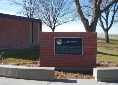
Traveling northwest from Ash Hollow, the emigrants encountered three natural features of the North Platte Valley which became well-known milestones. First was Court House Rock, rising abruptly from the plains as the vanguard of the bluffs farther . . . — — Map (db m61968) HM
Named for the Oglala band of Dakota Sioux and located on the Union Pacific Railroad, Ogallala was a lusty cowtown of the Old West. From 1875 to 1886 it was a wild and woolly cowboy capital where gold flowed across the gaming tables, liquor across . . . — — Map (db m51222) HM
By 1878 more than 300 Northern Cheyennes were desperate to escape their hated reservation in Indian Territory (Oklahoma). Led by Dull Knife and Little Wolf, they headed for their homeland in the north, fighting their way across Kansas. At about . . . — — Map (db m178707) HM
This region holds much that is significant to the history of the West. At this point, I-80 follows the route of the Overland Trail, along the South Platte River. Leaving the South Platte near here, the trail continued up the North Platte Valley, . . . — — Map (db m61966) HM
The first Keya Paha County Fair was held in September 1898. Ever since, the center of the fair’s activities has been the Barn Dance. The current fairground was purchased in 1921. A new dance hall was approved in 1929 and built by Fred Taylor. The . . . — — Map (db m179183) HM
In 1910 the Kimball Irrigation District voted to construct an irrigation system with a reservoir and two canals. The rough topography traversed by the canals required several aqueducts, which used flumes manufactured in Kimball, Nebraska, by . . . — — Map (db m178497) HM
On its journey to the Pacific Ocean the Lewis and Clark Expedition camped near here on September 2, 1804. At this camp the explorers’ imagination and knowledge of military fortifications misled them into concluding that sand ridges and mounds left . . . — — Map (db m181799) HM
This has been the homeland of the Ponca Indians since earliest recorded history. In 1868 the federal government signed the Treaty of Fort Laramie, which transferred the land to the Sioux without the permission of the Ponca. Treaties made with the . . . — — Map (db m179194) HM
On the night of June 2, 1969, while on maneuvers in the South China Sea off the coast of Vietnam, the Australian aircraft carrier Melbourne was in collision with the destroyer USS Frank E. Evans. The impact cut the Evans in . . . — — Map (db m181893) HM WM
Lincoln Army Air Field was constructed in 1942 on the former Lincoln Municipal Airport. The 2,750-acre property was leased to the army by the City of Lincoln. The base provided technical training for aircraft mechanics, basic training for army . . . — — Map (db m66966) HM
General John J. Pershing, commander of the American Expeditionary Forces to Europe in World War I, was Professor of Military Science at the University of Nebraska-Lincoln between September 1891 and June 1895. Upon his arrival in Lincoln, which was . . . — — Map (db m54351) HM
In 1878 public-spirited citizens, led by former governor Robert W. Furnas, organized the Nebraska State Historical Society. The legislature designated the Society a state institution in 1883 and began providing financial support.The Society's . . . — — Map (db m47377) HM
On March 6, 1855, Lancaster County was created by act of the Territorial Legislature. Many early settlers came for land, while others were attracted by the commercial possibilities of the nearby Salt Basin. In 1859, a site east of the Salt Basin was . . . — — Map (db m88549) HM
The Territorial Legislature at Omaha drew the boundaries of Lancaster County in 1855. Settlers first arrived in 1856 and a county government was established "on paper" in 1859. Methodist Elder John M. Young arrived at the head of a colony in . . . — — Map (db m66883) HM
Mari Sandoz (1896-1966), Nebraska historian and novelist, lived at this site, 1226 J Street, from 1925 to 1937. Here in 1928, she began writing Old Jules, the biography of her father. From the J Street curb, she often wrote and watched . . . — — Map (db m223459) HM
From 1854 to 1867 the seat of territorial and state government was in Omaha. In 1867 the State Legislature appointed a Capital Commission to select a location for the new state capital. Commission members Governor David Butler, Auditor John . . . — — Map (db m87800) HM
William Henry Ferguson, Lincoln businessman and investor built this house in 1909 - 11. It is one of the best examples of the Second Renaissance Revival style in Lincoln and perhaps in Nebraska. Architects were Searles, Hirsh, and Gavin of . . . — — Map (db m87762) HM
In 1874 construction began on Lincoln's first U.S. Post Office and Courthouse on a block originally intended as a market square. The building was completed by 1879 at a cost of about. $200,000. Alfred B. Mullet, supervising architect of the U.S. . . . — — Map (db m66884) HM
With the discovery of gold in the Rocky Mountains in the late 1850's , overland freighting and travel intensified. Every few miles westward along the trails, enterprising individuals established road ranches which offered lodgings and provision to . . . — — Map (db m174996) HM
The fort was established on the Oregon Trail on the south side of the Platte River in October 1863, on the eve of intensified Indian raids on the Plains.
Built next to the well-known Cottonwood Springs and McDonald ranch, it commanded a . . . — — Map (db m101821) HM
The fort near here was established on the Oregon Trail on the south side of the Platte River in October 1863, on the eve of intensified Indian raids on the Plains. Built next to the well-known Cottonwood Springs and McDonald ranches, it commanded a . . . — — Map (db m180897) HM
William Frederick Cody (1846-1917), known to the world a "Buffalo Bill," was the most noted Nebraskan of his day. The Many national and European tours of his various "Wild West" exhibitions made him the living symbol of the American West.
Cody . . . — — Map (db m125056) HM
Sioux Lookout, the highest point in Lincoln County, was a prominent landmark on the overland trails.
From its lofty summit the development of the West unfolded before the eyes of the Sioux and other Indians.
Trappers and traders came by here . . . — — Map (db m107393) HM
Beneath this platform, evidence of the great westward migration still remains. These shallow depressions were once deep ruts created by thousands of hooves, shoes and wheels. The Overland Trail is often visualized as a single well-defined . . . — — Map (db m88677) HM
Settlement promoted by the Kinkaid Act of 1904 was directly responsible for the establishment of Valleyview, originally called Riverview. In February 1912 Walter Hesselgesser and Earl Cronk opened Valleyview Store, which included a grocery, living . . . — — Map (db m189343) HM
In 1908 John Harrop, originally from Roca, Nebraska, filed a homestead claim just west of the
Calamus River about thirteen miles north of Taylor in Loup County. Harrop acquired 640 acres
under the Kinkaid Act of 1904, which had been passed to . . . — — Map (db m77919) HM
Near this site, July 12, 1859, Nebraska Territorial Militia and U. S. Army Dragoons, totaling 300 men, under the joint command of General John Milton Thayer and Lieutenant Beverly Holcombe Robertson, prepared to attack a large Pawnee village. . . . — — Map (db m189244) HM
The Joseph and Katherine Severa Skala house, built near Battle Creek by 1869, is a rare product of Czech-American culture. Discovered inside a house being demolished in 1968, the remains were moved here. The timber rooms have been preserved as . . . — — Map (db m189248) HM
This hallowed ground is the final resting place for many early settlers of Madison. Founded in 1874, it was used until early 1900. Here lie Madison’s founder, Henry Mitchell Barnes, first generation Americans, Civil War veterans, pioneers, and many . . . — — Map (db m181889) HM
Near here at a point midway between the source of the Elkhorn River and its entry into the Platte, is the town of Meadow Grove. The Elkhorn Valley has long been an important passageway for travelers and settlers. In 1739, the Mallet brothers made . . . — — Map (db m182088) HM
In July 1866, a group of German Lutheran families from Ixonia, Wisconsin, arrived in the area that became the city of Norfolk. They staked claims along the North Fork of the Elkhorn River. They were later joined by their pastor, Reverend Heckendorf, . . . — — Map (db m181891) HM
This park developed on ground once known as the “clay pit.” John F. Flynn came to Norfolk in April 1880 to start a brick factory at this site. Flynn, Dr. Ferdinand Verges, August Pilger, and Herman Gerecke formed the Norfolk Brick and Tile Company, . . . — — Map (db m181896) HM
McPherson County was Nebraska’s last “dry” county. No alcohol was sold legally from the county’s founding in 1890 until 2004. Federal Prohibition began in 1920 with the 18th Amendment. Supporters believed Prohibition would decrease crime and . . . — — Map (db m178790) HM
[side 1] Built in 1906 and remodeled in 1923, this was the home of cattleman Heber Hord until his death in 1949. Hord was the only son of Thomas Benton (T.B.) Hord, who founded a livestock feeding company based in Central City. T.B. Hord . . . — — Map (db m181600) HM
Lone Tree, a giant, solitary cottonwood, was a noted Platte River landmark as early as 1833. Standing on the north side of the river some three miles southwest of present Central City, the tree was visible at great distance. Several travelers . . . — — Map (db m53229) HM
For thousands of Mormons, the great pioneer trail along the north bank of the Platte which paralleled the river about a mile south of here was an avenue of escape from persecution and a roadway to a new life.
Brigham Young led the first mass . . . — — Map (db m53233) HM
Rising 470 feet above the North Platte River Vally, Chimney Rock stands to the south as the most celebrated of all natural formations along the overland routes to California, Oregon, and Utah. Chimney Rock served as an early landmark for fur . . . — — Map (db m223464) HM
The property upon which this visitor center sits was donated by Gordon and Patty Howard
In Memory of Roszel F. (Frank) Durnal and Mary B. Durnal and their descendants, who gave Chimney Rock to the Nebraska State Historical Society in 1939 . . . — — Map (db m169810) HM
On June 23, 1850, twenty-eight-year-old Amanda Lamme, a California-bound emigrant, died of cholera and was buried near here in what is now private pastureland. She was the wife of M.J. Lamme of Boone County, Missouri, and mother of three . . . — — Map (db m223465) HM
Bridgeport, founded in 1900 as a station by the Burlington Railroad, celebrated its centennial in 2000. The town is located on or near many historic trails of the West, including the Oregon, California Mormon, Pony Express, and Sidney-Black Hills . . . — — Map (db m79389) HM
Just north of here the Camp Clarke bridge crossed the North Platte River. The bridge was built in the spring of 1876 by entrepreneur Henry T. Clarke to improve the trail from the Union Pacific Railroad at Sidney, Nebraska, to the gold mining towns . . . — — Map (db m79422) HM
Courthouse and Jail Rocks are two of the most famous landmarks of western migration. Nearby passed the Oregon-California Trail, the Mormon Trail, the Pony Express Trail, and the Sidney-Deadwood Trail. The rocks were vanguards of unforgettable scenic . . . — — Map (db m79391) HM
Mud Springs, so-named for its seeps of water, was an oasis on the dry plateau between Lodgepole Creek and the North Platte River. Overland travelers began using the springs in the late 1850s when a cutoff was laid out from Old Julesburg to . . . — — Map (db m223466) HM
Narcissa Whitman, trail-blazer and martyred missionary, is one of the great heroines of the frontier West. In 1836 she and Eliza Spalding, following the north side of the Platte on horseback, became the first white women to cross the American . . . — — Map (db m223469) HM
Genoa, named by the Mormon Pioneers, was among several temporary settlements established by the Church of the Latter Day Saints in 1857, along the 1000-mile trail from Florence, Nebraska to Salt Lake City. These settlements were to serve as . . . — — Map (db m179388) HM
This was Pawnee Country, the last Nebraska home of an Indian Confederacy which once numbered more than 10,000, consisting of four tribes — Skidi, Grand, Republican and Tapage. Their domain covered a large part of Central Nebraska where they lived in . . . — — Map (db m179389) HM
During the 1930s, President Franklin D. Roosevelt's New Deal created government programs to counter the effects of the Great Depression. Hundreds of post offices were built and the U.S. Treasury commissioned art for many of them. Twelve Nebraska . . . — — Map (db m78462) HM
It was an accepted custom for many early fur traders to marry into Indian tribes. As the Indians ceded their lands, the rights of the half-breed descendants were not always identified. This situation was recognized by the government in 1830, byt . . . — — Map (db m48131) HM
The Nemaha county seat was established at Brownville in March 1855 by the first territorial legislature. Brownville retained the county seat until an 1883 election approved its removal to Auburn, a town formed in 1882 by the merger of the adjacent . . . — — Map (db m140410) HM
On August 29, 1854, shortly after the Kansas-Nebraska Act had opened the territory west of the Missouri River to permanent settlement, Richard Brown arrived on the site of the town which was to bear his name. Other settlers soon followed. . . . — — Map (db m177299) HM
This is the former home of Robert Valentine Muir, an early resident of Brownville. Born in Scotland in 1827, Muir came to America in 1835 and moved to Nebraska in 1856 as Treasurer for the Nebraska Settlement Company. He operated a sawmill, flour . . . — — Map (db m183305) HM
On October 16, 1867, the first meeting of the Nebraska State Teachers’ Association was held on this site in the Brownville Union High School, at that time the largest free high school in Nebraska. Presiding over this meeting was Robert W. Furnas, . . . — — Map (db m188561) HM
The first French people in this area were trappers and traders along the Missouri River. Permanent French settlers began to arrive during the 1850s. Among the early settlers were Julien Bahuaud and the Laurent Bernard, Jean Bize, and Jean Lavigne . . . — — Map (db m183300) HM
Peru State College, originally incorporated as Mount Vernon Seminary, became Nebraska's first state-supported college on June 20, 1867. The school was initially organized and largely financed by local residents, then offered to the Methodist . . . — — Map (db m78461) HM
On June 20, 1867, at the urging of Civil War veteran and legislator Col. Thomas J. Majors, the state legislature established a teacher training school at Peru on the site of the former Mount Vernon Seminary. Called the Nebraska State Normal School, . . . — — Map (db m223470) HM
During the Civil War many regular troops were withdrawn from Plains military posts to fight in the east. The Sioux, Cheyenne and Arapaho, seizing this opportunity, attempted to drive white settlers from their lands.
Beginning on August 7, 1864, . . . — — Map (db m76706) HM
From April through October 1870 Company C of the second U.S. Cavalry garrisoned a temporary military post, Camp Bingham, located northeast of here on the Little Blue River, to protect nearby settlements from Indians.
On May 15 Sergeant Patrick J. . . . — — Map (db m85665) WM
This cabin, one of Nebraska’s oldest structures, was built in the summer of 1855 as the home of Allen B. Mayhew, his wife, Barbara Ann (Kagy) Mayhew, and their sons, Edward and Henry. John Henry Kagi, Barbara Mayhew’s brother, lived briefly with . . . — — Map (db m177269) HM
After Nebraska Territory was organized in 1854, Dr. W. H. Goode came to establish Methodist missions. In 1855 Goode appointed Rev. William D. Gage to lead the Nebraska City Mission.
Construction of a church began at this site in 1855. It was . . . — — Map (db m66936) HM
Permanent settlement in this area dates from 1846, with the establishment of old Fort Kearny on Table Creek. Nebraska City, founded in 1854, became an important depot for military and commercial freighting. Pioneer businessmen, such as S. F. . . . — — Map (db m177231) HM
The Atlas-F ICBM (operational 1961-65) was an important component of national defense during the Cold War. Twelve Atlas sites, one located half a mile west, were manned by the 551st Strategic Missile Squadron, Lincoln Air Force Base.
On November . . . — — Map (db m54341) HM
This area of the Little Nemaha Valley was settled in the late 1850's and early 1860's. Many settlers were Northern European immigrants. By 1881, the Missouri Pacific R.R. had begun constructing its Kansas City-Omaha line through the area. The . . . — — Map (db m182086) HM
Pawnee City, the county seat of Pawnee County, was platted and the first lots were sold in the spring of 1857. The county, named for the Pawnee Indians who lived in Nebraska for generations, was defined by the territorial legislature on March 3, . . . — — Map (db m223472) HM
Warnings to avoid “bloody Kansas” prompted the Steinauer brothers, Anton, Nicholas, and Joseph, to settle here in Pawnee County. They arrived in September 1856, only two years after the creation of Nebraska Territory. Famine and depression had . . . — — Map (db m177419) HM
Named for the beautiful, spirited wild horses so numerous in this area when white men first visited this lush plains, this Spring symbolized the hope and faith its discovery brought to the early pioneers. Though the rich land beckoned them, men . . . — — Map (db m79379) HM
After the Civil War, herds of Texas cattle were driven north to marketing points in eastern Nebraska, but settlement by homesteaders forced the trail farther west each year. Beginning in 1875, Union Pacific selected Ogallala as its main shipping . . . — — Map (db m79377) HM
Through this valley passed the Oregon Trail, highway for early explorers, fur traders, California-bound gold seekers, freighters, and brave pioneers seeking new homes in the West. Traffic was especially heavy from 1843 to 1866. At times as many as . . . — — Map (db m45521) HM
The first flour mill in Pierce County was constructed here about 1880 by Stephen F. Gilman. Power for its operation came from a dam on the north fork of the Elkhorn River. Flour from the mill was marketed widely under the “Golden Crescent” . . . — — Map (db m206800) HM
This bridge originally spanned Willow Creek southwest of Pierce. It was fabricated in 1913 by the Canton (Ohio) Bridge Company, which held Pierce County’s bridge contract between 1905 and 1918. It was moved here in 1994. The thirty-four-foot . . . — — Map (db m206814) HM
The Meridian Road was organized in 1911 by a group of "good roads" boosters. Proposed as a direct north-south automobile route through the central United States. Its name and derived from the Sixth Principal Meridian. In 1912 the route was largely . . . — — Map (db m76707) HM
Due to the generosity of Mrs. Albert Gehner, Mr. Theodore Friedhof, and many other benefactors, this site has become a focal point of agricultural activity in Platte County.
The donation of this land, formerly known as the Browner Farm, and a . . . — — Map (db m122883) HM
Andrew Jackson Higgins, designer and manufacturer of World War II landing craft known as "Higgins boats," was born August 28, 1886, at Columbus, Nebraska. His parents were John Gonegle Higgins, a prominent lawyer and judge, and Annie Long O'Connor . . . — — Map (db m9775) HM
In October 1934 Camp Platte was established near here by the Civilian Conservation Corps (CCC). The CCC was one of President Franklin D. Roosevelt’s New Deal programs designed to promote economic recovery during the Great Depression. Its goal was . . . — — Map (db m206955) HM
The Columbus Powerhouse is one of Nebraska’s largest hydroelectric generating plants and the pulse of the Loup River Public Power District hydroelectric system. The system was financed in 1933 by a $7.3 million New Deal Public Works Administration . . . — — Map (db m182100) HM
Born in 1894, Frank Zybach grew up in Loup Township, Platte County, Nebraska. He began inventing at age 13. In 1948, he developed a prototype of a self-propelled sprinkler irrigation machine. In 1952, the “Zybach Self-Propelled Sprinkling . . . — — Map (db m181698) HM
The West produced many fighting men and ranking high among them are Frank and Luther North of Columbus, leaders of the legendary Pawnee Scouts. The Pawnee, located at their nearby reservation, were eager to cooperate with the Army in fighting their . . . — — Map (db m53147) HM
In June 1720 a Spanish military force led by Sir Pedro de Villasur left Santa Fe, New Mexico, to gather information on French activities near the Missouri River. The force included 45 veteran soldiers, 60 Pueblo Indian allies, some Apache scouts, . . . — — Map (db m53143) HM
The Granville Cemetery Association was organized in February 1881. Incorporators included Civil War veteran Adin H. Potter, formerly of Granville, New York, who deeded the land. He was one of the few Union soldiers to escape from Andersonville . . . — — Map (db m206997) HM
The history of Duncan, Nebraska has been closely associated with overland routes through the Platte and Loup River valleys. The Mormon Trail passed nearby during the mid-19th Century and the first transcontinental railroad was completed to this . . . — — Map (db m53194) HM
The Lincoln Highway Association was founded in 1913 to promote a coast-to-coast, toll- free automobile route. The Lincoln Highway, which followed existing roadways through thirteen states, was dedicated on October 31, 1913. The route was marked by . . . — — Map (db m53206) HM
During the 1950s and 1960s Paul Zimmerer, working in his auto and farm equipment repair shop in Lindsay, Nebraska, invented a series of irrigation products that changed the landscape of Nebraska agriculture. One was the tractor-towed “Towline” that . . . — — Map (db m181350) HM
This cemetery north of Genoa in Woodville Township is the center of Platte County’s West Hill area. Land for the cemetery was first purchased in 1876 from Will Irwin. The first grave was opened in 1878 for Joshua Middleton, victim of a prairie . . . — — Map (db m181797) HM
Alfred Maximilian Gruenther, four-star general in the U.S. Army, was born in Platte Center, Nebraska, on March 3, 1899, to Christian and Mary Shea Gruenther. He graduated fourth in his class from the U.S. Military Academy at West Point in 1918. . . . — — Map (db m206951) HM
The early settlement of Polk County in 1867 brings us in close touch with the trail of the pioneer. Then from year to year, others came and settlement advanced. These early settlers came by covered wagon, many with ox team. The nearest railroad was . . . — — Map (db m76945) HM
In 1873 Horace A. Cowles, Civil War veteran, set up the Cyclone post office in his home one mile east and one mile south of present-day Shelby. A second post office, Arcade, was established one mile east of town in 1879; a year later it moved to . . . — — Map (db m182095) HM
The site for Stromsburg was selected in 1870 by Lewis Headstrom, member of a townsite company from Galva, Illinois. In 1872 the town was platted and named “Stromsburg,” the last syllable of Headstrom’s name plus “burg,” which in Swedish means . . . — — Map (db m181423) HM
In June, 1886, the townsite of Bartley was platted on land owned by the Reverend Allen Bartley, a minister of the Methodist Church. The previous year, Methodist Bishop Mallalieu had proposed this site as the location for a church-affiliated . . . — — Map (db m176889) HM
The US built prisoner of war camps across the country during World War II. One such camp opened north of Indianola. It held mostly German soldiers captured in North Africa and Italy. Prisoners began arriving by train in November 1943. The camp was . . . — — Map (db m223474) HM
George W. Norris, whose home is on Norris Avenue, McCook, Nebraska, served forty years in the Congress of the United States. Born in Ohio, he worked his way through college, followed the footsteps of the pioneers westward, settling in Nebraska. He . . . — — Map (db m79364) HM
The first publicized report of oil in Nebraska was an 1883 newspaper account of a "vein of petroleum" discovered in Richardson County. Over the next 57 years, the search for oil consumed thousands of dollars, and hundreds of wells were drilled . . . — — Map (db m80107) HM
Humboldt was platted in 1868 and the first business on the city square was established in 1869. Town founder O.J. Tinker deeded two acres for a public square in 1871 and Humboldt was incorporated in 1873. The bandstand in the center of the City . . . — — Map (db m177300) HM
Near here was located the first town and county seat in Saline County. Situated on Swan Creek from which it took its name, Swan City held prominence for only a few years.
The first settlement buildings, including a store and a sawmill, were . . . — — Map (db m76751) HM
PFC Charley Havlat of Dorchester, Nebraska, was the last confirmed American combat fatality in the European Theater during World War II. He was born in rural Saline County, the oldest son of Anton and Antonia (Nemec) Havlat, Czech immigrants to . . . — — Map (db m76758) HM WM
The village of Pleasant Hill once stood in the valley to the east. Founded in 1867, it became a thriving community with several businesses, including a general store, post office, sawmill, and gristmill. From 1871 to 1878 Pleasant Hill was the . . . — — Map (db m76764) HM
Sergeant Leodegar Schnyder, who is buried in nearby Atlanta Center Cemetery, served in the U.S. Army for fifty-three years, longer than any other non-commissioned officer. Thirty-seven years were spent at the same frontier army post.
Born in . . . — — Map (db m76754) HM
Many nationalities blended in America and Nebraska to create our great nation and state. Prominent among them were the Czechs.
They left a land which knew a great history and culture. The first university in Central Europe was established in . . . — — Map (db m76756) HM
Commemorative of the Astorian Expedition organized June 23, 1810, by John Jacob Astor's American Fur Company This expedition discovered the Oregon Trail which spread knowledge of the Nebraska country leading to its occupancy by white people. The fur . . . — — Map (db m229275) HM
This log cabin was built about 1835 in the Missouri River floodplains. Soon after 1835 cholera occurred at lower elevations, and the cabin was moved to the upper plateau. In about 1850 it was moved to this location, where it was used as a . . . — — Map (db m80854) HM