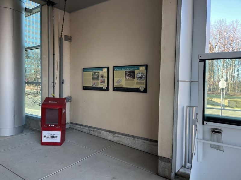
Small groups of people occupied a temporary camp here between 4,500 and 3,200 years ago. This era, called the Late Archaic by archaeologists, is characterized by changes in lifestyle. Growing numbers of people seasonally gathered in larger . . . — — Map (db m214232) HM
This land was once part of more than 1,100 acres acquired by the Terrett family by the mid-19th century. Within Fairfax County until annexed by the City of Alexandria in 1952, the area was primarily agricultural fieldsd and woodlands here before . . . — — Map (db m214230) HM
The area west of the Mill Race complex once was a sloping meadow through which ran the meandering tail race of the Cameron Mills. The mill site itself was located beneath what is now the parking garage of the Hoffman Center complex. Built in the . . . — — Map (db m27230) HM
Peter Wise, a city councilman and tanner, established the Duke Street Tanyard in 1797. The Business was situated near the stone bridge on the east bank of Hooff's Run by West End Village. The tannery's ownership and name changed many times; Quakers . . . — — Map (db m72479) HM
Josiah Watson, a wealthy merchant and postmaster of Alexandria, established his 272-acre plantation, “Bush Hill”, in 1791. Richard Marshall Scott purchased the plantation in 1791; his family stayed here for 200 years. Scott was an . . . — — Map (db m2610) HM
This historic site is a section of the mill race that provided water power to Cloud's Mill which stood directly across Paxton street.
At the intersection of Beauregard and Morgan Streets, water diverted from the Holmes Run ran through the . . . — — Map (db m150801) HM
Archaeologists excavated four ship hull remnants along the Alexandria waterfront — one from the Hotel Indigo Site (44AX229) and three from the Robinson Landing Site (44AX235). Over 200 years ago, Alexandrians repurposed these old merchant ships . . . — — Map (db m216125) HM
This park is named for Joseph M. Hensley, the City of Alexandria's Director of Recreation, Parks and Cultural Activities from 1977 until his retirement in 1986.
Joe devoted 33 years to improving the quality of life in Alexandria. Among the . . . — — Map (db m197471) HM
Archaeologists excavated four ship hull remnants along the Alexandria waterfront — one from the Hotel Indigo Site (44AX229) and three from the Robinson Landing Site (44AX235). Over 200 years ago, Alexandrians repurposed these old merchant ships . . . — — Map (db m216130) HM
Archaeologists excavated four ship hull remnants along the Alexandria Waterfront — one from the Hotel Indigo Site (44AX229) and three from the Robinson Landing Site (44AX235). Over 200 years ago, Alexandrians repurposed these old merchant ships . . . — — Map (db m216126) HM
Three roads formed this Fairfax County intersection by the early 19th century. Braddock Road, Middle Turnpike (later called Leesburg Pike/King Street/Route 7) and Quaker Lane were the wagon routes for trade between the port town of Alexandria and . . . — — Map (db m150816) HM
During the Civil War, thousands of formerly enslaved individuals came to Union-controlled Alexandria to seek refuge and freedom. As a result, several new African American neighborhoods developed during and after the Civil War, including four in . . . — — Map (db m239750) HM
The African American Heritage Trail along the waterfront consists of two interconnecting routes. Both begin at Waterfront Park. Together, these trails illuminate the history of the African American community in Alexandria over a span of several . . . — — Map (db m239718) HM
13,000 years ago
The Paleoindian Period
A Native American hunter during the Paleoindian period discards a broken spear point, on a bluff overlooking a tributary to the Potomac River at the southern edge of present-day Alexandria. . . . — — Map (db m166409) HM
The launch of urban renewal in 1965 led to a boom of archaeological discoveries in Alexandria's Old and Historic District. As buildings were razed exposing artifact-laden layers of history, community outcry demanded that the City address and halt . . . — — Map (db m115770) HM
Alexandria was established by Virginia's colonial assembly in 1749, over four decades the U.S. Congress authorized creation of a national capital on the banks of the Potomac River. Once the final site for the Federal city was selected by President . . . — — Map (db m141166) HM
The Alexandria Library's Kate Waller Barrett Branch (2 blocks north, 1 block east) and the Alexandria Black History Museum (6 blocks north) have an unusual shared history. The library building was constructed in 1938 and named for Dr. Kate Waller . . . — — Map (db m115715) HM
Just two blocks north of this location along Fayette Street (named for the Marquis de Lafayette who visited Alexandria in 1824), near the southwest corner of Queen Street, stood the Old Powder House, dating from 1791-1809. On the same spot, the . . . — — Map (db m115713) HM
Before the American Revolution, the Church of England was the established church of Virginia and part of the colonial government. For administrative purposes, the colony was divided into "parishes" and all residents paid taxes to maintain church . . . — — Map (db m115716) HM
At this intersection, a jail opened in 1827 when Alexandria was a part of Washington, D.C. In the 19th century, it housed criminals, debtors, and Civil War military prisoners. Before Emancipation, the jail was among the locations where enslaved . . . — — Map (db m243181) HM
One of King Street's greatest commercial buildings was built by one of Alexandria's most beloved citizens. Edgar Warfield, Jr. was born in 1842, and at the age of 18 he co-founded the "Old Dominion Rifles," a Confederate militia that served in . . . — — Map (db m115749) HM
Alexandria's electric streetcar system, the Washington, Alexandria & Mount Vernon Railway, was established in 1892 between Alexandria and Mount Vernon. In 1896, the line extended into Washington, crossing the Long Bridge where the 14th Street Bridge . . . — — Map (db m115760) HM
As Virginia's population grew, so did its reliance on fish from the Potomac River as a dietary staple. In 1813, the city authorities passed a law designating the county wharf at the foot of Oronoco Street as the official place for landing fish. . . . — — Map (db m239715) HM
The Alexandria waterfront has changed dramatically since the City's founding in 1749. The Potomac River once flowed along the high banks about two blocks west of here near Water (now Lee) Street. Two hundred and fifty years ago, the area where . . . — — Map (db m182672) HM
The building at 1315 Duke Street, two blocks south of here, was originally built around 1812 as a residence for General Robert Young, commander of Alexandria's militia, who died in 1824. This three-story brick building then became the . . . — — Map (db m115706) HM
In an 18th century town of mostly wooden buildings, where open flames provided heat, light and cooking on a daily basis, Alexandrians constantly faced the danger of fire. Water to fight fires had to be carried in buckets from nearby wells, town . . . — — Map (db m115714) HM
Restoration
In the early 20th century Alexandria's economy was struggling, despite major efforts to develop a strong industrial base. But by the early 1920s, inspired by efforts to restore the colonial city of Williamsburg, Virginia, . . . — — Map (db m129178) HM
Gadsby's Tavern Museum consists of two buildings — the smaller c.1875 tavern and larger 1792 City Tavern and Hotel. While both were constructed by John Wise, they were made famous by John Gadsby, a rising tavern keeper who rented the buildings . . . — — Map (db m115755) HM
George Washington considered Alexandria his hometown after its founding in 1749, and it is here that he came to do business, learn the events of the world, pick up mail, and visit friends. His first association with the town was probably as a 17 . . . — — Map (db m115747) HM
A visit to George Washington's Mount Vernon estate, about nine miles to the south, has long been viewed as a patriotic duty of Americans. In the late 19th century, visitors often traveled there from Washington by boat, stopping first in Alexandria. . . . — — Map (db m115719) HM
When Alexandria was founded in 1749, this corner was planned as the main intersection in the new town, with the streets named in honor of Thomas Fairfax, 6th Lord Fairfax of Cameron, a major land-owner in Northern Virginia. From Cameron Street, . . . — — Map (db m167213) HM
In 1804, Francois-Dominique Toussaint L'Ouverture, a formerly enslaved Haitian Black military leader, led the only successful uprising of enslaved people in the Western Hemisphere. As a result of the rebellion, the Caribbean island of Haiti . . . — — Map (db m239747) HM
All stories should end with accumulating snow.
Increasing depth racing the concluding plot
Erasing the physical details of the recent narrative
Leaving only softened shapes and relative positions
And as the end obliterating even . . . — — Map (db m143372) HM
During the 19th century, numerous entrepreneurs gradually improved the lots and expanded the warehouses and wharves associated with the 200 block of the Strand. Josiah Davis owned many properties along Alexandria's waterfront and bought property . . . — — Map (db m195640) HM
■ a living public art sculpture encompassing the entire park ■ a combination of three garden types: a hanging garden, topiary garden and rain garden ■ the result of an international design competition an important example of . . . — — Map (db m243158) HM
Revolutionary War hero Henry "Light Horse Harry" Lee, father of Confederate General Robert E. Lee, purchased several lots on North Washington Street in Alexandria soon after the War for Independence. He lived with his family in a house on Cameron . . . — — Map (db m115721) HM
Alexandria's Market Square was established only a few years after the town was founded in 1749. The site selected was centrally located in a prime block of the colonial settlement, immediately adjacent to the City Hall. At the time, Cameron and . . . — — Map (db m115757) HM
In the early morning hours of May 24, 1861, the day after a public referendum in Virginia supported secession from the United States, Alexandria was invaded by Union forces crossing the Potomac. Colonel Elmer E. Ellsworth, the young commander of the . . . — — Map (db m115753) HM
Living history
Discover the spirit of Alexandria that has been making history for centuries.
Alexandria has had a role in our nation's history since its founding in 1749. George Washington called Alexandria home in his . . . — — Map (db m236052) HM
Historically, Alexandria's development moved from east to west, and three distinct areas of the city have unofficially been known as the "West End." The first West End ended at Shuter's Hill, the current site of the George Washington Masonic . . . — — Map (db m115709) HM
The 500 block of King Street has long been associated with retail trade in Alexandria. In the late 18th century, Adam Lynn, Sr. owned the quarter-block at this corner of King and St. Asaph Streets, where he operated a small bake shop selling . . . — — Map (db m115746) HM
Alexandria, D.C.
In 1791, Alexandrians applauded their inclusion in the District of Columbia, believing that the town would benefit economically as part of the Federal district. These positive feelings toward inclusion in the District . . . — — Map (db m239716) HM
Potomac River ferry companies date back to as early as 1740, when Hugo West received permission to operate a ferry from the Hunting Creek warehouse in Prince William over the Potomac River to Fraziers Point in Maryland "...the price for a man 1 . . . — — Map (db m143267) HM
An extensive amount of man-made land hides the original topographical feature that characterized the southernmost tip of Alexandria's crescent-shaped bay. This area was known from at least the 1760s as Point Lumley. As it does today, the town . . . — — Map (db m239746) HM
John Hunter established one of the first shipyards in the City at the foot of Wilkes Street as early at 1783. The first "Potomac River Longboat" was built here at Hunters Shipyard in 1815. Shipbuilding and repair continued on this site for well . . . — — Map (db m143370) HM
Early Uses
The West End was a rough and rowdy area just outside Alexandria's city limits. Stockyards, rail tracks, a tavern, and small shops catered to the farmers and drovers supplying the city's markets in the years before the Civil War. . . . — — Map (db m236050) HM
The Stabler-Leadbeater Apothecary Museum traces one of America's oldest continuously-run family businesses that combined manufacturing, wholesaling and retailing. Founded in 1792, and operated just across Fairfax Street until 1933, the pharmacy . . . — — Map (db m115762) HM
The Alexandria Custom House stood here in 1917. Built in 1858, the third floor of the three-story granite building housed the U.S. District Court for the Eastern District of Virginia. On November 27, 1917, a hearing in that courtroom would play a . . . — — Map (db m182671) HM
Between 1820 and 1860, Alexandria had a thriving cabinet and furniture-making industry, primarily along King Street, between Royal and Alfred streets. Among the city's best-known furniture makers—and business rivals—were Charles Koones and James . . . — — Map (db m195643) HM
One block south is The Alexandria Lyceum, formed as a public education organization in 1834 by Quaker schoolmaster Benjamin Hallowell and other civic leaders. In 1839, the founders joined with the Alexandria Library Company to construct a . . . — — Map (db m115718) HM
Home to the Northern Virginia Fine Arts Association, the Athenaeum is a fine example of Greek Revival architecture, with a long and colorful history of occupation. The building was constructed between 1851 and 1852 as the Bank of the Old Dominion, . . . — — Map (db m115768) HM
In 1860, Alexandria was a vibrant southern city boasting a population of 12,652 and 96 firms which produced everything from bark to tin-ware. During the U.S. Presidential campaign in the fall of 1860, business-minded Alexandrians were decidedly . . . — — Map (db m115781) HM
On January 1, 1808, the earliest date allowed by Article I, Section 9 of the United States Constitution, the Act Prohibiting Importation of Slaves went into effect and stated, "It shall not be lawful to import or bring into the United . . . — — Map (db m188750) HM
The West End in the 19th century centered on Duke Street and Diagonal Road. Large undeveloped, the area was devoted to stockyards, agricultural shipment, and "a" notorious business: the slave trade. The house at 1707 Duke Street (left) was part . . . — — Map (db m151028) HM
Underground ice wells were used in the 18th and 19th centuries to store ice for use during the warm months. In Alexandria, blocks of ice were cut from the Potomac River. Ice was placed in this well through a square opening which is marked in the . . . — — Map (db m129196) HM
In 1793, the Alexandria Common Council granted permission for John Wise to build an icehouse underneath the corner of Royal and Cameron Streets as part of his construction of the new City Tavern.
This brick-lined ice well is a unique . . . — — Map (db m243155) HM
Throughout most of the nineteenth century, three buildings stood on this section of 1300 to 1312 King Street, on what previously had been vacant land. The main structures on Lots 1 and 2 have been preserved, whereas the building on Lot 3 was . . . — — Map (db m236062) HM
Close to midnight on Tuesday, August 8, 1899, Benjamin Thomas, a 16-year-old Black Alexandrian, was lynched from a lamppost on this corner.
Earlier, white rioters attacked the City Jail on N. St. Asaph Street, where they seized and dragged . . . — — Map (db m188809) HM
From this point, King Street slopes gently down to the Potomac. But when Alexandria was founded in 1749, the new town was perched on a high bluff some 20 feet above the river. The town was established on a shore of a crescent-shaped bay that . . . — — Map (db m115766) HM
From 1898 to 1911, a 181-foot-long side wheel steamboat based out of Washington, D.C., called the River Queen would sometimes dock at the wharf at the foot of Prince Street in Alexandria. Build in 1864, it had first gained fame as the site . . . — — Map (db m239733) HM
At the turn of the 20th century, Alexandria was home to at least a dozen pharmacies, two of them associated with the name Timberman. Charles Parke Custis Timberman and other brother John Elmer Winfield Timberman were born near Pohick Church in . . . — — Map (db m115723) HM
The Torpedo Factory Art Center Building was formerly a munitions plant during World Wars I and II. In September, 1974, the Art Center opened in the Torpedo Factory as a Bicentennial project. The idea was conceived by Marian Van Landingham, a . . . — — Map (db m98078) HM WM
Originally called the United States Naval Torpedo Station, the Torpedo Factory was built during World War I, and was specifically designed for the fabrications of dangerous naval ordnance. The building was barely completed when that war ended in . . . — — Map (db m115784) HM
Few periods of Alexandria's history have been more tumultuous than the War of 1812. During the first decade of the 19th century, Great Britain's interception of American ships, impressment of U.S. seamen, and support of Indian aggression along the . . . — — Map (db m115769) HM
Archaeological Evidence of a Working Seaport
The archaeologists tasked with researching this property on the 200 block of South Union Street used a host of sources such as historic photographs, lithographs, deeds, court cases, newspapers, . . . — — Map (db m195635) HM
The Wilkes Street Tunnel was part of the eastern division of the Orange & Alexandria Railroad, founded in 1848 to promote trade with western Virginia. The Orange & Alexandria inaugurated its track in Alexandria on May 7, 1851 with a run from the . . . — — Map (db m143378) HM
Now a city park, Windmill Hill got its name from the windmill built here on Miller's Cliff by inventor John R. Remington in 1843. With soothing winds and a grand view of the busy port, the hill was the scene of fashionable promenades and numerous . . . — — Map (db m143377) HM
In honor of all from the City of Alexandria who served and died during World War I
Robert Adams •
George Anderton •
Stanley Bernard •
Herbert Bernhard •
William Bradley •
Bernard Brock •
William Brown •
Christopher Cloxom • . . . — — Map (db m129195) WM
A small group of Christian believers established Zion Baptist Church in 1864 on the corner of Wolfe and South Union Streets, northeast of the Wilkes Street Tunnel. At the end of the Civil War, Zion Baptist was one of five African American Baptist . . . — — Map (db m239753) HM
This area, called "Cross Canal," was a neighborhood of black residents who settled across from the canal shortly after the Civil War. The canal, located just north of this marker, extended from the Potomac River to Washington Street, thence north to . . . — — Map (db m129476) HM
During the Civil War, thousands of African Americans fled to the Union-controlled city, either moving into government-run freedmen camps; settling into historically black neighborhoods such as the Bottoms, or seeking out affordable housing on the . . . — — Map (db m237644) HM
Populated almost exclusively by Black residents, the racially segregated neighborhood of The Berg evolved by necessity to have its own set of dwellings, amenities, and social institutions. Houses like the "five frame shanties" that stood on this . . . — — Map (db m204836) HM
Neighborhoods function as support networks and knit people together. For Alexandria's Black residents in the late-19th and early-20th centuries, establishing neighborly bonds was essential for survival within a racist, segregated society.
In . . . — — Map (db m204833) HM
During the Civil War, an influx of self-emancipated slaves (often referred to as "contrabands") arrived in Alexandria. For several decades thereafter, this population, along with other free Black migrants, changed the racial character of both the . . . — — Map (db m204837) HM
Beneath this block lies Lock and Pool No. 2 of the Alexandria Canal. Construction of this seven-mile section of the canal began on the 4th of July, 1831 under the direction of Captain William Turnbull of the U.S. Army Topographical Engineers, and . . . — — Map (db m237641) HM
Located on both sides of Montgomery Street between North Fairfax and North Lee Streets, the Old Dominion Glass Company opened its doors in 1901 to produce high quality soda, beer, and medicine bottles. Along with the Belle Pre Bottle Company, the . . . — — Map (db m237636) HM
This is the original entrance to the Robert H. Robinson Library, built in 1940 as the segregated facility for Alexandria's African American residents. — — Map (db m188812) HM
On August 21, 1939, five young African-American men, William Evans, Edward Gaddis, Morris Murray, Clarence Strange and Otto Tucker entered the Barrett Library, then a whites-only segregated, public facility. When they requested library cards and . . . — — Map (db m195649) HM
This modest, wood-frame building has played an important role in the segregated history of Alexandria. During World War II, the federal government encouraged women to join the war effort by providing safe and affordable day care. In Alexandria, . . . — — Map (db m129190) HM
For over a century, this two-acre block was occupied by a mansion known as Colross. Built in 1800 by John Potts, the mansion, with its outbuildings, gardens, orchard, and a "clover lot" was in effect a small plantation.
Colross's owners . . . — — Map (db m72384) HM
Alexandria's First Cotton Factory
On April 19, 1847, the Mount Vernon Manufacturing Company purchased this lot along North Washington Street. The present building on this site was completed a year later in 1848, becoming the city's first . . . — — Map (db m127782) HM
Over the course of the Civil War (1861-1865), the Union Army Surgeon General of Alexandria opened over 30 military hospitals with 6,500 beds within the city limits. Grosvenor Hospital was added as a branch of Mansion House on August 17, 1862, and . . . — — Map (db m185293) HM
In 1941, the United States Housing Authority (USHA), under the Federal Works Agency, began to plan for the construction of permanent housing for Black defense workers in the Uptown neighborhood. Then known as the Lanham Act Alexandria Defense . . . — — Map (db m182231) HM
Panel 1:
In the summer of 1939, Attorney Samuel W. Tucker organized six youths — William Evans, Otto Tucker, Edward Caddis, Morris Murray, Clarence Strange, and Robert Strange — for a “sit-in” at the segregated . . . — — Map (db m141636) HM
Shuter's Hill, a high bluff overlooking King Street, is probably named for the a local resident named Shuter who lived nearby in the 1740s. The site has been visited by people for more than 5,000 years. In fact, archaeologists have uncovered . . . — — Map (db m115785) HM
A small slaughterhouse stood on this spot in the 1870s and 1880s. Its discovery occurred when the City of Alexandria made plans to rebuild Jefferson-Houston School. A City ordinance requires archaeological research to take place prior to . . . — — Map (db m195662) HM
About 100 years before Ramsey Homes was built, prominent Alexandrian Henry Daingerfield purchased this parcel of land. In 1849, prominent Alexandrian Henry Daingerfield purchased a parcel of land upon which the Ramsey Homes would eventually be . . . — — Map (db m188811) HM
Enforced racial segregation in Alexandria meant separate, poorly funded schools for the City's African American students. Here, in the African American neighborhood then known as Uptown, a new school was built in 1920 at 901 Wythe Street for . . . — — Map (db m182228) HM
The racially integrated working-class neighborhood known as the Hump, named for the high ground at its northern boundary, once spanned three blocks, centering on the 800 block of Montgomery Street. The Hump was first settled in the decade . . . — — Map (db m72500) HM
African Americans in Alexandria suffered, along with other of their race, when a segregated system prevented them from enjoying recreation facilities in their hometown.
From 1926 to 1951, the city had a municipal pool for white residents . . . — — Map (db m80843) HM
Parker-Gray High School served Alexandria's African American students—first on Wythe Street and later on Madison Street—during the City's years of enforced school segregation. With little support from the City, the school's faculty and coaches . . . — — Map (db m195656) HM
This city block became part of the Alexandria town grid in 1798. Near the rural outskirts of the developing town, the block remained vacant throughout the nineteenth century. Colross, a country estate, was established in the vicinity, and outside . . . — — Map (db m70671) HM
The Alexandria War Memorial in front of Alexandria Union Station was dedicated on November 11, 1940, before a crowd of 3,000 people. A nearby flag pole was also dedicated in the ceremony. Numerous dignitaries attended, including the City's mayor, . . . — — Map (db m216133) HM
Captain Rocky Versace Plaza
and
Vietnam Veterans Memorial
[In the center of the memorial:]
★ My son is ★ was ★ he often did ★ does ★ his eyes are ★ were brown ★
Tere Rios Versace . . . — — Map (db m115677) WM
Four Mile Run and the course of its namesake waterway have changed dramatically over the centuries, partly due to natural events and partly to modern human engineering. Although a setting for a rich abundance of plant and animal . . . — — Map (db m130987) HM
Local citizens formed the Town of Potomac on March 13, 1908, to provide better services and promote growth. Taxes paid for police and public works projects, such as water and sewer service to replace polluted wells and outhouses. Electric . . . — — Map (db m146442) HM
150 entries matched your criteria. The first 100 are listed above. The final 50 ⊳