By Bill Kirchner, September 23, 2014
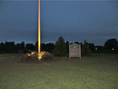
Naval Ammunition Depot Marker
| On South Technical Boulevard south of U.S. 6, on the right when traveling south. |
| On West 2nd Street (Business U.S. 6) east of North Hastings Avenue, on the left when traveling east. |
| On West 70th Street, 0.4 miles west of Shiloh Avenue, on the right when traveling west. |
| On County Road 198, 0.1 miles east of L Street (524th Road), on the right when traveling east. |
| On N Street south of East 2nd Street, on the left when traveling south. |
| On East 2nd Street at N Street, on the left when traveling west on East 2nd Street. |
| On L Street (U.S. 275) at Riverside Park Road, on the left when traveling north on L Street. |
| On N Street south of East 2nd Street, on the left when traveling south. |
| On N Street south of East 2nd Street, on the left when traveling south. |
| On 513 Avenue, 1.4 miles north of Orchard, on the left when traveling north. Reported permanently removed. |
| On West 2nd Street just west of South Center Street (State Highway 45), on the right when traveling west. |
| On Heath Street at Cedar Street, on the right when traveling west on Heath Street. |
| On Front Street (State Highway 14) just north of 10th Street, on the right when traveling north. |
| On Front Street (State Highway 14) just north of 10th Street, on the right when traveling north. |
| On Beaver Street (State Highway 39) at 4th Street, on the right when traveling west on Beaver Street. |
| On Perkins Road (State Highway 2) just east of County Road 57, on the left when traveling east. |
| On Box Butte Avenue just south of West 18th Street, on the right when traveling south. |
| On State Highway 87 at Dodge Road (State Highway 7E), on the right when traveling north on State Highway 87. |
| On Sampson Street just north of Outlaw Trail Scenic Byway (State Highway 12), on the right when traveling north. |
| On State Highway 12, on the right when traveling west. |
| On U.S. 20 at milepost 235, on the right when traveling west. |
| On US 20 (U.S. 20), on the left when traveling east. |
| On North Main Street, 0.1 miles south of East 3rd Street, on the left when traveling south. |
| On Court Street (State Highway 10C) at 2nd Street, on the left when traveling south on Court Street. |
| On Windmill St Recreation Road east of Lowell Road (Nebraska Route 10C), on the right when traveling east. |
| On 2nd Street near Court Street (Nebraska Highway 10C), on the left when traveling west. |
| On Windmill State Recreation Road just west of Lowell Road (Nebraska Route 10C), on the right when traveling east. |
| On 2nd Street east of Court Street (Nebraska Highway 10C), on the right when traveling east. |
| On U.S. 30, 0.1 miles east of Navaho Road. |
| On LaBarre Street at 1st Street, on the left when traveling south on LaBarre Street. |
| On U.S. 30, on the right when traveling west. |
| On 31st Street at Central Avenue, on the right when traveling west on 31st Street. |
| On Central Avenue near 22nd Street, on the right when traveling north. |
| On 31st Street at Central Avenue, on the right when traveling west on 31st Street. |
| On West 11th Street at 6th Avenue, on the right when traveling west on West 11th Street. |
| On Central Avenue at 19th Street, on the left when traveling north on Central Avenue. |
| On Central Avenue at East 25th Street (U.S. 30), on the left when traveling south on Central Avenue. |
| On U.S. 30, 0.2 miles east of 46th Avenue, on the right when traveling east. |
| On Central Avenue at Railroad Street, on the right when traveling north on Central Avenue. |
| On Central Avenue near 19th Street, on the left when traveling north. |
| Near University Drive, 0.2 miles east of Lincoln Highway (U.S. 30), on the right when traveling east. |
| On Interstate 80 at milepost 271, on the right when traveling west. |
| On U.S. 30 at 1733 Road, on the right when traveling east on U.S. 30. |
| On 9th Avenue at U.S. 30, on the right when traveling south on 9th Avenue. |
| On State Highway 2, 1 mile east of Ravenna Road (State Highway 68), on the right when traveling east. |
| On Grand Avenue (State Highway 68) at East Syracuse Street, on the right when traveling north on Grand Avenue. |
| On State Highway 2, 1 mile east of Ravenna Road (State Highway 68), on the right when traveling east. |
| On State Highway 2, 1 mile east of Ravenna Road (State Highway 68), on the right when traveling east. |
| On U.S. 30 at South C Street, on the left when traveling west on U.S. 30. |
| On U.S. 30 at South D Street, on the right when traveling west on U.S. 30. |
| On Lincoln Highway (U.S. 30) at C Street, on the right when traveling west on Lincoln Highway. |
| On U.S. 75, 0 miles north of O Street, on the right when traveling north. |
| On South 4th Street (State Highway 15) just south of Kansas Street, on the left when traveling south. |
| On Road 41 close to Road M, on the right. |
| On Road 41 close to Road M, on the right. |
| On Main Street, on the right when traveling east. |
| On Main Street, on the right when traveling east. |
| Near Main Street, on the right when traveling west. |
| On Main Street west of North 6th Street, on the right when traveling west. |
| On Main Street, on the right when traveling east. |
| On Main Street, on the right when traveling east. |
| On Livingston Highway (U.S. 34), on the right when traveling east. |
| On Main Street, on the right when traveling east. |
| On Main Street, on the right when traveling east. |
| On State Highway 50, on the left when traveling north. |
| Near U.S. 81, 1.5 miles south of 898th Rd.. |
| On U.S. 81, 1.5 miles south of 898th Rd. |
| Near U.S. 81, 1.5 miles south of 898th Rd.. |
| Near U.S. 81, 1.5 miles south of 898th Rd.. |
| Near U.S. 81, 1.5 miles south of 898th Rd.. |
| On South Broadway Avenue north of East Franklin Street (State Highway 84), on the right when traveling north. |
| On West Franklin Street (State Highway 84) east of South Robinson Avenue, on the left when traveling east. |
| On Mill Street near 2nd Street. |
| On Broadway Street (U.S. 6) south of West 10th Street, on the right when traveling south. |
| On Bodeman Park Drive just north of U.S. 6, on the right when traveling north. |
| On U.S. 20, on the right when traveling east. |
| On State Highway 61, 0.2 miles north of Survey Valley Road, on the left when traveling north. |
| On U.S. 20, 3 miles west of U.S. 83, on the left when traveling west. |
| On U.S. 20 at milepost 198, on the right when traveling west. |
| On U.S. 20 at milepost 221 east of Main Street, on the right when traveling west. |
| On Gold Rush Byway (U.S. 385) 0.3 miles south of Local Road 38, on the left when traveling north. |
| On Main Street (Lincoln Highway) (U.S. 30) at Road 79, on the right when traveling east on Main Street (Lincoln Highway). |
| On Front Street at Elm Street, on the left when traveling west on Front Street. |
| On Illinois Street (Lincoln Highway) (U.S. 30) at 8th Avenue, on the right when traveling west on Illinois Street (Lincoln Highway). |
| Near Interstate 80 (at milepost 61), 1.3 miles east of Upland Parkway (Alternate Interstate 80), on the right when traveling west. |
| On Illinois Street (aka Lincoln Highway) (U.S. 30) at Ball Street, on the right when traveling east on Illinois Street (aka Lincoln Highway). |
| On Hickory Street at 10th Street, on the left when traveling east on Hickory Street. |
| On Fort Sidney Road, 0.1 miles north of Deaver Drive, on the left when traveling north. |
| Near Interstate 80 (at milepost 61), 1.3 miles east of Upland Parkway (Alternate Interstate 80), on the right when traveling west. |
| Near Interstate 80 (at milepost 61), 1.3 miles east of Upland Parkway (Alternate Interstate 80), on the right when traveling west. |
| On Lincoln Highway (U.S. 30) 1 mile west of 13th Avenue, on the left when traveling west. |
| On Lincoln Highway (U.S. 30) near Road 99, on the left when traveling east. |
1000 entries matched your criteria. The first 100 are listed above.
Next 100 ⊳