598 entries match your criteria. Entries 201 through 300 are listed.⊲ Previous 100 — Next 100 ⊳
Historical Markers and War Memorials in North Dakota
By Connor Olson, April 19, 2019
The Stone Circle
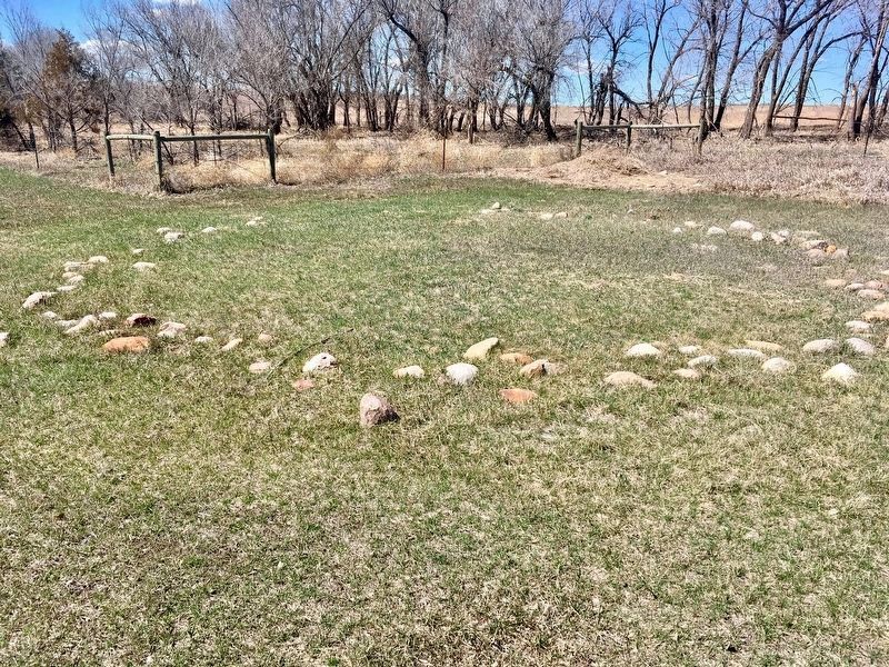
| 201 ► North Dakota, Dunn County, Dunn Center — A Mystery Exposed — |
| Near Fourth Street Southwest east of Olson Lane. | |||
| 202 ► North Dakota, Dunn County, Dunn Center — Chelsey and Polly Dinkins Memorial Dam — Refuge Manager and Wife — 1936-1983 — |
| On 5th Street SW, 0.3 miles south of 4th Street SW, on the right when traveling south. | |||
| 203 ► North Dakota, Dunn County, Killdeer — Killdeer Mountain — Tachawakute (The Place Where They Kill Deer)* — |
| On Killdeer Mount Battlefield Road, on the right when traveling north. | |||
| 204 ► North Dakota, Eddy County, New Rockford — Eddy County Vietnam Veterans Memorial — |
| On 1st Avenue North at 3rd Avenue North East, on the right when traveling north on 1st Avenue North. | |||
| 205 ► North Dakota, Eddy County, Sheyenne — Veterans of Foreign Wars Memorial — |
| On 3rd Street South just north of Sunnyside Avenue, on the right when traveling north. | |||
| 206 ► North Dakota, Emmons County, Hazelton — 1st Hazelton Post Office 1903 — History of Hazelton, N.D. Post Office — |
| On Main Street just east of Cook Avenue, on the right when traveling east. | |||
| 207 ► North Dakota, Emmons County, Linton — Emmons County Record — |
| On Broadway Street North at East Maple Avenue, on the right when traveling north on Broadway Street North. | |||
| 208 ► North Dakota, Foster County, Carrington — Thomas Nichols Putnam House — |
| On Main Street just west of 5th Avenue North, on the right when traveling west. | |||
| 209 ► North Dakota, Golden Valley County, Beach — Custer Trail — |
| On 4th Street Northeast (State Highway 16) just east of North Central Avenue, on the left when traveling east. | |||
| 210 ► North Dakota, Golden Valley County, Beach — 17 — Votes for Women — Road to the 19th Amendment — National Votes for Women Trail — |
| On 1st Avenue Southeast south of 1st Street Southeast, on the right when traveling south. | |||
| 211 ► North Dakota, Grand Forks County, Arvilla — C.C.C. Memorial — 1934 1942 — |
| On Park Avenue NE, 0.2 miles west of Wood Avenue. | |||
| 212 ► North Dakota, Grand Forks County, Arvilla — Civilian Conservation Corp (CCC) Project — |
| On Park Avenue NE, 0.2 miles west of Wood Avenue. | |||
| 213 ► North Dakota, Grand Forks County, Grand Forks — A Brutal Winter — |
| On North 3rd Street at 1st Avenue North on North 3rd Street. | |||
| 214 ► North Dakota, Grand Forks County, Grand Forks — A Flood of Assistance — |
| On North 3rd Street at 2nd Avenue North, on the right when traveling north on North 3rd Street. | |||
| 215 ► North Dakota, Grand Forks County, Grand Forks — A Story of Triumph — |
| On North 3rd Street near 2nd Avenue North. | |||
| 216 ► North Dakota, Grand Forks County, Grand Forks — Alexander Griggs — 1838-1903 — |
| Near South 4th Street at Bruce Avenue, on the left when traveling north. | |||
| 217 ► North Dakota, Grand Forks County, Grand Forks — Blizzard "Hannah" — |
| On North 3rd Street at 1st Avenue North on North 3rd Street. | |||
| 218 ► North Dakota, Grand Forks County, Grand Forks — Blooming 46 School House — |
| On Belmont Road. | |||
| 219 ► North Dakota, Grand Forks County, Grand Forks — Campbell House — |
| On Belmont Road. | |||
| 220 ► North Dakota, Grand Forks County, Grand Forks — Clifford Annex — 407-411 DeMers Avenue — 1906-1998 — |
| On DeMers Avenue (Business U.S. 2) just east of South 5th Street, on the right when traveling east. | |||
| 221 ► North Dakota, Grand Forks County, Grand Forks — Digging Through the Muck — |
| On North 3rd Street near 2nd Avenue North. | |||
| 222 ► North Dakota, Grand Forks County, Grand Forks — Dinnie Block — 109 North Third Street — 1907 - 1997 — |
| On North Third Street at 2nd Avenue North on North Third Street. | |||
| 223 ► North Dakota, Grand Forks County, Grand Forks — Electric Construction Company — 16 South Fourth Street — 1908-1998 — |
| On South 4th Street just south of DeMers Avenue (Business U.S. 2), on the right when traveling south. | |||
| 224 ► North Dakota, Grand Forks County, Grand Forks — Evacuating Two Cities — |
| On North 3rd Street at 1st Avenue North on North 3rd Street. | |||
| 225 ► North Dakota, Grand Forks County, Grand Forks — Fannie Mahood Heath Memorial Garden — |
| On Belmont Road. | |||
| 226 ► North Dakota, Grand Forks County, Grand Forks — Finks and Gokey Block — National Register of Historic Places — |
| On DeMers Avenue (Business U.S. 2) just east of North 5th Street, on the right when traveling east. | |||
| 227 ► North Dakota, Grand Forks County, Grand Forks — First National Bank Building — National Register of Historic Places — |
| On DeMers Avenue (Business U.S. 2) at North 4th Street, on the left when traveling east on DeMers Avenue. | |||
| 228 ► North Dakota, Grand Forks County, Grand Forks — Flames and Flood — |
| On North 3rd Street at 2nd Avenue North on North 3rd Street. | |||
| 229 ► North Dakota, Grand Forks County, Grand Forks — Grand Forks County Courthouse — National Register of Historic Places — |
| Near South 4th Street just north of Bruce Avenue, on the left when traveling north. | |||
| 230 ► North Dakota, Grand Forks County, Grand Forks — Grand Forks' First Post Office — |
| On Belmont Road. | |||
| 231 ► North Dakota, Grand Forks County, Grand Forks — Grand Forks Flood Protection Project — Dedicated April 22, 2007 — |
| On Demers Avenue at North 3rd Street on Demers Avenue. | |||
| 232 ► North Dakota, Grand Forks County, Grand Forks — Lincoln Drive - a neighborhood history — |
| On Euclid Avenue. | |||
| 233 ► North Dakota, Grand Forks County, Grand Forks — Lustron — |
| On Belmont Road. | |||
| 234 ► North Dakota, Grand Forks County, Grand Forks — New Hampshire Apartments — 105 North Third Street — 1904 - 1997 — |
| On North 3rd Street at 1st Avenue North on North 3rd Street. | |||
| 235 ► North Dakota, Grand Forks County, Grand Forks — North Dakota's Oldest Concrete Pavement — |
| On Belmont Road. | |||
| 236 ► North Dakota, Grand Forks County, Grand Forks — Oxcarts — |
| Near Belmont Road at 24th Avenue South, on the right when traveling north. | |||
| 237 ► North Dakota, Grand Forks County, Grand Forks — Rebuilding and Recovery — |
| On North 3rd Street near 2nd Avenue North. | |||
| 238 ► North Dakota, Grand Forks County, Grand Forks — Returning to Devastation — |
| On North 3rd Street at 2nd Avenue North on North 3rd Street. | |||
| 239 ► North Dakota, Grand Forks County, Grand Forks — Security Trust Company — 101 North Third Street — 1889 - 1997 — |
| On North 3rd Street at 1st Avenue North on North 3rd Street. | |||
| 240 ► North Dakota, Grand Forks County, Grand Forks — The Flood Fight Begins — |
| On North 3rd Street at 1st Avenue North on North 3rd Street. | |||
| 241 ► North Dakota, Grand Forks County, Grand Forks — The Flood of 1997 — |
| On 6th Avenue North at North 24th Street on 6th Avenue North. | |||
| 242 ► North Dakota, Grand Forks County, Grand Forks — The Old Red River Ox-Cart Trail — |
| On Belmont Road. | |||
| 243 ► North Dakota, Grand Forks County, Grand Forks — The River Wins — |
| On North 3rd Street at 1st Avenue North on North 3rd Street. | |||
| 244 ► North Dakota, Grand Forks County, Grand Forks — 15 — Votes For Women — Road to the 19th Amendment — National Votes for Women Trail — |
| Near Bruce Avenue at South 4th Street, on the left when traveling north. | |||
| 245 ► North Dakota, Grand Forks County, Grand Forks — Welcome to Memorial Park — |
| On 1st Avenue North at North 3rd Street on 1st Avenue North. | |||
| 246 ► North Dakota, Grand Forks County, Grand Forks Air Force Base — B-25J "Flo" — |
| On 19th Avenue near 25th Street North East. | |||
| 247 ► North Dakota, Grand Forks County, Grand Forks Air Force Base — Minuteman III ICBM — |
| On 19th Avenue at 25th Street North East on 19th Avenue. | |||
| 248 ► North Dakota, Grand Forks County, Grand Forks Air Force Base — Missile Transporter Erector — |
| On 19th Avenue at 25th Street North East on 19th Avenue. | |||
| 249 ► North Dakota, Grand Forks County, Larimore — Larimore City Hall — |
| On Tower Avenue (North Dakota Route 18). | |||
| 250 ► North Dakota, Grand Forks County, Niagara — Old Fort Totten Trail — |
| Near U.S. 2 at 21st Avenue Northeast, on the right when traveling west. | |||
| 251 ► North Dakota, Grant County, Carson — Bismarck-Deadwood Stage Trail — Cannonball Stage Station State Historic Site — |
| Near 53rd Avenue SW, on the right when traveling south. | |||
| 252 ► North Dakota, Grant County, Carson — Cannonball Stage Station — |
| On 53rd Avenue Southwest, 1 mile south of 82nd Street Southwest, on the right when traveling south. | |||
| 253 ► North Dakota, Grant County, Carson — Passenger Coaches — Cannonball Stage Station State Historic Site — |
| Near 53rd Avenue SW, on the right when traveling south. | |||
| 254 ► North Dakota, Griggs County, Binford — Camp Atchison Historic Site — |
| On State Highway 1, 0.4 miles south of 8th Street NE, on the left when traveling south. | |||
| 255 ► North Dakota, Griggs County, Binford — Lake Jessie Historic Site — |
| Near 9th Street Northeast near 107th Avenue Northeast. | |||
| 256 ► North Dakota, Griggs County, Binford — U.S. Army Wagoneers — Historic Site — |
| On North Dakota Route 65 near 106th Avenue Northwest, on the left when traveling west. | |||
| 257 ► North Dakota, Griggs County, Binford — Watne — Tvedte (Tweed) — |
| On North Dakota Route 65 near 106th Ave Northeast, on the left when traveling west. | |||
| 258 ► North Dakota, Griggs County, Cooperstown — Griggs County Court House — Erected - 1885 — |
| On Rollin Avenue Southwest just west of 9th Street Southeast (State Highway 45), on the left when traveling west. | |||
| 259 ► North Dakota, Griggs County, Cooperstown — Launch Facility Security — Ronald Reagan Minuteman Missile State Historic Site — November-33 Launch Facility — |
| Near 2nd Street NE (North Dakota Route 200) 0.2 miles east of 116th Avenue NE, on the right when traveling east. | |||
| 260 ► North Dakota, Griggs County, Cooperstown — Launcher Closure Door — Ronald Reagan Minuteman Missile State Historic Site — November-33 Launch Facility — |
| Near North Dakota Route 200, 0.2 miles east of 116th Avenue NE, on the right when traveling east. | |||
| 261 ► North Dakota, Griggs County, Cooperstown — Missile Maintenance — Ronald Reagan Minuteman Missile State Historic Site - — November-33 Launch Facility — |
| Near North Dakota Route 200, 0.2 miles 116th Avenue NE, on the right when traveling east. | |||
| 262 ► North Dakota, Griggs County, Cooperstown — Missile Transport — Ronald Reagan Minuteman Missile State Historic Site — November-33 Launch Facility — |
| Near 2nd Street NE (North Dakota Route 200) 0.2 miles east of 116th Avenue NE, on the right when traveling east. | |||
| 263 ► North Dakota, Griggs County, Cooperstown — More than Meets the Eye — Ronald Reagan Minuteman Missile State Historic Site — November-33 Launch Facility — |
| Near North Dakota Route 200, 0.2 miles east of 116th Avenue NE, on the right when traveling east. | |||
| 264 ► North Dakota, Griggs County, Cooperstown — November-33: "Ace in the Hole" — Ronald Reagan Minuteman Missile State Historic Site — November-33 Launch Facility — |
| On 2nd Street NE (North Dakota Route 200) 0.2 miles east of 116th Avenue NE, on the right when traveling east. | |||
| 265 ► North Dakota, Griggs County, Cooperstown — Opheim Cabin — First Permanent Home in Griggs County — |
| On 9th Street Southeast (State Highway 45) just north of Odegard Avenue Southwest, on the left when traveling north. | |||
| 266 ► North Dakota, Griggs County, Cooperstown — Oscar-Zero: Command, Control and Support — |
| On 113th 1/2 Avenue Northeast near 113th Avenue Northeast (State Route 45), on the left when traveling north. | |||
| 267 ► North Dakota, Griggs County, Cooperstown — Strategic Arms Reduction Treaty (START) — Ronald Reagan Minuteman Missile State Historic Site — November-33 Launch Facility — |
| Near 2nd Street NE (North Dakota Route 200) 0.2 miles east of 116th Avenue NE, on the right when traveling east. | |||
| 268 ► North Dakota, Griggs County, Cooperstown — The Minuteman: America's "Ace in the Hole" — Ronald Reagan Minuteman Missile State Historic Site — November-33 Launch Facility — |
| Near 2nd Street NE (North Dakota Route 200) 0.2 miles east of 116th Avenue NE, on the right when traveling east. | |||
| 269 ► North Dakota, Hettinger County, Mott — Detachment One Company C — 141st Engineer Combat Battalion, Corps (Whl) — Mott, North Dakota — |
| On Brown Avenue just north of East 5th Street, on the right when traveling north. | |||
| 270 ► North Dakota, Kidder County, Dawson — Dawson Congregational Church Bell — |
| On Lake Avenue at Thompson Street South East, on the right when traveling north on Lake Avenue. | |||
| 271 ► North Dakota, Kidder County, Dawson — Dawson Veterans Memorial Park — |
| On Lake Avenue at Thompson Street, on the right when traveling north on Lake Avenue. | |||
| 272 ► North Dakota, Kidder County, Steele — The World's Largest Sandhill Crane — |
| On 5th Street North East, 0.1 miles east of Mitchell Avenue North. | |||
| 273 ► North Dakota, Kidder County, Tappen — Dr. J.S. Weiser — Killed here by the Sioux — July 24, 1863 — |
| Near 27th Street SE, 1 mile east of 40th Avenue SE. | |||
| 274 ► North Dakota, Kidder County, Tappen — Sibley Trail — McPhaill’s Butte — July 24, 1863 — |
| Near 30th Street Southeast near 39th Avenue Southeast. | |||
| 275 ► North Dakota, Lamoure County, Edgeley — Ray Schlosser — Aug 29, 1911 - April 22, 1995 — |
| Near U.S. 281, 0.3 miles north of 65th St. SE. | |||
| 276 ► North Dakota, Lamoure County, Kulm — In Memory of the Sioux Indians — |
| Near 86th Street Southeast near 73rd Avenue Southeast. | |||
| 277 ► North Dakota, Lamoure County, Kulm — In Memory of the Soldiers — |
| Near 73rd Avenue Southeast near 86th Avenue Southeast. | |||
| 278 ► North Dakota, Lamoure County, Kulm — Whitestone Hill Battlefield State Historic Site — |
| Near 73rd Avenue Southeast near 86th Avenue Southeast. | |||
| 279 ► North Dakota, LaMoure County, LaMoure — Civilian Conservation Corps Project — |
| On State Highway 13, 0.6 miles west of Main St, on the right when traveling east. | |||
| 280 ► North Dakota, LaMoure County, LaMoure — Honorable Milton R. Young — |
| On 3rd Avenue Southwest (State Highway 13) 0.2 miles west of Main St, on the left when traveling east. | |||
| 281 ► North Dakota, LaMoure County, LaMoure — LaMoure County Courthouse — |
| On 4th Avenue Northeast at 2nd St. NE, on the right when traveling west on 4th Avenue Northeast. | |||
| 282 ► North Dakota, LaMoure County, LaMoure — Steamboats on the River — |
| On State Highway 13, 0.2 miles west of Main St, on the left when traveling east. | |||
| 283 ► North Dakota, LaMoure County, LaMoure — Symbol of Freedom — |
| On 3rd Avenue Southwest (State Highway 13) 0.2 miles west of Main St, on the left when traveling east. | |||
| 284 ► North Dakota, Logan County, Napoleon — Oley T. Thompson — Historical Marker — |
| On State Highway 3 at 65th Street SE on State Highway 3. | |||
| 285 ► North Dakota, McHenry County, Granville — Gilbert Peterson Cabin — Built 1890 — |
| On McHenry Avenue north of 3rd Street, on the left when traveling north. | |||
| 286 ► North Dakota, McIntosh County, Ashley — Ashley Jewish Homesteaders Cemetery - Left Marker — |
| On 48th Ave. | |||
| 287 ► North Dakota, McIntosh County, Ashley — Ashley Jewish Homesteaders Cemetery -Right Marker — |
| On 48th Ave. | |||
| 288 ► North Dakota, McIntosh County, Ashley — Hoskins Settlement — 1884 - 1888 — |
| On County Highway 11, 0.7 miles west of 45th Avenue SE. | |||
| 289 ► North Dakota, McIntosh County, Wishek — Wishek, North Dakota Veterans Memorial — |
| On 4th Avenue South at South 9th Street on 4th Avenue South. | |||
| 290 ► North Dakota, McKenzie County, Cartwright — Fairview Lift Bridge — |
| On Black Top Road near State Highway 200. | |||
| 291 ► North Dakota, McKenzie County, Cartwright — Hjalmer Nelson Memorial Bridge — 1955 - 1997 — |
| Near Black Top Road near Highway 200. | |||
| 292 ► North Dakota, McKenzie County, Cartwright — The Cartwright Tunnel — |
| Near Black Top Road near State Highway 200. | |||
| 293 ► North Dakota, McKenzie County, Cartwright — The Montana Eastern Railway Company — 1912 - 1935 — Great Northern's Second Main — |
| Near Black Top Road near State Highway 200. | |||
| 294 ► North Dakota, McKenzie County, Grassy Butte — Grassy Butte Post Office Museum — |
| On Museum Drive at Main Streett, on the right when traveling north on Museum Drive. | |||
| 295 ► North Dakota, McKenzie County, Schafer — The Schafer Jail — |
| Near 121st Avenue North West near State Highway 23, on the left when traveling north. | |||
| 296 ► North Dakota, McKenzie County, Schafer — The Schafer Jail — |
| Near 121st Avenue North West near State Highway 23, on the left when traveling south. | |||
| 297 ► North Dakota, McKenzie County, Watford City — “Cannon Ball” Concretions — |
| On Scenic Drive, on the right when traveling north. | |||
| 298 ► North Dakota, McKenzie County, Watford City — Badlands Panorama — |
| On Theodore Roosevelt Expressway (U.S. 85), on the right when traveling north. | |||
| 299 ► North Dakota, McKenzie County, Watford City — Bentonitic Clay — |
| On Scenic Drive, on the right when traveling north. | |||
| 300 ► North Dakota, McKenzie County, Watford City — Building From Hard Times — |
| On Scenic Drive, on the left when traveling north. | |||
598 entries matched your criteria. Entries 201 through 300 are listed above. ⊲ Previous 100 — Next 100 ⊳