598 entries match your criteria. Entries 101 through 200 are listed.⊲ Previous 100 — Next 100 ⊳
Historical Markers and War Memorials in North Dakota
By Bill Pfingsten, June 5, 2011
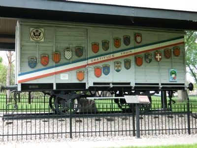
Boxcar used in the 1st World War Marker
| 101 ► North Dakota, Burleigh County, Bismarck — Boxcar used in the 1st World War — |
| On East Boulevard Ave.. | |||
| 102 ► North Dakota, Burleigh County, Bismarck — Bullboats — |
| Near Double Ditch Loop. | |||
| 103 ► North Dakota, Burleigh County, Bismarck — Burleigh County Veterans Memorial — |
| On East Thayer Avenue at North 5th Street, on the right when traveling west on East Thayer Avenue. | |||
| 104 ► North Dakota, Burleigh County, Bismarck — Camp Hancock Site Map — Camp Hancock State Historic Site — |
| Near East Main Avenue at North 1st Street, on the right when traveling east. | |||
| 105 ► North Dakota, Burleigh County, Bismarck — Church of the Bread of Life — |
| Near East Main Avenue (Business Interstate 94) at North 1st Street, on the right when traveling east. | |||
| 106 ► North Dakota, Burleigh County, Bismarck — Combat Wounded Veterans — Military Order of the Purple Heart — 1782 - 1932 — |
| On E. Boulevard Ave.. | |||
| 107 ► North Dakota, Burleigh County, Bismarck — Ditch 2 — Double Ditch State Historic Site — |
| Near North Dakota Route 1804, 1.1 miles south of Double Ditch Loop. | |||
| 108 ► North Dakota, Burleigh County, Bismarck — Ditch 3 — Double Ditch State Historic Site — |
| Near State Highway 1804, 1.1 miles south of Double Ditch Loop, on the right when traveling south. | |||
| 109 ► North Dakota, Burleigh County, Bismarck — Double Ditch State Historic Site — |
| Near North Dakota Route 1804, on the right when traveling south. | |||
| 110 ► North Dakota, Burleigh County, Bismarck — Double Ditch State Historic Site — |
| On North Dakota Route 1804, 1.1 miles south of Double Ditch Loop. | |||
| 111 ► North Dakota, Burleigh County, Bismarck — Episcopalian Services In The Area — May 8, 1873 † May 8, 1960 — |
| Near East Main Avenue at North 1st Street, on the right when traveling east. | |||
| 112 ► North Dakota, Burleigh County, Bismarck — Federal Building — U.S. Post Office and Courthouse — |
| On East Broadway Avenue just east of North 3rd Street, on the left when traveling east. | |||
| 113 ► North Dakota, Burleigh County, Bismarck — Final Occupation of Double Ditch — Double Ditch State Historic Site — |
| Near North Dakota Route 1804. | |||
| 114 ► North Dakota, Burleigh County, Bismarck — First Masonic Ceremony Held in the Present State of North Dakota — July 31, 1863 — |
| Near Sherman Drive just east of Sibley Drive. | |||
| 115 ► North Dakota, Burleigh County, Bismarck — First News of Custer’s Death — |
| On S 5th Street south of E Main Street, on the right when traveling south. | |||
| 116 ► North Dakota, Burleigh County, Bismarck — Geophysical Prospecting in Archaeology — |
| Near Double Ditch Loop (State Highway 1804). | |||
| 117 ► North Dakota, Burleigh County, Bismarck — Glaciation and Forming the Missouri River Trench — Double Ditch State Historic Site — |
| Near Double Ditch Loop, 0.5 miles north of Edgewood Drive, on the right when traveling north. | |||
| 118 ► North Dakota, Burleigh County, Bismarck — Hancock History — Camp Hancock State Historic Site — |
| Near East Main Avenue at North 1st Street, on the right when traveling east. | |||
| 119 ► North Dakota, Burleigh County, Bismarck — Homes — Double Ditch State Historic Site — |
| Near North Dakota Route 1804. | |||
| 120 ► North Dakota, Burleigh County, Bismarck — Hunting and Gathering — |
| Near Double Ditch Loop. | |||
| 121 ► North Dakota, Burleigh County, Bismarck — Locomotive #2164 — Camp Hancock State Historic Site — |
| Near East Main Avenue at North 1st Street, on the right when traveling east. | |||
| 122 ► North Dakota, Burleigh County, Bismarck — Mandan Origin Stories — Double Ditch State Historic Site — |
| Near Double Ditch Loop, 0.4 miles north of Edgewood Drive, on the right when traveling north. | |||
| 123 ► North Dakota, Burleigh County, Bismarck — Mandans and the Practice of Farming — |
| Near Double Ditch Loop. | |||
| 124 ► North Dakota, Burleigh County, Bismarck — Midden Mounds (Trash Heaps) — Double Ditch State Historic Site — |
| Near North Dakota Route 1804. | |||
| 125 ► North Dakota, Burleigh County, Bismarck — Missouri River Resources — Double Ditch State Historic Site — |
| Near North Dakota Route 1804. | |||
| 126 ► North Dakota, Burleigh County, Bismarck — Potande and the Mandan Fishery — |
| Near Double Ditch Loop. | |||
| 127 ► North Dakota, Burleigh County, Bismarck — Sakakawea Statue — |
| On East Boulvard Avenue. | |||
| 128 ► North Dakota, Burleigh County, Bismarck — Site of First Court House of Burleigh County, Dakota Territory — 1875-1936 — |
| On East Thayer Avenue just east of North 5th Street, on the right when traveling west. | |||
| 129 ► North Dakota, Burleigh County, Bismarck — Square Buttes — Double Ditch State Historic Site — |
| Near North Dakota Route 1804. | |||
| 130 ► North Dakota, Burleigh County, Bismarck — Stone Shelter — Double Ditch State Historic Site — |
| Near Double Ditch Loop, 0.4 miles north of North Dakota Route 1804, on the right when traveling north. | |||
| 131 ► North Dakota, Burleigh County, Bismarck — The Founding Community AD 1490-1550 — Double Ditch State Historic Site — |
| Near North Dakota Route 1804, 0.9 miles south of Double Ditch Loop, on the right when traveling south. | |||
| 132 ► North Dakota, Burleigh County, Bismarck — The Honorable John Burke — of North Dakota — |
| On East Boulevard Avenue. | |||
| 133 ► North Dakota, Burleigh County, Bismarck — The Pioneer Family — |
| On E Boulevard Avenue at N 6th Street, on the right when traveling west on E Boulevard Avenue. | |||
| 134 ► North Dakota, Burleigh County, Menoken — Apple Creek — |
| On Interstate 94, on the right when traveling west. | |||
| 135 ► North Dakota, Burleigh County, Menoken — Early Archeological Studies At Menoken Village — Menoken Village State Historic Site — |
| Near 171st Street Northeast, 0.2 miles north of 30th Avenue Northeast, on the right when traveling north. | |||
| 136 ► North Dakota, Burleigh County, Menoken — Investigating a Pit House — Menoken Village State Historic Site — |
| Near 171st Street Northeast, 0.2 miles north of 30th Avenue Northeast, on the right when traveling north. | |||
| 137 ► North Dakota, Burleigh County, Menoken — Menoken Indian Village Site — |
| On 171st Street Northeast. | |||
| 138 ► North Dakota, Burleigh County, Menoken — Menoken Village State Historic Site — |
| Near 171st Street Northeast, 0.2 miles north of 30th Avenue Northeast, on the right when traveling north. | |||
| 139 ► North Dakota, Burleigh County, Menoken — Menoken Village State Historic Site — |
| Near 171st Street Northeast, 0.3 miles north of 30th Avenue Northeast, on the right when traveling north. | |||
| 140 ► North Dakota, Burleigh County, Menoken — Trade at Menoken — Menoken Village State Historic Site — |
| Near 171st Street Northeast, 0.2 miles north of 30th Avenue Northeast, on the right when traveling north. | |||
| 141 ► North Dakota, Cass County, Buffalo — Sibley Trail — |
| On 34th Street South East, 0.3 miles west of 137th Avenue South East, on the right when traveling west. | |||
| 142 ► North Dakota, Cass County, Fargo, Downtown — Black Building & Fargo Theatre — |
| On Broadway North just north of 2nd Avenue North, on the left when traveling north. | |||
| 143 ► North Dakota, Cass County, Fargo, Downtown — Bonanza Farms — |
| On 1st Avenue North at Broadway North, on the left when traveling east on 1st Avenue North. | |||
| 144 ► North Dakota, Cass County, Fargo, Downtown — City Hall & Library — |
| On Broadway North at 1st Avenue North, on the right when traveling north on Broadway North. | |||
| 145 ► North Dakota, Cass County, Fargo, Downtown — Depot Plaza Story — |
| On Main Avenue (U.S. 10) at 7th Street South, on the right when traveling west on Main Avenue. | |||
| 146 ► North Dakota, Cass County, Fargo, Downtown — Eddie and Hildegarde Kraus — |
| On 4th Avenue North at Broadway North, on the left when traveling east on 4th Avenue North. | |||
| 147 ► North Dakota, Cass County, Fargo, Downtown — Fargo & Moorhead Streetcar Railway — |
| On Northern Pacific Avenue at Broadway North, on the right when traveling east on Northern Pacific Avenue. | |||
| 148 ► North Dakota, Cass County, Fargo, Downtown — First Lutheran Church & Cathedral of St. Mary — |
| On Broadway North at 6th Avenue North, on the left when traveling north on Broadway North. | |||
| 149 ► North Dakota, Cass County, Fargo, Downtown — Ford Building & BNSF Railroad — |
| On Broadway North north of 4th Avenue North, on the left when traveling north. | |||
| 150 ► North Dakota, Cass County, Fargo, Downtown — Gasoline Horsepower — |
| On U.S. 10. | |||
| 151 ► North Dakota, Cass County, Fargo, Downtown — Grand Lodge of North Dakota — Ancient Order of United Workmen — |
| On Roberts Street North just north of 1st Avenue North, on the left when traveling north. | |||
| 152 ► North Dakota, Cass County, Fargo, Downtown — Great Northern Caboose X227 — Burlington Northern Caboose BN11224 — |
| On North Broadway Drive just north of Main Avenue (U.S. 10), on the left when traveling north. | |||
| 153 ► North Dakota, Cass County, Fargo, Downtown — Great Northern Railway — |
| On Northern Pacific Avenue at Broadway North, on the left when traveling west on Northern Pacific Avenue. | |||
| 154 ► North Dakota, Cass County, Fargo, Downtown — Machinery Row — |
| On 1st Avenue North at Broadway North, on the left when traveling west on 1st Avenue North. | |||
| 155 ► North Dakota, Cass County, Fargo, Downtown — NDSU Agriculture — |
| On 1st Avenue North at Broadway North, on the right when traveling west on 1st Avenue North. | |||
| 156 ► North Dakota, Cass County, Fargo, Downtown — Northern Pacific Railroad — |
| On North Pacific Avenue at Broadway North, on the left when traveling east on North Pacific Avenue. | |||
| 157 ► North Dakota, Cass County, Fargo, Downtown — Osco Drug — Serve Yourself and Pay Less — |
| On 2nd Avenue North at Broadway North, on the left when traveling west on 2nd Avenue North. | |||
| 158 ► North Dakota, Cass County, Fargo, Downtown — Plains Art Museum — |
| On Broadway North at 1st Avenue North, on the right when traveling south on Broadway North. | |||
| 159 ► North Dakota, Cass County, Fargo, Downtown — Prairie Plantings at Sodbuster — |
| On 4th Street North just south of 2nd Avenue North, on the right when traveling north. | |||
| 160 ► North Dakota, Cass County, Fargo, Downtown — Recreation on the Red River — |
| On 2nd Avenue North at Broadway North, on the left when traveling west on 2nd Avenue North. | |||
| 161 ► North Dakota, Cass County, Fargo, Downtown — Red River Valley — |
| On 2nd Avenue North at Broadway North, on the right when traveling west on 2nd Avenue North. | |||
| 162 ► North Dakota, Cass County, Fargo, Downtown — Red River Valley Crops — |
| On 1st Avenue North at Broadway North, on the right when traveling east on 1st Avenue North. | |||
| 163 ► North Dakota, Cass County, Fargo, Downtown — Replica of the Statue of Liberty — |
| On Main Avenue (U.S. 10) just east of 2nd Street South, on the right when traveling east. | |||
| 164 ► North Dakota, Cass County, Fargo, Downtown — ROCO & Powers Hotel — |
| On Broadway North at 4th Avenue North, on the right when traveling south on Broadway North. | |||
| 165 ► North Dakota, Cass County, Fargo, Downtown — Site Where Generals Grant & Sheridan Stopped — September 4th, 1883 — |
| On Main Avenue (U.S. 10) just east of 8th Street South, on the left when traveling east. | |||
| 166 ► North Dakota, Cass County, Fargo, Downtown — Sodbuster Statue & Restoration — |
| On 4th Street North just south of 2nd Avenue North, on the right when traveling north. | |||
| 167 ► North Dakota, Cass County, Fargo, Downtown — Steamboats on the Red River — |
| On 2nd Avenue North at Broadway North, on the left when traveling east on 2nd Avenue North. | |||
| 168 ► North Dakota, Cass County, Fargo, Downtown — The Bill of Rights — |
| On 1st Avenue North just west of Roberts Street North, on the right when traveling west. | |||
| 169 ► North Dakota, Cass County, Fargo, Downtown — The Changing Faces of Entertainment — |
| On 4th Avenue North at Broadway North, on the right when traveling west on 4th Avenue North. | |||
| 170 ► North Dakota, Cass County, Fargo, Downtown — The Ford Building — |
| On Broadway North at 6th Avenue North, on the right when traveling north on Broadway North. | |||
| 171 ► North Dakota, Cass County, Fargo, Downtown — 'The Next Great City' — |
| On U.S. 10. | |||
| 172 ► North Dakota, Cass County, Fargo, Downtown — The Wurlitzer — |
| On 4th Avenue North at Broadway North, on the left when traveling west on 4th Avenue North. | |||
| 173 ► North Dakota, Cass County, Fargo, Downtown — Theaters of Fargo — |
| On 4th Avenue North at Broadway North, on the right when traveling east on 4th Avenue North. | |||
| 174 ► North Dakota, Cass County, Fargo, Downtown — 18 — Votes For Women — Road to the 19th Amendment — National Votes for Women Trail — |
| On Main Avenue (U.S. 10) at 7th Street South, on the right when traveling east on Main Avenue. | |||
| 175 ► North Dakota, Cass County, Fargo, Downtown — Wildlife in the Red River Valley — |
| On 2nd Avenue North at Broadway North, on the right when traveling east on 2nd Avenue North. | |||
| 176 ► North Dakota, Cass County, Fargo, West Acres — "The Woodchipper" in FARGO — |
| On 44th Street S. at 20th Ave. S. on 44th Street S.. | |||
| 177 ► North Dakota, Cass County, Fargo, West Acres — The Fargo Walk of Fame — |
| Near 44th Street S. at 20th Ave. S.. | |||
| 178 ► North Dakota, Cass County, Fargo, Willow Park — Abraham Lincoln — 1809 — 1865 — |
| Near 45th Street South just south of 15th Avenue South, on the right when traveling south. | |||
| 179 ► North Dakota, Cass County, Fargo, Willow Park — George Washington — 1732 — 1799 — |
| Near 45th Street South just south of 15th Avenue South, on the right when traveling south. | |||
| 180 ► North Dakota, Cass County, Fargo, Willow Park — Ronald Reagan — 1911 — 2004 — |
| Near 45th Street South just south of 15th Avenue South, on the right when traveling south. | |||
| 181 ► North Dakota, Cass County, Fargo, Willow Park — Thomas Jefferson — 1743 — 1826 — |
| Near 45th Street South just south of 15th Avenue South, on the right when traveling south. | |||
| 182 ► North Dakota, Cass County, Leonard — The Maple Creek Crossing Historic Site — |
| On 150th Avenue Southeast near 47th Street Southeast, on the left when traveling south. | |||
| 183 ► North Dakota, Cass County, West Fargo, Riverside — North Dakota Jewry — |
| Near Main Avenue W. at 15th Street NW. | |||
| 184 ► North Dakota, Cass County, Wild Rice — The First Prestressed Concrete Bridge Deck Constructed in North Dakota — Built - 1953 — |
| On State Highway 16, 0.5 miles east of Interstate 29, on the right when traveling east. | |||
| 185 ► North Dakota, Cavalier County, Langdon — Boyd Block — |
| On 3rd Street at 8th Avenue, on the left when traveling south on 3rd Street. | |||
| 186 ► North Dakota, Cavalier County, Langdon — Cavalier County Agriculture — Pioneers on the Prairie — |
| On 8th Avenue at 3rd Street, on the right when traveling west on 8th Avenue. | |||
| 187 ► North Dakota, Cavalier County, Langdon — Cavalier County Places — Pioneers on the Prairie — |
| On 8th Avenue at 3rd Street, on the right when traveling west on 8th Avenue. | |||
| 188 ► North Dakota, Cavalier County, Langdon — Cavalier County Timeline — Pioneers on the Prairie — |
| On 8th Avenue at 3rd Street, on the right when traveling west on 8th Avenue. | |||
| 189 ► North Dakota, Cavalier County, Langdon — Construction, System Components, and Deployment — Pyramids on the Prairie — |
| On 8th Avenue at 3rd Street, on the right when traveling west on 8th Avenue. | |||
| 190 ► North Dakota, Cavalier County, Langdon — Cyclone of May 29, 1909 — |
| On 3rd Street just north of 8th Avenue, on the left when traveling south. | |||
| 191 ► North Dakota, Cavalier County, Langdon — Early History — Pioneers on the Prairie — |
| On 8th Avenue at 3rd Street, on the right when traveling west on 8th Avenue. | |||
| 192 ► North Dakota, Cavalier County, Langdon — Local Impact — Pyramids on the Prairie — |
| On 8th Avenue at 3rd Street, on the right when traveling west on 8th Avenue. | |||
| 193 ► North Dakota, Cavalier County, Langdon — Progress on the Prairie — Cavalier County Today — |
| On 8th Avenue at 3rd Street, on the right when traveling west on 8th Avenue. | |||
| 194 ► North Dakota, Cavalier County, Langdon — Safeguard — Pyramids on the Prairie — |
| On 8th Avenue at 3rd Street, on the right when traveling west on 8th Avenue. | |||
| 195 ► North Dakota, Cavalier County, Langdon — Scenarios of an Intercontinental Missile (ICBM) Attack — Pyramids on the Prairie — |
| On 8th Avenue at 3rd Street, on the right when traveling west on 8th Avenue. | |||
| 196 ► North Dakota, Dickey County, Fullerton — Carroll House — |
| Near North Monroe Street at Minneapolis Avenue, on the right when traveling south. | |||
| 197 ► North Dakota, Dickey County, Oakes — 1891 Church - Oakes Historical Park — |
| Near 2nd Street South south of Maple Ave. | |||
| 198 ► North Dakota, Dickey County, Oakes — Hudson Townsite — |
| On 108th Avenue Southeast at 91st St SE, on the right when traveling north on 108th Avenue Southeast. | |||
| 199 ► North Dakota, Dickey County, Oakes — Stagecoach Relay Station — |
| Near 85th Street Southeast, 0.3 miles west of 110th Ave SE, on the left when traveling west. | |||
| 200 ► North Dakota, Divide County, Crosby — Crosby Freedom Rock Veterans Memorial — Honoring Divide County Veterans — Ray "Bubba" Sorensen II — |
| Near 5th Avenue Southwest at 6th Street West, on the right when traveling west. | |||
598 entries matched your criteria. Entries 101 through 200 are listed above. ⊲ Previous 100 — Next 100 ⊳