Near St. George Street close to St. Anthony Street, on the left when traveling west.
English
When the French settled at Port-Royal in the early 1600s, the shores of the Annapolis River were bordered with tidal salt marsh. In the 1630s, the French at Port-Royal started reclaiming this fertile land by building dykes.
The . . . — — Map (db m78488) HM
On St. George Street close to St. James Street, on the left when traveling north.
English
From its strategic setting, Annapolis Royal has witnessed pivotal events in the history of European settlement in Canada. Located on a former Mi’kmaq meeting place, the townsite and its environs were known as Port-Royal by the . . . — — Map (db m78670) HM
Near St. George Street close to St. Anthony Street, on the left when traveling west.
In commemoration of the captures of Port Royal by New England expeditions under Maj. Robert Sedgwick 1654 and Colonel Francis Nicholson 1710. In this second expedition Col. Samuel Vetch was Adjutant-General. There were 36 transports, 4 ships of 60 . . . — — Map (db m78439) HM
Near St. George Street close to St. Anthony Street, on the left when traveling west.
English
Two cemeteries are located in this burial ground: the earlier Acadian parish cemetery and the later Church of England cemetery. The wooden markers once placed on most of the graves have long since decayed. The gravestones that . . . — — Map (db m78605) HM
Near St. George Street close to St. Anthony Street, on the left when traveling west.
Two markers are located on these monument. Charles Fort / Le fort Charles English
A group of about 70 Scottish settlers began a colony here in 1629, eight years after King James I granted ‘Nova Scotia’ to Sir William . . . — — Map (db m78486) HM
Near St. George Street at St. Anthony Street, on the left when traveling east.
In memory of
Daniel Auger de Subercase
1663-1732
Chevalier of the Military Order of St. Louis, last French commander of this fort and defender of Acadie.
Honour to unsuccessful valour — — Map (db m78442) HM
Near St. George Street close to St. Anthony Street, on the left when traveling west.
English
In September 1744, French soldiers and Aboriginal warriors attacked this fort. The took advantage of the overcast and rainy weather to attack at night under cover of darkness, sometimes managing to slip onto the outer works of the . . . — — Map (db m78606) HM
On St. George Street close to St. Anthony Street, on the left when traveling west.
English
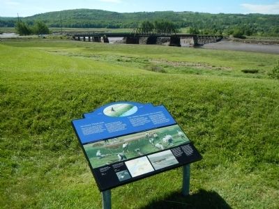
Before you, the Allain and Annapolis rivers meet, creating a stopping place used by travelers for many centuries. The Annapolis River makes access to the site easy, while the natural rise of land provides a good view downstream. . . . — — Map (db m78483) HM
Near St. George Street close to St. Anthony Street, on the left when traveling west.
English
Forts like this are called bastioned forts after one other principal pars - the bastion. The fort’s shape creates areas of crossfire which allow the land surrounding the fort to be moere easily defended. From the late 1600s to the . . . — — Map (db m78598) HM
On St. George Street close to Church Street, on the right when traveling north.
The modern-day market in Annapolis Royal sits on land that for much of the town’s history was church property. The earliest Roman Catholic Church, built of stone, was located next to the fort and destroyed following Sir William Phips’ capture of . . . — — Map (db m78720) HM
Near St. George Street close to St. Anthony Street, on the left when traveling west.
English
A French Huguenot in the British army, Mascarene served here from 1710 to 1750. He was a member of the Council of Nova Scotia (1720-50), lieutenant-colonel of Philipps’ Regiment (1742-50), and administrator and commander in chief . . . — — Map (db m78491) HM
On St. George Street close to St. James Street, on the left when traveling west.
1738 - 2013 This replica of the Masonic stone of 1606 was presented to the Masons of Nova Scotia as a gift from the Most Wor. Bro. Roy F. Lively past Grand Master of Nova Scotia 2008-2009 commemorating the 275th Anniversary of Masonry in Nova . . . — — Map (db m78668) HM
Near St. George Street close to St. Anthony Street, on the left when traveling west.
English
When the French first came to the Annapolis Basin, Samuel de Champlain called it “Port-Royal” in recognition of its great size.
Eventually, the area surrounding the basin and along the Annapolis River became known as . . . — — Map (db m78449) HM
Near St. George Street close to St. Anthony Street, on the left when traveling west.
English
Since the 1740s, three wharves have been built where the ruins of the Queen’s Wharf now lie. Everything the fort needed was landed on the wharf: troops, provisions, weapons and much more. It served the needs of the military until . . . — — Map (db m78445) HM
On St. George Street close to St. James Street, on the left when traveling north.
English
Rose Fortune is a uniquely intriguing figure in Nova Scotia history. An independent businesswoman of African descent, she demonstrated remarkable character and indomitable resolve in her varied enterprises.
Operating a . . . — — Map (db m78671) HM
Near St. George Street close to St. Anthony Street, on the left when traveling west.
English
Adjutant-General of the force under Colonel Francis Nicholson which captured Port Royal, Capital of Acadia, in 1710.
First Governor and Commander-in-Chief. A notable figure in colonial history. An able soldier and administrator. . . . — — Map (db m78482) HM
Near St. George Street close to St. Anthony Street, on the left.
To the illustrious memory of Lieut. Gen’l Timothé Pierre du Guast,
Sieur de Monts,
the pioneer of civilization in North America, who discovered and explored the adjacent river, A.D. 1604, and founded on its banks the first settlement of . . . — — Map (db m78443) HM
On St. George Street, on the right when traveling north.
English
The Sinclair Inn is an important document in the history of building in Atlantic Canada. In the 1780s, tavern-keeper Frederick Sinclair created this inn by combining two existing structures. Both were frame, and the walls of one . . . — — Map (db m78701) HM
On St. George Street at Victoria Street, on the right when traveling north on St. George Street.
This tablet marks the Site of the Brith-place of General
Sir William Fenwick Williams
Baronet
1799 - 1883
“The Hero of Kars”
Pasha of Turkey. Grand Officier Legion of Honour, France.
Member of the British Parliament. . . . — — Map (db m78672) HM
Near St. George Street close to St. Anthony Street, on the left when traveling west.
The Black Hole
The French built this powder magazine into the earthworks of their new fort in 1702. Both the French and the British used it to store gunpowder. In the early 1800s, it was used briefly as a prison or “Black Hole.” . . . — — Map (db m78601) HM
Near St. George Street close to St. Anthony Street, on the left when traveling west.
English
You are standing on the west bastion which, in the 1700s, was the principal bastion. This being the closest bastion to the river, a flag was flown here to show approaching vessels who controlled the stronghold.
Important . . . — — Map (db m78603) HM
On St. George Street at Drury Lane, on the right when traveling north on St. George Street.
In the early hours of July 4, 1724, a combined force of Mi’kimaq and Maliseet warriors attacked Annapolis Royal, slipping into the town as its residents slept. They attacked the fort from the cover of the hollow near the east bastion. Although the . . . — — Map (db m78702) HM
Near St. George Street close to St. Anthony Street, on the left when traveling west.
Two plaques share a common stand.
William Wolseley
1756-1842
English
William Wolseley was born at Annapolis Royal, the son of an officier of the garrison. He entered the Royal Navy in 1769, and served with . . . — — Map (db m78607) HM
On County Route 201, 0.8 kilometers west of Rice Road, on the left when traveling west.
Commemorating two combats between British garrisons of Annapolis Royal and allied French and Indians in the half century of conflict for possession of Acadia: on the north bank of the Annapolis River, 10th June, 1711; and here, 8th December, 1757. . . . — — Map (db m197083) HM
On Main Street (Route 4) just east of Church Street, on the right when traveling east.
The congregation of St. James was founded in 1804. The present day church was built in 1862. Our ten original memorial windows were installed and dedicated in 1911. They use Christian symbolism to uplift the spirit.
St. James has had three church . . . — — Map (db m139424) HM
On McKeen Street north of William Street, on the right when traveling north.
English:
Having demonstrated the feasibility of transatlantic wireless communication in 1901, Guglielmo Marconi established a permanent station on Cape Breton Island in 1902. When the original Table Head site proved too . . . — — Map (db m139300) HM
On Timmerman Street north of Vivian Street, on the left when traveling east.
English:
In 1901 Signor Guglielmo Marconi received the first transatlantic radio message at Signal Hill in St. John’s. On 15 December, 1902, he sent the first West to East message from a new station at Table Head to Poldhu, . . . — — Map (db m139201) HM
Near Havenside Road, on the left when traveling east.
English:
During the first half of the 19th century maritime officials took steps to reduce the many navigational risks and shipwrecks along the eastern seaboard of Canada. One of the new lighthouses put up was at Louisbourg, in 1842. It . . . — — Map (db m79965) HM
Three panels are located at this site.
Chabert’s Mission / La mission du marquis de Chabert
English:
In 1750 the Marquis de Chabert, a French astronomer, was commissioned to go to North America to correct the maps of . . . — — Map (db m142944) HM
Near Havenside Road, on the left when traveling east.
English:
Here are the ruins of Louisbourg’s first light, the earliest to be erected in Canada and the second in North America. Lit in 1734, it was badly damaged in a fire two years later, then quickly repaired. The replacement lantern was . . . — — Map (db m142960) HM
Near Havenside Road, on the left when traveling east.
English:
On this site was erected by France, in 1731, the first Lighthouse Tower, constructed of fireproof materials, in North America.
Near here the British erected batteries to silence the defensive works erected by France. In 1745, . . . — — Map (db m79967) HM
English:
These are the remains of a two and a half storey masonry house built in the late 1730s for merchant and militia captain Julien Fizel and his wife Françoise Tetard.
The house served several purposes: the basement was used as . . . — — Map (db m142961) HM
English:
In 1713, France decided to found Louisbourg to defend her colonial and maritime interests in North America. As capital of the colony of Isle Royale and guardian the Gulf of Saint. Lawrence, it became the most important French . . . — — Map (db m79915) HM
Near Havenside Road, on the left when traveling east.
English:
This tablet commemorated the valour and endurance displayed against overwhelming odds, by the French forces, who, in 1745 and again in 1758, garrisoned the defensive batteries on the Island opposite the entrance to the harbour of . . . — — Map (db m79968) HM
On Main Street close to Huntington Avenue, on the left when traveling east.
French Naval Guns raised
by the Dominion Coal Company in 1895
from the bottom of Louisburg Harbour
and mounted at the Louisburg Railroad Station
presented to the Fortress of Louisburg
National Historic Site
by the
Dominion Steel . . . — — Map (db m142962) HM
English:
This point of land is named after Capt. D.J. Kennelly (ca. 1831-1907), who had a house near here during the late 19th century. An Irish-born industrialist who came to Cape Breton during the 1870s, Kennelly was captivated by . . . — — Map (db m142963) HM
On Havenside Road, on the right when traveling east.
English:
During the 1745 and 1758 sieges the attackers built artillery batteries on Lighthouse Point to silence the Island Battery. This would have allowed warships to enter the harbour for a combined land and sea assault on the town. The . . . — — Map (db m142964) HM
On Havenside Road, on the left when traveling east.
English:
Louisbourg’s destiny has been largely shaped by its harbour. Well-protected, relatively deep and close to the fishing banks, it was the harbour that attracted the French to settle here in the 1700s. In the 19th century ice-free . . . — — Map (db m79963) HM
English:
Captured in Africa at the age of 19 and transported to Ile Royale, where she was sold to a member of the colonial elite, Marie Marguerite Rose is seen to be a key figure of the initial phase of Black slavery in Canada. Gaining her . . . — — Map (db m79917) HM
Two panels make up this marker
Slavery / Esclavage
English:
Marie Marguerite Rose was the name given to a young woman captured in Guinea, Africa, sold to French traders and brought to Louisbourg in 1736 as a slave for . . . — — Map (db m79918) HM
On Main Street (Nova Scotia Route 22) close to Huntington Avenue, on the left when traveling north.
Cape Breton’s mining industry dictated the need of an outlet in Louisbourg to link the various railways around Sydney with Louisbourg’s ice-free harbour, allowing for year-round shipping of coal. The first attempt in 1873 was a narrow, poorly . . . — — Map (db m142965) HM
On Havenside Road, on the left when traveling east.
English: Between 15 May and 15 July the ocean in front of you is dotted with the buoys of the lobster fishery. The Mi’kmaq as well as the French and the English ate lobster and other shellfish during the 18th Century. During the 1754 siege . . . — — Map (db m79941) HM
On Kennington Cove Road, on the left when traveling west.
English: In both sieges the attackers made their initial landings in this cove. In 1745 the French defended the cove with only a small detachment but in 1757 they built and garrisoned extensive fieldworks here. The following year . . . — — Map (db m142966) HM
English: Here, 8th June, 1758, the men of Brigadier General James Wolfe’s brigade, after having been repulsed with heavy loss by the French troops entrenched westward made their gallant and successful landing.
Thus began the operation . . . — — Map (db m79938) HM
On New Waterford Highway (Nova Scotia Route 28) just east of Daley Road, on the left when traveling east.
Shannon MacLellan — Army William MacLellan — Army John (Buddy) MacDonald — Navy John MacNeil — Navy Harry Roper — Army Vincent Savage — RCAF James J. MacNeil — RAF Alex Donohue — Army Wallace McPhee . . . — — Map (db m151628) WM
Near Ellsworth Avenue (Nova Scotia Route 28) at James Street, on the right when traveling east.
The Anderton Shearer-Loader was a widely used coal cutter loader in which the ordinary jib of the longwall coal cutter was replaced by a shear drum capable of cutting a "web" of variable depth. The machine traveled on an armored conveyor and . . . — — Map (db m151727) HM
Near Ellsworth Avenue (Nova Scotia Route 28) at James Street, on the right when traveling east.
The armoured face conveyor (AFC) is a very large and robust piece of coal mining equipment that was installed along the full length of an underground longwall face. The coal cutting machine or shearer rode on top of the AFC where it deposited cut . . . — — Map (db m151729) HM
Near Ellsworth Avenue (Nova Scotia Route 28) at James Street, on the right when traveling east.
On March 3rd 1973, No. 12 Colliery experienced an underground fire. The fire claimed the life of coal miner Earl Leadbeater. This memorial has been placed here at Colliery Lands Park in his memory. No. 12 Colliery is his resting place as he is . . . — — Map (db m151726) HM
Near Ellsworth Avenue (Nova Scotia Route 28) at James Street, on the right when traveling east.
2 leg x 510 tonne yield hydraulically powered longwall roof support. These longwall roof supports were the last set purchased and were used underground at Prince Colliery. Each support was 5 feet wide, weighed 13 tonnes, and had a height range of 48 . . . — — Map (db m151728) HM
On Plummer Avenue east of Baker Avenue, on the right when traveling east.
Erected to the memory of those killed in explosion in No. 12 Colliery New Waterford July 25th 1917
Gaeton Angelo Aged 24
Yrs. • Frank Pancryk Aged 32
Yrs. • Constantino Boa Aged 22
Yrs. • Isaac Boone Aged 38
Yrs. • George Butt Aged 26 . . . — — Map (db m151635) HM
On Plummer Avenue just east of Baker Avenue, on the right when traveling east.
Dedicated to the Honor and Sacrifice of the Men and Women of New Waterford and surrounding districts who made the supreme sacrifice in two World Wars — — Map (db m151632) WM
On Plummer Avenue, 0.03 kilometers east of Baker Avenue, on the right when traveling east.
(panel 1) In March of 1925, the members of District 26, United Mine Workers of America (UMWA) were earning an average of $3.70 per day. The pits had worked only part time for the past twenty-four months and the miners had been through a . . . — — Map (db m151636) HM
Near Ellsworth Avenue (Nova Scotia Route 28) at James Street, on the right when traveling east.
William Davis, a miner, with the British Empire Steel Corporation (BESCO), was employed at the No. 12 Colliery, New Waterford. In 1920, BESCO management began a targeted campaign to break the union. There were 58 strikes in the Sydney Coal Field . . . — — Map (db m151725) HM
On Long Beach Road north of Marconi Trail (Route 255), on the right when traveling north.
The first Boy Scout Troop in North America was formed in this village in 1908 by William Glover (1874-1949), a bookkeeper at the North Atlantic Colliery. He was master of the local Masonic Lodge and director of the St. Paul's Anglican Church Choir. . . . — — Map (db m139294) HM
On Marconi Trail (Nova Scotia Route 255) 0.2 kilometers south of Birch Grove Road, on the right when traveling north.
Flint Island is a treeless little republic sitting in the Atlantic six miles east of Port Morien. The nearest landfall is the Northern Head, approximately two miles west. It is an estimated 800 yards long and 140 yards wide.
The first lighthouse . . . — — Map (db m144074) HM
On Marconi Trail (Nova Scotia Route 255) 0.2 kilometers south of Birch Grove Road, on the right when traveling north.
In 1861, Archibald and Company, a family-run business from North Sydney, opened the Gowrie Mine in Cow Bay. It was the most successful mining operation in Cape Breton in the 19th Century. Preliminary mining commenced at an old pit near the shore. . . . — — Map (db m144075) HM
On Long Beach Road, 1 kilometer north of Marconi Trail (Route 255), on the left when traveling north.
Français:
Deux mille pieds au sud-est de cet endroit se trouvent les vestiges de la première exploitation régulière d’une mine de charbon en Amérique, commencée par le Français en 1720. Cette industrie, modeste à son origine, est . . . — — Map (db m139292) HM
On Marconi Trail (Nova Scotia Route 255) 0.2 kilometers south of Birch Grove Road, on the right when traveling north.
The history of the village of Port Morien, rooted as it was in mining and fishing, is tightly entwined with Morien Bay itself.
The Mi'kmaq name was "Noolektooch", (Noo-lack-took) meaning "place jammed with ice", or "bivouacking place". Early . . . — — Map (db m144077) HM
On Marconi Trail (Nova Scotia Route 255) at Breakwater Street, on the right when traveling north on Marconi Trail.
Joseph Talmage (J.T.) Irwin purchased a parcel of land in 1917 on the south side of Breakwater Street, with the intention of building an all-purpose store. He operated it for several years. At his death in 1934, his wife, Charlotte, and their . . . — — Map (db m144071) HM
On Marconi Trail (Nova Scotia Route 255) at Breakwater Street, on the right when traveling north on Marconi Trail.
Schooling in Port Morien and Area
Records show that schooling in Cow Bay goes back to 1826. There was a school at Gowrie Mine in 1862, and it burned down in 1880. In 1867, there was a school at South Head, destroyed by fire in 1890, rebuilt, . . . — — Map (db m144072) HM
On Marconi Trail (Nova Scotia Route 255) at Breakwater Street, on the right when traveling north on Marconi Trail.
The Port Morien Project
In the year 2000, a group of interested citizens met to revive an organization in the community, the Port Morien Development Association. It was an organization active in the late 1960s and early 1970s. On February 9, . . . — — Map (db m144073) HM
On Long Beach Road north of Marconi Trail (Route 255), on the right when traveling north.
Commercial coal mining began in Port Morien in 1720 after a mine had been opened to supply The Fortress at Louisbourg. This was the first commercial coal mine in North America. After the English victory at Louisbourg in 1758, the mine remained in . . . — — Map (db m139293) HM
On Marconi Trail (Nova Scotia Route 255) 0.2 kilometers south of Birch Grove Road, on the right when traveling north.
The first recorded commercial fishing activity in Cow Bay occurred when the Bourinot family purchased fish, dried them, and supplied the fishermen.
Lobster factories could be found in both Port Morien and South Head. The factory owned by David . . . — — Map (db m144076) HM
On Esplanade at Amelia Street, on the left when traveling north on Esplanade.
[English] On 3 August 1802, the 245 ton ship, “Northern Friends,” arrived in Sydney Harbour with 415 settlers from Scotland. This marked the first emigration directly from Scotland to Cape Breton and formed the vanguard of the . . . — — Map (db m169199) HM
Near Esplanade at Dorchester Street, on the left when traveling north.
English: "Voyage after voyage, men who had seen a dozen ships go down about them, men who had been torpedoed once, twice, three times, sailed and sailed again." —Joseph Schull, Merchant Seaman During the Second World War, . . . — — Map (db m171490) HM
Near Charlotte Street north of York Street, on the right when traveling north.
Cossit House was built in 1787 by Reverend Ranna Cossit, the first Anglican Minister in Sydney. It was purchased by the Province of Nova Scotia and the Old Sydney Society in 1976, and opened to the public by the Honourable Vincent J. Maclean, . . . — — Map (db m171097) HM
On Esplanade north of York Street, on the left when traveling north.
English:
A distinguished military engineer, of Huguenot descent, Desbarres served in the British Army in North America during the Seven Years’ War, and participated in the capture of Louisbourg in 1758 and of Quebec in 1759. From . . . — — Map (db m140081) HM
On Esplanade at York Street, on the left when traveling north on Esplanade.
This statue stood on top of the Royal Bank of Canada building at the corner of Charlotte and Dorchester Streets from 1901 to 1976. The bank was erected when the Sydney Steel Plant, the major event in the industrialization of the area, was being . . . — — Map (db m171096) HM
On Esplanade north of York Street, on the left when traveling north.
English:
A native of Sydney, Bourinot was a journalist and legislative reporter in Halifax before joining the parliamentary staff at Ottawa in 1868. From 1880 to 1902 he served as Clerk of the House and was a recognized authority . . . — — Map (db m140082) HM
On Esplanade just north of Amelia Street, on the left when traveling north.
Born in Sydney, Cape Breton 1894, Peter enlisted in Canadian Forces after war broke out in 1914. While serving in Europe, he was wounded in France and hospitalized for three months. When hostilities ended in 1918, he earned a law degree from . . . — — Map (db m169201) HM WM
Near Wentworth Street just west of Esplanade (Nova Scotia Route 4), on the left when traveling west.
In the Second World War, Sydney Harbour played a vital role in the Battle of the Atlantic and played a critical role in the conduct of the war. Sydney served as a convoy gathering point for supplies being shipped to the United Kingdom and provided . . . — — Map (db m151606) HM
Near Esplanade at Dorchester Street, on the right when traveling north.
Come and explore the Colonial Town of Old Sydney. Few cities in North America can boast eight buildings erected between 1785 and 1802 within a two-block radius. In season, we invite you to visit these historic buildings: St. Patrick's Church Museum . . . — — Map (db m171099) HM
On Victoria Road (Route 28) south of Church Street, on the right when traveling north.
English:
In the late 19th and early 20th centuries, thousands of immigrants came to Cape Breton from Europe, the West Indies, the United States, and elsewhere to work in iron and steel production. Many settled in Whitney Pier, . . . — — Map (db m139295) HM
Near New Waterford Highway (Nova Scotia Route 28) 0.6 kilometers east of Cooks Lane, on the left when traveling east.
English:
During the Second World War the Royal Canadian Navy and the Royal Canadian Air Force protected shipping on vital North Atlantic routes which were the lifeline of the Allies. Army units shared in the defence of the . . . — — Map (db m140130) HM
[1.] Water turbines
the power that ran the mill
This illustration shows one type of
setup for a turbine driven gristmill.
Illustration from "the Red Mill Reborn".
Used with permission of
'Lou Robertella, . . . — — Map (db m108181) HM
You can see where some of the rock
has been removed to make a millstone
Located at Kennedy Hill, Central New Annan
Donated by Mr. William Woodlock — — Map (db m108169) HM
This turbine came from a sawmill
located a few hundred yards
upstream of our mill
The saw mill was built ca 1886 by brothers James and Alexander Sutherland. Another brother Robert, built a blacksmith shop on the same property. The mill . . . — — Map (db m108182) HM
Turbines began to become commonplace in the mid-1800's and had virtually replaced vertical waterwheels by the mid 1860's.
Below are a number of illustrations showing typical mill setups and power transfer.
In 1881 the Schoellkopf Power Station . . . — — Map (db m108183) HM
On Sunrise Trail (Nova Scotia Route 6) just west of Nova Scotia Route 326, on the left when traveling east.
Within this iron fence lies
Duncan MacLanders
1788 - 1870
and
Johanne Faulkner
1788 - 1876
First of the line to leave the
shores of Scotland and seek a freer
and fuller life in the New World.
Erected by descendants in . . . — — Map (db m108165) HM
On Glooscap Trail (National Route 2) 0.5 kilometers west of Belmont Road/Fort Belcher Road, on the right when traveling west.
English: This was the chief route of the French and Indians from Cobequid to Isle St. Jean and Louisbourg and later of the British from Halifax to Charlottetown.
Français: C’était la route principale des Français . . . — — Map (db m139192) HM
On Tidal Bore Road, 0.6 kilometers north of Glooscap Trail (Nova Scotia Route 236), on the left when traveling north.
In 1760-62 near this Head of Cobequid Bay the first English speaking settlers of the Townships of Onslow and Truro landed. Of Ulster Irish, Scottish and English stock, these pioneers were among those brought to Nova Scotia from New England by the . . . — — Map (db m108717) HM
On Main Street (Nova Scotia Route 6) at Church Street, on the left when traveling west on Main Street.
In this harbour Capt. David Donahew of New England with three armed vessels surprised Lieut. Paul Marin's allied force en route from Annapolis Royal to Louisbourg. He drove them ashore, disheartened the Canadian Indians and prevented the French . . . — — Map (db m108133) HM
On Main Street at Church Street, on the right when traveling east on Main Street.
In memory of those
who gave their lives
in the Great War
1914 - 1918
Alexander Henderson • George McIntosh
Freeman McLellan • Harry McLellan
George Powers • Arthur Rose • William Tattrie
Roy Weatherby • George Weatherby
Orrin F. . . . — — Map (db m108154) WM
On Nova Scotia Route 311 at Balmoral Road (Nova Scotia Route 256), on the left when traveling north on Provincial Route 311.
The land for the church was
donated by
Mr. John R. Hayman
and was contracted to be
built for the sum of one
thousand, four hundred
thirty two dollars.
The closing service for
St. Andrew's Presbyterian
Church was held
December . . . — — Map (db m108184) HM
On Prince Street just east of Lorne Street, on the left when traveling east.
Legend
This plaque commemorates
The centennial of the formation of the Presbyterian Church in Canada in 1875;
The ministry of the Rev. Daniel Cock (1771-1805) of Greenock, Scotland, and the Rev. David Smith (1771-1795) of St. Andrew's, . . . — — Map (db m108220) HM
On Prince Street just east of Louise Street, on the right when traveling east.
The Lumber Jack represents the exciting role Truro has played in development of forestry in Nova Scotia. Truro has always been, and still is today, a centre of forestry activity. The forest industry continues to be the backbone of the local and . . . — — Map (db m108243) HM
On Prince Street at Lorne Street, on the left when traveling east on Prince Street.
This building, opened in 1884, was erected to house the Post Office, Customs and Internal Revenue. Designed under the supervision of federal Chief Architect Thomas Fuller, the Truro Post Office was part of a nation-wide programme to house federal . . . — — Map (db m108244) HM
On Prince Street at Forrester Street, on the right when traveling east on Prince Street.
Erected by the
Citizens of Truro
In Honor of the Men
who during
The Great War
1914 - 18
nobly upheld the
honor of the Empire
in France and Flanders
and gave their lives
that right shall prevail
[World War II] 1939 - 45 . . . — — Map (db m108214) WM
On Victoria Street East (Nova Scotia Route 6) just south of Havelock Street (Nova Scotia Route 2), on the right when traveling west.
Born in Amherst, Chandler was called to the New Brunswick bar in 1823. He represented Westmorland in the legislature (1827-36), was a Legislative Councillor (1836-78) and a member of the Executive Council almost continuously between 1844 and 1858. . . . — — Map (db m107018) HM
On Victoria Street East (Nova Scotia Route 6) just south of Havelock Street (Nova Scotia Route 2), on the right when traveling south.
Born in Cumberland County, N. S., McCully practised law in Amherst and was appointed to the Legislative Council of Nova Scotia in 1848 serving as Solicitor General and Government leader in the Council (1860-62). As editor of the Halifax Morning . . . — — Map (db m108034) HM
On Victoria Street East (Nova Scotia Route 6) just south of Havelock Street (Nova Scotia Route 2), on the right when traveling west.
Born in Amherst, educated at Windsor Academy, and called to the bar in 1834, Dickey practiced law in Amherst and sat in the Legislative Council of Nova Scotia (1858-67). A Father of Confederation, he attended both the Charlottetown and Quebec . . . — — Map (db m107017) HM
On Victoria Street East (Nova Scotia Route 6) just south of Havelock Street (Nova Scotia Route 2), on the right when traveling south.
Born at Amherst and educated in medicine, Tupper was elected in 1855 to the Nova Scotia Assembly, becoming Premier in 1864. In alliance with John A. Macdonald, he skilfully manoeuvered unwilling Nova Scotians into Confederation. Having held . . . — — Map (db m108038) HM
On Victoria Street East (Nova Scotia Route 6) just south of Havelock Street (Nova Scotia Route 2), on the right when traveling south.
Erected by
Senator and Mrs. Curry
in memory of their son
Captain Leon Hall Curry
and his Brothers in Arms
from
Cumberland County
who gave their lives
to their country
in the Great German War
1914 - 1918
[Roll of Honored . . . — — Map (db m108029) WM
499 entries matched your criteria. The first 100 are listed above. Next 100 ⊳