On U.S. 380 at milepost 65.5,, 0.5 miles east of U.S. 54, on the right when traveling west.
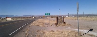
Carrizozo, county seat of Lincoln County, was established in 1899, a new town on the El Paso and Northeastern Railroad. The ghost town of White Oaks, once a booming mining camp, is nearby. Billy the Kid, Sheriff Pat Garrett, Governor Lew Wallace, . . . — — Map (db m45912) HM
On Central Avenue (U.S. 54 at milepost 122.5), 0.1 miles south of A Avenue, on the right when traveling north.
Carrizozo, county seat of Lincoln County, was established in 1899, a new town on the El Paso and Northeastern Railroad. The ghost town of White Oaks, once a booming mining camp, is nearby. Billy the Kid, Sheriff Pat Garrett, Governor Lew Wallace, . . . — — Map (db m45914) HM
On Main Street (U.S. 54 at milepost 170) north of Duboise Avenue, on the right when traveling north.
The earliest settlers in the area were the Spanish ranchers who raised sheep and cattle on the open rangelands surrounding Corona. In the 1850's, a stage line was established from Las Vegas to White Oaks and Fort Stanton, transporting passengers, . . . — — Map (db m45907) HM
On Main Street (U.S. 54 at milepost 168.5) at Mayeux Road, on the right when traveling south on Main Street.
In late November, 1880, William “Billy the Kid” Bonney, David Rudabaugh and William Wilson were hiding out near here at a store and tavern operated by James Greathouse and a partner named Kuch. The night of November 27, they were . . . — — Map (db m45908) HM
During the Army era, the fort’s commander and his family lived in this beautiful stone structure. During the Hospital’s tenure, it was the residence of the Medical Officer in Charge. Over the years, it is the only building that has remained . . . — — Map (db m86089) HM
Photo etchings caption:
Building 12, torn down in 1930, was actually attached to Building 13. When it was taken down, a chunk of the roof fell into a lady’s bedroom.
Originally built in 1855 of adobe, the building that occupied this . . . — — Map (db m86189) HM
On the site located 100 yards west of this sign resided the L.G. Murphy Sutler Store (the post trader). Begun in 1866 by Lawrence G. Murphy and Emil Fritz (both former Dragoons stationed at Fort Stanton), it was a large, rambling, adobe structure . . . — — Map (db m123794) HM
Constructed in 1855, this building was originally a single story complex of four quarters for officers and their families. It has evolved over time to be more spacious and comfortable with a second story, bay windows and covered porches. Seen in the . . . — — Map (db m86307) HM
Built in 1855, as a single story, gabled roof structure of simple design and construction, this building housed officers and their families. It was here that 2nd Lieutenant John J. Pershing was quartered in 1887 and where he met his future wife. On . . . — — Map (db m86734) HM
On U.S. 70 at milepost 273.5, on the right when traveling east.
In one of the Lincoln County War’s earliest violent encounters, John H. Tunstall was shot and killed at a nearby site on February 18, 1878. Tunstall’s death set off a series of violent reprisals between his friends, among whom was William . . . — — Map (db m46009) HM
On U.S. 380 at milepost 97.9, on the right when traveling west.
Encamped a few yards away on July 19, 1878 were U.S. troops from Fort Stanton. Allegedly brought to protect lives and property, their presence quickened Murphy party into firing McSween's residence and pillaging the Tunstall store. — — Map (db m45989) HM
On U.S. 380 at milepost 98.5, on the right when traveling west.
Side A:
Spanish-speaking settlers established a town here in the 1850's, after the U. S. Army began to control the Mescalero Apaches. First known as Las Placitas del Rio Bonito, the name of the community was changed to Lincoln when . . . — — Map (db m46007) HM
On Billy the Kid Trail (U.S. 380 at milepost 98.4), on the right when traveling east.
This is a two-sided markerSide A:
Spanish-speaking settlers established a town here in the 1850s, after the U.S. Army began to control the Mescalero Apaches. First known as Las Placitas del Río Bonito, the name of the community . . . — — Map (db m119774) HM
On Billy the Kid Trail (U.S. 380 at milepost 97.5), on the right when traveling east.
Built in 1874, as place of business and residence of L.G. Murphy & Co., a dominant factor in area in 1870's, and headquarters of the Murphy faction during Lincoln County War. Firm failed, and store became county gov't and judicial center for 33 . . . — — Map (db m119775) HM
On U.S. 380 at milepost 97.7, on the right when traveling east.
Built in 1888 by J.J. Dolan, who took part in the L.C. War on the Murphy side, and afterwards was conspicuous in county affairs. In later times the building served as a hotel, the most familiar name being Bonito Inn. — — Map (db m45961) HM
On Billy the Kid Trail (U.S. 380 at milepost 97.8), on the right when traveling east.
South some 75 yds. was the lone adobe house of J.B. Wilson, noted J.P. in Lincoln Co. War. At night, Mar 17, 1879 he helped Gov. Lew Wallace meet with Bill Bonney, leader of remaining McSween men, and arranged a surrender under promise of protection. — — Map (db m45969) HM
On U.S. 380 at milepost 97.7, on the right when traveling west.
Opening a law office in Lincoln, 1875, Alex A. McSween rebuilt an old adobe into a ten room house. On July 19, 1878, Peppin's posse fired it to oust inmates. Leading victim of this strategm was McSween himself. The burned-down house was never . . . — — Map (db m45992) HM
On U.S. 380 at milepost 97.7, on the right when traveling west.
J.H. Tunstall and A. A. McSween erected-1877. A focal point in Lincoln County War in which both partners were slain. Despite looting by Seven Rivers group, building continued as a store under pioneer merchants, notably John M. Penfield. — — Map (db m45991) HM
On Sudderth Drive, 1.4 miles west of U.S. 70, on the left when traveling west.
Part original structure. Famous landmark for 100 years. Originally grist and sawmill. Used as rendezvous by William H. Bonney (Billy, the Kid), Pat Garrett, Johnny Riley, J.J. Pershing (then Lt. at Ft. Stanton) and other historic figures. — — Map (db m46014) HM
On U.S. 70 at milepost 264, on the right when traveling west.
Famous New Mexico landmark for over 100 years. Original building still stands and water turns massive water wheel during the summer. Billy the Kid, Pat Garrett and General Pershing visited here. Turn on NM 48, 2.7 miles to west, then proceed 1.4 . . . — — Map (db m46011) HM
On State Road 349, on the right when traveling east.
Her second husband was George Barber. Under the Desert Land Act, they patented 400 acres in 1883. The act required irrigating the land and in 1881 Susan built a dam across Three Rivers stream and a half-mile ditch to convey water to her property. By . . . — — Map (db m103652) HM
On State Road 349, on the right when traveling east.
White Oaks grew rapidly after the discovery of gold in 1869. From tent city to bustling mining town, it was the largest town in Lincoln County with cultural events and an occasional bandit. Gold depletion and failure to grant railroad right-of-way . . . — — Map (db m105813) HM
Albert J. Connell In Lieu Entry: October 1930 Ashley Pond bought H. H. Brook's ranch in January 1917. That same year, Pond hired Albert J. (A. J.) Connell to be the director of the newly formed Los Alamos Ranch School. The school did not own all the . . . — — Map (db m156673) HM
Harold H. Brook Homestead Entry: August 1908 Los Alamos Ranch School Purchase: 1917 Harold Hemingway Brook was an agronomist from Illinois who came to Santa Fe for treatment of tuberculosis. He recovered enough to apply for homestead entry in . . . — — Map (db m156686) HM
The human history on the Pajarito Plateau goes back at least 10,000 years. Paleoindians first hunted its forests; millennia later, Pueblo Indians farmed its broad mesas before abandoning their settlements for locations along the Rio Grande. The . . . — — Map (db m156599) HM
Martha Brook Homestead Entry: August 1913 Los Alamos Ranch School Purchase: 1920 Martha Brook was Harold Brook's mother. Brook applied for homestead entry in Martha's name in August 1913 for 150 acres of what is now Eastern Area, the airport, and . . . — — Map (db m156687) HM
Among those tempted by the Homestead Act of 1862, which offered free land in exchange for the successful establishment of a farmstead, was Victor Romero. In 1913 he applied for 15 acres of land that is now within the boundaries of Los Alamos . . . — — Map (db m156598) HM
William Mackwood Hopper Homestead Entry: August 1908 Harold H. Brook Purchase: 1914 Los Alamos Ranch School Purchase: 1917 William Mackwood Hopper met Harold Brook when they both lived in Santa Fe. In August 1908, four days after Brook applied for . . . — — Map (db m156681) HM
On State Road 11 at milepost 5.3, on the right when traveling south.
Columbus was founded in 1891 as a U.S./Mexico border station but eventually coalesced around the railroad station three miles to the north in 1903. The area’s history is tied to a March 9, 1916, raid on Columbus by Mexican revolutionary leader . . . — — Map (db m37778) HM
Pancho Villa State Park commemorates the historic Columbus Raid of 1916. Ruins of Camp Furlong, headquarters for General John Pershing's expeditionary force, still exist at the park. The old Columbus Customs Service building has been restored to . . . — — Map (db m81737) HM
On State Road 9 at State Road 11, on the right when traveling east on State Road 9.
Now the site of the Columbus Historical Society Museum the depot was built c. 1902 by the El Paso & Southwestern Railroad which was merged with the Southern Pacific in 1924.
Site No. 390-B
A Registered Cultural Property
State of New . . . — — Map (db m37782) HM
On U.S. 180 at milepost 164, on the right when traveling south.
In 1780, Governor Juan Bautista de Anza passed here while searching for a trade route between Santa Fe and the mines of Sonora, Mexico. Deming, named for Mary Anne Deming, was founded in 1881 when the Santa Fe and Southern Pacific Railroads were . . . — — Map (db m38212) HM
On East Pine Street, on the right when traveling east.
This is a two-sided markerFront Side:
Born in 1827, Mary Ann Deming was married to Charles Crocker, one of the founders of the Central Pacific Railroad. A “silver spike” was driven here in 1881 that commemorated . . . — — Map (db m121958) HM
Near New Mexico Route 118 east of South 1st Street.
Gallup, New Mexico, the Indian Capital of the World is known as the epicenter of Native American history, art, culture and tradition in the southwest.
Europeans, Asians, and Mexicans came to build the railroad, and many stayed on to mine coal. . . . — — Map (db m184299) HM
On South 3rd Street (New Mexico Route 610) at West Hill Avenue, on the right when traveling south on South 3rd Street.
In 1864 during a period of destabilization among U.S. settlers, Spanish inhabitants and Native Americans, the Navajo and some Apache were singled out by the U.S. government as responsible for raiding. Thousands of Navajo people were forcibly marched . . . — — Map (db m148698) HM
On West Aztec Avenue at South 2nd Street (State Route 610), on the left when traveling east on West Aztec Avenue.
Centuries before Gallup's founding in 1881 this was a region of interweaving native cultures, Navajo, Hopi and Zuni. Resources of coal, timber, railroads and trading attracted settlers who created a city of increasing cultural diversity.
We . . . — — Map (db m148758) HM
On South 2nd Street (New Mexico Route 610) south of West Hill Avenue, on the right when traveling north.
The Zuni Pueblo is 40 miles south of Gallup. Zuni land-use area, which included what is now Gallup, has been inhabited since 1,000 BC. By 1350 AD agriculture was fully developed and there were approximately 36 active Zuni pueblos. The Spanish . . . — — Map (db m148701) HM
On New Mexico Route 434 at 518, on the left when traveling north on State Route 434.
St. Vrain Mill The St. Vrain Mill is a stone, water-powered, vertical gristmill. The mill (molino de piedra in Spanish) was one of several in the Mora Valley that supplied flour and meal to nearby Fort Union in the mid-1800s. The mill was . . . — — Map (db m145867) HM
On State Road 120 just east of Interstate 25, on the right when traveling east.
Wagon Mound is the westernmost natural landmark on the Santa Fe Trail. It could be seen for miles by weary travelers making their way over the long and arduous road. The promontory was named by the trail travelers for its resemblance to a large . . . — — Map (db m156740) HM
On State Road 120 at Interstate 25, on the right when traveling east on State Road 120.
This last great landmark on the Santa Fe Trail was named for its resemblance to the top of a covered wagon. At Wagon Mound, travelers could cross from the Cimarron Cutoff to Fort Union, which is located on the Mountain Branch of the Trail. The two . . . — — Map (db m45824) HM
On New Mexico Route 161, 2.3 miles north of Interstate 25, on the right when traveling north.
The low line of trees to the south marks La Junta (the junction) of the Mora and Sapello Rivers. It is also known as La Junta because its location is where the Cimarron and Mountain Branches of the Santa Fe Trail join. Arriving with the U.S. . . . — — Map (db m156802) HM
Near New Mexico Route 161, 2.6 miles north of Interstate 25, on the left when traveling north.
In 1848, the U.S. Secretary of War ordered Lieutenant Colonel Edwin V. Sumner, as commander of the Ninth Military Department to "revise the whole system of defense (sic)" in the New Mexico Territory. The immediate goal was to move U.S. troops out of . . . — — Map (db m156808) HM
Near New Mexico Route 161, 7.5 miles north of CanAm Highway (Interstate 25).
The deep ruts etched into the earth in front of you are a record of Fort Union's role as the guardian of the Santa Fe Trail. Formed from a network of routes used for hundreds of years by American Indians, Spaniards, Mexicans, New Mexicans, and . . . — — Map (db m148988) HM
On New Mexico Route 161, 6.6 miles north of Interstate 25, on the left when traveling north.
Fort Union Arsenal (marker south side)West of Fort Union near the base of the mesa are the ruins of Fort Union Arsenal. The first Fort Union was built at this location in 1851. In 1867 this wooden fort was razed and the adobe Arsenal . . . — — Map (db m156765) HM
Near New Mexico Route 161, 7.5 miles north of CanAm Highway (Interstate 25).
You are looking at the largest United States military base to be found for 500 miles in any direction during the late 1800s. There was nothing bigger from Kansas to California. For 25 years, this frontier-era Army post was a federal government-run . . . — — Map (db m148970) HM
On New Mexico Route 161, 2.3 miles north of Interstate 25, on the right when traveling north.
On the hillside in front of you, the wagon ruts of the Santa Fe Trail bear silent witness to the passage of time and nations moving east and west. When Mexico won its independence from Spain in 1821, legal trade began between the United States and . . . — — Map (db m156801) HM
On New Mexico Route 161, 0.6 miles south of CanAm Highway (Interstate 25), on the left when traveling south.
For westbound travelers, camping here in this green river valley meant that their journey on the Santa Fe Trail was almost over. For travelers headed east it represented a decision, for the trail split here into two very different adventures. The . . . — — Map (db m148818) HM
Near New Mexico Route 161, 7.5 miles north of CanAm Highway (Interstate 25).
There were few chances for family life for any enlisted man in the United States Army on the frontier. Regulations did not allow new recruits to have a wife or child. No soldier could marry without the permission of his commanding officer. That . . . — — Map (db m148994) HM
On Interstate 25 at milepost 374, on the right when traveling north.
Opened by William Becknell in 1821, the Santa Fe Trail became the major trade route to Santa Fe from Missouri River towns. The two main branches, the Cimarron Cutoff and the Mountain Branch, joined at Watrous. Travel over the Trail ceased with the . . . — — Map (db m55199) HM
Near New Mexico Route 161, 7.5 miles north of CanAm Highway (Interstate 25).
If you look straight ahead about a mile, you can see the site of the first Fort Union. There, at the foot of the mesa, soldiers quickly threw up buildings made from logs and uncured, rough-sawn lumber in the summer of 1851. Their mission was to . . . — — Map (db m149182) HM
Near New Mexico Route 161, 7.5 miles north of CanAm Highway (Interstate 25).
Today it's tough to look at the low wagon wheel ruts of the Santa Fe Trail — just ahead of you and grasp how many tens of thousands of lives this road turned upside down. Comanche, Kiowa, Jicarilla Apache, Mountain Ute, and other American . . . — — Map (db m149008) HM
Near New Mexico Route 161, 2.6 miles north of Interstate 25, on the left when traveling north.
Like surging tides upon the shore, a procession of human cultures has influenced this region. Each new wave of people left unique impressions on the landscape and each other. 1100-1900 Jicarilla Apache, Ute, Comanche, Pueblo, and other . . . — — Map (db m156804) HM
On New Mexico Route 161, 7.6 miles north of Interstate 25.
The Santa Fe Trail was a 900-mile overland road that connected Franklin, Missouri, with Santa Fe, New Mexico. Near here, the trail split into the Mountain Route and the Cimarron Route and travelers had to decide which to take to continue east to . . . — — Map (db m156973) HM
On New Mexico Route 161, 7.6 miles north of Interstate 25.
Rested and resupplied at Fort Union, traders headed west into the last 130 miles of the long and arduous trip to Santa Fe. They reached the trading post at Watrous first and then the small town of Las Vegas, founded as a trail stop in 1835. One of . . . — — Map (db m156972) HM
On State Road 161 at Interstate 25, on the left when traveling east on State Road 161.
The Mountain Branch and the Cimarron Cutoff of the Santa Fe Trail meet at Watrous. This important spot on the Trail was first known at La Junta, "junction" in Spanish. In 1879, with the coming of the railroad, it was named for Samuel B. Watrous, a . . . — — Map (db m55198) HM
Near 2nd Street (Briges Street) just north of Concord Street, on the left when traveling north.
Watrous - Western Junction of the Santa Fe Trail has been designated a Registered National Historic Landmark Under the provisions of the Historic Sites Act of August 21, 1935 this site possesses exceptional value in commemorating and . . . — — Map (db m148788) HM
On U.S. 70 at milepost 178, on the right when traveling east.
Albert Jennings Fountain was a Civil War veteran, New Mexico legislator and prominent lawyer. On February 1, 1896, Fountain and his eight-year-old son, Henry, were traveling home to Mesilla from Lincoln. They carried grand jury indictments against . . . — — Map (db m46077) HM
On State Road 545 at U.S. 54, on the left when traveling east on State Road 545.
In 1719, Spanish Franciscan missionaries built a chapel here dedicated to Nuestra Señora de la Luz, Our Lady of the Light. The naming of the village is also attributed to the will o’wisp light in the canyon, a perpetually burning lamp in an . . . — — Map (db m46073) HM
On U.S. 54 at milepost 96.6 at County Road B030, on the right when traveling north on U.S. 54. Reported missing.
Located in the Tularosa Basin east of the great lava flows known as the malpais, Three Rivers was once prominent in the cattle empires of Albert Bacon Fall, John S. Chisum, and Susie McSween Barber, “the cattle queen of New Mexico.” . . . — — Map (db m46039) HM
On U.S. 54 at milepost 96.6, on the right when traveling north.
Located in the Tularosa Basin at the turn-off for Three Rivers Petroglyphs, this ranching village settled in the early 1870's took its name for a nearby convergence of three creeks. The cattle empires of Albert Bacon Fall, John Chisum, and Susan . . . — — Map (db m91006) HM
On U.S. 54 at milepost 78, on the right when traveling north.
The Tularosa Basin has been occupied by Indian groups for thousands of years. The first Hispanic settlers moved here from the Rio Grande Valley in 1862. Anglo settlers and cattlemen began moving into the region in the 1870s. The original 1862 . . . — — Map (db m46072) HM
On U.S. 54 at milepost 351, on the left when traveling west.
The area is rich in prehistoric evidence, and home of the buffalo and Plains Indians. Explored by the early Spanish, the area was settled when the Rock Island Railroad was built thru in 1901.
The brick building, built in 1921, was home for a fine . . . — — Map (db m78866) HM
On U.S. 54 at milepost 343, on the left when traveling west.
Founded in 1906 and at one time had a couple dozen buildings with all types of business found in early western towns including a newspaper called Obar Progress.
A partial list of the several hundred pioneer families who homesteaded in the Obar . . . — — Map (db m78867) HM
On U.S. 54 at milepost 305.5, on the right when traveling west.
This area was troubled by both Comanches and Comancheros, New Mexicans who traded illegally with the Indians, until the military campaigns of 1874. With the coming of the railroad in 1898, the small community of Liberty, eight miles to the north, . . . — — Map (db m78868) HM
On East Tucumcari Boulevard, 0.5 miles west of Quay Road Am, on the right when traveling west.
This area was troubled by both Comanches and Comancheros, New Mexicans who traded illegally with the Indians, until the military campaigns of 1874. With the coming of the railroad in 1898, the small community of Liberty, eight miles to the north, . . . — — Map (db m78888) HM
On East Main St (U.S. 54), on the right when traveling east.
Tucumcari Mountain has long been a landmark for travelers along the Canadian River. Pedro Vial mentioned it in 1793, while opening a trail between Santa Fe and St. Louis. In order to find the best route from Arkansas to California, Capt. Randolph . . . — — Map (db m4378) HM
On East Tucumcari Boulevard, 0.5 miles west of Quay Road Am, on the right when traveling west.
Tucumcari Mountain has long been a landmark for travelers along the Canadian River. Pathfinder Pedro Vial mentioned it in 1793, while opening a trail between Santa Fe and St. Louis. In order to find the best route from Arkansas to California, Capt. . . . — — Map (db m119938) HM
On State Road 209, 0.5 miles south of Interstate 40, on the left when traveling south.
Tucumcari Mountain has long been a landmark for travelers along the Canadian River. Pathfinder Pedro Vial mentioned it in 1793, while opening a trail between Santa Fe and St. Louis. In order to find the best route from Arkansas to California, Capt. . . . — — Map (db m119940) HM
On State Road 68 at milepost 8.7 at Los Luceros (County Road 48), on the right when traveling north on State Road 68.
Historic Los Luceros includes a Pueblo Indian ruin and an 18th century rancho/hacienda on Sebastián Martin Serrano's 1703 land grant. Evolving out of family inheritance, local artistry and preservation efforts, the complex contains five adobe . . . — — Map (db m45711) HM
On Juan Medina Road (County Road 98) 0.1 miles east of High Road to Taos (State Road 76), on the left when traveling south.
Indians occupied the Chimayo valley centuries before the arrival of the Spaniards. The village of Chimayo, founded in the early 18th century, shortly after the reconquest of New Mexico, has been a center of the Spanish weaving tradition for over 250 . . . — — Map (db m32819) HM
On State Road 76 at milepost 10.2,, 0.4 miles east of Cundiyo Road (State Road 503), on the right when traveling west. Reported missing.
Cordova, originally named Pueblo Quemado after a nearby burned-out Indian Pueblo, was permanently re-settled in 1750 after Indian attacks. It was renamed Cordova in 1900 after a prominent local family. The village chapel, San Antonio de Padua, is an . . . — — Map (db m45675) HM
On State Road 554 at milepost 11.5 north of State Road 571.
This village was settled in the 1830s by residents from the Abiquiú area. The Territorial Legislature of 1909 established the Spanish-American Normal School here to train teachers for northern New Mexico schools. After several changes in name and . . . — — Map (db m73395) HM
On North Paseo De Onate (U.S. 84 at milepost 191), 0.5 miles north of Fairview Drive, on the right when traveling south.
When it was described by Gaspar Castano de Sosa in 1591, the Española Valley contained about ten Tewa-speaking pueblos, several of which are still occupied today. Juan de Oñate established New Mexico’s first colony here in 1598. Long on the northern . . . — — Map (db m45671) HM
Frank Bond (1863-1945), prominent Española merchant, came from Canada in 1882. In 1887 Bond married May Anna Caffal of Pueblo, Colorado and built the home. The house grew from a two-room adobe to this large structure. Acquired by the city in 1957, . . . — — Map (db m45665) HM
On State Road 68, on the right when traveling north.
Governor Juan de Oñate set up his headquarters in San Juan Pueblo in 1598, but by 1601 he had moved the Spanish capital across the Rio Grande to Yuque-Yunque Pueblo. Named San Gabriel, it served as the seat of government until 1610, when Oñate's . . . — — Map (db m32877) HM
On Los Alamos Highway (State Road 30 at milepost 7.1) at Roller Road, on the left when traveling north on Los Alamos Highway.
Pablita Velarde was an internationally acclaimed artist whose paintings largely depicted Pueblo life. She was commissioned by the WPA art's program to paint murals at Bandelier National Monument. Selected as one of New Mexico's "Living Treasures", . . . — — Map (db m45663) HM
On Highway 84/64 (State Road 84) at Highway 162 (State Road 162) on Highway 84/64.
Elevation 7,860 ft.
In 1832 the Mexican government made a large community land grant to Manuel Martinez and other settlers but settlement was delayed by raids by Utes, Jicarilla Apaches and Navajos. Tierra Amarilla, first called Nutritas, . . . — — Map (db m74256) HM
On Highway 84/64 (State Road 84) at Highway 162 (State Road 162) on Highway 84/64.
Elevation 7,860 ft.
In 1832 the Mexican government made a large community land grant to Manuel Martinez and other settlers but settlement was delayed by raids by Utes, Jicarilla Apaches and Navajos. Tierra Amarilla, first called Nutritas, . . . — — Map (db m74257) HM
On State Road 76 near County Road 77A, on the right when traveling east.
In 1754, Governor Tomás Vélez Cachupín granted land on the Rio Truchas to families from Santa Cruz and Chimayó. Because Nuestra Señora de Rosario de Truchas was on the northern frontier, and subject to attack by Plains Indians, the governor . . . — — Map (db m64915) HM
On State Road 68 at County Road 60, on the left when traveling north on State Road 68.
Founded in 1875, this small farming community was named La Jolla. It was once famous for finely woven blankets. Here the Camino Real left the Rio Grande and followed a canyon northeast to Embudo Creek where it began a climb over the mountains to . . . — — Map (db m43810) HM
On U.S. 70, 0.1 miles east of State Road 467, on the right when traveling west.
Portales derives its name from the porch-like appearance of a cave entrance at nearby Portales Springs. It developed as a major peanut producing region in the early twentieth century, after the Pecos Valley Railroad opened the area for commercial . . . — — Map (db m56117) HM
On U.S. 70 at University Place, on the right when traveling east on U.S. 70.
Portales derives its name from the porch-like appearance of a cave entrance at nearby Portales Springs. It developed as a major peanut producing region in the early twentieth century, after the Pecos Valley Railroad opened the area for commercial . . . — — Map (db m56120) HM
On U.S. 70, 1.7 miles east of State Road 202, on the right when traveling east.
Rose Powers White worked tirelessly to compile histories of early pioneers of southeastern New Mexico. She published numerous articles and was frequently asked to lecture to organizations and school groups. She served as president of the New . . . — — Map (db m56113) HM
A ribbon of green in an arid land, the 126-mile Animas River brings a most precious gift to the Four Corners region: reliable year-round water. Starting in the San Juan Mountains, the Animas joins the San Juan River just south of here at Farmington. . . . — — Map (db m184354) HM
In the early 1100s, travelers on this familiar path could see a sprawling settlement ahead. Across the river, ceremonial kivas and great houses with hundreds of rooms dominated the landscape. Smaller house-style unit pueblos and farming areas spread . . . — — Map (db m184352) HM
On West Broadway Avenue (U.S. 64 at milepost 62), on the right when traveling east.
Prehistoric farmers established major communities along the rivers of this region in the eleventh century. Eight hundred years later, historic settlement was also made possible by abundant water. Bloomfield was established in 1879 near a site which . . . — — Map (db m36460) HM
On Locke Avenue, 0 miles north of Apache Street, on the left when traveling north.
First settled 1876 to 1878 by families of William and Marion B. Hendrickson, Charles and Milton Virden, Orville Pyle, A.F. Miller and William Lock. The first school-house was built in 1879; the Methodist Episcopal Church in 1886. William Lock . . . — — Map (db m22805) HM
On Main Street at Orchard Avenue, on the right when traveling west on Main Street.
Farmington, New Mexico, the heart of the Four Corners, boasts a thriving downtown, where character, history and culture fuse in a mixture of places and events. Originally the land in what is now Northwest New Mexico was known as Tóta’ . . . — — Map (db m22861) HM
On West Main Street at North Orchard Drive, on the left when traveling east on West Main Street.
"The Hunters arrived in Farmington in 1891 and donated the land for this plaza to the city of Farmington in May 1902. This pavilion is dedicated to the memory of the Hunters for their generosity and community spirit in helping Farmington grow." — — Map (db m185385) HM
On Brigham Street (County Route 6100) west of County Route 6337, on the right when traveling east.
Among early settlers on this site were the families of Wm. Simpson, A.D. Arthur and Frank Coolidge, Ager and James K.P. Pipkin, Hugh Curry, W.L. Kennedy and others. James B. Ashcroft was called by L.D.S. Church as bishop in 1997. He supervised . . . — — Map (db m240549) HM
Near State Road 597 at milepost 0.4,, 0.5 miles west of U.S. 160.
This is the only place in the United States marking the common corner of four states – Colorado, New Mexico, Arizona and Utah.
Who established this corner?
The four corners monument was established and perpetuated by U.S. Government . . . — — Map (db m36522) HM
On Interstate 25 at milepost 339 at U.S. 84, on the right when traveling north on Interstate 25.
Interstate 25 cuts through dipping strata that form hogback ridges between the Great Plains and the south end of the Rocky Mountains. The Santa Fe Trail from here to Santa Fe, followed a natural valley eroded in less resistant strata between the . . . — — Map (db m55196) HM
On North Grand Avenue (U.S. 85) at Legion Drive, on the right when traveling north on North Grand Avenue.
Las Vegas served as an important stop on the Santa Fe Trail and later as a major railroad center. Here General Kearny announced the annexation of New Mexico by the U.S. in 1846. In 1862, during the Confederate occupation of Santa Fe, Las Vegas . . . — — Map (db m45887) HM
On Plaza Street just west of North Gonzales Street, on the left when traveling west.
Mr. Acalde, and people of New Mexico: I have come amongst you by the orders of my government, to take possession of your country, and extend over it the law of the United States, we consider it, and have done so for some time, a part of the . . . — — Map (db m148846) HM
Essential for any settlement, water is highly valued in the high desert. Fortunately water from the Pecos River, Glorieta Creek, and area springs sustained the pueblo's growth. Whether needed for making mud plaster, creating pottery, or growing . . . — — Map (db m185384) HM
On State Road 518 south of State Road 94, on the right when traveling north.
From 1863 to 1867, this mountain was the home of Juan Maria Agostini, an Italian penitent who lived there as a hermit, carving crucifixes and religious emblems which he traded for food. Leaving this area, he moved to the Organ Mountains, in southern . . . — — Map (db m73309) HM
On U.S. 550 at milepost 4.2,, 0.2 miles east of Santa Fe Hills Boulevard, on the right when traveling east.
The Pueblo Indian province of Tiguex, in the area of Bernalillo, served as winter headquarters for Francisco Vásquez de Coronado in 1540-42 during his explorations of the Southwest. Bernalillo was founded after the Spanish reconquest of New Mexico . . . — — Map (db m45440) HM
On Pan American Central Highway (State Road 313) north of Denny Road, on the right when traveling north.
Archaeological research indicates that this fertile valley has been the focus of human occupation for at least 10,000 years. Soon after the Spanish colonized New Mexico in 1598, a series of estancias, or farming and ranching communities, flanked the . . . — — Map (db m45441) HM
On Corrales Road (State Road 448) at Jones Road, on the right when traveling south on Corrales Road.
Spanish colonization of this region, once the location of many Tiwa Indian pueblos, began in the 17th century. Corrales is named for the extensive corrals built here by Juan González, founder of Alameda. In the 18th century this rich farming . . . — — Map (db m45436) HM
300 entries matched your criteria. Entries 101 through 200 are listed above. ⊲ Previous 100 — Next 100 ⊳