By James Hulse, August 30, 2021
The Sgt. William Henry Barnes Marker at the entrance to the cemetery.
| On Orleans Avenue, 0.2 miles north of Comal Street. |
| On Buren Road, 0.2 miles east of State Highway 238, on the right when traveling south. |
| On Commerce Street east of Main Street, on the right when traveling north. |
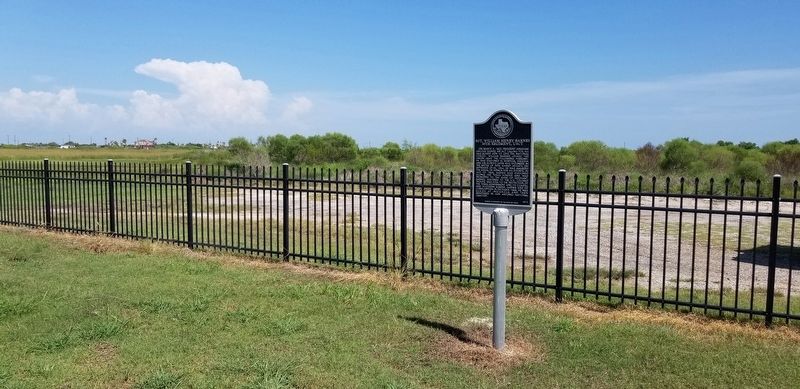
| On State Highway 35 at State Highway 185, on the right when traveling west on State Highway 35. |
| On State Highway 35 at State Highway 328 on State Highway 35. |
| Near Commerce Street east of Main Street, on the right when traveling north. |
| On State Highway 35 at State Highway 238, on the right when traveling east on State Highway 35. |
| Near Martin Luther King Drive at Nueces Street. |
| On North Virginia Street (Farm to Market Road 1090) at Railroad Street, on the right when traveling north on North Virginia Street. |
| Near 4th Street (Business Interstate 20) at Market Street, on the right when traveling west. |
| Near U.S. 283, 0.1 miles south of County Road 328, on the left when traveling north. |
| Near County Road 473, 0.1 miles north of County Road 470. |
| Near Boca Chica Boulevard (State Highway 4) 0.1 miles east of Palmito Hill Road, on the right when traveling east. |
| On West University Boulevard at International Blvd, on the left when traveling south on West University Boulevard. |
| On East Ruben M Torres Boulevard at Frontage Road, on the right when traveling west on East Ruben M Torres Boulevard. |
| On East Ruben M Torres Boulevard at Frontage Road, on the right when traveling west on East Ruben M Torres Boulevard. |
| Near Palmito Hill Road, 0.1 miles south of Boca Chica Boulevard (State Highway 4), on the right when traveling south. |
| On Boca Chica Boulevard (State Highway 4) 0.2 miles Palmito Hill Road, on the right when traveling east. |
| On International Boulevard at West University Blvd, on the left when traveling west on International Boulevard. |
| On May Street at Taylor Avenue, on the left when traveling south on May Street. |
| Near Palmitto Hill Road, 0.1 miles south of Boca Chica Boulevard (State Highway 4), on the right when traveling south. |
| On Boca Chica Boulevard (State Highway 4), on the right when traveling west. |
| On Boca Chica Boulevard (State Highway 4) 0.2 miles east of Palmito Hill Road, on the right when traveling east. |
| Near Palmito Hill Road, 0.1 miles south of Boca Chica Boulevard (State Highway 4), on the right when traveling south. |
| Near Palmito Hill Road, 0.1 miles south of Boca Chica Boulevard (State Highway 4), on the right when traveling south. |
| Near East 5th Street at East Madison Street. |
| Near East 5th Street at East Madison Street. |
| Near East 5th Street at East Madison Street. |
| On Military Highway (U.S. 281) 0.1 miles west of Don Felipe Trevino, on the left when traveling west. |
| On East Queen Isabella Blvd (State Highway 100) at North Garcia Street, on the left when traveling east on East Queen Isabella Blvd. |
| On East Maxan Street at North Garcia Street, on the right when traveling east on East Maxan Street. |
| On South Tarnava Street at Railroad Street, on the left when traveling north on South Tarnava Street. |
| On Farm to Market Road 1420 at Combes Rio Hondo Road (Farm to Market Road 508), on the left when traveling east on Highway 1420. |
| On Channel View Road at State Park 100 Road, on the left when traveling east on Channel View Road. |
| On Channel View Road at State Park Road 100, on the right when traveling east on Channel View Road. Reported missing. |
| On U.S. 271, 0.5 miles north of County Road 4114, on the left when traveling north. |
| On Quitman Street (Texas Route 11) east of Moreland Street, on the right when traveling east. |
| On U.S. 59, 0.2 miles south of County Highway 1641-A, on the right when traveling north. |
| On East Houston Street (Texas Route 11) at South Kaufman Street, on the right when traveling east on East Houston Street. |
| On U.S. 79, 0.2 miles west of County Highway 3223, on the left when traveling west. |
| On Kickapoo Street (County Highway 3305) at County Highway 3331 on Kickapoo Street. |
| On Kickapoo Street (County Highway 3305) at County Highway 3331 on Kickapoo Street. |
| On Farm to Market Road 241, 0.6 miles north of County Highway 1104. |
| On East 6th Street (U.S. 84) at South Main Street (State Highway 62), on the right when traveling west on East 6th Street. |
| On West Crockett Street (Farm to Market Road 23) 0.2 miles west of Barron Street, on the right when traveling west. |
| On Avenue F Northwest (U.S. 287) at North Main Street, on the right when traveling east on Avenue F Northwest. |
| On S. Washington Street south of W. Main Street (Texas Highway 158), on the right when traveling south. |
| Near State Highway 158, 0.5 miles east of State Highway 208. |
| On E. 7th Street (Loop State Highway 229) at Austin Street, on the right when traveling east on E. 7th Street. |
| Near State Highway 158, on the right when traveling east. |
| Near Unnamed Road, 0.2 miles north of Hayrick Road. |
| On State Highway 158, on the left when traveling west. |
| Near U.S. 84/283, 0.1 miles north of Roosevelt Street, on the right when traveling north. |
| Near U.S. 84/283, 0.1 miles Roosevelt Street, on the right when traveling north. |
| On U.S. 267 at Farm to Market Road 567, on the right when traveling west on U.S. 267. |
| Near Wallis Avenue (U.S. 84) west of 2nd Street, on the right when traveling east. |
| On Parkwood Boulevard, 0.1 miles south of Warren Parkway, on the right when traveling north. |
| On Preston Road, 0.1 miles south of Warren Parkway, on the left when traveling north. |
| On North College Street at West Lela Street, on the left when traveling north on North College Street. |
| On West Willie Street near South Parker Street, on the left when traveling west. |
| On East Louisiana Street, on the left when traveling east. |
| On Farm to Market Road 102 at Alleytown Road (County Road 268), on the right when traveling north on Road 102. |
| On Jackson Street west of Live Oak Street, on the right when traveling west. |
| On Wallace Street at Milam Street (State Highway 52 Spur), on the right when traveling west on Wallace Street. |
| On Milam Street (State Highway 52) at Spring Street, on the right when traveling north on Milam Street. Reported missing. |
| Near Veterans Drive at Walnut Street (U.S. 90). |
| On Travis Street, 0.1 miles south of Preston Street, on the right when traveling north. |
| On Front Street at Preston Street, on the left when traveling north on Front Street. |
| On Travis Street at Crockett Street, on the right when traveling south on Travis Street. |
| On County Road 208 at County Road 205, on the left when traveling north on County Road 208. |
| On Main Plaza at South Seguin Avenue (Business State Highway 46), on the right when traveling south on Main Plaza. |
| On Business Interstate 35, 0.3 miles north of State Highway 46, on the left when traveling north. |
| On Comal Avenue at Lindheimer Avenue, on the right when traveling west on Comal Avenue. |
| On Landa Park Drive, 0.1 miles south of Gazebo Circle, on the left when traveling north. |
| On Moorman Road at Hillcrest Street, on the left when traveling west on Moorman Road. |
| On Central Avenue (U.S. 67/377) at Austin Street, on the right when traveling west on Central Avenue. |
| On Central Avenue (U.S. 67/377) at Houston Street, on the right when traveling west on Central Avenue. |
| On Moorman Road at Hillcrest Street, on the left when traveling west on Moorman Road. |
| On U.S. 83, 0.3 miles south of Texas Highway 1929, on the left when traveling north. |
| On West California Street (Farm to Market Road 51) west of Frontage Interstate 35 Frontage Road, on the right when traveling west. |
| On South Denton Street at Davis Street, on the right when traveling south on South Denton Street. |
| Near Fair Avenue south of Elizabeth Street, on the left when traveling south. |
| On East Main Street at South Schopmeyer Street, on the left when traveling east on East Main Street. |
| Near Fair Avenue south of Elizabeth Street, on the left when traveling south. |
| Near U.S. 82 east of Parkside Circle when traveling west. |
| Near Langford Cove Road at Sheldon Road, on the right when traveling south. |
| On North 22nd Street, 0.1 miles north of East Main Street (U.S. 84), on the right when traveling north. |
| On North 9th Street north of Richards Street, on the right when traveling north. |
| On U.S. 67/385, on the right when traveling south. |
| On 11th Street (State Highway 466) at Avenue E (State Highway 163), on the left when traveling east on 11th Street. |
| Near Avenue E (State Highway 163) at Quail Run, on the left when traveling south. |
| Near Avenue E (State Highway 163) near Quail Run, on the left when traveling south. |
| Near Avenue E (State Highway 163) at Quail Run, on the left when traveling south. |
| Near Avenue E (State Highway 163) at Quail Run, on the left when traveling south. |
| Near Avenue E (State Highway 163) at Quail Run, on the left when traveling south. |
| On West 3rd Street at Austin Street, on the right when traveling east on West 3rd Street. |
| On Interstate 10 at milepost 138,, 2.5 miles west of West Broadway Street, on the right when traveling west. |
| On State Highway 54, 30 miles north of Interstate 10, on the left when traveling north. |
843 entries matched your criteria. Entries 101 through 200 are listed above.
⊲ Previous 100 —
Next 100 ⊳