On March 3, 1863, President Abraham Lincoln signed an Act calling for all able-bodied men to join the National Forces. William Barnes joined the Union Army the following February. He was stationed in Norfolk, Virginia and six months later was . . . — — Map (db m182612) HM
In November of 1863, in the midst of the Civil War, the Union Army arrived in Calhoun County. Union and Texas troops rarely met on the field of battle in Texas, as most of the war was concentrated in the east and south of the country. The Union . . . — — Map (db m120714) HM
As part of the U. S. Naval initiative to control Texas Confederate ports, the gunboats "Clifton" and "Westfield" turned to the town then known as Lavaca after easily taking Galveston and Indianola. On October 31, 1862, under a flag of truce, . . . — — Map (db m173656) HM
In February 1863, local inventor E. G. Singer developed and tested a torpedo with a unique spring action ignition system on the shores of Lavaca Bay. With nine other Lavaca citizens including Singer's financial partner Dr. J. R. Fretwell and . . . — — Map (db m172433) HM
Named for the nearby tidal lake of the same name, the community of Green Lake began to develop in the late 1840s, although records indicate there were some settlers in the area before that time. A group of wealthy planters from Kentucky migrated to . . . — — Map (db m61292) HM
Constructed in 1858, this three-story hexagonal lighthouse was originally located in Matagorda Bay, at the southern tip of Half Moon reef. The beacon served as an aid to ships trading in Port Lavaca and the nearby town of Indianola (14 mi. SE). . . . — — Map (db m53111) HM
Artillery batteries in Lavaca returned fired on two Union gunships that fired first on the small town October 31, 1862. Accurate fire from the shore batteries forced the gunboats, Clifton and Westfield, to move outside the range of the smaller . . . — — Map (db m173657) HM
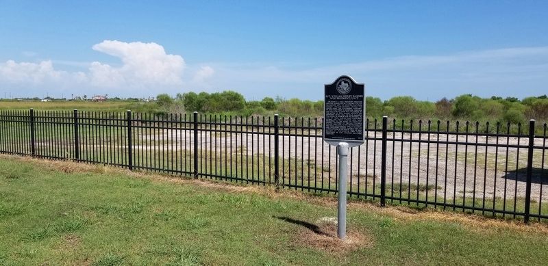
Founded in the aftermath of a Comanche raid on the nearby settlement of Linville, the town of Lavaca (the cow) was established in 1840. The busiest port in the Matagorda Bay area and a major center for over-land export of cattle and other goods, . . . — — Map (db m53110) HM
Burials in this historic cemetery began in the 1840s, with several mass graves dating from an 1849 cholera epidemic. Pioneer families and their descendants, as well as prominent state, county, and city officials, are also interred in the community . . . — — Map (db m182147) HM
Chartered in 1850, the San Antonio & Mexican Gulf Railroad was one of the first railroads in Texas. San Antonio investors hoped it would open trade from the Gulf. As the line was built westward from Port Lavaca, wagons loaded with goods met the . . . — — Map (db m181220) HM
Camp Pecan
C.S.A.
This Civil War camp of the Texas Frontier Regiment was located 21 mi. southeast. Established in 1862 as one of a line of posts a days horseback ride apart. The number of men guarding the frontier were few. Trouble . . . — — Map (db m80810) HM
A native of Illinois, William Jeff Maltby gained fame as a frontiersman, veteran of the Mexican War and American Civil War and Texas Ranger. Maltby began his Texas exploits about 1850, building frontier forts for the U.S. Army. He retired to . . . — — Map (db m79083) HM
The last land engagement of the Civil War was fought near this site on May 12-13, 1865, thirty-four days after Robert E. Lee surrendered at Appomattox.
Col. Theodore H. Barrett commanded Federal troops on Brazos Island 12 miles to the east. . . . — — Map (db m35271) HM
Civil War "Sister Cities" across the river in neutral Mexico, were linked to Texas by a ferry which landed here.
Ferry hauled to Matamoros the Confederate cotton brought from East Texas, Louisiana, Arkansas to Brownsville in Matamoros, many . . . — — Map (db m223463) HM
A major center of activity for Confederacy. Chief depot for war material and supplies imported from Europe through neutral port of Bagdad, Mexico. Terminus of Cotton Road, point of entry and departure for important personages of South in intercourse . . . — — Map (db m220710) HM
Created February 12, 1848
From Nueces County
Organized August 7, 1848
Named in Honor of Ewen Cameron 1811-1843 Captain in the Mier Expedition Shot at Queretaro County Seat, Santa Rita 1848-1849 Brownsville, Since the Earliest Battles of . . . — — Map (db m220711) HM
If you were an American of Hispanic descent during the Civil War, which side would you choose?
Your answer might depend on status, wealth, livelihood, or location. Altogether, more than 20,000 Hispanic soldiers fought in the Civil War. Many were . . . — — Map (db m164601) HM
You are currently standing north of the core battlefield area. To listen to the historical narrative of the battle and learn more about ongoing preservation efforts of the cultural and natural resources located in this National Historic Landmark, . . . — — Map (db m164595) HM
Oldest permanent fort in Texas called Fort Taylor in March, 1846 Later renamed in honor of Major Jacob Brown killed here in May, 1846 Permanent post established, 1849 Evacuated by Federal troops in 1861; by Confederates, 1863 Reoccupied by . . . — — Map (db m222837) HM
Named by Gen. Zachary Taylor during Mexican War for Maj. Jacob Brown, who died in 1846 defending the post. Permanent 385-acre reservation laid out 1848 by Col Wm. Davenport, around original earthworks.
Young officers in the Taylor occupancy . . . — — Map (db m222880) HM
At this site the last battle of the Civil War, known as Palmito Hill, was fought by Confederate troops under Colonel John S. (Rip) Ford and Union Forces on May 13, 1865, 34 days after Lee's surrender at Appomattox. — — Map (db m118442) HM
These palmetto piling are the remains of the Boca Chica Crossing of the railroad from Boca Chica Inlet to White's Ranch on the Rio Grande. Begun by General Francis H. Herron, U.S.A., in 1864 and completed in 1865 by General Philip H. Sheridan for . . . — — Map (db m164594) HM
Hundreds of Union and Confederate troops fought the last land battle of the Civil War here on May 12 and 13, 1865, more than a month after Confederate General Robert E. Lee surrendered to U.S. General Ulysses S. Grant in Appomattox, Virginia.
. . . — — Map (db m220813) HM
You are currently standing north of the core battlefield area. Before you lies the site of last land battle of the American Civil War—May 12-13, 1865. Tune to Channel 1610 AM to listen to a historical narrative of the battle and to learn more about . . . — — Map (db m218633) HM
Back in 1865, the weary soldiers fighting over this rough terrain probably gave little thought to the price of cotton. But their commanders did.
Throughout the war, wagonloads of the South's "white gold” streamed into the Rio Grande Valley . . . — — Map (db m164600) HM
Jose Fernandez, a pioneer in overland freight, made a huge fortune in arms and supplies for Mexican and Civil War trade. He joined Porfirio Diaz's inner circle (1876), and acquired a large coffee plantation in Veracruz. He amassed sizeable property . . . — — Map (db m222186) HM
Joseph Kleiber was a native of Alsace-Lorraine who owned and operated a pharmacy in Brownsville during the Civil War era. In those years he was also the Confederate Postmaster. His business correspondence was conducted in English, Spanish, and . . . — — Map (db m222161) HM
Stephen Powers was a captain of volunteers with Zachary Taylor's army at Matamoros and was promoted to commander of an American garrison under Gen. Winfield Scott (1847). He became Cameron county judge in 1858. He served as 12th District judge . . . — — Map (db m222160) HM
The beacon for the commerce of the Rio Grande
Erected by the United States Government in 1852
Extinguished during the Civil War
Discontinued, 1888 - 1895
Permanently discontinued, 1905
Erected by the State of Texas . . . — — Map (db m156329) HM
Built of brick brought from New Orleans by schooner, the beacon’s 16 mile range guided ships into the harbor and to the Rio Grande, bringing commerce to SW Texas. Darkened during the Civil War, it was used as a lookout by both Union and . . . — — Map (db m156332) HM
After Texas seceded and joined the Confederacy, the Federal Navy in late 1861 blockaded this port with the U.S. "Santiago de Cuba". Commerce stoppage caused removal of customs offices to Brownsville and some civilians to neutral Bagdad, Mexico. . . . — — Map (db m165643) HM
About 10 miles east of this site during the Civil War was Paso Real, ferry point on Arroyo Colorado. As early as 1846, stagecoaches had gone over Paso Real Ferry (the name probably meant "The King's Pass"). In the 1860's, the spot had international . . . — — Map (db m221105) HM
(Front)
Brazos Santiago Pass, to south of this spot, was important Confederate harbor-entry during the Civil War. On island across the pass were fort and town of Brazos Santiago, where on Feb. 21, 1861, Texas troops under Col. John S. Ford . . . — — Map (db m166268) HM
Named by the Spanish, Brazos Santiago Pass is a narrow passageway extending inward from the sea. The pass lies between Brazos Island and Padre Island. The changing depths of the pass channel kept large vessels from entering, but offered seclusion . . . — — Map (db m166273) HM
Came to Texas from Alabama in 1849. Practiced law and taught school in Gilmer.
In Civil War, organized and was elected captain of Co. E, 14th Texas Cavalry (dismounted), unit in famed Gen. M. D. Ector's brigade. In thick of fight, in Tennessee . . . — — Map (db m139372) HM
The Pitts Family Cemetery was established by William Harrison Pitts, founder of Pittsburg, according to family history. The earliest burial on this site was that of Sarah Richardson Harvey Pitts, the third wife of W. H. Pitts and mother of their . . . — — Map (db m139328) HM
Alabama physician. Came to Texas, 1847. Served Cass County in Texas House and Senate for 24 years. Was called the Ablest Parliamentarian of his time.
Served as one of the Speakers of Texas House of Representatives in critical Civil War years, . . . — — Map (db m160772) HM
Dating from before the Civil War, this is Texas oldest
courthouse in active service. Plans to build the courthouse
were adopted in September 1859, with contracts finalized in
December. Enslaved workmen under J.T. Veal dug clay, and
hand-formed . . . — — Map (db m218614) HM
To make farm and kitchen tools needed in wartime, Chapel Hill Manufacturing Co. in 1863 set up plant on this site, processing native iron, used Cherokee limestone to purify the ore. Nearby hardwood supplied charcoal.
Crew included 100 . . . — — Map (db m232780) HM
Cherokee County pioneer David Greene Templeton arrived in the county shortly after the legislature organized it in 1846. Settling in the Gum Creek community (later Old Jacksonville), the North Carolina native became a prominent landowner and civic . . . — — Map (db m232776) HM
Elijah Earle (1804-1880) and his second wife, Mary Elizabeth Jarratt Tatum (1824-1904), set aside land for this graveyard in 1858. Elijah selected his own burial site at the time, marking it by carving his initials on a tree trunk. He was buried . . . — — Map (db m122853) HM
A blacksmith by trade, Kentuckian Jackson Smith came to Texas in the 1830s and participated in the war for independence. He later visited this area as a Republic of Texas scout. In the 1840s, he settled southwest of here in the Gum Creek community. . . . — — Map (db m232778) HM
At this site. Housed some of the more than 3,000 Federals captured at Mansfield, La., on April 8, 1864, in Red River campaign to prevent Federal invasion of Texas. Camp Ford, at Tyler, was largest P.O.W. camp west of the Mississippi. Texas had 2 . . . — — Map (db m232128) HM
(front)
Civil War manufacturing, supply and military center. Field Transportation Bureau shop made and repaired wagons, saddles, harnesses. Gun factory produced "Mississippi rifles" and pistols. Two iron works cast plows, skillets, pots, . . . — — Map (db m95136) HM WM
During the Civil War this area along the road from Rusk to Crockett served as a training camp for Confederate soldiers. Located in a bare field with an available water supply from the nearby Pryor Branch, Camp Rusk was used for training new recruits . . . — — Map (db m232136) HM
Born 1840. Came from Illinois to Texas, 1859. During Civil War rose from private, 1st Texas Artillery, to Colonel in 16th Cavalry. Was in bloody battles of Shiloh, Chickamauga, Nashville, Richmond. After war, when "didn't have 2 pairs of pants", . . . — — Map (db m96647) HM
Fort Chadbourne C.S.A.
Located 8 mi. north on old Butterfield Stageline. Upon secession, company of First Regiment Texas Mounted Rifles occupied this post to give protection against Indians. Stopover on way west for many Union . . . — — Map (db m82378) HM
Born near town of Paint Lick, Kentucky. Came to Collin County, Texas, 1858. Joined Confederate army at McKinney, October, 1861, as private in Army of Tennessee.
Served in five divisions. Was in Battle of Chickamauga; hurt at Murfreesboro, . . . — — Map (db m95975) HM
Virginia native. Leader Texas secession movement. Joined army, rose to captain 15th Texas Infantry company serving in Louisiana, Arkansas, chiefly Tennessee campaigns. Elected to State Supreme Court 1866, removed by reconstruction military . . . — — Map (db m95988) HM
Born in Illinois. Came to Texas 1856. Joined Confederate Army in New Orleans, 1861; fought in siege of Vicksburg (1863), in Battle of Mansfield (1864), and at Pleasant Hill, LA., where he was captured. Exchanged at Blair's Landing, he served to end . . . — — Map (db m18741) HM
Born in Kentucky. Joined the Confederate Army at Gonzales, Texas, 1862. Was in Co. F, Willis’ Battalion of Cavalry, Army of Virginia. Fought in battles of Holly Springs, Harrisburg, Fort Pillow and others. Captured, he became prisoner of war on Ship . . . — — Map (db m82905) HM
Established in 1891, two years after the founding of the city of Robert Lee, developers L. B. Harris and Eugene Cartledge, as president and secretary of the Austin & Northern Land & Cattle Company, on Sept. 29, 1892, sold for $1.00 this 11.7-acre . . . — — Map (db m18740) HM
Surrendered as U.S. outpost beginning Civil War. Became part frontier defense line from Red River to Rio Grande. Headquarters first Texas Mounted Rifles 1861 and Texas Frontier Regiment 1863. Manned by troops and Rangers in state and C.S.A. service . . . — — Map (db m85760) HM
(Front Side)
South Carolinian. Came to Texas 1853 ▲ Surveyor of lands in this region, including the site of Camp Colorado ▲ Texas Ranger ▲ Prominent secessionist. Member Texas state troops at start of Civil War ▲ . . . — — Map (db m85761) HM
Opened in 1850s for supply trains and cavalry travel along line of U.S. forts from Belknap on the Brazos to Fort Mason and to Fort Clark near the Rio Grande.
Along this road passed great men, including Col. Robert E. Lee, later (1861-65) . . . — — Map (db m94425) HM
Mountain and town named in honor of man in power here in 1840’s, a Comanche chief friendly to Texans. Santa Anna in 1846 visited President Polk in Washington during U.S. negotiations to annex Texas. Also signed and kept until his death of cholera in . . . — — Map (db m94527) HM
Commercial cattle-trailing companies delivered more than half of all Texas cattle driven to the Kansas railheads. Many large ranches did not want to spare their men for a trail drive lasting one or two months. Smaller ranches had to rely upon family . . . — — Map (db m214674) HM
Texas cattle trailing to Louisiana developed as a business in the Galveston/Houston area during the Spanish period (ending in 1821) and the Mexican period (1821-1836). The process continued under the Republic of Texas (1836-1845), when the "Texas . . . — — Map (db m214676) HM
James Calvin Rhea (1837-1925) came to Texas from Tennessee in 1855. He and his brother, W.A. Rhea, built a gristmill in the Collin County community that became known as Rhea Mills. Built about 1890 by John W. Hamilton, this home features Eastlake . . . — — Map (db m167835) HM
E.W. Kirkpatrick (1844-1924), a veteran of the Confederate Army and a prominent leader in business and civic organizations, purchased this property in the 1870s as a site for his prosperous plant nursery. This spacious Queen Anne style house and a . . . — — Map (db m171042) HM
Site of all Collin County Fairs and Ex-Confederate - Old Settlers picnics, this land first housed a fair in 1858. The fair was held each year, usually in autumn, except during the Civil War years. In 1883, the Ex-Confederate-Old Settlers Picnic . . . — — Map (db m164771) HM
Born as war clouds gathered, Alleyton was a key point on the supply line of the Confederate States of America during the Civil War. It was both beginning and end of the cotton road leading to the Confederacy's back door on the Rio Grande River. . . . — — Map (db m36906) HM
Influential owner-editor of "Colorado Citizen", which he and brothers, Hicks and James, founded in 1857. All joined Confederate Army in Civil War, Hicks was killed.
In ill health, James moved away. Ben published "Citizen", 1873-1907. This was his . . . — — Map (db m244037) HM
Home begun 1856, with slave labor, by Chas. Wm. Tait, military surgeon, surveyor; Texas Legislator, planter. After Civil War duty in 4th Texas Cavalry, finished home. Cottonwood siding. Handmolded brick in the four chimneys and basement. . . . — — Map (db m178953) HM
Built 1883 by town of Columbus, using over 400,000 handmade bricks. Has 32-inch walls. Served as water tower and fire house until 1912. Since 1926 owned by Shropshire-Upton Chapter, United Daughters of the Confederacy.
Recorded Texas . . . — — Map (db m201839) HM WM
Columbus business leader, merchant, physician, farmer, 1858-87. President, 1861-66, Columbus Tap Railway. Served two Confederate enlistments during the Civil War, 1860s.
Married (1st) m. Manerva Thompson (d. 1853); (2nd) Sara Jane Palmer. Had . . . — — Map (db m178951) HM
Born in Wayne County, West Virginia, as Beauregard Mansfield. His name was changed to Joseph Jefferson Mansfield for his father, a Confederate Colonel who was killed soon after Mansfield's birth. Mansfield came to Texas in 1881, studied law, was . . . — — Map (db m176533) HM
A Georgia native and a doctor's son, Robert Henry Harrison received his medical degree in Ohio in 1846. He married Martha V. Towell in 1856, then served as a Colonel in the Confederate Army. He moved to Columbus with his family in 1869, lived in a . . . — — Map (db m176643) HM
The Buffalo Bayou, Brazos & Colorado—first railway built in Texas—in the 1850s mapped its route from Houston to Austin through Alleyton (3 mi. E), bypassing Columbus. To retain their town's supremacy in its trade area, Columbus citizens projected . . . — — Map (db m201848) HM
Site of 1820 trading post of Jesse Burnam. His ferry on the Colorado River helped Gen. Sam Houston reach San Jacinto, 1836. To cut off Santa Anna, Houston then burned post and ferry.
Town started in 1850s was named for Osage Orange trees. . . . — — Map (db m61298) HM
Manufacturing and supply center in Civil War. The local newpaper urged southern cause so strongly that 1861 vote was 239 to 86 favoring secession.
More than 300 Confederate soldiers enlisted here. The "Texas Mounted Rifles" of Capt. Theodore . . . — — Map (db m130117) HM
Founded in Republic of Texas, 1845, by Prince Karl of Solms-Braunfels. Focal point of German immigration to central and western Texas.
Sent men, goods to Confederacy, in Civil War.
Historic, recreational, tourist center. Site of Landa . . . — — Map (db m174740) HM
In 1861, ten heavily German counties in Texas voted against secession, though Comal County was an exception. States' rights puzzled some voters. Many had lately taken naturalization oaths. After secession, some avoided military duty from . . . — — Map (db m156496) HM
Where in 1863 Capt. Wm. Seekatz, one of the founders and oldest settlers and later captain of the first Boy Scout Troop of New Braunfels, Texas Ed. Braden, Joe Ney, Jack Marshall and Ed. Dreiss associates manufactured saltpetre from guano . . . — — Map (db m211940) HM
During the Civil War, wrote poems Texans memorized, cut out of newspapers, sent their boys on the battlefront: about the deaths of heroes, Texans' units, Confederate victories and such topics. She also did social work and nursing at Camp Ford, . . . — — Map (db m220769) HM
Side A
Not for fame or reward, not for place or rank, not lured by ambition or goaded by necessity but in simple obedience to duty as they understood it. For four weary years these brave men suffered all, sacrificed all, dared all, and . . . — — Map (db m72290) WM
Born in Connecticut. Graduated at 19 from Yale. Studied medicine in France, where friends were Revolutionary War hero Lafayette and inventor Samuel F. B. Morse. As a North Carolina doctor he later took interest in politics and government.
Came . . . — — Map (db m72293) HM
Born in Talladega, Alabama, in April 1842, Thomas Oscar (T.O.)
Moore was a civic leader in Comanche. After Moore's father's
business failed in 1854, the family moved to Texas, settling in
Hays County in 1855. By the fall of 1857, the family had . . . — — Map (db m220770) HM
On this site during the Civil War and later, grazed by tens of thousands the Longhorns of cattle baron John S. Chisum. Ranch headquarters were 10 miles east. Here in 1863-1865, Chisum not only ranched but also was buyer of cattle to feed Confederate . . . — — Map (db m82187) HM
Front
Cooke County
C.S.A.
Military, defense center in Civil War. Cooke voted 231 to 137 anti-secession, yet nine military units served Confederacy from here. In constant danger of Federal or Indian attack. Col. Wm. . . . — — Map (db m121778) HM
William O. Davis (d. 1941), a veteran of the Civil War, came to Texas in 1870. Self-educated, he became a prominent local attorney and from 1876 to 1882 represented the area in the Texas Senate. An active civic leader, he later served as . . . — — Map (db m188224) HM
Originally the Howeth family cemetery, this site traces its history to 1854, when a tornado struck the Howeth family cabin near Gainesville. First buried here were Thomas and Louisa Howeth, young children of William and Harriet Bell Howeth. William . . . — — Map (db m188045) HM
Facing the threat of invasion from the north and fearing a Unionist uprising in their midst, the people of North Texas lived in constant dread during the Civil War. Word of a "Peace Party" of Union sympathizers, sworn to destroy their government, . . . — — Map (db m97585) HM
Georgia native W. O. Davis served in the Confederate Army and was admitted to the Georgia Bar in 1870. He moved to Texas, settling in Gainesville, and was soon involved in local politics and civic life. In a long public service career, Davis served . . . — — Map (db m188047) HM
Founded 1850. Named for Gen. Edmund P. Gaines, who in 1836 aided Republic of Texas. Military supply headquarters during Civil War. Important in defense against Indian attacks and invasion. Center for agriculture, industry, oil. Home of famed . . . — — Map (db m97591) HM
Born in Falls County. Son of early Texas settlers Albert G. and Elidia Anderson Gholson.
After 1858-1859 service with Texas Rangers, he re-enlisted in company under Capt. J.M. Smith, and in 1860 aided in the rescue of Cynthia Ann Parker, . . . — — Map (db m89697) HM
Born in Warren County, Ohio, to Asahel C. and Meeky (Bobo) Bates, John Calhoun Bates completed his medical study at the Eclectic Medical Institute in Cincinnati, Ohio, in 1850. He then moved to Florida where he began practicing medicine. Dr. Bates . . . — — Map (db m217499) HM
Into the western part of Texas about 1885 came Civil War veterans of the Gray and the Blue, to tame the wilderness. They grazed cattle where drought parched the grass. Lived in dugouts. Found daily existence a siege that reminded them of war . . . — — Map (db m104851) HM
One of the most important sites in the old west. Named for skulls pointing toward crossing. Only ford for many miles where animals could enter, drink and leave Pecos River safely. Elsewhere deep banks would trap them. Ford mapped 1849 by Capt. R. B. . . . — — Map (db m68928) HM
Site 33 miles west on U.S. 290. Upon U.S. surrender Texas forts start of Civil War. Made part Confederate far western frontier line. Occupied by 2nd Texas Cavalry on supply line to and from Arizona-New Mexico. Campaign 1861-62, intended to make . . . — — Map (db m7284) HM
A Confederate veteran. Captain, Co. B. 2nd Regiment, Arkansas Cavalry, Civil War. Born in Mississippi. Came to Texas, 1877. Served as county clerk after moving here, 1888.
Married Elizabeth A. Royal. One of his 5 children was U.S. Congressman . . . — — Map (db m126676) HM
A Confederate veteran.
Born in Lamar County. In Civil War, was in Co. G, Col. R.T.P. Allen's Texas Infantry, and was discharged in 1865.
On September 5, 1871, married Miss Matilda Peacock, in Lampasas County. They had 2 sons. Moved to . . . — — Map (db m126679) HM
U.S. Army veteran of Civil War, discharged after loss of arm, siege of Vicksburg.
Born in Pennsylvania. Came to Texas after war. Was a farmer-teacher-postmaster.
Wives: (1) Melinde Beal; (2) Zilla Parker. Had 4 children. Lived in Ozona . . . — — Map (db m117983) HM
A Confederate veteran, of 18th La. Cav. Bn., Civil War.
Born in Louisiana. Came to Texas in 1872; to Ozona, 1891. Built city's first school, first courthouse, Baptist church, other structures.
Married Alice Crimm, March 1, 1876. Had three . . . — — Map (db m126678) HM
Born in Maryland. Fought in Civil War as a Virginian in the Confederate Army, although he had brothers in the U.S. Army. He came to Texas soon after the war. Married Henrietta Norrid in Fredericksburg, August 23, 1870. Lived in Ozona in old age. . . . — — Map (db m117977) HM
This is a two-sided marker
(Front): Native Georgian. Came to Texas 1856. Although opposed to secession he aided in raising 18th Texas Infantry as Lt. Colonel, C.S.A. Made commanding Colonel of 18th in 1862. After service in Vicksburg area . . . — — Map (db m44613) HM
Formed from El Paso County; Created March 10, 1911; Organized April 18, 1911; Named for David B. Culberson 1830-1903 famous constitutional lawyer, a Confederate officer, member of the Texas legislature, member of the United States congress; Van . . . — — Map (db m43479) HM
The lands which now lie within the boundaries of the Figure 2 Ranch were occupied in the 19th century by nomadic Native American tribes. One of the last battles between Texas Rangers and Apache Indians occurred in the mountains west of this site in . . . — — Map (db m52722) HM
843 entries matched your criteria. Entries 101 through 200 are listed above. ⊲ Previous 100 — Next 100 ⊳