Near Horner Chapel Road (Ohio Route 73) 0.9 miles west of Horner Chapel Road (County Road T-116), on the right when traveling west.
In the traditions of many American Indian tribes, the Great Serpent was a powerful spirit. People could call upon the Great Serpent for the power to cure-illnesses or to be successful in hunting animals. The Great Serpent offered its power in the . . . — — Map (db m214415) HM
Near Horner Chapel Road (Ohio Route 73) 0.9 miles west of Horner Chapel Road (Route T-116), on the right when traveling west.
According to Tenskwatawa, often referred to as the Shawnee Prophet, when the first Shawnee people came to this land many thousands of years ago, several warriors were lost when they were taken beneath the sea on the back of an immense turtle. . . . — — Map (db m214417) HM
Near Horner Chapel Road (Ohio Route 73) 0.9 miles west of Horner Chapel Road (County Road T-116), on the right when traveling west.
Frederic W. Putnam, the Harvard University archaeologist who studied Serpent Mound in the late 1800s, described this area as a village site - actually two overlapping village sites, one earlier and one later.
Here he found "sites of . . . — — Map (db m214418) HM
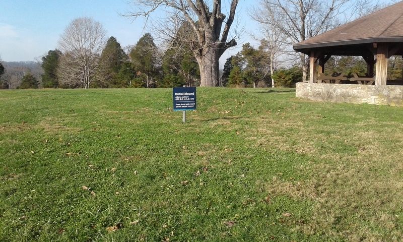
On Horner Chapel Road (Ohio Route 73) 0.9 miles west of Horner Chapel Road (County Road T-116), on the right when traveling west.
An effigy mound is a geoglyph, or symbol made of earth. The most common effigy mounds in North America are animal effigies.
Ohio has only two well-documented effigy mounds, Serpent Mound and Alligator Mound.
Ohio's effigy mounds were . . . — — Map (db m214420) HM
On Ohio Route 73, 0.9 miles west of Horner Chapel Road (County Road T-116), on the right when traveling west.
The head of Serpent Mound is lined up to the point on the western horizon where the sun sets on the Summer Solstice – the longest day of the year.
Some think the three main curves of the serpent's body point to the Summer Solstice sunrise, . . . — — Map (db m214409) HM
On Ohio Route 73, 1 mile west of Horner Chapel Road (County Road T-116), on the right when traveling west.
"the most singular sensation of awe and admiration overwhelmed me … there seemed to come to me a picture as of a distant time, of a people with strange customs, and with it came the demand for an interpretation of this mystery. The . . . — — Map (db m214412) HM
On Ohio Route 73, 0.9 miles west of Horner Chapel Road (County Road T-116), on the right when traveling west.
Serpent Mound sits within a large crater almost nine miles across. The bedrock in the center of the crater has been thrust upwards to between 400 and 900 feet above its original position, while an outer ring of bedrock has dropped from at least . . . — — Map (db m214414) HM
Near Ohio Route 73, 0.9 miles west of Horner Chapel Road (County Road T-116), on the right when traveling west.
"Serpent Mound was purposefully built for a special, sacred purpose. I should think that anyone that views the Serpent will realize its sacredness and treat this place as they would any cathedral, synagogue, or mosque. When we see . . . — — Map (db m214419) HM
On Ohio Route 73, 0.9 miles west of Horner Chapel Road (County Road T-116), on the right when traveling west.
The ancestors of the American
Indians of the Eastern Woodlands
built Serpent Mound, but archaeologists
disagree about when they built it.
Some
argue
that the Adena culture
built the mound around 2,300 years
ago. This is the same culture . . . — — Map (db m214422) HM
On Ohio Route 73, 0.9 miles west of Homer Chapel Road (County Road T-116), on the right when traveling west.
Archaeologists from Ohio Valley Archaeology, Inc. assisted by volunteers, followed up on the magnetometry survey by excavating a trench across a portion of the lost coll feature. The results suggested that part of the mound had once covered this . . . — — Map (db m214408) HM
Near Ohio Route 73, 0.9 miles west of Homer Chapel Road (County Road T-116), on the right when traveling west.
The serpent head was first described by Squire and Davis in "Ancient Monuments of the Mississippi Valley" 1843
Saved from destruction in 1885 by Fredrick Ward Futnam, Professor of American Archaeology and Ethnology, Harvard University. . . . — — Map (db m214416) HM
On Zane Trace (Ohio Route 41), on the right when traveling south.
Ohio’s first highway and mail route authorized by Congress 1796 marked and cleared in 1797 by Col. Ebenezer Zane a blazed trail, it became the route of the old stage line from Maysville to Wheeling used by noted statesmen to and from the . . . — — Map (db m121836) HM
On Ohio River Scenic Byway (U.S. 52) 1.5 miles west of State Highway 247, on the right when traveling west.
One half mile north of this monument the home of Gen. Nathaniel Massie, founder of Manchester in 1791, first settlement in the Virginia Military District. Residence of Charles Willing Byrd, Secretary and Acting Governor, Northwest Territory and . . . — — Map (db m45344) HM
On East Elm Street east of North Main Street, on the left when traveling east.
Bluffton, Ohio Est. 1861
Celebrating Our Heritage
This fair lady continues to bless our modern & diverse community.
Early explorers & surveyors paved the way for Mennonite homesteads.
Native peoples enjoying Nature's . . . — — Map (db m196224) HM
On Spencerville Road (Ohio Route 117), on the left when traveling west.
Shawnee Indian Reservation
1817-1831
Established by treaty with the Shawnee Indians September 29, 1817, following the War of 1812.
This 25 square mile reservation which adjoined the United States military reserve, was occupied by the . . . — — Map (db m196048) HM
On Defiance Trail North, on the left when traveling north.
Imagine what Ohio's early inhabitants thought when they first gazed across a vast ocean of tall grasses. What did the prairie hold in store for them? Early Native American tribes, like the Miami, Ottawa and Potawatomi, found the prairie to be a . . . — — Map (db m236507) HM
On Lafayette Road, 0.1 miles north of Ada Road (Ohio Route 81), on the right when traveling north.
Following the American Revolution, the British Crown sought to retain possession of the Ohio Country by sending chief British Indian Agent Alexander McKee and others to establish trading posts with Native Americans and resist American settlement. In . . . — — Map (db m238374) HM
On Main Street at North Street (Ohio Route 81), on the right when traveling south on Main Street.
Allen County was originally Indian territory not opened for settlement until 1817, and was formally surveyed in 1820. County government was organized in 1831 and with the improvement of roads, settlers came and established communities in every part . . . — — Map (db m22930) HM
On South Main Street at Circular Street, on the right when traveling north on South Main Street.
This street follows the course of an Old Indian Trail that joined the Tawa Indian town on the Auglaize River to the Black Swamp Trail near Lafayette. At one time, this corner was the junction of Three Early Roads, Wapakoneta Rd. - Main St. - . . . — — Map (db m63077) HM
On Shawnee Road, on the left when traveling north.
In memory of PHT and the Hawg Creek Shawnee. This area was their home until the 1830's when they were forcibly removed by the U.S. government. Some stayed and their descendants live here to this day. Chief PHT died before the removal and was buried . . . — — Map (db m79664) HM
In 1831, the Shawnee Indians built a 20 x 30 ft. hewed-log council house within their Hog Creek Settlement. It was located about 270 ft. east of this marker. After the Indians’ forced exodus west, it served as a temporary dwelling for the Griffith . . . — — Map (db m100742) HM
On Deep Cut Road (County Road 206) west of Sunderland Road, on the right when traveling west. Reported damaged.
The headwaters of the Auglaize are just south of you. You are on the old Auglaize-Miami portage trail, the most direct canoe route between Lake Erie and the Ohio River. Here, long before white men arrived and until 1817, was an Indian settlement -- . . . — — Map (db m194331) HM
On Bluelick Road, 0.1 miles west of Sugar Street, on the right when traveling west.
In 1959 this area was discovered to be an almost four thousand year old burial ground of the Glacial Kame People-named for the distinctive gravel elevations in which their dead were buried. The area was once a farm owned by Henry Boose, an early . . . — — Map (db m78679) HM
On West Kibby Street at South Metcalf Street, on the right when traveling west on West Kibby Street.
Northeast corner of The Shawnee Indian Reservation of 25 square miles in present-day Shawnee Township. Home of the Hog Creek Shawnees from 1817 to their removal to Kansas in 1833. Granted to the Shawnees by treaty September 29, 1817. . . . — — Map (db m63069) HM
Near Ohio Route 198, 0.2 miles south of Deep Cut Road.
Erected by order of General William H. Harrison in October 1812 and became an important depository of army stores during the war. — — Map (db m19821) HM
On Fort Amanda Road at Sunderland Road, on the right when traveling west on Fort Amanda Road.
Site of the 86 acre homestead of Dye Sunderland who served in Captain Samuel McCormick's Company of The War of 1812
Here in 1820, on the site of the Indian town of Tawa the Sunderland family established the First Permanent Home in . . . — — Map (db m91455) HM
On Ohio Route 603, on the right when traveling south.
Tensions between Native Americans and Euro-American settlers remained high on the Ohio frontier during the War of 1812. Grievances mounted rapidly following the removal of the Greentown Delawares to Piqua in the late summer of 1812. On September . . . — — Map (db m28800) HM
On Main Street (U.S. 250) just south of Center Road, on the right when traveling south.
James Lake is a 4 1/2 acre lake that drains an 85 acre
area west of the village. The water enters James Lake through
3 private lakes.
The lake was a gift to the village from the Don and Mary
Ringler family and is called James Lake in honor . . . — — Map (db m166365) HM
On Ohio Route 39, on the right when traveling west.
A migration of Indians throughout Ohio began due to unstable conditions created by the American Revolution. The massacre of Christian Indians at the Moravian mission of Gnadenhutten in 1782 and Colonel William Crawford’s expedition against . . . — — Map (db m168811) HM
On Pymatuning Lake Road (County Route 274) 1.2 miles north of Martin Road (County Route 269), on the left when traveling south.
Pymatuning Wetlands The advancing and retreating mile-high glacial sheet of ice and snow shaped the countryside around this area. As the last of the ice masses melted, a great swamp developed, punctuated by towering white pines, bogs, and . . . — — Map (db m107661) HM
On Bridge Street (Ohio Route 531) at Morton Drive, on the right when traveling west on Bridge Street.
More than 400 years ago, the Iroquois and Algonquin Native American tribes settled in the Ashtabula River basin, and named the river "Hash-tah-buh-lah"—"river of many fish."
The Ashtabula River became a shipping hub over the following . . . — — Map (db m132365) HM
On Mill Road west of Welton Road, on the right when traveling west.
Today, much more accurate information is known about the prehistoric occupation of Conneaut Fort thanks to scientific excavations conducted by a team from Case Western Reserve University in 1971. The styles of pottery and projectile points found . . . — — Map (db m213855) HM
On Mill Road west of Welton Road, on the right when traveling west.
The first Euro-American settlers arrived in the Conneaut area in 1798. As they began clearing the of prior Native American occupation of the area. Early settler Aaron Wright reported the existence of a graveyard containing some 2,000-3,000 . . . — — Map (db m213856) HM
On Mill Road west of Welton Road, on the right when traveling west.
The prehistory of Ohio is generally divided into four major time periods: The Paleoindian, Archaic, Woodland, and Proto-historic periods. The Archaic and Woodland are each further sub-divided into Early, Middle, and Late time periods.
The . . . — — Map (db m214343) HM
Prehistoric Earthworks
Indians built a fortification across this neck of land sometime before 1650. A low wall is all that remains today of a stockade where earth had been piled at the base of posts. The stockade and the naturally steep . . . — — Map (db m224955) HM
On Mound Street just east of Gary Drive, on the right when traveling west.
Largest mound on The Plains, 40 foot high and 140 in diameter. It has not been excavated and therefore is one of the few remaining mounds whose shape and size has not been altered. A second mound just south of Hartman Mound was 6 foot high and 40 . . . — — Map (db m175135) HM
On Mound Street at Gary Street, on the right when traveling west on Mound Street.
The Adena Culture was a Pre-Columbian Native American Culture that existed from 1000 B.C. to 100 A.D. in a time known as the Early Woodland Period. The Adena People existed throughout present day Ohio and its neighboring states.
The Adena . . . — — Map (db m174985) HM
On Cemetery Road at Main Street (Ohio Route 197), on the left when traveling east on Cemetery Road.
The Shawnee chief Na-Wa-Ba-She-Ka or White Feather resided here- in the town which was located on both sides of the Auglaize River. A North- South trail paralleled the river and ran through the town on the east bank. The same trail went through an . . . — — Map (db m74880) HM
On East Main Street east of South Water Street, on the right when traveling east.
Long before there was a State of Ohio, the forests that covered western Ohio were the hunting grounds of native American tribes. The Shawnee tribes established a community on the banks of the Auglaize River that they called Waughpaughkonnetta as . . . — — Map (db m237805) HM
Near Ohio Route 198, 0.2 miles south of Deep Cut Road.
After Gen. William Hull's surrender at Detroit early in the War of 1812, most of Michigan Territory came under British and Indian control. To prevent a possible invasion of Ohio, Gen. William Henry Harrison, commander of the Northwestern Army, . . . — — Map (db m165760) HM
On Center Street west of Walnut Street, on the left when traveling west.
Blackhoof: Born in Florida about 1721. Arriving in this vicinity 1783 - Surnames: Cut-The-We-Ka-Saw or Catahecassa - Principal Chief of Shawnee Indian Nation - erected here in 1822. In a clearing of the vast forest a two story 18'x24' log house - . . . — — Map (db m237214) HM
On U.S. 33 at Ohio Route 65, on the left when traveling east on U.S. 33.
Nearby sleeps Chief (Blackhoof) Catahecassa, last principle chief of the Shawnees prior to their removal to Kansas in 1832. This was Blackhoofs town where he lived and died in Sept. 1831, at the age of 109. He fought with the French against Braddock . . . — — Map (db m16971) HM
On Herzing Street, 0.2 miles east of South Main Street (Ohio Route 66), on the left when traveling east.
Erected here in 1795 by General "Mad" Anthony Wayne, probably after the signing of the Greenville Treaty, on land ceded by the Indians. This area was also the site of the signing of the Treaty of St. Marys in 1818 (the Indian campsites being to the . . . — — Map (db m19855) HM
Near East Spring Street (Ohio Route 29) west of South Chestnut Street, on the right when traveling east.
To the right is the Saint Marys River. This waterway was used by the Indians for generations as a route to hunting grounds in Kentucky. French, and later English traders traversed its course with trade goods in exchange for furs. James Girty, a . . . — — Map (db m30258) HM
Near East Spring Street (Ohio Route 29/66) east of Miami and Erie Canal Trail, on the right when traveling east.
The headwaters of the St. Marys River be just southeast of the City of St. Marys. The ever flows generally northwest to Wayne, Indiana, where it meets with the St. Joseph River in downtown ft. Wayne to form the Maumee River. The Maumee then flows . . . — — Map (db m228266) HM
On Ohio Route 65 at U.S. 33, on the right when traveling north on State Route 65.
By the Treaties at the Maumee Rapids in 1817, and 1818 at St. Mary’s, the Shawnee Indians were given a reservation of ten miles by twelve miles. This being the eastern boundary line. Indian Towns within this area were Blackhoof’s (now St. Johns), . . . — — Map (db m237213) HM
On Auglaize Street (Ohio Route 501) when traveling west.
Plaque # 1 The Shawnee Indians were driven from
the southern United States in the late 17th
and early 18th centuries by white settlers
and Catawba, Cherokee and Chickasaw
Nations. the Shawnee were given permission
by the Miamis and . . . — — Map (db m86526) HM
The Walnut Grove Cemetery is the burial place of members of the Zane and Martin families. Their graves lie within the brick enclosure. The cemetery is also the resting-place of many early Martins Ferry residents, including veterans of the . . . — — Map (db m28444) HM
On Columbus Street (U.S. 62) near Main Street (Ohio Route 125), on the right when traveling south.
Ohio
Revolutionary
Memorial
Trail
$50 Fine
or
10 days
imprison-
ment or
both for
defacing
this
marker
Ohio State
General Code
Section 12489 — — Map (db m137356) HM
On Reily Millville Road at Cochran Road, on the right when traveling west on Reily Millville Road.
Lewis-Sample Farmstead. The farmstead shares the name of the Lewis and Sample families, two owners since European-descended settlers began moving into the Ohio County in the late 1700s. Andrew (1762-1847) and Martha Lewis (1774-1852) acquired . . . — — Map (db m157034) HM
On High Street (Ohio Route 129/177) west of Monument Street, on the left when traveling east.
The site for Fort Hamilton was chosen because of a ford on the Great Miami River at the approximate site of the High - Main Street Bridge. That shallow crossing was believed to have been on an ancient Indian trail known as the Wabash Trail. The . . . — — Map (db m73615) HM
On Elk Creek Road at Howe Road, on the right when traveling north on Elk Creek Road.
The village of Miltonville, located along the banks of Elk Creek, was platted in 1816 by George Bennett, Theophilus Eaglesfield, and Richard V. V. Crane. The creek served two grist mills, one built around 1804 and operated by a free black, Bambo . . . — — Map (db m28776) HM
On Scio Road (Ohio Route 332) at Autumn Rd SW (County Road 19), on the left when traveling south on Scio Road.
The Algonquin Mill
was named for an Indian camp site near the settlement which is now Petersburg. This structure, built about 1826, replaced an earlier mill. Originally operated by water power from Little McQuire Creek, it drove two sets of burrs. . . . — — Map (db m159707) HM
Near West Canal Street (Ohio Route 183), on the right when traveling east.
Side A
The Great Trail
Gateway to the Ohio Country
The ancient trail that passed near this spot was the major overland route entering the Ohio Country from the east through the 1700s. Also known as the Tuscarawas Path, the . . . — — Map (db m80715) HM
On Alliance Road Northwest (Ohio Route 183) at Linden Road Northwest (County Road 229), in the median on Alliance Road Northwest.
The Great Indian Trail between Ft. Pitt and Chillicothe followed this route. In 1764 Col. Henry Bouquet and his expedition followed this trail to Coshocton to free 200 captives held by the Seneca, Delawares, and Shawnee Tribes. The resulting treaty . . . — — Map (db m159651) HM
This memorial is in memory of Jacob
and Martha Boggs Johnson, and marks
the spot where the Indian cabin stood
Into which they moved April 1. 1805. With
other pioneers they came as the Indians
departed and worthily bore their part
in subduing . . . — — Map (db m127297) HM
On Patrik Avenue (Ohio Route 54) 0.1 miles south of Jefferson Avenue, on the left when traveling south.
Simon Kenton who is buried here. During the Revolutionary War he frequently served as scout under George Rogers Clark and later praised Clark for his role in saving the Kentucky settlements. Kenton's Indian captivity of 1778-79 acquainted him with . . . — — Map (db m34088) HM
On KentonStreet at Ward Street, on the right when traveling north on KentonStreet.
War Council of 1812. To confirm that the Treaty of Greenville would be upheld, Ohio Governor Return J. Meigs called a council with Native Americans June 6-9, 1812. He sought approval to cross native land when marching to Canada and to ensure . . . — — Map (db m81636) HM
On Indian Drive at Mound Circle, in the median on Indian Drive.
This Adena Mound is the second largest
conical mound in Ohio. These large conical
mounds are believed to be Adena while the
many small or effigy mounds are Hopewell,
a later culture.
This mound is the property of the Village
of Enon. . . . — — Map (db m100536) HM
On Mound Circle at Indian Drive, in the median on Mound Circle.
First settlers in the area were the Adena Native Americans, known for their mounds like the one in Enon, Ohio. Adena, Hopewell, and Fort Ancient cultures developed earthworks, circa 52 BC to 1500 AD. These three nations were located in much of the . . . — — Map (db m175284) HM
On E Main Street (U.S. 40) at S Spring Street (Ohio Route 72), on the left when traveling west on E Main Street.
This Marks the Site of
The First Tavern in Springfield
Near Which
In 1808 A Permanent Peace Treaty
Was Made By
Simon Kenton and Others
With the Indians — — Map (db m217174) HM
On Main Street (U.S. 40) west of Broadway Street, on the right when traveling west.
Near here, at the forks
of the Mad River, in 1799
Simon Kenton and other
Kentuckians erected the
first American Stockade
in the Mad River Valley. — — Map (db m137376) HM
Text on the Front (South) Side of Monument:
Madonna of the Trail
N S D A R Memorial
to the
Pioneer Mothers
of the
Covered Wagon Days
Text on the Left (West) Side of Monument:
The National Road
Completed by . . . — — Map (db m108458)
On Cliff Park Road, on the left when traveling west.
A great warrior and a charismatic orator, Tecumseh (shooting star) was born to Puckeshinewa and Methoataske in March of 1768, at the Peckuwe village on the Mad River west of present day Springfield, Ohio. Present at the August 8, 1780 Battle of . . . — — Map (db m217519) HM
Near Tecumseh Road (Ohio Route 369) north of Lower Valley Pike.
"In memory of those men who died in
the Battle of Piqua, August 8, 1780,
the largest Revolutionary War battle
West of the Alleghenies." — — Map (db m35288) HM
On Tecumseh Road (Ohio Route 369) north of Lower Valley Pike.
Within this park and immediate vicinity, former site of the Shawnee Indian Village of Piqua. The Shawnees and their British Allies were defeated by General George Rogers Clark with his army of Kentucky Frontiersmen. This battle greatly advanced the . . . — — Map (db m35295) HM
On Tecumseh Road (Ohio Route 369) north of Lower Valley Pike, on the right when traveling north.
[Front Side of Marker]
Here
General
George Rogers
Clark
With his Kentucky soldiers
Defeated and drove
From this region
The Shawnee Indians
August 8 1780
Thus aiding to make
The Northwest Territory
Part of the . . . — — Map (db m35379) HM
On Tecumseh Road (Ohio Route 369) at Lower Valley Pike, on the right when traveling north on Tecumseh Road.
The Shawnee village of Peckuwe stood on this site until August 8, 1780. This village was inhabited by the Peckuwe and Kispoko Divisions of the Shawnee Tribe.
The Shawnee, along with the other tribes in Ohio, often placed a large cedar pole in . . . — — Map (db m35274) HM
On Tecumseh Road (Ohio Route 369) at Lower Valley Pike, on the right when traveling north on Tecumseh Road.
Approximately three miles west of Springfield at the present site of George Rogers Clark Memorial Park lay the Shawnee Indian Town called Piqua. This town was the site of the battle of Piqua on August 8th, 1780 - one of the last battles of the . . . — — Map (db m35171) HM
Near Tecumseh Road (Ohio Route 369) 0.2 miles north of Ohio Route 4.
Before you lay Piqua, or Picawey, a Shawnee settlement where 1,000 Kentucky militiamen under Col. George Rogers Clark defeated an alliance of Shawnee, Delaware, Mingo and Wyandot warriors on August 8, 1780 in the largest battle fought west of the . . . — — Map (db m34207) HM
On Tecumseh Road (Ohio Route 369) north of Ohio Route 4.
Statesman, Warrior and Patriot was born March 1768, three miles west of Springfield, close to Route 40 - State Route 369 - at the Shawnee Indian Town called Piqua. Site of the battle of Piqua, August 8th, 1780, presently George Rogers Clark Memorial . . . — — Map (db m35123) HM
Near Park Road 2 north of Elklick Road, on the right.
Throughout times historic and prehistoric, the relatively flat land, rich soils and ample water
supply of the Little Miami River valley have proved appealing to populations settling here.
The Adena people inhabited this area from approximately . . . — — Map (db m204653) HM
On Ohio Route 133, 0.2 miles south of Edenton-Pleasant Plain Road (Ohio Route 727), on the left when traveling north. Reported missing.
The stone monument in the adjacent field commemorates the Bullskin trace, an old Indian trail used by Daniel Boone to escape the Shawnee Indians in 1778. Used by soldiers of General Anthony Wayne’s Army in 1793. It was made the Xenia State road in . . . — — Map (db m207762) HM
On Ohio Route 133, 0.2 miles south of Edenton-Pleasant Plain Road (Ohio Route 727), on the left when traveling north.
Used by Boone to escape in 1778, by General Wayne in Indian Campaign, 1793. Made state road, 1807. Used for ammunition train, 1812. Underground Railroad prior 1861 — — Map (db m204973) HM
On Burdsall Road (County Route 25), on the right when traveling south.
In these fields on the southwest side of the east
Fork of the Little Miami River, opposite the mouth
of Grassy Run, was fought the Battle of Grassy
Run April 10, 1792. Simon Kenton led a group of
frontiersmen from Limestone (Maysville), KY . . . — — Map (db m95461) HM
On Glancy Corner Marathon Rd (County Route 54), on the right when traveling south. Reported missing.
Last Indian Battle
fought March 16, 1792 on the south
bank of East Fork Creek near the mouth
of Grassy Run Clermont County
Tecumseh Shawnee Chjef, known as
“Blazing Star”, and Simon Kenton, a scout,
were engaged in a sharp . . . — — Map (db m95462) HM
Built by people of the Adena or Hopewell cultures during the Early to Middle Woodland era (circa 800 B.C - 500 A.D), the Beam Farm Mound, 1200 feet northwest, has stood on the uplands overlooking Anderson Fork for two thousand years. Notable among . . . — — Map (db m121070) HM
On Prairie Road (County Route 21) at Starbuck Road (County Route 11), on the left when traveling east on Prairie Road.
Near this site in October 1786 General Benjamin Logan with an army of 700 Kentucky volunteers camped on their way to destroy seven Indian towns in the Mad River Valley. During the night a renegade deserted the camp to warn the Indians. The army . . . — — Map (db m121033) HM WM
Side A:
Clinton County was a major center of activity for the Shawnee, Miami, and Delaware Indians. Early traces and trails developed as Indians traveled from village to village; gathered flint, salt and gold; traded furs, mica, and feldspar; . . . — — Map (db m27827) HM
On Harvey Avenue (Ohio Route 39) 0.4 miles east of Bushwick Street, on the right when traveling east.
Land Ordinance of 1785. In April 1784, the Continental Congress adopted the Report of Government for the Western Territory, a broad plan drafted primarily by Thomas Jefferson for organizing the United States' new western lands that were ceded . . . — — Map (db m221421) HM
On County Road 24 at Local Road 26, on the right when traveling north on County Road 24.
On the hill north of here was made, in 1764.
The memorable treaty which brought almost continuous peace between the Indians and the Whites.
The expedition of 1500 men, under Col. Henry Bouquet, marched from Fort Pitt reaching the Forks of the . . . — — Map (db m3289) HM
On Ohio Route 83, on the left when traveling north.
1764. Lt.Col. Henry Bouquet with 1500 British regulars and American Militia penetrated the Ohio wilderness to crush Chief Pontiac’s Indian conspiracy.
Here at the forks of the Muskingum River during October and November, Bouquet subdued the . . . — — Map (db m3286) HM
On Chestnut Street, on the right when traveling east.
Around the spring nearby, was perpetrated, on April 20, 1781, the massacre of 20 Indians by Col. Daniel Broadhead's army of 300. This slaying was committed following destruction, the same day, of the two villages, Goschachgunk, (Coshocton) and . . . — — Map (db m14707) HM
On Main Street at 2nd Street, in the median on Main Street.
Goschachgunk (Blackbear Town), now Coshocton, was the capital city of the Delaware Nation. On this parkway stood their Council House. In this House on March 9, 1777, a Great Council of the Delawares, under the leadership of Chief White Eyes, met and . . . — — Map (db m300) HM
On South 2nd Street (County Route 271) at Clow Lane, on the left when traveling south on South 2nd Street.
On this area stood Lichtenau, lost mission
of the Moravians, the first white settlement in
Coshocton County. It was established on April 12,
1776 by the Moravians Missionaries, Rev. David Zeis
berger and Rev. John Heckewelder, with eight . . . — — Map (db m157910) HM
On County Road 271, 0.2 miles south of Papermill Road (County Road 270), on the left when traveling south.
This earthen mound was built between 800 B.C. and 500 A.D. by prehistoric people who lived in this valley. The mound was used for ceremonial purposes. Unlike most other mounds in Ohio which were used for burials. The mound was first excavated in . . . — — Map (db m157909) HM
On Ohio Route 93 at Ohio Route 36 on State Route 93.
In the early 1770s, Chief White Eyes (Koquechagachton) of the Delaware tribe founded White Eyes Town approximately two miles southeast of this marker on a plain near present day West Lafayette. A friend of the Moravian leader David Zeisberger, White . . . — — Map (db m15175) HM
637 entries matched your criteria. The first 100 are listed above. Next 100 ⊳