After filtering for Minnesota, 140 entries match your criteria. The first 100 are listed. ⊳
Railroads & Streetcars Topic
By McGhiever, September 29, 2022
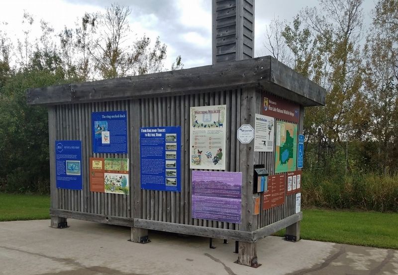
Markers on kiosk at Rice Lake National Wildlife Refuge
| 1 ► Minnesota, Aitkin County, East Lake — From Railroad Tracks to Refuge Road — |
| On 363rd Lane at Minnesota Route 65, on the right when traveling west on 363rd Lane. | |||
| 2 ► Minnesota, Aitkin County, East Lake — Mandy Lake — Rice Lake National Wildlife Refuge — |
| On Mandy Lake Access at 363rd Lane, on the left when traveling west on Mandy Lake Access. | |||
| 3 ► Minnesota, Becker County, Detroit Lakes — Detroit Lakes — A City with a Past — |
| On Frontage Road (U.S. 10) 0.1 miles south of North Shore Drive, on the right when traveling south. | |||
| 4 ► Minnesota, Beltrami County, Bemidji — Bemidji's Great Northern Depot — |
| On Minnesota Avenue Southwest just south of 1st Street West, on the left when traveling south. | |||
| 5 ► Minnesota, Beltrami County, Bemidji — 473 — Great Northern Depot — |
| On Minnesota Avenue Southwest just south of 1st Street West, on the left when traveling south. | |||
| 6 ► Minnesota, Big Stone County, Clinton — The Chicago, Milwaukee, St. Paul & Pacific Depot — built circa 1885 — |
| Near Main Street near Center Street, on the right when traveling east. | |||
| 7 ► Minnesota, Blue Earth County, Lake Crystal — Lake Crystal and the Railroad — |
| On East Robinson Street east of North Main Street (County Highway 76), on the right when traveling east. | |||
| 8 ► Minnesota, Blue Earth County, Mankato — Washington Park / Fourth Street Route Depot Grounds — |
| On North 4th Street north of East Plum Street, on the right when traveling north. | |||
| 9 ► Minnesota, Brown County, Essig — Essig, Minnesota — |
| On 1st Street at Main Street (County Road 11) on 1st Street. | |||
| 10 ► Minnesota, Brown County, Hanska — Hanska — 1901 • 2001 — |
| On Broadway (State Highway 257) at 2nd Street East on Broadway. | |||
| 11 ► Minnesota, Brown County, Searles — Searles — |
| On Main Street at Broadway Street (County Road 24), on the right when traveling west on Main Street. | |||
| 12 ► Minnesota, Brown County, Springfield — Springfield, Minnesota — |
| On East End Avenue (County Highway 5) at East Rock Street (U.S. 14) on East End Avenue. | |||
| 13 ► Minnesota, Carver County, Mayer — Dakota Rail History in Mayer — |
| On 1st St NW at County Highway 25, on the right when traveling east on 1st St NW. | |||
| 14 ► Minnesota, Cass County, Pine River — Pine River Railway Depot — 1895 — 102 Barclay Ave. W — |
| On Mill Street at Barclay Avenue, on the left when traveling south on Mill Street. | |||
| 15 ► Minnesota, Cass County, Walker — "Big Enough to Keep" — Circle of Time — |
| On Minnesota Avenue West (State Highway 200/371) at 3rd Street, on the right when traveling east on Minnesota Avenue West. | |||
| 16 ► Minnesota, Cass County, Walker — "More Than Just A Fish Camp!" — Circle of Time — |
| On Minnesota Avenue West (State Highway 200/371) at 3rd Street, on the right when traveling east on Minnesota Avenue West. | |||
| 17 ► Minnesota, Cass County, Walker — "Spare That Tree" — Circle of Time — |
| On Minnesota Avenue West (State Highway 200/371) at 3rd Street, on the right when traveling east on Minnesota Avenue West. | |||
| 18 ► Minnesota, Chisago County, Almelund, Wild River State Park — Looking For A Better Life — |
| 19 ► Minnesota, Chisago County, Sunrise, Sunrise Township — Arrow Line Railway — Looking for a Better Life — |
| 20 ► Minnesota, Clay County, Moorhead — The First Bridge over the Red River — Historic Downtown Moorhead — |
| On 4th Street South just north of Main Avenue (U.S. 10), on the right when traveling north. | |||
| 21 ► Minnesota, Crow Wing County, Brainerd — Depot Park — |
| On Front Street at South 6th Street (Voyageur Highway) (Business State Highway 371), on the right when traveling west on Front Street. | |||
| 22 ► Minnesota, Crow Wing County, Brainerd — First Northern Pacific — Historic Site — 1871 - 1971 — |
| On 6th Street (State Highway 371) at Washington Street (State Highway 210/371), on the right when traveling north on 6th Street. | |||
| 23 ► Minnesota, Crow Wing County, Brainerd — Former Northern Pacific Railway Water Tower — Official Minnesota Historic Site — |
| On 6th Street (State Highway 371) at Washington Street (State Highway 210/371), on the right when traveling north on 6th Street. | |||
| 24 ► Minnesota, Crow Wing County, Nisswa — Lake Hubert Depot — |
| On County Road 13 at Clark Lake Dam Road, on the right when traveling west on County Road 13. | |||
| 25 ► Minnesota, Crow Wing County, Nisswa — The Present Location of the Lake Hubert Depot — |
| On County Road 13 at Clark Lake Dam Road, on the right when traveling west on County Road 13. | |||
| 26 ► Minnesota, Dakota County, Hastings — Steamboats, Trains, and Barges — |
| Near 1st Street near Tyler Street. | |||
| 27 ► Minnesota, Dakota County, Lilydale — The Railroad and Mendota — |
| 28 ► Minnesota, Goodhue County, Red Wing — Chicago, Milwaukee & St. Paul Railroad Depot — Completed: 1905 — |
| On Levee Street east of Broad Street, on the left when traveling east. | |||
| 29 ► Minnesota, Hennepin County, Fort Snelling — River Valleys Take Shape / A Strategic Advantage / Making a Safe Landing — Fort Snelling State Park — Where Rivers and People Come Together — |
| Near the Minnehaha Trail north of Snelling Lake Road, on the right when traveling north. | |||
| 30 ► Minnesota, Hennepin County, Fort Snelling — Welcome to Fort Snelling State Park — |
| On Minnehaha Park Drive at E. 54th Street, on the left when traveling south on Minnehaha Park Drive. | |||
| 31 ► Minnesota, Hennepin County, Minneapolis, Calhoun Isles — 10 — Grade Separation Project (1912–16) — The Museum in the Streets: Minneapolis, Minnesota — Uptown: Minneapolis' Lake District — |
| On Lyndale Avenue at W 29th Street, on the left when traveling north on Lyndale Avenue. | |||
| 32 ► Minnesota, Hennepin County, Minneapolis, Calhoun Isles — 18 — Hennepin Avenue and Lake Street/Uptown — The Museum in the Streets: Minneapolis, Minnesota — Uptown: Minneapolis' Lake District — |
| On Hennepin Avenue at West Lake Street, on the right when traveling north on Hennepin Avenue. | |||
| 33 ► Minnesota, Hennepin County, Minneapolis, Calhoun Isles — 7 — Lyndale Avenue and Lake Street/Crowell Building — The Museum in the Streets: Minneapolis, Minnesota — Uptown: Minneapolis' Lake District — |
| On W. Lake Street at Lyndale Avenue S., on the right when traveling east on W. Lake Street. | |||
| 34 ► Minnesota, Hennepin County, Minneapolis, Calhoun Isles — 2 — The Railroad and the City — Midtown Corridor — CM & St P Grade Separation Historic District — |
| On the Midtown Greenway at Humboldt Avenue, on the left when traveling east on the Midtown Greenway. | |||
| 35 ► Minnesota, Hennepin County, Minneapolis, Cedar-Riverside — Rail Traffic in the Twin Cities — Historic Marker — |
| On 20th Avenue S. at the Bluff Street Bikeway/Dinkytown Greenway, on the right when traveling north on 20th Avenue S.. | |||
| 36 ► Minnesota, Hennepin County, Minneapolis, Downtown East — Beauty and Nature at the Falls — Mill Ruins Park — |
| On W. River Parkway west of 11th Avenue S., on the right when traveling west. | |||
| 37 ► Minnesota, Hennepin County, Minneapolis, Downtown East — Bridges of the St. Anthony Falls Area — Mill Ruins Park — |
| On Portland Avenue, on the right when traveling east. | |||
| 38 ► Minnesota, Hennepin County, Minneapolis, Downtown East — Giants in the Land: The Power of Minneapolis Mills and Millers — Saint Anthony Falls Heritage Trail — |
| Near W. River Parkway west of Portland Avenue, on the right when traveling west. | |||
| 39 ► Minnesota, Hennepin County, Minneapolis, Downtown East — Tailrace Skyline — |
| On Portland Avenue, on the right when traveling east. | |||
| 40 ► Minnesota, Hennepin County, Minneapolis, Downtown West — Bridge Square to the Gateway — Saint Anthony Falls Heritage Trail — |
| On Hennepin Avenue north of 1st Street S., on the right when traveling east. | |||
| 41 ► Minnesota, Hennepin County, Minneapolis, Hiawatha — Minnehaha Depot — |
| On Minnehaha Avenue south of East Minnehaha Parkway, on the right when traveling south. | |||
| 42 ► Minnesota, Hennepin County, Minneapolis, Longfellow — 17 — Hiawatha-Minnehaha Corridor — The Museum in the Streets: Minneapolis, Minnesota — 27th and Lake: Industry and Transportation Infrastructure — |
| On E. Lake Street at Hiawatha Avenue (State Highway 55), on the right when traveling west on E. Lake Street. | |||
| 43 ► Minnesota, Hennepin County, Minneapolis, Longfellow — Map — Minneapolis, Minnesota — The Museum in the Streets — 27th and Lake: Industry and Transportation Infrastructure — |
| On Lake Street at 29th Avenue South, on the right when traveling east on Lake Street. | |||
| 44 ► Minnesota, Hennepin County, Minneapolis, Longfellow — 4 — Snelling Avenue: African American Community — The Museum in the Streets: Minneapolis, Minnesota — 27th and Lake: Industry and Transportation Infrastructure — |
| On Snelling Avenue at E. Lake Street, on the right when traveling south on Snelling Avenue. | |||
| 45 ► Minnesota, Hennepin County, Minneapolis, Longfellow — 7 — The CM&StP & the South Side — Midtown Corridor: CM & St P Short Line — |
| Near the Midtown Greenway east of 26th Avenue S, on the right when traveling east. | |||
| 46 ► Minnesota, Hennepin County, Minneapolis, Lowry Hill East — 3 — Building the Corridor — The CM&StP Grade Separation — Midtown Corridor: CM & St P Grade Separation Historic District — |
| On The Midtown Greenway west of Bryant Avenue, on the right when traveling east. | |||
| 47 ► Minnesota, Hennepin County, Minneapolis, Lyn-Lake — 4 — Flour, Fuel and Baseball — The CM&StP Grade Separation — Midtown Corridor: CM & St P Grade Separation Historic District — |
| On The Midtown Greenway east of Garfield Avenue, on the left when traveling east. | |||
| 48 ► Minnesota, Hennepin County, Minneapolis, Marshall Terrace — Building a Community in Northtown — |
| On St. Anthony Parkway at California Street NE, on the right when traveling east on St. Anthony Parkway. | |||
| 49 ► Minnesota, Hennepin County, Minneapolis, Marshall Terrace — New Bridge Planning Process and Design — |
| On St. Anthony Parkway at California Street NE, on the right when traveling east on St. Anthony Parkway. | |||
| 50 ► Minnesota, Hennepin County, Minneapolis, Marshall Terrace — Northtown and the St. Anthony Parkway Bridge — |
| On St. Anthony Parkway at California Street NE, on the right when traveling east on St. Anthony Parkway. | |||
| 51 ► Minnesota, Hennepin County, Minneapolis, Marshall Terrace — River, Railroad and Industry — |
| On St. Anthony Parkway at California Street NE, on the right when traveling east on St. Anthony Parkway. | |||
| 52 ► Minnesota, Hennepin County, Minneapolis, Northeast Park — Minneapolis Diagonal Trail — |
| On Stinson Boulevard NE at New Brighton Boulevard, on the right when traveling south on Stinson Boulevard NE. | |||
| 53 ► Minnesota, Hennepin County, Minneapolis, Phillips — Crosstown — The Lake Street Connection — |
| On E. 26th Street at Chicago Avenue, on the right when traveling east on E. 26th Street. | |||
| 54 ► Minnesota, Hennepin County, Minneapolis, Phillips — Fun Fare — Big Island and Wildwood — |
| On E. 26th Street at Chicago Avenue, on the right when traveling east on E. 26th Street. | |||
| 55 ► Minnesota, Hennepin County, Minneapolis, Phillips — Horse Car, Streetcar, Bus — A Rapid Evolution — |
| On Chicago Avenue at E. 26th Street, on the right when traveling south on Chicago Avenue. | |||
| 56 ► Minnesota, Hennepin County, Minneapolis, Phillips — Martin Olav Sabo Bridge — |
| On the Midtown Greenway west of Hiawatha Avenue (Minnesota Highway 55). | |||
| 57 ► Minnesota, Hennepin County, Minneapolis, Phillips — Map — Midtown: A Place to Call Home — The Museum in the Streets: Minneapolis, Minnesota — |
| On East Lake Street at Elliot Avenue, on the right when traveling west on East Lake Street. | |||
| 58 ► Minnesota, Hennepin County, Minneapolis, Phillips — Passed by a Bus — The Streetcar Era Ends — |
| On Chicago Avenue at E. 26th Street, on the right when traveling south on Chicago Avenue. | |||
| 59 ► Minnesota, Hennepin County, Minneapolis, Phillips — Tracking Growth — Transit to South Minneapolis — |
| On E. 26th Street at Chicago Avenue, on the right when traveling west on E. 26th Street. | |||
| 60 ► Minnesota, Hennepin County, Minneapolis, Powderhorn — 2 — 2108-30 East Lake: Twin City Rapid Transit Lake Street Station and Car Yard — The Museum in the Streets: Minneapolis, Minnesota — 27th and Lake: Industry and Transportation Infrastructure — |
| On E. Lake Street at 22nd Avenue S., on the right when traveling east on E. Lake Street. | |||
| 61 ► Minnesota, Hennepin County, Minneapolis, Saint Anthony Main — A Tale of Two Waterpower Companies — |
| Near SE Main Street. | |||
| 62 ► Minnesota, Hennepin County, Minneapolis, Saint Anthony Main — Hydroelectricity Comes of Age — |
| Near SE Main Street. | |||
| 63 ► Minnesota, Hennepin County, Minneapolis, Saint Anthony Main — Power on the East Side — Saint Anthony Falls Heritage Trail — |
| On Southeast Main Street west of Southeast 3rd Avenue, on the left when traveling west. | |||
| 64 ► Minnesota, Hennepin County, Minneapolis, Saint Anthony Main — The Falls That Built the City — Saint Anthony Falls Heritage Trail — |
| On Southeast Main Street west of Southeast 3rd Avenue, on the left when traveling west. | |||
| 65 ► Minnesota, Hennepin County, Minneapolis, Saint Anthony Main — The Stone Arch Bridge — Saint Anthony Falls Heritage Trail — |
| 66 ► Minnesota, Hennepin County, Minneapolis, Seward — 8 — Bridging the Mississippi — Midtown Corridor — C M & St P Short Line — |
| Near Midtown Greenway at Dorman Avenue. | |||
| 67 ► Minnesota, Hennepin County, Minneapolis, Southwest Minneapolis — Como–Harriet Streetcar Line — |
| On West 42nd Street west of West Lake Harriet Parkway, on the right when traveling west. | |||
| 68 ► Minnesota, Hennepin County, Minneapolis, Southwest Minneapolis — Harriet Bandshells — Music, Wind and Fire On the Lake — |
| On East Lake Harriet Parkway at West Minnehaha Parkway, on the left when traveling north on East Lake Harriet Parkway. | |||
| 69 ► Minnesota, Hennepin County, Wayzata — Wayzata Depot — |
| On Lake Street East (County Route 16) at Manitoba Avenue, on the right when traveling west on Lake Street East. | |||
| 70 ► Minnesota, Jackson County, Wilder — Breck Mission and Farm College — 1885 1909 — |
| On 5th Street (County Highway 13) at Maple Street (County Highway 13), on the right when traveling west on 5th Street. | |||
| 71 ► Minnesota, Kandiyohi County, Atwater, Gennessee Township — Train Wreck — |
| On County Road 4 Northeast, 0.3 miles south of Highway 12 Northeast (U.S. 12), on the right when traveling north. | |||
| 72 ► Minnesota, Kandiyohi County, New London — Early History of New London — |
| On Main Street South (State Highway 9) at 1st Avenue Southwest, on the right when traveling south on Main Street South. | |||
| 73 ► Minnesota, Kandiyohi County, Spicer — Spicer — |
| On Lake Avenue North (County Highway 30) north of Manitoba Street (County Highway 58), on the right when traveling north. | |||
| 74 ► Minnesota, Kandiyohi County, Willmar — Engine 2523 — |
| Near Town Highway 71 Service Drive east of Porto Rico Street Northeast, on the right when traveling east. | |||
| 75 ► Minnesota, Kandiyohi County, Willmar — Great Northern Railway Engine No. 2523 |
| Near Business U.S. 71 at Puerto Rico Street Northeast, on the right when traveling north. Reported permanently removed. | |||
| 76 ► Minnesota, Kittson County, Hallock — Hallock History — |
| On 2nd Street South (County Road 1) just west of South Birch Avenue, on the right when traveling east. | |||
| 77 ► Minnesota, Lake County, Two Harbors — D&IR Railroad Company Sleigh |
| Reported missing. | |||
| 78 ► Minnesota, Lake County, Two Harbors — Duluth and Iron Range Depot — |
| On South Avenue at 6th Street (County Route 20), on the right when traveling east on South Avenue. | |||
| 79 ► Minnesota, Lake County, Two Harbors — Duluth and Iron Range Railroad Locomotive #3 — "The 3 Spot" — 1883 — |
| On South Avenue at 6th Street (County Route 20), on the right when traveling east on South Avenue. | |||
| 80 ► Minnesota, Lake County, Two Harbors — Duluth Missabe & Iron Range Yellowstone Mallet #229 — |
| On 6th Street (County Route 20) at South Avenue, on the right when traveling south on 6th Street. | |||
| 81 ► Minnesota, Lake County, Two Harbors — Hand Car, Velocipede, Sleigh, Station Wagon — |
| 82 ► Minnesota, Lake County, Two Harbors — Ore Car #251, 1884 & Bobber Caboose #22 (#52), 1893 — |
| 83 ► Minnesota, Mille Lacs County, Princeton, Princeton Township — Brickton: You Are Here! — |
| On U.S. 169 at Baxter Road, on the right when traveling north on U.S. 169. | |||
| 84 ► Minnesota, Mille Lacs County, Princeton, Princeton Township — Work in the Brickyards — |
| On U.S. 169 at Baxter Road, on the right when traveling north on U.S. 169. | |||
| 85 ► Minnesota, Morrison County, Little Falls — Northern Pacific Railway Depot — |
| On 1st Street NW at 1st Avenue NW, on the right when traveling north on 1st Street NW. | |||
| 86 ► Minnesota, Morrison County, Motley — Motley, Minnesota — 1887-1987 — |
| On Main Street East just east of U.S. 10, on the left when traveling east. | |||
| 87 ► Minnesota, Murray County, Fulda — Fulda Depot — |
| On East Front Street at South St. Paul Avenue on East Front Street. | |||
| 88 ► Minnesota, Otter Tail County, Ottertail — Otter Tail City & Ottertail Village — This Historic Town Lost the Railroad, the County Seat, & Went from Boom to Bust — Twice — |
| On Otter Tail Scenic Byway (State Highway 78/108) at Bay View Road, on the right when traveling south on Otter Tail Scenic Byway. | |||
| 89 ► Minnesota, Otter Tail County, Perham — Arrival of the Northern Pacific Railway at Perham — |
| On West Main Street (Otter Tail Scenic Byway) (County Road 80) just west of 2nd Avenue Southwest, on the left when traveling east. | |||
| 90 ► Minnesota, Otter Tail County, Perham — Perham — The Town Came Alive With the Arrival of the Railroad — Right on Track with the Northern Pacific — |
| On West Main Street (Otter Tail Scenic Byway) (County Road 80) just west of 2nd Avenue Southwest, on the left when traveling east. | |||
| 91 ► Minnesota, Pine County, Sandstone — A Railroad Industry — Discover the Banning Quarry — |
| 92 ► Minnesota, Pipestone County, Pipestone — Rock Island Depot — Pipestone Historic Site — |
| On North Hiawatha Avenue north of 4th Street Northwest, on the right when traveling south. | |||
| 93 ► Minnesota, Pope County, Starbuck — Northern Pacific Railroad — |
| Near Depot Lane. | |||
| 94 ► Minnesota, Ramsey County, Maplewood — A History of Change — |
| On Frost Avenue at Atlantic Street, on the right when traveling east on Frost Avenue. | |||
| 95 ► Minnesota, Ramsey County, Maplewood — Building the "Skally" — |
| Near Frost Avenue at English Street. | |||
| 96 ► Minnesota, Ramsey County, Maplewood — The Shops at Gladstone — |
| Near English Street near Frost Avenue. | |||
| 97 ► Minnesota, Ramsey County, Maplewood — Water: A Well Needed Resource — |
| Near Frost Street near English Street. | |||
| 98 ► Minnesota, Ramsey County, Saint Paul, Battle Creek — Battle Creek Regional Park — |
| Near Point Douglas Road South, 0.6 miles north of Lower Afton Road. | |||
| 99 ► Minnesota, Ramsey County, Saint Paul, Cathedral Hill — James J. Hill / The James J. Hill House — |
| On Summit Avenue, 0.1 miles south of Selby Avenue, on the left when traveling south. | |||
| 100 ► Minnesota, Ramsey County, Saint Paul, Cathedral Hill — The Selby Streetcar Tunnel — |
| Near Summit Avenue at Selby Avenue, on the left when traveling south. | |||
140 entries matched your criteria. The first 100 are listed above. The final 40 ⊳