On North Chester Avenue at Golden State Highway (California Route 204), in the median on North Chester Avenue.
Padre Garces seeking a new route between Sonora, Mexico and Monterey crossed Rio de San Felipe (Kern River May 7, 1776) at Rancheria San Miguel now Bakersfield. First recorded white man in this locality, he brought Christianity to the Indian and on . . . — — Map (db m34769) HM
On Kern Canyon Road (State Highway 178), on the left when traveling east.
One mile north of here on May 1, 1776, Francisco Garces of the Franciscan Order, crossed Kern River in his search for a shorter route from Sonora, Mexico to Monterey, California. He was the first known explorer to describe this river, which he . . . — — Map (db m24984) HM
People living in small towns built churches to provide services within walking distance from their homes.
Saint John’s Episcopal Mission opened to parishioners in Rosedale in 1892. In the early days, a pastor from Saint Paul’s Episcopal . . . — — Map (db m25457) HM
This is the site of the first Catholic Church St. Joseph's and Cemetery built in Kern County in August 1866. It was established by Father Francis Dade, the circuit priest headquartered in Visalia. The Catholic Church here in Havilah was moved to . . . — — Map (db m89215) HM
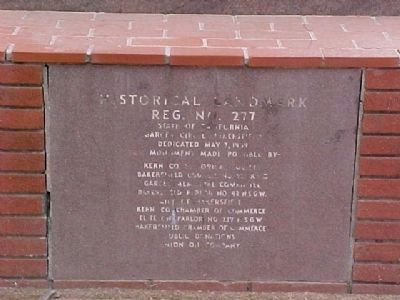
On Locust Street at Diamond Street, on the right when traveling east on Locust Street.
Immaculate Heart
of Mary Catholic
Church, established
Aug 12, 2015.
This building once
housed a Masonic
Lodge and the
church pictured below.
Wayside Community Chapel
Church, built in 1934 from land
donated by the LA Rescue . . . — — Map (db m186316) HM
On West F Street, on the right when traveling east.
The present, remodeled bank building was constructed in 1936 as the second St. Malchy Church. In the early 1980's the structure was sold to the newly formed Sierra National Bank, which was acquired by the Bank of the Sierra in May 2000. — — Map (db m52888) HM
On Garces Highway (State Highway 155), on the right when traveling west.
On May 3, 1776, three miles north of this point at a Yokut village site in Grizzly Gulch, father Francisco Garcés performed the first recorded baptism in the San Joaquin Valley. The service was held for a dying Yokut boy he called Muchachito (young . . . — — Map (db m168621) HM
On Hackett Street west of 14th Avenue, on the right when traveling west.
Historical site - Kings County's First Church - Methodist organized - 14060 Hackett Street - est. 1876.
Kings County Historical Society — — Map (db m236174) HM
Near Main Street south of First Street. Reported permanently removed.
At the time of the first Spanish settlement in California in 1769, the native Pomo had inhabited Lake County for at least 10,000 years. When Mexico became independent of Spain in 1822, secularization af the Mission system provided rich land grants . . . — — Map (db m144283) HM
On Crown Valley Road, 1.4 miles south of California Route 14, on the left when traveling south.
The Acton Community Presbyterian Church began as the Union Moral and Religious Association of Acton. The association's first meeting was held on April 28, 1888. The first formal service took place on June 17, 1888 at the Little White School which . . . — — Map (db m127488) HM
Near Baldwin Avenue, 0.3 miles south of Interstate 210, on the right when traveling south.
Discovered in the foothills of
Southern California
in 1905 by William Warren Orcutt,
petroleum geologist.
Artifact reputed to have
served as a baptismal font at
the nearby La Purisima Mission
destroyed by earthquake in 1821. — — Map (db m193775) HM
On Lake Street at Providencia Avenue, on the right when traveling south on Lake Street.
In 1817, Spanish Padres planted four golden
sycamore trees at a nearby location to mark
the halfway point between the Los Angeles and
San Fernando missions. It was customary for
travelers to rely on natural features to reach their
destinations . . . — — Map (db m238247) HM
On Calabasas Road near El Canon Avenue, on the right when traveling east.
Original El Camino Bell
erected 1913 by
Board of Supervision,
and Oak Tree used to
dispense justice.
City of Calabasas
Erected 1913 by Los Angeles County
Board of Supervisors. — — Map (db m246167) HM
On Washington Boulevard, on the right when traveling west.
In 1883 this land was donated by Señor J. Francisco Figueroa to the Roman Catholic Church of Los Angeles in order that a mission church be built to serve the people of La Ballona Valley. In 1887 a small wooden chapel was built on this site. Priests . . . — — Map (db m49951) HM
On Tyler Avenue, 0.1 miles south of Interstate 10, on the left when traveling south.
This tablet
commemorates the site of
the oldest Protestant
Evangelical Church
in Southern California;
the erection of the first
school house; and the end
of the Santa Fe Trail. — — Map (db m211471) HM
This picturesque little church takes us back to the night when
Douglas of Finland stood beneath Annie Laurie's window and sang
to her the romantic love song which has since been sung and loved
the world over. The Wee Kirk o’ the Heather pays . . . — — Map (db m232610) HM
On Pennsylvania Avenue at Markridge Road, on the left when traveling north on Pennsylvania Avenue.
Ananda Ashrama was founded
in 1923 as an extension
of the Vedanta Centre, Boston,
established by Swami Paramananda
in 1909.
Vedanta, India's ancient philosophy,
teaches that our true nature is
divine. All paths lead to the
same . . . — — Map (db m239531) HM
On Louise Street, 0.1 miles north of Broadway, on the right when traveling north.
Established in 1919. Constructed in 1926. Designed by Clarence L. Jay and Lincoln Rogers.
Spanish Colonial Revival architecture.
City of Glendale Historical Landmark. — — Map (db m210004) HM
On Avenue 64 at Church Street, on the right when traveling north on Avenue 64.
This dinner bell
was used on
the San Rafael Ranch,
1890 - 1920.
Presented to
the Church of the Angels
by the San Rafael Ranch Co. — — Map (db m149010) HM
On Foothill Boulevard at Rosemont Avenue, on the right when traveling west on Foothill Boulevard.
The chimes in this church,
St. Luke's of the Mountains
of La Crescenta, California,
were presented by
Mr. and Mrs. Robert Watchorn
in memory of their
beloved son
Lieutenant Emory Ewart Watchorn,
1926. — — Map (db m198224) HM
On University Drive, on the right when traveling north.
This mixed-media art installation
recalls Biola University's original
building at Sixth and Hope Streets in
downtown Los Angeles, and the two
iconic neon signs created in 1935 and 1938
that proclaimed the timeless message:
“Jesus saves." . . . — — Map (db m236405) HM
Near Biola Avenue, 0.4 miles north of Rosecrans Avenue.
These bells are part of a Carillon cast especially for Biola in 1914. For nearly half-a-century they rang over downtown Los Angeles, from high above Biola’s campus at 6th and Hope Streets. They were the musical partner to the landmark “Jesus Saves” . . . — — Map (db m201275) HM
This plaza is dedicated in loving memory of
Zahur-ul-Haqq
Zahur-ul-Haqq is recognized as the first convert of the Methodist mission in India. Born in
Tilhar, India, in 1834, Haqq was raised in a prominent Muslim family and practiced . . . — — Map (db m236333) HM
On Bonita Avenue at White Avenue, on the right when traveling east on Bonita Avenue.
Constructed in 1921 for
retired Illinois teacher
Hortense Lear, this home
combines flat-roofed
Spanish Pueblo style with a
semi-round early American
portico. Miss Lear occupied
the home 1921-1953, then
left it in her will to the
Church of . . . — — Map (db m190914) HM
On East Broadway, on the right when traveling west.
Unity, a non denominational Church, was founded in Long Beach by the Reverends Louise and John Samuel Newman in 1923. A grass roots fundraising campaign led to the purchase of this site in 1933. Construction began in 1941. Architecture was inspired . . . — — Map (db m72707) HM
On 600 East 5th Street, on the right when traveling east.
Modeled after English Gothic churches, this is the third church on the site where the Long Beach United Presbyterian congregation was founded in 1906. The sanctuary has beautiful woodwork and stained glass. — — Map (db m73099) HM
On 3rd Street at Cedar Avenue, on the left when traveling west on 3rd Street.
The First Congregational Church of Long Beach, constructed 1914, has been listed in the National Register of Historic Places by the United States Department of the Interior, September 28, 2012. — — Map (db m72455) HM
Near Sepulveda Boulevard at Skirball Center Drive, on the left when traveling north.
While their date of origin is unknown, synagogues were common
in the Land of Israel by the first century CE. With the destruction
of the Jerusalem Temple in the year 70, they emerged as the
nucleus of Jewish religious activity. . . . — — Map (db m183316) HM
Near Lassen Street just west of Valley Circle Boulevard, on the right when traveling west.
Chatsworth Community Church, 1903.
Declared Historic Cultural Monument No. 14 by the Cultural Heritage Board, Municipal Art Department, City of Los Angeles. — — Map (db m163863) HM
On College Street west of Hill Street, on the right when traveling west.
French Roots
Between 1850 and
1860, French and
French Canadian
immigration to Los
Angeles exceeded that
of all other nations. In
1883, a French-language newspaper,
Le Progrès, began publication. Damien
Marchessault, a . . . — — Map (db m229825) HM
On Figueroa Street just north of 6th Street, on the right when traveling north.
The Smart Set In Downtown
Beginning in the 1880s, ladies and gentlemen swirled to music in the ballroom
of the Bellevue Terrace Hotel. The three-story Victorian-style hotel, with 140 rooms
and three turrets, was considered . . . — — Map (db m231316) HM
Near Central Avenue north of 1st Street, on the left when traveling north.
Ficus Macrophylla
(Moreton Bay Fig)
planted circa 1920.
Declared 2008,
Historic-Cultural
Monument No. 920,
Cultural Heritage Commission, City of Los Angeles. — — Map (db m183767) HM
On Los Angeles Street just north of Arcadia Street, on the right when traveling north.
Born on the island of Majorca, off the coast of Spain, Father Serra was ordained in Palma where he taught for fifteen years before being sent to Mexico as a missionary in 1749. In 1769 he became Padre Presidente of the Franciscan . . . — — Map (db m54556) HM
Near 1st Street at Central Avenue, on the right when traveling west.
Los Angeles Hompa Hongwanji Buddhist Temple,
built 1924-26.
Declared
October 24, 1986
Historic-Cultural Monument No. 318
by the
City of Los Angeles
Cultural Heritage Commission,
Cultural Affairs Department.
(second marker:) . . . — — Map (db m231223) HM
On Main Street, 0.1 miles south of Cesar Chavez Avenue, on the right when traveling south.
This tablet commemorates the
one hundredth anniversary
of the erection of this church,
Our Lady Queen of Angeles.
Built in 1814 by the Franciscan
Fathers, restored and enlarged in 1912,
Right Reverend Thomas James Conaty
being Bishop . . . — — Map (db m113805) HM
On Paseo de la Plaza at Olvera Street, on the right when traveling west on Paseo de la Plaza.
The church is located on the site of the Tapia/Olvera adobe, which served
as an early service building for the United Methodist Church mission in
Los Angeles. The Methodist Church was also the founding agent in
Southern California for Goodwill . . . — — Map (db m162772) HM
On North Main Street north of Arcadia Street, on the left when traveling north.
The Annunciation mosaic on the church facade is a reproduction of a detail from the image of Our Lady of the Angels in the Portiúncula Chapel at Assisi. This image provided the inspiration from which the city was named to honor Nuestra Señora de Los . . . — — Map (db m164889) HM
On Judge John Aiso Street (San Pedro Street) north of 1st Street, on the right when traveling north.
The Union Church, built in 1922, has great historic significance as
the first Christian church built in Little Tokyo, and the site of important
spiritual, cultural, and community service activities. It is listed on the
National Register of . . . — — Map (db m234531) HM
Near Glendale Boulevard at Park Avenue, on the right when traveling north.
Aimee Semple McPherson (1890-1944) founded the International Church of the Foursquare Gospel and was a well-known figure in Los Angeles. After her founding of the Angelus Temple in 1923, the population of the Echo Park neighborhood greatly . . . — — Map (db m122445) HM
On Glendale Boulevard at Park Avenue, on the right when traveling north on Glendale Boulevard.
Angelus Temple, founding church of International Church of the Foursquare Gospel, has been designated a National Historic Landmark. This building possesses national significance in commemorating the history of the United States of America. — — Map (db m219917) HM
On Lilac Terrace west of Lookout Drive, on the left when traveling west.
The Hebrew Benevolent Society of Los Angeles (1854), first charitable organization in the city, acquired this site from the city council by deed of April 9, 1855. This purchase of a sacred burial ground represented the first organized community . . . — — Map (db m122688) HM
Near Hollywood Boulevard west of Highland Avenue, on the right when traveling west.
Heaven Dogs were believed by the Chinese to ward off evil spirits and were widely used to guard the sacred Ming Tombs in the interior of China. They were first introduced in the reign of Huo Pin in 117 BC and achieved their greatest vogue in the . . . — — Map (db m167862) HM
Near Cahuenga Boulevard East at Cahuenga Terrace, on the right when traveling north.
Dedicated to the memory of Christine Witherall Stevenson.
Erected 1923. Declared 1995,
Historic-Cultural Monument No. 617,
City of Los Angeles,
Cultural Heritage Commission,
Cultural Affairs Department. — — Map (db m230075) HM
On Franklin Avenue at Highland Avenue, on the right when traveling west on Franklin Avenue.
First United Methodist Church, 1930, a Gothic revival edifice constructed of steel and exposed concrete, standing as a visual beacon in the heart of Hollywood. — — Map (db m128905) HM
On Evergreen Drive just east of Memorial Drive, on the left when traveling east.
This church was inspired from a carpenter's primitive model of the
first parish meeting house of Portland, then Falmouth, Maine, which
was attended by Longfellow as a boy, and torn down in 1824. One of
his earliest poems, written at . . . — — Map (db m230114) HM
On 6th Street at Berendo Street, on the right when traveling west on 6th Street.
Founder's Church of Religious Science,
Modern style.
Architect - Paul Williams.
Built 1960.
Declared 2002,
Historic-Cultural Monument No. 727,
City of Los Angeles,
Cultural Heritage Commission,
Cultural Affairs Department. — — Map (db m234303) HM
On Wilshire Boulevard at Hobart Boulevard, on the left when traveling east on Wilshire Boulevard.
City's Oldest Jewish Community
Along the grandest concourse of religious architecture found in Los Angeles, Wilshire Boulevard Temple is the sole example to be honored with a listing on the National Register of Historic Places. The . . . — — Map (db m224094) HM
On Finley Avenue at Vermont Avenue, on the right when traveling east on Finley Avenue.
Established in 1969
as the Vermont Gurdwara and
significant for its association with
the social and cultural development
of the Sikh community in Los Angeles. Built 1994.
Declared 2023, Los
Angeles Historic-Cultural
Monument No. . . . — — Map (db m243417) HM
Near Mission Hills Road, 0.2 miles west of Indian Hills Road.
In the beginning was the land of Armenia and the kingdom of
Pakradouni, Ani.
And Ani became Volga. And Volga became Crimea. And Crimea
became Don. And Don became the Republic of Armenia.
And the Armenian became a citizen of the . . . — — Map (db m217685) HM
Near San Fernando Mission Blvd near Columbus Avenue, on the right when traveling west.
Born in Victoria, Spain - 1736. Joined the Franciscan Order in 1751. Sent to the College of San Fernando in Mexico City in 1759.
Labored in Mexico and Baja, California until 1775. Spent 10 years at Mission San Diego.
Selected 2nd Presidente of . . . — — Map (db m101198) HM
Near San Fernando Mission Boulevard east of Sepulveda Boulevard.
1. Historical Museum
The museum exhibits a pictorial history of the mission, pottery, santos, trade and commerce items, together with an extensive collection of early mission baskets given by Marie and Mark Harrington.
2. . . . — — Map (db m114714)
Near San Fernando Mission Boulevard, 0.3 miles east of Sepulveda Boulevard, on the left when traveling east.
Founded in 1797 by Father Fermin Francisco Lasuen.
We honor those men of faith, courage and vision who guided the founding of the mission and also those who have preserved it for posterity. — — Map (db m169607) HM
Near San Fernando Mission Boulevard at Columbus Avenue, on the right when traveling west.
A replica of one in Cordoba, Spain; was built around 1812-1814 and was part of the water system in San Fernando Mission garden.
100 years later this garden was the property of Mr. Leslie C. Brand, who donated a part of it to Los Angeles for a . . . — — Map (db m130560) HM
Near Haskell Avenue north of Plummer Street, on the right when traveling north.
Modern style. Frank Ehrenthal, architect.
Built 1964. Declared 2010, Historic-Cultural Monument No. 975, Cultural Heritage Commission, City of Los Angeles. — — Map (db m179250) HM
The only survivor of aviation's most ironic airplane crash.
On July 18, 1969 Navajo N9150Y crashed into this mausoleum
"Portal of the Folded Wings."
Dale miraculously survived but with massive injuries. With faith in God
and . . . — — Map (db m235328) HM
On Catalina Street north of 1st Street, on the right when traveling north.
Spanish Revival style.
Clarence J. Smale, architect.
Built 1925. Declared 2007,
Historic-Cultural
Monument No. 861,
Cultural Heritage Commission,
City of Los Angeles. — — Map (db m230214) HM
On Sherman Way just west of Lindley Avenue, on the right when traveling west.
It is said that this Christ was made by Michelangelo for an English family. To save it from the Protestants they sent it together with other images to America in the year 1568. The ship
containing the cargo arrived in Lima and it was violently . . . — — Map (db m178039) HM
On Wilshire Boulevard at Plymouth Boulevard, on the left when traveling west on Wilshire Boulevard.
Romanesque Gothic style, 1924.
The tower,
modeled after the Moorish La Giralda,
Sevilla,
lends visual, cultural focus to the boulevard.
Declared
Historic Cultural Monument No. 114 by the Cultural Heritage Board, Municipal Arts Department, City . . . — — Map (db m183317) HM
On Exposition Boulevard, on the right when traveling east.
The ultimate origin of the ancient Olympic Games is lost in the prehistoric past. In the ninth century before the Christian Era the young men of Greece were already accustomed to gather on the sacred grounds of Olympia to honor their god Zeus by . . . — — Map (db m216070) HM
On Childs Way east of Trousdale Parkway, on the right when traveling east.
When Orro Childs, John G. Downey and
Isaias Hellman deeded 308 lots to the trustees of the
University of Southern California in 1879, they were
not only providing a new campus and a source of
funding for the new institution; they were laying . . . — — Map (db m235269) HM
Near Figueroa Street south of Exposition Boulevard, on the right when traveling south.
This plaque commemorates the 1963 Crusade for Christ
with a total attendance of 920,927 highlighted by the
concluding session on Sunday, September 8th. Citizens
from every walk of life occupied every seat and spilled
onto the playing field . . . — — Map (db m238195) HM
Near Figueroa Street south of Exposition Boulevard, on the right when traveling south.
Commemorating the first mass to be celebrated by a Pope in California,
Los Angeles Memorial Coliseum,
September 15, 1987.
His Excellency Archbishop Roger M. Mahony
and the church of Southern California
welcoming the Holy Father on his second . . . — — Map (db m233700) HM
On Central Avenue just south of 24th Street, on the right when traveling south.
A Tradition of Faith and Activism
A block west of Central Avenue, radiating from
the corner of 24th Street and Griffith Avenue,
stands Second Baptist Church, among the most
influential of the city's African American
faith . . . — — Map (db m229395) HM
On 24th Street at Griffith Avenue, on the right when traveling east on 24th Street.
Second Baptist Church
of Los Angeles
has been placed on the
National Register
of Historic Places
by the United States
Department of the Interior, March 17, 2009. — — Map (db m177395) HM
On Adams Boulevard east of Hoover Street, on the right when traveling east.
Italian Renaissance architecture, 1907. Declared
Historic Cultural Monument No. 57
by the Cultural Heritage Board, Municipal Arts Department, City of
Los Angeles. — — Map (db m187044) HM
Near Adams Boulevard at Flower Street, on the right when traveling east.
Romanesque style. Architects: Pierpont and Walter Davis. Built 1924. Declared 1991, Historic-Cultural Monument No. 516, City of Los Angeles, Cultural Heritage Commission, Cultural Affairs Department. — — Map (db m189274) HM
On 34th Street, 0.3 miles west of Figueroa Street, on the right when traveling west.
University of Southern California.
Erected 1964.
Norman Topping, President of the University.
Leonard K. Firestone, Chairman of the Board.
Killingsworth, Brady & Associates, Architects. — — Map (db m229305) HM
On Crenshaw Boulevard at 36th Street on Crenshaw Boulevard.
Deep Los Angeles Roots
West Angeles Church of God in Christ (COGIC) is a historic
black megachurch whose success could hardly have been
predicted forty years ago. Founded in 1943 by C.E. Church
Sr., the church first operated out . . . — — Map (db m240148) HM
Near Vineland Avenue, 0.1 miles south of U.S. 101, on the left when traveling south.
On July 16, 1769, padre Junipero Serra
dedicated the first of 21 missions to be
established in Alta California. These
missions along what is today known as
El Camino Real are located one day's ride
apart. Mission bells symbolizing the
founding . . . — — Map (db m155801) HM
Near Coldwater Canyon Avenue, 0.4 miles south of Ventura Boulevard, on the left when traveling south.
St. Saviour's Chapel, 1914.
Declared Historic Cultural Monument No. 32 by the Cultural Heritage Board, Municipal Art Department, City of Los Angeles. — — Map (db m175149) HM
Settling Basin built by San Fernando Mission Indians about 1800. Mission water supply came from these wells.
panel 2:
Original water supply system, San Fernando Mission, circa 1800. Declared Historic Cultural Monument No. 50 . . . — — Map (db m111907) HM
On Laurel Canyon Boulevard just south of Burbank Boulevard, on the left when traveling south.
The first structure built as a synagogue in the San Fernando Valley on land donated by the family of Nathan and Vera Blumberg. The modern
Georgian building, designed by
architect Herman Light, was the gift of
George and Isadore Familian in . . . — — Map (db m170171) HM
On Sherman Way just east of Louise Avenue, on the left when traveling east.
Dedicated
to those who have served in
the Armed Forces of the
United States and to those
who gave their lives for
their country. — — Map (db m178067) HM WM
On Commonwealth Avenue at 6th Street, on the right when traveling north on Commonwealth Avenue.
First Congregational Church.
English Gothic Revival Style.
Architects - Allison & Allison.
Built 1931. Declared 2002, Historic-Cultural Monument No. 706, City of Los Angeles, Cultural Heritage Commission, Cultural Affairs . . . — — Map (db m234025) HM
Near 12th Street at Valencia Street, on the right when traveling west.
Greek Revival style, S. Tilden Norton, architect.
First Sinai congregation
in Los Angeles, 1909-1926.
Built 1909. Declared 1977, Historic-Cultural
Monument No. 173,
Cultural Heritage Commission, City of Los Angeles. — — Map (db m224478) HM
On Marine Avenue just south of L Street, on the left when traveling south.
Marked by Wilmington Parlor No. 278, Native Daughters of the Golden West, April 5, 1946.
Historic Mother Church.
Los Angeles Presbytery.
Dedicated November 1870.
Rededicated November 1939. — — Map (db m179878) HM
On Neptune Avenue, 0.2 miles north of Pacific Coast Highway (California Route 1), on the left when traveling north.
Declared Historic Cultural Monument No. 47 by the Cultural Heritage Board, Municipal Art Department, City of Los Angeles.
St. John's Episcopal Church Diamond Jubilee,
marked June 8, 1958,
Native Daughters of the
Golden . . . — — Map (db m180527) HM
On San Gabriel Boulevard at Lincoln Avenue, on the right when traveling south on San Gabriel Boulevard.
This tablet was erected by Walter P. Temple and blessed by Right-Reverend John J. Cantwell, Bishop of Monterey and Los Angeles, July 31, 1921, to commemorate the founding of Mission San Gabriel Archangel, on this ground, at Old Mission by Rev. . . . — — Map (db m154575) HM
On La Presa Drive north of Huntington Drive, on the left when traveling north.
Built by Joseph Chapman (Jose El Ingles), a woodman from Maine, taken prisoner during a pirate raid near Santa Barbara in 1818. He also helped construct the new
Plaza Church in Los Angeles, and in 1819-1820
he built a grist mill at Mission Santa . . . — — Map (db m144860) HM
Near Terrace Drive, 0.2 miles south of Green Street, on the right when traveling south.
In November 1946, Herbert W. Armstrong
(1892-1986) of the Radio Church of God, later
called the Worldwide Church of God, signed a
lease-option contract for the former Fowler
estate at 363 Grove Street. Ambassador
College began on October 8, . . . — — Map (db m151831) HM
On Burke Street at Serapis Avenue, on the right when traveling west on Burke Street.
Point of Historical Interest,
First Baptist Church
of Rivera,
founded May 27, 1888.
Plaque placed by Poppy Trail
Parlor No. 266 and Whittier Parlor No. 298 Native Daughters of the
Golden West - March 17, 1970. — — Map (db m243076) HM
Near Old Settlers Lane south of Hacienda Place, on the right when traveling south.
Built about 1840 by Ygnacio Alvarado.
Chapel served by San Gabriel Mission.
Pomona's first public school.
Dr. B. S. Nichols family home 1886-1951.
1951, Alfonso B. Fages home. — — Map (db m128914) HM
Near Western Avenue, 0.6 miles south of Palos Verdes Drive, on the right when traveling south.
Saint Peter’s Episcopal Church, dedicated April 13, 1884.
Marked April 15, 1947, Rudecinda Parlor No. 230, Native Daughters of the Golden West.
San Pedro’s oldest church and first cemetery, both dating from the 1880’s.
Declared . . . — — Map (db m175138) HM
A native of England, he came to New Brunswick in 1812 and then into the U.S., first settling in Kentucky. As a Mormon living in Missouri in 1838, he was sent as an emissary to negotiate with an army that was either going to kill all Mormons or move . . . — — Map (db m154510) HM
On San Dimas Avenue at 2nd Street, on the right when traveling north on San Dimas Avenue.
First organized church in San Dimas, the
regular Baptist church was located on
South Cataract Ave. The building was
moved to this location in 1908. Its first
pastor was Rev. E.G.O. Groat. The name was
later changed to the "First Baptist . . . — — Map (db m167200) HM
On 2nd Street west of San Dimas Avenue, on the left when traveling west.
The Methodists led by Rev. W.A. Brown,
as pastor, completed their new church
in 1901. Bishop Inwood of San Diego
presided over the dedication ceremonies.
In 1999 the building was severely damaged
by fire. With help from the . . . — — Map (db m168936) HM
On San Dimas Avenue at 3rd Street, on the right when traveling north on San Dimas Avenue.
The Union Church of San Dimas
was organized in 1912 and later renamed
the San Dimas Community Church.
Built in 1917 on San Dimas Avenue at
Third Street, it is now affiliated with
the United Church of Christ. — — Map (db m167211) HM
Donated by The Wm Hannon Foundation commemorating San Fernando Mission Sept 1797 to Sept 1997.
panel 2:
Fray Junipero Serra, 1713-1784, founder of the California Missions.
In memory of Eugenie B. Hannon. — — Map (db m127688) HM
On O'Melveny Avenue at San Fernando Mission Boulevard on O'Melveny Avenue.
On Monday, January 17, 1994, an earthquake
hit our Valley. Our temple was heavily
damaged and had to be demolished.
With God's Faithful help, the unending
support of our Construction Committee,
Congregation and Community, God's House
was . . . — — Map (db m238084) HM
566 entries matched your criteria. Entries 101 through 200 are listed above. ⊲ Previous 100 — Next 100 ⊳