While the plantation owner’s house was situated on a hill, African American slaves had to live in less desirable surroundings. Slave quarters were built in low, marshy area near the water. Mosquitoes and damp living conditions were a constant . . . — — Map (db m80868) HM
The needs of the English settlers were similar to those of the Piscataways. As farmers they wanted good soil, so they often settled near “old fields,” areas once used by Native Americans. Look across the field to the ruins of the Java . . . — — Map (db m80873) HM
Near Londontown Road, 1.3 miles east of Mayo Road (Route 253).
From London Town, and original port of entry, a ferry crossed South River. It linked a north-south system of roads from about 1695 until the 19th century. — — Map (db m3419) HM
Near Londontown Road, 1.3 miles east of Mayo Road (Route 253).
Has been designated a Registered National Historic Landmark under the provisions of the Historic Sites Act of August 21, 1935. This site possesses exceptional value in commemorating or illustrating the history of the United States. — — Map (db m3420) HM
Near Londontown Road, 1.3 miles north of Mayo Road (Route 253).
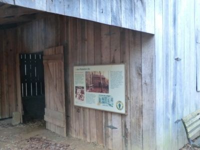
The ravine in front of you was once Scott Street. Rumney's Tavern, the Brown Carpenter Shop and the Brown House are on this side of the street. On the other side were a number of structures, some of which were commercial enterprises such as . . . — — Map (db m22141) HM
Near Londontown Road, 1.3 miles north of Mayo Road (Route 253).
A Transportation Network
Ferries were a critical link in the colonial road system. The ferry crossing at London Town was part of a larger transportation network that extended from Virginia to New York, moving people and goods to market along . . . — — Map (db m22143) HM
Near Londontown Road, 1.3 miles north of Mayo Road (Route 253).
[drawing of tenement house]
Lord Mayor's Tenement: An architectural drawing by Willie Graham, Colonial Williamsburg Foundation.
Discovering the Lord Mayor's Tenement
This building has been reconstructed on the footprint of the . . . — — Map (db m22145) HM
Near Londontown Road, 1.3 miles north of Mayo Road (Route 253).
Location, Location, Location
One of the mysteries that still surrounds the lost town of London is the William Brown House. Built between 1758 and 1764 overlooking the South River, William Brown intended it to serve as his dwelling and an . . . — — Map (db m22137) HM
On Friendship Road (Maryland Route 261) 0.1 miles south of Fairhaven Road (Route 423), on the left when traveling south.
Surveyed, 1663, as Holland’s Hills for Francis Holland; bought 1665, by Richard Harrison, Quaker planter and shipowner, who owned about 6,000 acres. The house, built in three stages between 1665 and 1733 by Richard Harrison and his son Samuel, is . . . — — Map (db m2938) HM
On Muddy Creek Road, 0.1 miles east of Galesville Road, on the right when traveling east.
Cedar Park
Patented to Richard Ewen in 1666 as “Ewen upon Ewenton.” Brick house built c.1697 by Richard Galloway II around earlier frame structure possibly dating back to 1656. Known as “West River Farm” in 18th Century. . . . — — Map (db m65889) HM
Site of
First Quaker Regional Gathering
In Maryland
By George Fox in 1672
Ann of Arundell Chapter, MD.
National Society of Colonial
Dames XVII Century
1999 — — Map (db m65888) HM
On Davidsonville Road (Maryland Route 424) 0.5 miles north of John Hanson Highway (U.S. 50), on the right when traveling north.
600 acres patented in 1664 to Mareen Duval, Esq., great Hugenot and native of France. Appointed Commissioner for Advancement of Trade 1683, he died here 1694. The plantation remained the ancestral seat of a junior branch of the Duvall family for . . . — — Map (db m43527) HM
On Governor Ritchie Highway (Maryland Route 2) 0.1 miles north of Furnace Branch Road (Maryland Route 270), on the right when traveling north.
The Curtis Creek Furnace, located on the south side of Furnace Creek, one-half mile east of Ritchie Highway, was established in 1759 and with a foundry built in 1829, continued to turn out high grade charcoal pig iron until abandoned in 1851. — — Map (db m2867) HM
Near Ritchie Highway (Maryland Route 2) at Aquahart Road when traveling south.
This site was originally settled in 1649 and was known as the Westminster parish. About 1780 it was the property of Francis Cromwell, a cousin of the monarch of England. It was obtained by the Curtis Creek Mining Co. in 1850 from the estate of John . . . — — Map (db m14158) HM
On Baltimore-Annapolis Boulevard (Maryland Route 648) at Furnace Branch Road (Maryland Route 270), on the right when traveling south on Baltimore-Annapolis Boulevard.
Erected, 1731, near this site, Marley Chapel served as a chapel of ease for the northern parish area of St. Margaret’s Episcopal Church. After its abandonment bricks from the chapel were used in constructing St. Alban’s Episcopal Church, Glen . . . — — Map (db m2868) HM
On Solomon’s Island Road (Maryland Route 2) 0.5 miles south of Mill Swamp Road, on the left when traveling south.
Charles Lord Baltimore and his council attended the meeting of the Assembly here Oct. 2 – Nov. 6, 1663. 31 towns and ports of entry were established at this session in the several counties along the bay. Practically none of these towns exist . . . — — Map (db m2945) HM
On Solomons Island Road (Maryland Route 2) at Harwood Road, on the left when traveling south on Solomons Island Road.
Jonathan Rawlings given a license to keep an “ordinary” (tavern) in 1771.
George Washington
dined here September 26, 1773, on his way to the Annapolis races. — — Map (db m3141) HM
On Solomon’s Island Road (Maryland Route 2) 1 mile north of Harwood Road, on the right when traveling north.
Came here to the home of Col. Thomas Tailler on “the ridge” December 13, 1682 for his first conference with Charles Lord Baltimore as to the location of the boundary line between Maryland and Pennsylvania. — — Map (db m3042) HM
(Left side of the marker) Much of the early history of Thomas Point still lies buried under sand and water at its ever-eroding shoreline. Evidence does exist, however, that Native Americans enjoyed the bounty of the Bay’s seafood sometime between . . . — — Map (db m94344) HM
On Solomons Island Road, 0.3 miles north of Bay Front Road.
These stones mark the graves of Anne and Christopher Birckhead They are believed to be the oldest dated tombstones in Maryland
This registers for her bones, her fame is more perpetual than these stones and still her virtues, though her life be . . . — — Map (db m83399) HM
On Greenock Road (Maryland Route 259) at Southern Maryland Boulevard (Maryland Route 4), on the right when traveling north on Greenock Road.
Portland Landing
and
Saint Jerome's
Surveyed 1700
Owned by Col. Henry Darnall
brother-in-law of Charles,
3rd Lord Baltimore and
Secretary of State. — — Map (db m3142) HM
On Solomons Island Road (Maryland Route 2) 0.3 miles north of Bay Front Road (Maryland Route 258), on the right when traveling north.
The first church on this site was built, 1695, and the present structure was completed 1765. The Reverend Henry Hall (1675–1722) served as the first rector, 1698-1722. From 1786–1792 Saint James’ was the home parish of Thomas John . . . — — Map (db m3143) HM
On Generals Highway (Maryland Route 178) at Indian Landing Road, on the left when traveling south on Generals Highway.
This stone marks the Old Stage-Coach Road over which General George Washington traveled when on his way to Annapolis to resign his commission as Commander-in-Chief of the American Forces 23 December 1783. — — Map (db m2880) HM
On Veterans Highway, 0.4 miles south of Benfield Road, on the right when traveling south.
Adam Shipley, who came to Anne Arundel County in 1668, on March 30, 1681, patented 200 acres on the south side of the Severn River. Dedicated during the Tercentenary Commemoration of the Shipleys of Maryland. May 25, 1968. — — Map (db m2885) HM
On Benfield Boulevard, 0.1 miles east of Veterans Highway, on the right when traveling east.
Adam Shipley, came to Anne Arundel County in 1668. On March 30, 1681, 200 acres were surveyed and patented in his name. This tract was the earliest patented in the Shipley name. Marker was dedicated during the development of the subdivision named . . . — — Map (db m2887) HM
On Veterans Highway, 0.5 miles south of Benfield Road, on the left when traveling south.
Adam Shipley, who came to Anne Arundel County in 1668, on March 30, 1681, patented 200 acres on the south side of the Severn River. Dedicated during the Tercentenary Commemoration of the Shipleys of Maryland. May 25, 1968. — — Map (db m80457) HM
On Veterans Highway, 0.5 miles south of Benfield Road, on the left when traveling south.
Near here was junction of old Baltimore-Annapolis Road (“Generals Highway”) and a road laid out by Charles Carroll from Doughoregan Manor. On the south side of Severn Run stood Widow Ramsey’s where George Washington breakfasted June 7, . . . — — Map (db m2888) HM
Near Bayside Beach Road, 2.3 miles east of Fort Smallwood Road (Maryland Route 173), on the right when traveling east.
On June 22-24, 1608, Captain John Smith and his small crew in an open boat explored the waters adjacent to Hancock's Resolution Park. This is proved by his mapping of the Magothy River, Bodkin Creek, and the Patapsco River (which he called the . . . — — Map (db m9279) HM
Near Bayside Beach Road, 2.3 miles east of Fort Smallwood Road (Maryland Route 173).
Recorded on the
National Register
of
Historic Places
1975.
Second Marker (inside the facility):
Hancock's Resolution
Unusual for its stone construction, this house was built c1785 by Stephen & Belinda Ridgely Hancock, a . . . — — Map (db m9064) HM
On Governor Stone Parkway at Benfield Boulevard, on the right when traveling north on Governor Stone Parkway.
Born in England about 1603, he emigrated to Virginia about 1628, and he came to Maryland about 1648. He brought with him nine settlers, and many others followed. He obtained about 5,000 acres located in St. Mary’s, Charles and Calvert counties.
. . . — — Map (db m2889) HM
During 2001-2004, Anne Arundel County’s Lost Towns Project conducted excavations in the neighboring community of Leitch in search of the lost town of Herrington (c. 1660), one of Maryland’s earliest legislated port towns. Established by the Maryland . . . — — Map (db m79981) HM
On Owensville Road (Maryland Route 255) at Muddy Creek Road (Maryland Route 468), on the left when traveling east on Owensville Road.
Here April, 1672, George Fox, founder of Quakerism, opened the first General Meeting of Friends in Maryland, marking the beginning of West River Yearly Meeting and its successor, Baltimore Yearly Meeting of Friends. Site of West River Quaker Meeting . . . — — Map (db m3038) HM
On Owensville Road (Maryland Route 255) 1.4 miles east of Solomon's Island Road (Maryland Route 2).
Visited his Quaker friend William Richardson near this spot after the conference at Col. Thomas Tailler’s December 13, 1682. Lord Baltimore and the members of his Council accompanied him to this place. — — Map (db m3039) HM
On Galesville Road, 0.8 miles east of Muddy Creek Road (Maryland Route 468).
Attended a meeting of the Friends (Quakers) at Thomas Hooker’s December 1682 on this tract called “Brownton” (patented in 1652 for 660 acres). Penn sailed from here across the Bay to the Choptank River to a General Meeting of the Friends. — — Map (db m3041) HM
This outstanding Georgian mansion, built between 1754 and 1768, was the home of Charles Carroll, Barrister and framer of Maryland’s first Constitution and Declaration of Rights. Carroll and his wife Margaret Tilghman made Mount Clare a center of . . . — — Map (db m3152) HM
1754–1914.
This oldest colonial structure of Baltimore was built in 1754 upon the estate known as “Georgia Plantation”
by
Charles Carroll, Barrister
1723–1783
One of the foremost patriots of . . . — — Map (db m41351) HM
Near Washington Boulevard, on the right when traveling south.
In the late 1760’s, the Mount Clare mansion was built by Charles Carroll, Barrister and his wife, Margaret Tilghman, as their summer home. The mansion was located on the grounds of the original plantation, Georgia, and included an orangery, . . . — — Map (db m2533) HM
The Susquehannock and Algonquian Indians had long traveled through this area when Captain John Smith explored and mapped the Chesapeake Bay region in 1608. As the Susquehannocks went from Pennsylvania to the bay, they crossed the Gwynns Falls . . . — — Map (db m6390) HM
Near Frederick Avenue (Maryland Route 144), on the right when traveling west.
The Ellicott Driveway portion of the Gwynns Falls trail follows the route of a millrace that carried water to a flour-milling complex owned by the Ellicott family. In the 1800s, 26 gristmills along the Gwynns Falls and other on the Jones Falls . . . — — Map (db m5533) HM
On South Hanover Street (Maryland Route 2) south of Redbird Avenue, on the right when traveling north. Reported damaged.
Welcome to the Gwynns Falls Trail, Baltimore's Greenway to the Chesapeake Bay. From here the trail runs 15 miles through 2,000 acres of stream-valley parklands to the I-70 Park & Ride near historic Franklintown and alternatively through Solo . . . — — Map (db m212961) HM
On this site was erected Patapsco Friends Meeting House 6th Mo. 12th, 1681 is the earliest record of this meeting. Removed to Aisquith & Fayette Sts. Baltimore Town 2nd Mo. 22nd, 1781. — — Map (db m65715) HM
On North Calvert Street at Lafayette Street, on the left when traveling north on North Calvert Street.
This “noble pile” as it was described at the dedication of January 8, 1900, is the third courthouse built on Monument Square. When Calvert Street was leveled in 1784, the original courthouse—site of the May 1774 Stamp Act Protest . . . — — Map (db m89370) HM
On East Lexington Street, on the left when traveling east.
[This marker portrays the subject in a pictorial manner. It shows the major streets of Baltimore in 1729. The six stars on the map represent the locations of this and five other identical markers.] — — Map (db m7483) HM
On Saint Paul Street (Maryland Route 2), on the right when traveling south.
Cecilivs Calvert Baron Baltimore of Baltimore in the Kingdom of Ireland•Absolvte Lord and Proprietary of the Provinces of Maryland and Avalon in America•Who on November 13, 1633 with the co-operation and assent of the first Colonists, proclaimed in . . . — — Map (db m89251) HM
On East Baltimore Street at South Calvert Street on East Baltimore Street.
Baltimore’s central business district has constantly reinvented itself in response to changes in building technologies, business practices, and architectural styles. Originally,
detached houses that doubled as shops and offices lined the streets. . . . — — Map (db m103260) HM
On North Charles Street just south of East Saratoga Street, on the right when traveling north. Reported permanently removed.
St. Paul's Church (Episcopal) stands on the only property that has remained under the same ownership since the original survey of Baltimore Town in 1730. In that year, Lot. No. 19, the highest point in the new town, was granted to St. Paul's . . . — — Map (db m166953) HM
On Cathedral Street at Saratoga Street on Cathedral Street.
Incorporated 1692, 37 years before Baltimore Town itself, St. Paul’s moved to this vicinity in 1731. It was City’s first place of public worship. this rectory, the “parsonage on the hill” built 1788–1791 on half acre lot given by . . . — — Map (db m2538) HM
On East Lexington Street at Holliday Street, on the left on East Lexington Street.
Founder in 1755, Zion Church is the oldest Lutheran congregation in Maryland. German Lutherans began settling in Baltimore Town shortly after it was laid out in 1730. Relying on itinerant preachers from Pennsylvania, the small struggling community . . . — — Map (db m2714) HM
On Buffalo Yard Road at Penguin Coast, on the right when traveling south on Buffalo Yard Road.
"There are birds as big as ducks but they cannot fly and they bray like asses."
This description of African penguins — the earliest known — was written in 1497 by a crew member accompanying the famed Portuguese . . . — — Map (db m212304) HM
On Warren Street at Henry Street, on the right when traveling west on Warren Street.
Since the founding of Baltimore, 1729, this hill has been a popular point for viewing the city’s growth. Here 4,000 people feasted 1780, to celebrate the ratification by Maryland of the Federal Constitution and in honor of the new government gave . . . — — Map (db m2555) HM
On Shakespeare Street just east of South Bond Street, on the right when traveling west.
This property is listed on the National Register [of Historic Places]
as part of
Fell's Point
National Historic District
and is registered with the
Preservation Society
1770
— — Map (db m145475) HM
On Shakespeare Street just west of South Bethel Street, on the left when traveling west.
In memory of
Edward Fell
Maryland 1723 from Lancaster, England. Acquired land, Jonestown. Later part of Baltimore Town. Importer, died 1743.
William Fell
Brother of Edward. Maryland 1730. Married Sarah Bond 1732. Acquired thousand . . . — — Map (db m145477) HM
On South Ann Street, on the right when traveling south.
Built in 1765 by a young Fell's Point merchant, this House is Baltimore's oldest surviving urban residence. The furnishings in the parlor are the Maryland State Society Daughters of the American Revolution 1973-1976 United States of America . . . — — Map (db m6457) HM
On North Charles Street at University Parkway on North Charles Street.
Part of “Merryman’s Lott” 210 acres of virgin timberland granted by Lord Baltimore in 1688 to Charles Merryman, whose descendants farmed here until 1869. Stone house built in 19th century occupied by Bishops of Maryland since 1909, when . . . — — Map (db m2452) HM
On Falls Road (Maryland Route 25) 0.1 miles south of 36th Street, on the right when traveling south.
Surveyed for John Walsh in 1754, large square cupola once crowned brick mansion. Built in Italianate style c.1860 by Henry Snyder. Leased after 1864 to James Hooper, owner of Meadow Mill. Estate was sold in 1870 to David Carroll, co-owner of Mount . . . — — Map (db m2520) HM
On Herring Run Trail, 0.5 miles Belair Road, on the right when traveling west.
Home of a Founding U.S. Congressman
William Smith was born in 1728 in Lancaster County, Pennsylvania. He became a successful merchant, and moved to Baltimore in 1761 to expand his shipping business. At the time, revolutionary feelings were . . . — — Map (db m153967) HM
Baltimore began as a humble waterfront village in 1729. It burst into prominence as America expanded westward, forging a role as a major trading and transportation center that linked the nation’s interior to the world. From a mere 25 wooden houses . . . — — Map (db m104058) HM
On West Conway Street at South Sharp Street, on the right when traveling west on West Conway Street.
"Mother Church" of the United Brethren in Christ. First chapel erected 1771, present edifice, 1785. Burial place of the denomination's founder, Philip Wilhelm Otterbein, pastor, 1774-1813. Lovely Lane Chapel, "Mother Church of American Methodism," . . . — — Map (db m13573) HM
On East Pratt Street at South Gay Street, on the right when traveling east on East Pratt Street.
Between the eastern coastal and the western mountains, lie the rolling hills of the Piedmont Plateau. Piedmont literally means "foot of the mountain." Its rolling hills were formed from the sediment of the once majestic Appalachians. Over 200 . . . — — Map (db m183361) HM
The landscape of Historic Jonestown reveals four centuries of American History. From 18th and 19th century landmarks to vestiges of an immigrant past, from signs of 20th ceentury decline to a bold 21st century rebirth, its streetscapes tell an . . . — — Map (db m108922) HM
On Fayette Street, on the right when traveling east.
On this site purchased in 1773,
the first permanent meeting house, a dwelling for the pastor and a school house were erected and a cemetery established for the First Baptist Church of Baltimore Town. The present and fourth building of the church is . . . — — Map (db m2599) HM
On Fort Avenue at Towson Street, on the right when traveling east on Fort Avenue.
Established as a port of entry in 1706, this peninsula was originally known as Whetstone Point. Along this road in 1814, soldiers marched to the defense of Fort McHenry, nearby. Port facilities served as a Federal supply camp in the Civil War. Later . . . — — Map (db m2561) HM
Captain John Smith visited the Patapsco River twice in 1608 after settling at Jamestown the previous year. In a 40-foot shallop, Smith and his crew were exploring the Chesapeake Bay hoping, in vain, to discover a passage to the Pacific Ocean. On the . . . — — Map (db m6360) HM
Near Tanbark Drive just west of Lochlea Road when traveling west.
Native Plants
The arboretum was planned to showcase native plants, although there are some non-native plants (mainly from China, Japan and Korea). Native plants are those that existed in this area (the Piedmont and Coastal areas of the . . . — — Map (db m212275) HM
On South Sharp Street at West Hill Street, on the right when traveling south on South Sharp Street.
The Federal Hill and Otterbein Historic Districts exemplify preservation efforts in Baltimore. Adjacent to the Inner Harbor, they were among the earliest areas developed in the city. After periods of economic prosperity and decline, these historic . . . — — Map (db m6357) HM
On Parkside Drive at Boehms Lane on Parkside Drive.
On hill to the north stood the Georgian mansion built c. 1775 by Daniel Bowley II (1745–1807), Baltimore merchant and patriot of the revolution. He was a town commissioner, 1771–1778, and three times a State Senator. In 1814, British soldiers . . . — — Map (db m242400) HM
Near West Cromwell Street at Clarkson Street, on the right when traveling east.
"aboundance of fish lying so thicke with their heads above water, as for want of nets we attempted to catch them with a frying pan…"
Captain John Smith, 1608
You are overlooking the Middle . . . — — Map (db m212915) HM
Near West Cromwell Street at Clarkson Street, on the right when traveling east.
Westport is one of the oldest communities in Baltimore. Settlers established farms here as early as 1675. The Baltimore Iron Works Company formed in the 1730s, established a pattern of growth that included industrial development, followed by . . . — — Map (db m212918) HM
In an age of high infant mortality, Sarah and John Brown experience more than their share of loss. Plagued by smallpox, yellow fever, cholera, typhoid, measles and mumps, early Baltimore families buried one of every three children before their . . . — — Map (db m30564) HM
The Calhoun-Buchanan vault holds the remains of 29 members of two of Baltimore's leading Scots-Irish Presbyterian families spanning five or six generations. The neo-classical granite vault is probably the work of Robert Mills (1781-1855), the . . . — — Map (db m6637) HM
Newcomers like James McHenry helped shape the future of the new republic. A native of Ireland's County Antrim, McHenry (1753-1816) emigrated to Philadelphia in 1771 where he studied medicine with Benjamin Rush, one of Colonial America's most . . . — — Map (db m6647) HM
The William and Robert Smith vault, another of Maximilian Godefroy's Egyptian-flavored designs, belonged to one of early Baltimore's most successful and accomplished families.
William Smith followed his brother John from Lancaster, . . . — — Map (db m6638) HM
Baltimoreans associated the name McDonogh with a well-known private school founded in 1873. Buried here are the parents of the school's founder, Irish natives John (1734-1809) and Elizabeth McDonogh (1747-1808).
John McDonogh, a brickmaker, . . . — — Map (db m6633) HM
Near Washington Boulevard (U.S. 1) at South Street.
Though now heavily silted, the Patapsco River was once navigable to this point, and Elkridge Landing, just downstream, was an important colonial port, rivaling old Annapolis. Here hogsheads of tobacco from nearby plantations were rolled to waiting . . . — — Map (db m166504) HM
Near Washington Boulevard (U.S. 1) at South Street.
Dorsey's Forge (1761-1815):
"At that time there were two Negroes belonging to Edward H. Dorsey, a Negro man called Prince, who was a forgeman, and a Negro man called Sam who was a striker in a Blacksmith shop." - Maryland Chancery . . . — — Map (db m8842) HM
Near Washington Boulevard (U.S. 1) at South Street.
When European settlers discovered the Patapsco Valley, they found a source of untamed beauty rich in resources. Susquehannock and Pscataway Indians hunted and fished the valley full of elk, black bear, bison, gray wolves and deer. The white settlers . . . — — Map (db m8840) HM
Near Washington Boulevard (U.S. 1) at South Street.
This inconspicuous ditch is a remnant of the Avalon millrace. Originally dug in the 1700s, it supplied water from the Patapsco River to Dorsey's Forge. The millrace later served the Avalon Iron & Nail Works and the Baltimore County Water & Electric . . . — — Map (db m8841) HM
On Sweet Air Road (Maryland Route 145) 0.1 miles east of Manor Road, on the right.
500 acre grant in 1704 to Thomas MacNemara. Later called “Sweet Air.” Charles and Daniel Carroll, MacNemara’s kinsmen, acquired the property and sold it in 1751 to Roger Boyce, who built the present house. It was purchased in 1785 for . . . — — Map (db m2052) HM
On Pleasantville Road at Fork Road / Baldwin Mill Road, on the right on Pleasantville Road.
In this valley 7031 acres laid out, 1683, for Charles, Third Lord Baltimore. Opened to settlers, 1721 by Charles, Fifth Lord Baltimore. Frederick, Sixth Lord Baltimore, ordered manor sold, 1766. Land remaining 1782 seized and sold as confiscated . . . — — Map (db m129902) HM
On Ruxton Road (Maryland Route 133) at Falls Road (Maryland Route 25), on the left on Ruxton Road.
The first inhabitant of this village, dating back to 1706, was Richard Gist, father of the Revolutionary War hero, Mordecai Gist. The industrial development of the Jones Falls Turnpike Road, circa 1806, and later by the Baltimore and Susquehanna . . . — — Map (db m2272) HM
Near Oella Avenue, 0.2 miles north of Old Frederick Road, on the left when traveling north.
This plaque is in commemoration of the 20th Anniversary of the opening of the Benjamin Banneker Museum. (June 9, 1998) the result of a collaborative effort between the Friends of Benjamin Banneker Historical Park and Museum and Baltimore County . . . — — Map (db m144731) HM
The self-educated Negro mathematician and astronomer was born, lived his entire life and died near here.
He assisted in surveying the District of Columbia, 1791, and published the first Maryland Almanac, 1792. Thomas Jefferson recognized his . . . — — Map (db m160718) HM
On Frederick Road (Maryland Route 144) at Rolling Road (Maryland Route 166), on the right when traveling west on Frederick Road.
A colonial road built for the purpose of rolling hogsheads of tobacco from the plantations to Elk Ridge Landing for shipment to England. — — Map (db m2131) HM
Near Washington Boulevard (U.S. 1) at South Street.
Over the last 300 years, the now tranquil Patapsco Valley has seen dramatic changes.
During the industrial revolution, resource-hungry industries stripped trees from the hillsides to make charcoal. Every household needed wood as its . . . — — Map (db m8875) HM
The Colonial Forest of Baltimore County 1750
According to available records Baltimore's forests were composed of large tracks of mature trees, interspersed with grassy openings that the colonists called barrens.
Harvesting the Trees
In . . . — — Map (db m219263) HM
On Frederick Road (Maryland Route 144) at Oella Avenue, on the right when traveling west on Frederick Road.
Established 1772 by the three Ellicott brothers from Bucks County, Pennsylvania. They opened the road from here to Baltimore. The B. and O. R. R. was completed to this point May 20, 1830. — — Map (db m175) HM
On Fork Road at Brinton Road, on the left when traveling west on Fork Road.
Oldest Methodist Congregation in Maryland worshipping in its original location. Organized as Fork Meeting by Robert Strawbridge. Land near “The Forks of the Gunpowder” given in 1771 by James Baker, who converted to Methodism under the . . . — — Map (db m1928) HM
On North Point Road (Maryland Route 20) 0.3 miles south of McComas Road, on the left when traveling south.
Thomas Todd settled here from Gloucester County, Virginia, in 1664. Homestead has remained in Todd Family for more than three centuries. Farm once contained 1,700 acres. 17th Century brick house was burned by British Soldiers September 14, 1814, as . . . — — Map (db m2123) HM
On North Point Road (Maryland Route 20) 0.3 miles south of McComas Road, on the left when traveling south. Reported missing.
Todd’s Inheritance is a lasting symbol for Americans land especially Baltimoreans) who stood their ground when attacked by invading forces. Throughout the War of 1812, settlements around the Chesapeake Bay fell to British raiders who had superior . . . — — Map (db m79874) HM
On Reisterstown Road (Route 140) at St. Thomas Lane, on the right when traveling north on Reisterstown Road.
A frontier parish church authorized by Act of Assembly 1742 as “a Chapel of Ease for the Forest Inhabitants” of Saint Paul’s Parish (Baltimore). Reverend Thomas Craddock inducted as first minister January 14, 1745. — — Map (db m2070) HM
On Cradock Lane, 0.5 miles Reisterstown Road (Route 140), on the left when traveling north.
Named for free school of Trentham, Staffordshire, England, where Reverend Thomas Craddock had taught. When he married High Sheriff John Risteau’s daughter, this estate was her dowry. They built a house in 1746 and in 1747 he opened a boy’s boarding . . . — — Map (db m2069) HM
On Belair Road (U.S. 1) at Bradshaw Road, on the right when traveling north on Belair Road.
The old church here standing was built by Edward Day at his own expense and consecrated in 1817 to replace Saint John’s at Joppa Town which, built in 1725, lay in ruins. — — Map (db m1921) HM
948 entries matched your criteria. Entries 101 through 200 are listed above. ⊲ Previous 100 — Next 100 ⊳