By Howard C. Ohlhous, October 14, 2006
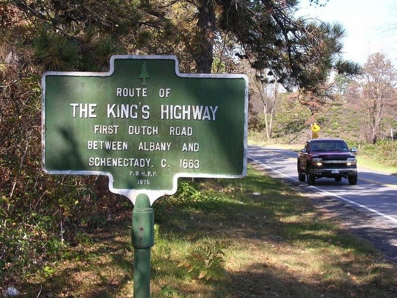
The King’s Highway Marker
| On Kings Road at Old State Road, on the right when traveling south on Kings Road. |
| On Eagle Street at Corning Place on Eagle Street. |
| On State Street at Lodge Street on State Street. |
| On State Street (New York State Route 5) at James Street, on the right when traveling west on State Street. |
| On Broadway just north of State Street (New York State Route 5), on the right when traveling north. |
| On Broadway (New York State Route 5) north of Hudson Avenue, on the right when traveling north. |
| On State Street at Eagle Street, on the left when traveling east on State Street. |
| On Eagle Street at Eagle Street and State Street, on the right on Eagle Street. |
| On Broadway (New York State Route 5) at Frontage Road, on the left when traveling south on Broadway. |
| On Eagle Street at Corning Place, on the left when traveling north on Eagle Street. |
| On State Street (New York State Route 5) at North Pearl Street, on the right when traveling west on State Street. |
| On State Street (New York State Route 5) west of North Pearl Street, on the right when traveling west. |
| On Broadway at Beaver Street, on the right when traveling south on Broadway. |
| On State Street at Lodge Street on State Street. |
| On Broadway at Maiden Lane, on the right when traveling north on Broadway. |
| On Eagle Street at Corning Place, on the right when traveling east on Eagle Street. |
| On North Pearl Street (New York State Route 32) 0.1 miles south of Clinton Avenue (U.S. 9), on the right when traveling south. |
| On Clinton Street near Schuyler Street, on the right when traveling south. |
| On Tabor Road at Lendrum Road, on the right when traveling south on Tabor Road. |
| On Switzkill Road (County Route 1), on the right when traveling south. |
| On Helderburg Trail (New York State Route 443), on the right when traveling east. |
| On County Route 312, on the right when traveling south. |
| On Continental Avenue at Ontario Street, on the right when traveling south on Continental Avenue. |
| On Delaware Avenue, on the left when traveling north. |
| On Van Schaick Avenue at Delaware Avenue, on the right when traveling west on Van Schaick Avenue. |
| On Delaware Avenue, on the left when traveling north. |
| On Delaware Avenue, on the right when traveling north. |
| On Crescent Road (County Route 159) at New Loudon Road (New York State Route 9), on the right when traveling east on Crescent Road. |
| On Broadway (New York State Route 32) at Earl Dr. (Private), on the right when traveling north on Broadway. |
| On Boght Road (New York State Route 9R), on the right when traveling west. |
| On Indian Fields Road (New York State Route 32), on the left when traveling south. |
| On Interstate 87, on the right when traveling south. |
| On Van Wies Point Road south of Wheeler Road, on the left when traveling south. |
| On New York State Route 146 just west of Christopher Lane, on the right when traveling west. |
| On Main Street (New York State Route 146), on the right when traveling east. |
| On Knox-Gallupville Road (County Route 255), on the right when traveling west. |
| On Berne-Altamont Road (New York State Route 156) at Farm Lane, on the right when traveling south on Berne-Altamont Road. |
| On Kings Road, on the left when traveling east. |
| On Kings Road, on the right when traveling south. |
| On Broadway at 15th Street, on the right when traveling south on Broadway. |
| On New York State Route 32, on the left when traveling south. |
| On New York State Route 143 at Myers Road, on the right when traveling west on State Route 143. |
| On New York State Route 85 at New York State Route 143, in the median on State Route 85. |
| On East 163rd Street east of Melrose Avenue, on the right when traveling east. |
| On East 140th Street just west of Brook Avenue, on the right when traveling east. |
| On Shore Road, on the right when traveling north. |
| Near Broadway (U.S. 9), on the right when traveling north. |
| On Westchester Avenue near Saint Peter's Avenue. |
| On Second Street, on the right when traveling west. |
| On U.S. 11 at Main Street (State Route 26/79), on the right when traveling north on U.S. 11. |
| On Genesee Street, 0.1 miles east of James Street, on the right when traveling east. |
| On New York State Route 34, 0.5 miles north of Ford Road, on the left when traveling north. |
| On West Cayuga Street (New York State Route 38) west of Keeler Street, on the right when traveling north. |
| On Sherman-Westfield Road (County Route 74) south of Fort Street, on the left when traveling south. |
| On East Lake Road (New York State Route 5) east of North Portage Road (New York State Route 394), on the left when traveling east. |
| On South Portage Road (New York State Route 394) at South Gale Street, on the right when traveling south on South Portage Road. |
| On South Portage Road at South Gale Street, on the right when traveling south on South Portage Road. |
| On County Road 60, on the right when traveling west. |
| On County Road 60, on the left when traveling west. |
| On New York State Route 7. |
| On East River Road (County Route 32) 0.3 miles south of County Route 33, on the right when traveling south. |
| On Lake Shore Road, 0.4 miles south of Sheldon Lane, on the left when traveling south. |
| On Cumberland Head Road, on the left when traveling south. |
| On New York State Route 9 at Old Dock Road, on the left when traveling south on State Route 9. |
| On New York State Route 9 north of South Junction Road, on the right when traveling south. |
| On New York State Route 82, on the right when traveling south. |
| On U.S. 9, 0.1 miles north of Commons Road (County Route 6), on the left when traveling north. |
| On U.S. 9, 0.1 miles north of Commons Road (County Route 6), on the left when traveling north. |
| On Taconic State Parkway, 4 miles Jackson Corners Road, on the right when traveling north. |
| Near Clermont Avenue, 0.3 miles Woods Road (County Route 35). |
| On Main Street west of State Route 9G, on the right when traveling west. |
| On New York State Route 9G at Station Road, on the left when traveling north on State Route 9G. |
| On New York State Route 9G, on the right when traveling north. |
| On Cheviot Road at Cheviot Rd ext when traveling east on Cheviot Road. |
| On Route 23, on the left when traveling east. |
| Near New York State Route 9H, 0.2 miles north of Fischer Road, on the right when traveling south. |
| Near New York State Route 9H, 0.2 miles north of Fisher Road, on the right when traveling south. |
| Near New York State Route 9H, 0.2 miles north of Fischer Road, on the right when traveling south. |
| Near New York State Route 9H, 0.2 miles north of Fischer Road, on the right when traveling south. |
| Near New York State Route 9H, 0.2 miles north of Fischer Roaf, on the right when traveling south. |
| On New York State Route 9H south of Hudson Avenue (County Route 21), on the right when traveling north. |
| On U.S. 9 at State Farm Road, on the right when traveling north on U.S. 9. |
| On Broad Street (New York State Route 9) at Church Street, on the right when traveling north on Broad Street. |
| Near New York State Route 9H, 0.2 miles north of Fischer Road, on the right when traveling south. |
| On County Route 10 east of Half Circle Road, on the right when traveling west. |
| On County Route 10 at White Birch Road, on the left when traveling west on County Route 10. |
| On Livingston Circle near Old Post Road (County Route 19), on the left when traveling south. |
| On Old Post Road (County Route 19) at Livingston Circle, on the left when traveling north on Old Post Road. |
| On County Route 8 at Taghkanic Road on County Route 8. |
| On New York State Route 9J at Ferry Road, on the left when traveling north on State Route 9J. |
| On 9J, on the left when traveling north. |
| On County Route 26A at Gibbons Road, on the right when traveling west on County Route 26A. |
| On River Street, on the left when traveling south. |
| On Gaffey Road north of New York State Route 23. |
| On New York State Route 10 at Terry Road, on the left when traveling north on State Route 10. |
| On New York State Route 343, 0.2 miles north of Randall Road, on the left when traveling south. |
909 entries matched your criteria. The first 100 are listed above.
Next 100 ⊳