After filtering for Virginia, 992 entries match your criteria. Entries 201 through 300 are listed.⊲ Previous 100 — Next 100 ⊳
Waterways & Vessels Topic
April 28, 2012
Orientation Overview
| 201 ► Virginia, Chesapeake, Greenbrier West — Planning a Canal — |
| 202 ► Virginia, Chesapeake, Greenbrier West — Site of the Original Causeway — |
| 203 ► Virginia, Chesapeake, Greenbrier West — The Iron Titans Tame the Marsh — The Waterways — |
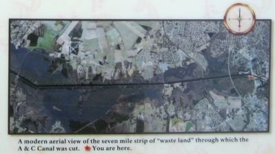
| 204 ► Virginia, Chesapeake, Greenbrier West — Under Two Flags — The Waterways — |
| 205 ► Virginia, Chesapeake, Greenbrier West — Village of Great Bridge — A Vital Link — Reported permanently removed |
| 206 ► Virginia, Chesapeake, Greenbrier West — Village of Great Bridge — A Vital Link — |
| 207 ► Virginia, Chesapeake, Greenbrier West — Welcome — To the Great Bridge Battlefield & Waterways Park and Visitor Center — |
| 208 ► Virginia, Chesapeake, Greenbrier West — What is a Lock? — The Waterways — |
| 209 ► Virginia, Chesapeake, Greenbrier West — Why Build a Canal Here? — The Waterways — |
| 210 ► Virginia, Chesapeake, Pleasant Grove West — Dismal Swamp Canal — The Battle of South Mills — |
| 211 ► Virginia, Chesapeake, Pleasant Grove West — Dismal Swamp Canal Trail — Interpretive Signage and Points of Interest on Dismal Swamp Canal Trail — |
| 212 ► Virginia, Chesapeake, Pleasant Grove West — From Towpath...to Highway...to "Toe" path — The Evolution of the George Washington Highway — Dismal Swamp Canal Trail — |
| 213 ► Virginia, Chesapeake, Pleasant Grove West — Great Dismal Swamp National Wildlife Refuge — Dismal Swamp Canal Trail — |
| 214 ► Virginia, Chesapeake, Pleasant Grove West — WP-11 — Herring (Heron) Ditch — |
| 215 ► Virginia, Chesapeake, Pleasant Grove West — WP-12 — North West Canal — |
| 216 ► Virginia, Chesapeake, Pleasant Grove West — Outliers — Dismal Swamp Canal Trail — |
| 217 ► Virginia, Chesapeake, Pleasant Grove West — Stone Mileposts along the Dismal Swamp Canal — Dismal Swamp Canal Trail — |
| 218 ► Virginia, Chesapeake, Pleasant Grove West — The Superintendent's House... from Tolls to Tea — Dismal Swamp Canal Trail — |
| 219 ► Virginia, Chesapeake, South Norfolk — Jordan Bridge — South Norfolk — |
| 220 ► Virginia, Chesapeake, Western Branch South — K-264 — Dale Point — |
| 221 ► Virginia, Chesterfield County, Chester — Changes Over Time — The intertwined history of the land and the water — Dutch Gap Conservation Area: A Changing Story — |
| 222 ► Virginia, Chesterfield County, Chester — K-203 — Colonel Thomas Lygon — |
| 223 ► Virginia, Chesterfield County, Chester — Dutch Gap — |
| 224 ► Virginia, Chesterfield County, Chester — Dutch Gap Canal — Butler's Bypass — Bermuda Hundred Campaign — |
| 225 ► Virginia, Chesterfield County, Chester — John Smith Explores the Chesapeake — Captain John Smith Chesapeake National Historic Trail — |
| 226 ► Virginia, Chesterfield County, Chester — 2 — The Bermuda Hundred Campaign — |
| 227 ► Virginia, Chesterfield County, Chester — 3 — The Bermuda Hundred Campaign — |
| 228 ► Virginia, Chesterfield County, Chester — 6 — The Bermuda Hundred Campaign — |
| 229 ► Virginia, Chesterfield County, Chester — The James River...Floating Through The Centuries — |
| 230 ► Virginia, Chesterfield County, Chester — The Lightkeeper’s House — The lights of Dutch Gap — |
| 231 ► Virginia, Chesterfield County, Chester — 30 — The Siege of Petersburg — |
| 232 ► Virginia, Chesterfield County, Chester — The Tides — A changing landscape — Dutch Gap Conservation Area - A Changing Story — |
| 233 ► Virginia, Chesterfield County, Colonial Heights — S-36 — Redwater Creek Engagement — |
| 234 ► Virginia, Chesterfield County, Dutch Gap — Farrar's Island — Crown Land Grant Issued in 1637 — Henricus Historical Park: 1611 — |
| 235 ► Virginia, Chesterfield County, Dutch Gap — John Smith Explores the Chesapeake — Captain John Smith Chesapeake National Historic Trail — National Park Service, U.S. Department of the Interior — |
| 236 ► Virginia, Chesterfield County, Dutch Gap — Join the Adventure — Captain John Smith Chesapeake National Historic Trail — National Park Service, U.S. Department of the Interior — |
| 237 ► Virginia, Chesterfield County, Enon — Appomattox River Overlook — The Bermuda Hundred Campaign — |
| 238 ► Virginia, Chesterfield County, Enon — Broadway Landing — The Bermuda Hundred Campaign — |
| 239 ► Virginia, Chesterfield County, Enon — Historic Point of Rocks — The Bermuda Hundred Campaign — |
| 240 ► Virginia, Chesterfield County, Enon — The Appomattox River Raid, June 26-28, 1862 — McClellan's 1862 Peninsula Campaign — |
| 241 ► Virginia, Chesterfield County, Enon — The United States Submarine Propeller Alligator — |
| 242 ► Virginia, Chesterfield County, Enon — 15 — Welcome to R. Garland Dodd Park at Point of Rocks — Captain John Smith's Adventures on the James — www.johnsmithtrail.org — |
| 243 ► Virginia, Chesterfield County, Ettrick — Shaping Of The Town — Virginia State University — |
| 244 ► Virginia, Chesterfield County, Ettrick — Silk Mill — Virginia State University — |
| 245 ► Virginia, Chesterfield County, Ettrick — The Beginning of Ettrick — Virginia State University — |
| 246 ► Virginia, Chesterfield County, Hopewell — K-202 — Bermuda Hundred — |
| 247 ► Virginia, Chesterfield County, Hopewell — S-22 — Port Walthall — |
| 248 ► Virginia, Chesterfield County, Richmond — Drewry's Bluff — |
| 249 ► Virginia, Chesterfield County, Richmond — Duty Above and Beyond — |
| 250 ► Virginia, Chesterfield County, Richmond — May 15, 1862—The Battle of Drewry's Bluff — |
| 251 ► Virginia, Chesterfield County, Richmond — The USS Monitor — |
| 252 ► Virginia, Clarke County, Berryville — King Wheat, Millwood & The Burwell-Morgan Mill — |
| 253 ► Virginia, Clarke County, Millwood — B-23 — Ashby’s Gap — |
| 254 ► Virginia, Colonial Heights — S-33 — Fort Clifton — |
| 255 ► Virginia, Danville — U-39 — Dix's Ferry — |
| 256 ► Virginia, Danville — Mills Along The Dan — Reported unreadable |
| 257 ► Virginia, Dinwiddie County, Burgess — S-63 — Battle of Hatcher’s Run — 5-7 February 1865 — |
| 258 ► Virginia, Dinwiddie County, Dinwiddie — The Siege of Petersburg — Petersburg National Battlefield Park — National Park Service, U.S. Department of the Interior — |
| 259 ► Virginia, Emporia — Meherrin River Trail — Emporia, Virginia. Chowan River Basin — |
| 260 ► Virginia, Essex County, Caret — N-19 — Portobacco Indians — |
| 261 ► Virginia, Essex County, Champlain — O-83 — Layton’s Landing Wharf and Ferry — |
| 262 ► Virginia, Essex County, Loretto — O-84 — Saunders’s Wharf — |
| 263 ► Virginia, Essex County, Millers Tavern — O-23 — Bacon's Northern Force — |
| 264 ► Virginia, Essex County, Tappahannock — USS Tappahannock AO-43 — |
| 265 ► Virginia, Essex County, Tappahannock — Bountiful Marshes — Captain John Smith Chesapeake National Historic Trail — National Park Service, U.S. Department of the Interior — |
| 266 ► Virginia, Essex County, Tappahannock — The Golden Leaf that Built a Port — |
| 267 ► Virginia, Essex County, Tappahannock — N-25 — Toppahanock Indian Village — |
| 268 ► Virginia, Fairfax County, Alexandria — E-69 — Little Hunting Creek — |
| 269 ► Virginia, Fairfax County, Alexandria — The Last Defense — Fort Hunt — Reported missing |
| 270 ► Virginia, Fairfax County, Alexandria, Belle View — Historic Jones Point — Mount Vernon Trail — George Washington Memorial Parkway, National Park Service — |
| 271 ► Virginia, Fairfax County, Alexandria, Mount Vernon — Batteau Construction Project — |
| 272 ► Virginia, Fairfax County, Alexandria, Mount Vernon — Batteau Design — |
| 273 ► Virginia, Fairfax County, Alexandria, Mount Vernon — George Washington's Distillery and Gristmill in 1799 — |
| 274 ► Virginia, Fairfax County, Alexandria, Mount Vernon — Punt — |
| 275 ► Virginia, Fairfax County, Alexandria, Mount Vernon — Visionary Farmer — |
| 276 ► Virginia, Fairfax County, Centreville — Blackburn's Ford — Guarding the Fords — |
| 277 ► Virginia, Fairfax County, Centreville — Civil War Winter Quarters — |
| 278 ► Virginia, Fairfax County, Centreville — Walney Ice Pond — Ellanor C. Lawrence Park — |
| 279 ► Virginia, Fairfax County, Chantilly — C-18 — Sully Plantation — |
| 280 ► Virginia, Fairfax County, Chantilly — 3 — Travelling Back in Time — Sully Historic Site — Cain's Branch Archaeological Trail — |
| 281 ► Virginia, Fairfax County, Clifton — Clifton Hotel — |
| 282 ► Virginia, Fairfax County, Clifton — Fulmer Brill House — ca. 1912 — |
| 283 ► Virginia, Fairfax County, Clifton — Huckbill — 1902 — |
| 284 ► Virginia, Fairfax County, Dranesville — T-37 — Sharpsburg / Antietam Campaign — |
| 285 ► Virginia, Fairfax County, Fairfax Station — Hogshead — |
| 286 ► Virginia, Fairfax County, Fort Belvoir — Long Parade Ground — |
| 287 ► Virginia, Fairfax County, Great Falls — T-38 — Gettysburg Campaign — |
| 288 ► Virginia, Fairfax County, Great Falls — Potomac Connections — Piedmont Region — Potomac Heritage National Scenic Trail — |
| 289 ► Virginia, Fairfax County, Great Falls — Potomac Connections — Piedmont Region — Potomac Heritage National Scenic Trail — |
| 290 ► Virginia, Fairfax County, Great Falls — Seneca Tract — |
| 291 ► Virginia, Fairfax County, Great Falls — Washington's Canal — |
| 292 ► Virginia, Fairfax County, Groveton — E-96 — Huntley — |
| 293 ► Virginia, Fairfax County, Herndon — Hawkins-Martz-Carroll House — |
| 294 ► Virginia, Fairfax County, Herndon — Mosby’s Herndon Station Raid — “My loss watching nothing.” — Mosby's Confederacy — Reported permanently removed |
| 295 ► Virginia, Fairfax County, Idylwood, Mosby — A Memorial to the Four Chaplains — The Tragedy of the Sinking of the Dorchester — |
| 296 ► Virginia, Fairfax County, Lorton — A Corridor and a Barrier — |
| 297 ► Virginia, Fairfax County, Lorton — E-107 — Colchester — |
| 298 ► Virginia, Fairfax County, Lorton — Delaying Tactics — Star-Spangled Banner National Historic Trail — National Park Service, U.S. Department of the Interior — |
| 299 ► Virginia, Fairfax County, Lorton — In the Footsteps of History — Special Places on the Mason Neck — |
| 300 ► Virginia, Fairfax County, Lorton — Noman Monroe Cole, Jr. — 1933 - 1997 — |
992 entries matched your criteria. Entries 201 through 300 are listed above. ⊲ Previous 100 — Next 100 ⊳