After filtering for South Dakota, 84 entries match your criteria.
Charity & Public Work Topic
By Ruth VanSteenwyk, May 21, 2017
Civilian Conservation Corps Camp Marker
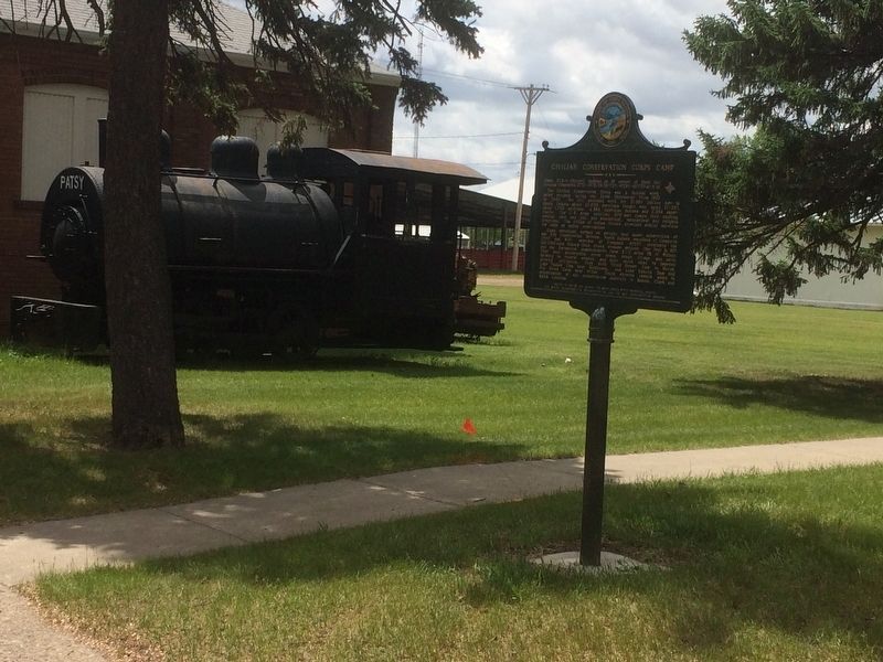
| 1 ► South Dakota, Beadle County, Huron — 517 — Civilian Conservation Corps Camp — |
| On 3rd Street Southwest west of Livestock Avenue, on the right when traveling east. | |||
| 2 ► South Dakota, Beadle County, Huron — 349 — W. Glenn Sloan — Engineer Man of Vision — |
| On 4th Street NE (U.S. 14) at Jersey Avenue NE, on the right when traveling east on 4th Street NE. | |||
| 3 ► South Dakota, Bennett County, Tuthill — 540 — Civilian Conservation Corps Camp — |
| On U.S. 18 at 230th Avenue (State Highway 73), on the right when traveling west on U.S. 18. | |||
| 4 ► South Dakota, Brown County, Aberdeen — Baird Park — |
| Near 24th Ave NE, 0.3 miles west of Roosevelt St N. | |||
| 5 ► South Dakota, Brown County, Aberdeen — South Dakota Boy's State — Home of — |
| 6 ► South Dakota, Brown County, Columbia — Sand Lake's Observation Tower — …A Bird's Eye View — |
| On Sand Lake Dr, 0.2 miles County Highway 16. | |||
| 7 ► South Dakota, Brown County, Houghton — 515 — Civilian Conservation Corps Camp — |
| On 112th Street (State Highway 10) 1.3 miles west of 400th Ave., on the right when traveling east. | |||
| 8 ► South Dakota, Butte County, Belle Fourche — "Buckskin Johnny" Spaulding Cabin — Historic Structure — |
| Near 5th Avenue (CanAm Highway) (U.S. 85) just north of Faulk Street, on the right when traveling north. | |||
| 9 ► South Dakota, Charles Mix County, Lake Andes — Civilian Conservation Corps Camp — |
| On 382nd Avenue, 0.2 miles south of State Highway 50, on the right when traveling south. | |||
| 10 ► South Dakota, Codington County, Watertown — Fire and Rescue — |
| On 1st Avenue Northwest east of 3rd Street Northwest, on the left when traveling east. | |||
| 11 ► South Dakota, Custer County, Custer — 516 — Civilian Conservation Corps Camp — Camp SP-3 / Camp Narrows — French Creek — |
| On State Highway 87, 0.5 miles north of Lame Johnny Road, on the left when traveling north. | |||
| 12 ► South Dakota, Custer County, Custer — 527 — Civilian Conservation Corps Camp — |
| Near South Playhouse Road east of Needles Highway (State Highway 87). | |||
| 13 ► South Dakota, Custer County, Custer — 531 — Civilian Conservation Corps Camp — |
| On Mt. Rushmore Road (U.S. 16) at Lightning Creek Road (Forest Road 288), on the right when traveling west on Mt. Rushmore Road. | |||
| 14 ► South Dakota, Custer County, Custer — Fire Tower Lookouts — |
| Near Mount Coolidge Lookout Road near State Highway 87. | |||
| 15 ► South Dakota, Custer County, Custer — Stockade Lake Bridge — |
| On Stockade Lake Drive, 1 mile east of Lower French Creek Road, on the left when traveling east. | |||
| 16 ► South Dakota, Custer County, Custer — 444 — The Hearst Highway — Dedicated to the memory of — |
| On Hearst Memorial Highway (U.S. 385) at Avenue of the Chiefs, on the right when traveling north on Hearst Memorial Highway. | |||
| 17 ► South Dakota, Custer County, Hot Springs — 520 — Civilian Conservation Corps Camp — |
| On U.S. 385, 1.9 miles north of 7-11 Road (County Road 101), on the right when traveling north. | |||
| 18 ► South Dakota, Custer County, Hot Springs — Stephen Tyng Mather — July 4, 1867 — Jan. 22, 1930 — |
| Near Wind Cave Road, 1 mile south of U.S. 385. | |||
| 19 ► South Dakota, Custer County, Hot Springs — The CCC's Enduring Legacy — Wind Cave National Park — |
| On Wind Cave Road. | |||
| 20 ► South Dakota, Custer County, Pringle, West Custer Township — Early Game Preserve — Wind Cave National Park — |
| On U.S. 385, 1 mile north of State Highway 87, on the right when traveling north. | |||
| 21 ► South Dakota, Day County, Andover — Amsden Dam — |
| Near 140th Street, 0.2 miles east of 442nd Ave.. | |||
| 22 ► South Dakota, Day County, Waubay — A Room with a View — |
| On Waubay Refuge Entrance Road. | |||
| 23 ► South Dakota, Day County, Waubay — Potholes and Prairie — |
| On Waubay Refuge Entrance Road. | |||
| 24 ► South Dakota, Day County, Waubay — Saving Men and Beasts — |
| On Waubay Refuge Entrance Road. | |||
| 25 ► South Dakota, Day County, Waubay — Waubay National Wildlife Refuge — Welcome to — |
| On Waubay Refuge Entrance Road. | |||
| 26 ► South Dakota, Day County, Waubay — Waubay National Wildlife Refuge — Welcome to — |
| On Waubay Refuge Entrance Road. | |||
| 27 ► South Dakota, Day County, Waubay — Waubay Wetland Management District — |
| On Waubay Refuge Entrance Road. | |||
| 28 ► South Dakota, Hamlin County, Castlewood — Civilian Conservation Corps Camp — Camp DSE-224 Poinsett located on the east bank of Dry Lake — Companies: 2751- August 4, 1934 to October 20, 1934 — |
| On 192nd Street (State Highway 28) near North Lake Drive, on the right when traveling west. | |||
| 29 ► South Dakota, Hand County, Miller — 704 — Harlan J. Bushfield & Vera S. Cahalan Bushfield — |
| On East 5th Street east of North Broadway (U.S. 14), on the right when traveling west. | |||
| 30 ► South Dakota, Hughes County, Pierre — Boy Scout Cabin — |
| Near Farm Island Road. | |||
| 31 ► South Dakota, Hughes County, Pierre — CCC Camp S - 207, Farm Island, 1933 - 37 — |
| Near Farm Island Road. | |||
| 32 ► South Dakota, Hughes County, Pierre — Civilian Conservation Corps (CCC) — |
| Near Farm Island Road. | |||
| 33 ► South Dakota, Hughes County, Pierre — 506 — Civilian Conservation Corps Camp — |
| On State Highway 34 at milepost 214 at Whitetail Avenue, on the right when traveling east on State Highway 34. | |||
| 34 ► South Dakota, Hughes County, Pierre — Farm Island Causeway — |
| Near Farm Island Road, 1 mile south of South Dakota Highway 34, on the right when traveling south. | |||
| 35 ► South Dakota, Hughes County, Pierre — 692 — Hughes County Courthouse / Site of First Library in Pierre — |
| On North Euclid Avenue (U.S. 83) south of East Prospect Avenue, on the left when traveling north. | |||
| 36 ► South Dakota, Hughes County, Pierre — Mateer Park — |
| On West Oak Street at West Broadway Avenue, on the right when traveling west on West Oak Street. | |||
| 37 ► South Dakota, Hughes County, Pierre — Much Was Accomplished — |
| Near Farm Island Road, 1 mile south of South Dakota Highway 34, on the right when traveling south. | |||
| 38 ► South Dakota, Jackson County, Philip — 510 — Civilian Conservation Corps Camps — |
| On State Highway 240, 0.9 miles south of Interstate 90, on the right when traveling south. | |||
| 39 ► South Dakota, Jerauld County, Wessington Springs — Municipal Field House — |
| On 2nd Street Southwest, 0.1 miles east of Dakota Avenue South, on the right when traveling west. | |||
| 40 ► South Dakota, Lawrence County, Deadwood — Civilian Conservation Corps Camp — Camp F-20 / Park Creek — |
| On U.S. 385 at Galena Road (Forest Road 534), on the right when traveling north on U.S. 385. | |||
| 41 ► South Dakota, Lawrence County, Deadwood — 519 — Civilian Conservation Corps Camp — |
| On U.S. 385 at Roubaix Lake Road, on the right when traveling south on U.S. 385. | |||
| 42 ► South Dakota, Lawrence County, Deadwood — Deadwood’s Boy Scout Tree Project — A Trail to Deadwood's Past — |
| On Main Street (U.S. 85) at McKinley Street, on the left when traveling south on Main Street. | |||
| 43 ► South Dakota, Lawrence County, Deadwood — Deadwood's Carnegie Library — |
| On Williams Street at Denver Avenue, on the right when traveling north on Williams Street. | |||
| 44 ► South Dakota, Lawrence County, Deadwood — Job Corps Project — |
| Near Pine Street near Sherman Street (CanAm Highway) (U.S. 85), on the right when traveling west. | |||
| 45 ► South Dakota, Lawrence County, Deadwood — Partners in Land Preservation — A Trail to Deadwood's Past — |
| Near Charles Street (CanAm Highway) (U.S. 85) at Stewart Street, on the right when traveling south. | |||
| 46 ► South Dakota, Lawrence County, Deadwood — Rev. L.R.S. Ferguson Ski & Sled Area — A Trail to Deadwood's Past — |
| On Charles Street (U.S. 85) at Stewart Street, on the left when traveling south on Charles Street. | |||
| 47 ► South Dakota, Lawrence County, Deadwood — St. Johns Episcopal Church, Est. 1880 — A Trail to Deadwood's Past — |
| On Williams Street just north of Shine Street, on the right when traveling north. | |||
| 48 ► South Dakota, Lawrence County, Lead — City Hall and Masonic Temple — |
| On West Main Street (CanAm Highway) (U.S. 85) at Alert Street, on the right when traveling east on West Main Street (CanAm Highway). | |||
| 49 ► South Dakota, Lawrence County, Lead — Civilian Conservation Corps Camp — |
| On U.S. 14A north of Roughlock Falls Road (County Highway 222), on the right when traveling north. | |||
| 50 ► South Dakota, Lawrence County, Nemo — 521 — Civilian Conservation Corps Camp — |
| On Nemo Road at Merritt Estes Road (County Road 208), on the right when traveling south on Nemo Road. | |||
| 51 ► South Dakota, Lawrence County, Whitewood — 717 — 1940 DAR Penny Pines Forest — |
| On U.S. 85 at Polo Loop, on the right when traveling north on U.S. 85. | |||
| 52 ► South Dakota, Lyman County, Vivian — 514 — Civilian Conservation Corps Camp — |
| Near I-90 (Interstate I-90) 5.6 miles US 83 (U.S. 83), on the right when traveling east. | |||
| 53 ► South Dakota, Marshall County, Lake City — Governor William J. Janklow and Fort Sisseton — |
| On 434th Ave., 1.5 miles 118th Stret when traveling north. | |||
| 54 ► South Dakota, Marshall County, Lake City — Senator Curt Jones and Fort Sisseton — |
| On 434th Ave., 1.5 miles north of 118th Stret. | |||
| 55 ► South Dakota, Meade County, Sturgis — 512 — Civilian Conservation Corps Camps — |
| On South Dakota Route 34 at Custer Avenue, on the left when traveling east on State Route 34. | |||
| 56 ► South Dakota, Miner County, Howard — 691 — Howard Public Library — First Chartered Library in Dakota Territory — |
| On 233rd Street (State Highway 34) west of South Maple Street, on the right when traveling west. | |||
| 57 ► South Dakota, Minnehaha County, Garretson — Festival of Progress — |
| On Park Road. | |||
| 58 ► South Dakota, Minnehaha County, Sioux Falls — "RISE" and the Big Sioux River — |
| Near South Cliff Avenue, 0.2 miles south of East 41st Street, on the right when traveling south. | |||
| 59 ► South Dakota, Minnehaha County, Sioux Falls — AAUW Sioux Falls Branch — |
| On West 22nd Street, on the left when traveling west. | |||
| 60 ► South Dakota, Minnehaha County, Sioux Falls — Children's Home Society of South Dakota — |
| On East 10th Street (State Highway 42) at South Van Eps Avenue, on the right when traveling east on East 10th Street. | |||
| 61 ► South Dakota, Minnehaha County, Sioux Falls — Kiwanis Avenue — |
| On South Kiwanis Avenue, 0.1 miles south of West 16th Street, on the right when traveling south. | |||
| 62 ► South Dakota, Minnehaha County, Sioux Falls — Presentation Children's Home — |
| On South Western Avenue south of West 15th Street, on the right when traveling south. | |||
| 63 ► South Dakota, Minnehaha County, Sioux Falls — Sioux Falls Municipal Band — McKennan Park Historic District — |
| On East 26th Street west of South 4th Avenue. | |||
| 64 ► South Dakota, Minnehaha County, Sioux Falls — South Dakota Achieve — |
| On South Western Avenue south of West 51st Street, on the right when traveling north. | |||
| 65 ► South Dakota, Minnehaha County, Sioux Falls, Axtell Park — The Woman's Alliance — Cathedral Historic District — |
| On South Spring Avenue at West 9th street, on the left when traveling north on South Spring Avenue. | |||
| 66 ► South Dakota, Minnehaha County, Sioux Falls, Downtown — 542 — Early Firefighting in Sioux Falls — |
| On South Minnesota Avenue at West 9th Street, on the right when traveling north on South Minnesota Avenue. | |||
| 67 ► South Dakota, Minnehaha County, Sioux Falls, Downtown — Hattie C. Phillips — 1841 – 1933 — |
| On South Phillips Avenue at West 10th Street (State Highway 42), on the right when traveling south on South Phillips Avenue. | |||
| 68 ► South Dakota, Minnehaha County, Sioux Falls, Downtown — Yesterday — Rotary Centennial Plaza — |
| On South River Road at East 10th Street (State Highway 42), on the right when traveling north on South River Road. | |||
| 69 ► South Dakota, Pennington County, Custer — Harney Peak Lookout — |
| 70 ► South Dakota, Pennington County, Hill City — "Work Call" — |
| On East Main Street (U.S. 385) 0.4 miles north of Museum Drive, on the left when traveling north. | |||
| 71 ► South Dakota, Pennington County, Hill City — 524 — Civilian Conservation Corps Camp — |
| On U.S. 385 at Horse Creek Road, on the right when traveling south on U.S. 385. | |||
| 72 ► South Dakota, Pennington County, Hill City — 533 — Civilian Conservation Corps Camp — |
| On Deerfield Road at East Slate Road, on the right when traveling east on Deerfield Road. | |||
| 73 ► South Dakota, Pennington County, Hill City — Newton Lake CCC Camp — |
| Near Deerfield Road, 3.2 miles north of Main Street (U.S. 385), on the right when traveling north. | |||
| 74 ► South Dakota, Pennington County, Johnson Siding — 529 — Civilian Conservation Corps Camp — |
| On U.S. 385, 0.1 miles north of Custer Gulch Road, on the right when traveling south. | |||
| 75 ► South Dakota, Pennington County, Mystic — 526 — Civilian Conservation Corps Camp — |
| On Tigerville-Mystic Road, 0.8 miles north of County Road 242, on the right when traveling south. | |||
| 76 ► South Dakota, Pennington County, Rapid City — 4 — Pioneers and Native Americans — [Founders Park Plaza] — |
| Near West Omaha Street just east of Canal Street, on the right when traveling west. | |||
| 77 ► South Dakota, Perkins County, Lemmon — Petrified Wood — |
| Near Main Street near Sixth Street West. | |||
| 78 ► South Dakota, Spink County, Northville — Northville Water System — |
| On Thayer St at Elm St on Thayer St. | |||
| 79 ► South Dakota, Spink County, Redfield — Redfield Carnegie Library — |
| On E 5th Ave. near Main St.. | |||
| 80 ► South Dakota, Tripp County, Winner — Shorty McDonald Playground — |
| On East 7th Street east of South Main Street, on the right when traveling east. | |||
| 81 ► South Dakota, Turner County, Parker — 726 — Turner County Poor Farm — |
| On 450th Avenue, 0.4 miles north of 279th Street, on the right when traveling south. | |||
| 82 ► South Dakota, Union County, Alcester — 518 — Civilian Conservation Corps Camp — |
| On 479th Avenue (State Highway 11) at 301st St, on the right when traveling north on 479th Avenue. | |||
| 83 ► South Dakota, Walworth County, Java — City of Java, South Dakota — |
| On Milwaukee St at 1st Ave on Milwaukee St. | |||
| 84 ► South Dakota, Walworth County, Java — Hiddenwood Park — |
| On Hiddenwood Park Complex Rd. | |||