Near East Jackson Street east of South 16th Street, on the right when traveling east.
Byrd Lockhart, Jr. moved to Green DeWitt’s Colony from Missouri around 1826 with several female relatives. He worked as a surveyor for the colony and settled in Gonzales, where he organized defenses against Indian attacks and supervised . . . — — Map (db m173015) HM
On South 17th Street (State Highway 35) at East Bernard Street, on the right when traveling north on South 17th Street.
In September 1836 Columbia, now known as West Columbia, became capital of the Republic of Texas. This took place with the removal of the ad interim government here from Velasco. After the election called by ad interim President David G. Burnet, the . . . — — Map (db m49703) HM
On East Brazos Avenue west of North 16th Street, on the right when traveling west.
In 1836 and 1837, the town of Columbia (Now West Columbia) served as the capital of the Republic of Texas. Josiah Hughes Bell, a colonist with Stephen F. Austin's Old Three Hundred, surveyed and platted Columbia in 1824 to serve as a center for . . . — — Map (db m41707) HM
On East Brazos Avenue (State Highway 35) west of North 16th Street, on the right when traveling west.
When ad interim President David G. Burnet selected Columbia to serve as
the capital for the first elected Congress of the Republic of Texas, Columbia
had a population of approximately 3,000. A group of businessmen promised accommodations for use . . . — — Map (db m164586) HM
On East Brazos Avenue (State Highway 35) at North 17th Street, on the right when traveling west on East Brazos Avenue.
Under Mexican rule, the municipality of Columbia was a part of
the Department of Brazos, State of Coahuila and Texas. In early
1830, the Mexican government imposed a series of new policies in
an effort to strengthen Mexico's hold on the . . . — — Map (db m164566) HM
On East Brazos Avenue at North 17th Street, on the right when traveling west on East Brazos Avenue.
General Santa Anna, the president of Mexico, posed one of the greatest
problems to the new republic. Captured following the Mexican army's defeat at San Jacinto, on April 21, 1836, Santa Anna and the Texas cabinet traveled aboard the steamboat . . . — — Map (db m164569) HM
Near East Jackson Street east of South 16th Street, on the right when traveling east.
New Yorker George Rounds served in Col. James W. Fannin's regiment in the Texas War for Independence but escaped the Goliad Massacre. He settled in Columbia, where he operated a tavern. Just before his death, he drew up a will devising his estate . . . — — Map (db m173039) HM
Near Oil Field Road (County Route 467) 0.5 miles east of Texas Highway 36W, on the right when traveling east.
A member of Austin's colony, 1829. Soldier in the Battle of Velasco; delegate to the General Convention, 1832; chief justice of Brazoria County, 1836. In this home, built about 1830, Stephen F. Austin died, December 27, 1836 — — Map (db m78618) HM
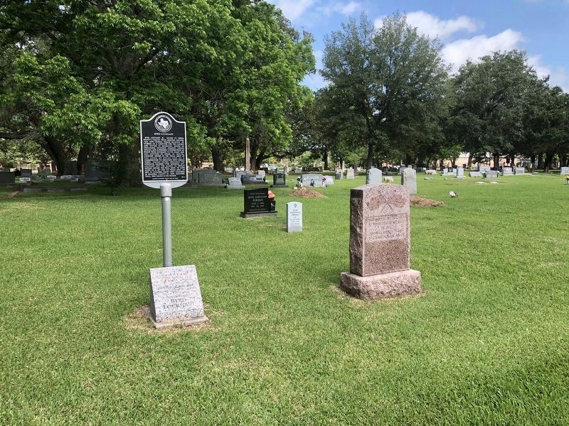
Near East Jackson Street south of South 16th Street, on the right when traveling east.
Faithful soldier, Texas War for Independence. He was in unit of Capt. Jacob Eberly, detailed by Gen. Sam Houston to guard Bell's Landing (East Columbia) until civilians could escape in front of Santa Anna's army. He and 15 others then hurried to . . . — — Map (db m173011) HM
Near East Jackson Street east of South 16th Street, on the right when traveling east.
Born in Georgia September 24, 1798 Died July 10, 1837 Delegate to the Consultation, 1835 Signer of the Texas Declaration of Independence, 1836 — — Map (db m173097) HM
On East Brazos Avenue (State Highway 35) at North 17th Street, on the right when traveling west on East Brazos Avenue.
A tribute to the fidelity of pioneer Masons whose outstanding
leadership laid the cornerstone of the Republic of Texas. These
great Masons gave us our freedom, our heritage, our liberty, and
strengthened our faith in God. No men could have . . . — — Map (db m164584) HM
Near East Jackson Street east of South 16th Street, on the right when traveling east.
Came to Texas in January, 1836 Led out to be shot with Fannin's men, March 27, 1836, but escaped Fought at San Jacinto in Captain William H. Patton's company Died in Columbia, December 27, 1836 — — Map (db m173082) HM
Near site of The First Capitol of the Republic of Texas
About 1833 Leman Kelsy built a story-and-a-half clapboard structure near this location. When Columbia became capital of the Republic of Texas in 1836, the building was one of two . . . — — Map (db m43057) HM
On E. Jackson St., 0.8 miles east of S. 17th, on the right when traveling east.
Site given by Josiah H. Bell family out of their grant, the first deeded to one of "Old 300" in colony of Stephen F. Austin. Has graves of many heroes of Texas Revolution of 1836.
Deeded in 1852 to Bethel Presbyterian Church. Since 1933 managed . . . — — Map (db m172990) HM
On Farm to Market Road 1301 at County Route 376, on the right when traveling south on Road 1301.
Zeno Phillips, one of Stephen F. Austin's "Old 300" colonists, acquired land here in 1829. Zeno and his brothers John Clark, Sidney, and James Ray (J.R.) Phillips, served in the Republic of Texas Army. The cemetery began with the burial of Zeno and . . . — — Map (db m96305) HM
On East Brazos Avenue (U.S. 35) at North 17th Street, on the right when traveling west on East Brazos Avenue.
The newly formed Republic of Texas faced many problems. With
no credit and no resources other than land, the republic had a
debt of 1.25 million dollars. Hostile Indians plagued the population. The new government appropriated $20,000 to . . . — — Map (db m164574) HM
On East Brazos Avenue (U.S. 35) at North 17th Street, on the right when traveling west on East Brazos Avenue.
In the August 9, 1836 issue of the Telegraph and Texas Register,
Stephen F. Austin, Henry Smith and Branch T. Archer were listed
as candidates for the office of president of the new republic.
Archer later withdrew and threw his support to . . . — — Map (db m164572) HM
On E. Brazos Avenue (State Highway 35), on the right when traveling west.
Following the signing of the Texas Declaration of Independence on
March 2, 1836 at Washington on the Brazos, an ad interim government was formed. Headed by President David G. Burnet and Vice
President Lorenzo de Zavala, this government . . . — — Map (db m164571) HM
On East Brazos Avenue (State Highway 35) west of North 16th Street, on the right when traveling west.
The Brazos River, whose formal name Brazos de Dios is Spanish for Arms of
God, is the longest river in Texas. As it wound its way through Texas, it witnessed the coming of the first Anglo settlers, the signing of the Texas Declaration of . . . — — Map (db m164587) HM
On East Brazos Avenue (State Highway 35) west of North 16th Street, on the right when traveling west.
A triple trunked live oak tree stood near the buildings which
housed the House of Representatives and Senate. Tradition holds
that the Texas Declaration of Independence was first read publicly
under this tree causing it to also be called . . . — — Map (db m164589) HM
On East Brazos Avenue at North 17th Street, on the right when traveling west on East Brazos Avenue.
In January of 1836, General Antonio Lopez de Santa Anna began gathering
troops on the Rio Grande River to begin his attempted take-over of Texas. Texans living in the southern parts of Texas began fleeing eastward to escape the invading Mexican . . . — — Map (db m164568) HM
Near North Texas Avenue at North Washington Avenue.
Isom Palmer, whose name has various spellings, was born to Martin and Sarah (Hardwick) Parmer. In 1825, the Palmer (Parmer) family moved to Texas, settling near Nacogdoches the next year, and participated in the 1826 Fredonian Rebellion. Palmer . . . — — Map (db m170312) HM
Near Boonville Road, 0.1 miles east of Austins Colony Parkway.
Eli Seale 1793-1857
Elias (Eli) Seale was born in North Carolina in 1793. He served as a fifer in the War of 1812 in Mississippi, and in 1835 moved with his three brothers and his family from Alabama to Texas. He received his Mexican . . . — — Map (db m170484) HM
Near Boonville Road, 0.1 miles east of Austins Colony Parkway.
On November 17, 1835, after Francis Smith convinced the people of Cincinnati, Ohio, to aid the cause of the Texas Revolution, the Ohioans began raising funds to procure two cannons and their attendant equipment for Texas. Since the United States . . . — — Map (db m170471) HM
On Steep Hollow Road at Texas Route 1179 on Steep Hollow Road.
Richardson Perry
Born in Mississippi — 1817
Died at the Alamo — 1836
On October 10, 1835, Perry received this league of land (4428 acres) as one of the Austin Colonists. This was one of the final Mexican land grants approved at San Felipe. The . . . — — Map (db m220452) HM WM
On High Prairie Road, 1.6 miles west of Wellborn Road (Farm to Market Road 2154), on the right when traveling west.
Old Three Hundred Colonist William T. Millican was born in South Carolina about 1780 and came to Texas with his parents and siblings in 1821. They joined Stephen F. Austin's first colony and were granted land in this area on which to make their . . . — — Map (db m179148) HM
On South Broadway Street west of North Fisk Avenue, on the right when traveling west.
Donor of present townsite of Brownwood, Fisk was noted as a soldier, public servant, surveyor and businessman. The son of English parents, he was born in New York. As a boy he was so studious that he voluntarily gave up recess periods to read. In . . . — — Map (db m126061) HM
On West Fox Street east of South Echols Street, on the right when traveling east.
When Mexican Dictator Santa Anna revoked national rights, 30 or more men from this sparsely settled area left to resist his armies: in Grass Fight (Nov. 26, 1835), Siege of Bexar (Dec. 5-9) and other actions. While able men were absent, the foe . . . — — Map (db m201851) HM
Near Farm to Market Road 1363, 0.4 miles east of State Highway 36, on the left when traveling north.
Colonial statesman, Methodist lay leader, pioneer in Burleson County. Came to Texas in 1822 from Kentucky. Had office of surveyor, Austin's Colony, 1823 - 1836; was a military officer in Indian conflicts and also Army of Gen. Sam Houston during . . . — — Map (db m210617) HM
Surrounded by a rock wall, the small pioneer family cemetery just west of this site is located on land that was once part of the William H. Magill homestead. Magill, a veteran of the Battle of San Jacinto, moved his family to Burnet County in . . . — — Map (db m27595) HM
One of "Old 300" of Stephen F. Austin's first colony from Pennsylvania, took part in 1836 War for Texas Independence, he made and lost several stakes.
In 1851 bought a league and labor of Burnet County land, including site of Fort Croghan. . . . — — Map (db m29150) HM
On County Highway 401 at State Highway 71, on the right when traveling north on County Highway 401.
Texas patriot Jesse Burnam (also spelled Burnham), born in Madison County, Kentucky, was the youngest son of seven children. In 1812, Jesse married Temperance Null Baker in Shelbyville, Tennessee. Jesse was a private in the Mounted Volunteers of . . . — — Map (db m139958) HM
On West San Antonio Street (State Highway 142) at South Blanco Street, on the right when traveling east on West San Antonio Street.
At this site once stood the home of Susanna Dickinson Hannig (1814-1883), who came to Texas from Tennessee in 1831 with her husband Almeron Dickinson. He died at the Battle of the Alamo on March 6, 1836. Susanna, with her daughter Angelina, was . . . — — Map (db m195674) HM
On Texas 35 (State Highway 35) 1.2 miles west of Farm to Market Road 1593, on the right when traveling west.
An Early Landing Place of
Supplies for the Interior
Captain Jack Shackelford's
"Red Rovers" of Alabama
Disembarked at This Point
A Town Established Here in 1836
Was Burned by Indians in 1840 — — Map (db m181121) HM
This cemetery served the Hatch family and other members of the former community of Chocolate. Captain Sylvanus Hatch, founder of the settlement, was born in Falmouth, Massachusetts on June 1, 1788. He became a contractor and builder, eventually . . . — — Map (db m207766) HM
Burials in this historic cemetery began in the 1840s, with several mass graves dating from an 1849 cholera epidemic. Pioneer families and their descendants, as well as prominent state, county, and city officials, are also interred in the community . . . — — Map (db m182147) HM
Rafael Morales was a Mexican soldier in Santa Anna's army against General Sam Houston in the Battle of San Jacinto (1836). His father was a soldier in the Mexican War of Independence from Spain in 1821.
Spanish:Rafael Morales . . . — — Map (db m221957) HM
The Port of Matamoros was established in 1824. Commercial cargo, shipped mainly from New Orleans and other U.S. ports, was unloaded at the Port and transported overland to Matamoros, Reynosa, Camargo, Monterrey, and Mier. Mexico maintained a . . . — — Map (db m16542) HM
On Channel View Road at State Park Road 100, on the right when traveling east on Channel View Road. Reported missing.
Named by the Spanish, Brazos Santiago Pass is a narrow passageway extending inward from the sea. The pass lies between Brazos Island and Padre Island. The changing depths of the pass channel kept large vessels from entering, but offered seclusion . . . — — Map (db m166273) HM
On Miller Street (State Highway 61) at Magnolia Avenue South, on the right when traveling west on Miller Street.
In the spring of 1832, Wm. B. Travis, Patrick C. Jack and other American settlers in Texas were unjustly imprisoned by Col. Juan Bradburn, commander of the Mexican garrison at Anahuac. Bradburn's refusal to deliver his prisoners for civil trial . . . — — Map (db m157356) HM
On Unnamed roads within the park at Unnamed roads within the park, on the right when traveling west on Unnamed roads within the park.
Known as Perry's Point until 1825, Anahuac was a port of entry for early Texas colonists. In 1830 the Mexican government established a military post here to collect customs duties and to enforce the law of April 6, 1830, which curtailed further . . . — — Map (db m117180) HM
On this site first known as Perry's Point, a fort, established in 1830 by General Manuel Mier y Terán for the purpose of halting Anglo-American colonization was named Anahuac, the Aztec name of Mexico City, then the capital of Texas. The . . . — — Map (db m117183) HM
Near Interstate 10 at milepost 815, on the right when traveling east.
A veteran of the War of 1812, James Taylor White (b.1789) migrated to this area from Louisiana in 1828. As a rancher, he developed one of the largest herds of Longhorn cattle in southeast Texas.
On White's ranch in June 1832, area colonists . . . — — Map (db m121266) HM
On Unnamed roads within the park at Unnamed roads within the park, on the right when traveling east on Unnamed roads within the park.
Adventurer from Kentucky who first came to Texas in 1817 with an expedition seeking to expel Spain from North America. Bradburn served in the Army of the Republic of Mexico in the 1820s, and in 1830 was sent to establish a military post at the mouth . . . — — Map (db m117179) HM
On Unnamed roads within the park at Unnamed roads within the park, on the right when traveling west on Unnamed roads within the park.
Crippled by disease at 15, with a leg permanently bent at the knee, wore a pegleg which like his two natural legs was covered with his trousers. Hence he was nicknamed "Three-Legged Willie."
Settled in Texas in 1827 to practice law. Here at . . . — — Map (db m117181) HM
On White Park Road, 0.3 miles west of Texas Highway 61, on the right when traveling west.
Drafted and signed at Turtle Bayou on June 13, 1832; this first formal protest of Texas colonists against Mexican tyranny formed an early step in events that led eventually to the Texas Revolution of 1836.
The settlers were protesting recent . . . — — Map (db m60341) HM
On Unnamed roads within the park at Unnamed roads within the park, on the right when traveling east on Unnamed roads within the park.
Co-commander with James Bowie, siege of the Alamo. Born in South Carolina; moved with family in 1818 to Alabama, where at 19 he was admitted to the bar; came to Texas 1831. In Anahuac he joined William H. Jack and others resisting tyranny of . . . — — Map (db m117182) HM
On Kickapoo Street (County Highway 3305) at County Highway 3331 on Kickapoo Street.
A blacksmith by trade, Kentuckian Jackson Smith came to Texas in the 1830s and participated in the war for independence. He later visited this area as a Republic of Texas scout. In the 1840s, he settled southwest of here in the Gum Creek community. . . . — — Map (db m232778) HM
On U.S. 175 near County Route 3405, on the left when traveling west.
Originally an Indian trail. Used in 1765 by the Spanish priest Calahorra on an Indian peace mission. Gained importance, 1820s, for use in hauling salt from Neches Saline to Nacogdoches.
Survivors of the Killough family massacre of 1838 fled via . . . — — Map (db m81748) HM
On U.S. 69 at County Road 2626, on the right when traveling north on U.S. 69.
Joseph H. Bowman, a veteran of the Texas War for Independence from Mexico, offered one hundred acres of land to the Rev. W.D. Lewis to come to Mt. Hope community and establish a Methodist church and cemetery. The Rev. Mr. Lewis agreed and the . . . — — Map (db m28138) HM
Born in Kentucky. Came to Texas in 1832. Commanded company of volunteers at Siege of Bexar (San Antonio), Dec. 5-10, 1835. Delegate to constitutional convention where he signed Texas Declaration of Independence, 1836. Aide-de-Camp to Gen. Sam . . . — — Map (db m94449) HM
On Business State Highway 78, on the right when traveling north.
Born in Wilson County, Tennessee, George Washington Smith came to Texas in 1834 with his wife Elizabeth Briggs. He fought in the Texas War for Independence (1835-36) as a private in Capt. Clendennin’s Company 1st Regiment Artillery. In the Mexican . . . — — Map (db m163227) HM
Texas Historic Cemetery
Needwood Church and School - 1890
✟ ✟ Needwood Cemetery - 1894 ✟ ✟
Needwood Cemetery Association - 1992
Founded by Bailey Stinson & Irma Morgan
O God, above all creations Thy . . . — — Map (db m152793) HM WM
On Bowie Street north of Washington Street, on the left when traveling north.
Texas struggle for independence from Mexico peaked with the fall of the Alamo in March 1836. As the Mexican Army swept across Texas, Sam Houston ordered the evacuation of colonists. He ordered the burning of cabins and buildings to avoid giving aid . . . — — Map (db m244144) HM
Benjamin Beason, one of Stephen F. Austin's original 300 colonists, settled by a widely used Colorado River crossing near here in 1822. He and his wife Elizabeth proceeded to build a large home (also used as an inn) and established a gristmill, . . . — — Map (db m201791) HM
Near Walnut Street (U.S. 90) 0.2 miles west of Old U.S. 90, on the left when traveling west.
Site of the camp,
March 19-26, 1836
of the Texas Army
under General Sam Houston,
who directed the retreat
from Gonzales to the San Jacinto — — Map (db m76821) HM
United States Consul to the colonies in Texas, 1829-1832. A native of Philadelphia, Pa., he later joined Austin's Colony serving in campaigns leading to Texas War for Independence.
In 1837, with W.B. DeWees, he platted the town of Columbus.
In . . . — — Map (db m244149) HM
On Washington Street at Bowie Street, on the right when traveling west on Washington Street.
Dilue Rose was a pioneer and memoirist. Her family arrived in Texas in April 1833, and she and her husband, Ira A. Harris, moved to Columbus in 1845. As a child, Dilue Rose was acquainted with the leaders of the Texas Revolution and of the Republic . . . — — Map (db m244089) HM
On Veterans Drive (Old U.S. 90) at Milentz Street, on the right when traveling east on Veterans Drive (Old U.S. 90).
Site of the Camp, March 20-26, 1836, of one division of General Santa Anna's Army under the command of General Joaquín Ramírez y Sesma. It crossed the Colorado at Atascosita Ford, eight miles below Columbus. — — Map (db m29707) HM
On Bowie Street north of Washington Street, on the left when traveling north.
The migration of Anglo settlers into Spanish Texas began when Moses Austin, father of Stephen F. Austin, received a Spanish land grant to establish a colony in the region. Following Moses' death, Stephen F. Austin continued his father's efforts. In . . . — — Map (db m244131) HM
On Houston Street east of Live Oak Street, on the right when traveling east.
Virginia native William Demetris Lacey (1808-1848) grew up in Kentucky and in 1831 settled in what is now Columbus. He established a tanyard and saddle shop on this site and married Sarah Ann "Sally" Bright in 1832. Elected to several public offices . . . — — Map (db m244038) HM
On Walnut Street (U.S. 90), on the right when traveling east.
William L. Menefee, born ca. 1796 in Knox County, Tennessee, served in the Tennessee Militia in the War of 1812. He studied law and was admitted to the bar sometime prior to 1824 when he moved to Alabama. In 1830 he and his wife Agnes (Sutherland) . . . — — Map (db m130391) HM
On Farm to Market Road 109 at Farm to Market Road 1291, on the right when traveling north on Highway 109.
First German settlement in Colorado County • Founded in 1837 by William Frels who immigrated to Texas in 1834 and fought for independence, 1835-1836 • Proposed site of Hermann University, first institution of higher learning sponsored by . . . — — Map (db m237458) HM
On McElroy Lane, 1 mile north of San Felipe Road (County Highway 31), on the right when traveling north.
Pioneer, farmer, soldier, and county official Mike Muckleroy was born in Franklin County, Tennessee, and came to Texas in 1840. An early and long-time resident of Colorado County, he came to be affectionately known throughout the area as "Uncle . . . — — Map (db m176234) HM
Near Odd Fellows Cemetery Road, 0.2 miles south of U.S. 90.
Born in New York. Moved to Texas 1829. Settled in Stephen F. Austin's second colony in 1832. In Texas Revolution, fought at Battle of San Jacinto in 1836. Helped lay out town of Houston same year. At 24 became first Commissioner of Texas General . . . — — Map (db m163183) HM
On County Road 208 at County Road 205, on the left when traveling north on County Road 208.
Site of 1820 trading post of Jesse Burnam. His ferry on the Colorado River helped Gen. Sam Houston reach San Jacinto, 1836. To cut off Santa Anna, Houston then burned post and ferry.
Town started in 1850s was named for Osage Orange trees. . . . — — Map (db m61298) HM
On Peace Avenue, 0.1 miles south of East Commerce Street, on the left when traveling south.
Ferdinand Lindheimer arrived in Texas as it was becoming a republic. Later he played important roles in the developing New Braunfels community.
Lindheimer created the town's first botanical garden, served as superintendent of the county school . . . — — Map (db m210029) HM
A member of Stephen F. Austin's Colony, George Washington Gentry came to Texas in 1835 with his father and brother. Settling what is now Washington County, he worked as a farmer and surveyor. He participated in the Texas Revolution, several Indian . . . — — Map (db m158029) HM
On South Main Street (U.S. 83) at Jackson Boulevard, on the right when traveling south on South Main Street.
Texas troops under Sam Houston won independence, as they shouted out "Remember The Alamo" when we tried that here the neighbors complained about the noise.
At this very location on April 12, 1861 absolutely nothing happened. — — Map (db m136348) HM
On Richards Street east of 9th Street, on the right when traveling west.
The Texas Legislature created Cottle County in 1876 and named it for George Washington Cottle, who died defending the Alamo forty years earlier. Stage routes connected early ranches, including the OX, SMS, and Matador, to established towns in . . . — — Map (db m104852) HM
(Inscription on front of monument)
.. Be sure you are right - then go ahead ..
(Inscription on rear of monument)
David Crockett was born in Tennessee on August 17, 1786
Participated in the Creek Indian Campaign 1813-1814 . . . — — Map (db m116599) HM
On Liberty Avenue at Peace Avenue, on the left when traveling south on Liberty Avenue.
Greenwood Cemetery was part of a Republic of Texas grant, called the John Grigsby League, given for service in the Battle of San Jacinto. W. H. Gaston, pioneer Dallas banker, acquired title to the site in 1874, after the noted local legal battle, . . . — — Map (db m72412) HM
On Ripy Road south of Riek Road, on the right when traveling south.
Darius Gregg (1804-70), who came to Texas from Tennessee in 1827, and fought in the Texas War for Independence, accumulated about 20,000 acres in this area in the early 1850s. Gregg, a surveyor and Houston realtor, spent several summers here . . . — — Map (db m193960) HM
On North Shady Shores Lane at Montserrat Road, on the left when traveling north on North Shady Shores Lane.
Reflecting the earliest years of Anglo settlement in this part of north central Texas, the Swisher Cemetery began on land granted to H. H. Swisher for his service in the Texas War for Independence from Mexico. The oldest burial in the cemetery, . . . — — Map (db m183200) HM
On East Broadway Street (U.S. 87) at East Courthouse Street, on the left when traveling west on East Broadway Street.
De Witt County
Included in the colonial grant in 1825 to Green De Witt, Texas empesario ▲ Settled until 1840 largely by Anglo Americans ▲ Created a county of the state of Texas March 24, 1846, its area being taken from Gonzales, . . . — — Map (db m195686) HM
On U.S. 183, 0.1 miles south of Brown Road (County Highway 245), on the right when traveling south.
Pennsylvania native George Washington Davis (1797-1853) brought his family to Texas in 1831. He selected a league of land near present-day Cuero in the Green De Witt Colony and became an active participant in the movement toward Texas . . . — — Map (db m167236) HM
On U.S. 87 at Catholic Church Road (County Highway 138), on the right when traveling north on U.S. 87.
George Lord was born in Essex County, England on April 21, 1816 to Felstead and Anna Siggs Lord. He immigrated to Canada in 1834 and worked there for two years. He then moved to New Orleans and joined other volunteers under a Capt. Lyons to serve . . . — — Map (db m167377) HM
On West Main Street (State Highway 72) at North Eckhardt Street, on the right when traveling west on West Main Street.
Soldiers and builders of Texas. York, born in Kentucky, came to Texas in 1821, was a captain in siege which expelled Mexican Army from Bexar, 1835. Gave site for Yorktown, 1847. Died in an Indian fight won by his men.
Eckhardt came from . . . — — Map (db m174481) HM
On South Seaman Street (Texas Route 6) at West Commerce Street, on the right when traveling south on South Seaman Street.
County seat, Eastland County. Named for William M. Eastland—Texas War for Independence hero who was in Mier Expedition against Mexico, and was executed in "Black Bean" lottery at Rancho Salado in 1842.
Most noted early local people were . . . — — Map (db m105247) HM
On West Knox Street at Glasscock Street on West Knox Street.
Born in Kentucky, February 15, 1795 • Came to Texas in 1822 with Austin's first colony • Died July 2, 1874 His wife Elizabeth Smith Rankin Born January 30, 1802 Died June 1, 1882 — — Map (db m164753) HM
On Couch Street north of North Ward Street, on the left when traveling north.
A soldier in the Army of Texas
in 1836 • Born in Tennessee, Feb-
ruary 2, 1804; died October 15, 1891
His wife
Mary Hardeman
Born in Tennessee, February
12, 1812 • Died February 19, 1857 — — Map (db m117284) HM
Near Water Street, 0.2 miles east of North Main Street (U.S. 77), on the left when traveling east.
Served in the Army of Texas in
1836 • Born in Alabama, September
10, 1810 • Died January 11, 1885
His wife
Isabella Weir
McDaniel
Born in Alabama, March
8, 1818 • Died May 4, 1897 — — Map (db m117283) HM
Near Water Street, 0.2 miles east of North Main Street (U.S. 77), on the left when traveling east.
Soldier in the Texas Army in
1836 • Born in Tennessee June
17, 1808 • Died November 24, 1880
His wife
Stacy Choate Jordan
Born in Tennessee, October 15,
1816 • Died January 27, 1884 — — Map (db m117282) HM
On West Franklin Street west of South College Street, on the right when traveling west.
By birth and education, a Virginian;
through residence, 1813-1825, an Alabaman jurist
In that year, Texas claimed him
—
As president of the Constitutional Convention in 1836
and as a member of the Congress of the young republic,
he . . . — — Map (db m152358) HM
On West Washington Street (Business Highway 377) at North Erath Avenue, on the left when traveling east on West Washington Street.
Protector of the Texas frontier. Hero of San Jacinto. Major in the Confederate Army. Member of the Texas Congress and Legislature. Born in Vienna, Austria January 1, 1813. Died at Waco, Texas May 15, 1891. Erath County was named in his honor. . . . — — Map (db m117456) HM
On North Main Street at West Sam Rayburn Drive, on the left when traveling north on North Main Street.
The first influx of settlers into the area now known as Fannin County began in the early winter of 1836 when Dr. Daniel Rowlett brought ten families up Red River to a site about 16 miles northeast of present day Bonham. Because of the ease of river . . . — — Map (db m234067) HM
In the cause of independence, raised company of 36 riflemen in his native Kentucky, starting for Texas November 1835. City of San Antonio was liberated by time they arrived. Although an officer, Tarleton fought in the ranks in the victory at San . . . — — Map (db m234166) HM
Came to Texas 1836. Caused Fannin County to be created, 1837. Served as congressman, Republic of Texas, 1837-38, 1839-40, 1843-44. Helped (1840) organize Constantine Lodge No. 13, A.F. & A.M., and was its first Worshipful Master. Was most versatile . . . — — Map (db m234167) HM
On East Sam Rayburn Drive (State Highway 56) at North Center Street (Highway 78), on the right when traveling west on East Sam Rayburn Drive.
(panel 1)
Born February 20, 1807 in South Carolina • Studied at South Carolina College 1825-1827
• On the staff of the Governor of South Carolina at the time of the Nullification Controversy 1832 to 1833 • Practiced law at Pendleton, . . . — — Map (db m128658) HM WM
On Market Street West at South Piner Street, on the right when traveling west on Market Street West.
Named for David Crockett (1786-1836), the colorful Tennessee pioneer and congressman who rallied to cause of Texas in her war for independence. Late in 1835, Crockett traveled by riverboat, horseback, and on foot, entering Texas along the Red River . . . — — Map (db m234224) HM
On East Farm Road 955, on the right when traveling east.
Born in South Carolina in about 1787, James
Jeffres Ross was a member of the ""Old Three
Hundred." He arrived in Stephen F. Austin's colony
in late 1822 or early 1823, moving onto the league
granted him near Eagle Lake in Colorado . . . — — Map (db m22753) HM
On North Washington Street at West Main Street, on the right when traveling north on North Washington Street.
Stage station on the Old San Felipe Trail founded by James J. Ross. John Crier, James Cummins - members of Austin's first colony • nearby resided William J. Russell, participant of the Battle of Velasco • Jerome B. Alexander, Fedelie S. . . . — — Map (db m239479) HM
On North Washington Street at West Main Street, on the right when traveling north on North Washington Street.
North Carolina native Phillip Shaver (1814-1875) settled in the Fayette County community of Rutersville c. 1840. Two years later, he joined the Texas Army to defend area settlers from Indians and Mexican soldiers and also received from the Republic . . . — — Map (db m183370) HM
Near Park Drive (State Highway 92 Spur) 0.3 miles west of U.S. 77, on the right when traveling west.
In September 1848, the remains of Texans killed in the 1842 Dawson Massacre and the 1843 “Black Bean Death Lottery” were reburied at this site in a sandstone vault. The Kreische family did its best to care for the grave during their . . . — — Map (db m53218) HM
907 entries matched your criteria. Entries 201 through 300 are listed above. ⊲ Previous 100 — Next 100 ⊳