On South Martin Luther King Jr. Drive at South Calumet Avenue on South Martin Luther King Jr. Drive.
The Platt Luggage Building, originally located at 2301 South Prairie Avenue, was designed by Howard Van Doren Shaw for the publishing company originally owned by H. H. Forsythe. Howard Van Doren Shaw was one of the region's most successful and . . . — — Map (db m69593) HM
On East Cermak Road at South Wabash Avenue, on the right when traveling east on East Cermak Road.
White Castle #16
Lewis E. Russell (with Lloyd W. Ray, construction superintendent for White Castle System of Eating Houses, Inc.), architect
1930
This tiny white glazed-brick building remains the best-surviving example in Chicago of . . . — — Map (db m187703) HM
On South Forrestville Avenue north of 112th Street, on the right when traveling north.
The Arcade (b. 1881-82) was the largest public building in the town of Pullman, serving as its social and commercial heart. Among the first indoor malls, the three-story building reached 90 feet in height and cost $318,000. The Pullman Arcade . . . — — Map (db m194276) HM
On West Kinzie Street near North Dearborn Street, on the right when traveling east.
Built as the headquarters of one of the leading varnish manufacturers in the United States, this building is a rare Chicago example of Dutch Renaissance Revival-style architecture, marked by distinctive stepped gables. It was designed by Henry . . . — — Map (db m234669) HM
On North State Street, on the left when traveling north.
The Norwegian sailing ship
Sleipner
left Bergen, Norway- May 23, 1862
arrived Chicago- August 2, 1862
this ship, carrying 107 passengers and 350 tons of cargo
moored at this location in the Chicago River. The Sleipner
called again in 1863, . . . — — Map (db m134955) HM
On North Clark Street at West Chicago Avenue, on the right when traveling north on North Clark Street.
(Former) Cosmopolitan State Bank
Schmidt, Garden & Martin, architects
1920
This Georgian Revival-style bank combines simplified classical
details with finely-crafted brick masonry and carved limestone.
The bank served the large . . . — — Map (db m180903) HM
On East Chicago Avenue at North Wabash Avenue, on the right when traveling west on East Chicago Avenue.
This rare surviving example of Victorian Gothic design is also one of the city's best late-19th century apartment buildings. Because early luxury apartments were viewed with skepticism, this building was designed to look like a series of four . . . — — Map (db m66612) HM
On East Huron Avenue at North Michigan Avenue, on the left when traveling east on East Huron Avenue.
Allerton Hotel
Murgatroyd & Ogden, architects
1922-24
A rare example of Northern Italian Renaissance
Revival architecture applied to a high-rise
structure and the city's first building to use
a pronounced setback and towers, as . . . — — Map (db m180890) HM
Near East Chicago Avenue west of North Mies Van Der Rohe Way, on the right when traveling west.
Eli Schulman, the renowned restaurateur & creator of Eli's Cheesecake, was a Chicago original. Friend to all Chicagoans, no matter what their status, Eli embodied the determination, the open-armed spirit & the street-smart charm of the city he . . . — — Map (db m232614) HM
On North Streeter Drive at East Illinois Street, on the left when traveling south on North Streeter Drive.
Water Marks mosaic sculptures celebrate something few people know. Chicago owes its greatness to a canal built over 150 years ago.
Generations of French fur traders and American travelers―nation builders―dreamed of . . . — — Map (db m81423) HM
On North Michigan Avenue south of East Pearson Street, on the right when traveling south.
Finely detailed with tapestry brick and carved stone ornament, this Arts & Crafts-influenced facade is an excellent example of the type of designs for which this architectural firm was noted. "Towertown," as the area surrounding the Chicago Water . . . — — Map (db m66729) HM
On North Michigan Avenue, on the right when traveling north.
Tribune Tower
John Mead Howells and
Raymond Hood, architects
1925
This design was the result of an international competition for ‘the most beautiful office building in the world,” held in 1922 by the Chicago Tribune. The . . . — — Map (db m106357) HM
On West Wacker Drive at North LaSalle Street on West Wacker Drive.
On this site about 1834, Gurdon S. Hubbard built Chicago’s first warehouse for storing pork and other pioneer produce. Because of its size and substantial construction early skeptics called the building "Hubbard’s Folly." — — Map (db m47692) HM
On West Adams Street at Franklin Street, on the left when traveling west on West Adams Street.
This terra-cotta-clad office building is a handsome example of the Gothic Revival architectural style. Built on the site of an earlier wholesale warehouse for the Carson, Pirie, Scott & Co. Department Store, the building exemplifies the . . . — — Map (db m236485) HM
On South Michigan Avenue at East 9th Street, on the right when traveling south on South Michigan Avenue.
The Karpen Furniture Company commissioned Marshal and Fox to design a 12-story showroom and company office. The building’s simple ornament contrasted with the exuberant facades of Marshall and Fox’s other work, including the Blackstone and Drake . . . — — Map (db m47884) HM
On North Michigan Avenue at Madison Street, on the right when traveling south on North Michigan Avenue.
Born in New Jersey, Ward grew up in Niles, Michigan. He left school at 14 to work as a laborer and then a clerk. In 1865 he moved to Chicago, where he clerked briefly in the dry goods emporium of Field, Palmer and Leiter. His next job, selling a St. . . . — — Map (db m237359) HM
On South Michigan Avenue at East Congress Parkway, on the right when traveling south on South Michigan Avenue.
The extraordinary engineering talent of Dankmar Adler and the architectural genius of Louis Sullivan created this building to reflect the cultural maturity of Chicago. Combining hotel and office space with a splendid theater, the Auditorium was a . . . — — Map (db m34975) HM
On East Balboa Avenue near South Michigan Avenue, on the right when traveling west.
An outstanding example of Modern French style of Beaux-Arts Classical architecture. As one of the city's earliest luxury hotels, it became the "Hotel of Presidents," serving as host to a dozen U.S. Presidents, including Woodrow Wilson, Franklin D. . . . — — Map (db m94409) HM
On South Wabash Avenue north of Balbo Avenue, on the right when traveling north.
For over a half century, this building housed the headquarters of the Company which has come to be known as Brunswick Corporation. Then called the Brunswick-Balke-Collender Company, it moved here in 1913 after a fire destroyed its previous home. The . . . — — Map (db m237407) HM
On South Wabash Avenue north of East Monroe Street, on the right when traveling south.
The Carson Pirie Scott store ranks as one of the most important structures in early modern architecture. An example of 19th-century modular construction, it also clearly expresses the period's philosophy about an ornamental architecture.
. . . — — Map (db m244990) HM
On South LaSalle Street at West Adams Street, on the right when traveling south on South LaSalle Street.
This massive block-long office building was built to house one of Chicago’s leading banks and exemplifies the large commercial buildings that define the distinctive LaSalle Street “canyon.” Architect Daniel Burnham personally . . . — — Map (db m47757) HM
Named for brothers Ira and James Couch, owners of the Tremont Hotel which stood at Lake & Dearborn streets from 1850 to 1871. Chicago's first brick building, the Tremont hosted President Abraham Lincoln when he visited Chicago. — — Map (db m245008) HM
Named for brothers Ira and James Couch, owners of the Tremont Hotel which stood at Lake & Dearborn streets from 1850 to 1871. Chicago's first brick building, the Tremont hosted President Abraham Lincoln when he visited Chicago. — — Map (db m245011) HM
On South Dearborn Street north of West Congress Parkway, on the right when traveling north. Reported missing.
[Side A]
Dearborn Street showcases some of Chicago’s best architecture, art, and urban design dating from the late 19th century. Great names in architecture include Chicago School architects William LeBaron Jenney, Burnham & Root, and . . . — — Map (db m47885) HM
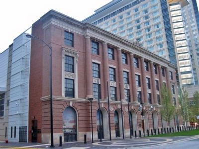
Fairbanks Morse & Company
Building
Has been placed on the
National Register
of Historic Places
By the United States
Department of Interior
Built 1906 — — Map (db m99883) HM
This is one of the defining commercial high-rises of the post-World War II era. The use of stainless steel cladding is an eloquent testimony to the corporation that commissioned the building as its headquarters. The placement of all structural . . . — — Map (db m241094) HM
The Commission on Chicago Architectural Landmarks by authority of the City Council of the City of Chicago has
designated this building as an architectural landmark.
In recognition of the fine open relationship of the building elements to the . . . — — Map (db m241093) HM
On Wabash Avenue at Madison Street on Wabash Avenue.
Since the early 1900s, Jewelers Row has been an important center of jewelry, silver, and watch manufacturing and trade. These distinguished loft buildings and early 20th-century skyscrapers also reflect the development of Chicago commercial . . . — — Map (db m236784) HM
On North Wabash Avenue north of East Washington Street, on the left when traveling south.
Since the early 1900s, Jewelers Row has been an important center of jewelry, silver, and watch manufacturing and trade. These distinguished loft buildings and early 20th-century skyscrapers also reflect the development of Chicago commercial . . . — — Map (db m242103) HM
On South Wabash Avenue south of East Madison Street, on the right when traveling south.
Since the early 1900s, Jewelers Row has been an important center of jewelry, silver, and watch manufacturing and trade. These distinguished loft buildings and early 20th-century skyscrapers also reflect the development of Chicago commercial . . . — — Map (db m245007) HM
On North Franklin Street at West Lake Avenue, on the right when traveling north on North Franklin Street.
Lake-Franklin Group
Burling & Adler, George Edbrooke, architects
1872 - 1875
This rare grouping of post-Fire buildings is the
best reminder of the wholesale district, an area
integral to the city's former role as the world's
largest . . . — — Map (db m181282) HM
On South State Street north of Ida B. Wells Drive.
Acclaimed as one of the most important, early examples of skeletal-frame commercial architecture, this National Historic Landmark was designed by the so-called "father of the skyscaper." It was built by Levi Leiter, a former partner of Marshall . . . — — Map (db m235659) HM
On South Wabash Avenue at East 11th Street, on the right when traveling south on South Wabash Avenue.
The city’s earliest surviving steal-frame building, a type of construction that changed commercial architecture. As one of the first structures clad in terra cotta, it marked an important step in the development of the architectural terra cotta . . . — — Map (db m47781) HM
On North State Street, on the right when traveling north.
Daniel H. Burnham and Charles Atwood, 1892;
D.H.Burnham and Co., 1902, 1906, 1907;
Graham, Burnham & Co., 1914 architects
1892- 1914
The Marshall Field and Company Building is the “grande dame” of
Chicago department store . . . — — Map (db m134434) HM
On North Michigan Avenue north of East South Water Street, on the right when traveling north.
Herbert Bell of the Bell & Zoller Coal Company commissioned this 23-story skyscraper in 1924. When completed, it was one of the first generation skyscrapers that sprang up on North Michigan Avenue as a result of Burnham and Bennett's 1909 Plan of . . . — — Map (db m236848) HM
On North Dearborn Street north of West Randolph Street.
Constructed as headquarters for the Oliver Typewriter Company, this Chicago School-style building clearly expresses its internal steel frame through a grid-like exterior. Classical cast-iron ornament subtly advertises the company's name and product. . . . — — Map (db m242893) HM
On East Monroe Street near South State Street, on the right when traveling east.
This massive hotel, once the world's largest, bears the name of Potter Palmer, one of Chicago's most important businessmen. It is designed in the Classical Revival style with French Neoclassical influences. Interior spaces of note include the . . . — — Map (db m92465) HM
One of Chicago's finest 1920s-era skyscrapers, this building exemplifies the importance of the City's pioneering 1923 zoning ordinance, which encouraged Chicago's distinctive tower-embellished skyline. Designed by one of the City's leading . . . — — Map (db m242105) HM
On South LaSalle Street at West Adams Street, on the left when traveling south on South LaSalle Street.
Its powerful exterior softened by John Root’s lively ornament, the Rookery typifies the 1880s' lingering picturesque attitude toward commercial architecture. A transitional structure in the evolution of modern architecture, it employs both . . . — — Map (db m47758) HM
On South Dearborn Street at West Polk Street, on the left when traveling north on South Dearborn Street.
Attributed to famed architect William Le Baron Jenney, the Rowe Building, a printing arts factory built in 1892, typifies the late nineteenth century Romanesque Revival style.
Renovated in 1980, the Rowe Building is a distinguished member of . . . — — Map (db m47780) HM
On Upper Wacker Drive at West Lake Drive, in the median on Upper Wacker Drive.
The Sauganash Hotel was built
in 1831 on what is now the south
east corner of Lake Street and
Wacker Drive. It was Chicago's
first hotel and it soon became the
social center of town.
In 1833, prominent local citizens
met in the Sauganash . . . — — Map (db m183335) HM
On this site stood the Sauganash Hotel, built in 1831 by pioneer Mark Beaubien, which was location of the frontier town’s first village board election in 1833. The Wigwam, an assembly hall built in 1860 (destroyed c. 1867) on the site of the hotel, . . . — — Map (db m47725) HM
On West Wacker Drive at North State Steet on West Wacker Drive.
This was Chicago’s main business street in 1834, connecting the village with Fort Dearborn. Years before this also was the site of a trading post with the Indians.
Erected by
Chicago’s Charter Jubilee
Authenticated by Chicago Historical . . . — — Map (db m47691) HM
On South State Street south of West Jackson Boulevard, on the right when traveling south.
(side 1)
Chicago’s Great Street
There is only one State Street. Widely celebrated in song, “That Great Street” has been known since the 1870s for its concentration of premier department stores and world-class . . . — — Map (db m81432) HM
On State Street south of Adams Street, on the right when traveling south.
[side 1]
Chicago’s Great Street
There is only one State Street. Widely celebrated in song, “That Great Street” has been known since the 1870s for its concentration of premier department stores and world-class architecture. . . . — — Map (db m235745) HM
On West Jackson Boulevard near South LaSalle Street, on the right when traveling east.
These two statues, one symbolizing agriculture and the other industry, once stood over the main entrance of the Board of Trade Building built in 1885. The statues greeted commodity traders and the public for 45 years. Thought lost forever when the . . . — — Map (db m47760) HM
On East Jackson Blvd. (U.S. 66) at South State Street, on the right when traveling east on East Jackson Blvd..
Built in 1912 as the Rothschild Building
Holabird and Roche – architect
Renamed the Goldblatt Building in 1936
Placed on the Nation Register of Historic Places in 1989
Rededicated by DePaul University September 14, 1993
Richard . . . — — Map (db m134433) HM
On South Dearborn Street north of West Polk Street, on the right when traveling north.
Built in 1883, the Donohue Building was the first large printing factory in historic Printing House Row. The Annex was added in 1913. The Donohue Buildings served until 1971 as the headquarters of the M.A. Donohue Publishing Company, a well known . . . — — Map (db m47779) HM
On East Madison Street at South Wabash Avenue, on the right when traveling east on East Madison Street.
This distinctive structure combines the structurally expressive character of the Chicago School with the decorative appearance of traditional masonry architecture. It was designed by Frederick P. Dinkelberg, an associate of one of the nation’s . . . — — Map (db m223813) HM
On Center Avenue, on the right when traveling north.
In memory of
Allan Pinkerton,
born in Glascow, Scotland,
August 25th 1819.
Died in Chicago, Illinois,
July 1st 1884.
Aged 65 years.
A friend to honesty
and a foe to crime,
devoting himself for a generation to the prevention . . . — — Map (db m61986) HM
On Halsted Street, 0 miles north of Adams Street, on the right.
Mr. Walgreen purchased his first store in June 1901 on the South Side of Chicago. By the time of his death in 1939, he had built the largest drugstore chain in America—493 stores. Customer service and innovation were key to his success. . . . — — Map (db m133777) HM
Ray A. Kroc, founder of McDonald's Corporation, opened his first McDonald's franchise (the ninth McDonald's drive-in in the U.S.) on this site April 15, 1955.
In memory of his wisdom and spirt, McDonald's Corporation dedicates this site to Ray A. . . . — — Map (db m78319) HM
The residence of Charles Gates Dawes
1865 - 1951
Soldier · Statesman · Diplomat · Banker
Vice President of the United States
Given by him to Northwestern University
with the hope that it might become the
home of the Evanston Historical . . . — — Map (db m139208) HM
On Madison Street east of Hannah Avenue, on the right when traveling east.
This plaque
is dedicated, by
the Forest Park Chamber
of Commerce
to the memory of
Howard F. Sammon,
founder, president, and chairman
of the
Forest Park National Bank,
for his service to the community
and his business . . . — — Map (db m235840) HM
Near 47th Street (Local Route 43) west of Harlem Avenue (Illinois Route 43), on the right when traveling west. Reported unreadable.
This is the sight of the trading post established and operated by Bernardus and David Laughton, fur traders in 1828. Laughton’s Ford on the Des Plaines lies directly west. — — Map (db m230025) HM
On 216th Street, 0.1 miles east of Locust Street, on the right when traveling east.
Transportation has always played a vital role in the growth of Matteson, which sits at the crossroads of America's first transcontinental road, The Lincoln Highway, and the Illinois Central Railroad. The Mahler family was instrumental in bringing . . . — — Map (db m172983) HM
George Gabel opened an Indian trading post on this site in 1847. In 1856 he sold the property to John Dilg who had arrived in the Chicago area in 1850 and settled on Waukegan Road in 1854. Dilg and his wife, Maria Magdalena Gabel Dilg operated . . . — — Map (db m94518) HM
On Lake Street at Maple Avenue, on the right when traveling east on Lake Street.
On this site in 1835, Joseph Kettlestrings and his
wife, Betty, first settlers of Oak Park, built their
cabin amid the oaks on "the only dry land between
Chicago and the Aux Plaines.” It later became an inn
called The Oak Ridge House, and was . . . — — Map (db m188769) HM
On Scottswood Road at Coonley Road, on the left when traveling east on Scottswood Road.
Avery Coonley House
has been designated a
Registered National
Historic Landmark
Under the provisions of the
Historic Sites Act of August 21, 1935
this site possesses exceptional value
in commemorating or illustrating
the history . . . — — Map (db m242943) HM
Portions of the Lincoln Highway were first established by identifying existing roads to be paved. The Sauk Trail from the eastern Illinois border westbound through Sauk Village was designated as a section of the original route, including the . . . — — Map (db m204975) HM
On South Main Street at East Grand Prairie Street, on the right when traveling north on South Main Street.
On this block Mary Ann (Elwell) Gogin operated a General Merchandise Store in the late nineteenth century.
One of the first women in Illinois to own and manage her own store. Mrs. Gogin was affectionately known as "Auntie" to the residents of . . . — — Map (db m23315) HM
On South Lincoln Street north of East Lamotte Street, on the left when traveling north.
Here stood the Dubois Tavern. Jesse K. Dubois, a close friend of Abraham Lincoln, was an official in the United States Land Office in Palestine from 1849-1853 and later became the Auditor of Public Accounts for Illinois. His son, Fred T. Dubois, . . . — — Map (db m23309) HM
On East Grand Prairie Street at South Lincoln Street, on the left when traveling east on East Grand Prairie Street.
Two early residents of Palestine, John Houston and Francis Dickson, purchased this lot as the site for a combination dwelling and store about 1818.
By 1820 their stock of merchandise provided nearby settlers with goods which they previously had . . . — — Map (db m23313) HM
On Illinois Route 33 north of Vincennes Ave., on the left when traveling north.
In this area Joseph Kitchell who settled here in 1817 erected a Grist Mill and Distillery which eliminated the trip to Shakertown, Indiana where the farmers had previously taken their grain.
Horses were used for power, grain was taken in pay, . . . — — Map (db m23307) HM
On Illinois Route 33 at North Highway Street, on the right when traveling west on State Route 33.
This area reminded Frenchman John LaMotte of the land of milk and honey, Palestine. While a member of the LaSalle exploring party, he became separated from the group, traveled down the Wabash River, and first gazed upon the region in 1678. Other . . . — — Map (db m23328) HM
On South Main Street at East Grand Prairie Street, on the left when traveling north on South Main Street.
The Fife Opera House, located on the second floor of the Fife Hardware Store, was built by David Fife. It operated from 1901-1912.
It seated 700 people on red leather seats, had electric fans and was heated with a coal furnace. There were five . . . — — Map (db m23314) HM
On East 800th Avenue west of North 600th Street, on the right when traveling east.
During the early part of the Winter of 1906, DeWitte T. Finley made a location on the Shire farm, about six miles southwest of Robinson, and successfully drilled in the Shire No. 1. It was drilled to a depth of about one thousand feet, and . . . — — Map (db m229776) HM
Near West Lincoln Highway (Illinois Route 38) east of West Locust Street, on the left when traveling east.
This house, built in 1861, was the home of Joseph Glidden, who in 1873 invented barbed wire fencing. With Phineas W. Vaughn he perfected a machine to manufacture it. DeKalb was the home of Isaac L. Ellwood and Jacob Haish, also manufacturers of . . . — — Map (db m230891) HM
Near Sycamore Road (Illinois Route 23) 0.1 miles north of Gateway Drive, on the right when traveling north.
DeKalb's roots date to 1912 when a group of farmers and bankers formed the DeKalb County Soil Improvement Association to improve area farming. In 1917, an offshoot was formed, the DeKalb County Agricultural Association, with a focus on quality seed. . . . — — Map (db m230905) HM
On Roberts Lane south of Roberts Circle, on the right when traveling south.
Success in developing and commercializing hybrid seed corn in the 1930s and early 1940s prompted DeKalb Agricultural Association in 1944 to see if the principles of hybridization could be applied to the breeding of poultry. Association President Tom . . . — — Map (db m230904) HM
On Oak Street west of North 4th Street, on the right when traveling west.
Known for his inventive genius, eccentric personality, and generous philanthropy, Jacob Haish is perhaps most remembered as an inventor of barbed wire. Born in Germany, he immigrated to this country in 1832 and came to DeKalb County in the 1840s.
. . . — — Map (db m230903) HM
On North 4th Street north of Lincoln Highway (Illinois Route 38), on the right when traveling north.
The DeKalb® brand winged ear logo is perhaps one of the most widely-recognized agricultural trademarks in the world. Over the years it has undergone many design enhancements from the original concept. But the same iconic image of a flying ear of . . . — — Map (db m230901) HM
Near Aberdeen Court, 0.1 miles south of Bethany Road, on the right when traveling south.
DeKalb Swine Breeders grew from the shared vision of two companies, Lubbock Swine Breeders Inc. (LSB) of Lubbock, Texas, and DeKalb AgResearch, Inc. (DeKalb) of DeKalb, Illinois, that synergistically combined to transform agriculture. LSB began . . . — — Map (db m230908) HM
On South Center Street north of Adams Street, on the left when traveling south.
Barnett Tavern, owned and operated by Alvin and Rebecca Barnett, stood at 200 South Center Street. The two-story home was a stopping-place for weary travelers, circuit lawyers, and judges journeying across the Illinois prairie. When in Clinton, . . . — — Map (db m24236) HM
On North Center Street at Washington Street, on the left when traveling north on North Center Street.
During his twenty years on the Eighth Judicial Circuit, Abraham Lincoln tried numerous cases in the DeWitt County courthouses, including a slander case involving William Dungey. Dungey, “a dark skinned man of Portuguese descent,” . . . — — Map (db m24237) HM
On Curtiss Street at Main Street, on the left when traveling east on Curtiss Street.
The Farmer's and Merchant's Bank Building was built in 1892 for the first bank in Downers Grove. The bank was organized on May 10, 1892. The officers of the bank included Charles Curtiss, President, W.A. Tope, M.D., Vice President, and W.H. Edwards, . . . — — Map (db m60037) HM
On Geneva Road at Main Street, on the right when traveling east on Geneva Road.
Moses Stacy, soldier in the War of 1812, arrived here in 1835. This inn, built in 1846 and his second home, was a halfway stop between Chicago and the Fox River Valley and a probable stage stop for Rockford-Galena coaches. For many years the . . . — — Map (db m97573) HM
On South Webster Street at Aurora Avenue on South Webster Street.
Naperville's Horse Market Days drew farmers and dealers from all over to haggle and show off their horses.
Monthly horse sales in front of the Pre-Emption House began in 1885. Dealers hired boys to exercise the animals and take them to the . . . — — Map (db m246563) HM
On South Villa Avenue at Ovaltine Court, on the right when traveling south on South Villa Avenue.
This arched gateway, located in Villa Park, Illinois, marks the beginning of the Great Western Trail that extends for 12 miles through DuPage County. The trail was constructed on an abandoned spur of the Chicago Great Western Railway. The spur, . . . — — Map (db m244829) HM
On East Central Boulevard west of South Villa Avenue, on the left when traveling west.
In 2004, the Villa Historic District was awarded a Historic Landmark plaque by the Villa Park Historic Preservation Commission to recognize its significance to the Village of Villa Park. These buildings represent such an important part of . . . — — Map (db m244870) HM
On North Frontage Road south of S Quincy Road, on the right when traveling east.
The Chicken Basket was established in 1946 born out of a gas station next door that sold fried chicken. It was a Blue Bird bus stop as well as a restaurant and used to have ice skaters on the roof to attract Route 66 travelers. It became Dell . . . — — Map (db m157104) HM
On North Frontage Road south of South Quincy Street, on the right when traveling east.
Most businesses on Route 66 began as combinations of gas stations, garages, and lunch counters. At the Chicken Basket, tasty food won out over gasoline sales. Throughout the 1940s and 50s, hungry travelers flocked to the popular restaurant. But in . . . — — Map (db m157100) HM
On Illinois Route 1 south of Grapevine Road, on the left when traveling south.
One of the original Milestones which marked the Trail from Vincennes to Chicago.
This stone was No. 97 which designated the number of miles from Vincennes. — — Map (db m11658) HM
On East Court Street east of Central Avenue, on the left when traveling east.
Plaque One
These Millstones long in the Service
of our Pioneers dedicated to their memory
by the Edgar County Historical Society
1817 - 1927
Plaque Two
From the Lewis Jones Farm near Nevins
presented to
Edgar . . . — — Map (db m23457) HM
On East Court Street east of South Main Street, on the right when traveling east.
This property has been
placed on the
National Register
of Historic Places
by the United States
Department of the Interior
Circa 1924 — — Map (db m226117) HM
721 entries matched your criteria. Entries 101 through 200 are listed above. ⊲ Previous 100 — Next 100 ⊳