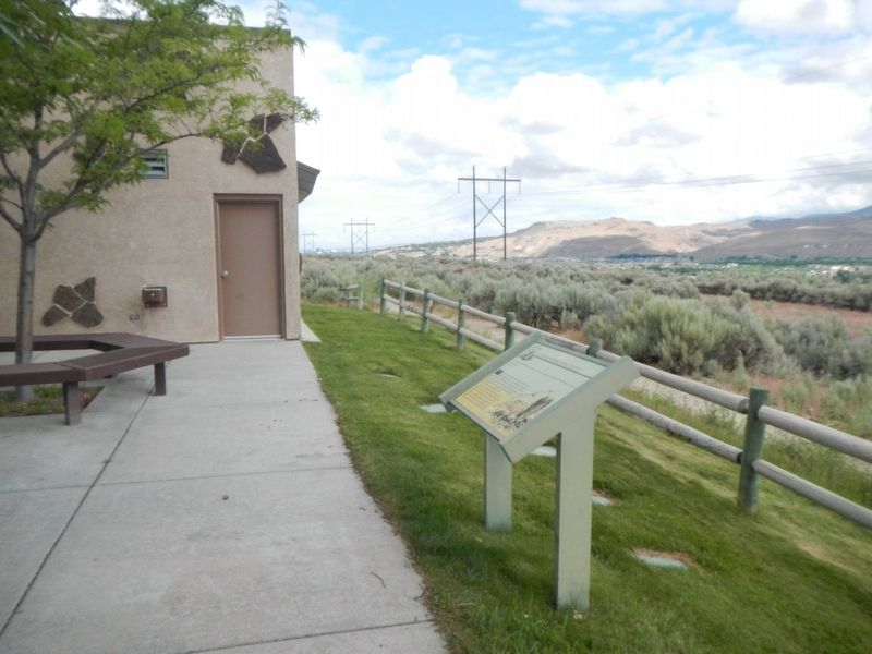
"… we found a gap in the bluffs of Boise valley, where we turned down and succeeded in reaching the valley in safety, although our road was very steep and stony, and long…" -- P.V. Crawford, 1851
Gutzon Borglum, Sculptor of Mount Rushmore
Born: St. Charles, Idaho 1867
Died: Chicago, Illinois 1941
Copy executed by Irene Deely of Boise, Idaho 2009
"I have tried to give to posterity, in a true, unstudied picture, a glimpse of . . . — — Map (db m32232) HM
President Abraham Lincoln created Idaho Territory, appointed its first officers and judges and addressed Congress about Idaho in 1863 and 1864. He considered Idaho issues in the White House on the afternoon that he was shot and invited the former . . . — — Map (db m126722) HM
U.S. commercial airline service began with a Varney Airlines flight from Pasco to Boise which landed here on April 6, 1926. Army planes had delivered airmail before that time.
After Varney Airlines was merged with newer companies to . . . — — Map (db m22734) HM
The play was intense and furious: men smacking a leather-covered ball with their hands, or whipping their paddles, or palas, through the air. The sport, pelota, was brought to Idaho by early Basque immigrants. Juan and Juana Anduiza . . . — — Map (db m119131) HM
This unique building was built for Juan Cruz Anduiza in 1912 as a boarding house for Basque sheepherders who wintered in Boise. The rooms were across the front and down the side of the building and the kitchen, dining room, etc. were in the . . . — — Map (db m119133) HM
Higher than any other dam from 1915 until 1934, Arrowrock Dam still is an essential part of Boise Valley's irrigation system.
Located six miles upstream from here, Arrowrock is 350 feet high and 1,150 feet wide. Built at a cost of $4,725,000 . . . — — Map (db m22597) HM
The clinking of glasses, the clang of silverware, good conversation and enjoyable times have long been a part of this corner. Food and drink are especially important to the Basques, drawing people together in this highly social culture. . . . — — Map (db m119127) HM
Idaho has a large Basque community that preserves it's ancient European traditions in a new land of opportunity. Coming here originally to herd sheep on mountain and desert ranges, they shifted into other occupations as quickly as possible, making . . . — — Map (db m31680) HM
Far from their homeland, the temperate, verdant, Euskadi, away from their lively communal life of feast days and dancing, of pelota games and good wind, Basques in Idaho found themselves in an arid land where few spoke the native tongue. Many . . . — — Map (db m119130) HM
In 1863 and 1864, overland packers hauling supplies from Salt Lake City to Idaho City crossed here and took a direct route northward to More's Creek.
They cut a steep grade from the Oregon Trail down to Beaver Dick's Ferry, which served . . . — — Map (db m22641) HM
In 1903, Boise High School opened to students in an elaborate, red brick Victorian building. As the city grew, more space was needed and a new building was designed by the firm of Tourtellotte and Hummel. In order to minimize disruption to students, . . . — — Map (db m111328) HM
Expanding from a two-year community college (1932-1965) to a campus with a graduate program, Boise State was designated as a university in 1974.
Originating as an Episcopalian academy founded in 1892, this institution was located a mile north of . . . — — Map (db m22735) HM
Emigrants on the Oregon Trail passed through Boise Valley beginning in the 1840’s. After Boise was founded in the summer of 1863, wagon trains came down off the bench to the south and forded the Boise River east of town. From then on, Boise’s Main . . . — — Map (db m267168) HM
From this old Indian trail later known as the Old Oregon Trail Captain B,L,E, Bonnevilles partner on first sighting the river May 1833 exclaimed - Les Bois Les Bois Voyes Les Bois meaning The Woods The Woods See The Woods
Capt Bonneville . . . — — Map (db m71837) HM
From the high ridge above the Boise River 5 miles southwest of here, westward-bound travelers got their first view of the Boise Valley. In 1811, Wilson Price Hunt and the Overland Astorians' party were the first white sojourners to enjoy the scene. . . . — — Map (db m119002) HM
For years, the Gymnasium (later named the Kinesiology Building) hosted sporting events, university gatherings and big-name concerts like The Beach Boys. The first basketball game played in the building was a win over the College of Southern Idaho in . . . — — Map (db m266691) HM
There was no blue turf in Bronco Stadium when it opened in 1970, but that didn't hold back the Broncos— the football team won the NCAA Division I-AA national championship in 1980. College football’s only blue artificial turf was installed in 1986. — — Map (db m266687) HM
Bonneville Point
According to tradition, a hunting party led by the explorer Captain Benjamin Bonneville reached this promontory in 1833. They saw the lush river valley below and exclaimed in French, “Les bois; les bois; vouyez . . . — — Map (db m71835) HM
Many residents eagerly anticipated construction of the first Broadway Bridge. The Idaho Statesman declared in July 1891 that “It will be a Dandy.” The bridge, touted as one of the finest bridges of its kind in the Pacific Northwest, opened in . . . — — Map (db m266596) HM
The design for the original Broadway Bridge included room for streetcar tracks, but several years passed before engineers incorporated them into the structure. The first streetcar traveled across the bridge on December 25, 1905. The “South Boise . . . — — Map (db m266600) HM
The Cyrus Jacobs home, built in 1864, is the oldest surviving brick dwelling in Boise. Jacobs, a prominent merchant and mayor of Boise, lived here for almost 40 years. Beginning in 1910, it became the residence of Basque families - first, the . . . — — Map (db m119186) HM
Julia Davis Park was donated to the City of Bosie by the area's first homesteader, Thomas Jefferson Davis. He arrived in Boise in the spring of 1863, and his claim was the first to be filed in Idaho Territory. The claim was for 320 acres, most of . . . — — Map (db m125827) HM
In the late 1800s, Idaho Territory needed to attract homesteaders to farm the Boise Valley. At the time, the area was dry sagebrush desert. A young engineer, Arthur Foote, designed a great canal system that was to allow the Boise River to . . . — — Map (db m119027) HM
Diversion Dam was completed in 1909 to lift water into an already constructed New York canal system, greatly expanding its irrigated farmlands.
After a quarter century of failure to dig a large canal above Diversion Dam, United States Reclamation . . . — — Map (db m22586) HM
In 1906, at the age of seventy-five, Ezra Meeker began a journey east from his home in Puyallup, Washington, to retrace the route of the Oregon Trail over which he originally traveled in 1852 with his wife and young son. He traveled the route with . . . — — Map (db m118993) HM
The first computer in Boise City was installed in this building in July, 1957.
The computer was a Remington-Rand UNIVAC 120, owned by the Idaho Highway Department, who occupied this building until August, 1960. The computer contained 800 . . . — — Map (db m266981) HM
Concern for the safety of westward-bound emigrants became more immediate when news of the Utter party's disastrous confrontation with hostile Indians on September 9 and 10, 1860, reached western settlements. Colonel George Wright, commander of . . . — — Map (db m119004) HM
Fort Boise was founded on these grounds by the U.S. Army Cavalry in June 1863. Earlier two different trading posts located closer to the Snake River had carried the same name. Many of the original buildings are still in use. — — Map (db m267460) HM
When in 1899 organized lawlessness challenged the power of Idaho, he upheld the dignity of the state, enforced its authority and restored
law and order within its boundaries, for which he was assassinated in 1905.
“Rugged in body, . . . — — Map (db m128543) HM
Imagine leafy Lombary poplars, dazzling rose bushes, lush gardens, circular walks, stately homes, and huge churning waterwheels along a wide avenue, and you'll get a picture of early days on Grove Street. The profusion of leaves and petals was . . . — — Map (db m119189) HM
The thread of several cultures, wrapped around a mystery, winds its way through this site. Originally, a log cabin stood here, occupied in the early 1860s by a Boise sheriff. Later, a house was built on the site and deeded by the mayor to Dr. . . . — — Map (db m119126) HM
New addition built 1893
Prison Commissioners
William J. McConnell, Gov.
Jas. F. Curtis, Sec. of State
Geo.M. Parsons, Atty. Gen.
Jas. King, Arch’t. — — Map (db m63000)
Westward-bound emigrants entered Idaho after crossing Thomas Fork Valley. They soon encountered the climb and descent of Big Hill, witnessed nature's curiosities at Soda Springs, and discovered willing traders at Fort Hall.
In 1843 wagons . . . — — Map (db m118992) HM
This reproduction of the Liberty Bell was presented to the people of Idaho by direction of The Honorable John W. Snyder Secretary of the Treasury
As the inspirational symbol of the United States Savings Bonds Independence . . . — — Map (db m128542) HM
In 1850, at age seventeen, Jesus Urquides joined the California gold rush to Stockton and the Sierra Nevadas.
In 1860, striking out on his own, he followed the rush to Walla Walla, Lewiston, and The Dalles.
Boise Basin’s 1863 gold rush lured . . . — — Map (db m110696) HM
Legendary mule packer Jesus Urquides was a Boise pioneer and founder of a freighting business located on this site.
Born January 18, 1833 in Sonora, Mexico, Urquides migrated to the California gold fields in 1850 where he worked as a mule packer . . . — — Map (db m110694) HM
After the transcontinental railroad was completed on May 10, 1869, new stage and freight routes were established to connect southwester Idaho with newly established railheads.
Kelton, Utah, soon became the main shipping point for Boise, when John . . . — — Map (db m118996) HM
Soon after the discovery of Gold in Northern Idaho (1862) the City of Boise was founded (1863). Its first people were the U.S. Cavalry, Merchants, Mining and Stockmen. Although a few Mormons from Utah had previously lived in this valley, it was not . . . — — Map (db m125829) HM
(English:)
For centuries, Basques have used the "laiak" to prepare the earth for planting. This photo, from the early 1900s, shows Basque women poised for work.
From its stone base to its seven flying ribbons, the sculpture embraces . . . — — Map (db m119128) HM
Maria Dolores (Lola) Urquides was born to Jesus and Adelaida Urquides on October 8, 1882.
She married Daniel H. Binnard in 1902, but he died suddenly in 1915 and Lola moved back to 115 Main Street to care for her aging father until his death in . . . — — Map (db m110689) HM
More's Creek is named for J. Marion More, leader of the party of miners who founded Idaho City, October 7, 1862.
Like most of Idaho's early miners, he came originally from the South. Unlike most of them, he struck it rich. During the Idaho gold . . . — — Map (db m22595) HM
Along this historic trail, from 1841 to 1861, traveled the greatest land migration in history. Nearly half a million pioneers came to settle America's Northwest. One out of every eight would perish along the way. — — Map (db m125859) HM
Between 1843 and 1869 over 300,000 emigrants fulfilled Americas's Manifest Destiny by voluntarily relocating to Oregon and California. Their nearly 2,000 mile journey along game trails long used by the early Native Americans would become known as . . . — — Map (db m119239) HM
This memorial is dedicated to all the service men & women from Idaho that served in Operation Desert Storm 1991
Including
Capt. Paul R. Eichenlaub 2nd
Capt. Douglas L. Bradt
Sgt. Nels A. Moller
Who made the ultimate sacrifice in . . . — — Map (db m267218) WM
Indians, trappers, and emigrants who came this way before 1900 used a more direct route to get between Boise and Glenns Ferry. Their road still can be seen at Bonneville Point 5 miles from here.
Following close to a line of hills . . . — — Map (db m22181) HM
Placed here by Ezra Meeker on May 9, 1906
Pioneer • Preservationist • Visionary
Ezra Meeker was largely responsible for locating and preserving the Old Oregon Trail. To commemorate the centennial of this monument, a time capsule of . . . — — Map (db m128544) HM
By 1951 Boise Junior College was in need of a building where students and faculty could gather for dances, socializing and informal study sessions. The Student Union later housed the Department of Theatre Arts and the Subal Theatre (named for the . . . — — Map (db m266698) HM
As manager of the Piotrkow Trybunalski Glass Factory, he saved over 700 Jews during the Holocaust while risking his own life. (Poland 1944)
Memoir of Alina Braun Rindler, A Survivor
Donated by the Jewish American Society for Historic . . . — — Map (db m134549) HM
Sacajawea was a Lemhi Shoshoni Indian born near Salmon, Idaho around 1790. She was the only Idaho native, and the only female, to be a member of the famed Lewis and Clark "Corps of Discovery" expedition that opened up the American west. Sacajawea . . . — — Map (db m73205) HM
Wednesday September 15th "Today we traveled up a long hill some 4 miles. Road good, ascent very gradual. When we arrived at the top we got a grand view of the Boise River Valley. It is all filled or covered with dry grass and a few trees . . . — — Map (db m125787) HM
Built in 1967 to accommodate a growing student population, the Student Union was renovated and expanded in 1991 and again at the turn of the century. The building serves as the center for campus life, hosting lectures, meetings, conferences, . . . — — Map (db m266696) HM
A place to call out the name of an old friend, play the card game “mus,” sit down to a meal, or dance to the music of the accordion and the txistu, the melodic Basque flute. All communities need somewhere to meet, and this is one place the . . . — — Map (db m119187) HM
Since opening in 1937, this building has been the center of Boise's art community.
In 1933, with financing from the federal Public Works Administration (PWA), the City of Boise broke ground for construction of the new Boise Gallery . . . — — Map (db m119194) HM
“One of the fine new buildings in Boise,” heralded the Idaho Statesman newspaper in 1935, when the Belaustegui Hotel & Basque Boarding House was constructed by Augustin and Petra Belaustegui. A few years later, part of the hotel . . . — — Map (db m119188) HM
The Canyon House was located across the Boise River from where you are standing. The house was designed and built by Arthur De Wint Foote in 1885, using funds from literary works by his wife, Mary Hallock Foote. As Chief Engineer for the Idaho . . . — — Map (db m119029) HM
Hunt’s party laid the groundwork for future trapping expeditions across the Snake River Plain. Donald Mackenzie, who accompanies Hunt and later joined the British North West Company, returned to establish trade relations with resident Indian bands. . . . — — Map (db m71834) HM
Beaver pelts lured the first Euro-Americans deep into the American West. In 1810, only four years after Lewis and Clark completed their epic journey, John Jacob Astor established the Pacific Fur Company. He soon financed sea and land expeditions . . . — — Map (db m71832) HM
This log cabin is built of native Idaho woods, and each room inside is paneled is a different species.
Originally known as Chateau de Bois. this cabin was erected in 1940 to house the state forester. Built by the Civilian . . . — — Map (db m119193) HM
In June 1863, John O’Farrell cleared his land and built this single-room cabin for his young wife and family on the block across Fort Street to the south. The cabin is made with logs from cottonwood trees, which were abundant along the Boise River. . . . — — Map (db m267155) HM
John A. O’Farrell was born in 1823 in County Tyrone, Ireland. In 1836, he entered Naval School and in 1838 at the age of 15 he began a life as a sailor that would take him to ports all over the world.
In 1843, he arrived in New York City after . . . — — Map (db m267164) HM
The O'Farrell Cabin
Boise's first home
and place of worship
Built by John O'Farrell
1863
Reverse
This memorial
preserved
by Sons and Daughters
of Idaho Pioneers
1958 — — Map (db m267008) HM
The Oregon Trail is still clearly visible coming off the rimrock across the river. Here the west bound emigrants after 1840 came gratefully down into this green valley.
The first cart passed here with Spalding and Whitman, pioneer missionaries, . . . — — Map (db m22639) HM
The landscape before you is part of the homeland of the Shoshone, Bannock, and Northern Paiute Indians. They occupied these lands for countless generations before the arrival of Euro-Americans. Living in small bands of several families, their lives . . . — — Map (db m71830) HM
Few things in Boise compare with the quiet charm of Julia Davis Park. Edging the north bank of the Boise River downstream from Broadway Ave. to just beyond Capitol Blvd., this emerald jewel is the setting for the city's major cultural institutions: . . . — — Map (db m125828) HM
Created in May 1935 by President Franklin D. Roosevelt, the WPA was the largest of his New Deal relief programs...
The WPA created jobs and provided income to many Idahoans during the Great Depression. The program funded thousands of . . . — — Map (db m119200) HM
On this very site stood the home of Boise pioneers Tom and Julia Davis.
In 1889, the Davis family built this fashionable Victorian home on a section of their homestead extending from Front Street to the Boise River. This handsome . . . — — Map (db m119190) HM
In 1879, with the death of his friend Antonio de Ocampo, the packer Urquides inherited Ocampo’s city lot at 115 Main Street.
Here along a canal he built a home for his wife, Adelaida, their sons, Arthur and Manuel and daughter, Maria . . . — — Map (db m110693) HM
The Warm Springs Avenue neighborhood began to emerge in the 1890’s, soon after Kelly Hot Springs, for which the street was named, was tapped to provide water for Boise’s fire hydrants.
The prominent owners of the water line built their mansions on . . . — — Map (db m109839) HM
"When we first came in sight of Boise City and valley we were upon a hill seven miles distant." -- Julius Caesar Merrill, 1864
Creaking, groaning wheels, the dust so thick that the hunch-back oxen ahead looked more like tawny . . . — — Map (db m125861) HM
(Three Panels are found at this overlook:)
"The River Boise..."
"Descending some steep hills we came down on the river 'Boisee,' which deserved its appellation from the dense fringes of cottonwood and willow trees that . . . — — Map (db m125862) HM
Adelia Garro Simplot is a fourth generation Idahoan of Basque heritage, and her passion for preserving Basque culture is visible today by these historic buildings that make up the Basque Block.
Her conservation efforts began when she made the . . . — — Map (db m311578) HM
Basque sheepherders created tree carvings called arborglyphs while working in remote areas throughout Idaho during the twentieth century. Loneliness and the need for communication moved the herders to leave their mark on the world around them. The . . . — — Map (db m311623) HM
Built in 1940, the Administration Building was the first building on Boise Junior College’s new campus, housing classrooms, offices, a library and more. Founded in 1932, BJC became Boise College in 1965, Boise State College in 1969 and Boise State . . . — — Map (db m266703) HM
The Assembly Hall was built in 1941 to house the Department of Music. Campus and community patrons attended numerous concerts over the years in the main hall, which still houses the J.W. Cunningham Memorial Organ donated by Laura Moore Cunningham . . . — — Map (db m266702) HM
When the College of Engineering enrolled its first students in 1996, classes were held in the College of Technology Building. Two additional buildings (opened in 1999 and 2000) enlarged the Engineering Complex and helped expand the university’s . . . — — Map (db m266739) HM
During his tenure at Boise State from 1946-81, Lyle Smith coached football, baseball and
basketball, and also served as athletic director.
He became head coach of the Boise Junior
College football team in 1947, and during his 20
years as head . . . — — Map (db m266611) HM
A witness in a new country to Christian faith
High adventure · Missionary courage
This tablet is erected to the memory of
Daniel Sylvester Tuttle
First Missionary Bishop of Idaho 1867 - 1886 — — Map (db m266606) HM
The Bob Gibb Friendship Bridge, built in 1977, is a scenic gateway from campus to Boise’s Jula Davis Park. Partnerships in areas ranging from the arts and history to economic development allow both the city and university to grow and thrive. — — Map (db m266701) HM
Boise State University was founded as a two-year college on Sept. 6, 1932, in St. Margaret’s Hall on Idaho Street near downtown Boise. Led by founder and first president Episcopal Bishop Middleton Barnwell, the school opened with 78 students and . . . — — Map (db m266730) HM
Boise State University's first campus was at St. Margaret's Hall, an Episcopal School that was converted to Boise Junior College in 1932. Located at 1st & Idaho, the building served as the BJC campus until 1940, and its cornerstones are now part . . . — — Map (db m266734) HM
Alexander Rossi, an early Boise resident, donated a “dry plat of desert sagebrush” to the US Treasury Department for the Assay Office. Over time, building occupants planted flower and vegetable gardens, shrubs and trees. Local citizens donated to . . . — — Map (db m305341) HM
In 1860, prospectors struck gold in Nimíipuu (Nez Perce) lands in Idaho’s Clearwater Valley. The news brought miners from California and Nevada, where they had flocked since the Gold Rush of 1849. In 1862, mineral discoveries in southwestern Idaho – . . . — — Map (db m305326) HM
The Assay Office is Italianate, an architectural style popular in the US between 1840 and 1885. Inspired by Italian farmhouses and Renaissance palazzos – or palatial buildings – the style usually has many delicate decorative details. The building’s . . . — — Map (db m305335) HM
Idaho Territory was remote and hard to get to. Early on, there were no trains, only rough roads and trails over difficult terrain. The closest US Treasury Department offices were in Denver or San Francisco. This made it hard and expensive for miners . . . — — Map (db m305334) HM
In 1961, the US General Services Administration (GSA) considered this site for a new federal building. The public wanted to preserve the historic Assay Office and park-like grounds. Intervention by Idaho Senator Frank Church helped save the . . . — — Map (db m305347) HM
By 1972 the US Forest Service outgrew this space. The federal government gave the property to the Idaho State Historical Society (ISHS) with the condition that it preserve the historical site. Fittingly, the building now houses the State Historic . . . — — Map (db m305349) HM
Has Been Designated a
Registered National Historic Landmark
Under the Provisions of the
Historic Sites Act of August 21, 1935
This Site Possesses Exceptional Value
In Commemorating and Illustrating
the History of the United States . . . — — Map (db m305301) HM
This structure has been recorded by the Historic American Buildings Survey of the United States Department of the Interior for its archives at the Library of Congress — — Map (db m267565) HM
[Panel one]
The park’s famous donor, historic site and weathered
artifacts are all part of Boise’s rich heritage.
C.W. Moore and Boise History
Christopher W. Moore arrived in Boise in 1863, the year of the city’s founding. On . . . — — Map (db m311634) HM
After sponsoring the Wilderness Act of 1964 and the Wild and Scenic Rivers Act in 1968, Senator Frank Church continued to pursue legislation for the protection of over one million acres in central Idaho, formerly known as The Idaho Primitive Area. . . . — — Map (db m267003) HM
Hells Canyon is North America's deepest river gorge. It measures nearly 8,000 feet deep and spans 10 miles from the peaks of the Seven Devils Mountains in Idaho to the eastern Wallowa Mountains in Oregon. This landscape of extremes was preserved . . . — — Map (db m267002) HM
Cecil D. Andrus was a tireless advocate for conservation. He helped create cooperative agreements for the management of lands in Idaho, preserving thousands of square miles of land for public recreational use. He opposed irresponsible mining . . . — — Map (db m267004) HM
In 1970, Cecil C. Andrus opposed a mining company’s proposal to develop an open-pit molybdenum mine at the base of Castle Peak in the White Cloud Mountains. With strong public support for his position, Andrus won the governorship that year and spent . . . — — Map (db m267005) HM
1241 entries matched your criteria. The first 100 are listed above. Next 100 ⊳