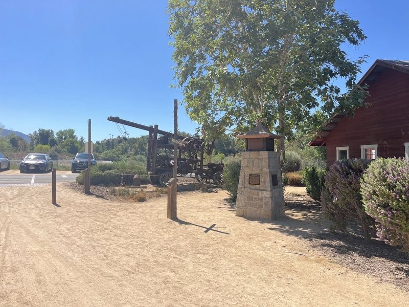
A good cattle operation depended on the hard work and dedication of their cowboys who saw to the day to day operations of moving cattle from one pasture to another or repairing miles-long fences. It took a full week to ride the fence line around the . . . — — Map (db m283196) HM
Directly across the river from where you are standing was once part of William Alexander Leidedorff's Rio de los Americanos land grant. Born in 181 0on the island of Saint Croix to a mother of African descent and a Danish father, Leidensdorff . . . — — Map (db m259483) HM
In memory of the American Servicemen of Hispanic descent and all others who sacrificed their lives to protect the freedoms we enjoy. — — Map (db m15474) HM
As a teacher, writer, editor, and activist, Idár preserved Mexican culture in South Texas
and encouraged women to pursue an education and push for equal rights. While
working as a journalist, she became the president of the newly-established . . . — — Map (db m171579) HM
The first female Mexican American author to write in English. Who Would Have Thought
It? was the first novel to be written in English by a Mexican living in the United States.
The book was published in 1872 without the author's name on the . . . — — Map (db m171894) HM
A California suffragist and an educator, she campaigned and translated at rallies in
Southern California where suffragists distributed tens of thousands of pamphlets in
Spanish and worked as a translator for the California suffrage movement. She . . . — — Map (db m171533) HM
News of the 1848 gold discoveries in California traveled around the globe, stirring up thousands of dreams of instant wealth. A slow trickle at first, by 1849 gold seekers rushed in from China, Australia, Mexico, Colombia, Argentina, Chili, Brazil, . . . — — Map (db m229813) HM
A line of strong, diverse, and dedicated teachers from a wide range of social and economic backgrounds have shaped the lives of Sacramento’s children. Ernesto Galarza was such a teacher, with an influence reaching far beyond Sacramento. He was born . . . — — Map (db m229914) HM
First panel:
The Comité Centro Mexicano commemorates the same respect and sense of equality dictated by this historical plaque. With great honor we re-dedicate it in honor of all humanity on this date.
From 1948 to 1975, El Centro . . . — — Map (db m91735) HM
English:
Residents Built and Destroyed on this Corner
The first permanent structures here were the adobe apartments for the Mission military families.
In 1856, a wooden Wells Fargo Express Office replaced the adobe ruins. . . . — — Map (db m82205) HM
Joseph Rodriguez
Private First Class – U.S. Army
Hometown: San Bernardino, California
Recognition: Medal of Honor
Joseph Rodriguez was a twenty-two year old private first class (PFC) assigned to Company F, 2nd Battalion, 17th . . . — — Map (db m242417) HM WM
"Guachama Rancheria, lying along this road, was named San Bernardino May 20, 1810, by Francisco Dumetz. In 1819 it became the San Bernardino Rancho of Mission San Gabriel. The adobe administration building stood about 70 yds. north of this spot, . . . — — Map (db m51015) HM
Established by Tiburcio Tapia, to whom the Cucamonga Rancho was granted March 3, 1839 by Governor Juan Bautista Alvarado of Mexico. — — Map (db m149064) HM
This site sits at the base of the prominent Red Hill Landmark. The early historic importance of the property stems from its proximity to a reliable water source, Cucamonga Creek, and to its location on the major roadway between Los Angeles and San . . . — — Map (db m117911) HM
In 1839 Governor Juan Alvarado granted the 13,000-acre tract called Cucamonga to Tiburcio Tapia, an ex-soldier who was a prominent merchant and alcalde in Los Angeles. A half-mile west of this marker Tapia, employing Indian laborers, immediately . . . — — Map (db m149478) HM
This was California's oldest commercial winery. The winery's two 1400 gallon oak aging casks were not "coopered" locally, but were carried "around the Horn" on a clipper ship!
Missionaries brought grape vines to Mexico and California in . . . — — Map (db m293766) HM
Built in 1945, this park continues to provide a center reminiscent of early Mexican Heritage.
Recognized by Hampton Hotels Save-A-Landmark program as a site worth seeing. — — Map (db m204524) HM
Constructed in 1842 by Diego Sepulveda, nephew of Antonio Maria Lugo, this is believed to be the oldest house in San Bernardino County. The land, formerly controlled by San Gabriel Mission, was part of Rancho San Bernardino, granted to the Lugos in . . . — — Map (db m143658) HM
Here was a palm-studded desert resting place, 1826-1866, for Mexican pioneers, mountain men, the Army of the West, Mormon Battalion, Boundary Commission, Forty-Niners, Railway Survey, Butterfield Overland Mail stages, and California Legion. It was . . . — — Map (db m51578) HM
The Santa Margarita Ranch House Bell. It is not known where the Santa Margarita Ranch House Bell was cast or in what year it was first hung in the arch on the front porch of the ranch house.
It has been suggested that it may have been brought . . . — — Map (db m117060) HM
El Camino Real began in San Diego and followed a coastal route later named Highway 101. In the early 1900s, bells were placed on this route to guide travelers to nearby Spanish Missions. This is an exact replica of the original bell and is . . . — — Map (db m193450) HM
Between 1937 and 1940, these adobe and wood buildings were built by actor Leo Carrillo as a retreat, working ranch, and tribute to old California culture and architecture. The Leo Carrillo Ranch, with its Flying "LC" brand, originally covered 2,538 . . . — — Map (db m51105) HM
Spanish Ancestry
Leo Carillo was a Los Angeles-born stage and screen actor. As a seventh-generation Californio, he was an ambassador of early California culture across the generations. Leo’s stewardship for Rancho de Los Quiotes, and . . . — — Map (db m312240) HM
While marching to the conquest and occupation of California during the Mexican War, a detachment of 1st U.S. Dragoons, under the command of Brig. Gen. Stephen W. Kearny, was met on this site by native California lancers under, the command of Gen. . . . — — Map (db m51095) HM
On October 29, 1772, Colonel Pedro Fages headed east from San Diego searching for army deserters. It was the first entry by Europeans into Oriflamme Canyon. From there, Fages and his men traveled on through Cajon Pass, around the Mojave and the . . . — — Map (db m219286) HM
Commemorating Cañada de Los Coches Rancho, smallest Mexican Grant in Calif.
Granted in 1843 to Apolinaria Lorenzana by Governor Manuel Micheltorena. Site of Old Gristmill. — — Map (db m88571) HM
Presidio Comandante Francisco Maria Ruiz built this house next to his 1808 pear garden late in 1821 for his close relative and fellow soldier, Joaquin Carrillo, and his large family. From this adobe dwelling, in April 1829, daughter Josefa Carrillo . . . — — Map (db m82465) HM
Built by Juan Francisco Lopez, one of San Diego's early Spanish settlers, the Casa Larga, or Long House, was among the first substantial houses built in the Pueblo of San Diego about 1835. In 1846 it was the home of Juan Matias Moreno, secretary to . . . — — Map (db m11128) HM
Estudillo House has been designated a Registered National
Historic Landmark under the provisions of the Historic Sites Act of August 21, 1935. This site possesses exceptional value in commemorating or illustrating the history of the United . . . — — Map (db m11781) HM
The stone pilings seen in this archaeological excavation unit are part of the original foundation of the Casa de Aguirre built circa 1853. The original adobe mansion extended ten feet to the east of where the current building ends. The 21st century . . . — — Map (db m71058) HM
Rafael Mamudes was a native of Hermosillo and led an adventurous life. He was once a baker and followed his trade to Monterey. He also mined at Calaveras County and made a sea voyage to Guaymas, Mexico. When he came here to San Diego, he supported . . . — — Map (db m12664) HM
Did You Know?
On a trail close to this one, soldiers and families walked down from the Spanish presidio two centuries ago to tend their gardens and livestock. Around 1820, some families started to build houses beside their gardens and "Old . . . — — Map (db m194306) HM
Near this point, sea and land parties of the Portola-Serra Expedition met. Two ships, the San Antonio and San Carlos, anchored on May 4-5, 1769. The scurvy-weakened survivors of the voyage established a camp, where on May 14 and July 1 they greeted . . . — — Map (db m51104) HM
After many attempts dated back to 1774 to provide a reliable source of water for crops and livestock for Mission San Diego de Alcala, a dam and flume system was finished between 1813 and 1816 by Indian laborers and Franciscan Missionaries to divert . . . — — Map (db m51074) HM
Formerly attached to Mission San Luís Rey, the 2,219-acre ranch passed through brief ownership by two Mission Indians, then Don Abel Stearns, and into possession of Ysidora Bandini upon marriage to Col. Cave Johnson Couts. The adobe ranch house, . . . — — Map (db m148680) HM
[Panel 1:] Pioneer Monument
Sculptor, Frank Happersberger (1859-1932)
Dedicated to the City of San Francisco on November 29, 1894, the Pioneer Monument was a gift of philanthropist James Lick. Lick, who died in 1876, left . . . — — Map (db m32183) HM
This plaque is placed on the 250th anniversary of the birth of California’s apostle, Padre Junípero Serra, O.F.M. to mark the northern terminus of El Camino Real as Padre Serra knew it and helped to blaze it.
1713 - November 24 - 1963 . . . — — Map (db m32169) HM
On June 29, 1776, Father Francisco Palou, a member of the Anza Expedition, had a brushwood shelter here on the edge of a now vanished lake, Lago de los Dolores (Lake of the Sorrows), and
offered the first mass. The first mission was a log . . . — — Map (db m32067) HM
Juana Briones, born in Hispanic California, was a preeminent woman of her time. In the 1830s and 1840s she transformed an isolated cove in the then Mexican hamlet of Yerba Buena into her rancho. At the site of this park she raised cattle and grew . . . — — Map (db m143437) HM
The area bounded by Montgomery, Pacific, Jackson and Kearny streets was known as “Chilecito” or “Little Chile” & was established during the gold rush period by Chilean settlers. — — Map (db m58384) HM
This marker consists of six plaques arranged in a 2 X 3 pattern. The top left plaque is the title plaque and may contain some text. The top right plaque displayed an arrow which points in the direction of the named street. Other plaques contain . . . — — Map (db m73083) HM
If you had visited El Polin in the early days you would have encountered an active community. The settlers spent most of the day outside since the houses were small and were used mainly for sleeping and storage. All family members, . . . — — Map (db m305961)
She secured her own lands and managed them herself… She had the native Spanish hospitality and dignity, which endeared her to her people to the end of the Mexican regime and secured for her an abiding place in the memories of the American . . . — — Map (db m309631) HM
San Francisco Giants: 1958-1963
San Francisco Giants All-Star: 1962
Oldest of the Alou brothers, Felipe preceded Matty
and Jesus in Giants outfield in 1958. A superb
right fielder, his bust-out year was 1962, when he hit
.316, 25 HR, 98 . . . — — Map (db m175008) HM
San Francisco N.L., 1960-1973
Boston A.L., 1974
Los Angeles N.L., 1975
High kicking right-hander from the Dominican Republic won 243 games and lost only 143 over 16 seasons. Won 20 games six times and no-hit Houston in 1963. Led N.L. in . . . — — Map (db m163132) HM
San Francisco Giants: 1960-1973 · Hall Of Fame: 1983
Giants Retired Number: 27
San Francisco Giants All-Star: 1962, 1963, 1964, 1965, 1966, 1967, 1968, 1969, 1971 All-Star Game Most Valuable Player: 1965
"Dominican Dandy" is the . . . — — Map (db m175879) HM
San Francisco Giants: 1958-1966
Hall of Fame: 1999 ·
Giants Retired Number: 30
NL Rookie of the Year: 1958
San Francisco Giants All-Star: 1959, 1960, 1961, 1962, 1963, 1964
The Baby Bull rose from Puerto Rican poverty to Major
League . . . — — Map (db m176641) HM
San Francisco, N.L., 1958-1966, St. Louis, N.L., 1966-1968
Atlanta, N.L., 1969-1972, Oakland, A.L., 1972
Boston, A.L., 1973, Kansas City, A.L., 1974
A powerful first baseman and consistent run
producer for 17 major league . . . — — Map (db m193872) HM
San Francisco Giants: 1965-1967, 1969-1974
Flashy Cuban keystoner was master of the double play, daring opposing runners to touch him during his pivot.
In 1973, he set NL single season record for fielding percentage by a second baseman . . . — — Map (db m175362) HM
Artist who used indigenous
symbols, imagery, colors and
traditions of Mexican culture to
resolutely depict and celebrate
women's form and experience — — Map (db m186740) HM
Army veteran, drag performer, politcal activist, first openly gay candidate for public office in the world, founder of the Imperial Court System
Jose Sarria — — Map (db m120176) HM
Sylvia Rivera
(1951-2002)
Gay liberation and transgender rights
advocate, a founding member of the
Gay Liberation Front, Gay Activist
Alliance and Street Transvestite
Action Revolutionaries — — Map (db m237822) HM
The small Arroyo Grande jail was nicknamed the 'Hoosegow' by members of the community. Derived from the Spanish language, the term 'hoosegow' found its origin around 1865.
Built by the County of San Luis Obispo, the jail was intended for . . . — — Map (db m314048) HM
A Spanish mission founded by Fray Junipero Serra, O.F.M., First president of the California missions. This was the fifth in a chain of 21 missions stretching from San Diego to Sonoma. Built by the Chumash Indians living in the area. Its combination . . . — — Map (db m27237) HM
El Camino Real, the Royal Highway, connected the California missions. At the beginning it was a trail, and a cross carved into the bark of trees showed the right path. This was such a tree, and the cross was lost until the day the tree fell (near . . . — — Map (db m154363) HM
This imposing building is an excellent example of California Mexican Era architecture. Using Indian labor, Petronilo Rios built the two-story Adobe about 1846 as his residence and headquarters for sheep and cattle operations. Named "Caledonia" in . . . — — Map (db m68935) HM
The Anza Expedition of 1776, on its way up the Peninsula to locate sites for the Presidio and the Mission of San Francisco, camped here on March 26 at a dry watercourse a short league beyond Arroyo de San Mateo. Location: El Camino Real and Ralston, . . . — — Map (db m154364) HM
After gold was discovered, the thousands who came to California began to build cities and towns. Today's Half Moon Bay grew upon the Mexican land grant awarded to Mexican soldier Candelario Miramontes.
In 1853 Estanislao Zaballa came from Spain . . . — — Map (db m102405) HM
Born in Balaguer, Catalonia, Spain • First Governor of California • Founder of San Diego and Monterey •
Discoverer of the Bay of San Francisco on November 4, 1769.
Presented by the President of the Generalitat of Catalonia, the Honorable . . . — — Map (db m1096) HM
The home of Francisco Sanchez (B. 1805, D. 1862). Alcalde of San Francisco and Commandante of Militia under the Mexican Republic. Grantee of the 8,926 – acre Rancho San Pedro, and later a respected American citizen. His house built 1842-46. . . . — — Map (db m28732) HM
Left Side - English
She donated 59,000 acres of land for the benefit of all people.
Right Side - Spanish
Donadora de 59,000 acres par beneficio de la comunidad — — Map (db m62575) HM
The Chumash Indian Village of "Mishopshnow," discovered by Juan Rodriquez Cabrillo, August 14, 1542, was located one-fourth mile southwest of here. Fray Juan Crespi of the Gaspar de Portola expedition named it "San Roque," August 17, 1769. Portola's . . . — — Map (db m147308) HM
By the mid 19th century the United States was expanding westward toward huge
territories loosely governed by Mexico. Though officially part of Mexico, these
sprawling territories were in fact too far from Mexico City and had been
neglected too . . . — — Map (db m310310) HM
One of the first ranchos created in California was Nuestra Señora del Refugio,
which permitted Jose Francisco Ortega, the retired commandante of Santa Barbara presidio, the use of mission lands along the Gaviota coast, beginning about 1797, . . . — — Map (db m310309) HM
Built by Indian labor in 1817 for Don Domingo Carrillo, whose daughter married Don Jose Maria Covarrubias in 1838. Descendants of these families, many of them leaders in public affairs, occupied this house for over a century. Don Jose Maria was the . . . — — Map (db m50550) HM
Near this site August 26, 1850, two weeks before California Statehood, duly elected common council, City of Santa Barbara, held first official meeting. Here in 1875, first City Hall erected and area still center of city's governmental activities. . . . — — Map (db m50548) HM
Chief Scout for Gaspar de Portolá. Ortega assisted with the founding of Mission San Buenaventura and established the presidio at Santa Barbara where he served as commandant from 1781-1784. Husband of Doña María Carrillo. — — Map (db m131602) HM
Built in 1826 by Daniel Hill of Massachusetts for his bride Rafaela Luisa Ortega y Olivera, granddaughter of José Francisco Ortega, founder and first Comandante of the Royal Presidio of Santa Barbara. Later occupied by the family of Guillermo . . . — — Map (db m50559) HM
An adobe house was built here in 1857 where Don Agustin Janssens, a Belgian, and his wife, Maria Antonia Pico, lived into the 1870s. Janssens, a frequent office holder in the region, had arrived in California in 1834. Don Bruno F. Orella, a native . . . — — Map (db m106411) HM
On this site, February 22, 1873, Jose Lobero, impressario and musician, opened the first legitimate theatre in southern California. The Lobero continues to serve the cultural interests of Santa Barbara one hundred years later. — — Map (db m50920) HM
Jose Lobero opened the region's first legitimate theatre on this site February 22, 1873. For many years the old theatre was the center of social life in Santa Barbara. A new Lobero Theatre, opened in 1924 on the same site, continues to serve the . . . — — Map (db m126018) HM
The original water supply for the Santa Barbara Mission is an outstanding
example of an early water system in Southern California. It was constructed
by the Native Americans under the direction of the Franciscan Padres.
Constructed in . . . — — Map (db m147954) HM
This presidio was established under orders of King Carlos III, April 19-21, 1782, by Governor Felipe De Neve, Padre Junipero Serra and Lieutenant Jose Francisco Ortega, to provide the benefits of government for the inhabitants of the Santa Barbara . . . — — Map (db m50557) HM
Constructed in 1849 by Don José de la Guerra, this adobe was originally used to house supplies brought in from ships anchored in the harbor.
Don Gaspar Oreña bought the adobe and added the story-and-a-half portion in 1858, shortly after his . . . — — Map (db m106881) HM
Oldest established drug store
in Southern California, founded 1855 by
Benigno Gutierrez.
Commemorating
one hundred years’
service to community,
July 10, 1955. — — Map (db m236053) HM
Mission Santa Inéz has been designated a National Historic Landmark. This religious complex possesses national significance in commemorating the history of the United States of America.
Mission Santa Ines, founded in 1804, is one of the . . . — — Map (db m143491) HM
At a watering hole on the east side of Pacheco Pass, Juan Pacheco built this adobe for his rancho in the early 1840’s. The gun ports in the walls are visible reminders of the dangers from Yokuts Indians, marauding bands of ex-Mission Indians, and . . . — — Map (db m247973) HM
This arroyo honoring San Joseph, patron saint of flight and students, was first discovered and traversed by Spanish explorers in 1769. On March 25-26, 1776 Colonel Juan Bautista de Anza made it his encampment No. 99 as mapped by his cartographer . . . — — Map (db m54025) HM
Morion
1971
John Augsburger
San Luis Obispo, California
This sculpture is a stylized version of a morion (pronounced mohr·ee·on), which is a Spanish conquistador helmet. It has been Cupertino's symbol since the 1970s. The morion was . . . — — Map (db m314207) HM
Lt. Colonel Juan Bautista de Anza and party crossed this area in March 1776, enroute to select sites for the Presidio and Mission of San Francisco — — Map (db m310392) HM
John Cameron Gilroy
circa 1854
John Cameron Gilroy, native of Scotland, arrived in Spanish California in 1814, and became the first permanent English speaking settler. He married Maria Clara de la Ascencion Ortega, daughter of the family that . . . — — Map (db m68909) HM
First contact between the Spanish expeditions and the Ohlone tribes was usually friendly. These encounters, recorded in expedition diaries, indicated that throughout Ohlone territory, the Spanish were treated as "distinguished guests," suggesting . . . — — Map (db m197734) HM
Members of the Juan Bautista de Anza Expedition camped in this vicinity near Llagas Creek, March 24, 1776. The Anza Expedition led to the establishment of the Pueblo of San José de Guadalupe, Mission Santa Clara de Asis, Mission San Francisco de . . . — — Map (db m296845) HM
In 1844 Juana de Briones de Miranda, a pioneer Latina property owner, businesswoman and humanitarian, purchased the 4,439 acre Rancho La Purisima Concepcion from Indian grantee Jose Gorgornio. The grant extended two miles south, encompassing . . . — — Map (db m54016) HM
Rancho La Purísima Conceptión was granted to a former Santa Clara Mission Indian, Jose Gorgonio, by Governor Alvarado on June 30, 1840. In 1844, Gorgonio and another Indian, José Ramon, sold the grant to Dona Juana Briones de Miranda, who lived with . . . — — Map (db m90786) HM
Lt Colonel Juan Bautista de Anza and party crossed this area in March 1776 in route to select sites for the Presidio and the Mission of San Francisco — — Map (db m312521) HM
Established in December, 1845, Spanishtown developed as Indians, Californios and immigrants from Peru, Argentina and Mexico built their homes on the hill above Deep Gulch. Cinnabar was first mined from a nearby cave known to local Indians. Later in . . . — — Map (db m50750) HM
Located in what was originally known as the East San Jose barrio of “Sal Si Puedes” or “Get Out If You Can,” Cesar and Helen Chavez and their family resided in a home at this site from 1951 to 1953 while Cesar began his work in the Civil Rights . . . — — Map (db m212692) HM
Within a year after the opening of the first overland route from Mexico to Alta California, Governor Filipe de Neve authorized the establishment of the first civil settlement in the state on lands including and surrounding the present Civic Center. . . . — — Map (db m52937) HM
Lt. Juan Bautista de Anza and party crossed this area in March 1776. en route to select sites for the Presido and the Mission of San Francisco
In the center of the marker is a circular motif, designed by Doris Birkland Beezley, of a rider . . . — — Map (db m38342) HM
The Plaza de César E. E. Chávez is part of the original plaza of the 1797 Pueblo de San José and is the oldest continuously used public open space in the city. The plaza was the hub of the old Spanish settlement: the site of Juzgado and the . . . — — Map (db m30207) HM
The Juan Bautista de Anza National HistoricTrail marks a 1,200 mile route that brought settlers to California from Tubac, in present-day Arizona, to what is now San Francisco.
The Spanish planned a system of Presidios, or military . . . — — Map (db m30147) HM
The Palomar Ballroom was constructed on this site in 1946. Operating
under various names, it was an important venue for music and dance
lovers for almost 60 years. As the first racially integrated ballroom in
the city, it attracted big bands, . . . — — Map (db m155027) HM
1604 entries matched your criteria. Entries 301 through 400 are listed above. ⊲ Previous 100 — Next 100 ⊳