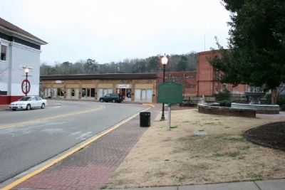
On South Court Street at West Main Street, on the right when traveling south on South Court Street.
Located within Daniel Pratt Historic District, this park overlooks Autauga Creek and the manufacturing complex around which this New England style village developed. Daniel Pratt founded Prattville in 1839, and patterned the town after those of his . . . — — Map (db m27958) HM
On Martin Luther King Drive north of Cone Street, on the right when traveling north.
In 1957, the Citizens Community Improvement Club, represented by Willie Lee
Wood Sr., Mary E. Averhart, Lewis Douglas, and Isom Jones, successfully
lobbied the City of Prattville to designate a vacant 1.5-acre lot as a new
park for African . . . — — Map (db m294217) HM
On Patrician Drive W 0.1 miles north of Patrician Drive S, in the median.
George and Patrice Fuller from Illinois fell in love with the Southland. In spite of the 1930 economic depression, they acquired sufficient property to plan Spanish Fort Estates.
Their foresight also preserves evidence of the last stand of the . . . — — Map (db m170735) HM
Land
“The Source of all wealth”
Henry George 1839-1897
Taxes applied to the source are an inducement to use the land wisely
These parks donated by
Fairhope Single Tax Corporation September 29, 1931
Capital
“The . . . — — Map (db m128893) HM
The camellia, often called the Queen of winter flowers, is the state flower of Alabama. Originally from the Orient, the camellia made its way to Europe in the 1600s, then to America and Australia in the 1700s. It now flourishes in the southern . . . — — Map (db m188784) HM
Near Fort Morgan Road (Alabama Route 180) 1.2 miles west of Dune Drive, on the right when traveling west.
Historic 650 miles Water Route along the
Coosa, Alabama and Mobile Rivers
_________
Beginning on the Coosa River at the
Alabama-Georgia State Line
Established 2007 — — Map (db m122443) HM
On Orange Beach Boulevard (State Highway 161) at Catman Road, on the right when traveling south on Orange Beach Boulevard.
Transportation into Orange Beach was difficult in the early 1900’s. The First ‘real road’ into the area came through Gulf State Park. It was built about 1948, during the administration of Gov. Jim “Big Jim’ Folsom. It was called a ‘Farm to Market . . . — — Map (db m299165) HM
On Perdido Beach Boulevard (Alabama Route 182) 0.1 miles east of Tannin Boulevard, on the right when traveling east.
Romar Beach began as a large homestead property with three miles of beachfront spanning from Gulf State Park to Hwy 161 in Orange Beach. The original property now covers only 480 feet. It was a true homestead and the owners were required to ‘till . . . — — Map (db m122463) HM
On East Barbour Street (U.S. 82), on the right when traveling east.
Constructed During Administration of Governor George Corley Wallace
Dedicated to the six Distinguished Barbour Countians who served Alabama as Governor
John Gill Shorter 1861-63
William Dorsey Jelks 1901-07
Braxton . . . — — Map (db m190110)
Near State Park Road south of Furnace Road (County Route 62), on the right when traveling south.
Wilson Hayes constructed this typical farm house for his wife and six children just south of Six Mile around 1900. After he moved to Oklahoma c. 1915, his daughter Ollie and her husband Levert Rotenberry lived in the home until 1928. Between 1928 . . . — — Map (db m37136) HM
On State Park Road south of Furnace Road (County Road 62), on the left when traveling south.
Originally located off Patton Chapel Road in what is today Hoover, Alabama, the Sunshine and Dorothy Morton house was moved to the Brierfield Park in March 2005 by the Morton family and restored over the next two years by restoration specialist . . . — — Map (db m37177) HM
On East Commerce Street (Alabama Route 10) at South Park Street, on the left when traveling west on East Commerce Street.
Greenville City Hall-Site of Public School
A two-story brick Greenville Public School was built in 1897 on this site. In 1921, the upper story was partially destroyed by fire and the school was remodeled into a grammar school. In 1927, the . . . — — Map (db m70749) HM
Near Braggs Road (Alabama Route 263) 0.4 miles north of Sherling Lake Road (County Road 44), on the left when traveling north.
Commissioned and opened to the public in 1950, Sherling Lake is part of the Alabama Department of Conservation's efforts to construct public fishing lakes throughout Alabama in the 1940s. Greenville Chamber of Commerce President A.G. Johnson . . . — — Map (db m228690) HM
On East Commerce Street (Alabama Route 10) west of Flowers Street, on the left when traveling west.
The Camellia Gardens at Beeland Park
Large camellias grew prolifically all over Butler County, many
of them one hundred years old. Since the mid-1930s, Glenn
Stanley, Editor of the Greenville Advocate used the slogan
"Greenville, The . . . — — Map (db m300180) HM
On East Commerce Street (Alabama Route 10), on the right when traveling east.
The Rock Wall at Beeland Park
On this site, R.A. Beeland donated eight acres in
1933 for a recreational park. Completed in eight
months by the Civil Works Administration. Beeland
Park was dedicated on April 12, 1934. Boys and
Girl Scout . . . — — Map (db m300181) HM
On Gurnee Avenue south of 12th Street, on the right when traveling south.
In the early 1940s, all of the buildings
on Block 148 were demolished to make
way for two new buildings, the USO
Recreation Center and a public health
building. Paul W. Hofferbert designed the
USO building for the Army. Hofferbert
was a local . . . — — Map (db m217677) HM
In 2007, the City of Oxford began planning what is today known as
Choccolocco Park. Discoveries at the site identified the presence of the
humans inhabiting this land as early as 10,000 years ago. Oxford undertook
an archaeological investigation . . . — — Map (db m144980) HM
Choccolocco Park is located on land that was farmed by the Caver,
Christian and Davis families from 1840 until the late twentieth
century. During the Great Depression, the farm was documented
by the Historic American Building Survey. The subjects . . . — — Map (db m145025) HM
On Mc Cullars Lane east of Recreation Dr, on the left when traveling east.
Oxford Lake, since the 1800's, has been the social & recreational center for this area. In the 1900's there was horse racing, boating, & a trolley line that brought visitors to the park. In the 1930s the lake had an amusement park. This site was . . . — — Map (db m261791) HM
The interpretive trail winds through what was once the 19th century
Muscogee (Creek) Nation town of Choccolocco. Archaeologists have
found evidence that Native Americans began coming to this place about
8,000 BC and the establishment of long-term . . . — — Map (db m145097) HM
On County Road 251 0.1 miles north of County Road 714, on the right when traveling north.
The furnace was constructed 1862-1863 by the Nobles Brothers Foundry from Rome, GA using financing from the Confederate States of America. Slave labor was used to dig a half mile canal upstream to the Chattooga River, which powered the airblast. A . . . — — Map (db m156261) HM
On East Main Street (Business U.S. 411) at Iris Drive, on the right when traveling east on East Main Street.
Dedicated on November 19, 1948 has been listed in the Alabama Register of Landmarks and Heritage by the Alabama Historical Commission June 27, 2019 — — Map (db m181355) HM
I propose to create a Civilian Conservation Corps to be used in simple work…More important however, than the material gains will be the moral and spiritual value of such work.
–Franklin D. Roosevelt
On Oct. 29, 1929 the world changed as we know it. On that
ominous day, the stock market crashed and facilitated the U.S.
Great Depression. Many Americans were unemployed and
numerous families lost their homes to foreclosure. In 1933
President . . . — — Map (db m175325) HM
In 1933 the Civilian Conservation Corps began construction of Cheaha State
Park as parks across the nation were built, President Franklin D. Roosevelt
provided jobs and stability as well as parks for future generations. The 2,799
acre Cheaha . . . — — Map (db m175560) HM
On CCC Camp Road north of Reservation Rd, on the right when traveling west.
The Civilian Conservation Corps (CCC) was created as a public
work relief program during the Great Depression as part of Roosevelt's
New Deal. Congress passed legislation to create the agency in
March 1933, and by the time the CCC dissolved in . . . — — Map (db m280034) HM
The Civilian Conservation Corp (CCC) Park features a stone picnic pavilion constructed in 1935 as well as mature tree
growth, trails and a commanding view that overlooks the Tennessee River and Wilson Dam. Many of the trails along
the river bluff . . . — — Map (db m280037) HM
Near Cahaba Road at Capitol Street, on the right when traveling north. Reported permanently removed.
"We by-and-by discovered...a pair of those
splendid birds, the Ivory-billed Woodpeckers
(Picus principalis). They were engaged in
rapping some tall dead pines, in a dense part of
the forest, which rang with their loud notes." . . . — — Map (db m112801) HM
On Business U.S. 80 north of Colby Avenue, on the right when traveling north.
The bloodshed on this bridge
named to honor Klan Leader,
Edmund Pettus, must fuel our
resolve to secure the right to
vote in perpetuity. This park
was designed and donated by
Hank and Rose Sanders to
honor their parents, Rev. D.A.
and Ora . . . — — Map (db m224571) HM
On Depot Street just north of Front Street, on the right when traveling north.
Town of Berry Established 1883
Thompson Berry settled in this area in the 1840s. Berry devoted
most of his time to raising cattle and farming. As time passed, he
became the owner of a gin and gristmill and several thousand
acres of land . . . — — Map (db m163759) HM
On Mound Parkway 0.6 miles west of Route 69, on the right when traveling west.
I do not think in the Southern States there is a group of Mounds to compare to Moundville, in the arrangement and state of preservation of the mounds.
- Clarence B. Moore, amateur archaeologist, 1910
Spanning more than . . . — — Map (db m144745) HM
On Kirkland Street (Alabama Route 27) at West Alabama Street, on the left when traveling south on Kirkland Street.
Southern Live Oak - Quercus Virginiana
The tree before you sprouted from an acorn circa 1750 and is the lone survivor of a forest that once covered this land. If this elderly oak could talk, it would have quite a story to tell. It is . . . — — Map (db m232912) HM
On Main Street at Browntown Road (County Road 47/416), on the left when traveling north on Main Street.
The Town of Dutton was incorporated in 1963. The town was named after Marion M. Dutton. The prime reason for incorporating the area was to have an entity in place in order to form the Waterworks Board of Dutton and to be able to borrow government . . . — — Map (db m197512) HM
Near Alabama Route 79, on the right when traveling south.
Nature preserve, recreation area, and wildlife management area.
This tract was protected and made available for public recreation through the efforts of the Alabama forever wild land trust. The Alabama state lands division of the department of . . . — — Map (db m145464)
Near Veterans Drive (Alabama Route 35) north of Lee Highway (U.S. 72), on the right when traveling north.
Friendship Park
Long known as The Friendly City, Scottsboro extends an open, warm and welcoming greeting to its citizens and its visitors. One of the most notable friendships in Scottsboro's long history was born in boyhood, tempered in . . . — — Map (db m167007) WM
This park was created to:
• Honor the men and women from Jackson County who served and sacrificed their lives to preserve our freedom.
• Recognize and honor all service men and women of the Armed Forces, Army, Marines, Navy, Coast Guard, Air . . . — — Map (db m268106) WM
On City Park Road 0.2 miles south of Kentucky Avenue ( Road 117), on the right when traveling south.
This cabin was originally constructed over 100 years ago approximately 10 miles west of this site in Bennett's Cove.
It was given to the Stevenson community park by Mary and Walker Leland Jordan.
The cabin was moved to this site and restored . . . — — Map (db m197507) HM
On Cloudland Drive at Hawksbury Ln, on the left when traveling south on Cloudland Drive.
In October 1963, the Bluff Park
Art Association began as a fundraiser
for the Bluff Park Elementary School
Library and was incorporated
November 2, 1965.
The founding members included:
Dorothy Copeland, Pres •
Jack A Pearson. Treas . . . — — Map (db m313144) HM
On 20th Street North north of Park Place, on the right when traveling north.
"Bull” Connor's police force still tried in vain to stop the marches to
City-Hall. The number of well-organized protestors overwhelmed
the police. Some marchers actually made it to Woodrow Wilson
Park (now Linn Park) that connects City Hall and . . . — — Map (db m187706) HM
Near Valley View Drive west of Richard Arrington Jr Boulevard South.
Side 1 - Building the Park
In the mid-1930’s, civic leaders worked to move Vulcan to a place of honor on Red Mountain. The park was built through the combined efforts of several groups: the Kiwanis Club of Birmingham, the Birmingham Parks . . . — — Map (db m83807) HM
Near Richard Arrington Junior Boulevard South 0.4 miles south of 16th Avenue South, on the right when traveling south.
The origins of this park date to 1923, when the Kiwanis Club of Birmingham
spearheaded the drive to successfully create a comprehensive park system
for the Magic City. In 1925, the Olmsted Brothers landscape firm revealed
A Park System for . . . — — Map (db m189282) HM
Near Valley View Drive west of Richard Arrington Jr Boulevard South.
One popular element of the park’s original design was a water feature known as the cascade. Cascading fountains were important features in formal European gardens. Their terraced pools and waterfalls animated the landscape with the sounds and . . . — — Map (db m83857) HM
Near Valley View Drive west of Richard Arrington Jr Boulevard South. Reported unreadable.
The WPA (Works Progress Administration) funded the design and construction of Vulcan Park in the late 1930s. This was done in conjunction with the Alabama Highway Department’s improvement of U.S. Highway 31, the major north/south route that runs . . . — — Map (db m69022) HM
On Essex Road South at Clairmont Avenue South, on the left when traveling north on Essex Road South.
A residential district extending from the crest of Red Mountain to the floor of Jones Valley with roads built along natural land contours. Birmingham real estate promoter and civic leader, Robert Jemison, Jr., began development as Mountain Terrace . . . — — Map (db m26983) HM
On 4th Avenue North west of 18th Street North, on the left when traveling west.
Built 1999, SW corner of 4th Ave. N. & 18th St. N.
Urban Impact worked with artist Ronald McDowell who wanted
to create a public park along Fourth Avenue to honor Eddie
Kendricks, Birmingham native and a lead singer of the
legendary Motown . . . — — Map (db m188036) HM
On 16th Street North south of 6th Avenue North, on the right when traveling south.
Built 1871 (renovated from 1979 to mid-1990s),
1601 & 1630 6th Ave. N.
Kelly Ingram Park was the main battleground in the 1963
Birmingham Campaign, dubbed “Project C" (with “C”
meaning "Confrontation"). The campaign was the . . . — — Map (db m187845) HM
Near Alpha Street South at Kappa Avenue South, on the right when traveling north.
Memorial Park is the site of the Miracle Sunday Prayer Vigil that occurred on May 5, 1963. to protest the incarceration of Civil Rights demonstrators held in the city jail. Citizens attending a mass meeting at New Pilgrim Baptist Church staged a . . . — — Map (db m295304) HM
On Park Avenue at Rockland Drive, on the right when traveling north on Park Avenue.
51 Structures, 70% residential, built early 20th century to post World War II period.
The 1885 sale of Gardner Hale’s land began the housing development. The 33 acre 1924 Independent Presbyterian Church Children’s Fresh Air Farm, 1923 Bluff . . . — — Map (db m28518) HM
This park was donated to the people of Florence by Dr. Kirk R. and Lillian Cook Deibert who initially acquired this property in 1952. The acreage was once a part of a large ante-bellum plantation owned by Judge Sidney Cherry Posey. In 1875 his heirs . . . — — Map (db m33086) HM
On McFarland Park Road, on the right when traveling west.
This bottom land serves as a reservoir for TVA's flood control program.
Florence leases it for recreational purposes when not being used by TVA.
Major Robert McFarland, a native of Ireland, his wife, Kate Armstead McFarland, and their seven . . . — — Map (db m28453) HM
On East Tuscaloosa Street at North Wood Street (County Road 47), on the right when traveling east on East Tuscaloosa Street.
This park, first designated as a Public Walk, was laid out as part of the original plans of Florence in 1818. On February 20, 1924, the Board of City Commissioners officially changed its name from City Park to Woodrow Wilson Park in honor of the . . . — — Map (db m35665) HM
At the beginning of World War I, Chile was the largest supplier of nitrates, a key ingredient in explosive munitions, to the United States. The United States government became concerned that this steady supply might be affected or even cut off . . . — — Map (db m268966) HM
On Alabama Route 203 south of Route 187, on the right when traveling north.
He inspired a world enslaved in tyranny
and brought hope to his fellow man...
from the cottonfields of Oakville to the
acclaim of the entire world. He made us
all proud to be called Lawrence Countians.
Dedicated October, 1983 . . . — — Map (db m180484) HM
On Wheeler Dam Highway (Alabama Route 101) at County Route 412 on Wheeler Dam Highway.
In January 1933, just before TVA was formed, the US Army corps of Engineers began working on Wheeler Lock and Dam to improve navigation on the treacherous upper Muscle Shoals and Elk river Shoals.
When TVA was created that May, it took over . . . — — Map (db m229351) HM
Near North 5th Street north of Park Road, on the right when traveling north.
Opelika's Board of Parks and Recreation hired W.J. "Bill" Calhoun as its first director in 1951. His top priority was to develop a wooded area behind Northside School. Two adjacent parcels of land were donated by I.J. Scott, Sr. and Winston Smith . . . — — Map (db m210764) HM
Near Holy Ground Road 2.3 miles north of Jones Bluff Road (County Road 40).
One of the significant battles of the Creek War of 1813-14 occurred near here on December 23, 1813. The 3rd Regiment, U.S. Infantry forces under the command of General F. L. Claiborne attacked a band of Creek Indians. Called "Holy Ground" by Creeks . . . — — Map (db m116890) HM
On Heart of Huntsville Drive SW south of Constellation Drive, on the right when traveling south.
C.B. "Bill" Miller, of Miller and Miller, Inc., had a positive impact in all areas of the transportation industry across the State of Alabama. He has erected bridges, railroads, parks, pedestrian walks, airports, drainage, wastewater facilities, . . . — — Map (db m54247) HM
Near Oakwood Avenue Northeast just east of England Street Northeast, on the right when traveling east.
Dallas (Optimist) Park
1928-1949
Built in 1928, Dallas Park served as the baseball field for the Dallas Mill teams coached by H.E. "Hub” Myhand, who came to Huntsville in 1927 as physical director for Dallas Manufacturing Co. Until the . . . — — Map (db m154279) HM
On Ward Avenue NE at White Street NE, on the left when traveling east on Ward Avenue NE.
On January 25, 1934, Oscar Goldsmith, Lawrence B. Goldsmith, Annie Schiffman Goldsmith, Robert L. Schiffman, and Strauss Schiffman gave this property to the City of Huntsville for an athletic field. The gift was in memory of Betty Bernstein . . . — — Map (db m130148) HM
Near Spragins Street Southwest south of Spring Street Southwest.
This inexhaustible source of pure water was a marvel to Indian and frontiersman alike prior to the 19th century. John Hunt, an early settler, built a cabin near this site by 1805. The spring became a major attraction at the land sales of 1809, . . . — — Map (db m279906) HM
Near Fountain Circle Southwest near West Side Square.
By 1957, the Big Spring that was once so essential to Huntsville's origin and growth, was no longer the city's primary water supply. However, Big Spring Park lives on as a source of pride for the city and a monument to its founding.
Even with all . . . — — Map (db m167104) HM
On Gunter Avenue (U.S. 431) at Taylor Street, on the right when traveling south on Gunter Avenue.
This park is the result of the support of Errol C. Allan (1930-2013), longtime resident and enthusiastic supporter of Guntersville. The park is located at the site of two historic buildings (one destroyed by fire, the other by water damage). The . . . — — Map (db m235552) HM
Near Government Street (U.S. 90) just east of South Hamilton Street, on the right when traveling east.
The first and only replica of the Crown & Scepter of Queen Isabella and casks of earth from her place of birth, Madrical, Old Castile, and her place of interment, the Basilica at Granada, reside here, gifts from her beloved Granada. The originals . . . — — Map (db m154246) HM
Near South Franklin Street south of Government Street (U.S. 90), on the left when traveling north.
Adventurer Soldier Dreamer. The first to bring the influence of Spain, its laws, its culture to Alabama. This is an original concept in stone of DeSoto. Vicinte Rodilla Zanón of Valencia • Sculptor 1967 • — — Map (db m154241) HM
Near Government Street (U.S. 90) just east of South Hamilton Street, on the right when traveling east.
“Columbus, I lent you my jewels so you could buy your ships: the only ornaments I have are the violets from the hills.” This statue, a gift from the Spanish Cultural Institute, stood in the Spanish Pavilion at the New York World’s Fair. . . . — — Map (db m154242) HM
On Government Street (U.S. 90) at Old Government Street on Government Street.
Side 1
Dedicated on March 21, 1926, near what was then the western city limits of Mobile, the park made possible by the Mothers' Army and Navy League, a volunteer women's group organized in the city during the Great War. Fundraising for Memorial . . . — — Map (db m149322) HM
Near Government Street (U.S. 90) just east of South Hamilton Street, on the right when traveling east.
The design of this fountain was inspired by famous fountains of Spain designed by one of the great fountain designers of the world, Buigas of Barcelona. Friendship Arches (Arcos de la Amistad)These Arches of Friendship and the ten colorful . . . — — Map (db m154240) HM
Near South Dearborn Street north of Canal Street, on the right when traveling north.
St. John’s Episcopal Church, established and built in 1855, stood at the northwest corner of this block, its rectory adjacent. Between 1860 and 1870, the Church Home, an orphanage and school consisting of three buildings, was constructed. This was . . . — — Map (db m123443) HM
Near South Franklin Street south of Government Street (U.S. 90), on the left when traveling north.
(2010 marker inscription) Damaged in 1979 during Hurricane Frederic, The Little Colt was basically lost to the city until 2001 when it was retrieved from a private warehouse. The Wayne D. McRae Philanthropic Fund provided funding to Main . . . — — Map (db m154239) HM
On Dauphin Street at St Joseph Street on Dauphin Street.
On May 26, 1824, the United States Congress passed an act granting two parcels of land to the City of Mobile. The property, located on the southwest corner of the block bound by St. Francis, St. Joseph, Dauphin, and Conception streets, was . . . — — Map (db m294571) HM
On Dexter Avenue at South Bainbridge Street, on the right when traveling east on Dexter Avenue.
Dedicated December 14, 2019
By
Kay Ivey, Governor
Alabama Legislature
Alabama Bicentennial Commission
Alabama Bicentennial Park is a legacy of Alabama's 200th anniversary of statehood, commemorated between March 3, 2017, and December 14, . . . — — Map (db m268820) HM
On Dexter Avenue at North Bainbridge Street, on the right when traveling west on Dexter Avenue.
Dedicated December 14, 2019
By
Kay Ivey, Governor
Alabama Legislature
Alabama Bicentennial Commission
Alabama Bicentennial Park is a legacy of Alabama's 200th anniversary of statehood, commemorated between March 3, 2017, and December 14, . . . — — Map (db m268822) HM
On North Bainbridge Street at Dexter Avenue, on the right when traveling south on North Bainbridge Street.
Alabama Bicentennial Park
Alabama Bicentennial Park commemorates Alabama's
200th anniversary of statehood. The park's bronze relief
sculptures present sixteen moments from Alabama history,
complemented by narratives that provide historical . . . — — Map (db m182565) HM
Role of MIA
The Montgomery Improvement Association (MIA) was founded on December 5, 1955, to implement the 382-day Montgomery Bus Boycott that jumpstarted the 20th-century Civil Rights Movement. The MIA, as its name suggests, remains . . . — — Map (db m310043) HM
On Dexter Avenue east of Court Square, on the left when traveling east.
History Happened Here
The City of Montgomery built this public park on one of the
lots occupied by the Montgomery Fair Department Store.
Rosa Parks was an assistant to the tailor for Montgomery Fair.
On December 1, 1955, Mrs. Parks . . . — — Map (db m121435) HM
On Walker Street at Shady Street, on the right when traveling south on Walker Street.
[Top Row - Left to Right:]
Many more than 200 years ago, Montgomery's history began along a hard bend of
the Alabama River in south central Alabama. Long before it was the capital, indeed
before the founding of the country, the area was home . . . — — Map (db m244537) HM
On Gordon Drive Southeast at 8th Avenue Southeast, on the right when traveling east on Gordon Drive Southeast.
Born in 1894 in Normandy, Tennessee, Carolyn Cortner was raised in the Courtland area of Lawrence County, Alabama. She attended Ward-Belmont College in Tennessee. She married Wilburn Smith in 1912. She did not attend formal architecture school . . . — — Map (db m27814) HM
On Wheeler Wildlife Boat Launch north of Route 67, on the right when traveling north.
1838
Trail of Tears: The discovery of gold in Georgia and thirst for land expansion prompted the U.S. Government and white communities to force the Cherokee nation from their ancestral lands. During the summer and winter of 1838, the first . . . — — Map (db m113290) HM
On 12th Avenue Northwest at 6th St NW, on the right when traveling south on 12th Avenue Northwest.
This park is dedicated to the players, coaches and families who made the Rough Riders
football team unique and special part of Decatur's history.
The Rough Riders were a semi-professional football team from Decatur, Alabama. The team was . . . — — Map (db m285758) HM
Near Highway 67 South 0.2 miles north of Willowbrook Street, on the right when traveling north.
Known as the "Crossroads of North Alabama,” the Town of Priceville incorporated in April 1975, though its earliest settlers migrated to the foot of Priceville Mountain just after the War of 1812. The community was rich farmland once owned by the . . . — — Map (db m191691) HM
Near South Brundidge Street at Memorial Drive, on the right when traveling north.
In memory of those who returned home from our country’s wars but later died as a result of chemical agent poisoning, post traumatic stress disorder, or other combat - related causes. “They left the war, but the war never left them.” — — Map (db m249800) WM
Near Luther Drive 0.1 miles north of University Avenue, on the left when traveling north.
Janice Hawkins Park was named in honor of the First Lady of Troy University, a devoted wife and loving mother, whose work benefited Troy in the fine arts, service to students, internationalization of the University, and support of military veterans. . . . — — Map (db m111581) HM
Near S. Brundidge Street at Memorial Drive, on the right when traveling north.
In Memory Of
All Those Still
Unaccounted
For
This memorial has been placed here to honor those who left home and family to go to a foreign land and give their lives for the causes of freedom and justice in doing so. Many of these . . . — — Map (db m249806) WM
Near South Brundidge Street at Memorial Drive, on the right when traveling north.
In honor of the fallen heroes of Crenshaw, Barbour, Butler, Henry & Pike Counties who gave their lives in the Vietnam War.
Bracken, Randy C. • Branno, Paul D. • Campbell, Thomas J.D. • Coes, Barry B. • Cooper, William M. • Davis, Willie L. • . . . — — Map (db m249812) WM
On 8th Street 0.1 miles south of 8th Avenue, on the right when traveling north.
This park was dedicated on May 15, 1990 to D. O. Langston for his service to the town of Ashville, his support for senior citizens, and his enduring impact on our community.
A native of Oakvale, Mississippi, Mr. Langston was born in 1904 and died . . . — — Map (db m156372) HM
This rustic cabin was built for Mr. and Mrs. Troy Stamps of Bessemer, Ala., the first resident care takers of Tannehill Historical State Park, shortly after area was declared a state historic district by the state legislature in 1969.
Parts of . . . — — Map (db m215690) HM
On 6th Street at 28th Avenue, on the right when traveling west on 6th Street.
As you look at the ruins of the former Alabama State Capitol, it may be difficult to realize that the building stood at the center of debates over freedom and liberty. Until the end of the Civil War, Alabama and Tuscaloosa were centers of . . . — — Map (db m144856) HM
Near Greensboro Avenue north of Jack Warner Parkway (County Road 88).
Mike Medeiros was affectionately known by the community as Captain Mike. Captain Mike always greeted his passengers on the Bama Belle Riverboat with energy, optimism and a desire to make their experience a wonderful memory. He was a role model for . . . — — Map (db m156404) HM
Near Queen City Avenue east of Jack Warner Parkway, on the right when traveling east.
In 1926, the City of Tuscaloosa purchased a 31-acre tract of land that would become Queen City Park. Amenities were added utilizing funds from President Roosevelt's Civil Works Administration (CWA) and Works Project Administration (WPA). Some of the . . . — — Map (db m203568) HM
On North School Street north of N Park Ave, on the left when traveling north.
The first recorded land owner was James Tittle on November 28,
1822; second, John Hellums on October 20, 1823; third, Ashley
Aldridge on September 10, 1858. All these made up the town
of Kansas. The first postmaster noted was Frank Gamba in . . . — — Map (db m286455) HM
On Prestwick Road 0.5 miles west of Johnson Road, on the right when traveling west.
Prestwick Post Office
The Prestwick Post Office was established on
February 24, 1904, with Alice Speadham as
postmaster. It was discontinued temporarily on
October 31, 1923. After it was reestablished in
March 1927, Walter B. Taylor held . . . — — Map (db m244903) HM
On Old Saint Stephens Road 1.2 miles east of Cement Plant Road, on the right when traveling west.
The St. Stephens Historical Commission was chartered by the State of Alabama in 1988: The board is charged with "acquiring, maintaining, protecting, promoting, and preserving" Alabama's first capital, St. Stephens.
Washington . . . — — Map (db m294044) HM
On Bessie Munden Road 0.2 miles west of Route 221, on the right when traveling west.
This 22-acre park is named for its founder, Bessie W. Munden, a noted African American educator and civic leader in Wilcox County. Dedicated on October 25, 1959, Bessie W. Munden Recreational Park is significant as one of Alabama's oldest . . . — — Map (db m203708) HM
On 21st Street north of 20th Ave, on the right when traveling north.
Ark Post Office
Winston County
Established on November 11, 1881, the Ark Post Office
served this area along the Byler Road and operated
for less than 10 years, when the Haleysville Post
Office took over mail service on March 5, . . . — — Map (db m309085) HM
On County Road 3500 at U.S. 278, on the left when traveling north on County Road 3500.
Natural Bridge Park is located in the vicinity of early
historic crossings of three Native American paths. The
Mobile Trace served as the primary north-south route.
The Chickasaw Trading Path, the main east-west route,
was in use by the early . . . — — Map (db m309076) HM
Near Seward Highway (State Highway 1) west of Bushnell Road, on the right when traveling west.
“Whenever the [upriver Dena'ina<] needed anything,... they come down to Alexander Creek to trade for beluga grease, seal oil...and they gave [coastal Dena'ina] caribou skins and marten skins. They helped each other, for the were the . . . — — Map (db m283052) HM
On November 23, 1920 the Alaska Engineering Commission rel[i]nquished responsibility for local government. Anchorage incorporated into a civilian run city.
4th Avenue was still the main commercial street. Even though the population remained . . . — — Map (db m260220) HM
Near Portage Lake Loop, on the right when traveling north.
Welcome to your National ForestPortage Valley is part of the Chugach National Forest, the northernmost National Forest in the United States. This is public land, shared by all people of the United States, and managed by the Forest Service. . . . — — Map (db m311328) HM
13491 entries matched your criteria. The first 100 are listed above. Next 100 ⊳