By Devry Becker Jones (CC0), June 20, 2020
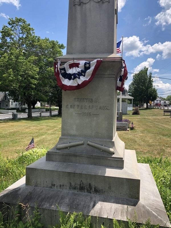
Civil War Memorial
| On Central Square at Mill Street on Central Square. |
| On Central Square, 0.1 miles north of New Hampshire Highway 12. |
| On Central Square just south of Mill Street. |
| On Central Square just south of Mill Street, on the left when traveling north. |
| On Central Square just south of Mill Street, on the left when traveling north. |
| On Central Square just north of New Hampshire Highway 12, on the left when traveling north. |
| On Main Street (New Hampshire Route 12) 0.5 miles south of Bridge Street, on the right when traveling south. |
| On New Hampshire Route 12, 0.9 miles north of Upper Walpole Road, on the right when traveling north. |
| On Gulf Road at Egypt Road, on the right when traveling south on Gulf Road. |
| On River Road, 0.5 miles south of Stoneleigh Heights, on the right when traveling north. |
| On Main Street west of Spring Street, on the left when traveling west. |
| On New Hampshire Route 63 at Park Hill Common, on the right when traveling north on State Route 63. |
| Near Main Street (New Hampshire Route 119) north of Parker Street, on the right when traveling north. |
| On Durkee Street, 0.1 miles east of Main Street (New Hampshire Route 10/119), on the left when traveling east. |
| On Main Street (New Hampshire Route 10/119) south of Richmond Road (New Hampshire Route 119), on the left when traveling north. |
| On Main Street (New Hampshire Route 119) just north of Parker Street, on the right when traveling north. |
| On Main Street (New Hampshire Route 10/119) just south of Richmond Road (New Hampshire Route 119), on the right when traveling north. |
| On Main Street (New Hampshire Route 10/119) south of Richmond Road, on the right when traveling north. |
| On Main Street (State Highway 119) at Richmond Road (State Highway 119), on the right when traveling north on Main Street. |
| On Main Street (New Hampshire Route 10/119) north of Parker Street, on the right when traveling north. |
| Near Richmond Road (State Highway 119) at Michigan Street, on the right when traveling north. |
| On Base Station Road, 5.9 miles east of U.S. 302, on the left when traveling east. |
| On Main Street (New Hampshire Route 16), on the right when traveling north. |
| On East Milan Road, 1.5 miles north of 12th Street, on the left when traveling north. |
| On U.S. 302 at Mt. Washington Hotel Road, on the left when traveling north on U.S. 302. |
| On U.S. 302 at Mt. Washington Hotel Road, on the left when traveling north on U.S. 302. |
| On U.S. 302 at Mt. Washington Hotel Road, on the left when traveling north on U.S. 302. |
| On U.S. 302 at Mt. Washington Hotel Road, on the left when traveling north on U.S. 302. |
| On Base Station Road, 6.2 miles east of U.S. 302 when traveling east. |
| On U.S. 302 at Zealand Road, on the right when traveling east on U.S. 302. |
| Near Crawford Notch Road (U.S. 302) 0.3 miles south of Mt. Clinton Road, on the right when traveling south. |
| On U.S. 302, 0.3 miles east of Mt Clinton Road, on the right when traveling east. |
| On U.S. 302, 0.4 miles east of Rosebrook Road, on the right when traveling east. |
| On U.S. 302 at Base Station Road, on the right when traveling west on U.S. 302. |
| On U.S. 3 at School Street, on the left when traveling north on U.S. 3. |
| On New Hampshire Route 145 at Clarksville Pond Road, on the right when traveling north on State Route 145. |
| On U.S. 3 at Mohawk Road, on the right when traveling north on U.S. 3. |
| On Main Street (U.S. 3) at Pleasant Street, on the left when traveling north on Main Street. |
| On Main Street (U.S. 3) at Pleasant Street, on the right when traveling north on Main Street. |
| On Main Street (U.S. 3) north of Mohawk Road, on the left when traveling north. |
| On Main Street (U.S. 3) north of Titus Hill Road, on the right when traveling north. |
| On Main Street (U.S. 3) south of Bridge Street (New Hampshire Route 26), on the left when traveling north. |
| On Mohawk Road (New Hampshire Route 26) 0.1 miles east of Abeneki Lane, on the right when traveling west. |
| On South Main Street (U.S. 3) at Colby Street, on the right when traveling north on South Main Street. |
| On State Highway 26, on the left when traveling east. |
| Near New Hampshire Route 26, 1.1 miles east of Cold Spring Road, on the right when traveling east. |
| On Mt. Washington Auto Road. |
| Near Mount Washington Auto Road west of White Mountain Road (State Highway 16). |
| On White Mountain Road (State Highway 16) at Mount Washington Auto Road, on the right when traveling north on White Mountain Road. |
| On Main Street (U.S. 3) 0.1 miles north of Berlin-Groveton Highway (New Hampshire Route 110), on the right when traveling north. |
| On Main Street at West Street, on the right when traveling north on Main Street. |
| On Owl's Head Highway (New Hampshire Route 115) 0.8 miles west of Meadows Road (New Hampshire Route 115A), on the right when traveling east. |
| On Meadows Road (New Hampshire Route 115A) 0.5 miles south of Presidential Highway (U.S. 2), on the right when traveling south. |
| On Presidential Highway (U.S. 2) at Turnpike Road, on the right when traveling east on Presidential Highway. |
| On Portland Street (U.S. 2) 1.8 miles east of Prospect Street (U.S. 3), on the right when traveling west. |
| On Route 3 at U.S. 2, on the right when traveling south on Route 3. |
| On Weeks State Park Road at Prospect Street (U.S. 3), on the left when traveling east on Weeks State Park Road. |
| On Bridge Street (U.S. 2) at Main Street (U.S. 3), on the right when traveling west on Bridge Street. |
| On Main Street (U.S. 2) at School Street, on the right when traveling west on Main Street. |
| On Portland Street (U.S. 2) at Prospect Street (U.S. 3), on the left when traveling west on Portland Street. |
| Near Main Street (Route 2) north of Mechanic Street, on the left when traveling north. |
| On Prospect Street (U.S. 3) at Portland Street (U.S. 2), in the median on Prospect Street. |
| On Main Street (U.S. 2) at School Street, on the left when traveling north on Main Street. |
| On Main Street (U.S. 2) south of Depot Street, on the right when traveling north. |
| On Main Street (U.S. 2) north of Mechanic Street, on the left when traveling west. |
| On White Mountain Road (New Hampshire Route 16) 3 miles south of Milan Hill Road (New Hampshire Route 110B), on the right when traveling south. |
| On Main Street, 0.1 miles south of Town Common Road, on the right when traveling south. |
| On New Hampshire Route 16 at milepost 99.6,, 10 miles south of Main Street (U.S. 2), on the left when traveling south. |
| On Hill Road at U.S. 3, on the right on Hill Road. |
| On Daniel Webster Highway (U.S. 3) at Back Lake Road, on the left when traveling north on Daniel Webster Highway. |
| On Daniel Webster Highway (U.S. 3) at Back Lake Road, on the left when traveling north on Daniel Webster Highway. |
| On Daniel Webster Highway (U.S. 3) at Back Lake Road, on the left when traveling north on Daniel Webster Highway. |
| On Main Street (U.S. 3) at Back Lake Road, on the right when traveling west on Main Street. |
| Near Daniel Webster Highway (U.S. 3) 1 mile south of US-Canadian Border Station, on the right when traveling south. |
| On Durand Road East, on the right when traveling west. |
| On Stark Highway (New Hampshire Route 110) 8.5 miles east of U.S. 3, on the right when traveling east. |
| On Hollow Road (New Hampshire Route 145) at Creampoke Road, on the right when traveling north on Hollow Road. |
| On U.S. 3, 0.5 miles north of Main Street, on the right when traveling south. |
| On U.S. 3, 0.3 miles south of Washburn Road, on the right when traveling south. |
| On Main Street at Town Commons Road, on the right when traveling south on Main Street. |
| On Depot Street at Winter Street on Depot Street. |
| On Daniel Webster Highway at Main Street on Daniel Webster Highway. |
| On Main St. at Depot Street on Main St.. |
| On Rum Hill Road (U.S. 302), on the right when traveling south. |
| On Wild Ammonoosuc Road (New Hampshire Route 112) at Lisbon Road (U.S. 302), on the right when traveling north on Wild Ammonoosuc Road. |
| On Whitefield Road (New Hampshire Route 116) at Deer Run Road, on the right when traveling west on Whitefield Road. |
| On Main Street (U.S. 302) east of Park Avenue, on the right when traveling east. |
| Near Christmas Tree Lane at Glessner Road. |
| Near Glessner Road at Main Street (U.S. 302), in the median. |
| On Maple Street (New Hampshire Route 142) 0.1 miles north of Main Street (U.S. 302), on the right when traveling north. |
| On Main Street (U.S. 302) at Beech Hill Road, on the right when traveling east on Main Street. |
| On Main Street (U.S. 302) at Church Street, on the right when traveling east on Main Street. |
| On Main Street (U.S. 302) at Agassiz Street (New Hampshire Route 142), on the right when traveling east on Main Street. |
| On Main Street (U.S. 302) at Maple Street (New Hampshire Route 142), on the right when traveling west on Main Street. |
| On Blair Road, 0.1 miles west of Daniel Webster Highway (U.S. 3), on the right when traveling west. |
| On Church Street (Route 4) at Canaan Street (U.S. 4), on the left when traveling east on Church Street. |
| On U.S. 4 at Parker Street, on the left when traveling east on U.S. 4. |
| On Canaan Street at Apple Blossom Road, on the right when traveling north on Canaan Street. |
| On Canaan Street near Roberts Road, on the right when traveling north. |
785 entries matched your criteria. Entries 101 through 200 are listed above.
⊲ Previous 100 —
Next 100 ⊳