6479 entries match your criteria. Entries 301 through 400 are listed.⊲ Previous 100 — Next 100 ⊳
Forts and Castles Topic
By Barry Swackhamer, January 29, 2013
Presidio of Monterey Museum Marker
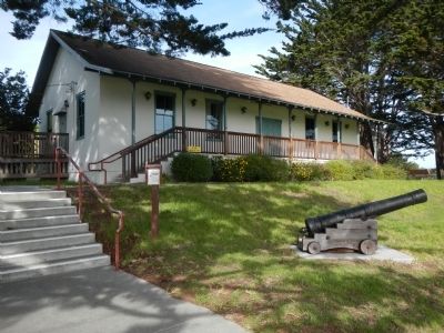
| 301 ► California, Monterey County, Monterey — 5 — Presidio of Monterey Museum — |
| On Corporal Ewing Road. | |||
| 302 ► California, Monterey County, Monterey — Spanish Presidio — |
| On Church Streeet east of Abrega Street, on the right when traveling east. | |||
| 303 ► California, Riverside County, Chuckwalla — 53 — Young Divisional Camp — Camp Young Headquarters Desert Training Center — California-Arizona Maneuver Area — |
| On Cottonwood Springs Road at unknown dirt road, on the right when traveling north on Cottonwood Springs Road. | |||
| 304 ► California, Sacramento County, Sacramento, Midtown — General John A. Sutter — February 15, 1808 – June 18, 1880 |
| On 28th Street at L Street, on the left when traveling south on 28th Street. Reported permanently removed. | |||
| 305 ► California, Sacramento County, Sacramento, Midtown — 525 — Sutter's Fort — This Tree Came From Kandern, Baden, Germany — The Birthplace of General John A. Sutter — |
| 306 ► California, Sacramento County, Sacramento, New Era Park — 591 — Captain John A. Sutter's Landing — |
| On C Street at 28th Street, on the right when traveling west on C Street. | |||
| 307 ► California, Sacramento County, Sacramento, Old Sacramento — The Arrival of Sutter — |
| Near K Street at Interstate 5, on the right when traveling east. | |||
| 308 ► California, Sacramento County, Sacramento, Southwestern Sacramento — 666 — Camp Union Sutterville — |
| On Sutterville Road, on the left when traveling east. | |||
| 309 ► California, San Bernardino County, Baker — 34 — Soda Springs - Zzyzx Mineral Springs — |
| Near Zzyzx Road, 5 miles south of Interstate 15. | |||
| 310 ► California, San Bernardino County, Baker — The Desert Studies Center — Zzyzx — |
| On Zzyzx Road, 5 miles south of Interstate 15, on the left when traveling south. | |||
| 311 ► California, San Bernardino County, Barstow — Fort Irwin — |
| On Fort Irwin Road, 27 miles north of Interstate 15, in the median. | |||
| 312 ► California, San Bernardino County, Barstow — National Training Center and Fort Irwin — Painted Rocks — |
| On Fort Irwin Road, 26 miles north of Interstate 15, on the right when traveling north. | |||
| 313 ► California, San Bernardino County, Colton — 617 — Fort Benson — |
| On South Hunts Lane at East Oliver Holmes Road, on the right when traveling south on South Hunts Lane. | |||
| 314 ► California, San Bernardino County, Goffs — 61 — Pah-Ute Creek — Fort Pah-Ute — Mojave Road — |
| On Lanfair Road at Goffs Road, on the right when traveling south on Lanfair Road. | |||
| 315 ► California, San Bernardino County, Lanfair — 19 — Camp Rock Spring — |
| On Cedar Canyon Road at New York Mountain Road, on the right when traveling east on Cedar Canyon Road. | |||
| 316 ► California, San Bernardino County, Lanfair — Fort Pah-Ute — 1867-68 — |
| Near Old Government Road. | |||
| 317 ► California, San Bernardino County, Newberry Springs — Camp Cady — |
| On Harvard Road at Mannix Road, on the right when traveling south on Harvard Road. | |||
| 318 ► California, San Bernardino County, Newberry Springs — 963-1 — Camp Cady — 1860-1871 — |
| Near Cherokee Road. | |||
| 319 ► California, San Bernardino County, San Bernardino — 44 — Site of Mormon Stockade — |
| Near Arrowhead Avenue north of 3rd Street, on the right when traveling north. | |||
| 320 ► California, San Diego County, Oak Grove — 482 — Camp Wright — 1861 - 1866 — |
| On State Highway 79 at milepost 49.3, on the right when traveling south. | |||
| 321 ► California, San Diego County, San Diego — 69 — Fort Guijarros Site — |
| On Rosecrans Street at Guijarros Road on Rosecrans Street. | |||
| 322 ► California, San Diego County, San Diego — 62 — Fort Rosecrans — |
| On Rosecrans Street at Guijarros Road on Rosecrans Street. | |||
| 323 ► California, San Diego County, San Diego — 54 — Fort Stockton — |
| Near Presidio Drive. | |||
| 324 ► California, San Diego County, San Diego — 523 — San Diego Barracks — 1850 - 1921 — |
| On West Harbor Drive east of Pacific Highway, on the right when traveling west. | |||
| 325 ► California, San Diego County, San Diego — 59 — San Diego Presidio Site — |
| Near Presidio Drive. | |||
| 326 ► California, San Diego County, San Diego — The Old Presidio Historic Trail — A short walk to the Serra Museum and the site of California's first Spanish mission and presidio. — |
| On Mason Street north of Juan Street, on the left when traveling north. | |||
| 327 ► California, San Francisco City and County, San Francisco, Alcatraz Island — Lower Military Prison — From Fort to Prison — Golden Gate National Recreation Area — |
| 328 ► California, San Francisco City and County, San Francisco, Financial District — 90 — Fort Gunnybags — |
| On Sacramento Street, on the right when traveling west. | |||
| 329 ► California, San Francisco City and County, San Francisco, Fort Mason — Fort Mason — Historic San Francisco Port of Embarkation |
| Near Marina Boulevard at Laguna Street. Reported missing. | |||
| 330 ► California, San Francisco City and County, San Francisco, Fort Mason — Fort Mason Historic District — Revived San Francisco hosts 1915 world’s fair! — |
| On San Francisco Bicycle Route 2, on the right when traveling west. | |||
| 331 ► California, San Francisco City and County, San Francisco, Fort Mason — Fort Mason Historic District — U.S. Army Post (1864-1966) — |
| On San Francisco Bicycle Route 2 at Van Ness Avenue, on the right when traveling west on San Francisco Bicycle Route 2. | |||
| 332 ► California, San Francisco City and County, San Francisco, Fort Mason — San Francisco Port of Embarkation — Soldiers shipped out from here — |
| On San Francisco Bicycle Route 2, on the right when traveling west. | |||
| 333 ► California, San Francisco City and County, San Francisco, Fort Mason — San Francisco Port of Embarkation |
| Near Marina Boulevard. Reported missing. | |||
| 334 ► California, San Francisco City and County, San Francisco, Fort Mason — San Francisco Port of Embarkation (1932-1962) — Headquarters — |
| Near MacArthur Avenue west of Franklin Street, on the right when traveling west. | |||
| 335 ► California, San Francisco City and County, San Francisco, Lincoln Park — Lands End — Golden Gate National Recreation Area — |
| Near El Camino del Mar near Seal Rock Drive. | |||
| 336 ► California, San Francisco City and County, San Francisco, Main Post — Ammunition Magazine — |
| On Sheridan Avenue at Anza Avenue, on the right when traveling west on Sheridan Avenue. | |||
| 337 ► California, San Francisco City and County, San Francisco, Main Post — At Home in the Nineteenth Century Army — |
| On Funston Avenue at Moraga Avenue, on the left when traveling north on Funston Avenue. | |||
| 338 ► California, San Francisco City and County, San Francisco, Main Post — Laundresses' Row — |
| Near Taylor Road north of Sheridan Avenue, on the right when traveling south. | |||
| 339 ► California, San Francisco City and County, San Francisco, Main Post — Montgomery Street Barracks — |
| On Montgomery Street near Lincoln Boulevard, on the right when traveling south. | |||
| 340 ► California, San Francisco City and County, San Francisco, Main Post — Montgomery Street Barracks — |
| On Montgomery Street at Sheridan Avenue, on the right when traveling south on Montgomery Street. | |||
| 341 ► California, San Francisco City and County, San Francisco, Main Post — Music in the Military: Presidio Band Barracks — |
| On Montgomery Street near Lincoln Boulevard, on the right when traveling south. | |||
| 342 ► California, San Francisco City and County, San Francisco, Main Post — Old Post Hospital — |
| On Funston Avenue south of Lincoln Boulevard, on the right when traveling south. | |||
| 343 ► California, San Francisco City and County, San Francisco, Main Post — Outpost of an Empire — |
| On Graham Street south of Sheridan Avenue, on the right when traveling south. | |||
| 344 ► California, San Francisco City and County, San Francisco, Main Post — Pershing Square — |
| On Graham Street south of Sheridan Avenue, on the right when traveling south. | |||
| 345 ► California, San Francisco City and County, San Francisco, Main Post — Sixth Army Headquarters — |
| On Keyes Avenue north of Sal Street, on the right when traveling north. | |||
| 346 ► California, San Francisco City and County, San Francisco, Main Post — Sutler's Quarters — |
| Near Taylor Road north of Sheridan Avenue, on the right when traveling south. | |||
| 347 ► California, San Francisco City and County, San Francisco, Main Post — The Alameda — |
| On Presidio Boulevard at Funston Avenue, on the left when traveling west on Presidio Boulevard. | |||
| 348 ► California, San Francisco City and County, San Francisco, Marina District — Fort Mason Historic District — U.S. Army post (1864-1966) — |
| On Laguna Street at Marina Boulevard, on the right when traveling north on Laguna Street. | |||
| 349 ► California, San Francisco City and County, San Francisco, North Waterfront — 15 — Alcatraz Fire Power — |
| Near The Embarcadero south of Bay Street, on the right when traveling north. | |||
| 350 ► California, San Francisco City and County, San Francisco, North Waterfront — Army Soldiers — Alcatraz Landing — Keepers & the Kept — |
| Near The Embarcadero south of Bay Street, on the right when traveling north. | |||
| 351 ► California, San Francisco City and County, San Francisco, North Waterfront — 6 — Guardhouse & Sallyport Complex — |
| Near The Embarcadero south of Bay Street, on the right when traveling north. | |||
| 352 ► California, San Francisco City and County, San Francisco, North Waterfront — 11 — Main Prison Building — |
| Near The Embarcadero south of Bay Street, on the right when traveling north. | |||
| 353 ► California, San Francisco City and County, San Francisco, North Waterfront — 7 — The Dock — |
| Near The Embarcadero south of Bay Street, on the right when traveling north. | |||
| 354 ► California, San Francisco City and County, San Francisco, North Waterfront — 7 — The Dock — |
| On The Embarcadero south of Bay Street, on the right when traveling north. | |||
| 355 ► California, San Francisco City and County, San Francisco, Presidio of San Francisco — Aviation Firsts: Crissy Army Airfield — |
| On Lincoln Boulevard south of Ledrum Court, on the left when traveling south. | |||
| 356 ► California, San Francisco City and County, San Francisco, Presidio of San Francisco — Bachelor Officers' Quarters: Pershing Hall — |
| On Moraga Avenue at Hardie Avenue, on the right when traveling east on Moraga Avenue. | |||
| 357 ► California, San Francisco City and County, San Francisco, Presidio of San Francisco — Battery Lancaster — |
| Near Coastal Trail. | |||
| 358 ► California, San Francisco City and County, San Francisco, Presidio of San Francisco — 82 — Castillo de San Joaquin — |
| 359 ► California, San Francisco City and County, San Francisco, Presidio of San Francisco — Crissy Field Transformed — |
| On Lincoln Boulevard south of Lendrum Court, on the left when traveling south. | |||
| 360 ► California, San Francisco City and County, San Francisco, Presidio of San Francisco — Defending the Golden Gate — |
| Near Marine Drive. | |||
| 361 ► California, San Francisco City and County, San Francisco, Presidio of San Francisco — Defending the Golden Gate — |
| Near Marine Drive. | |||
| 362 ► California, San Francisco City and County, San Francisco, Presidio of San Francisco — Exploring the San Francisco Headlands — Golden Gate National Recreation Area — Presidio — |
| Near Lincoln Boulevard. | |||
| 363 ► California, San Francisco City and County, San Francisco, Presidio of San Francisco — Explosive Military Advances — Coastal Defense System 1885-1905 — |
| Near Lincoln Boulevard. | |||
| 364 ► California, San Francisco City and County, San Francisco, Presidio of San Francisco — Fort Point — |
| On Marine Drive, on the left when traveling north. | |||
| 365 ► California, San Francisco City and County, San Francisco, Presidio of San Francisco — Fort Point Arch — |
| Near Coastal Trail. | |||
| 366 ► California, San Francisco City and County, San Francisco, Presidio of San Francisco — Fort Point Light — |
| Near Marine Drive. | |||
| 367 ► California, San Francisco City and County, San Francisco, Presidio of San Francisco — Fort Point National Historic Site — |
| On Long Avenue at Marine Drive, on the right when traveling west on Long Avenue. | |||
| 368 ► California, San Francisco City and County, San Francisco, Presidio of San Francisco — Fort Point National Historic Site — |
| On Marine Drive, 0.3 miles north of Long Avenue, on the left when traveling north. | |||
| 369 ► California, San Francisco City and County, San Francisco, Presidio of San Francisco — Guarding the Golden Gate — A defense priority on the West Coast — |
| Near Lincoln Boulevard. | |||
| 370 ► California, San Francisco City and County, San Francisco, Presidio of San Francisco — Landscaping the Post: From Grassy Hills to Forests — |
| On Letterman Drive at Presidio Boulevard, on the left when traveling west on Letterman Drive. | |||
| 371 ► California, San Francisco City and County, San Francisco, Presidio of San Francisco — Lover’s Lane — |
| On MacArthur Avenue near Sunset Street, on the right when traveling north. | |||
| 372 ► California, San Francisco City and County, San Francisco, Presidio of San Francisco — Old and New: Presidio Fire Station — |
| On Lincoln Boulevard at Keyes Avenue, on the right when traveling west on Lincoln Boulevard. | |||
| 373 ► California, San Francisco City and County, San Francisco, Presidio of San Francisco — Old Post Chapel — |
| On Moraga Avenue at Mesa Street, on the right when traveling east on Moraga Avenue. | |||
| 374 ► California, San Francisco City and County, San Francisco, Presidio of San Francisco — Post Chapel — |
| On Fisher Loop, 0.1 miles south of Sheridan Avenue. | |||
| 375 ► California, San Francisco City and County, San Francisco, Presidio of San Francisco — Sergeants' Row — |
| On Sheridan Avenue at Riley Avenue, on the right when traveling north on Sheridan Avenue. | |||
| 376 ► California, San Francisco City and County, San Francisco, Presidio of San Francisco — The Era of Earthworks Batteries — Battery East — Golden Gate National Recreation Area — |
| Near U.S. 101 at Lincoln Boulevard. | |||
| 377 ► California, San Francisco City and County, San Francisco, Presidio of San Francisco — Western Defense Command Headquarters — |
| On Lincoln Boulevard at Keyes Street, on the right when traveling west on Lincoln Boulevard. | |||
| 378 ► California, Santa Barbara County, Santa Barbara — 636 — Site of Royal Spanish Presidio — |
| On East Canon Perdido Street at Santa Barbara Street, on the right when traveling west on East Canon Perdido Street. | |||
| 379 ► California, Santa Clara County, Cupertino — Captain Elisha Stephens — 1804 - 1887 — A True Pioneer — |
| Near Stevens Creek Boulevard. | |||
| 380 ► California, Shasta County, Anderson — 379 — Fort Reading. — |
| On Dersch Road, 0.6 miles east of Deschutes Road, on the left when traveling east. | |||
| 381 ► California, Shasta County, Fall River Mills — Captain Dick and Richard Pugh — |
| On McArthur Road (Route A19) south of Soldier Mountain Road, on the right when traveling north. | |||
| 382 ► California, Shasta County, Fall River Mills — 355 — Fort Crook — |
| On McArthur Road, on the right when traveling north. | |||
| 383 ► California, Siskiyou County, Fort Jones — 317 — Fort Jones — 1852-1858 — |
| On Eastside Road, 0.4 miles south of Main Street, on the right when traveling north. | |||
| 384 ► California, Sonoma County, Jenner — 5 — Fort Ross — |
| Near Highway 1 near Fort Ross Road, on the left when traveling north. | |||
| 385 ► California, Sonoma County, Jenner — Fort Ross Chapel — |
| Near Fort Ross Road, 0.2 miles west of Coast Highway (California Route 1), on the left when traveling west. | |||
| 386 ► California, Sonoma County, Jenner — Fort Ross Defenses — |
| Near Coast Highway (California Route 1) near Fort Ross Road, on the left when traveling north. | |||
| 387 ► California, Sonoma County, Jenner — Sandy Beach Cove — |
| Near Highway 1 near Fort Ross Road. | |||
| 388 ► California, Sonoma County, Jenner — The Call Family Residence — 1878 - 1972 — |
| Near Highway 1 near Fort Ross Road. | |||
| 389 ► California, Sonoma County, Jenner — The Native Alaskan Village — |
| Near Highway 1 near Fort Ross Road. | |||
| 390 ► California, Sonoma County, Jenner — The Russian Cemetery — |
| Near Coast Highway (State Highway 1) near Fort Ross Road, on the left when traveling north. | |||
| 391 ► California, Sonoma County, Jenner — The Russian Village Site - Sloboda — |
| Near Coast Highway (State Highway 1) near Fort Ross Road, on the left when traveling north. | |||
| 392 ► California, Sonoma County, Jenner — Welcome to Fort Ross — |
| Near Fort Ross Road south of Coast Highway (California Route 1). | |||
| 393 ► California, Tulare County, Visalia — Camp Babbitt — |
| On North Santa Fe Street south of East Race Avenue, on the right when traveling south. | |||
| 394 ► California, Ventura County, Simi Valley — 4 — Fort Apache — Corriganville — |
| Near Smith Road, 0.5 miles east of Kuehner Drive, on the left when traveling east. | |||
| 395 ► California, Yuba County, Wheatland — Camp Far West Cemetery |
| Near Camp Far West Road south of Spenceville Road/Camp Beale Highway. Reported missing. | |||
| 396 ► Colorado, Bent County, Las Animas — Welcome to Bent County — |
| Near Carson Avenue (Colorado Route 101) north of 8th Street, on the right when traveling north. | |||
| 397 ► Colorado, Costilla County, Fort Garland — 16 — Fort Garland |
| On State Highway 159, 0.2 miles south of U.S. 160, on the left when traveling north. Reported permanently removed. | |||
| 398 ► Colorado, Costilla County, Fort Garland — 190 — Fort Garland / Buffalo Soldiers — |
| Near State Highway 159, on the right when traveling south. | |||
| 399 ► Colorado, Delta County, Delta — Fort Uncompahgre — |
| Near North Palmer Street north of Confluence Drive, on the right when traveling north. | |||
| 400 ► Colorado, Denver County, Denver, Lincoln Park — Camp Weld — |
| On West 8th Avenue at Vallejo Street, on the left when traveling east on West 8th Avenue. | |||
6479 entries matched your criteria. Entries 301 through 400 are listed above. ⊲ Previous 100 — Next 100 ⊳