Samuel McCulloch, Jr. (1810-1893), wounded at the Battle of Goliad October 9, 1835, was one of the first casualties of the Texas Revolution. This site is part of land he received in 1850 as a bounty for his service. The oldest marked grave is that . . . — — Map (db m179924) HM
Decisive in Texas history, was fought here, September 18, 1842. Col. Mathew Caldwell and Capt. John C. Hays, commanding a force of Texas volunteers, opposed the Mexican Army under General Adrian Woll that had captured San Antonio, and with the loss . . . — — Map (db m128119) HM
Occurred in this vicinity on September 18, 1842 when Captain Nicholas Mosby Dawson and 53 men from La Grange, in attempting to join Captain Mathew Caldwell (Old Paint) and his company of Texas volunteers during the Battle of the Salado, were . . . — — Map (db m85981) HM
Came to Texas 1829. Served in Battles of Anahuac and San Jacinto in Texas War for Independence and the Indian, Mexican and Civil Wars. Born Natchez, Miss., Married Mary Ann Sawyer 1850. Prominent in Civic and Public Affairs.
Recorded - . . . — — Map (db m163736) HM
Came from South Carolina to Texas in 1834. Served in Battle of San Jacinto in Texas War for Independence, 1836. Was one of a party with Deaf Smith that destroyed Vince's bridge near Pasadena. This deed may have kept Santa Anna's army from retreat . . . — — Map (db m177129) HM
Son of Alamo defender Gregorio Esparza, 11-year old Enrique, his mother, two brothers and sister were present at the seige by the Mexican Army (Feb 23 - March 6, 1836). Hidden in a pile of hay, the youth saw his father fall and witnessed the heroic . . . — — Map (db m208260) HM
Erected by the State of Texas to Commemorate the Heroic Deeds of
Captain Richard Andrews Born in Sandersville Georgia in 1800. Fell at the Battle of Concepcion October 28, 1835.
The first sacrifice in the War of Texas Independence. Son . . . — — Map (db m216417) HM
Having Lost The Opening Skirmishes of the Texas Revolution at Gonzales and Goliad, the Mexican Army in Texas consolidated in San Antonio in October 1835. Texan troops also advanced to San Antonio and camped on the outskirts of town. On the . . . — — Map (db m216327) HM
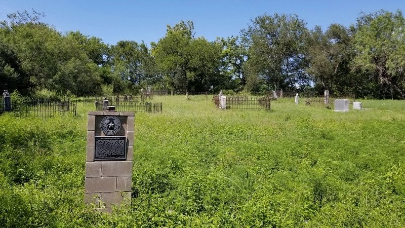
Started in 1840's; still used by founding families. Graves include those of Texas patriots Francisco Antonio Ruiz, 1836 acting mayor, whose father and cousin signed Declaration of Independence; and Blas Herrera, who alerted the Alamo defenders to . . . — — Map (db m179892) HM
Born in Kentucky. Moved to Texas in 1833. In Texas Revolution he fought in Siege of Bexar (1835) and Battle of San Jacinto (1836). In 1842 took part in Somervell expedition against Mexico.
Resided at Washington-on-the-Brazos; present Kendall . . . — — Map (db m194072) HM
Tennessee native Roden Taylor Crain, a member of Capt. William Kimbro's company of San Augustine County volunteers, was a soldier in the struggle for Texas Independence from Mexico. He fought at the Battle of San Jacinto on April 21, 1836, and later . . . — — Map (db m233706) HM
Named for James Bowie (1799-1836), who fought for Texas freedom from 1819, when he joined the Long Expedition, to 1836 — when he died in defense of the Alamo.
Inhabited before 1800 by agricultural Indians, charted 1819 for . . . — — Map (db m96141) HM
Front
Hero of the Alamo
"They never fail who
die in a just cause"
Love of adventure
brought the young
South Carolinian to
Texas with James Long
in 1819. Romance made
of him a Mexican
citizen and won for
him in San . . . — — Map (db m96572) HM
Robert James Calder was born in 1810 to James H. and Jane E. (Caldwell) Calder in Baltimore, Maryland. His father died when he was a child, and Robert and his mother moved to Kentucky, where he was raised in part by his mother's family. They moved . . . — — Map (db m120660) HM
Kentucky native Albert Sidney Johnston graduated from the U.S. Military Academy at West Point in 1826. He was assigned to posts in New York and Missouri, and served in the Black Hawk War in 1832. He resigned his commission in 1834 to return to . . . — — Map (db m91921) HM
(South Face of Monument)
Henry Smith was born in Kentucky, May Twentieth 1788, came to Texas in 1827 and settled in what is now Brazoria County which he regarded as his home until his death. He was severely wounded in the Battle of . . . — — Map (db m90101) HM
Participated in the Battle of Velasco, 1832 · Member of the Convention of Texas, 1832 · President of the Convention of 1833 · Minister of the United States, 1836-1837 · Member of the 5th Congress of the Republic · Born in Virginia, 1806 · Died . . . — — Map (db m172703) HM
Emigrated to Texas from Missouri in 1827 as an Austin Colonist • Participated in the Battle of Velasco, 1832 • Five of his sons were in the Army of Texas in 1836 • Born May 14, 1786 • Died in December, 1833
Erected by the State of Texas . . . — — Map (db m158869) HM
Born in Massachusetts. Came to Texas in 1831. Served in Texas Revolution at Siege of Bexar as Wagonmaster for Stephen F. Austin, "Father of Texas". Stole the bells of Mission Concepcion (Property of Mexico, Texas' enemy) to melt into bullets. Also . . . — — Map (db m158873) HM
John Sweeny, Sr. (d. 1855) moved his family from Tennessee to Brazoria County, Texas, about 1833. With the help of slaves, he cleared his land and established a large plantation. This log cabin, originally located about 9 miles southwest of this . . . — — Map (db m49709) HM
A structure erected in noted old river port town of Marion in Republic of Texas era. First portion, of hand-hewn cedar, was built about 1835 by colonist Thomas W. Nibbs. Merchant-civic leader-soldier Ammon Underwood (1810-87) bought and enlarged . . . — — Map (db m49707) HM
Erected by the State of Texas in memory of Colonel Robert M. Coleman
Signer of the Texas Declaration of Independence
Aide-de-Camp to General Sam Houston at San Jacinto
Colonel of the First Regiment of Texas Rangers
Born in Kentucky in . . . — — Map (db m173991) HM
Landing place of the "Lively" First vessel bringing immigrants to Austin's colony in 1821. There the Battle of Velasco, between Texas colonists and Mexican troops, was fought June 26, 1832. A treaty of peace between Texas and Mexico was signed . . . — — Map (db m167496) HM
One of oldest Texas towns. Port of entry for over 25,000 settlers, 1821-1835. Scene of first armed conflict leading to Texas Revolution, 1832. In mid-1800s, resort place for wealthy plantation families. Declined after the Civil War and 1875 . . . — — Map (db m167498) HM
A Republic of Texas soldier during War for Independence. Born in Edgefield, S. C.; came to Texas in 1835. Entering army, he fought in famed victory of San Jacinto, April 21, 1836. He received headright and bounty lands in Brazoria, San Patricio, . . . — — Map (db m173108) HM
Born in Missouri. Rode a mule to Texas in 1831 to join his uncle, Stephen F. Austin, Father of Texas. A private in Texas War for Independence. Legislator, congressman, member of Texas Secession Convention. Enlisted as a private in the Civil War, but . . . — — Map (db m53084) HM
Adjutant of the Texas army in Battle of Velasco, June 26, 1832. Wounded there, he was guarding civilians at time Texas won independence in Battle of San Jacinto, April 21, 1836.
A bosom friend of Stephen F. Austin, Caldwell received land . . . — — Map (db m90590) HM
In Texas War for Independence, joined Matamoros expedition of January 1836. In detachment that captured horses of Gen. Urrea of Mexican army, Brown was made captive in a counterattack, and spent 11 months in prison in Mexico, but finally escaped. . . . — — Map (db m90602) HM
Grandson of Moses Austin, whose dream of Anglo-American colony changed course of Texas history.
Came to Texas with his mother and stepfather in 1831; served in Texas army from 1835 to 1838. A highly successful planter, he was instrumental in . . . — — Map (db m111119) HM
After the Battle of San Jacinto, the ad interim government of the new Republic of Texas first convened in this building, also known as the American Hotel, and met with the imprisoned Santa Anna.
George B. Erath, later a San Jacinto veteran . . . — — Map (db m243670) HM
During the beginning of the Texas Revolution, a naval force was quickly assembled, based out of Quintana and Velasco.
Even before Texas declared its independence, in late 1835 the provisional Texian government adopted laws to create a . . . — — Map (db m243671) HM
The Texas Revolutionary Army built an artillery battery near this spot in early 1836, guarding the entrance of the Brazos River for the new Republic of Texas.
The fort existed for several years, through at least 1840: ... had an old . . . — — Map (db m243676) HM
After the Battle of San Jacinto, Santa Anna was held prisoner here and negotiated with the ad interim government of the new Republic of Texas at the nearby American Hotel.
Held prisoner with Santa Anna were several of his officers, . . . — — Map (db m244328) HM
First vessel with emigrants to Austin's colony landed here December 23, 1821.
The Battle of Velasco was fought here June 26, 1832.
Public and secret treaties of peace between the Republic of Texas and General Santa Anna were signed here . . . — — Map (db m237185) HM
An important cause of the Texas Revolution occurred right here on the beach at the mouth of the Brazos River.
The San Felipe was a schooner of the Quintana trading firm McKinney, Williams & Company. Having foreknowledge of "Mexican . . . — — Map (db m246033) HM
Here was fought a battle -- the first collision in arms between Texas colonists and the Mexican military -- a conflict preliminary to the Texas War for Independence.
On June 26, 1832, when Texans under John Austin and Henry Smith came down . . . — — Map (db m244208) HM
• Ratified the constitution
• Appointed committees
• Provided for protection from Indians
• Provided for the army and navy
• Created the judicial branch
• Created the postal department
• Created the land office
• Established a . . . — — Map (db m164582) HM
Byrd Lockhart, Jr. moved to Green DeWitt’s Colony from Missouri around 1826 with several female relatives. He worked as a surveyor for the colony and settled in Gonzales, where he organized defenses against Indian attacks and supervised . . . — — Map (db m173015) HM
In September 1836 Columbia, now known as West Columbia, became capital of the Republic of Texas. This took place with the removal of the ad interim government here from Velasco. After the election called by ad interim President David G. Burnet, the . . . — — Map (db m49703) HM
In 1836 and 1837, the town of Columbia (Now West Columbia) served as the capital of the Republic of Texas. Josiah Hughes Bell, a colonist with Stephen F. Austin's Old Three Hundred, surveyed and platted Columbia in 1824 to serve as a center for . . . — — Map (db m41707) HM
When ad interim President David G. Burnet selected Columbia to serve as
the capital for the first elected Congress of the Republic of Texas, Columbia
had a population of approximately 3,000. A group of businessmen promised accommodations for use . . . — — Map (db m164586) HM
Under Mexican rule, the municipality of Columbia was a part of
the Department of Brazos, State of Coahuila and Texas. In early
1830, the Mexican government imposed a series of new policies in
an effort to strengthen Mexico's hold on the . . . — — Map (db m164566) HM
General Santa Anna, the president of Mexico, posed one of the greatest
problems to the new republic. Captured following the Mexican army's defeat at San Jacinto, on April 21, 1836, Santa Anna and the Texas cabinet traveled aboard the steamboat . . . — — Map (db m164569) HM
New Yorker George Rounds served in Col. James W. Fannin's regiment in the Texas War for Independence but escaped the Goliad Massacre. He settled in Columbia, where he operated a tavern. Just before his death, he drew up a will devising his estate . . . — — Map (db m173039) HM
A member of Austin's colony, 1829. Soldier in the Battle of Velasco; delegate to the General Convention, 1832; chief justice of Brazoria County, 1836. In this home, built about 1830, Stephen F. Austin died, December 27, 1836 — — Map (db m78618) HM
Faithful soldier, Texas War for Independence. He was in unit of Capt. Jacob Eberly, detailed by Gen. Sam Houston to guard Bell's Landing (East Columbia) until civilians could escape in front of Santa Anna's army. He and 15 others then hurried to . . . — — Map (db m173011) HM
Born in Georgia September 24, 1798 Died July 10, 1837 Delegate to the Consultation, 1835 Signer of the Texas Declaration of Independence, 1836 — — Map (db m173097) HM
A tribute to the fidelity of pioneer Masons whose outstanding
leadership laid the cornerstone of the Republic of Texas. These
great Masons gave us our freedom, our heritage, our liberty, and
strengthened our faith in God. No men could have . . . — — Map (db m164584) HM
Came to Texas in January, 1836 Led out to be shot with Fannin's men, March 27, 1836, but escaped Fought at San Jacinto in Captain William H. Patton's company Died in Columbia, December 27, 1836 — — Map (db m173082) HM
Near site of The First Capitol of the Republic of Texas
About 1833 Leman Kelsy built a story-and-a-half clapboard structure near this location. When Columbia became capital of the Republic of Texas in 1836, the building was one of two . . . — — Map (db m43057) HM
Site given by Josiah H. Bell family out of their grant, the first deeded to one of "Old 300" in colony of Stephen F. Austin. Has graves of many heroes of Texas Revolution of 1836.
Deeded in 1852 to Bethel Presbyterian Church. Since 1933 managed . . . — — Map (db m172990) HM
Zeno Phillips, one of Stephen F. Austin's "Old 300" colonists, acquired land here in 1829. Zeno and his brothers John Clark, Sidney, and James Ray (J.R.) Phillips, served in the Republic of Texas Army. The cemetery began with the burial of Zeno and . . . — — Map (db m96305) HM
The newly formed Republic of Texas faced many problems. With
no credit and no resources other than land, the republic had a
debt of 1.25 million dollars. Hostile Indians plagued the population. The new government appropriated $20,000 to . . . — — Map (db m164574) HM
In the August 9, 1836 issue of the Telegraph and Texas Register,
Stephen F. Austin, Henry Smith and Branch T. Archer were listed
as candidates for the office of president of the new republic.
Archer later withdrew and threw his support to . . . — — Map (db m164572) HM
Following the signing of the Texas Declaration of Independence on
March 2, 1836 at Washington on the Brazos, an ad interim government was formed. Headed by President David G. Burnet and Vice
President Lorenzo de Zavala, this government . . . — — Map (db m164571) HM
The Brazos River, whose formal name Brazos de Dios is Spanish for Arms of
God, is the longest river in Texas. As it wound its way through Texas, it witnessed the coming of the first Anglo settlers, the signing of the Texas Declaration of . . . — — Map (db m164587) HM
A triple trunked live oak tree stood near the buildings which
housed the House of Representatives and Senate. Tradition holds
that the Texas Declaration of Independence was first read publicly
under this tree causing it to also be called . . . — — Map (db m164589) HM
In January of 1836, General Antonio Lopez de Santa Anna began gathering
troops on the Rio Grande River to begin his attempted take-over of Texas. Texans living in the southern parts of Texas began fleeing eastward to escape the invading Mexican . . . — — Map (db m164568) HM
Isom Palmer, whose name has various spellings, was born to Martin and Sarah (Hardwick) Parmer. In 1825, the Palmer (Parmer) family moved to Texas, settling near Nacogdoches the next year, and participated in the 1826 Fredonian Rebellion. Palmer . . . — — Map (db m170312) HM
Eli Seale 1793-1857
Elias (Eli) Seale was born in North Carolina in 1793. He served as a fifer in the War of 1812 in Mississippi, and in 1835 moved with his three brothers and his family from Alabama to Texas. He received his Mexican . . . — — Map (db m170484) HM
On November 17, 1835, after Francis Smith convinced the people of Cincinnati, Ohio, to aid the cause of the Texas Revolution, the Ohioans began raising funds to procure two cannons and their attendant equipment for Texas. Since the United States . . . — — Map (db m170471) HM
Richardson Perry
Born in Mississippi — 1817
Died at the Alamo — 1836
On October 10, 1835, Perry received this league of land (4428 acres) as one of the Austin Colonists. This was one of the final Mexican land grants approved at San Felipe. The . . . — — Map (db m220452) HM WM
Old Three Hundred Colonist William T. Millican was born in South Carolina about 1780 and came to Texas with his parents and siblings in 1821. They joined Stephen F. Austin's first colony and were granted land in this area on which to make their . . . — — Map (db m179148) HM
Donor of present townsite of Brownwood, Fisk was noted as a soldier, public servant, surveyor and businessman. The son of English parents, he was born in New York. As a boy he was so studious that he voluntarily gave up recess periods to read. In . . . — — Map (db m126061) HM
When Mexican Dictator Santa Anna revoked national rights, 30 or more men from this sparsely settled area left to resist his armies: in Grass Fight (Nov. 26, 1835), Siege of Bexar (Dec. 5-9) and other actions. While able men were absent, the foe . . . — — Map (db m201851) HM
Colonial statesman, Methodist lay leader, pioneer in Burleson County. Came to Texas in 1822 from Kentucky. Had office of surveyor, Austin's Colony, 1823 - 1836; was a military officer in Indian conflicts and also Army of Gen. Sam Houston during . . . — — Map (db m210617) HM
Surrounded by a rock wall, the small pioneer family cemetery just west of this site is located on land that was once part of the William H. Magill homestead. Magill, a veteran of the Battle of San Jacinto, moved his family to Burnet County in . . . — — Map (db m27595) HM
One of "Old 300" of Stephen F. Austin's first colony from Pennsylvania, took part in 1836 War for Texas Independence, he made and lost several stakes.
In 1851 bought a league and labor of Burnet County land, including site of Fort Croghan. . . . — — Map (db m29150) HM
Texas patriot Jesse Burnam (also spelled Burnham), born in Madison County, Kentucky, was the youngest son of seven children. In 1812, Jesse married Temperance Null Baker in Shelbyville, Tennessee. Jesse was a private in the Mounted Volunteers of . . . — — Map (db m139958) HM
At this site once stood the home of Susanna Dickinson Hannig (1814-1883), who came to Texas from Tennessee in 1831 with her husband Almeron Dickinson. He died at the Battle of the Alamo on March 6, 1836. Susanna, with her daughter Angelina, was . . . — — Map (db m195674) HM
An Early Landing Place of
Supplies for the Interior
Captain Jack Shackelford's
"Red Rovers" of Alabama
Disembarked at This Point
A Town Established Here in 1836
Was Burned by Indians in 1840 — — Map (db m181121) HM
This cemetery served the Hatch family and other members of the former community of Chocolate. Captain Sylvanus Hatch, founder of the settlement, was born in Falmouth, Massachusetts on June 1, 1788. He became a contractor and builder, eventually . . . — — Map (db m207766) HM
Burials in this historic cemetery began in the 1840s, with several mass graves dating from an 1849 cholera epidemic. Pioneer families and their descendants, as well as prominent state, county, and city officials, are also interred in the community . . . — — Map (db m182147) HM
Rafael Morales was a Mexican soldier in Santa Anna's army against General Sam Houston in the Battle of San Jacinto (1836). His father was a soldier in the Mexican War of Independence from Spain in 1821.
Spanish:Rafael Morales . . . — — Map (db m221957) HM
The Port of Matamoros was established in 1824. Commercial cargo, shipped mainly from New Orleans and other U.S. ports, was unloaded at the Port and transported overland to Matamoros, Reynosa, Camargo, Monterrey, and Mier. Mexico maintained a . . . — — Map (db m16542) HM
Named by the Spanish, Brazos Santiago Pass is a narrow passageway extending inward from the sea. The pass lies between Brazos Island and Padre Island. The changing depths of the pass channel kept large vessels from entering, but offered seclusion . . . — — Map (db m166273) HM
In the spring of 1832, Wm. B. Travis, Patrick C. Jack and other American settlers in Texas were unjustly imprisoned by Col. Juan Bradburn, commander of the Mexican garrison at Anahuac. Bradburn's refusal to deliver his prisoners for civil trial . . . — — Map (db m157356) HM
Known as Perry's Point until 1825, Anahuac was a port of entry for early Texas colonists. In 1830 the Mexican government established a military post here to collect customs duties and to enforce the law of April 6, 1830, which curtailed further . . . — — Map (db m117180) HM
On this site first known as Perry's Point, a fort, established in 1830 by General Manuel Mier y Terán for the purpose of halting Anglo-American colonization was named Anahuac, the Aztec name of Mexico City, then the capital of Texas. The . . . — — Map (db m117183) HM
A veteran of the War of 1812, James Taylor White (b.1789) migrated to this area from Louisiana in 1828. As a rancher, he developed one of the largest herds of Longhorn cattle in southeast Texas.
On White's ranch in June 1832, area colonists . . . — — Map (db m121266) HM
Adventurer from Kentucky who first came to Texas in 1817 with an expedition seeking to expel Spain from North America. Bradburn served in the Army of the Republic of Mexico in the 1820s, and in 1830 was sent to establish a military post at the mouth . . . — — Map (db m117179) HM
Crippled by disease at 15, with a leg permanently bent at the knee, wore a pegleg which like his two natural legs was covered with his trousers. Hence he was nicknamed "Three-Legged Willie."
Settled in Texas in 1827 to practice law. Here at . . . — — Map (db m117181) HM
Drafted and signed at Turtle Bayou on June 13, 1832; this first formal protest of Texas colonists against Mexican tyranny formed an early step in events that led eventually to the Texas Revolution of 1836.
The settlers were protesting recent . . . — — Map (db m60341) HM
Co-commander with James Bowie, siege of the Alamo. Born in South Carolina; moved with family in 1818 to Alabama, where at 19 he was admitted to the bar; came to Texas 1831. In Anahuac he joined William H. Jack and others resisting tyranny of . . . — — Map (db m117182) HM
A blacksmith by trade, Kentuckian Jackson Smith came to Texas in the 1830s and participated in the war for independence. He later visited this area as a Republic of Texas scout. In the 1840s, he settled southwest of here in the Gum Creek community. . . . — — Map (db m232778) HM
Originally an Indian trail. Used in 1765 by the Spanish priest Calahorra on an Indian peace mission. Gained importance, 1820s, for use in hauling salt from Neches Saline to Nacogdoches.
Survivors of the Killough family massacre of 1838 fled via . . . — — Map (db m81748) HM
Joseph H. Bowman, a veteran of the Texas War for Independence from Mexico, offered one hundred acres of land to the Rev. W.D. Lewis to come to Mt. Hope community and establish a Methodist church and cemetery. The Rev. Mr. Lewis agreed and the . . . — — Map (db m28138) HM
Born in Kentucky. Came to Texas in 1832. Commanded company of volunteers at Siege of Bexar (San Antonio), Dec. 5-10, 1835. Delegate to constitutional convention where he signed Texas Declaration of Independence, 1836. Aide-de-Camp to Gen. Sam . . . — — Map (db m94449) HM
Born in Wilson County, Tennessee, George Washington Smith came to Texas in 1834 with his wife Elizabeth Briggs. He fought in the Texas War for Independence (1835-36) as a private in Capt. Clendennin’s Company 1st Regiment Artillery. In the Mexican . . . — — Map (db m163227) HM
Texas Historic Cemetery
Needwood Church and School - 1890
✟ ✟ Needwood Cemetery - 1894 ✟ ✟
Needwood Cemetery Association - 1992
Founded by Bailey Stinson & Irma Morgan
O God, above all creations Thy . . . — — Map (db m152793) HM WM
Texas struggle for independence from Mexico peaked with the fall of the Alamo in March 1836. As the Mexican Army swept across Texas, Sam Houston ordered the evacuation of colonists. He ordered the burning of cabins and buildings to avoid giving aid . . . — — Map (db m244144) HM
Benjamin Beason, one of Stephen F. Austin's original 300 colonists, settled by a widely used Colorado River crossing near here in 1822. He and his wife Elizabeth proceeded to build a large home (also used as an inn) and established a gristmill, . . . — — Map (db m201791) HM
Site of the camp,
March 19-26, 1836
of the Texas Army
under General Sam Houston,
who directed the retreat
from Gonzales to the San Jacinto — — Map (db m76821) HM
951 entries matched your criteria. Entries 201 through 300 are listed above. ⊲ Previous 100 — Next 100 ⊳