By Mark Hilton, August 26, 2013
Albert J. Pickett Marker
| On Alabama Route 14 at County Road 133, on the right when traveling west on State Route 14. |
| On South Autauga Street at Academy Street, on the right when traveling south on South Autauga Street. |
| On Autauga County Road 1, on the right when traveling north. |
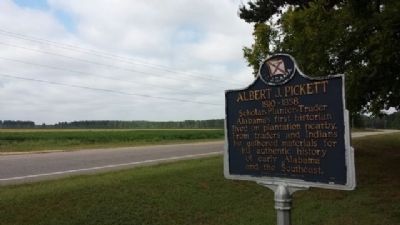
| On East 4th Street west of North Court Street, on the right when traveling west. |
| Near West Main Street, 0.1 miles west of South Chestnut Street, on the right when traveling east. |
| On East 4th Street at South Chestnut Street, on the right when traveling east on East 4th Street. |
| On South Court Street at West Main Street, on the right when traveling south on South Court Street. |
| On Dosterville Road, 1.5 miles west of South Memorial Drive (U.S. 31), on the left when traveling west. |
| On Bridge Street at Gin Shop Hill Road, on the right when traveling west on Bridge Street. |
| On County Road 3, 0.7 miles east of Greeno Road (U.S. 98), on the right when traveling east. |
| On West 2nd Street east of McMillan Avenue, on the right when traveling east. |
| On Franklin Street, on the right when traveling north. Reported permanently removed. |
| On Franklin Street, 0.4 miles north of Washington Avenue, on the right when traveling west. |
| On Franklin Street, 0.4 miles north of Washington Avenue, on the right when traveling west. |
| On Franklin Street, 0.1 miles north of Washington Avenue, on the left when traveling north. |
| On County Road 49 at Swift Coles Lane, on the left when traveling south on County Road 49. |
| On Main Street at Manci Avenue, on the right when traveling south on Main Street. |
| On Daphne Road (County Road 64) near State Route 181, on the right when traveling west. |
| On Sutton Place at Gulf Place, on the right when traveling south on Sutton Place. |
| On Fort Morgan Road (Alabama Route 180) west of Pontoon Lane, on the right when traveling west. |
| On Josephine Drive, on the right when traveling east. |
| On Jack Springs Road at Lottie Road (County Road 61), on the right when traveling south on Jack Springs Road. |
| On North Hickory Street at Municipal Park Drive, on the right when traveling south on North Hickory Street. |
| On Oak Street west of Magnolia Springs Highway, on the right when traveling west. |
| On Sibley Street, 0.1 miles west of U.S. 98, on the left when traveling west. |
| On Canal Road at Bay Circle, on the right when traveling west on Canal Road. |
| On Canal Road (Alabama Route 180) at Pensacola Avenue, on the right when traveling east on Canal Road. |
| On Orange Beach Boulevard (Alabama Route 161) at John M Snook Drive, on the right when traveling south on Orange Beach Boulevard. |
| On Canal Road east of Nancy Lane, on the left when traveling east. |
| On Perdido Beach Boulevard (Alabama Route 182) 0.1 miles east of Tannin Boulevard, on the right when traveling east. |
| On Franklin Street, 0.1 miles Washington Street, on the left when traveling north. |
| Near Spanish Fort Boulevard at Blakeley Way (County Road 72). |
| On Fort Mims Road north of Boatyard Road (County Route 80), on the right. |
| On Alabama Route 59, on the right. |
| On Alabama Route 59 north of Hodgson Road, on the right when traveling north. |
| On County Road 32, 0.2 miles west of Sherman Road, on the right when traveling west. |
| On County Road 32 at State Route 59, on the right when traveling west on County Road 32. |
| On U.S. 82 at County Route 79, on the right when traveling east on U.S. 82. |
| On John Scott Road near Bethel Road, on the left when traveling south. |
| On Court Street, on the left when traveling south. |
| On West Louisville Avenue, on the right when traveling east. |
| On North Midway Street, on the right when traveling north. |
| On Alabama Route 51 north of Clio Short Road, on the right when traveling north. |
| On Blue Springs Street, on the right when traveling west. |
| On East Broad Street east of North Livingston Avenue. |
| On Springhill Road north of U.S. 82, on the right when traveling north. |
| On North Eufaula Avenue (U.S. 431) 0.1 miles north of Broad Street, in the median. |
| Near North Randolph Avenue at East Browder Street. |
| On East Broad Street east of North Livingston Avenue, on the right when traveling west. |
| On East Broad Street east of North Livingston Avenue, on the right when traveling west. |
| On East Broad Street east of North Livingston Avenue. |
| On Alabama Route 51, on the right when traveling south. |
| On Alabama Route 51, on the right when traveling north. |
| On Montevallo Road (State Highway 25) at County Road 62, on the left when traveling west on Montevallo Road. |
| On State Park Road south of Furnace Road (County Road 62), on the left when traveling south. |
| Near Mill Street, 0.2 miles south of Walnut Street (State Route 25), on the right when traveling south. |
| On Main Street at Walter Owens Drive, on the left when traveling east on Main Street. |
| On Alabama Route 5, on the right. |
| On Main Street (U.S. 231) at Lee Street West, on the left when traveling north on Main Street. |
| On Lee Street (County Road 26), on the right when traveling west. |
| On College Street at Church Street, on the right when traveling north on College Street. |
| On Town Hall Road, on the left when traveling east. |
| On Alabama Route 160 at Nectar Bridge Road, on the right when traveling north on State Route 160. |
| On County Road 36, 0.1 miles north of New Home Church Road, on the right when traveling north. |
| On Second Avenue East (US Highway 231) at 4th Street North, on the right when traveling west on Second Avenue East (US Highway 231). |
| On Ingram Avenue East at 2nd Street South, on the right when traveling east on Ingram Avenue East. |
| On Alabama Route 75, on the left when traveling north. |
| On U.S. 29 just north of Twin Trail, on the right when traveling south. |
| On County Route 19, on the right when traveling south. |
| On U.S. 29 at County Road 19, on the right when traveling south on U.S. 29. |
| On Railroad Street at Depot Street, on the right when traveling west on Railroad Street. |
| On U.S. 15/29, on the right when traveling north. |
| On U.S. 82 at County Road 35, on the right when traveling west on U.S. 82. |
| On U.S. 82 west of Prairie Street, on the right when traveling east. |
| On North Prairie Street, on the right when traveling north. |
| On East Railroad Avenue at Jones Street, on the right when traveling north on East Railroad Avenue. |
| On East Commerce Street (Alabama Route 10) at South Conecuh Street (County Route 45), on the left when traveling east on East Commerce Street. |
| On Ridge Road (County Road 54) at Crenshaw Road, on the right when traveling north on Ridge Road. |
| On South Park Street south of Walnut Street, on the right when traveling north. |
| On Sherling Lake Road (Road 44) 0.4 miles north of Ridge Road (County Road 54), on the right when traveling north. |
| On East Commerce Street (Alabama Route 10) at Posey Street, on the right when traveling west on East Commerce Street. |
| Near Oakey Street Road at Halso Mill Road (County Route 59), on the right when traveling north. |
| On Airport Road, 0.1 miles south of Old Stage Road, on the right when traveling south. |
| On Martin Luther King Drive east of Douglas Street, on the right when traveling east. |
| Near Mountain Street Northwest west of Woodward Avenue Northwest. |
| On Public Square West (State Highway 21) south of Clinton Street Southwest, on the left when traveling south. |
| On Pelham Road North (State Highway 21) at Mountain Street Northeast, on the right when traveling north on Pelham Road North. |
| On Public Square East (State Highway 21) west of Ladiga Street Southeast, on the left when traveling north. |
| On Mountain Street Northwest west of Woodward Avenue Northwest, on the left. |
| On A Street Southwest near H Avenue Southwest, on the right when traveling west. |
| On A Street Southwest at G Avenue Southwest, on the left when traveling west on A Street Southwest. |
| On Main Street at East Oak Street, on the right when traveling north on Main Street. |
| On Snow Street near Hale Street, on the right when traveling west. |
| On Main Street south of East Oak Street, on the right when traveling north. |
| On McKibbon Street, 0.1 miles west of Ross Street, on the right when traveling west. |
765 entries matched your criteria. The first 100 are listed above.
Next 100 ⊳