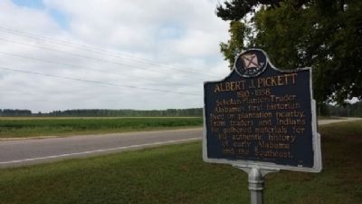
Alabama's first historian lived on plantation nearby. From traders and Indians he gathered materials for his authentic history of early Alabama and the Southeast. — — Map (db m304048) HM
Born August 13, 1810 in Anson County, North Carolina. Albert
James Pickett was the youngest child of Colonel William Raiford
Pickett and Frances Dickson. The family moved to the Alabama
Territory in 1818, establishing a plantation and lucrative . . . — — Map (db m304050) HM
Robert Ripley's world-wide syndicated Believe It Or Not! column for July 31, 1935 read: "C. D. Abbott is the first citizen of the U.S.A. He is first alphabetically in Autaugaville, the first town in Autauga, the first county in Alabama, the . . . — — Map (db m68839) HM
Established prior to 1833, the Robinson-DeJarnette Cemetery is located
on property first granted by the U. S. Government to early Autauga County
settler James Jackson. In 1825, Jackson transferred the land patent to
Eli Terry Sr. On March 16, . . . — — Map (db m294231) HM
The William Dixon Smith family settled in Autauga County in 1818, prior to Alabama Statehood. The family patriarch, William Dixon Smith (1809-1902), was a planter, forester, and operated a sawmill and gin. He also operated a mercantile business . . . — — Map (db m304169) HM
The James Jackson Cemetery is the final resting place of James Jackson,
one of the earliest White settlers in old Autauga County. He settled in the
area in 1817, when Alabama was still a territory. He established a large
plantation, Auburn Hill, . . . — — Map (db m303972) HM
Milton was settled around 1829. By 1840 it had become a prominent village of Autauga County. It was known as "Milton City” when the 1886 flood buried it in sand. Among the early families were Wm. L. and Sarah Taylor. Elihu and Elizabeth Parr Bates. . . . — — Map (db m209092) HM
Created in 1818 by an act of Alabama Territorial Legislature. Autauga Indians lived on creek from which the county takes its name. Autaugas were members of the Alibamo tribe. They sent many warriors to resist Andrew Jackson's invasion in Creek War. . . . — — Map (db m27907) HM
Side 1
Water has always played a significant role in the history of Prattville. Daniel Pratt chose the location for his new town because of the proximity to Autauga Creek and the Alabama River. This area was referred to as an . . . — — Map (db m70815) HM
Side 1
Daniel Pratt
Founder of Prattville
Daniel Pratt, a native of New Hampshire, became an industrialist, statesman and philanthropist in Alabama. He was a Methodist in both heart and practice. He encourage the development of the . . . — — Map (db m70813) HM
Located within Daniel Pratt Historic District, this park overlooks Autauga Creek and the manufacturing complex around which this New England style village developed. Daniel Pratt founded Prattville in 1839, and patterned the town after those of his . . . — — Map (db m27958) HM
Indian Springs Post Office
Location of considerable Community activity in the early nineteenth-century Autauga County
Thomas Hill House
Site of first Court after Autauga became a County
Union Baptist Meeting House
1830s . . . — — Map (db m70798) HM
Daniel Pratt, Prattville’s founding father, constructed an imposing home and garden within a quarter-mile of this site on Autauga Creek, near his industrial complex. The large home was designed and erected by Pratt himself, a noted architect / . . . — — Map (db m27985) HM
The Vine Hill Cemetery was established in the 1880s. The cemetery sits atop
a ridge in western Autauga County and has over 100 marked graves. The
oldest is for Kate Elizabeth Sherrill, who died in 1890. The cemetery
is the final resting place . . . — — Map (db m304120) HM
Barnwell
In 1903, Postmaster Charles 'Dewey' Slocum designated the community
post office 'Barnwell' in honor of Rev. Robert Woodward Barnwell, an
Alabama Episcopal Bishop. It first operated out of the Slocum home and
later from the Basil . . . — — Map (db m207535) HM
Side 1
In 1860, the center of commerce in Baldwin County ran along the rivers with the remainder of the county mostly wilderness. In 1861, with secession declared, the Alabama Legislature allocated funds to finish the stalled Mobile . . . — — Map (db m100846) HM
Ruins of the original Foundation of
Baldwin County's First Courthouse
Authorized 1820 • Constructed circa 1833
Preserved by Historic Blakely State Park 2011-12
With support in part of a Save Amerca's Treasures grant by the National Park . . . — — Map (db m82019) HM
Just a half century prior to the founding of the town of Blakeley, an Apalachee Indian village stood on this spot. The village was founded in the early 1700s by Apalachee refugees fleeing warfare in Florida for the relative safety of French . . . — — Map (db m131851) HM
The Bottle Creek site is the second largest mound center in Alabama and it represents the remnants of a large Mississippian Stage civic and ceremonial complex that dominated the Mobile-Tensaw Delta from AD 1250 to 1500. Located in the heart of the . . . — — Map (db m131832) HM
Blakeley was once one of the largest cities in Alabama. Envisioned by its founders as a rival to Mobile as a regional trading center, the town thrived briefly before a combination of factors brought about its decline. Today the site of the city is . . . — — Map (db m131864) HM
The Charles Swift Family
Charles Swift came to Alabama in 1880 and married Susan Roberts in 1885. He developed a successful lumber business, including a sawmill here on the Bon Secour River. The Swifts raised their eleven children in this . . . — — Map (db m122465) HM
The City of Daphne was incorporated July 8, 1927 with a population of 500. its history, however, dates to a much earlier period. Research and artifacts show that Tensaw, Alabama, Choctaw, Creeks, and Seminole Indians all lived in the this area prior . . . — — Map (db m100843) HM
Colonia Italiana 1888-The Beautiful Forest
In 1888, Alesandro Mastro-Valerio, realizing the plight of fellow Italian immigrants living and working in hazardous conditions in many northern states, bought land here to attract colonists. He . . . — — Map (db m130913) HM
By the 1750s, French colonists were living on family farms on the shores of Mobile Bay. One group of settlements, known as ‘The Village', was located here along on the bluffs of the eastern shore of the bay. The colonists raised cattle, pigs, and . . . — — Map (db m291606) HM
This countryside along what is called the “Old Spanish Trail” between Mobile Bay and Pensacola was only sparsely settled in the early 1900’s. In 1909, F. X. Duchesneau and other French Canadians from North Dakota moved here to . . . — — Map (db m285990) HM
Fairhope began as the dream of a group of individuals who were
seeking their own utopia. The first Single-Tax colonists (so called
because of their belief in the economic theories of Henry George,
who advocated no taxes other than a single land . . . — — Map (db m284081) HM
Master woodcarver, adventurer, writer, World War II Marine Corps veteran, and Fairhope legend are just a brief summary of Craig Turner Sheldon's life and contributions. He settled here in 1946 with his Wife Annie Lowrie to raise their growing family . . . — — Map (db m128894)
At the end of the Civil War, former slaves John
Lewis (1838-1891) and his wife Nancy Lewis (1841-1910)
enjoyed newly found freedom and moved here to
southwest Baldwin County, Alabama.
The Lewis' lived on unused land and had an . . . — — Map (db m285537) HM
Officially designated “Pleasure Island” in 1949 by Governor Jim Folsom, the 32 miles of white sandy beaches in Gulf Shores has been a prime fishing and golf destination for Alabamians and tourists. Early Alabama Gulf Coast individuals . . . — — Map (db m52045) HM
Navy Cove. The Mobile Bay shoreline just inside Mobile Point, close to Fort Morgan, is known as Navy Cove. This was the site of Native American villages for over two thousand years. The name came after the British Navy anchored here when Fort . . . — — Map (db m122441) HM
In 1841, Raphael Semmes acquired farmland at the head of this bayou. The new homestead was named Prospect Hill. Several of Semmes’ colleagues from the Pensacola Navy Yard obtained nearby property and established “a very nice colony of nautical . . . — — Map (db m71957) HM
Front
Lottie has the highest elevation in Baldwin County. A ridge forms a divide where waters to the east flow into Pensacola Bay and waters to the west flow into Mobile Bay. Pine Log Creek begins in Lottie. Pine Log Ditch, used to . . . — — Map (db m122349) HM
As early as 1889 settlers came to this community, then known as Bennett, to farm. In 1891, John E. Loxley, from Michigan, opened a lumber mill he named 'Bennett Mill'. The settlement was later renamed Loxley, honoring the timber merchant. . . . — — Map (db m234691) HM
Front:
Settlement of this area began in the early 1700’s and was expedited by a series of Spanish land grants in the early 1800’s. During the 1819-33 time period a brick factory along the south river bank supplied brick for . . . — — Map (db m66271) HM
The Village of Montrose. In 1839, Cyrus Sibley of Massachusetts acquired land on the eastern shore of Mobile Bay. Eight years later, a village was formally platted, surveyed, and was called 'Sibley City'. In 1852, it was renamed 'Montrose' as . . . — — Map (db m234963) HM
Front
This area, located along the southern shore of Wolf Bay, was the original 'Downtown' of Orange Beach. Beginning in the 1870's, the two schooners of James C. Callaway anchored near here in the deep-water Boat Basin. The . . . — — Map (db m130682) HM
(front)
The property where the cemetery is located was part of a Spanish Land Grant issued to the Suarez family prior to the War of 1812. In 1925, a United States Land Patent was confirmed and issued. The property has been in use since . . . — — Map (db m71618) HM
The community of Orange Beach goes back to at least
1838, as evidenced by property deeds. As an incorporated
city, it is quite young. Following Hurricane Frederic on
September 12, 1979, with all its publicity, Orange Beach
was 'discovered'! . . . — — Map (db m122462) HM
Front:
Orange Beach was named for the oranges that were grown here and exported until the hard-freezes of 1916. The orange groves are gone, but the name remained. Drawn here by the game they hunted, the early Indians discovered the . . . — — Map (db m81851) HM
Romar Beach began as a large homestead property with three miles of beachfront spanning from Gulf State Park to Hwy 161 in Orange Beach. The original property now covers only 480 feet. It was a true homestead and the owners were required to ‘till . . . — — Map (db m122463) HM
Courts met under "Jury Oak" early 1800s. Judge presided while sitting on tree limb. Public executions held at nearby "hanging tree". — — Map (db m221963) HM
Spanish Fort is the gateway to the second largest delta in the United States. The Mobile-Tensaw, River Delta is 30 miles long and 12 miles wide. It covers more than 200,000 acres of swamps, river bottomlands and marshes and is considered the best . . . — — Map (db m285174) HM
Incorporated in 1814 by the legislature of the Mississippi Territory, prior to Alabama's statehood, the town of Blakeley was envisioned by the founder Josiah Blakeley as a premier trading canter and a rival to Mobile as a port owing to its deep . . . — — Map (db m280482) HM
Front:
Historic Stockton
Modern Stockton is situated on a hill just above the original settlement, which was abandoned around 1840 because of Yellow Fever outbreaks. No verified source for the town name exists. Most likely it was . . . — — Map (db m66390) HM
Surveyed in 1799 to mark the 31° North Latitude, this line charted the first southern boundary of the United States, separating the U.S. from Spanish Florida. The line was marked at one-mile intervals by earthen mounds approximately fifteen-feet . . . — — Map (db m81856) HM
Sonora Community
The community of Sonora was named in 1901 by the wife of the first postmaster, G.L. Sharretts. Situated near Red Hill Ford on Baker Branch and the intersection of travel routes between Silverhill, Magnolia Springs, Marlow . . . — — Map (db m130878) HM
Summerdale
The Summerdale area was settled in the early 1850's by several families of Scotch and Irish descent. By 1900, the town had a church, a saw mill, a turpentine business, and a hotel. Many families of different nationalities moved . . . — — Map (db m188733) HM
Front:
In 1813, people on the United State’s southwestern frontier were fearful. The Redstick faction of the Creek Indian Nation opposed growing American influence in the area and had voted for war. However, Creeks living in the Tensaw . . . — — Map (db m116678) HM
Montgomery Hill Landing
In the late 1800’s and into the early 20th Century, Montgomery Hill Landing was used by local plantations to send and receive goods from Mobile or points North. Huge paddlewheel boats would dock here for loading and . . . — — Map (db m247493) HM
Tensaw
The native Mississippians, Tohomes, Mobilians, and Creeks inhabited this area for centuries. Tensaw was named for the Taensa people who lived nearby during the 1720s. They farmed the bottomlands and hunted the dense forests. . . . — — Map (db m247482) HM
In 1828, Reverend John Wesley Norton left his native South Carolina with his family and a wagon train of followers, crossed into the Creek Indian Nation and just into the edge of what was then Pike County, settling near the present town of . . . — — Map (db m78123) HM
Organized and constituted April 11, 1835. A committee called brethren John Tew and Solomon Sikes as presbyters. The presbyters, finding the brethren orthodox in faith, constituted a church which they named Bethel. Founders migrated from Pa., N. C.. . . . — — Map (db m220893) HM
County Seat of Barbour County
Clayton, the county seat of Barbour County, is located geographically in the center of the county. The town was located at the headwaters of the Pea and Choctawhatchee rivers on the historic road from Hobdy’s . . . — — Map (db m60772) HM
John H. Miller built this Gothic Revival townhouse in 1859. He and his wife moved from Orangeburg, South Carolina to Barbour County in the early 1830s, settling in an area which would become known as the Tabernacle community. He later purchased a . . . — — Map (db m60755) HM
This unusual house was built 1859 – 1861 by Benjamin Franklin Petty, a carriage and furniture merchant, who was a native of New York and a pioneer settler of Clayton. It was patterned after a design made popular by Orson S. Fowler’s book A . . . — — Map (db m39121) HM
Barbour County’s “Little Scotland”
In the 1820’s before the Creek Indian Cession, Scot immigrants from Richmond County, North Carolina, settled this area of west Barbour County. Few other regions outside the motherland of Scotland have . . . — — Map (db m89605) HM
The Central of Georgia Railroad completed a track spur connecting Eufaula, Alabama and Ozark, Alabama in the spring, 1890. The present site of Clio, Alabama was originally a water station known as Adkison Head. Old Clio was a small settlement . . . — — Map (db m200616) HM
"Chief Eufaula," the man often referred to in the historical record as "Yoholo Micco," was a Creek chieftain from the Upper Creek town of Eufaula. Born in the late 1700s, he fought alongside allied Creeks with United States forces against his Red . . . — — Map (db m284925) HM
This stretch of road between Eufaula and the Bullock County line was reconstructed thro the initiative and assistance of Edward Trippe Comer, of Savannah, GA. Its perpetual upkeep is insured by a fund of $100,000.00 set up in trust by him in 1919. . . . — — Map (db m163247) HM
Built by John Hart about 1850, the Hart House is recognized as an outstanding example of pure Greek Revival architecture. Hart (c. 1805-1863) moved from New Hampshire and became a prominent merchant and farmer. When constructed, the house was on the . . . — — Map (db m48376) HM
Interred on this gently sloping hillside are the remains of many of Eufaula’s early black citizens. Their names are known only to God because the wooden grave markers which located the burials have long since vanished. This burying ground was used . . . — — Map (db m27987) HM
The Second Creek war resulted in the final expulsion of the Creeks from eastern Alabama and paved the way for large-scale American settlement. The town of Irwinton gradually expanded westward from the bluff overlooking the Chattahoochee in the years . . . — — Map (db m101361) HM
The area surrounding Eufaula was once part of a regional Creek population center. Towns of note in the region included Sawokli (also known as Sabacola) and the town of Eufaula for which the modern city is named. Trails linked these closely-connected . . . — — Map (db m101355) HM
A small group of American settlers from Georgia formed a community called Eufaula in this vicinity as early as 1823. The settlement began to grow in importance later in the decade through the influence of prominent local landholder and Creek War . . . — — Map (db m101357) HM
One of the oldest towns in southeast Alabama was settled in 1817 by Daniel Lewis who established a trading post and named the community “Louisville” after the first capital of Georgia, his hometown. By 1820 four stores, a Methodist . . . — — Map (db m60768) HM
Near this site stood the old Pike County court house which was the county seat of Pike from 1822 to 1827. It also served as the temporary county seat of the newly created Barbour County in 1833, until Clayton was selected. Louisville was settled . . . — — Map (db m60674) HM
Absalom Pratt built this house 8 miles west of here circa 1835 though a section was constructed earlier. It was moved to this site in 1994 by the Cahaba Trace Commission, restored by the Alabama Historic Ironworks Commission, 1997-98, and dedicated . . . — — Map (db m37078) HM
Montebrier was built in 1866–67 for John William Mallet, a renowned scientist and educator and former Superintendent of Confederate Ordnance Laboratories. He came to Brierfield to assist General Josiah Gorgas, former Confederate Ordnance Bureau . . . — — Map (db m292815) HM
Originally located off Patton Chapel Road in what is today Hoover, Alabama, the Sunshine and Dorothy Morton house was moved to the Brierfield Park in March 2005 by the Morton family and restored over the next two years by restoration specialist . . . — — Map (db m37177) HM
Centreville Cemetery is older than the town of Centreville itself. The earliest known burial is that of Willie Coleman, dated 1822, and Centreville was established in 1823. One half of the cemetery, known as Cooper Cemetery, contains mostly the . . . — — Map (db m156403) HM
West Blocton began as a business and residential community adjoining the Cahaba Coal Mining Company's town of Blocton in 1883-84. West Blocton incorporated in 1901. Eugene D. Reynolds was the first mayor, 1901-1904, followed by Dr. L.E. Peacock, . . . — — Map (db m72283) HM
Woodstock was first settled in the 1820’s with a formal land grant to William Houston on Feb. 27, 1826. The settlement was established along the old Tuscaloosa to Huntsville Stage Coach Line. Woodstock got its name when Dr. J.U. Ray named it after . . . — — Map (db m63697) HM
1820-1889 seat of Blount County, a county older than the State.
Named for Tennessee Governor W. G. Blount who sent Andrew Jackson to aid Alabama settlers in Creek Indian War, 1812-1814.
Indian Chief Bear Meat lived here at crossing of . . . — — Map (db m156445) HM
1813: Colonel John Coffee and 800 Tennessee Volunteers see Bear Meat Cabin Cherokee Settlement near Blountsville
1816: Town settles around square
1820: Newly named Blountsville becomes county seat
1827: Town incorporated with Trustee System . . . — — Map (db m49176) HM
First minister assigned to Alabama Territory by Tennessee Conference. Preached first sermon two blocks west at Bear Meat Cabin (present Blountsville) April 18, 1818. He later organized churches in Shelby, St. Clair, Jefferson, Tuscaloosa and Cotaco . . . — — Map (db m27991) HM
The Dallas Community in Blount County was settled in the mid-1800s
after the Second Creek War (1836-1837). Settlers built general
merchandise stores, a blacksmith shop, a Methodist Church, and
a cemetery later known as Bethlehem Cemetery. Local . . . — — Map (db m307414) HM
While traveling south with his troops, General Andrew Jackson camped at the fork of the river in 1813. General Jackson carved his name in a locust tree naming this area Locust Fork. In 1817, the Hanby family came from Virginia and settled in this . . . — — Map (db m50125) HM
Planter, trader, historian, geologist, surveyor. Gathered authentic data from early settlers and Indians for his history of Blount County published in 1855. Made original survey of Blount County. — — Map (db m50123) HM
William M. Bailey (born 1859 in Cherokee Co.; died 1909 in Blount Co.) settled 40 acres on what became Co. Rd 36 to the west and New Home Church Rd to the east in 1893. He brought three small sons from Cherokee Co. after the death of his first wife . . . — — Map (db m42599) HM
Created Feb. 7, 1818 by Alabama Territorial Legislature from lands ceded by the Creek Indian Nation. Named for the Tennessee Governor W. G. Blount, who sent militia under Andrew Jackson to punish the Creeks for Fort Mims massacre. Jackson fought and . . . — — Map (db m24353) HM
The origin and development of Oneonta was due to the coming of the Birmingham Mineral Railroad, a part of the Louisville & Nashville Railroad. Because of the presence of iron ore, limestone and coal in the area, there was always a great potential . . . — — Map (db m156406) HM
In 1864, traveling in an ox cart, Dr. Robert M. Moore left his family in Walton County, Georgia, and journeyed to Blount County, Alabama. Finding fertile land, he returned to Walton County and persuaded his wife to move to Blount County with him. In . . . — — Map (db m49251) HM
The town of Aberfoil was incorporated January 26, 1839, in then Macon County, with the first election for councilors conducted and managed by Lewis Stoudenmire, Charles G. Lynch, Thomas Scott, David Hudson, and A. J. and E. A. Jackson. Aberfoil was . . . — — Map (db m61027) HM
Samuel Sellers (1788-1857) of North Carolina arrived with his large family at Three Notch Road on January 29, 1835. Here, in what was then the Missouri Beat, Pike County, the first post office in the area was established, 2.5 miles west of . . . — — Map (db m61061) HM
Built by U.S. Army engineers over the summer of 1824, Three Notch Road has served as Bullock County’s major transportation route throughout its history. It was constructed to facilitate military communication between Pensacola in Florida and Ft. . . . — — Map (db m89638) HM
In 1838, Samuel Feagin, first postmaster and founder
of Midway donated 6 acres of land to Micajah Stinson,
Henry Barron and Simon Stinson as legal representatives
of the Baptist Church at Fellowship for a public burying
ground and school. Arthur . . . — — Map (db m277687) HM
Pioneer Samuel Feagin Sr. settled the Village of Midway in 1836. He came from Jones County, Georgia and established his residence at what is still called “The Old Feagin Place.” Samuel purchased a large acreage of land and sold it to . . . — — Map (db m61854) HM
This community, settled during the mid-1830s, was first called Fulford’s Cross Roads, then Missouri Cross Roads when a post office was established here in 1846. The name Perote, adopted in 1850 was suggested by veterans returning from the Mexican . . . — — Map (db m276347) HM
Side 1
Built by U.S. Army engineers over the summer of 1824, Three Notch Road has served as Bullock County’s major transportation route throughout its history. It was constructed to facilitate military communication between Pensacola . . . — — Map (db m89637) HM
Log Cabin Museum
Early settlers of this area cleared land and built their first homes of logs in the early 1830s. This cabin was built by Reuben Rice Kirkland (1829-1915) about 1850. He and his first wife had ten children while living in the . . . — — Map (db m60969) HM
In the early 1800s, settlers coming from the Carolinas and Georgia received land grants and some purchased land from the Indians. They settled and cleared the forest for new farms and plantations in what would become a newly formed State of Alabama . . . — — Map (db m83258) HM
City of Georgiana Founded in 1855
Early settlers moved from Virginia, the Carolinas, Kentucky, Tennessee and Georgia into the deep forests of southern Butler County. In 1855, the Rev. Pitt S. Milner established a home-stead and post . . . — — Map (db m86265) HM
Side 1
Created in 1819 by Act of Alabama Territorial Legislature from lands ceded by the Creek Indian Nation by the Treaty of Fort Jackson, 1814.
Named for Captain William Butler, soldier of Creek Indian War, 1813-14, early settler . . . — — Map (db m70755) HM
Dr. John Coleman, born June 6, 1788 in North Carolina, was one of Butler County's earliest pioneer settlers. He built the Coleman-Crenshaw House some time between 1817 and 1821. In June 1820 the first election for Sheriff and Constable, held in . . . — — Map (db m130052) HM
A native of Virginia.
Pioneer settler of Butler County
for whom the county is named
Massacred by the Indians
near Butler Springs
March 18, 1818 — — Map (db m130049) HM
Ogly-Stroud Massacre
William Ogly built his cabin near this site at Poplar Springs along the Federal Road, and was killed here with most of his family on March 13, 1818. His friend Eli Stroud's wife was fatally wounded and their infant . . . — — Map (db m120933) HM
The Camellia City
Mr. J. Glenn Stanley, an ardent camellia enthusiast, dreamed of Greenville becoming “The Camellia City” and loyally promoted this slogan as editor of The Greenville Advocate. The city’s first Camellia Show was held at . . . — — Map (db m154579) HM
Oakey Streak
The community of Oakey Streak was so named for the abundance of oak trees in the immediate vicinity. From 1829-1843 the post office here was known as Middletown and from 1853-1935 Oakey Streak. Nearby was the Dawson Masonic . . . — — Map (db m70757) HM
Searcy School House was built in 1922, six miles north of Greenville,
Alabama. This historic building is one of the few original wood-frame
school houses remaining in Butler County. Considered state of the art
for its day, it was built by men of . . . — — Map (db m191642) HM
41459 entries matched your criteria. The first 100 are listed above. Next 100 ⊳