Built 1846-47 by slave labor, of handmade brick. Original cost $7,505.58. John Oldham, Mayor - Will Gibbon, Arch. Used as hospital for both Union and Confederate soldiers during War Between the States, this building was spared when the town, having . . . — — Map (db m49682) HM
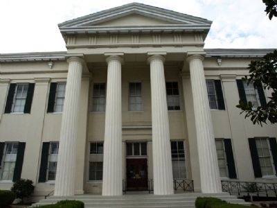
As the state capitol (1839-1903), this building was the site of the 1861 Secession Convention and 1868 and 1890 Constitutional Conventions. Andrew Jackson, Henry Clay, and Jefferson Davis spoke here. After housing state offices 1917-1959, the Old . . . — — Map (db m71069) HM
(South face)
Our Mothers
To the women of the Confederacy “Whose pious ministrations to our wounded soldiers soothed the last hours of those who died far from the objects of their tenderest love, whose domestic labors contributed . . . — — Map (db m16720) HM
Begun in 1833. Here Henry Clay, Andrew Jackson, and Jefferson Davis spoke. Was scene of 1861 Secession Convention, Black and Tan Convention of 1868, & 1890 Constitutional Convention. — — Map (db m71070) HM
Two of Jackson’s historic hotels once stood at this site. The Eagle Hotel, originally a tavern, was built in 1823. Andrew Jackson was a guest here in 1840. Alexander McClung, editor and Mexican War hero, committed suicide at the hotel in 1855. The . . . — — Map (db m51178) HM
Built ca. 1853 for James H. Boyd, Mayor of Jackson, 1842, 1844, 1850, and 1858. One of the few homes to survive the Civil War, the Greek Revival house is listed on National Register of Historic Places. — — Map (db m115286) HM
During the Civil War siege of Jackson, on
July 11, 1863, Union soldiers in the 2nd
Michigan Infantry staged an impromptu
assault on the city's fortifications.
Advancing south through what is today
eastern Belhaven, they overran a campsite . . . — — Map (db m115337) HM
Over 450 Confederate soldiers who died in and around Jackson during the Civil War are buried here. Their names are known but not the exact site of each grave, as some were reburied here from graves where they fell. As Jackson awaited the final . . . — — Map (db m105596) HM
Fortification Street is situated along a section
line from the 1820 Choctaw Cession that became
Jackson's northern city limit by act of
Mississippi's General Assembly in 1821. The area
was surveyed by U.S. General Thomas Hinds and
Judge Peter . . . — — Map (db m178435) HM
Greenwood Cemetery is the oldest landmark in Jackson. Authorized by the Mississippi Legislature on January 1, 1823, it was later expanded from six to twenty-two acres and given its present name. Among those buried here are numerous governors, public . . . — — Map (db m51179) HM
During the Siege of Jackson, July 10-17, 1863, Confederate Gen. William W. Loring's division held defensive positions extending east of the Canton Road to the Pearl River. A number of artillery batteries were posted on this line, the most prominent . . . — — Map (db m107070) HM
Following the surrender of Vicksburg on July 4, 1863, Union forces under William T. Sherman pursued Joseph E. Johnston's Confederate army to Jackson and laid siege to the city. North of Jackson, Parke's IX Corps moved astride the Canton Road and . . . — — Map (db m71101) HM WM
Upstream, to your left, Confederate and Union soldiers fought through the creek’s thick underbrush. Here at the far right of the Confederate line, Col. Hiram Granbury’s 7th Texas regiment, CSA, charged into the thickets but were confronted by Ohio . . . — — Map (db m85100) HM
From this vantage point, Maj. Gen. James McPherson, USA, should have been able to watch the unfolding of the battle, but the smoke and dust clouds hung motionless near the ground all day. Nevertheless, he was able to see a skirmish line along the . . . — — Map (db m84941) HM
In April of 1861, rumors of Civil War became a reality at Charleston harbor when Fort Sumter was fired upon by Southern forces. Many leaders, both North and South, believed that a dash to capture the opposing side’s capital city would bring a quick . . . — — Map (db m85138) HM
The official casualty count for the Battle of Raymond totaled 1,266. The Federals reported 66 killed, 339 wounded, and 37 missing in action, while the Confederates reported 73 killed, 251 wounded, and 190 missing. While casualty reporting has always . . . — — Map (db m219674) HM
Civil War cannon were designed to be pulled by a limber
with six horses. The ammunition chest on the limber held
30 to 50 rounds of ammunition, depending on the caliber of the gun.
Each cannon traveled with a caisson, also pulled by a . . . — — Map (db m178477) HM
May 12, 1863, on Fourteen Mile Creek, 2,500 Confederate troops under Gen. John Gregg attacked a 10,000 man corps under Gen. James B. McPherson. Outnumbered, Gregg was forced to withdraw to Jackson. — — Map (db m26145) HM
By the time of the Civil War, the Natchez Trace had lost its significance as a national road. One of the sections ran from Port Gibson toward Jackson but the route veered from the original Trace to reach Raymond. In the spring of 1863, General U.S. . . . — — Map (db m87360) HM
“A single field, dotted with spots of timber, separated the Lower Gallatin and Utica Roads, and the main force of the enemy was on the latter road. Finding that I would necessarily be driven into town by his artillery unless I moved . . . — — Map (db m84987) HM
Early on the morning of May 12, 1863, McPherson, having received
Grant's message to move “with all activity," ordered his 17th Corps out
of its encampment on the Roach farm, ten miles to the southwest.
Once at Raymond he would complete the . . . — — Map (db m178546) HM
Anticipating that the enemy would approach Raymond from both of these roads, Confederate General Gregg positioned Capt. Hiram Bledsoe’s battery of three cannon and a battalion of infantry here to defend Raymond from either direction. However, on May . . . — — Map (db m85122) HM
C.S. Bledsoe’s Missouri Battery (3 Guns),
Gregg’s Task Force;
Capt. Hiram M. Bledsoe.
Around 9:30 a.m., May 12, 1863, Brig. Gen. John Gregg placed Captain Bledsoe’s two 12-pounder smoothbores and one Whitworth rifle here on a knoll at . . . — — Map (db m85124) HM
C.S. Gregg’s Task Force
Brig. Gen. John Gregg
1st Tennessee Infantry Battalion
Maj. Stephen H. Colms
This battalion was initially posted north of here to the right of Bledsoe’s battery in support of the three guns. About 2 p.m., Major . . . — — Map (db m85102) HM
C.S. Gregg’s Task Force
Miscellaneous Attached Units, May 12, 1863
1st Mississippi Battalion State Troops
Capt. James Hall
The 40-man detachment picketed the road to Utica and contested McPherson’s advance, but was unable to penetrate . . . — — Map (db m85123) HM
The Confederate Cemetery in Raymond contains the graves of 140 Confederate soldiers who were killed during the battle of Raymond on May 12, 1863, or who died as a result of their wounds. Most of the men were from Tennessee and Texas; many died in . . . — — Map (db m85108) HM
Gregg's Brigade was called up from Port Hudson, Louisiana, and arrived in Jackson, Mississippi, on Saturday, May 9, 1863. On Sunday night Pemberton ordered the brigade to march to Raymond, where it arrived Monday afternoon, May 11. During the Battle . . . — — Map (db m178601) HM
Gregg's Brigade was called up from Port Hudson, Louisiana, and arrived in Jackson, Mississippi, on Saturday, May 9, 1863. On Sunday night Pemberton ordered the brigade to march to Raymond, where it arrived Monday afternoon, May 11. During the Battle . . . — — Map (db m178606) HM
When Maj. Gen. Ulysses Grant's army crossed the Mississippi
River, Confederate Lt. Gen. John Pemberton realized he needed
more men and ordered Brig. Gen. John Gregg's brigade out of
Port Hudson, Louisiana, to Jackson, Mississippi. However, . . . — — Map (db m178595) HM
When Maj. Gen. Ulysses Grant's army crossed the Mississippi
River, Confederate Lt. Gen. John Pemberton realized he needed
more men and ordered Brig. Gen. John Gregg's brigade out of
Port Hudson, Louisiana, to Jackson, Mississippi. However, . . . — — Map (db m178605) HM
The Treaty of Doaks Stand, 1820, opened this land to white settlement. Land was quickly claimed, and pioneer families established themselves in this wilderness. William Dean and his wife Margaret settled near here on the Old Natchez Trace in . . . — — Map (db m87359) HM
As soon as the fighting broke out that morning, six guns of the 8th Michigan Light Artillery, marching near the front of the column, unlimbered and “went into battery” about a hundred yards from the bridge. They returned fire on the . . . — — Map (db m85032) HM
“One officer, not more than thirty feet from where I stood, quietly loaded up an old Meerschaum, lit a match, his pistol hanging form his wrist, and when he had got his pipe agoing, he got hold of his pistol again, and went on . . . — — Map (db m85099) HM
Civil War field artillery was organized in batteries, and while six guns were considered the ideal number, four gun batteries were common, especially in the Confederate service. A captain commanded the battery, and lieutenants were in charge of . . . — — Map (db m178542) HM
Confederate Brig. Gen. John Gregg arrived in Raymond on May 11 with orders from Pemberton to contain the right flank of the Federal army as it advanced north and determine where it was heading. Thinking he faced a force only half the size of his, . . . — — Map (db m85021) HM
(Front Side)
Confederate
We of the South Remember,
We of the South Revere.
(Rear Side)
Erected by the people of Hinds County in grateful memory of their men who in 1861-65 gave or offered to give their lives for the . . . — — Map (db m85144) WM
When the first shots of the Battle of Raymond shattered the morning calm, Capt. Samuel De Golyer's 8th Battery, Michigan Light Artillery galloped to the
front. Maj. Gen. McPherson reported that, "De Golyer's battery was placed in position in the . . . — — Map (db m178537) HM
Marching north toward Raymond on the Utica Road, the vanguard of Logan’s Union division was met by gunfire as the soldiers approached the Fourteenmile Creek bridge. Although confident that he outnumbered the enemy, Maj. Gen. James McPherson . . . — — Map (db m85039) HM
After the Battle of Raymond on May 12, Gregg's Confederates retreated through town and encamped on a ridge almost three miles east of the town square. McPherson's 17th Corps Federals marched into Raymond and went into camp for the night. During the . . . — — Map (db m219680) HM
Built, 1857-9, by the famous Weldon brothers with skilled slave labor crew. After the Battle of Raymond, fought 1 ¼ m. S.W. of here, May 12, 1863, this building served as a Confederate hospital. — — Map (db m85140) HM
St. Mark’s was organized in 1837 by Rev. James McGregor Dale and construction of the sanctuary was completed in 1855. Following the battle of Raymond on May 12, 1863, the church was used as a hospital for Federal soldiers. The interior of the church . . . — — Map (db m115932) HM
(Front Side)
Texas
Remembers the valor and devotion of its sons who participated in the Battle of Raymond and in other engagements of the Vicksburg Campaign.
Upon this field on May 12, 1863, soldiers of the 7th Texas Infantry, . . . — — Map (db m85976) WM
“Move your command tonight to the next cross-roads if there is water, and tomorrow with all activity into Raymond.”
Maj. Gen. Grant to Maj. Gen. McPherson, USA, May 9, 1863
“Move your brigade promptly to . . . — — Map (db m84988) HM
By late afternoon, as Brig. Gen. John Gregg, his officers, and soldiers realized they were seriously outnumbered they managed to extricate themselves from the fight and withdraw through Raymond to Jackson.
From here you can see the road that . . . — — Map (db m85101) HM
Two historic transportation routes are incorporated into this walking trail.
The concrete highway, ca. 1927, is generally the same route used by the Union army marching toward Raymond in May 1863. The bridge and highway, however, are more . . . — — Map (db m84990) HM
“Vicksburg is the key,” said President Abraham Lincoln. “The war can never be brought to a close until that key is in our pocket.”
The United States government had to control the lower Mississippi River in order to move agricultural products . . . — — Map (db m84989) HM
On May 12, 1863, two divisions of the XVII Corps marched from the Roach Farm on the Utica Road and defeated Gregg’s Confederate brigade at Raymond. The next day, McPherson’s men moved to Clinton and cut the railroad. Meanwhile, two divisions of the . . . — — Map (db m85109) HM
U.S. 11th Battery,
Ohio Light Artillery;
7th Div.; 17th Corps; Army of the Tennessee.
Lieut. Fletcher E. Armstrong.
The two 12-pounder howitzers, two 6-pounder smoothbores, and two 12-pounder James rifles of this battery were the only . . . — — Map (db m84928) HM
U.S. 3d Battery,
Ohio Light Artillery;
3d Div.; 17th Corps; Army of the Tennessee.
Capt. William S. Williams
This battery of four 12-pounder James rifles and two 6-pounder smoothbores was the third and final battery of Maj. Gen. John . . . — — Map (db m84930) HM
U.S. 8th Battery,
Michigan Light Artillery;
3rd Div.; 17th Corps; Army of the Tennessee.
Capt. Samuel De Golyer
This was the third and final position of De Golyer’s battery of two 12-pounder howitzers and four 12-pounder James rifles . . . — — Map (db m84929) HM
U.S. 8th Battery,
Michigan Light Artillery;
3d Div.; 17th Corps; Army of the Tennessee.
Capt. Samuel De Golyer.
This battery of “flying artillery” was the initial battery of Maj. Gen. John A. Logan’s division to arrive on . . . — — Map (db m85038) HM
U.S. Battery D,
1st Illinois Light Artillery;
3d Div.; 17th Corps; Army of the Tennessee
Capt. Henry A. Rogers.
Formerly the “McAllister Battery” of the Battle of Shiloh, Captain Rogers’ four 24-pounder howitzers arrived on . . . — — Map (db m84927) HM
48th Indiana Infantry, Col. Norman Eddy
59th Indiana Infantry, Col. Jesse I. Alexander
4th Minnesota Infantry, Lieut. Col. John E. Tourtelotte
Col. John Sanborn's Brigade arrived at the head of Brig. Gen. . . . — — Map (db m178482) HM WM
Escort
4th Missouri Cavalry, Company F. Lieut. Alexander Mueller
2d Illinois Cavalry, Company E, Capt. Samuel P. Tipton
First Brigade, Col. John B. Sanborn
Second Brigade, Col. Samuel A.
George B. Boomer
Artillery, Lieut. . . . — — Map (db m178501) HM WM
On May 7, 1863, Maj. Gen. Ulysses Grant began his northeastward march with three corps in order to cut Lt. Gen. John Pemberton's railroad line of communications. By Monday, May 11, Grant planned to form an east-west line of three columns for the . . . — — Map (db m178604) HM
Waverly, or the Peyton house, is located on the historic Natchez Trace, the main road from Raymond to Clinton. Waverly was constructed from 1831-34, and in 1863 was used as the headquarters of Maj. Gen. James B. McPherson after the Battle of Raymond . . . — — Map (db m219687) HM
The Whitworth was developed in England before the Civil War by Sir Joseph Whitworth, and was generally used by the Confederate armies. However, very few breechloaders were used in the Civil War because their breech mechanisms were relatively clumsy . . . — — Map (db m178473) HM
On May 9, two divisions of McPherson's XVII Corps marched to Reganton, then known as Crossroads and moved southeast toward Utica, camping at Meyer's Farm three miles southeast. On May 10, the XIII Corps marched through here from Big Sand Creek . . . — — Map (db m103873) HM
Three divisions of the XIII Corps camped here May 7-9, 1863, while a reserve division was at Little Sand Creek, two miles southwest. On May 8, Grant reviewed the troops here. On May 9, the XVII Corps marched through Reganton and turned toward Utica. . . . — — Map (db m103867) HM
On May 11, 1863, two division of the XV Corps camped here. Water was scarce, and Sherman reported to Grant that he was "short of provisions and ammunition" while captured mail indicated "many million rations in Vicksburg." The next morning, Grant . . . — — Map (db m103891) HM
On May 8, 1863, as the Union XV Corps left Grand Gulf, two divisions of the XVII Corps rested at Hankinson's Ferry and Rocky Springs to wait for rations. Three divisions of the XIII Corps camped at Big Sand Creek, one and a half miles northeast, . . . — — Map (db m103861) HM
W. 3 mi. Mineral springs created popular health spa prior to Civil War. Girls boarding school organized, 1854. In 1862, wounded from Shiloh treated here. Now Y. M.C.A. state camp. — — Map (db m140831) HM
During Brig. Gen. Benjamin Grierson's raid in the late winter of 1864-1865, a small Confederate brigade under the command of Gen. Wirt Adams attacked the rear guard of one of Grierson's columns at Franklin Church on January 2, 1865. Among the . . . — — Map (db m140860) HM
To the Holmes County
soldiers of 1861—1865,
and members of Holmes
County Camp No 398 U.C.V.
in memory of their
patriotism and heroism
and to commend their
example to future
generations.
Their deeds, proud deeds.
shall . . . — — Map (db m184582) WM
Here in 1849, Robert Morris, Mason, schoolmaster, began movement that resulted in creation of the Order of the Eastern Star. Schoolhouse has also housed Masons and Co. C 15th Miss. Inf. C.S.A. — — Map (db m140863) HM
On March 13, 1863, near this site, the NATCHEZ burned and sank in the Yazoo. Converted into a Confederate gunboat and armored with cotton bales, the vessel had been taken into the Yazoo to avoid capture. — — Map (db m121107) HM
The Steele's Bayou Expedition (March 14-27, 1863) was one of several Union efforts to bypass Confederate defenses at Snyder's Bluff by sending amphibious forces through the Delta's waterways. While the expedition ultimately failed in its objective, . . . — — Map (db m187815) HM
Front
The 2,006.5-mile Underground Railroad Bicycle Route (UGRR) was created by the nonprofit organization Adventure Cycling Association. From Mobile, Alabama, to Owen Sound, Ontario, the trail memorializes the Underground Railroad, a . . . — — Map (db m102972) HM
Only now are historians recognizing the extent Black soldiers and sailors, both slave and free, played in the American Civil War of 1861-1865. After the war ended some of these men made their home in Moss Point. In the area, now surrounding . . . — — Map (db m102287) HM
Tomb ½ block W. Built first RR in old S. W., 1831. Invented passing track & raised platform. Dredged "Grant's Pass" & E. branch Pascagoula R. Legislator in Miss., Ala., & La., voting for Ala. charter to N.O. & M. (L & N), 1866. — — Map (db m102202) HM
Jackson County, being on the Confederate side during the American Civil War, suffered numerous incursions by Union forces. However, it was the one of April 9, 1863, which, although small by combat standards, had far-reaching import to Union . . . — — Map (db m102301) HM
During the American Civil War the Union forces' grand strategy, the Anaconda Plan, was to encircle and then strangle the Southern States into submission. Confederate response included the use of blockade runners that dashed through the naval . . . — — Map (db m122537) HM
On July 18, the USS Grey Cloud and USS New London turned at Round Island and headed directly toward the large hotel at Pascagoula announcing their arrival by firing two shells over the hotel scattering the civilian population. Both . . . — — Map (db m122486) HM
Here, on July 4, 1864, Union landing force, sent from Rodney by General Ellett in search of cotton, clashed with C.S.A. cavalry under Maj. Moorman & was driven back to boats. — — Map (db m162119) HM
On July 4, 1864, a small brigade of
Confederate cavalry under the command
of Col. Robert C. Wood attacked a
Union force composed of the Mississippi
Marine Brigade and two regiments of
United States Colored Troops on an
expedition from . . . — — Map (db m117953) HM
The yellow tever epldemics of 1843 and 1898 were fatal to many
residents of Rodney. Even though the Union gunboat "Rattler"
fired upon the town, Rodney and her churches were spared
destruction during the Civil War. Here was the disembarking . . . — — Map (db m119482) HM
During the Civil War, on September 13, 1863, a skirmish ocurred
at the church. On that Sunday morning the Union gunboat "Rattler"
had docked at Rodney. Rev. Baker, a northern sympathizer
who was to preach that day, invited Captain Fentrese of . . . — — Map (db m118341) HM
Incorporated in 1828, Rodney was noted for its high level of culture, county fairs and business activity. Rodney once contained two banks, two newspapers, 500 people and 35 stores. Cottonseed development, river boat landing, river boat taverns and . . . — — Map (db m118287) HM
This one-story, Greek Revival-style house was constructed ca. 1847 with a wood façade shaped to resemble stone blocks and a hexagon-shaped entrance vestibule. On October 5, 1863 Confederate Major Amos McLemore, who had been sent to the area to round . . . — — Map (db m73449) HM
Newt Knight: Robin Hood or Renegade?
On October 5, 1863, Major McLemore sat in front of the fire in the comfortable home of Amos Deason. He had been sent from Atlanta to round up a growing number of deserters who hid out in the swamps of . . . — — Map (db m129103) HM
Near this site on June 25, 1863, a small group of Confederate soldiers and civilians under the command of Lt. W. M. Wilson of the 43rd Tennessee Infantry, defeated a detachment of the 5th Illinois Cavalry. During the skirmish, the entire 40 man . . . — — Map (db m61931) HM
Following their defeat in the battle of Corinth, Confederate forces, now under Lt. Gen. John C. Pemberton, established a line of defense on the Tallahatchie River in November 1862. Union Gen. U.S. Grant, moving down the Mississippi Central Railroad, . . . — — Map (db m102633) HM
Cedar Oaks was built ca. 1857
by architect and builder William
Turner. After surviving the Union
occupation of Oxford during the
Civil War, the house was moved
to this site in 1963 by local
clubwomen after the house was
threatened by . . . — — Map (db m219924) HM
The mansion ca. 1853 located on this site was burned by Union troops in 1864. Two original outbuildings are included in the present house, built in 1869. Jacob Thompson (1810-1885), a native of North Carolina, moved to Pontotoc, Mississippi, in . . . — — Map (db m102991) HM
Home of Lucius Quintus Cincinnatus Lamar from 1868 to 1888. Lamar was an educator at the University of Mississippi; a colonel, 19th Miss. Inf., CSA; a U.S. congressman; senator; Secretary of the Interior; and an associate justice of the U.S. Supreme . . . — — Map (db m102883) HM
Front
In Memory of
The Patriotism of the
Confederate Soldiers
Of Lafayette County,
Mississippi.
______
They Gave Their Lives
In A Just and Holy Cause.
Erected 1907
Left side (West)
A . . . — — Map (db m102994) WM
The original courthouse was burned in August 1864 by Union Troops led by Gen. A. J. Smith. Judge R. A. Hill secured Federal funds to construct the present courthouse which was completed and occupied in January 1872. — — Map (db m102877) HM
On December 2, 1862, as the Confederates
fell back to the Yalobusha River, Union
Gen. U.S. Grant moved his headquarters
from Waterford to Abbeville. On the 4th,
he moved to Oxford, while his advance
crossed the Yocona River. W.T. . . . — — Map (db m102879) HM
As Gen. Pemberton's Confederates
fell back from the Tallahatchie River on
December 1-7, 1862, they fought a rear
guard action at Oxford on December 2. To
prevent the destruction of bridges over
the Yocona River, Union cavalry under
Col. T. . . . — — Map (db m219831) HM
Chartered in 1836 on Chickasaw cession land, Oxford was named for the university town in England and became home to the University of Mississippi in 1848. During the Civil War, Generals Grant and Sherman met in Oxford (1862), and the Square and many . . . — — Map (db m102878) HM
Built in 1872 by the Mississippi Central R.R. (later part of the Illinois Central line), this depot replaced an earlier structure burned during the Civil War. For many years, the depot was a hub of activity for the town and the University of . . . — — Map (db m102679) HM
Organized by Presbyterian settlers in 1836. Church building erected 1844-46 on land bought from N. Miss. College. Church and vicinity occupied by some 30,000 Union troops Dec., 1862. Wm. Faulkner married here, 1929. — — Map (db m219926) HM
Originally built for use as magnetic observatory. Used as Confederate morgue after Battle of Shiloh in April, 1862. Also used by Gen. U.S. Grant in fall of 1862 and later by forces of Gen. Nathan B. Forrest. — — Map (db m102673) HM
Established during the Civil War,
this cemetery was used for both
Union and Confederate soldiers
who died in the hospital at the
University of Mississippi following
the Battle of Shiloh. Shortly after the
war, the Union dead were removed
and . . . — — Map (db m219842) HM
In 1920, this building was dedicated in honor of James Zachariah George (1826-1897). Born in Georgia, George moved with his family to Mississippi in 1834, settling two years later in Carroll County.
At the outbreak of war between the United . . . — — Map (db m219881) HM
In 1977 this building was dedicated in honor of Lucius Quintus Cincinnatus Lamar II (1825-1893).
Born in Putnam County, Georgia, Lamar moved to Mississippi in 1849. He joined the faculty of the University of Mississippi as adjunct professor of . . . — — Map (db m219857) HM
The Lyceum, which opened for the first University of Mississippi class in 1848, symbolizes the origins, endurance, and triumphs of higher education in Mississippi. During the Civil War, the building served as a hospital for Union and Confederate . . . — — Map (db m102753) HM
906 entries matched your criteria. Entries 201 through 300 are listed above. ⊲ Previous 100 — Next 100 ⊳