By Jimmy Emerson, June 13, 2026
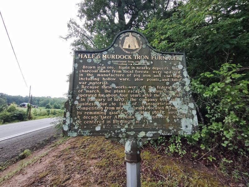
Hale & Murdock Iron Furnaces Marker
GEOGRAPHIC SORT WITH USA FIRST Geographic Sort Title Sort Marker Number Sort Marker Number Sort for Trails Publication Order Sort Publication Order Sort A Erected Year Sort Most Viewed Sort Most Recent-Interest Sort Most Recently Changed Sort SEE FAQ #33 FOR DESCRIPTIONS
On State Highway 18 0.2 miles west of 12th St SW, on the right when traveling east.
On Pond Street (Alabama Route 17) at 1st Avenue NE, on the right when traveling north on Pond Street.
On Alabama Route 207 south of Hammond Street, on the right when traveling south.
On Lee Highway (U.S. 72) at Big Oak (County Route 107), on the right when traveling east on Lee Highway.
On Alabama Route 101 at Putnam Parkway, on the left when traveling north on Alabama Route 101.
On Appleby Blvd. at Cypress Mill Road on Appleby Blvd..
On Hermitage Drive at North Court Street, on the right when traveling north on Hermitage Drive.
On East Ervine Avenue at North Court Street, on the right when traveling west on East Ervine Avenue.
On North Court Street 0.1 miles north of Hermitage Drive, on the right when traveling north.
On East College Street, on the right when traveling east.
On Military Road at Hermitage Drive on Military Road.
On McFarland Park Road, on the right when traveling west.
On Meridian Street at East Hawthorne Street, on the right when traveling south on Meridian Street.
On Veterans Drive at South Magnolia Street, on the right when traveling east on Veterans Drive.
Paid Advertisement
On Hermitage Drive just north of North Seminary Street, on the right when traveling south.
On North Court Street south of East Irvine Avenue, on the right when traveling south.
On South Magnolia Street, on the right when traveling north.
On Florence Boulevard (U.S. 43) at Sweetwater Avenue, on the right when traveling east on Florence Boulevard.
On East Tennessee Street (U.S. 72) at Short Court Street, on the left when traveling west on East Tennessee Street.
On Plantation Springs Drive.
On Lee Highway (U.S. 72) at County Route 33, on the right when traveling west on Lee Highway.
On Alabama Route 101 at Mill Creek Cir, on the right when traveling north on Alabama Route 101.
On Lee Highway (U.S. 72) at County Route 635, on the right when traveling east on Lee Highway.
Near McLean Drive 4.5 miles south of U.S. 72.
On Wheeler Street/Lambs Ferry Road (Alabama Route 207) south of Lee Street (County Route 66), on the left when traveling south.
On Alabama Route 101 at County Route 646, on the right when traveling north on Alabama Route 101.
On Main Street at County Road 45 on Main Street.
On County Route 14 at County Route 2, on the right when traveling north on County Route 14.
Paid Advertisement
On Van Buren Street 0.1 miles north of Jefferson Street.
On Clinton Avenue, on the right when traveling west.
On Alternate U.S. 72 at County Road 377, on the right when traveling east on U.S. 72Alternate .
On Alternate U.S. 72 at County Road 377, on the right when traveling east on U.S. 72Alternate .
On Court Street (County Route 460) east of Market Street ( Route 33), on the right when traveling east.
On Market Street (Alabama Route 33) at College Street, on the right when traveling south on Market Street.
On Market Street (Alabama Route 33) at Walnut Street when traveling south on Market Street.
On Morgan Street (County Road 87) at County Road 213, on the left when traveling west on Morgan Street.
On County Road 187, on the right when traveling west.
On Cooperage Way (County Route 700) at Route 20, on the right when traveling south on Cooperage Way.
On County Route 59 at County Route 7, on the right when traveling west on County Route 59.
On East Magnolia Avenue 0.1 miles east of North College Street ( Route 15), on the right when traveling west.
On East Glenn Avenue east of North College Street ( Route 15), on the right when traveling east.
On South College Street north of East Thach Avenue, on the right when traveling north.
On East Thach Avenue at Auburn Drive, on the left when traveling west on East Thach Avenue.
On Mitcham Avenue east of North Gay Street, on the right when traveling east.
Paid Advertisement
On Mitcham Avenue at North Gay Street, on the right when traveling west on Mitcham Avenue.
Near South College Street north of West Thach Avenue, on the right when traveling south.
Near South College Street, on the right when traveling south.
On Geneva Street south of South 8th Street, on the left when traveling south.
On South Railroad Avenue west of South 8th Street, on the left when traveling west.
On South Railroad Avenue at South 9th Street, on the right when traveling north on South Railroad Avenue.
On South 8th Street at South Railroad Avenue, on the right when traveling south on South 8th Street.
On County Road 391 east of County Road 151, on the right when traveling east.
On South Jefferson Street at Market Street, on the right when traveling north on South Jefferson Street.
On South Jefferson Street at West Washington Street, on the right when traveling south on South Jefferson Street.
On South Jefferson Street at West Washington Street, on the right when traveling north on South Jefferson Street.
On Beaty Street North at Market Street/Buck Island Road on Beaty Street North.
Near South Marion Street north of West Washington Street, on the right when traveling south.
On 4th Street at Grace Avenue, on the right when traveling west on 4th Street.
On Trinity Circle north of Browns Ferry Street (County Road 29), on the left when traveling east.
Near East Hobbs Street west of Thomas Street, on the left when traveling west.
Paid Advertisement
On South Marion Street north of West Washington Street, on the right when traveling north.
On Market Street east of North Marion Street, on the right when traveling west.
On Browns Ferry Street (County Road 29) west of Allyn Street, on the right when traveling west.
On Lentzville Road 0.7 miles south of Barker Road, on the right when traveling south.
On Market Street West at South Marion Street, on the right when traveling east on Market Street West.
On Market Street east of North Jefferson, on the right when traveling west.
On South Clinton Street at East Forrest Street, on the right when traveling north on South Clinton Street.
Near Trinity Circle north of Browns Ferry Street (County Road 29), on the left when traveling east.
On Trinity Circle north of Browns Ferry Street (County Road 29), on the left when traveling north.
Near Trinity Circle north of Browns Ferry Street (County Road 29), on the left when traveling east.
On Trinity Circle north of Browns Ferry Street (County Road 29), on the right when traveling east.
Near East Market Street west of South Clinton Street, on the right when traveling east.
On Elkmont Road/North Jefferson Street (Alabama Route 127) 1.2 miles south of Morris Road, on the right when traveling south.
On County Road 49 east of Railroad Street, on the left when traveling east.
On New Garden Road at New Garden Road (County Route 98), on the right when traveling south on New Garden Road.
On Upper Fort Hampton Road (County Road 49) east of Railroad Street, on the right when traveling east.
Paid Advertisement
On Dupree Hollow Road (County Route 37) 0.5 miles south of Easter Ferry Road (County Route 104), on the left when traveling south.
Near Dupree Hollow Road (County Route 37) 1.4 miles north of Buck Island Road ( Route 99), on the left when traveling north.
On Bee Line Highway (U.S. 31), on the right when traveling south.
On West Tuskeena Street (Alabama Route 21) at South Commerce Street ( Route 97), on the left when traveling west on West Tuskeena Street. Reported permanently removed.
On North Broad Street 1 mile north of U.S. 80, on the right when traveling north.
Near North Broad Street 1.5 miles north of U.S. 80, on the right when traveling north.
On Union Camp Road 0.2 miles north of Cooper Lane, on the right when traveling north.
On County Route 43 0.1 miles north of County Route 24, on the right when traveling north.
On Alabama Route 199 at Old Chehaw Road, on the right when traveling north on Alabama Route 199.
On East Rosa Parks Avenue at North Main Street ( Route 81), on the left when traveling west on East Rosa Parks Avenue.
On University Avenue at Tuskegee Airmen Circle, on the right when traveling north on University Avenue.
On Lee Highway/John T Reid Parkway (U.S. 72) at Gurley Pike, on the right when traveling west on Lee Highway/John T Reid Parkway.
On Old Highway 431 north of Cherry Tree Rd (County Road 28), on the left when traveling south.
On Franklin Street SE north of Lowe Avenue SE, on the left when traveling north.
On Poplar Avenue NW at Yukon Street NW, on the right when traveling west on Poplar Avenue NW.
On Monroe Street Northwest at Washington Street Northwest, on the left when traveling east on Monroe Street Northwest.
Paid Advertisement
On Westside Square, on the right when traveling north.
On Randolph Street Southeast at Greene Street Southeast, on the right when traveling west on Randolph Street Southeast.
On Maysville Road Northeast north of Humes Avenue Northeast, on the right when traveling north.
On Church Street NW, on the right when traveling north.
On Clinton Avenue East, on the right when traveling west.
︽
26483 entries matched your criteria. Entries 301 through 400 are listed above.
⊲ Previous 100 —
Next 100 ⊳