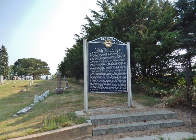
A marker, 200 feet to the south, recalls the death of White Buffalo Girl of the Ponca tribe. The death of this child, daughter of Black Elk and Moon Hawk, symbolizes the tragic 1877 removal of the Ponca from their homeland on the Niobrara River to . . . — — Map (db m182053) HM
”Near this location in July 1855 Logan Fontenelle noted French-Indian leader of the Omaha tribe, was slain in battle with the Sioux.” Petersburg Com’l Club, July 1955 — — Map (db m179380) HM
Logan Fontenelle, an interpreter and Omaha chief, was born at Bellevue in May, 1825. His father was Lucien Fontenelle, a noted fur trader both on the lower Missouri River and near Fort Laramie, Wyoming. His mother was a daughter of Big Elk, noted . . . — — Map (db m179377) HM
For more than ten thousand years the Beaver Valley and surrounding prairie, with their abundant water and wildlife, nurtured Native Americans. The Pawnee Indians, whose permanent earthlodge villages were a few miles to the south, claimed this area . . . — — Map (db m181373) HM
On the South Loup River southwest of here was the site of the U.S. Army’s Post South Loup Fork. This small outpost of Fort Kearney was established in May 1865 by Company “E”, Seventh Iowa Cavalry, under the command of Capt. James B. David and . . . — — Map (db m181699) HM
During their exploration of the Missouri and Columbia Rivers, Lewis and Clark held councils with Ponca, Omaha, and Sioux Indians inhabiting this region. The council with the Sioux occurred August 28-31, 1804 at Calumet Bluff now the southern . . . — — Map (db m101395) HM
On August 27, 1804, the Lewis and Clark Expedition set up its camp for four days downstream from Calumet Bluff. The explorers came across three American Indian boys who told them of a large Yankton Sioux camp nearby.
Knowing that President . . . — — Map (db m101392) HM
This scenic overlook provides a clear view of the valley of the Missouri River,
the longest waterway in North America. To the west is the Gavins Point Dam and
the Lewis and Clark Recreation Area. The dam was built to harness the fury of
the . . . — — Map (db m101391) HM
The Missouri, the continent's longest river, figures prominently in the unfolding of America's saga. Flowing nearby in its 2,341 - mile course from the Rocky Mountains to the Mississippi, the Big Muddy is not only loaded with sediment but . . . — — Map (db m101394) HM
Much of the early history of Cedar County involves the Indian inhabitants, the Ponca, Omaha, and Sioux. Several prehistoric and historic Indian villages were located in the region. In 1804, Lewis and Clark ascended the Missouri River near here . . . — — Map (db m181311) HM
Near this spot stood the Rowley sod house. Built in 1875 it was the first habitation in Chase County. On October 3, 1878, while on his way home to protect his family, Rowley was killed by Cheyenne Indians during the epic trek of Dull Knife’s Band . . . — — Map (db m177410) HM
When a Sioux Indian reservation was established north of here in Dakota Territory in 1878, early settlers in the region grew fearful of attack. They requested military protection, and in 1880 Fort Niobrara was built a few miles east of present-day . . . — — Map (db m77753) HM
Cheyenne County was organized in 1870 from lands ceded by the Cheyenne, Arapaho, and Dakota Sioux Indians. In the panhandle of Nebraska, it is part of the Cheyenne tableland portion of the Great Plains. Some fifteen miles west of Sidney lies the . . . — — Map (db m231054) HM
A distinct group of prehistoric hunter-gatherers known to archeologists as the Oxbow Complex once occupied the northern High Plains from western Nebraska to southern Canada. About 2500 B.C. a band of Oxbow people interred two of their own near . . . — — Map (db m231081) HM
By the early 1600s, the ancestors of the Pawnee Nation began consolidating into a few large communities. Each was home to hundreds, if not thousands, of people. Some of these were built along nearby Shell Creek. These Shell Creek cities may have . . . — — Map (db m179394) HM
Bancroft was the home of John G. Neihardt between
1900 and 1920. Here he wrote all of his short stories
and lyric poetry including A Bundle of Myrrh, The
Splendid Wayfaring, and the Quest and began his epic
poem A Cycle of . . . — — Map (db m159850) HM
An important Omaha Indian village called Tonwantonga (Large Village) by the Omaha stood on Omaha Creek in this area. Ruled by the great chief Blackbird, an estimated 1,100 people lived in this earthlodge town about 1795 and it played an important . . . — — Map (db m206966) HM
When the Lewis and Clark Expedition to the Pacific Ocean went through this area their mood was undoubtedly gloomy. On the previous day they had buried their comrade, Sergeant Charles Floyd, who died of a ruptured appendix. Although he was the . . . — — Map (db m206919) HM
From about 1846 until 1872, an Indian "trading house" occupied a site near here. Built by James Bordeaux, the trading station was once attacked and set afire by hostile Crow warriors. Fortunately, some friendly Sioux Indians came to the rescue and . . . — — Map (db m4529) HM
Following the 1874 establishment of military posts near the Red Cloud and Spotted Tail agencies for the Oglala and Brule Sioux, the army laid out a forty-two-mile road to transport military and Indian supplies between the agencies and posts.
Oglala . . . — — Map (db m89346) HM
Paha Sapa is sacred land of the Lakota that the white man has named Black Hills. We never lived in this place. It is the womb of Mother Earth—the rightful home of birds and animals. We came here only for ceremonies, vision quests and burials. The . . . — — Map (db m173952) HM
From about 1837 until 1850, more than a quarter million buffalo robes bought from Indians and 27 tons of fur company trade goods were hauled over the 300 mile long Fort Pierre-Fort Laramie Trail that followed the White River through this area. First . . . — — Map (db m4530) HM
Where Bison Roam Bison once roamed the Great Plains of North America. During the 19th century their numbers greatly declined, but they have rebounded slowly with more than 200,000 bison living on preserves and ranches. Fort . . . — — Map (db m235882) HM
Site of Cavalry Barracks 1874 Cheyenne Outbreak One hundred and forty-nine Northern Cheyenne Indians led by Dull Knife were taken into custody by troops from from Fort Robinson in October 23, 1878. Imprisoned in the log cavalry barracks, . . . — — Map (db m174893) HM
Oglala War-Chief
of the Sioux Nation
killed near this spot September 5, 1877
A great chief of heroic character.
He fought to the last to hold his
native land for the Indian people — — Map (db m174028) HM
Crawford sprang up as a tent city on land owned by homesteader/newspaper correspondent William E. Annin in 1886 when the Fremont, Elkhorn and Missouri Valley Railroad pushed through the Nebraska Panhandle. To Incorporate the town, editor William . . . — — Map (db m44254) HM
After escaping from Fort Robinson on January 9, 1879, the Cheyennes climbed the buttes to the south and fled through this area, pursued by Third Cavalrymen. Soldiers and Cheyennes fought sharp engagements west of here on January 11 and 13. The . . . — — Map (db m235873) HM
These officers quarters with adobe brick
walls are the oldest original buildings at
Fort Robinson. The post surgeon noted they
had dirt floors and complained over delays
in shipping heating stoves. A frame lean-to
at the rear provided kitchen . . . — — Map (db m223436) HM
Red Cloud Agency was established here in 1873
for Chief Red Cloud and his Oglala band, as well
as for other northern plains Indians, totaling
nearly 13,000. Their earlier agency had been located
on the North Platte near Fort Laramie. The . . . — — Map (db m223441) HM
The Chief of Fort Robinson Scouts, Baptiste “Little Bat” Garnier was shot by James Haguewood, bartender, in this building known as Dietrich’s Saloon, December 16, 1900. “Little Bat” died near the center of the street intersection about 3 a.m. and . . . — — Map (db m235888) HM
Just before 10 P. M. on January 9, 1879,
the 130 Cheyennes held in the cavalry barracks
made their desperate bid for freedom. After
disabling the soldier guards, they fled across
this ground to the White River beyond. Under
heavy fire from . . . — — Map (db m223442) HM WM
Perhaps no spot in Nebraska is so surrounded by historical and geographical landmarks as this one. Numerous landmarks of the period of the Indian Wars are visible from here. The site of a legendary battle between the Sioux and Crow Indians, Crow . . . — — Map (db m135118) HM
On this vast plain between Crow Butte and the White River, a Grand Council was held on September 20th, 1875. By the Treaty of 1868, the Government acknowledged the Black Hills and other lands in Dakota Territory belonged to the Lakota Indians. . . . — — Map (db m235897) HM
In September 1875 a lone cottonwood provided a landmark where the Allison Commission met with thousands of Lakota Sioux in a futile effort to buy the Black Hills. Based on the recollections of elderly Lakotas, Captain Christopher Robinson Chapter, . . . — — Map (db m235900) HM
Here in Dawson county, much of the early history is concerned with the pioneer trails to the west. The Mormon Trail to Utah and the first transcontinental railroad passed through here on the north side of the Platte River; the Oregon Trail and the . . . — — Map (db m68060) HM
Here, on August 7, 1867, a band of Southern Cheyennes, led by Chief Turkey Leg, wrecked a west-bound Union Pacific freight train and handcar which preceded it.
The engineer and fireman were killed and the boxcars looted and burned.
One of the . . . — — Map (db m120893) HM
Railroads played an important role in the settlement of the Great Plains. Their construction was particularly damaging to the Indian way of life, since railroads helped the military to patrol rapidly along their lines, and villages and farming . . . — — Map (db m101854) HM
The southeast corner of the Nebraska panhandle was organized November 6, 1888 from a part of Cheyenne County. Deuel County has two incorporated towns, Chappell, the County Seat and Big Springs.
Before 1850 Teton Sioux Indians camped on the . . . — — Map (db m119438) HM
Ponca, one of northeast Nebraska’s earliest communities, was platted in 1856 by Frank West and laid out by Dr. Solomon B. Stough. The town was named for the Ponca Indian tribe that inhabited the area when the first white settlers arrived. The . . . — — Map (db m206794) HM
When French traders and trappers explored the river in the early 1700's, the Ioway Indians occupied this area. Later explorers, such as Lewis and Clark, also traveled the Missouri. White settlement began in the late 1850's when the Omaha and Ponca, . . . — — Map (db m170764) HM
Built near this site in 1807 by Manuel Lisa, trader and indian commissioner, through whose influence the Omaha, Pawnee, Ponca, Otoe and Sioux tribes remained loyal to the United States during the War of 1812. — — Map (db m7892) HM
At the camp established very near here Captain Clark wrote about the "butifull Breeze from the N W. this evening which would have been verry agreeable, had the Misquiters been tolerably Pacifick, but thy were rageing all night." Clark may have . . . — — Map (db m7886) HM
Between 1804 and 1806, the Corps of Discovery traveled from St. Louis, Missouri, to the Pacific coast and back. President Jefferson instructed Meriwether Lewis to collect information on "the soil & face of the country, [its] growth & vegetable . . . — — Map (db m72050) HM
In August 1804, members of the Expedition visited villages like this one, homes to the Otoe and Missouria who lived in what is today Omaha. Planning to invite these tribes to a council, or meeting, the explorers found the villages deserted. The . . . — — Map (db m72049) HM
Near here, the Corps of Discovery held its first council, making speeches and presenting gifts to the Otoe and Missouria. Communicating through an interpreter, members of the Expedition believed their messages were clear. But were they?
This . . . — — Map (db m72057) HM
In 1803 the Missouri River carried the hopes of the young United States in its dark and unpredictable waters. President Thomas Jefferson sought a "direct & practicable water communication across the continent, for the purposes of commerce." The . . . — — Map (db m72059) HM
The joint efforts of many individuals and groups – among them military men and scientists, a president and an enslaved man, French-speaking boatmen and American Indians, women and men – determined the fate of the Corps of Discovery. . . . — — Map (db m57978) HM
Andrew was born on July 25, 1830, in Oakland County, Michigan, one of seven children, and was reared on a farm. His father, William, had served in the Continental Army during the American Revolution. Andrew attended the University of Michigan, and . . . — — Map (db m58201) HM
As a result of a major confrontation from 1866-1868 between the U.S. Army and the Lakota (Sioux), the U.S. government signed a treaty agreeing that the Army would abandon several posts along the Bozeman Trail. By this time, the Union Pacific had . . . — — Map (db m58157) HM
When Frontier County was organized in 1872, Stockville became the county seat. During its first decade no real town existed, it being only a trading center for the ranchers of the region. It was not until the middle-eighties, when the county filled . . . — — Map (db m223453) HM
Faced with the great influx of white settlers after the Civil War, hostile Sioux and Cheyenne Indians retreated into the Republican River Valley. Here they found a nearly ideal location since the valley remained one of the great buffalo ranges of . . . — — Map (db m176855) HM
After 1854 the Oto and Missouri Indian village and agency were located near here. For many years the two tribes had been living along the lower portion of the Platte River, but when Nebraska became a territory they relinquished all claims to . . . — — Map (db m78011) HM
The most important part of a living prairie is something you can't see without taking a shovel in hand. The dense, interlocking roots of prairie grasses make an underground structure unlike anything seen in the woodlands of the East. The insects, . . . — — Map (db m47596) HM
Ash Hollow was famous on the Oregon Trail. A branch of the trail ran northwestward from the Lower California Crossing of the South Platte River a few miles west of Brule, and descended here into the North Platte Valley. The hollow, named for a . . . — — Map (db m2503) HM
In 1854, the Federal Government hired contractors to carry the mail over the old trail to Salt Lake City and onto California. They built a mail station at Ash Hollow. Most of these mail stations became trading posts, carrying a small . . . — — Map (db m87326) HM
In 1872, settlement pioneered by Charles H. Jones in what is now Garfield County, followed the North Loup River northwestward to its junction with the Calamus River. In 1875, the post office serving the area near the confluence of the rivers was . . . — — Map (db m181898) HM
The source of the Calamus River is spring-fed Moon Lake, 60 miles northwest of here. The river was named after a common marsh plant eaten by muskrats. Archeological evidence indicates that prehistoric Indians camped in the valley as early as 3,000 . . . — — Map (db m189344) HM
In 1872-73 white settlers were moving into the North Loup Valley. Their presence sparked occasional conflicts with Lakota Sioux wandering down from the north to hunt or raid the Pawnee Reservation near Genoa. On January 18, 1874, Sioux passing . . . — — Map (db m181899) HM
Beneath the earthen exterior is an intricate structure of Cottonwood tree trunks and Willow branches. This is a moderate-sized earth lodge—thirty eight feet in diameter and eighteen feet high at the central fire hole.
Responsible for the . . . — — Map (db m45188) HM
You are near the Platte River's famous Grand Island. It is approximately forty miles in length and two miles at its widest. Providing abundant wood and water, it often served as a campsite for Pawnee Indians. Journalists for the expeditions of . . . — — Map (db m79694) HM
Grand Island, in the Platte River, has given its name to the city of Grand Island. The island was formed by a narrow channel branching off the Platte River approximately 28 miles upstream from the present city of Grand Island and rejoining the main . . . — — Map (db m53258) HM
The Pawnee: Prairie Town Builders, Pawnee History
The Pawnee migrated from the Southwest and lived in the Platte and Loup Village areas for more than seven centuries.
The Pawnee were the most influential and populous of the native peoples of . . . — — Map (db m45187) HM
The adjacent stone monument erected in 1930 was first placed about a mile south of this area. Originally on the highway overlooking the canyon, it was moved to this location after the highway was relocated.
Massacre Canyon is the large canyon . . . — — Map (db m79361) HM
Pony Express riders and Oregon Trail emigrants used Virginia Station, once located near this site. Indians traded for whiskey at the station and harassed the emigrant trains. The whiskey was dumped in a near-by creek, thus dubbing the station . . . — — Map (db m177351) HM
This region was once home to Oto and Missouri Indians, who ceded their land to the government before Nebraska Territory was created in 1854. White settlers arrived in 1857 and founded a town and post office named Helena about four miles west of . . . — — Map (db m177292) HM
By 1878 more than 300 Northern Cheyennes were desperate to escape their hated reservation in Indian Territory (Oklahoma). Led by Dull Knife and Little Wolf, they headed for their homeland in the north, fighting their way across Kansas. At about . . . — — Map (db m178707) HM
Seen through Ponca eyes, the original prairie environment was a cherished sea of grasses and plants. Together, with the buffalo, we kept the prairie healthy. Buffalo herds would graze the vast landscape, and our people would collect different types . . . — — Map (db m192598) HM
In contrast to the village earthlodge, the tipi was a light and portable shelter. It was a kind of seasonal, second home. Constructed of slender wooden poles and buffalo hide, tipis were pitched in a circular arrangement during the bison hunt and . . . — — Map (db m192656) HM
This building was constructed in 1936 by the Indian Emergency Conservation Work (IECW) force. Like the Civilian Conservation Corps, the IECW was part of the country's New Deal program aimed at providing economic relief during the Great Depression. . . . — — Map (db m192597) HM
Back in the day, our people lived in villages comprised of earthlodges. We called the lodges maithi, and they were set beside our gardens and crops. These dwellings were constructed by women, though men sometimes helped to cut and carry in the . . . — — Map (db m192655) HM
After a tragic history of forced relocation and land loss many tribes began coming together in the mid-20th century for intertribal gatherings. It was here that each tribe's long history of seasonal dances and sacred ceremonies culminated in a new . . . — — Map (db m192596) HM
For thousands of years our people depended upon the buffalo. We ate its meat, used its hides for our homes and clothing, its horns to make spoons, and our children even used the buffalo's ribs to make winter sleds. Every part of the animal was . . . — — Map (db m192600) HM
maN zhaN (the land) is xube' (sacred) to the Ponca People as is Ni' (water). Following forced removal of the Ponca Tribe to Oklahoma, the tribe split into two groups. The members that stayed in Oklahoma are now referred to . . . — — Map (db m192657) HM
This has been the homeland of the Ponca Indians since earliest recorded history. In 1868 the federal government signed the Treaty of Fort Laramie, which transferred the land to the Sioux without the permission of the Ponca. Treaties made with the . . . — — Map (db m179194) HM
Seen through Native eyes, the land and water are alive. Rocks, trees, meadows, and rivers: all of these natural elements possess their own life spirit. In our culture, Mother Earth is a powerful force in everyday life. We believe that our people, . . . — — Map (db m192653) HM
Our villages and old trails were always located near rivers or streams. Waterways were the highways of days gone by, and we used them for travel and trade. Sometimes they would also function as natural yet strategic barriers between one tribe and . . . — — Map (db m192599) HM
Sponsored by Senator Tom Brewer, legislative resolution 271 in the one hundred seventh legislature renamed the state office building located at 521 South 14th Street, Lincoln, Nebraska, as The Chief Standing Bear Justice Administration Building. The . . . — — Map (db m212117) HM WM
From his birth on the banks of the Niobrara River in Nebraska until his death in 1908, Chief Standing Bear spent his life in a constant struggle to gain equality and justice for our nation's Native Americans. Chief Standing Bear and the Ponca Tribe . . . — — Map (db m212118) HM
The fort was established on the Oregon Trail on the south side of the Platte River in October 1863, on the eve of intensified Indian raids on the Plains.
Built next to the well-known Cottonwood Springs and McDonald ranch, it commanded a . . . — — Map (db m101821) HM
• Born Feb. 26, 1846 near Le Claire, Iowa
• Pony Express rider in 1860
• Union Army Scout in 1861
• Scout for 5th Cavalry in 1868
• Chief of Scouts against the Sioux 1890
• Stage driver between Ft. Kearney & No Platte Nebr 1865
• Called . . . — — Map (db m130199) HM
The fort near here was established on the Oregon Trail on the south side of the Platte River in October 1863, on the eve of intensified Indian raids on the Plains. Built next to the well-known Cottonwood Springs and McDonald ranches, it commanded a . . . — — Map (db m180897) HM
This log cabin was constructed by the United States Army in the 1860's or 1870's at Fort McPherson. The logs were cut from the hills south of the Platte River near present-day Maxwell, Nebraska. Fort McPherson was established in 1863 by a . . . — — Map (db m191702) HM
The Pawnee were one of the most important Native American tribes of the Plains area. By the late eighteenth and early nineteenth centuries they were living in circular earthlodges in large villages, sometimes including more than a thousand people. . . . — — Map (db m191940) HM
Sioux Lookout, the highest point in Lincoln County, was a prominent landmark on the overland trails.
From its lofty summit the development of the West unfolded before the eyes of the Sioux and other Indians.
Trappers and traders came by here . . . — — Map (db m107393) HM
Near this site, July 12, 1859, Nebraska Territorial Militia and U. S. Army Dragoons, totaling 300 men, under the joint command of General John Milton Thayer and Lieutenant Beverly Holcombe Robertson, prepared to attack a large Pawnee village. . . . — — Map (db m189244) HM
Genoa, named by the Mormon Pioneers, was among several temporary settlements established by the Church of the Latter Day Saints in 1857, along the 1000-mile trail from Florence, Nebraska to Salt Lake City. These settlements were to serve as . . . — — Map (db m179388) HM
This was Pawnee Country, the last Nebraska home of an Indian Confederacy which once numbered more than 10,000, consisting of four tribes — Skidi, Grand, Republican and Tapage. Their domain covered a large part of Central Nebraska where they lived in . . . — — Map (db m179389) HM
It was an accepted custom for many early fur traders to marry into Indian tribes. As the Indians ceded their lands, the rights of the half-breed descendants were not always identified. This situation was recognized by the government in 1830, byt . . . — — Map (db m48131) HM
John B. Didier, Frenchman/Fur Trader• December 25, 1827 — Birth of John B. Didier, II to John and Anna B. Didier in France • 1827 — Arrived in America, settling in Cincinnati, Ohio • 1849 — Moved to St. Louis, MO, worked for . . . — — Map (db m194896) HM
During the Civil War many regular troops were withdrawn from Plains military posts to fight in the east. The Sioux, Cheyenne and Arapaho, seizing this opportunity, attempted to drive white settlers from their lands.
Beginning on August 7, 1864, . . . — — Map (db m76706) HM
The Lewis & Clark Expedition Barge/Keelboat was 55 feet long and 8 feet 4 inches wide and drew 2 to 2.5 foot [sic] of water when loaded with an estimated 12 to 15 ton[s] of supplies. The preponderance of the historic evidence indicates that it . . . — — Map (db m66982) HM
The Otoe and Missouria people who lived in this area in the 1700s and 1800s built villages with small groupings of earth lodges. Like the Omahas, Poncas and Pawnees who lived in Nebraska and Kansas, and Mandans, Arikawas and Hidatsas in the . . . — — Map (db m66979) HM
Pawnee City, the county seat of Pawnee County, was platted and the first lots were sold in the spring of 1857. The county, named for the Pawnee Indians who lived in Nebraska for generations, was defined by the territorial legislature on March 3, . . . — — Map (db m223472) HM
Warnings to avoid “bloody Kansas” prompted the Steinauer brothers, Anton, Nicholas, and Joseph, to settle here in Pawnee County. They arrived in September 1856, only two years after the creation of Nebraska Territory. Famine and depression had . . . — — Map (db m177419) HM
An early morning attack on a train of 12 wagons at this spot resulted in the death of 11 men and the capture of Mrs. Thomas Morton and 9 year old Danny Marble. The attack was by Indian “Dog Soldiers” of the Cheyenne Tribe led by Chief . . . — — Map (db m62794) HM
133 entries matched your criteria. The first 100 are listed above. The final 33 ⊳