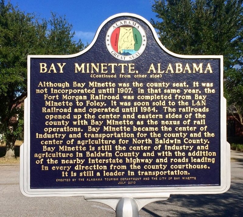
Side 1
In 1860, the center of commerce in Baldwin County ran along the rivers with the remainder of the county mostly wilderness. In 1861, with secession declared, the Alabama Legislature allocated funds to finish the stalled Mobile . . . — — Map (db m100846) HM
The community of Orange Beach goes back to at least
1838, as evidenced by property deeds. As an incorporated
city, it is quite young. Following Hurricane Frederic on
September 12, 1979, with all its publicity, Orange Beach
was 'discovered'! . . . — — Map (db m122462) HM
Lower Creek village of the Eufaula Indians antedating 1733. Early white settlers began moving into the village called Yufala in 1823. Irwinton chartered 1832, and renamed Eufaula in 1843.
Hub of a prosperous plantation region with thriving . . . — — Map (db m164055) HM
Louisville is one of the oldest communities in southeastern Alabama. Locąted within territory ceded by the Creeks in the Treaty of Fort Jackson (1814) ending the Creek War, the area was first settled by Americans as early as 1817. Many of its . . . — — Map (db m111642) HM
The City of Brent was founded in 1898 in the southern portion of Bibb County along the Gulf, Mobile and Ohio Rail line. The town was named after Mr. Brent H. Armstrong, a surveyor for the railroad. Brent was later incorporated in 1913. The . . . — — Map (db m217202) HM
The Treaty of Fort Jackson of August 9, 1814, by Major General Andrew Jackson on behalf of the President of the United States of America and the Chiefs, Deputies and Warriors of the Creek Nation, established a boundary line between the Mississippi . . . — — Map (db m277801) HM
Chambers County, created December 18, 1832 from Creek Indian cession. Named for Dr. Henry C. Chambers of Madison County, member of Constitutional Convention 1819, legislature of 1820, elected U.S. Senator 1825 but died enroute to Washington.
. . . — — Map (db m18162) HM
Known as Bluffton from about 1835-1893. Bluffton was incorporated in 1865. Name changed to Lanett, town of Lanett incorporated 1893. Its charter was approved in 1895. Early records mention academies, two near this site. The Presbyterian Church was . . . — — Map (db m92061) HM
Bluffton was the name of a village adjacent to West Point, Georgia in Chambers County, Alabama. Bluffton was incorporated as a town by an Act of the Alabama Legislature and approved February 20, 1866. It is not known who gave it the name of . . . — — Map (db m295585) HM
The town was named for the characteristics of local rocks. A post office was established in 1855 and closed in 1903. The Sand Rock High School Wildcats won the Class 1A football championship in 1985 and the Class 2A State softball championship in . . . — — Map (db m116616) HM
Clay County
Established Dec. 7, 1866
Boundaries of eastern Talladega County and western Randolph County were redrawn in 1866 to create the 58th county of Alabama. The name honors U. S. Senator Henry Clay of Kentucky. Historical place . . . — — Map (db m95095) HM
Coosa County
Named for the river on its western border, Coosa County was created by the Alabama Legislature on December 18, 1832, from land ceded by the Creek Nation in the Treaty of Cusseta. The name is taken from the Native American word . . . — — Map (db m131716) HM
Summerfield Summerfield was established in 1819 as Valley Creek and was renamed Summerfield in 1845 to honor the famous Methodist preacher John Summerfield. In 1829, the first academy in Dallas County was chartered in Valley Creek. In 1842, the . . . — — Map (db m217204) HM
Located 1½ miles south, town of Pollard established 1861 at juncture of Alabama & Florida and Mobile & Great Northern railroads. Named for Charles T. Pollard, builder of Alabama & Florida Railroad.
One of largest military training camps of . . . — — Map (db m84371) HM
The Treaty of Fort Jackson on August 9, 1814 by Major General Andrew Jackson on behalf of the President of the United States of America and the Chiefs, Deputies and Warriors of the Creek Indian Nation, established a boundary line between the . . . — — Map (db m71836) HM
On October 27, 1795, the United States concluded the Treaty of San Lorenzo with Spain, establishing 31 north latitude as the boundary between its southern territory and West Florida. Despite Spanish delays, commissions representing the two . . . — — Map (db m73359) HM
After much politicking, on February 9, 1903, delegates from this area, T.M. Espy, Byrd Farmer, and George H. Malone, were successful in getting a bill passed in the State Legislature to form a new county from parts of Henry, Dale, and Geneva . . . — — Map (db m41135) HM
The Town of Dutton was incorporated in 1963. The town was named after Marion M. Dutton. The prime reason for incorporating the area was to have an entity in place in order to form the Waterworks Board of Dutton and to be able to borrow government . . . — — Map (db m197512) HM
Created by an Act of the Legislature on December 7, 1821, Decatur County was comprised of portions of Madison and Jackson Counties. "Old Woodville," two miles north along County Highway 7, was designated as the County Seat. An 1823-‘24 completed . . . — — Map (db m246851) HM
The City of Hoover was founded in 1967 by William H. Hoover and consisted of four city blocks and only 410 citizens. Hoover grew rapidly in the following 43 years to more than 75,000 residents within 50 square miles, making it the sixth largest city . . . — — Map (db m52179) HM
S.W. Lipscomb, with his two brothers L.Y. and H.P., all from Epps, Alabama, settled here in 1885. L.Y. Lipscomb ran a general store on the old South Bessemer car line, which opened the 15 miles between Birmingham and Bessemer in 1890. This stop . . . — — Map (db m215906) HM
The first official meeting of the Town of Sylvan Springs, Incorporated on May 22, 1957, was held on July 13, 1957. The Town Hall was temporarily located in Harmon's Service Station. The following were classified Alderman:
Oscar Hogan, Alderman 1 . . . — — Map (db m217152) HM
Florence was surveyed for the Cypress Land Company in 1818 by Ferdinand Sannoner and named for the famous capital of Tuscany. The county seat of Lauderdale County, it was first incorporated in 1826. Located at the foot of Muscle Shoals, it became a . . . — — Map (db m35173) HM
created Feb. 6, 1818 by Alabama Territorial Legislature from lands ceded by Cherokee Nation 1806 and by Chickasaw Nation in 1816. Named for creek (and its limestone bed), which runs through county.
Few settlers here until Indian treaties.
Athens . . . — — Map (db m29109) HM
Tennessee. Lincoln County. Established 1809; named in honor of MAJOR GEN. BENJAMIN LINCOLN of the Revolutionary Army. After service at Saratoga, he was put in Chief Command in the Southern Colonies. Later, he was Secretary of War under the . . . — — Map (db m30570) HM
Side 1
Pikeville, designated as the first permanent county seat for Marion County, lies along General Andrew Jackson's Military Road. Earlier temporary county seats were mostly along the Tombigbee River in what was Mississippi when the . . . — — Map (db m96485) HM
When Mobile was laid out, this was the city's north-east boundary point.
Royal Street ran along a bluff overlooking the Mobile River. There were no streets between Royal and the river, only marshland. — — Map (db m86347) HM
At this point the northwest limits of French Mobile faded into the dense forest which surrounded the city in 1711 and many years thereafter. An 1815 map shows the forest reaching Joachim Street, one block west. — — Map (db m86348) HM
This site marks the southwestern limit of the city of Mobile in 1711. Known then as Fort Louis de la Mobile, it had been founded by the French at 27-Mile Bluff in 1702 and moved to its present site in 1711.
Mobile has been a city under six . . . — — Map (db m131883) HM
Alabama Territory
In 1817, the present-day states of Alabama and Mississippi
were both part of one Mississippi Territory. When Congress
designated Mississippi as a new state in 1817, it provided
that the eastern half of the territory would . . . — — Map (db m182578) HM
County Seat of Perry County
Population 4457
Founded by Anderson West in 1822
Home of Judson College
and
Marion Military Institute
Friendly People Welcome You. — — Map (db m116895) HM
Russell County was one of several counties created by the Alabama legislature in December, 1832 from land that had been part of the Creeks' ancestral homeland. The community of Girard (modern Phenix City) along the Chattahoochee River became the . . . — — Map (db m111609) HM
Old Russell County Courthouse
During the Federal occupation of the former Confederate States of America, the Alabama Legislature created Lee County primarily from the northern half of Russell County in 1866 and ordered the selection of the . . . — — Map (db m53160) HM
Near this site stood Shelbyville, A. T., first county seat of Shelby County; named for Isaac Shelby, governor of Tennessee. Shelby County was established February 7, 1818 by an act of the Alabama Territorial legislature. The first orphans’ court . . . — — Map (db m294988) HM
Created in 1818 by territorial legislature. Named for Revolutionary hero, Gen. St. Clair. First settlers from Tennessee, Georgia – veterans of Creek Indian War, 1813-14.
Pell City established as industrial town in 1890 by George H. Pell of . . . — — Map (db m49666) HM
The town charter for Pell City was granted in 1887. The town was named for George Hamilton Pell, a prominent New York industrialist and president of the East and West Railroad. In 1901, the town was almost deserted when a young man named Sumter . . . — — Map (db m49656) HM
Newtown — bounded on the east by 32nd Ave., west by Snow Terrace, south by 15th St., north by Black Warrior River — surveyed before Tuscaloosa — incorporated December 20, 1820 as “The lower part of Tuscaloosa” — built on part of Section 21, a . . . — — Map (db m263528) HM
Created in 1800 by proclamation of
governor of Mississippi Territory.
This was first U.S. civil government
in area that was to become Alabama.
Its original boundaries:
East to west: Chattahoochee to Pearl River;
South, 31° lat. . . . — — Map (db m122343) HM
In the early 1950's, Anchorage had 2 paved streets, 1 stoplight, 2 small skyscraper apartments and a new high school. The road to Seward and the new Anchorage International Air Terminal were completed. We were the first American city to have . . . — — Map (db m260233) HM
Alaska was purchased from the Russian Empire on March 30, 1867, for $7.2 million at about two cents per acre. The land went through several administrative changes before becoming an organized territory on May 11, 1912, and the 49th state of the . . . — — Map (db m257476) HM
The Alaska Constitution provides that "the entire State shall be divided in boroughs, organized or unorganized." Delegates to the Constitutional Convention chose "borough" rather than the more commonly accepted term "county" to avoid restrictive . . . — — Map (db m257324) HM
Celebrating the first 25 years of Alaska Statehood,
1959 - 1984
Summer is the bountiful time of easy living for brown bears in
Southeast Alaska, and they have arranged their lives to advantage,
stuffing themselves on greens, berries, . . . — — Map (db m258040) HM
On October 18, 1867, the Russian eagle ceded its perch on this hill to the American eagle.
What a Deal!
By the 1860s, the Russian-American Company (RAC), which managed Russia's colonies in Alaska, was losing money, so Russia decided to . . . — — Map (db m181361) HM
The first American flag was raised by a colorguard from Company F, 9th Infantry, to signify the transfer of Alaska from czarist Russia.
The first 49 star American flag was raised on July 4, 1959, by a colorguard from the First Battle Group 9th . . . — — Map (db m133863) HM
In 1882, construction began on the Cochise County Courthouse. A kiln was constructed and brick makers were hired to make brick to construct the new courthouse. The cornerstone was laid on August 11, 1882 and the beautiful Victorian Building was . . . — — Map (db m249809) HM
The boundary of the City of London England, established in Roman times, is marked by a heraldic dragon at each entry by freeway. This dragon marks the boundary of London land in Lake Havasu City. — — Map (db m269084) HM
The Gila River north of this site marked the international border of the United States and Mexico from 1848 to 1854. James Gadsden negotiated to purchase 38,000 sq. miles of "wild country" for $15 million in gold. Amended to $10 million for 29,640 . . . — — Map (db m33692) HM
The land passed from France to the United States in 1803 with the Louisiana Purchase. Arkansas then became a territory on March 2, 1819: the Post of Arkansas was designated its capital.
The Territorial Secretary Robert Crittendon, acting in . . . — — Map (db m108651) HM
The first temporary court house in Bradley County was erected on this site in 1842, two years after the creation of the county, and continued in use until 1858, when a court house built of brick was erected. — — Map (db m121054) HM
The county seat of Chicot County was located at Columbia in 1823, where it remained until 1855. The county took its name from Point Chicot, on the Mississippi. — — Map (db m89773) HM
Clark County was created by the legislature of Missouri Territory on Dec. 15, 1818 and named for the territorial governor, William Clark. It comprised, roughly, all of the present Clark, Hot Spring, Garland, Pike and Dallas counties. Early county . . . — — Map (db m121379) HM
Named for the white clay which resembles chalk, this magnificent bluff is one of the most important historical landmarks in Arkansas. At this point the St. Francis River cuts through Crowley's Ridge from west to east and forms the boundary between . . . — — Map (db m18136) HM
The county seat of Cleveland County "first called Dorsey County" was established at Toledo in 1878, where it remained until it was removed to Rison in 1889. — — Map (db m305265) HM
The seat of justice for Conway County was first established in 1825, at the old town of Cadron, which had been the first county seat of Pulaski County. The County of Conway was named for Congressmen Henry Warton Conway. — — Map (db m237025) HM
These stones memorialize Old Lewisburg .
First trading post of Conway County .
Established 1825 by Stephen D. Lewis .
Made county seat 1831 to 1850
again 1873 to 1884 .
Incorporated 1844 . — — Map (db m170957) HM
The site of Jonesboro was laid off as the county seat of Craighead County in 1859, and there was erected soon afterwards the first court house in the county. — — Map (db m116609) HM
The county seat of Desha County, named for Captain Ben Desha. Was located in 1838, soon after the creation of the county, at Napoleon where it remained until 1874. — — Map (db m299001) HM
This important river port, county seat of Desha County from 1838 to 1874, was located 24 miles east at the junction of the Arkansas River with the Mississippi. The town was finally abandoned after most of it washed into the Mississippi River. — — Map (db m107758) HM
Watson became the county seat of Desha County after Napoleon was abandoned to the Mississippi River. Lewis W. Watson donated the land and built the courthouse near this site. The county seat was moved to Arkansas City in 1880. Watson remained the . . . — — Map (db m107757) HM
Ozark was designated as the county seat of Franklin County in 1837, and the first court house in the county was erected on this site in 1838. — — Map (db m120001) HM
Hot Springs was originally
incorporated as a town prior to
the Civil War. It was again
incorporated in 1876, raised to
a city of the second class in
1876 and to a city of the first
class in 1879 when its population
surpassed 5,000. By 1910 it . . . — — Map (db m211168) HM
Near this spot in 1837 Robert Messer built the first house in Center Point. A few years later John Russey opened the first store. Center Point acquired its name and post office in 1848, and became an incorporated town in 1859.
Held by the . . . — — Map (db m121163) HM
Howard County was created on
April 17, 1873, from parts of
Hempstead, Pike, Polk, and
Sevier counties. The first
county seat was Centre Point.
After the completion of a
railroad to Nashville in
1885, the city grew rapidly.
In 1905 after a . . . — — Map (db m274166) HM
The first court house in Jackson County, created in 1832, was located at Litchfield, where it remained until 1839, when it was moved to Elizabeth. In 1852 Augusta (now Woodruff County) was made the county seat and two years later it was moved to . . . — — Map (db m116624) HM
In 1912, Secretary of State Earle Hodges (1911-1917) and the Pine Bluff chapter of the Daughters of the American Revolution sponsored a competition to produce a design for Arkansas’s first state flag. Since 1819, Arkansans had lived, fought, played . . . — — Map (db m168987) HM
The first court house in Lafayette County erected in 1828, was built of logs on Chickaninny Prairie. In 1840 a new town site for the county seat was laid off at the place to which was given the name of Lewisville. — — Map (db m178710) HM
Little River County was formed 1867 out of lands taken from Hempstead and Sevier Counties by Act 104 of the Arkansas Legislature approved March 7, 1867. The Act fixed the temporary county seat at the home of William M. Freeman, which was ½ mile . . . — — Map (db m121273) HM
Rocky Comfort, made the County Seat of Little River County in 1868, continued as such until 1880, when it was moved to Richmond and from there the Seat of Justice was moved to Ashdown. — — Map (db m121243) HM
The Arkansas Constitutional Convention of 1868 located the permanent county seat at Rocky Comfort, where it remained until 1880. The first term of court was held there August 4, 1868. A frame court house was erected with offices on the first floor . . . — — Map (db m121277) HM
A county government was organized in Madison County in 1836, in the barn of Evan S. Polk, a short distance northwest of the present town of Huntsville which was laid out as a town and made the permanent seat, of government in 1839. The county was . . . — — Map (db m141599) HM
Marion County, created in 1835, was first named Searcy County.
In 1836 its name changed to Marion by the first state legislature.
That same year Yellville was laid out as a town and made the permanent seat of county government.
The county . . . — — Map (db m93803) HM
The county seat of Montgomery
County was established on its present
site in 1842, the year the county was
created and to the place (now Mt. Ida)
was given the name, Montgomery Court
House. In 1850 the name of the town was
changed to Salem but . . . — — Map (db m200633) HM
Jasper, the county seat of Newton County, was designated as such soon after the creation of the county, December 14, 1842. It was named in honor of Thomas W. Newton. — — Map (db m155497) HM
The first court house in Pike County, built of logs, was erected on the site of the town of Murfreesboro, which was laid out as a site for the county seat in 1833. — — Map (db m121284) HM
The first court house in Prairie County erected in 1846, was located in the town of Brownsville, where it remained until 1873, when it was removed to Devalls Bluff, in 1875 the seat of justice was moved to Des Arc, where it has since remained. — — Map (db m172136) HM
The contemporary riverbank you see here barely resembles the site that fishers, hunters, farmers, and traders visited for 10,000 years. Some native trees are visible, however. Look for black willow and silver maple.
Farmers still grow crops, . . . — — Map (db m170361) HM
The county seat of Searcy County was created in 1838 and was first located at Lebanon, on Bear Creek, about five miles west of the present town of Marshall, to which place the seat of justice was moved in 1856. — — Map (db m141600) HM
In 1829 the year after the creation of the County of Sevier, the permanent seat of justice for the county was located at Paraclifta on Cossatot River about five miles from the southern boundary of the county where it remained until 1871, when it was . . . — — Map (db m121280) HM
This bell rang from the bell tower of the magnificent courthouse that graced this site for seventy-nine years before the present structure was built in 1976. The former courthouse was built in 1897 by Judge John S.R. Cowan of Hughes at a cost of . . . — — Map (db m172208) HM WM
In 1837, two years after the creation of White County, the site of the town of Searcy was laid off as the permanent seat of justice of the county. — — Map (db m116701) HM
Noted architect: Charles L. Thompson, Nov 30, 1901
Thomas Hough, founder of Augusta in 1848
built his home on this location before the Civil
War. During the Federal occupation Gen. Frederick
Steele headquartered here. Woodruff County was . . . — — Map (db m116628) HM
This building was designed by Frederic J. DeLongchamp, a designer and engineer of mining, born in Reno, Nevada, on June 2, 1882 and educated in Nevada. He designed 500 buildings, libraries, hotels, and post offices in the counties of the State of . . . — — Map (db m635) HM
Amador County, carved from Calaveras and El Dorado, was organized July 3, 1854, at the crossroads of Sutter Hill.
Act of Legislature, May 11, 1854, set June 17, 1854, as election date for people to vote on such a division, and appointed five . . . — — Map (db m11222) HM
You are standing at the point of the blue arrow, which lies on the border between the San Pablo and El Sobrante Ranchos. Both grants were
made by the Mexican Government to members of the Castro family in 1834 and 1841, respectively. On your right . . . — — Map (db m189391) HM
King Carlos III of Spain ordered the founding of El Pueblo de la Reina de Los Angeles in 1781. This statue was presented in 1976, in honor of the 200th anniversary of American Independence. It was dedicated in the Plaza by the King and . . . — — Map (db m162531) HM
In this building from September 1 to October 13, 1849 assembled the convention which drafted the constitution under which California was admitted to statehood, September 9, 1850. The forty-eight delegates met on the upper floor which ran the length . . . — — Map (db m196673) HM
It was over this building that the American flag was raised by Commodore John Drake Sloat, July 7, 1846, signalizing the passing of California from Mexican rule.
Restored through the efforts of the Native Sons of the Golden West with the . . . — — Map (db m95375) HM
1769 - Portola Expedition enters what is now Orange County.
1821 - California under Mexican Rule.
1842 - Rancho Canada de los Alisos granted to Don Jose Serrano; future site of Heritage Hill Historical Park.
1850 - California . . . — — Map (db m195046) HM
The Roman Imperial front and vaulted main hall of the courthouse have been widely pictured since completion in 1904. Designed by Chicago trained architect, Franklin Pierce Burnham, it is a close copy of the Petit Palais or Fine Arts Building of . . . — — Map (db m304078) HM
We honor California's Native American tribes who preserved their families, language, culture, and religion despite a history of great evils committed against them. They confronted state sponsored genocide, forced assimilation, family separation and . . . — — Map (db m266244) HM