After filtering for California, 777 entries match your criteria. The first 100 are listed. ⊳
Roads & Vehicles Topic
By Joseph Alvarado, July 25, 2023
Piedmont Way and Marker
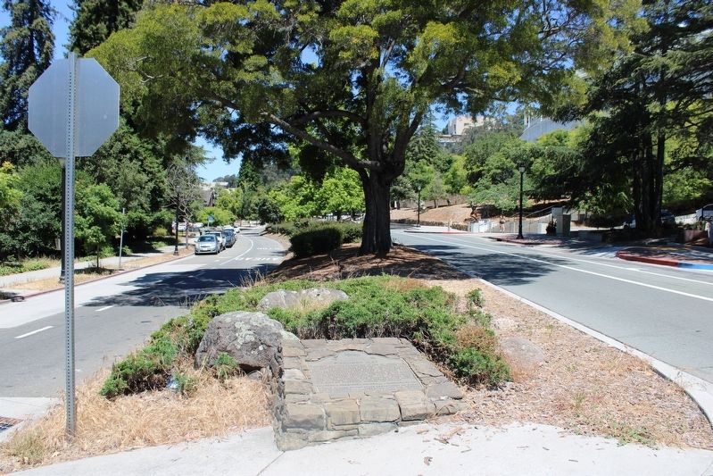
| 1 ► California, Alameda County, Berkeley — 986 — Piedmont Way — |
| On Piedmont Way at Bancroft Way, in the median on Piedmont Way. | |||
| 2 ► California, Alameda County, Berkeley, Downtown Berkeley — Howard Automobile Company — Frederick Reimers, Architect, 1930, Hayashida Architects, 2006 — Renovations for the Buddhist Churches of America, Jodo Shinshu Center — |
| On Durant Avenue at Fulton Street, on the right when traveling east on Durant Avenue. | |||
| 3 ► California, Alameda County, Dublin — Amador Valley Hotel — (Later the Dublin Hotel) — |
| On Donlon Way at Dublin Boulevard, on the right when traveling south on Donlon Way. | |||
| 4 ► California, Alameda County, Emeryville — Key Route Terminal — |
| On San Pablo Avenue, on the right when traveling north. | |||
| 5 ► California, Alameda County, Hayward — Original Bull Gear — |
| On Clawiter Road, on the right when traveling south. | |||
| 6 ► California, Alameda County, Hayward — Working Farm — Outbuildings of the Estate — |
| Near Hampton Road near Boston Road. | |||
| 7 ► California, Alameda County, Livermore — D.J. Murphy House — |
| On McLeod Street at Third Street on McLeod Street. | |||
| 8 ► California, Alameda County, Livermore — Duarte Garage — Built 1915 — |
| Near Pine Street near L Street. | |||
| 9 ► California, Alameda County, Livermore — Duarte Garage — Built Circa 1915 by F.H. Duarte — |
| On Portola Avenue, on the right when traveling east. | |||
| 10 ► California, Alameda County, Livermore — Timber Wagon — |
| Near South S Street at Holmes Steet. | |||
| 11 ► California, Alameda County, Livermore — Trevarno Road — Built 1913 — |
| On Trevarno Road south of First Street, in the median. | |||
| 12 ► California, Alameda County, Oakland, Downtown Oakland — Crossroads — |
| On Telegraph Avenue at Broadway, on the left when traveling south on Telegraph Avenue. | |||
| 13 ► California, Alameda County, Oakland, Merriewood — Kennedy Tunnel — |
| On Skyline Boulevard, on the right when traveling north. | |||
| 14 ► California, Alameda County, Oakland, Montclair — Shepherd Canyon Highway That Almost Was — |
| Near Montclair Railroad Trail. | |||
| 15 ► California, Alameda County, Oakland, Piedmont Avenue — 299 — El Camino Rancho San Antonio — |
| On West MacArthur Boulevard at Broadway, on the right when traveling east on West MacArthur Boulevard. | |||
| 16 ► California, Alameda County, Oakland, Produce and Waterfront — Birthplace of Oakland — |
| On Broadway at Second Street, on the right when traveling north on Broadway. | |||
| 17 ► California, Alameda County, Oakland, Waterfront Warehouse District — 26 — George A. Posey Tube Oakland Portal — |
| On 4th Street at Harrison Street, on the right when traveling east on 4th Street. | |||
| 18 ► California, Alameda County, Oakland, West Oakland — Seventh Street — |
| On Mandela Parkway at 7th Street, on the right when traveling south on Mandela Parkway. | |||
| 19 ► California, Alameda County, Oakland, Woodminster — Commemoration of Old Redwood Road from Redwood Canyon — |
| Near Mountain Boulevard. | |||
| 20 ► California, Alameda County, Piedmont — Piedmont Park History Trail — A Special Gift for Piedmont’s 100th Anniversary — |
| On Vista Avenue near Highland Avenue, on the right when traveling east. | |||
| 21 ► California, Alpine County, Alpine Village — CR-38 — Carson Trail - First Crossing in Mad Canyon — |
| On Crystal Springs Road, on the right when traveling west. | |||
| 22 ► California, Alpine County, Bear Valley — Old Emigrant Road — |
| Near Station House Road just west of Toll Gate Road. | |||
| 23 ► California, Alpine County, Hope Valley — Over the Sierra Nevada — |
| On Blue Lakes Road, on the right when traveling south. | |||
| 24 ► California, Alpine County, Kirkwood — CR-43 — Carson Trail - Ascent to Carson Pass — |
| Near Carson Pass Scenic Byway (California Route 88). | |||
| 25 ► California, Alpine County, Kirkwood — First Summit — |
| On "Additional Parking" Road near Carson Pass Scenic Byway (California Highway 88). | |||
| 26 ► California, Alpine County, Kirkwood — 378 — Memorial to Pioneer Odd Fellows — |
| Near Carson Pass Scenic Byway (State Highway 88). | |||
| 27 ► California, Alpine County, Kirkwood — Naming of Carson Pass — |
| On The "Additional Parking" Road at Carson Pass Scenic Byway (California Highway 88) on The "Additional Parking" Road. | |||
| 28 ► California, Alpine County, Kirkwood — 661 — Old Emigrant Road |
| On Carson Pass Scenic Byway (State Highway 88), on the right when traveling east. Reported missing. | |||
| 29 ► California, Alpine County, Kirkwood — 662 — Old Emigrant Road — |
| On Carson Pass Highway (California Route 88) at Mud Flat Road, on the right when traveling east on Carson Pass Highway. | |||
| 30 ► California, Alpine County, Markleeville — 318 — Ebbetts Pass — Historical Landmark — |
| On Ebbetts Pass Scenic Byway (State Highway 4), on the left when traveling east. | |||
| 31 ► California, Alpine County, Markleeville — Hermit Valley — Historical Landmark — |
| On Ebbetts Pass (State Highway 4), on the right when traveling east. | |||
| 32 ► California, Alpine County, Markleeville — The Emigrant Trail — |
| On Carson Pass Highway (California Route 88 at milepost 6.4) east of Red Vista Road, on the right when traveling east. | |||
| 33 ► California, Alpine County, Meyers — LP-3 — Luther Pass Trail - Came to Grass Lake — |
| On Luther Pass Road (California Route 89) 4 miles north of California Route 88, on the left when traveling north. | |||
| 34 ► California, Alpine County, Meyers — LP-2 — Luther Pass Trail - Luther Pass — |
| Near Luther Pass Road (California Route 89), on the left when traveling north. | |||
| 35 ► California, Alpine County, Picketts Junction — CR-40 — Carson Trail - Hope Valley — |
| On Burnside Road, on the right when traveling south. | |||
| 36 ► California, Alpine County, Picketts Junction — C.R.R.27 — Emigrant Trail - Carson River Route — |
| On Burnside Road, on the right when traveling south. | |||
| 37 ► California, Alpine County, Picketts Junction — LP-1 — Luther Pass Trail - Leaving the Carson Trail — |
| On Burnside Road, on the right when traveling south. | |||
| 38 ► California, Alpine County, Sorensens — LP-1 — Luther Pass Trail - Leaving the Carson Trail — |
| On Burnside Road south of Carson Pass Highway (California Route 88), on the right when traveling south. | |||
| 39 ► California, Alpine County, Woodfords — 805 — The Pony Express - Woodfords — |
| On Old Pony Express Way (California Route 88) east of California Route 89, on the right when traveling east. | |||
| 40 ► California, Alpine County, Woodfords — 805 — Woodfords Station — |
| On Old Pony Express Way (California Route 88) east of California Route 89, on the left when traveling east. | |||
| 41 ► California, Amador County, Kit Carson — Mormon-Carson Pass Emigrant Trail — |
| On Carson Pass Highway (State Highway 88), on the right when traveling east. | |||
| 42 ► California, Amador County, Kit Carson — Peddler Hill Overlook |
| On Carson Pass (State Highway 88), on the right when traveling east. Reported missing. | |||
| 43 ► California, Amador County, Kit Carson — 338 — Tragedy Spring — No 338 — Erected 1967 — |
| On Tragedy Springs Road near Carson Pass Scenic Byway (California Highway 88). | |||
| 44 ► California, Amador County, Martell — To The Memory of Mike Tovey — Wells Fargo Messenger — |
| On State Highway 88/104, 1.6 miles west of Ridge Road (State Highway 104), on the left when traveling west. | |||
| 45 ► California, Amador County, Plymouth — Forest Home — 1850's — Stage and Freight Stopover — |
| On Jackson Road (State Highway 16) 0.2 miles west of Forest Home Road, on the left when traveling east. | |||
| 46 ► California, Amador County, Singleton Springs — CR-55 — Carson Trail - Leek Springs — Carson Trail — |
| On Mormon Emigrant Trail (NF-5), 1 mile west of 88 (California Route 88), on the right when traveling west. | |||
| 47 ► California, Amador County, Sutter Creek — Knight Scarifier – “The Scarifier that will scarify” — |
| Near Old Route 49 (Main Street) near Worley Street, on the left when traveling north. | |||
| 48 ► California, Butte County, Berry Creek — B047 — Beckwourth Trail – Berry Creek — |
| On Oroville-Quincy Highway (Route 162). | |||
| 49 ► California, Butte County, Forest Ranch — 14 Mile House — |
| On Deer Creek Highway (California Route 32) at 14 Mile House Drive on Deer Creek Highway. | |||
| 50 ► California, Calaveras County, Angels Camp — Archie D. Stevenot — “Mr. Mother Lode” — |
| On State Highway 49, on the left when traveling south. | |||
| 51 ► California, Calaveras County, Avery — Avery Hotel — Formerly Half-Way House — |
| On Moran Road at Avery Hotel Road, on the left when traveling east on Moran Road. | |||
| 52 ► California, Calaveras County, Copperopolis — Copperopolis Historical Plaza — |
| On Main Street, on the right when traveling north. | |||
| 53 ► California, Calaveras County, Copperopolis — 281 — O'Byrne Ferry — |
| On O'Byrne Ferry Road (State Highway 49), on the right when traveling south. | |||
| 54 ► California, Calaveras County, Dorrington — Board's Crossing — |
| On Forest Service Road 5N75. | |||
| 55 ► California, Calaveras County, Dorrington — Dorrington Hotel — |
| 56 ► California, Calaveras County, San Andreas — 258 — Fourth Crossing — |
| On State Highway 49, on the right when traveling south. | |||
| 57 ► California, Contra Costa County, Clayton — Black Diamond Way — |
| On Marsh Creek Road at Main Street, on the right on Marsh Creek Road. | |||
| 58 ► California, Contra Costa County, El Cerrito — The Avenue — |
| On San Pablo Avenue near Cutting Boulevard, on the left when traveling north. | |||
| 59 ► California, Contra Costa County, El Sobrante — El Sobrante Chevrolet Service — |
| On San Pablo Dam Road near Pitt Way, on the right when traveling east. | |||
| 60 ► California, Contra Costa County, San Pablo — 512 — The Lincoln Highway in San Pablo — |
| On San Pablo Avenue at Church Lane, on the left when traveling north on San Pablo Avenue. | |||
| 61 ► California, Contra Costa County, Walnut Creek — 123 — Downtown Traffic — Mt. Diablo Blvd. at Main St. — Early 1950s — |
| On Mt. Diablo Boulevard near South Main Street, on the right when traveling east. | |||
| 62 ► California, Contra Costa County, Walnut Creek — 125 — Downtown Traffic — North Main Street — Early 1950s — |
| Near North Main Street near Duncan Street, on the left when traveling south. | |||
| 63 ► California, Contra Costa County, Walnut Creek — Farmall Tractor - c. 1925 — "A New Era in Power Farming" — |
| Near Castle Road Road near Comistas Drive. | |||
| 64 ► California, Contra Costa County, Walnut Creek — 130 — Harlan's Livery Stable — Main St. at Mt. Diablo Blvd. — circa 1880 — |
| On Mt. Diablo Boulevard near North Main Street, on the left when traveling east. | |||
| 65 ► California, Contra Costa County, Walnut Creek — 151 — Lawrence Garage — 1499 N. Main St. — 1921 — |
| On North Main Street near Bonanza Street, on the left when traveling north. | |||
| 66 ► California, Contra Costa County, Walnut Creek — 168 — Lommel's Creamery & Greyhound Bus Depot — 1700 N. Main St. — 1939 — |
| On Civic Drive at North Main Street, on the right when traveling east on Civic Drive. | |||
| 67 ► California, Contra Costa County, Walnut Creek — 121 — Main Street, 1910 — |
| On South Main Street near Olympic Boulevard, on the left when traveling north. | |||
| 68 ► California, Contra Costa County, Walnut Creek — 135 — Main Street, 1921 — |
| On North Main Street near Cypress Street, on the left. | |||
| 69 ► California, Del Norte County, Crescent City — 645 — Pioneer Stage Road to Oregon — |
| On Elk Valley Road at Parkway Drive, on the right when traveling north on Elk Valley Road. | |||
| 70 ► California, El Dorado County, Coloma — Mormon Workers Cabin — |
| Near Coloma Road (California Route 49) north of Mt Murphy Road. | |||
| 71 ► California, El Dorado County, Coloma — 748 — The Coloma Road — |
| Near State Highway 49. | |||
| 72 ► California, El Dorado County, El Dorado — 486 — El Dorado — |
| On Main Street (Pleasant Valley Road) at Church Street, on the right when traveling west on Main Street (Pleasant Valley Road). | |||
| 73 ► California, El Dorado County, El Dorado Hills — 699 — Mormon Tavern — Overland Pony Express Route - California — |
| On PG&E-Clarksville Sub-Station Road, on the right when traveling west. | |||
| 74 ► California, El Dorado County, El Dorado Hills — Sterlingshire — Historical Site — |
| On Green Valley Road, 0.1 miles east of Salmon Falls Road/El Dorado Hills Boulevard, on the right when traveling east. | |||
| 75 ► California, El Dorado County, Fresh Pond — JC-24 — Johnson Cutoff - Fresh Pond — |
| Near Old Carson Road. | |||
| 76 ► California, El Dorado County, Georgetown — The Dysfunctional Organization (TDO) — |
| On Rubicon Trail (at milepost 0) when traveling east. | |||
| 77 ► California, El Dorado County, Georgetown — GPY 141-02 — The Rubicon — |
| On The Rubicon Trail, on the right when traveling east. | |||
| 78 ► California, El Dorado County, Kyburz — 705 — Moore’s (Riverton) — |
| On U.S. 50 near Ice House Road, on the right when traveling west. | |||
| 79 ► California, El Dorado County, Kyburz — Riverton Bridge — |
| On U.S. 50 near Ice House Road, on the right when traveling west. | |||
| 80 ► California, El Dorado County, Kyburz — 706 — Webster’s — (Sugar Loaf House) — |
| On Interstate 50, on the left when traveling east. | |||
| 81 ► California, El Dorado County, Placerville — CR-69 — Carson Trail - Placerville — |
| Near Benham Street, on the left when traveling south. | |||
| 82 ► California, El Dorado County, Placerville — CR-66 — Carson Trail - Wagon Road to Placerville — |
| On Holm Road, on the right when traveling west. | |||
| 83 ► California, El Dorado County, Placerville — CR-67 — Carson Trail - Wagon Road to Placerville — |
| On Cedar Ravine Road, on the right when traveling east. | |||
| 84 ► California, El Dorado County, Placerville — JC-30 — Johnson Cutoff Trail - Placerville — |
| Near Benham Street, on the left when traveling south. | |||
| 85 ► California, El Dorado County, Placerville — Placerville — |
| On Coloma Street (State Hwy 49) at Bee Street, on the left when traveling north on Coloma Street (State Hwy 49). | |||
| 86 ► California, El Dorado County, Placerville — 701 — Placerville Pony Express — Station and Terminus — |
| On Main Street at Sacramento Street, on the right when traveling east on Main Street. | |||
| 87 ► California, El Dorado County, Pleasant Valley — CR-64 — Carson Trail - Descent to Pleasant Valley — |
| On Pleasant Valley Road at Newtown Road, on the right when traveling east on Pleasant Valley Road. | |||
| 88 ► California, El Dorado County, Pleasant Valley — CR-65 — Carson Trail - Wagon Road Junction — |
| On Pleasant Valley Road, on the left when traveling east. | |||
| 89 ► California, El Dorado County, Pollack Pines — The Pony Express - Sportsman’s Hall — |
| On Pony Express Trail east of Exit 57 (U.S. 50), on the right when traveling east. | |||
| 90 ► California, El Dorado County, Pollock Pines — CR-61 — Carson Trail - Junction — |
| On Park Creek Road at Old Carson Road on Park Creek Road. | |||
| 91 ► California, El Dorado County, Pollock Pines — JC-25 — Cutoff to Johnson Ranch and Placerville — |
| On Park Creek Road at Old Carson Road on Park Creek Road. | |||
| 92 ► California, El Dorado County, Pollock Pines — JC-14 — Johnson Cutoff - Ascent to the Summit — |
| Near Wrights Lake Road, 0.4 miles north of U.S. 50, on the right. | |||
| 93 ► California, El Dorado County, Pollock Pines — JC-23 — Johnson Cutoff - Bartlett Bridge — |
| Near Dubasary Lane. | |||
| 94 ► California, El Dorado County, Pollock Pines — JC-17 — Johnson Cutoff - Peavine Hill — |
| On Forest Service Road 11N99, 0.3 miles east of Granite Springs Road, on the left when traveling east. | |||
| 95 ► California, El Dorado County, Pollock Pines — JC-19 — Johnson Cutoff - Peavine Ridge — |
| On Peavine Ridge Road, 2.5 miles west of Ice House Road, on the left when traveling west. | |||
| 96 ► California, El Dorado County, Pollock Pines — JC-18 — Johnson Cutoff - Sear's Post — |
| On Peavine Ridge Road, on the right when traveling west. | |||
| 97 ► California, El Dorado County, Pollock Pines — JC-26 — Johnson Cutoff - Took the Hangtown Road — |
| On Pony Express Trail at Elm Street, on the right when traveling east on Pony Express Trail. | |||
| 98 ► California, El Dorado County, Pollock Pines — JC-27 — Johnson Cutoff Trail - Sportsman Hall — |
| On Pony Express Trail, on the right when traveling east. | |||
| 99 ► California, El Dorado County, Pollock Pines — 704 — Sportsman’s Hall — |
| On Pony Express Trail east of Exit 57 (U.S. 50), on the right when traveling east. | |||
| 100 ► California, El Dorado County, Pollock Pines — The Mormon Emigrant Trail — |
| On Pony Express Trail (Lincoln Highway) at Forebay Road, on the right when traveling east on Pony Express Trail (Lincoln Highway). | |||
777 entries matched your criteria. The first 100 are listed above. Next 100 ⊳