Named in 1872 for First Lieutenant Howard B. Cushing (b.1838- d.1871). During his early military career, Cushing participated in many notable Civil War battles, including Shiloh, Fredericksburg, Gettysburg and Hatcher’s Run. In 1871, while in . . . — — Map (db m69562) HM
This beautiful highway was made possible by his sincere interest and unceasing efforts. It is dedicated to him and shall be known as"Hitchcock Highway" — — Map (db m30020) HM
Originally named “Street of Joy” during Tucson’s Spanish period. In 1869, its name changed to Congress Street, derived from Charles O. Brown’s Congress Hall Saloon. In 1867, Arizona’s territorial capital was moved to Tucson, and Brown’s . . . — — Map (db m70187) HM
Originally named “Street of Joy” during Tucson’s Spanish period. In 1869, its name changed to Congress Street, derived from Charles O. Brown’s Congress Hall Saloon. In 1867, Arizona’s territorial capital was moved to Tucson, and Brown’s . . . — — Map (db m70191) HM
Named in 1869 for the convent located adjacent to San Augustín Cathedral. When the seven Sisters of St. Joseph of Carondelet finally arrived in 1870, they opened the city’s first parochial school for girls next to San Augustín. Three years later . . . — — Map (db m69589) HM
Named in 1869 for the convent located adjacent to San Augustín Cathedral. When the seven Sisters of St. Joseph of Carondelet finally arrived in 1870, they opened the city’s first parochial school for girls next to San Augustín. Three years later . . . — — Map (db m186122) HM
Named in 1869 for the convent located adjacent to San Augustín Cathedral. When the seven Sisters of St. Joseph of Carondelet finally arrived in 1870, they opened the city’s first parochial school for girls next to San Augustín. Three years later . . . — — Map (db m186125) HM
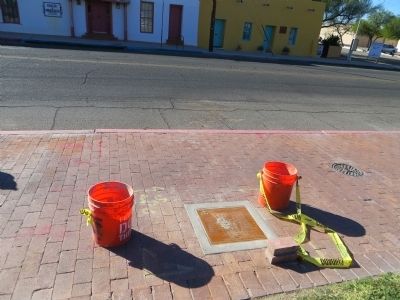
Its name derives from the Spanish word meaning “pomegranate.” The area between what is now Interstate-10 and Main Avenue once supported irrigated agricultural fields during Arizona’s Territorial period. — — Map (db m69620) HM
Named in 1872 after John A. Jackson (ca 1835-d.1870), a rancher and farmer who lived at the San Pedro settlement near Tucson. On 16 April 1870, he was ambushed and killed by Apache Indians as he returned to his ranch. — — Map (db m83201) HM
Named during Arizona’s Territorial period after territorial delegate to Congress, Richard McCormick (b.1832 – d.1901). In the 1870s he sponsored legislative measures to reduce discrimination against Mexicans in the Arizona territory. With . . . — — Map (db m70212) HM
Originally named “Flower Alley” during Tucson’s Spanish period, its name was later changed to honor German-born soldier and politician, Charles H. Meyer (b.1829- d.1907). He came to Arizona with the US Army and settled in Tucson in 1858. . . . — — Map (db m69592) HM
Named during Arizona’s Territorial period to honor Estevan Ochoa (b.1831 – d.1888), whose ancestors arrived in Mexico with the Cortez expedition. He was born in Chihuahua, Mexico to a wealthy mining and ranching family. Before settling . . . — — Map (db m70211) HM
Originally located between Granada Avenue and Church Street during Arizona's territorial period, "Post Office Street," was where postmaster and mayor, Mark Aldrich (b.1801 – d.1873) lived and worked. The southwestern half of the street was . . . — — Map (db m70190) HM
Memorial to Elias Pennington, pioneer rancher, farmer, miner, freighter and lumberman. In 1857, he came from Texas with his twelve children settling in various locations around southern Arizona for several years. Near this site, in 1863, Pennington . . . — — Map (db m82942) HM
Named in the late 1600s after the route connecting Tucson’s Presidio with mission San
Cosme de Tucson. The street was also called Calle del Arroyo, referencing the arroyo
immediately south of the presidio walls. The street was renamed in 1871 to . . . — — Map (db m69816) HM
Named during Arizona’s Territorial period after businessman and Tucson pioneer, William F. Scott (b.1831-d. ca.1914). In the 1870s, he operated a flour mill adjacent to his home at the corner of Main and McCormick (since demolished). — — Map (db m69817) HM
Named during Arizona’s Territorial period for Colonel John Finkle Stone (b. ca.1836-d.1869). He was a colonel in the Union Army and owner of the first house on Stone Avenue at McCormick Street. Stone also operated a mine near Apache Pass, where he . . . — — Map (db m69702) HM
Named Calle de las Milpas ("Road Which Leads to the Corn Fields") during Tucson’s Spanish period; the street linked the presidio with adjacent agricultural fields. Renamed Cemetery Street in the mid-1800s, the street was the main thoroughfare . . . — — Map (db m83008) HM
Named Calle de las Milpas ("Road Which Leads to the Corn Fields") during Tucson’s Spanish period; the street linked the presidio with adjacent agricultural fields. Renamed Cemetery Street in the mid-1800s, the street was the main thoroughfare . . . — — Map (db m83009) HM
Although they share the same alignment, during Arizona's Territorial period, Council Street and Miltenberg Street were divided by Stone Avenue. The alignment between Stone Avenue and Meyer Street was named Council Street, in reference to Tucson's . . . — — Map (db m69635) HM
In 1856, Tucson’s presidio walls made navigating the local streets difficult. In an effort to circumvent the walls and avoid having to re-enter the presidio through the main gate, a section of the south wall was opened and Court Street was . . . — — Map (db m69632) HM
Named in the 1870s after the military scout and surveyor, Charles Franklin (b. ca.1844-d.1924). In 1871, he served as a scout for General Crook, and a year later, helped Sidney W. Foreman complete the first formal survey of Tucson. “Charles . . . — — Map (db m69698) HM
Its name derives from the Spanish word meaning “pomegranate.” The area between what is now Interstate-10 and Main Avenue once supported irrigated agricultural fields during Arizona’s Territorial period. — — Map (db m69703) HM
Originally named “Flower Alley” during Tucson’s Spanish period, its name was later changed to honor German-born soldier and politician, Charles H. Meyer (b.1829- d.1907). He came to Arizona with the US Army and settled in Tucson in 1858. . . . — — Map (db m69696) HM
Named in 1880 in reference to Arizona’s first hospital, Saint Mary’s Hospital. Established by the Sisters of Saint Joseph of Carondelet, the hospital housed 11 patients, four sister-nurses, and one doctor. — — Map (db m70791) HM
Named during Arizona’s Territorial period for Colonel John Finkle Stone (b. ca.1836-d.1869). He was a colonel in the Union Army and owner of the first house on Stone Avenue at McCormick Street. Stone also operated a mine near Apache Pass, where he . . . — — Map (db m69700) HM
Named during Arizona’s Territorial period after Tucson’s mayor, Dr. James Toole (b.1824-d.1884). Before serving in politics, he acted as Adjutant General for the Arizona Territory. He was also a surgeon and later a banker. Upon collapse of his bank, . . . — — Map (db m69809) HM
Originally named “Street of Joy” during Tucson’s Spanish period. In 1869, its name changed to Congress Street, derived from Charles O. Brown’s Congress Hall Saloon. In 1867, Arizona’s territorial capital was moved to Tucson and Brown’s . . . — — Map (db m69810) HM
Why Put A Prison On A Mountain?
Honor Camp prisoners built the Mt. Lemmon Highway
In the early 20th century, the only road to Mt. Lemmon began at the town of Oracle and snaked up the north face of the mountain.
Construction . . . — — Map (db m83017) HM
Located and constructed in 1918 by
Lamar Cobb
First State Engineer of Arizona
Member of the Constitutional Convention
Born 1870 -- Athens, Georgia
Died 1926 -- Phoenix, Arizona
Erected to his memory
George P. Hunt . . . — — Map (db m27293) HM
The Apache Trail was created by Native American tribes traveling between their summer homes in the mountains and winter homes in the desert. The Trail became a roadway in 1905, for use in hauling supplies to the construction site of Roosevelt Dam. . . . — — Map (db m145828) HM
Dedicated October 1961
To the Memory of
Jacob Von Walzer
1808 – 1891
One of America's most famed legendary figures, whose exploits have stimulated the imagination of peoples everywhere by his contribution to the heritage of his . . . — — Map (db m74394) HM
In 1879 the Southern Pacific Mail and Stage Line Company built a one-room adobe station and mesquite corral. It was a horse changing and water stop on the route from the railroad station at Picacho for passengers going to Florence and beyond. In . . . — — Map (db m68220) HM
Built circa 1926-27
by the Arizona Department
of Transportation
This building constructed of Moenkopi Sandstone, has been listed on the National Register of Historic Places.
The Ash Fork Camp location was selected because it is a . . . — — Map (db m33443) HM
A colorful administrator, he is credited with establishing the basic location of Arizona's billion-dollar Interstate Highway System. He served as State Engineer twice, from 1924 to 1928 and from 1945 to 1951.
He devoted much of his final term to . . . — — Map (db m40780) HM
The Crook Road begins at this point
with the first in a series of mile markers
across the Mogollon Rim segment of the
military supply trail connecting Forts
Whipple, Verde and Apache. Reconnoitered
in 1871 by General George Crook with a . . . — — Map (db m28561) HM
Erected
in Memory of
Charles Churchill Small
Member American Society of
Civil Engineers
1874 [ Relief of Charles Small ] 1932
Father of Arizona Highways — — Map (db m29470) HM
In 1932, Charles Bell constructed this trail through the rugged canyon of Wet Beater Creek. It was, and still is, used to move cattle up and down the Mogollon Rim. Bell Trail is six miles to the edge of the Rim and climbs a rocky 1200 feet in the . . . — — Map (db m187583) HM
Built 1876, Abandoned 1882
Prescott Santa Fe Stage Line
Distance 507 miles
Division point between Pine Springs N.E. & Prescott S.W. Road built before 1866 used by military, emigrants & mail. Only road to Verde Valley until 1870. . . . — — Map (db m94810) HM
An Arizona natural wonder in continuous operation since 1927.
Recognized by Hampton Hotels Save-A-Landmark program as a site worth seeing — — Map (db m194739) HM
The Pioneer Trail was developed in 1932 to give access to the Pioneer Monument and commemorative plaque at the end of the trail.
Improvements to the trail were completed in May 2019 as a joint project of the Yavapai Questers and Cole Ortagus' . . . — — Map (db m151185) HM
This is the site of ‘the crossing' on the Mojave-Prescott "Hardyville" toll road. The road was authorized by the first territorial legislature and was built by W. H. Hardy, connecting Prescott with Hardyville on the Colorado River.
William John . . . — — Map (db m72625) HM
The Historic Chaves Trail passed near this location. The Chaves Trail is named for Lt. Col. J. Francisco Chaves, First Cavalry, New Mexico Volunteers who traveled north of here April 16-21, 1864 with two officers, thirty-five enlisted men, and . . . — — Map (db m132627) HM
In early times. Uptown Sedona was a patchwork of orchards, homestead and pastures. In the late 1930s, the Jordan’s built a stone building along the highway from which to sell their fruit to the increasing traveler traffic coming down the newly . . . — — Map (db m133575) HM
The Army's presence in Camp Verde contributed to settlement and roads in the Verde Valley area. A road came from Jerome to a stagecoach stop several miles south of town. West of the stop, a road crossed the creek and came into our area, not yet a . . . — — Map (db m133025) HM
From 1857 to 1860 Lt. Edward F. Beale and a crew of 100 men built the first federal highway in the southwest. The 1857 Beale Expedition used 22 camels and dromedaries for pack animals. This road went from Fort Smith, Arkansas to Los Angeles, . . . — — Map (db m32206) HM
Early day route from Sonora to California over the path taken by Father Eusebio Kino in 1700 when he sought to discover if California was part of the American mainland. The parched desert along this route has claimed hundreds of lives, particularly . . . — — Map (db m83418) HM
While the American Revolution brewed on the Atlantic Coast, Spain expanded its New World empire to protect California against the British and Russians. In 1774, Juan Bautista de Anza, commander of the Royal Presidio of Tubac, successfully explored . . . — — Map (db m158299) HM
During his 1774 exploratory trip, Anza made friends with Chief Olleyquotequiebe (Anza called him “Palma”) of the Quechan Indians, who controlled the river crossing. The Quechans welcomed the 1775 colonizing expedition and supplied . . . — — Map (db m158365) HM
About 1800 near this spot white man established the first trail from East to West across Baxter County. Later some of the Cherokee Indians were moved to Oklahoma using this route which was known as the Trail of Tears. — — Map (db m62248) HM
800 AD • Trace of the Rock People
1808 • Osage Boundary
1815 • Lawrence County
1827-28 • Lovely County
1838 • Trail of Tears
1840 • Trott's Stand
1858 • Old Wire Road
1858-61 • Butterfield Stage Route
1861 • Troop Trails
1862 • . . . — — Map (db m62485) HM
Benton County Hardware, circa 1893, W.J. Doke proprietor. First Motor Co. and first gas station in alley beside store. Recently housed Bentonville Furniture. — — Map (db m54310) HM
Elkhorn Tavern overlooks a highway of vital importance for Arkansas and Missouri during the Civil War. Union and Confederate leaders both wanted this 20-foot-wide dirt road to move men and supplies. Alongside the road ran 3-year-old telegraph . . . — — Map (db m35660) HM
John Butterfield was born in Berne, New York in 1801 and grew up on a farm amid the technological revolution of the first steamboat, the Erie Canal, the steam locomotive, and the electric telegraph.
In 1857, John Butterfield won a lucrative . . . — — Map (db m84484) HM
The Old Wire Road at Mudtown was used by the
Butterfield Overland Mail Co. and both Union and
Confederate soldiers during the Civil War. In
February 1862, Union troops ate food left behind
at a Confederate camp and were sickened. Some
died, . . . — — Map (db m224817) HM
The original Lowell Garage, owned by Thurman Moody, was located on the corner of what is now Lincoln Street and McClure Avenue. The old 71 Highway used to run along Lincoln Street so it was right on the highway, when the new Highway 71 was located . . . — — Map (db m224826) HM
This marker, set on the Butterfield Stagecoach Road, is placed near the spot where the trail crossed the east-west road between Huntsville and the Robinson settlement in western Benton County. John Robinson, a Revolutionary soldier, settled here . . . — — Map (db m68781) HM
This site was donated to the Benton County Historical Society by Scarlett Biggs Wilson and Lara Wilson Rosenblum in honor of their parents/grandparents, Guy and Nell Biggs, early pioneers of the Cross Hollows area. Cross Hollows is recognized for . . . — — Map (db m68789) HM
To commemorate the Centennial passage, through Benton County of the First Westbound Stage coach on the Butterfield Overland Mail Route from St. Louis to San Francisco. Callahan's Tavern, the site of which is about a half a mile northeast of this . . . — — Map (db m216324) HM
Built in the early 1930s by Phillips Petroleum, it was the city's first full-service garage. West of the gas station, it was brick with a wood-framed vaulted ceiling. It was leased to "Hoot" Gipson who operated an auto repair shop and 24-hour . . . — — Map (db m141852) HM
One of the city's earliest gas stations, built in 1927 by W.H. Lewis, it was purchased in 1929 by Independent Oil (became Phillips 66). They remodeled it from a frame structure with rubblestone veneer to Tudor Revival Style. Independent . . . — — Map (db m141850) HM
Settled 1833, was on the much-traveled Carrollton-Forsyth-Springfield road during the Civil War. A training center for Southern troops, it was important in movement of troops and supplies. Guerrilla warfare ravaged the area.
Skirmishes occurred . . . — — Map (db m141597) HM
Professor KALKLOSCH’s Guidebook, published in 1880, states: “The first street of the town was surveyed down the gulch below the spring. A broad avenue connects this street with the famous EUREKA BASIN SPRING. It being the first street it . . . — — Map (db m79755) HM
Ellis Murphy established Murphy's Firestone Tire Service at this site about 1923. Called "Murphy the Tire Man", his services were frequently required to patch inner tubes and repair tires for hundred[s] of automobiles bringing tourists to Eureka . . . — — Map (db m90706) HM
Crescent Spring was revered for its healing waters almost as much as the basin, the legendary Indian Healing Spring. Situated beside the Wagon Road on a hillside with a rocky outcropping described as "crescent" shaped, the spring was soon given . . . — — Map (db m80135) HM
"It being the first street in town... it was named Main Street. But owing to its low elevation and the law of gravitation, the water would find a level in the street, and as the immense travel created an abundance of mud, the street was nicknamed . . . — — Map (db m80153) HM
On this part of Spring Street you can easily see how Eureka Springs follows the natural lines of the landscape. Houses are built right into the bluff on the west side and buildings climb down the steep hillside on the other side. “The houses rise . . . — — Map (db m225187) HM
The Eureka Springs Railroad opened in February, 1883. As the first trains arrived at the original station house, a finely crafted wooden structure, passengers were met by horse drawn carriages and hacks which quickly carried them to the best . . . — — Map (db m80173) HM
Confederate Manufacturing
Arkadelphia was a manufacturing center for Confederate Arkansas early in the Civil War. Gen. Thomas Hindman established a powder works and an arsenal in 1862, producing guns, cannon, bullets, shells, wagons and . . . — — Map (db m96557) HM
Since Crowley's Ridge provided the only natural route for north-south travel across the lowlands of northeastern Arkansas, an Indian trail and later a military road crossed the river here. About 1840 Abraham Seitz established a ferry which was later . . . — — Map (db m4912) HM
The Battle of Mark's Mill, fought here on April 25, 1864, was a complete Confederate victory. General James F. Fagan's Confederate cavalry having surprised and captured a Union army of 2,000 men and 240 wagon loads of supplies. General Powell . . . — — Map (db m121283) HM
Approaching Marks Mills from the south General Joe Shelby's Missouri Division was ordered to move to the right in order to block the Marks Mills to Mt Elba Road preventing The Union forces from escaping across the Saline River.
Guided by . . . — — Map (db m121660) HM
Facts
After getting in the neighborhood of the supply train Gen. Shelby was ordered on the road leading to Mount Elba to intercept the train and attack the front. Cabell's Brigade moved up to the road leading direct to Marks' Mills. As they . . . — — Map (db m121658) HM
One of the oldest settlements in Columbia County. Here Colonel John Dockery had his plantation and home. Here T.P. Dockery, who became a general in the War Between the States, was born and reared. The Caddo Indian Trail from Camden on the Ouachita . . . — — Map (db m121136) HM
The Butterfield stage route
between Saint Louis and San
Francisco passed through the
main street of Van Buren,
Arkansas and crossed the
river at this point.
— — Map (db m96457) HM
First Highway constructed in Arkansas, Hopefield
to Little Rock, extended to Fort Smith and into Indian Territory, (Oklahoma). Built by the United States under supervision of the Quartermasters Department of the United States Army. Survey was . . . — — Map (db m116549) HM
Down the trail from where you are standing is the most well-preserved remaining section of the historic Trail of Tears in Arkansas.
Tradition and heritage run deep jn the collective souls of the Five Southeastern Tribes (Choctaw, Chickasaw, . . . — — Map (db m142034) HM
[Stone monument]
Trail of Tears
1832-1840
Arkansas River valley
routes
Choctaw – Chickasaw
Muscogee Creek
Seminole – Cherokee
[Panel]
Trail of Tears Routes through Franklin County
1. Northern Route through . . . — — Map (db m236869) HM
After crossing the lower slopes of Hot Springs Mountain, this "red" trail connects with Gulpha Gorge Trail on a ridge above Gulpha Gorge Campground. The Short Cut Trail leads to the summit.
Historic Exercise Trail
For the next 0.2 mile . . . — — Map (db m145671) HM
The Tufa Terrace Trail passes historic Ral Spring and follows a fairly level path across the hillside before rejoining the Grand Promenade. From there you can stroll the Grand Promenade or descend past the Thermal Cascade to Arlington Lawn. . . . — — Map (db m145670) HM
Tablet #1 Jenkins' Ferry State Park Act 10 of 1961 authorized this 37-acre state park as a commemorative site and recreation area. The park includes the ferry site where you are standing. The ferry was operated by the Jenkins' family . . . — — Map (db m37304) HM
Military Road
The Military Road, following part of the route of the old Southwest Trail, passed through the heart of Hot Spring County and the Midway community. Now known as Midway Road, the primitive pathway served as a major thoroughfare . . . — — Map (db m178623) HM
Down this road came the settlers who settled Arkansas and the southwest.
What once began as an Indian footpath became a major route of migration for settlers into the Arkansas Territory by 1819.
The trail bypassed the swamps of eastern . . . — — Map (db m221061) HM
Star City was laid off in 1871 as the County Seat of the newly created Lincoln County which was named in honor of President Abraham Lincoln. It was the center of many Indian trails and early roads which ran from Mississippi River landings back into . . . — — Map (db m229496) HM
Anderson Ferry, on Little River 2 miles north of this point, was in operation during the early 1800's. It served the pioneers traveling to southwest Arkansas and Texas on the Old Southwest Trail. Anderson Ferry provided a passage from Old Paraclifta . . . — — Map (db m121276) HM
In 1807, citizens of Crystal Hill built a road to connect Cadron and Arkansas Post. From Cadron the road was built almost due east and continued until they reached the Wattensaw. At the Wattensaw swamps they found an Indian path that led south to . . . — — Map (db m116694) HM
The Spring Bank Ferry operated on the Red River connection Miller and Lafayette counties via state Highway 160. This ferry is recorded in history as being the oldest operating ferry in southwest Arkansas.
According to records from Mrs. Kelly . . . — — Map (db m181760) HM
This plaque placed in honor of
William Richardson Blanton •
James Deas Blanton •
William "Kelley" Blanton, Sr. •
William "Kelley" Blanton, Jr.
Owners/Operators of the Spring Bank Ferry — — Map (db m181621) HM
About a mile south of this point is the natural gap or narrows of the Caddo River, famed in history and legend. A pioneer road through the gap connected Fort Smith with Old Washington and other points, with a toll bridge spanning the river. The . . . — — Map (db m201469) HM
Potts Inn John Kirkbride Potts (1803-1879) was born in Pennsylvania and moved to Arkansas in the 1820s. In 1828 he settled by Galla Creek, eventually acquiring 650 acres of land. Potts went to California in the Gold Rush of 1849: he failed to . . . — — Map (db m225451) HM
This stone is a marker from the old Military Road which extended from Little Rock to Ft. Smith. The marker was found west of Dardanelle in 1940 by Mr. Henry Sellers, District Highway Engineer, while supervising the construction of Arkansas Highway . . . — — Map (db m142032) HM
Construction of this earliest road connecting Memphis with Little Rock began in 1826 under the supervision of Lt. Frederick L. Griffith, U.S. Army. It was completed in 1828 under Lt. Charles Thomas. Miles of swamps and numerous streams made the road . . . — — Map (db m116509) HM
One of the largest public works projects to take place in territorial Arkansas was construction of the Memphis to Little Rock Road, an ambitious effort to allow travelers to cross the dense swamps and Grand Prairie of east Arkansas to reach the . . . — — Map (db m116571) HM
In the early days of Little Rock, the Arkansas River
was the lifeblood of the community. The Little Rock
extended out into the river, pulling the current around
it to form a natural landing basin for boats. The earliest
ferry across the . . . — — Map (db m116539) HM
River Highway
Davidsonville was located on a wedge-
shaped piece of land formed by the
confluence of the Black, Spring, and
Eleven Point rivers, placing it in the
midst of the transportation and trade
superhighways of the era. . . . — — Map (db m170927) HM
9533 entries matched your criteria. Entries 201 through 300 are listed above. ⊲ Previous 100 — Next 100 ⊳