After filtering for Maryland, 938 entries match your criteria. Entries 101 through 200 are listed.⊲ Previous 100 — Next 100 ⊳
Waterways & Vessels Topic
By Don Morfe, March 28, 1999
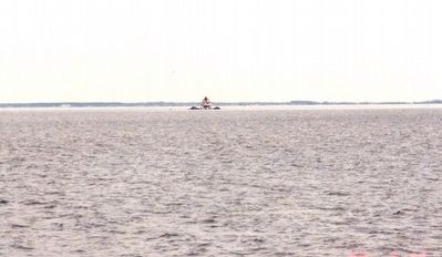
The Chesapeake Bay with the Thomas Point Lighthouse in the background
| 101 ► Maryland, Anne Arundel County, Highland Beach — Our Abundant Chesapeake — |
| On Thomas Point Road. | |||
| 102 ► Maryland, Anne Arundel County, Highland Beach — Thomas Point — Part Of The Bay Heritage — |
| On Thomas Point Road. | |||
| 103 ► Maryland, Anne Arundel County, Highland Beach — Twin Oaks — Frederick Douglass Summer Home — |
| On Wayman Avenue, on the right when traveling south. | |||
| 104 ► Maryland, Anne Arundel County, Linthicum Heights — AN/SPG-55B Radar — |
| On Elm Road east of West Nursery Road, on the right when traveling east. | |||
| 105 ► Maryland, Anne Arundel County, Linthicum Heights — XAF Radar Antenna — |
| On West Nursery Road south of Elm Road, on the right when traveling north. | |||
| 106 ► Maryland, Anne Arundel County, Pasadena — A Lighthouse Crumbles — Downs Park History Moment — |
| On Chesapeake Bay Drive, 0.6 miles north of John Downs Loop, on the right when traveling north. | |||
| 107 ► Maryland, Anne Arundel County, Pasadena — Captain John Smith — |
| Near Bayside Beach Road, 2.3 miles east of Fort Smallwood Road (Maryland Route 173), on the right when traveling east. | |||
| 108 ► Maryland, Anne Arundel County, Pasadena — Improvements on the Bayfront — Downs Park History Moment — |
| On Chesapeake Bay Drive, 0.4 miles north of John Downs Loop, on the right when traveling north. | |||
| 109 ► Maryland, Anne Arundel County, Pasadena — Observing the Enemy — Star-Spangled Banner National Historic Trail — |
| On Bayside Beach Road, 2.3 miles east of Fort Smallwood Road (Route 173), on the right when traveling east. | |||
| 110 ► Maryland, Anne Arundel County, Pasadena — Summer House on the Bay — Downs Park History Moment — |
| On Chesapeake Bay Drive, 0.1 miles north of John Downs Loop, on the right when traveling south. | |||
| 111 ► Maryland, Anne Arundel County, Pasadena — The Chesapeake Bay — |
| On John Downs Loop. | |||
| 112 ► Maryland, Anne Arundel County, Pasadena — The Rocky Beach Oyster Farm — Downs Park History Moment — |
| Near Chesapeake Bay Drive, 0.1 miles north of John Downs Loop, on the right when traveling north. | |||
| 113 ► Maryland, Anne Arundel County, Pasadena — The Tonkaway — Downs Park History Moment — |
| Near Chesapeake Bay Drive, 0.6 miles north of John Downs Loop, on the right when traveling north. | |||
| 114 ► Maryland, Anne Arundel County, Shady Side — Vanity — The boat that inspired the Chesapeake 20 |
| On East West Shady Side Road west of Bast Avenue, on the right when traveling north. Reported unreadable. | |||
| 115 ► Maryland, Anne Arundel County, Shady Side — At Work — At Play on the Bay — From Waterman's Home to Fishing Club — |
| On East West Shady Side Road west of Bast Avenue, on the right when traveling north. | |||
| 116 ► Maryland, Anne Arundel County, Shady Side — Boatbuilding in Shady Side — |
| On East West Shady Side Road west of Bast Avenue, on the right when traveling north. | |||
| 117 ► Maryland, Anne Arundel County, Shady Side — Crabbing — |
| On East West Shady Side Road west of Bast Avenue, on the right when traveling north. | |||
| 118 ► Maryland, Anne Arundel County, Shady Side — Edna Florence — |
| On East West Shady Side Road west of Bast Avenue, on the right when traveling north. | |||
| 119 ► Maryland, Anne Arundel County, Shady Side — Eels, Ducks, and Clams — |
| On East West Shady Side Road west of Bast Avenue when traveling north. | |||
| 120 ► Maryland, Anne Arundel County, Shady Side — Fishing — |
| On East West Shady Side Road west of Bast Avenue, on the right when traveling north. | |||
| 121 ► Maryland, Anne Arundel County, Shady Side — Going to Market — |
| On East West Shady Side Road west of Bast Avenue, on the right when traveling north. | |||
| 122 ► Maryland, Anne Arundel County, Shady Side — Imagine Yourself on the River |
| On East West Shady Side Road west of Bast Avenue, on the right when traveling north. Reported unreadable. | |||
| 123 ► Maryland, Anne Arundel County, Shady Side — Oystering — |
| On East West Shady Side Road west of Bast Avenue, on the right when traveling north. | |||
| 124 ► Maryland, Anne Arundel County, Shady Side — Seasons of the Waterman — |
| On East West Shady Side Road west of Bast Avenue, on the right when traveling north. | |||
| 125 ► Maryland, Anne Arundel County, Shady Side — The Edna Florence — |
| On East West Shady Side Road west of Bast Avenue, on the right when traveling north. | |||
| 126 ► Maryland, Anne Arundel County, Shady Side — The Changing Waterfront — |
| Near East West Shady Side Road west of Bast Avenue, on the right when traveling north. | |||
| 127 ► Maryland, Anne Arundel County, Shady Side — Welcome to the Captain Avery Museum — |
| On East West Shady Side Road west of Bast Avenue, on the right when traveling north. | |||
| 128 ► Maryland, Anne Arundel County, Skidmore — Sandy Point Shoal Lighthouse — |
| On South Beach Road. | |||
| 129 ► Maryland, Anne Arundel County, South River — The Old South River Club — |
| On South River Clubhouse Road, 0.8 miles east of Solomon’s Island Road (Maryland Route 2), on the right when traveling east. | |||
| 130 ► Maryland, Anne Arundel County, Tracys Landing — Chesapeake Bay Wetlands — |
| On Old Deale Road. | |||
| 131 ► Maryland, Baltimore, Bolton Hill — 29th Division Association — Center Haute Meuse 1917-Sector Alsace Argonne 1919 — |
| On Howard Street at Dolphin Street on Howard Street. | |||
| 132 ► Maryland, Baltimore, Bromo Arts District — Straight from the bay… right to the market! — |
| On West Lexington Street at North Eutaw Street, on the right when traveling west on West Lexington Street. | |||
| 133 ► Maryland, Baltimore, Canton — Captain John O'Donnell — 1749-1805 |
| On O'Donnell Street. Reported permanently removed. | |||
| 134 ► Maryland, Baltimore, Canton — Historic Canton — The Frigate Constellation was successfully launched in 1797 from Harris Creek in Canton. — |
| On Lakewood Ave.. | |||
| 135 ► Maryland, Baltimore, Canton — Historic Canton — |
| On O’Donnell Street at Potomac Street, in the median on O’Donnell Street. | |||
| 136 ► Maryland, Baltimore, Canton — Historic Canton — The Railroad Transfer Bridge — |
| Near Boston Street at Potomac Street, on the right when traveling east. | |||
| 137 ► Maryland, Baltimore, Canton — Historic Canton — The Industrial Heart of the City of Baltimore — |
| On Boston Street at South East Street, on the right when traveling east on Boston Street. | |||
| 138 ► Maryland, Baltimore, Canton — Historic Canton — Viewing the Entrance to the Baltimore Harbor from the Canton Waterfront Park — |
| On Boston Street at South Potomac Street, on the right when traveling east on Boston Street. | |||
| 139 ► Maryland, Baltimore, Canton — Professor Trash Wheel — |
| On Baltimore Waterfont Promenade east of Boston Street, on the right when traveling east. | |||
| 140 ► Maryland, Baltimore, Canton — The Harris Creek Rain Garden — Green Solutions to Water Pollution — |
| On Boston Street west of South Lakewood Avenue, on the right when traveling east. | |||
| 141 ► Maryland, Baltimore, Canton — The Railroad to Freedom — |
| On Boston Street just east of South Kenwood Street, on the right when traveling east. | |||
| 142 ► Maryland, Baltimore, Canton Industrial Area — Liberty Ship S.S. John W. Brown — |
| Near Newgate Avenue, 0.4 miles east of Keith Avenue, on the left when traveling east. | |||
| 143 ► Maryland, Baltimore, Canton Industrial Area — Lifeboat Number 2 — |
| Near Newgate Ave, 0.4 miles east of Keith Ave., on the left when traveling east. | |||
| 144 ► Maryland, Baltimore, Canton Industrial Area — Main Reduction (Bull) Gear Segment — |
| Near Newgate Ave., 0.4 miles east of Keith Ave., on the left when traveling east. | |||
| 145 ► Maryland, Baltimore, Carroll Park — Of Fords, Felles, and Falls — Gwynns Falls Trail — |
| Near Washington Boulevard. | |||
| 146 ► Maryland, Baltimore, Carroll Park — Restoring Water Quality — Gwynns Falls Trail |
| Near Washington Boulevard. Reported permanently removed. | |||
| 147 ► Maryland, Baltimore, Carroll Park — The Baltimore Ecosystem Study — Gwynns Falls Trail — |
| On Washington Boulevard (Alternate U.S. 1) south of Western Avenue, on the right when traveling south. | |||
| 148 ► Maryland, Baltimore, Carroll-South Hilton — Bridging Gwynns Falls — |
| On West Baltimore Street, on the right when traveling west. | |||
| 149 ► Maryland, Baltimore, Carroll-South Hilton — Ellicott Flour Mills — |
| Near Frederick Avenue (Maryland Route 144), on the right when traveling west. | |||
| 150 ► Maryland, Baltimore, Cherry Hill — Gwynns Falls Trail — Middle Branch Park at Waterview Avenue — |
| On Waterview Avenue. | |||
| 151 ► Maryland, Baltimore, Cherry Hill Park — Gwynns Falls Trail — Middle Branch Park at Hanover Street |
| On South Hanover Street (Maryland Route 2) south of Redbird Avenue, on the right when traveling north. Reported damaged. | |||
| 152 ► Maryland, Baltimore, Downtown — Baltimore Chamber of Commerce — Baltimore City Landmark — |
| On Water Street east of Commerce Street, on the left when traveling east. | |||
| 153 ► Maryland, Baltimore, Druid Hill Park — Disaster at Sea — Survival in the Wild — 🐧 — |
| On Buffalo Yard Road just south of African Journey, on the right when traveling north. | |||
| 154 ► Maryland, Baltimore, Druid Hill Park — Help from the Zoo — Maryland Zoo Connection — |
| On Buffalo Yard Road just south of African Journey, on the right when traveling north. | |||
| 155 ► Maryland, Baltimore, Druid Hill Park — Ponds, Springs & Fountains — Druid Hill Park — |
| On East Coast Greenway south of East Drive, on the right when traveling south. | |||
| 156 ► Maryland, Baltimore, Druid Hill Park — Saving Penguins — 🐧 Research & Conservation — |
| On Buffalo Yard Road just south of African Journey, on the right. | |||
| 157 ► Maryland, Baltimore, Druid Hill Park — Sea Lions Came First — Historic Maryland Zoo — |
| Near Safari Place north of Beechwood Drive, on the right when traveling north. | |||
| 158 ► Maryland, Baltimore, Druid Hill Park — Survival in the Wild / Research & Conservation — |
| On Buffalo Yard Road just south of African Journey, on the right when traveling north. | |||
| 159 ► Maryland, Baltimore, Evergreen — Bolton Street Synagogue Stone Run Path Restoration — |
| On Stony Run Walking Path at West Cold Spring Lane, on the right when traveling north on Stony Run Walking Path. | |||
| 160 ► Maryland, Baltimore, Federal Hill — 832 William Street — Federal Hill Historic District — |
| On William Street north of Warren Street, on the left when traveling north. | |||
| 161 ► Maryland, Baltimore, Federal Hill — Federal Hill — |
| On Warren Street at Henry Street, on the right when traveling west on Warren Street. | |||
| 162 ► Maryland, Baltimore, Federal Hill — Sailors Union Church — |
| On East Cross Street, on the right when traveling west. | |||
| 163 ► Maryland, Baltimore, Fells Point — Lady Maryland — Living Classrooms — Est. 1985 — |
| Near Thames Street south of Point Street, on the right when traveling east. | |||
| 164 ► Maryland, Baltimore, Fells Point — Sigsbee — Living Classrooms — Est. 1985 — |
| Near Thames Street south of Point Street, on the left when traveling west. | |||
| 165 ► Maryland, Baltimore, Fells Point — Archaeological Remains — Frederick Douglass-Isaac Myers Maritime Park — A Living Classroom |
| On Thames Street. Reported permanently removed. | |||
| 166 ► Maryland, Baltimore, Fells Point — Archaeological Remains — |
| On Thames Street south of Point Street, on the left when traveling south. | |||
| 167 ► Maryland, Baltimore, Fells Point — Association of Maryland Pilots — June 3, 1852 — |
| On Thames Street at Bond Street, on the right when traveling west on Thames Street. | |||
| 168 ► Maryland, Baltimore, Fells Point — Fells Point — |
| On Thames Street at Broadway, on the left when traveling east on Thames Street. | |||
| 169 ► Maryland, Baltimore, Fells Point — Fells Point |
| On Thames Street at South Broadway, on the right when traveling east on Thames Street. Reported damaged. | |||
| 170 ► Maryland, Baltimore, Fells Point — Frederick Douglass Sculpture — Living Classrooms — Est. 1985 — |
| On Thames Street south of Point Street, on the left when traveling south. | |||
| 171 ► Maryland, Baltimore, Fells Point — Hurricane Isabel High Water Mark — |
| On South Caroline Street at Lancaster Street, on the right when traveling north on South Caroline Street. | |||
| 172 ► Maryland, Baltimore, Fells Point — In Memory of Edward Fell / William Fell / Colonel Edward Fell / William Fell — |
| On Shakespeare Street just west of South Bethel Street, on the left when traveling west. | |||
| 173 ► Maryland, Baltimore, Fells Point — Living Classrooms Foundation — |
| On South Central Avenue south of Lancaster Street, on the right when traveling north. | |||
| 174 ► Maryland, Baltimore, Fells Point — Living Classrooms Foundation's East Harbor Campus |
| On South Central Avenue just north of Dock Street, on the right when traveling north. Reported permanently removed. | |||
| 175 ► Maryland, Baltimore, Fells Point — Merchant Ship Cannon — 8 pounder — Circa, 1790 - 1814 — |
| On South Ann Street south of Thames Street, on the left when traveling south. | |||
| 176 ► Maryland, Baltimore, Fells Point — The Black Shipbuilders of the Chesapeake Bay — Frederick Douglass-Isaac Myers Maritime Park and Museum |
| On South Bond Street at Thames Street on South Bond Street. Reported damaged. | |||
| 177 ► Maryland, Baltimore, Fells Point — The Chesapeake Campaign & The War of 1812 — Fell's Point National Register Historic District and Ft. McHenry National Monument — |
| On Thames Street at Broadway on Thames Street. | |||
| 178 ► Maryland, Baltimore, Fells Point — The Hankin Healthy Harbor Walking Tour — |
| On Thames Street east of Caroline Street, on the right when traveling east. | |||
| 179 ► Maryland, Baltimore, Fells Point — The Marine Railway — Frederick Douglass-Isaac Myers Maritime Park |
| On Thames Street. Reported permanently removed. | |||
| 180 ► Maryland, Baltimore, Fells Point — The Marine Railway — Living Classrooms — Est. 1985 — |
| On Thames Street south of Point Street, on the left when traveling south. | |||
| 181 ► Maryland, Baltimore, Fells Point — Welcome to the Frederick Douglas-Isaac Myers Maritime Park and Museum |
| On Thames Street. Reported permanently removed. | |||
| 182 ► Maryland, Baltimore, Fells Point — Welcome to the Frederick Douglass - Isaac Myers Maritime Park & Museum — |
| On Thames Street west of Point Street, on the right when traveling west. | |||
| 183 ► Maryland, Baltimore, Fells Point — Welcome to the Frederick Douglass - Isaac Myers Maritime Park & Museum — |
| Near Thames Street south of Point Street, on the left when traveling south. | |||
| 184 ► Maryland, Baltimore, Gwynns Falls/Leakin Park — Gwynns Falls Park at Windsor Mill Road — Gwynns Falls Trail — |
| On Windsor Mill Road. | |||
| 185 ► Maryland, Baltimore, Gwynns Falls/Leakin Park — Leakin Park at Winans Meadow — Gwynns Falls Trail — |
| On North Franklintown Road. | |||
| 186 ► Maryland, Baltimore, Gwynns Falls/Leakin Park — Seeing the Forest for the Trees — Gwynns Falls Trial — |
| On Windsor Mill Road. | |||
| 187 ► Maryland, Baltimore, Harbor East — On to Yorktown — Washington-Rochambeau Revolutionary Route National Historical Trail — |
| On President Street at Fleet Street, on the right when traveling south on President Street. | |||
| 188 ► Maryland, Baltimore, Herring Run Park — Columbus Obelisk — |
| On Harford Road (Maryland Route 147) south of Parkside Drive, on the right when traveling north. | |||
| 189 ► Maryland, Baltimore, Inner Harbor — Exodus 1947: "The ship That Launched a Nation" — |
| On East Pratt Street at Commerce Street, on the right when traveling east on East Pratt Street. | |||
| 190 ► Maryland, Baltimore, Inner Harbor — A History of Firsts in Baltimore — The Baltimore Museum of Industry — |
| On Light Street. | |||
| 191 ► Maryland, Baltimore, Inner Harbor — Admiral Guillermo Brown — |
| On Light Street (Maryland Route 2). | |||
| 192 ► Maryland, Baltimore, Inner Harbor — Adventure Begins at the Bay's Front Door — Baltimore Visitor Center and Gwynns Falls Trail — Chesapeake Bay Gateways Network — |
| On Light Street at Conway Street on Light Street. | |||
| 193 ► Maryland, Baltimore, Inner Harbor — An Active Port for 300 Years — The Port of Baltimore — |
| On East Pratt Street, on the right when traveling east. | |||
| 194 ► Maryland, Baltimore, Inner Harbor — Baltimore Turns the Tide — Star-Spangled Banner National Historic Trail — National Park Service, U.S. Department of the Interior — |
| On Light Street (Maryland Route 2) at East Conway Street, on the right when traveling north on Light Street. | |||
| 195 ► Maryland, Baltimore, Inner Harbor — Baltimore’s Maritime Heritage — Pride of Baltimore II — |
| On Light Street. | |||
| 196 ► Maryland, Baltimore, Inner Harbor — Baltimore’s Maritime Heritage — U.S.S. Constellation and Lightship Chesapeake — |
| Near Light Street east of E Conway Street, on the left when traveling south. | |||
| 197 ► Maryland, Baltimore, Inner Harbor — Baltimore’s Part in Saving the Bay — The Chesapeake Bay Critical Area Program |
| On Light Street. Reported permanently removed. | |||
| 198 ► Maryland, Baltimore, Inner Harbor — Coast Guard Cutter Taney - WHEC-37 |
| On East Pratt Street just east of Market Place, on the right when traveling south. Reported permanently removed. | |||
| 199 ► Maryland, Baltimore, Inner Harbor — Discover Baltimore: Four Centuries of Change — Heritage Walk — |
| On East Pratt Street. | |||
| 200 ► Maryland, Baltimore, Inner Harbor — Discovering the Jones Falls — Heritage Walk — Powering America's Industrial Revolution — |
| On East Pratt Street just west of Falls Avenue. | |||
938 entries matched your criteria. Entries 101 through 200 are listed above. ⊲ Previous 100 — Next 100 ⊳