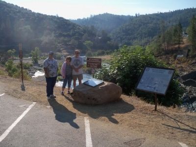
On Old Foresthill Road east of Golden Chain Highway (California Highway 49), on the right when traveling east.
The Mountain Quarries Railroad Bridge, also known a "No Hands Bridge", was completed on March 23, 1912. At the time of its construction the span bore the distinction of being one of the largest reinforced concrete railroad bridges in the United . . . — — Map (db m67664) HM
On Old Foresthill Road east of Golden Chain Highway (California Highway 49), on the right when traveling east.
In 1910, the Mountain Quarries Company contracted for the construction of a railroad bridge over the North Fork of the American River to haul limestone from their upstream quarry. The bridge and 17 wooden trestles were part of Mountain Quarries . . . — — Map (db m67659) HM
On 5th Street west of E Street, on the right when traveling east.
Founder of the City of Lincoln
First president of the Sacramento Valley Railroad
Founder of the California Central Railroad
Colonel Wilson came to California in 1849 not to look for gold but to build a transportation industry. After . . . — — Map (db m41008) HM
Across this footbridge situated high above Roseville's Southern Pacific railroad yards
passed untold thousands of Pacific Fruit Express employees on their way to work at the
world''s largest artificial ice plant. In disuse since 1974 when the . . . — — Map (db m136168) HM
On W Lake Blvd, on the right when traveling north.
Trails become roads around Lake Tahoe
Early travel in the Lake Tahoe basin was along Washoe Indian trails and later along American immigrant trails blazed in the 1840s over the rugged Sierra Nevada Mountain passes. The first roads in the . . . — — Map (db m112967) HM
The original Victoria Bridge was wooden and built in 1891 to
unite the new Arlington Heights tract with downtown.
Designed by William Irving and built by private developers,
the bridge was deeded to the city in 1891. The wooden . . . — — Map (db m217883) HM
On Mount Rubidoux Drive at Mission Inn Avenue, on the right when traveling west on Mount Rubidoux Drive.
Construction of this bridge was a major element
in the beautification program associated with the
widening of the bridge over the Santa Ana River
and of its Seventh Street approach. Its dramatic
design and excellent workmanship in . . . — — Map (db m301871) HM
Near Pennsylvania Avenue near the north bank of the American River.
Named in honor of Jim Jones whose love for the American River and fervor to protect its fisheries and flow levels greatly enhanced the river and parkway.
When this bridge was no longer needed for mining activities, Jim fought to save it so that . . . — — Map (db m377) HM
Folsom Dam and Reservoir are a component of the Central Valley Project, owned and operated by the Bureau of Reclamation, Mid-Pacific Region, Central California Area Office
Construction of Folsom Dam by the Corps began in . . . — — Map (db m17644) HM
Named in honor of
Dr. Guy A. West
Founding President of
Sacramento State College
(1947 – 1966)
Under his guidance and dedicated
leadership, the university grew from
four faculty and fewer than two
hundred students to a . . . — — Map (db m19578) HM
On Front Street south of O Street, on the right when traveling north.
R Street formed the boundary of a levee system that surrounded Sacramento. It also served as the base of operations for the State's first rail line, the Sacramento Valley Railroad. The line was designed by Theodore Judah, who also became the . . . — — Map (db m90220) HM
In 1911, the Northern Electric Railway Company, along with Sacramento and Yolo counties, built the Northern Electric Bridge. The bridge carried a single railroad track with twin motor-vehicle roadways. Pedestrian walks cantilevered from the central . . . — — Map (db m16492) HM
The Tower Bridge, a vertical-lift span, was opened for traffic on December 15, 1935 and was built at a cost of $994,000. The State Department of Public Works, the City and the County of Sacramento and the Federal Government built the bridge.
It . . . — — Map (db m16489) HM
Identifying A Need
By the early 1930’s, Americans were moving away from trains and ships and turning to automobiles as their mode of transporation. As a result, traffic on roadways increased dramatically. In Sacramento, M Street (now . . . — — Map (db m16490) HM
Near Laramie Avenue at Lincoln Street, on the left when traveling east.
Santa Fe Railroad extended from downtown Redlands following the Mill Creek Zanja.
The 1892 wooden bridge crossing the Zanja remains as a visual relic of the famous
Kite Shaped Track that extended to Mentone, Highland and San Bernardino. . . . — — Map (db m143518) HM
The story says that when Hattie, the daughter of City founder Samuel Merrill returned from a trip to Italy, she was so impressed with the Rialto Bridge in Venice, that she insisted her father name the city after it. While the exact reason the . . . — — Map (db m239695) HM
Construction Started February, 1967
Bridge Opened to Traffic August, 1969
California Bridge Authority
Governor Ronald Reagan • Lieutenant Governor Ed Reinecke • Secretary of Business & Finance Gordon C. Luce • Director of Finance Casper . . . — — Map (db m117882) HM
Extending from Sixth Avenue to Highway 163 and from the north to south boundaries of the park, the West Mesa remains Balboa Park's most recognizable example of the design style perfected by American landscape pioneer Frederick Law Olmsted. Samuel . . . — — Map (db m209219) HM
On El Prado east of Balboa Drive, on the right when traveling east.
When the 1915 Panama-California Exposition was related to an upper mesa of Balboa Park from the original proposed site near downtown San Diego, a bridge over Cabrillo Canyon was required. Director of Works Frank P. Allen, Jr. (1831-1943) . . . — — Map (db m209220) HM
On First Avenue north of Nutmeg Street, on the right when traveling north.
Length 463.24 ft.
Height 104 ft.
Erected by property owners under
"Improvement Act of 1911".
R.E. Hazard Contracting Co.,
general contractors.
Design and supervision by Tom Johnson
Allen, Civil Engineer, and R. . . . — — Map (db m295513) HM
Built in 1905 for $805, the Quince Street Footbridge
was designed by George d'Hemecourt with input
from Bankers Hill neighbors. This unique trestle
bridge takes fortunate walkers below the canyon
rim and away from city noise. — — Map (db m295465) HM
On Presidio Drive at Taylor Street, on the right when traveling west on Presidio Drive.
Until 1853 the erratic San Diego River dumped tons of debris into the harbor or poured into False Bay, now Mission Bay. At times it threatened to destroy Old Town San Diego. Lieutenant George Horatio Derby, U.S. Topographical Corps, built a dike . . . — — Map (db m11136) HM
As you gaze out at the majestic beauty of the Golden Gate Bridge, it probably isn't too difficult to determine which San Francisco tourist attraction is on the face of the top-selling postcard sold from City stores each year.
Right. The . . . — — Map (db m176590) HM
The scene before you is the result of a tectonic collision that went on for millions of years, beginning in the Jurassic period – about 200 million years ago – and ending here about 15 million years ago. During that time the Pacific seafloor . . . — — Map (db m210703) HM
Operation of the Fourth Street Bridge
The Peter R. Maloney Bridge, otherwise known as the Fourth Street Bridge, opened in 1917 after a two-year period of construction. Joseph B. Strauss, the leading designer of bascule bridges in the . . . — — Map (db m162761) HM
To reach the site of the south tower foundation, workers constructed a temporary roadway on a timber access trestle, or wharf, from the San Francisco shore. The dangers of the exposed location soon became apparent in 1933, when a freighter collided . . . — — Map (db m176570) HM
When asked how long the Golden Gate Bridge would last, Chief Engineer Joseph Strauss replied, "Forever." The Bridge was designed to be strong and durable, but to make it a lasting monument requires continual maintenance and improvements.
Since . . . — — Map (db m176575) HM
Bridge construction began in 1933, in the midst of the Great Depression. The unemployment rate was 25 percent, and jobs were much sought after. With the exception of highly specialized jobs, the Bridge was built by local labor. Besides the pay, the . . . — — Map (db m176574) HM
The Golden Gate Bridge is one of the world’s largest examples of the Art Deco style.
Named for the Exposition Internationale des Arts Décoratifs et Industriels Modernes, held in Paris in 1925, the Art Deco style was used by architect Irving . . . — — Map (db m176578) HM
Defending the Golden Gate
Battery Lancaster's mission was unique among the many artillery installations on this bluff. From 1900 through World War I, Lancaster's three guns offered the only artillery coverage from the south for the . . . — — Map (db m176564) HM
San Francisco grew rapidly in the early 1900s, but the mile-wide Golden Gate Strait limited access and development to the north. Traveling north to Marin County and the Redwood Empire beyond required a lengthy trip by ferryboat.
In 1923, popular . . . — — Map (db m176567) HM
In 1921, engineer Joseph B. Strauss submitted a design for a bridge that would cross the Golden Gate Strait — a hybrid bridge with a suspension span supported at each end by cantilever trusses. By 1929, consulting engineers Leon S. Moisseiff and . . . — — Map (db m176569) HM
Quick Facts on the Golden Gate Bridge
Period of construction: Just over four years. Construction commenced on January 5, 1933 and the Bridge was open to vehicular traffic on May 29, 1937.
Cost: $35 million dollars in the 1930’s, . . . — — Map (db m176583) HM
The curve of an arch experiences pushing forces, or compression.
At the south (San Francisco) end of the suspension bridge, a large steel arch carries the roadway deck over Fort Point, the brick fort below.
Fort Point was completed in . . . — — Map (db m176563) HM
The steel trusses on each side of the roadway deck structure along its length can be identified by their triangles. The trusses support beams holding up the roadway and stiffen the deck structure against wind. They span 50 feet (15 meters) between . . . — — Map (db m176573) HM
The Strauss Circle commemorates
the 75th anniversary of the Golden Gate Bridge
and honors the legacy of
Joseph B. Strauss, its first chief engineer. — — Map (db m195724) HM
Until 10,000 years ago, the sea level was over 300 ft (100 m) lower than today. An ancient river cut a canyon here, forming the Golden Gate Strait. When a warmer climate ended the Ice Age, the sea level rose and flooded the interior valley to form . . . — — Map (db m176566) HM
Joseph Strauss dreamed of a golden bridge spanning San Francisco Bay.
But people opposed it fearing it would never survive the strong tides, it would lower property values, it would ruin the view. More than 2,000 lawsuits were filed to stop . . . — — Map (db m195723) HM
Ever since the modern suspension bridge was invented in the early 1800s, one of the biggest challenges engineers have faced is preventing these flexible structures from moving too much in the wind.
A storm on December 1, 1951, caused the Golden . . . — — Map (db m131193) HM
By mid-1935, the north and south towers stood ready to support the two main cables. Each of the cables measured a little over 3 feet (1 meter) in diameter and weighed 12,000 tons. They were far too heavy to carry across the Golden Gate Strait on . . . — — Map (db m176572) HM
Only rarely must the Golden Gate Bridge withstand earthquakes or strong wind, but everyday it must fight another threat: corrosion of the steel which creates a byproduct called rust.
Steel is an alloy comprised principally of iron along with . . . — — Map (db m176579) HM
Tallest Bridge Towers
The Golden Gate Bridge not only set the record for longest bridge span when completed in 1937, it also had the tallest towers.
Honeycomb Legs — Strong, but Light
This innovation introduced by the Golden Gate . . . — — Map (db m176580) HM
Near Lincoln Boulevard west of Chrissy Field Avenue.
"The Golden Gate!" Army explorer John Charles Fremont named the entrance to San Francisco Bay in 1846. His Majesty Emperor Joshua Abraham Norton decreed in 1869 a bridge be built “…across the Golden Gate to Sausalito Ridge.” Work finally began 64 . . . — — Map (db m31685) HM
The side view (elevation view) of the Golden Gate Bridge shown here in bronze is 1:2,000: the actual bridge is 2,000 times larger. The distance between the actual towers is 4,200 feet (1,280 m), which set the world record for the longest span when . . . — — Map (db m195726) HM
On Golden Gate Bridge, on the right when traveling north.
This tower has been named for Pacific Gas and Electric Company in appreciation of its gift of light to the Golden Gate Bridge. PG&E made the largest single private contribution toward the permanent lightning of the twin towers, installed for the . . . — — Map (db m243378) HM
Suspension bridges are the longest-spanning bridges in the world. Prior to the record set by the Golden Gate Bridge in 1937, 4,200 ft (1,280 m), the longest-spanning bridge in the world was the George Washington Bridge, with a span of 3,500 ft . . . — — Map (db m176582) HM
One of the greatest construction challenges took place underwater. The south tower was located more than 1,100 feet (335 meters) from the San Francisco shore. To build the south tower structures, divers played a critical role descending up to 110 . . . — — Map (db m176576) HM
A long-span suspension bridge usually has tall towers. The height of the Bridge's towers directs the tensile (pulling) forces in the main cables upward, so that the cables can efficiently hold up the roadway deck.
The 746-foot-tall . . . — — Map (db m176571) HM
On Folsom Street north of 1st Street, on the right when traveling east.
Beginning in the 1860s, foundries South of Market Street fabricated mining machinery, railroad cars, and ships. This 1912 machine shop is the last. Fred V. Wilbert forged fine tools here. Edwin A. Klockars (1898-1994), a native of Munsmo, Finland, . . . — — Map (db m110905) HM
Emperor of the United States
and Protector of Mexico 1859-80,
whose prophetic wisdom
conceived and decreed the
bridging of San Francisco Bay
August 18 1869
Dedicated by E Clampus Vitus, Feb. 25, 1939 — — Map (db m241732) HM
Begun in 1933 in the depths of the Depression, the San Francisco-Oakland Bay Bridge put hundreds of men to work on two six-hour shifts, morning and night, for three years and seven months, to finish two months ahead of schedule on November 12, . . . — — Map (db m92904) HM
The Francis Lefty O'Doul Third Street Bridge,
City Landmark No. 194, was built in 1933.
The Strauss Engineering Company, designers
Of the Golden Gate Bridge, designed this heel
trunnion type steel truss bascule bridge. The
bridge is weighted at . . . — — Map (db m162763) HM
On Avenue of the Palms at 9th Street, on the left when traveling north on Avenue of the Palms.
Tom Loughlin’s sculpture repurposes steel girders and a light salvaged from the original East Span of the Bay Bridge which was opened in 1936., damaged in the 1989 Loma Prieta earthquake, and taken out of service in 2013. Demolition of the original . . . — — Map (db m210549) HM
On Treasure Island Road north of Macalla Road, on the right when traveling north.
With a strategic location in the center of the San Francisco Bay opposite the Golden Gate, Yerba Buena Island has been home to three branches of the U.S. Military – the Army, Navy and Coast Guard.
From 1867 to 1897 the Army used the island . . . — — Map (db m218468) HM
On Mackville Road near East Jahant Road, on the left when traveling south.
County of San Joaquin
Mackville Road Bridge
Dedicated to the citizens of the Clements and Lockeford areas and San Joaquin County, January 1977
Board of Supervisors
George L. Baker • Norman D. Shumway • Adrian C. Fondse • Clifford . . . — — Map (db m151208) HM
On 11th Street (California Route 205) east of Cable Road, on the right when traveling west.
In the 1800's the United States was experiencing its industrial revolution. Inventors were running rampant. The new horseless carriage was the rage. America soon realized that the horse and buggy were a thing of the past. Bicyclists, having trouble . . . — — Map (db m230997) HM
Near Branch Street at Short Street, on the right when traveling east.
To connect his properties, Newton Short built this swinging bridge without sides about 1875. Sides were added after 1902.
The bridge was given to
the city of Arroyo Grande on July 14, 1911, the date of incorporation. It is a mark of pride to . . . — — Map (db m273089) HM
Look across the bay. Can you see the tiny remnants of a wooden trestle bridge that once connected the place where you are standing to the sandspit?
The Navy built the bridge in 1942 as part of its efforts to create a functional Navy base in . . . — — Map (db m299893) HM
An officer for the Town of Hillsborough from April 1, 1956 until his untimely death on August 5, 1959, who made the supreme sacrifice at the hands of a criminal suspect whom he had apprehended. — — Map (db m18330) HM
After the 1906 earthquake and its resulting fires destroyed much of San Francisco, public support surged for a reliable water supply. This allowed San Francisco to look beyond the Bay Area to resolve the region’s growing need for reliable, . . . — — Map (db m202491) HM
In 1923, the cities of San Mateo, Burlingame, and Hillsborough began planning for a bridge to link the San Francisco Bay peninsula cities with East Bay and Central Valley communities. Even after the Dumbarton Bridge opened, in 1927, these . . . — — Map (db m28727) HM
On Centennial Way Trail at Spruce Avenue, on the right when traveling north on Centennial Way Trail.
History
The Cut Stone Bridge before you was constructed in 1863 for one of the earliest rail lines on the peninsula, the San Francisco & San Jose Railroad, which ran between the two cities of its name until it merged with the Central Pacific . . . — — Map (db m206367) HM
Near Covered Bridge Road 0.5 miles south of Graham Hill Road.
Built in 1892-93 and believed to be the tallest covered bridge in the country, it stood as the only entry to Felton for 45 years. In 1937 it was retired from active service to become a pedestrian bridge and figured prominently in many films of that . . . — — Map (db m2348) HM
Dedicated to the pioneer spirit of America
which bridges past, present and future
Designed in 1844 by Thomas Willis Pratt
Constructed 1969 by Roaring Camp & Big Trees
Narrow Guage RR. First Pratt-Truss covered bridge
built in . . . — — Map (db m190688) HM
On West Cliff Drive at Gharkey Street, on the right when traveling north on West Cliff Drive.
You are looking at the Santa Cruz Municipal Wharf, a place where people gather for fun and relaxation. When this wharf was built in 1914, it supported commerce and transportation. Steamships loaded with freight and passengers left for ports around . . . — — Map (db m205960) HM
This aqueduct was built in 1918 as connecting link of main canal of Anderson Cottonwood Irrigation Dist., to carry water across Anderson Gulch to irrigate lands in southern Shasta Co. Aqueduct is 1249 ft. long, 8 ft. wide, 5 ft. deep and 20 ft. from . . . — — Map (db m70339) HM
It took a bit of grit and determination for the Forest Service and Civilian Conservation Corps (CCC) crew to build this sturdy bridge...
Raymond Huber, who supervised the project remembers... “I was given a pickup and a plan of a 160-foot . . . — — Map (db m69821) HM
On Middle Creek Road at Benton Drive, on the right when traveling west on Middle Creek Road.
Two separate markers have been mounted on the same rock.Marker on the Right:
Diestelhorst Auto Camp
Gotlieb Justus Diestelhorst came to Shasta in 1852, to grow produce and vegetables to sell. He found the soil . . . — — Map (db m70331) HM
To cross Clear Creek in 1865 it would have cost you 10 cents to walk across, 25 cents to ride over on horseback, and $1.25 to cross by wagon. Charles Camden, the bridge owner, spent $20,000 to improve the road between here and the town of Shasta. . . . — — Map (db m12565) HM
On Scott River Road (at milepost 18), on the right when traveling north.
U S Forest Ranger
John F. Williams
Memorial Bridge
Gave his life to save
the life of a drowning
girl at this location
June 24, 1940 — — Map (db m70257) HM
President Franklin Delano Roosevelt established the Civilian Conservation Corps on March 31, 1933, to provide employment for America's youth and promote the nation's economic recovery. The CCC's work involved conservation projects on forest, park . . . — — Map (db m547) HM
On Main Street at South Weed Boulevard, on the right when traveling north on Main Street.
The Arch is the strongest form of architecture known to Man.
This steel arch replaces the original concrete arch first erected on this site in 1922. Due to the lack of maintenance over the years, surface cracks appeared. Because there were no . . . — — Map (db m62809) HM
The bridges, oil refineries, factories and ports along the East Bay shoreline reflect a commercial history that dates back to the Gold Rush. The Carquinez Strait provided easy passage for ships carrying cargo and people to and from the gold . . . — — Map (db m232404) HM
On Arnold Drive west of Carmel Avenue, on the right when traveling west.
Valley of the Moon is a translation of Sonoma Valley's name given by the Pomo and Coast Miwok peoples, the area's original inhabitants.
Many writers and artists have found creativity here. Mary Francis Kennedy (MFK Fisher), excited by the . . . — — Map (db m231586) HM
On State Highway 120 at milepost 16.4 at Kennedy Road, on the left when traveling west on State Highway 120.
Picturesque mining center and trading post, 1849, once called Dentville. Early ferry to the southern mines; county seat 1862-72; rare wooden covered bridge reputedly designed by U. S. Grant, brother-in-law of the Dent brothers, 1854; old flour mill, . . . — — Map (db m178066) HM
Near Covered Bridge Road east of Sonora Road (Main Street), on the right when traveling east.
Knight's Ferry Bridge
has been designated a
National Historic Landmark
This property possesses national significance
in commemorating the history of the
United States of America Knight’s Ferry Bridge is an exceptionally fine . . . — — Map (db m146387) HM
Founded 1849 by Judge O D Dickerson.
Named for Jesse Hill
Operator of the Ferry Boat that landed just upstream under the present bridge site. — — Map (db m58204) HM
On C Street near Cavalier Drive, on the left when traveling east.
This turnstyle bridge served the California & Oregon Railroad Co. It was surveyed in September 1870 and was completed in August 1871. The bridge was first crossed by the steam locomotive "Falcon" and by the "Clipper" the following day with one . . . — — Map (db m89184) HM
Near Steel Bridge Road, on the left when traveling north.
The Union Hill Mines, which began in 1862, were located up the western slope of Union Hill from the mouth of Weaver Creek, at the head of Union Gulch. It was one of the largest placer mines in Trinity County. Water was ditched from Weaver Creek and . . . — — Map (db m70306) HM
On Riverview Road, on the right when traveling north.
This one-mile section on the river (between Weaver Creek and Reading
Creek) has hosted at least seven bridges since the establishment of Kanaka
Bar/Douglas City in the early 1850s. All but the current one eventually
succumbed to the flows of . . . — — Map (db m306210) HM
On Jacksonville Road at River Road, on the right when traveling south on Jacksonville Road.
Beneath this bridge lies the site of the historic Gold Rush mining camp of Stevens Bar (or Stephens Bar) founded in 1849.
The first bridge to span the upper Tuolumne River was constructed just above this point in 1857. Following its destruction . . . — — Map (db m53342) HM
Near Richards Boulevard 0.5 miles south of 1st Street, on the left when traveling north.
Built in 1917-18, this entrance to Davis is among the oldest surviving examples of I-beam construction on a railroad grade separation. The underpass was part of the Lincoln Highway. The bicycle bore was added in 1978. Listed in the National Register . . . — — Map (db m57189) HM
Dedicated April 23, 2000
WEST SACRAMENTO
by
James Stretesky
First Northern Bank
Daniel F. Ramos Family
Frank C. Ramos Family
Dr. & Mrs. James O. Farley
West Sacramento Land Company
West Sacramento Chamber of Commerce
Pony Express Trail . . . — — Map (db m15708) HM
Sacramento’s graceful Tower Bridge has spanned the river since 1936. It is the only historically significant vertical-lift bridge in California and was placed on the National Register of Historic Places in 1982. Lights added in 1986 in honor of its . . . — — Map (db m15711) HM
On Tower Bridge Gateway (California Route 275) at The American River, on the left when traveling east on Tower Bridge Gateway.
Identifying A Need
By the early 1930s, Americans were moving away from trains and ships and turning to automobiles as their main mode of transportation. As a result, traffic on roadways increased dramatically. In Sacramento, M Street (now . . . — — Map (db m229443) HM
On Alleghany Ridge Road at Highway 49, on the right when traveling north on Alleghany Ridge Road.
In 1859 the rich Comstock Silver Lode was discovered in Washoe Territory, Nevada, causing many miners to quickly pack up and head east. Immediately a company was formed to construct a road connecting this area of California to the Comstock finds. . . . — — Map (db m65968) HM
Built in 1860, the Oregon Creek Covered Bridge was floated from its foundations by the flood waters from the breaking of English Dam in 1883. It was restored to place by using ox teams and log rollers, but turned end for end in the process. — — Map (db m65967) HM
William M. Thomas of Thomas and Post Consulting Engineers designed the 685-foot-long Parks Bar Bridge in 1912 for Yuba County. The original 16-foot-wide bridge with four 140-foot-long arch spans was constructed by the Portland Concrete Pile Company . . . — — Map (db m281050) HM
Near U.S. 285 just north of U.S. 50, on the right when traveling south.
The Top of the Rockies Scenic and Historic Byway travels through spectacular scenery and is surrounded by some of the state’s highest peaks. In the nineteenth century, these mountains yielded some of Colorado’s biggest mining fortunes. On the . . . — — Map (db m281215) HM
Near Gunnison River Drive (North Palmer Street) 0.3 miles west of U.S. 50.
Commerce at the confluence began with fur trade — beaver fur pelts snagged by trappers working out of Antoine Robidoux's Fort Uncompahgre trading post. Beaver, fox, coyote, muskrat, and other furs continued to be trapped and traded in the environs . . . — — Map (db m290983) HM
On 19th Street just south of Platte Street, on the right when traveling south.
The South Platte River has endured more than two centuries of ridicule, exploitation, and abuse. Yet the river that gave Denver life flows on, bringing hope that future generations will protect and respect this vital and historic . . . — — Map (db m289514) HM
On Wynkoop Street 0.1 miles west of 15th Street, on the left when traveling west.
This bridge symbolizes the revitalization of lower downtown Denver in the late twentieth century and represents one of the many contributions made to our community by Emanuel "Manny" Salzman. After moving to LoDo in 1980, Manny and his wife, Joanne, . . . — — Map (db m97412) HM
On North 30th Street at Glen Eyrie, on the right when traveling north on North 30th Street.
This stone bridge located on the original road to the mesa reservoirs and Blair’s cabin was constructed by John Blair, landscape gardener, who had charge of the construction of grounds and stone structures in General Palmer’s Glen Eyre Estate and . . . — — Map (db m283085) HM
Near Lake Street just east of Ute Pass Avenue, on the right when traveling east.
Lake Gazebo Built 1888 by Green Mountain Falls Town & Improvement Co. Until a board walk was built in the 1930’s, the gazebo sat on the island, accessible only by boat. Gazebo Bridge Built 1990 Designed and . . . — — Map (db m283837) HM
On South 3rd Street 0.1 miles south of Royal Gorge Boulevard (U.S. 50), on the right when traveling south.
Railroads have been essential to the growth of Cañon City. Trains brought people and materials into the region and carried local products to market. Most importantly, the railroads supported the mining industry. Worth Fighting Over . . . — — Map (db m281899) HM
3931 entries matched your criteria. Entries 201 through 300 are listed above. ⊲ Previous 100 — Next 100 ⊳