1607 entries match your criteria. Entries 301 through 400 are listed.⊲ Previous 100 — Next 100 ⊳
Hispanic Americans Topic
By Adam Margolis, August 30, 2025
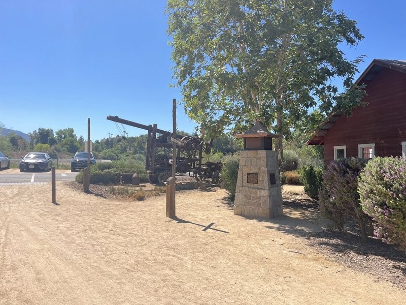
Cowboys Marker
301 ► California, Riverside County, Temecula — Cowboys —  |
| On Temecula Parkway. | |||
| 302 ► California, Sacramento County, Folsom — Rancho Rio de los Americanos — |
| Near Black Miners Bar Road (aka Park Road) near Greenback Lane. | |||
| 303 ► California, Sacramento County, Sacramento, Central Business District — California Mexican-American War Memorial — |
| On 10th Street at Capital Mall, on the right when traveling south on 10th Street. | |||
| 304 ► California, Sacramento County, Sacramento, Midtown — Jovita Idár — 19th Amendment Outdoor Museum — |
| On K Street at 19th Street on K Street. | |||
| 305 ► California, Sacramento County, Sacramento, Midtown — María Amparo Ruiz de Burton — 19th Amendment Outdoor Museum — |
| On K Street near 19th Street. | |||
| 306 ► California, Sacramento County, Sacramento, Midtown — Maria Guadalupe Evangelina de Lopez — 19th Amendment Outdoor Museum — |
| On 19th Street near K Street, on the right when traveling north. | |||
| 307 ► California, Sacramento County, Sacramento, Old Sacramento — A Multicultural Gold Rush — |
| Near K Street at Interstate 5, on the right. | |||
| 308 ► California, Sacramento County, Sacramento, Old Sacramento — Ernesto Galarza — |
| Near K Street at Interstate 5, on the right when traveling east. | |||
| 309 ► California, Sacramento County, Sacramento, Southside Park — Rededication of El Centro Mexicano Plaque — September 16, 2011 — |
| Near U Street west of 8th Street. | |||
| 310 ► California, San Benito County, San Juan Bautista — Progress Becomes History — El Progresso se Combirtió en Historia — |
| On Mariposa Street at 2nd Street, on the left when traveling north on Mariposa Street. | |||
| 311 ► California, San Bernardino County, Chino — Unflinching Courage — |
| On Cal Aero Drive, on the left when traveling west. | |||
| 312 ► California, San Bernardino County, Loma Linda — 95 — Guachama Rancheria — |
| On Mission Road 0.4 miles east of Mountain View Avenue, on the left when traveling east. | |||
| 313 ► California, San Bernardino County, Rancho Cucamonga — 490 — Cucamonga Winery — |
| On Foothill Boulevard (Route 66) at Vineyard Avenue, on the right when traveling west on Foothill Boulevard. | |||
| 314 ► California, San Bernardino County, Rancho Cucamonga — Red Hill — City of Rancho Cucamonga Historic Point of Interest — |
| On Foothill Boulevard (Route 66) at Vineyard Avenue, on the right when traveling west on Foothill Boulevard. | |||
| 315 ► California, San Bernardino County, Rancho Cucamonga — 360 — Tapia Adobe Site — |
| On Vineyard Avenue at Foothill Boulevard, on the right when traveling north on Vineyard Avenue. | |||
| 316 ► California, San Bernardino County, Rancho Cucamonga — The Thomas Winery … More than a century of service. — |
| On Foothill Boulevard. | |||
| 317 ► California, San Bernardino County, San Bernardino — 618 — Garces-Smith Monument — The Mojave Indian Trail — Monument Peak — |
| Near Forest Road 2N49, 7.2 miles north of Interstate 215. | |||
| 318 ► California, San Bernardino County, San Bernardino — La Plaza Park, San Bernardino, California — Route 66 Roadside Attraction |
| On North Mount Vernon Avenue (Old U.S. 66), on the right when traveling north. Reported missing. | |||
| 319 ► California, San Bernardino County, Yucaipa — 528 — Yucaipa Adobe — |
| On Kentucky Street at Dunlap Boulevard, on the right when traveling east on Kentucky Street. | |||
| 320 ► California, San Diego County, Anza-Borrego Desert State Park — 639 — Palm Spring — |
| On Vallecito Creek Road south of County Road S2. | |||
| 321 ► California, San Diego County, Camp Pendleton South — The Santa Margarita Ranch House Bell — |
| Near Vandegrift Boulevard. | |||
| 322 ► California, San Diego County, Carlsbad — El Camino Real Bell — |
| On State Street at Grand Avenue, on the left when traveling north on State Street. | |||
| 323 ► California, San Diego County, Carlsbad — 1020 — Leo Carrillo Ranch — (Rancho de Los Kiotes) — |
| Near Flying LC Lane north of Carrillo Way. | |||
| 324 ► California, San Diego County, Carlsbad — Living Californio — |
| Near Flying Leo Carrillo Lane, on the left when traveling north. | |||
| 325 ► California, San Diego County, Escondido — 533 — San Pasqual Battlefield — |
| On San Pasqual Valley Road (California Route 78 at milepost 25.1), on the right when traveling west. | |||
| 326 ► California, San Diego County, Julian — 858 — Pedro Fages Trail — |
| On Sunset Highway (County Road S1 at milepost 36), on the right when traveling south. | |||
| 327 ► California, San Diego County, Lakeside — 425 — Mexican Grant — Cañada de Los Coches Rancho — Smallest Mexican Land Grant in Calif. — |
| On East Main Street (Business Interstate 8). | |||
| 328 ► California, San Diego County, San Diego, Middletown — El Indio Shop — |
| On India Street south of Winder Street, on the left when traveling north. | |||
| 329 ► California, San Diego County, San Diego, Old Town — 74 — Casa de Carrillo — |
| Near Juan Street near Wallace Street. | |||
| 330 ► California, San Diego County, San Diego, Old Town — 60 — Casa de Lopez — |
| On Twiggs Street west of Congress Street. | |||
| 331 ► California, San Diego County, San Diego, Old Town — 53 — Estudillo House — |
| Near San Diego Avenue at Mason Street. | |||
| 332 ► California, San Diego County, San Diego, Old Town — Original Foundation Casa de Aguirre — c. 1853 — |
| Near Twiggs Street, on the left when traveling south. | |||
| 333 ► California, San Diego County, San Diego, Old Town — The Gravedigger of Old Town — Rafael Mamudes — (In Memory of) — |
| Near San Diego Avenue. | |||
| 334 ► California, San Diego County, San Diego, Old Town — The Old Presidio Historic Trail — A short walk to the Serra Museum and the site of California's first Spanish mission and presidio. — |
| On Mason Street at Jackson Street, on the right when traveling south on Mason Street. | |||
| 335 ► California, San Diego County, San Diego, Point Loma — 891 — Spanish Landing — |
| Near North Harbor Drive, on the right when traveling east. | |||
| 336 ► California, San Diego County, Santee — 52 — Mission Dam and Flume — |
| Near Father Junipero Serra Trail, on the right when traveling west. | |||
| 337 ► California, San Diego County, Vista — 940 — Rancho Guajome — |
| Near Santa Fe Avenue 2 miles south of Route 76, on the right when traveling south. | |||
| 338 ► California, San Francisco City and County, San Francisco, Civic Center — Pioneer Monument / California Native Americans — Sculptor, Frank Happersberger / — |
| On Fulton Street east of Larkin Street, in the median. | |||
| 339 ► California, San Francisco City and County, San Francisco, Mission Dolores — 784 — El Camino Real — |
| On Dolores Street north of Chula Lane, on the right when traveling south. | |||
| 340 ► California, San Francisco City and County, San Francisco, Mission Dolores — 327-1 — Site of Original Mission Dolores Chapel and Dolores Lagoon / The Rammaytush — |
| On Albion Street at Camp Street on Albion Street. | |||
| 341 ► California, San Francisco City and County, San Francisco, North Beach — 1024 — Juana Briones y Tapia de Miranda — 1802 – 1889 — North Beach Pioneer — |
| Near Stockton Street at Filbert Street. | |||
| 342 ► California, San Francisco City and County, San Francisco, North Beach — Little Chile — |
| Near Columbus Avenue at Kerney Street. | |||
| 343 ► California, San Francisco City and County, San Francisco, Northern Waterfront — Vallejo Street — |
| On The Embarcadero, on the right when traveling south. | |||
| 344 ► California, San Francisco City and County, San Francisco, Presidio of San Francisco — Daily Life in the Early 19th Century / La vida cotidiana en el siglo XIX — Presidio of San Francisco — |
| Near MacArthur Avenue. | |||
| 345 ► California, San Francisco City and County, San Francisco, Presidio of San Francisco — Juana Briones — Presidio of San Francisco — |
| Near El Polin Loop just south of MacArthur Avenue, on the right when traveling south. | |||
| 346 ► California, San Francisco City and County, San Francisco, South Beach — Felipe Alou — San Francisco Giants Wall of Fame — |
| On King Street at 2nd Street, on the right on King Street. | |||
| 347 ► California, San Francisco City and County, San Francisco, South Beach — Juan Antonio Marichal Sanchez — |
| On Third Street, on the right when traveling north. | |||
| 348 ► California, San Francisco City and County, San Francisco, South Beach — Juan Marichal — San Francisco Giants Wall of Fame — |
| On King Street north of 3rd Street, on the right. | |||
| 349 ► California, San Francisco City and County, San Francisco, South Beach — Orlando Cepeda — San Francisco Giants Wall of Fame — |
| On King Street at 2rd Street, on the right on King Street. | |||
| 350 ► California, San Francisco City and County, San Francisco, South Beach — Orlando Manuel Cepeda — "Baby Bull" "Cha-Cha" — |
| On King Street at 2nd Street, on the right when traveling north on King Street. | |||
| 351 ► California, San Francisco City and County, San Francisco, South Beach — Tito Fuentes — San Francisco Giants Wall of Fame — |
| On King Street north of Third Street, on the right when traveling north. | |||
| 352 ► California, San Francisco City and County, San Francisco, The Castro — Frida Kahlo — (1907 - 1954) — Rainbow Honor Walk — |
| On 19th Street at Castro Street, on the right when traveling west on 19th Street. | |||
| 353 ► California, San Francisco City and County, San Francisco, The Castro — José Sarria — (1922-2013) — Rainbow Honor Walk — |
| On Market Street at Castro Street, on the right when traveling east on Market Street. | |||
| 354 ► California, San Francisco City and County, San Francisco, The Castro — Sylvia Rivera — Rainbow Honor Walk — |
| On Market Street near 16th Street, on the right when traveling east. | |||
| 355 ► California, San Luis Obispo County, Arroyo Grande, Village — Arroyo Grande Hoosegow Jail — |
| On East Le Point Street west of Miller Way, on the right when traveling west. | |||
| 356 ► California, San Luis Obispo County, San Luis Obispo — 325 — Mission San Luis Obispo de Tolosa — 1772 — |
| Near Chorro Street. | |||
| 357 ► California, San Luis Obispo County, San Miguel — Cross of El Camino Real — |
| Near Mission Street, on the right when traveling south. | |||
| 358 ► California, San Luis Obispo County, San Miguel — 936 — Rios-Caledonia Adobe — |
| Near Mission Street at El Camino Real (U.S. 101). | |||
| 359 ► California, San Mateo County, Burlingame — 48 — Anza Expedition Camp — |
| On El Camino Real (California Route 82) at Howard Street, on the right when traveling north on El Camino Real. | |||
| 360 ► California, San Mateo County, Half Moon Bay — Zaballa House — |
| On Main Street north of Mill Street, on the left when traveling north. | |||
| 361 ► California, San Mateo County, Pacifica — Captain Don Gaspar de Portolà — |
| On Coast Highway (California Route 1) near Crespi Drive, on the right when traveling north. | |||
| 362 ► California, San Mateo County, Pacifica — 391 — Sanchez Adobe — |
| On Linda Mar Boulevard, on the right. | |||
| 363 ► California, San Mateo County, Redwood City — Soledad O. de Arguello — 1897 - 1874 — |
| Near Broadway Street, on the right when traveling east. | |||
| 364 ► California, Santa Barbara County, Carpinteria — 535 — La Carpinteria — 1769 — |
| On Carpinteria Avenue at Concha Loma Drive, on the right when traveling east on Carpinteria Avenue. | |||
| 365 ► California, Santa Barbara County, Goleta — America Expands — Gaviota Timeline: 6 — |
| On U.S. 101. | |||
| 366 ► California, Santa Barbara County, Goleta — California Ranchos — Gaviota Timeline: 5 — |
| On U.S. 101. | |||
| 367 ► California, Santa Barbara County, Santa Barbara — 308 — Casa Covarrubas — |
| On Santa Barbara Street at East De La Guerra Street, on the right when traveling south on Santa Barbara Street. | |||
| 368 ► California, Santa Barbara County, Santa Barbara — 307 — De La Guerra Plaza — 1850 - 1950 — |
| On East De La Guerra Street at State Street, on the right when traveling north on East De La Guerra Street. | |||
| 369 ► California, Santa Barbara County, Santa Barbara — Don Jose Francisco De Ortega — 1734-1798 — |
| Near Laguna Street at East Olivos Street. | |||
| 370 ► California, Santa Barbara County, Santa Barbara — 721 — Hill-Carrillo Adobe — |
| On East Carrillo Street at State Street, on the right when traveling east on East Carrillo Street. | |||
| 371 ► California, Santa Barbara County, Santa Barbara — Janssens-Orella Adobe House Site — |
| On State Street east of East Figueroa Street, on the right when traveling east. | |||
| 372 ► California, Santa Barbara County, Santa Barbara — Jose Francisco De Ortega — |
| Near Anacapa Street south of East Anapamu Street. | |||
| 373 ► California, Santa Barbara County, Santa Barbara — Jose Lobero's Opera House — 1873 — |
| On East Canon Perdido Street at Anacapa Street, on the right when traveling west on East Canon Perdido Street. | |||
| 374 ► California, Santa Barbara County, Santa Barbara — Moorish Fountain and Indian Community Laundry — |
| On Laguna Street at E. Los Olivos Street, on the right when traveling north on Laguna Street. | |||
| 375 ► California, Santa Barbara County, Santa Barbara — 361 — Old Lobero Theatre — |
| On East Canon Perdido Street at Anacapa Street, on the right when traveling west on East Canon Perdido Street. | |||
| 376 ► California, Santa Barbara County, Santa Barbara — Santa Barbara Mission Early Water Supply — Historic Civil Engineering Landmark — |
| Near Los Olivos Street north of Alameda Padre Serra, on the right when traveling north. | |||
| 377 ► California, Santa Barbara County, Santa Barbara — 636 — Site of Royal Spanish Presidio — |
| On East Canon Perdido Street at Santa Barbara Street, on the right when traveling west on East Canon Perdido Street. | |||
| 378 ► California, Santa Barbara County, Santa Barbara — The Oreña Adobe — 1849 — |
| On East de la Guerra Street at Anacapa Street on East de la Guerra Street. | |||
| 379 ► California, Santa Barbara County, Santa Barbara, Lower State — Gutierrez Drug Store — |
| On State Street at Ortega Street, on the left when traveling north on State Street. | |||
| 380 ► California, Santa Barbara County, Solvang — 305 — Mission Santa Inéz — |
| Near Mission Drive. | |||
| 381 ► California, Santa Clara County, Bell Station — The Old Adobe of Rancho San Luis Gonzaga — |
| Near Whiskey Flat Road. | |||
| 382 ► California, Santa Clara County, Cupertino — 800 — Arroyo de San Joseph Cupertino — |
| On McClellan Road east of Bryne Road, on the right when traveling east. | |||
| 383 ► California, Santa Clara County, Cupertino — Cupertino Morion Scuplture — |
| On Torre Avenue at Rodrigues Avenue, on the left when traveling south on Torre Avenue. | |||
| 384 ► California, Santa Clara County, Cupertino — De Anza Expedition 1775 - 1776 — |
| Near Stevens Creek Boulevard. | |||
| 385 ► California, Santa Clara County, Gilroy — “Alcalde” — John Cameron Gilroy — “Legacy of Gilroy” Commemorating the Historic Hospitality District — |
| On Monterey Street at East 6th Street, on the right when traveling north on Monterey Street. | |||
| 386 ► California, Santa Clara County, Gilroy — Arrival of the Spanish — La llegada de los españoles — |
| Near Watsonville Road. | |||
| 387 ► California, Santa Clara County, Morgan Hill — El Camino Real — 1797 — |
| Near Monterey Highway near Wright Avenue. | |||
| 388 ► California, Santa Clara County, Morgan Hill — Juan Bautista de Anza Expedition Campsite — |
| Near Santa Teresa Boulevard east of Native Dancer Drive, on the right when traveling west. | |||
| 389 ► California, Santa Clara County, Mountain View, Monta Loma — Mariano Castro Adobe — |
| On North Rengstorff Avenue at Central Expressway, on the right when traveling south on North Rengstorff Avenue. | |||
| 390 ► California, Santa Clara County, Palo Alto — 524 — Site of Juana Briones de Miranda Home on Rancho La Purisima Concepcion — |
| On Old Adobe Road at Old Trace Lane on Old Adobe Road. | |||
| 391 ► California, Santa Clara County, Palo Alto, Green Acres — Juana Briones Park — |
| Near Maybell Avenue just west of Clemo Avenue, on the right when traveling east. | |||
| 392 ► California, Santa Clara County, Palo Alto, Old Palo Alto — Juan Bautista de Anza — 1775-1776 Expedition — Juan Bautista Anza National Historic Trail — |
| On Middlefield Road at Embarcadero Road, on the left when traveling west on Middlefield Road. | |||
| 393 ► California, Santa Clara County, San Jose, Almaden — SpanishTown — |
| Near Hicks Road. | |||
| 394 ► California, Santa Clara County, San Jose, Alum Rock — Cesar E. Chavez — Memorial Walkway — Former Chavez Home Site — |
| On Scharff Avenue south of Plaza De Guadalupe, on the right when traveling south. | |||
| 395 ► California, Santa Clara County, San Jose, Alum Rock — Chavez Family Home — |
| On Scharff Avenue just south of Plaza De Guadalupe, on the right when traveling south. | |||
| 396 ► California, Santa Clara County, San Jose, Central San Jose — 433 — First Site of El Pueblo de San Jose de Guadalupe — |
| Near West Mission Street east of North San Pedro Street, on the left when traveling east. | |||
| 397 ► California, Santa Clara County, San Jose, Dartmouth — De Anza Expedition 1775 - 1776 — |
| On Meridian Avenue at Princeton Drive, on the right when traveling south on Meridian Avenue. | |||
| 398 ► California, Santa Clara County, San Jose, Downtown San Jose — Plaza de Cesar E. Chavez — |
| On South Market Street north of Park Avenue, on the left when traveling south. | |||
| 399 ► California, Santa Clara County, San Jose, Downtown San Jose — The Juan Bautista de Anza Trail — |
| On West Saint John Street west of North San Pedro Street, on the right when traveling east. | |||
| 400 ► California, Santa Clara County, San Jose, Downtown San Jose — The Palomar Ballroom — |
| On Notre Dame Avenue near Carlysle, on the left when traveling north. | |||
1607 entries matched your criteria. Entries 301 through 400 are listed above. ⊲ Previous 100 — Next 100 ⊳