13634 entries match your criteria. The first 100 are listed. ⊳
Parks & Recreational Areas Topic
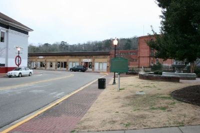
By Tim Carr, January 23, 2010
Heritage Park Marker
1 ► Alabama, Autauga County, Prattville — Heritage Park —  |
| On South Court Street at West Main Street, on the right when traveling south on South Court Street. | |||
| 2 ► Alabama, Autauga County, Prattville — North Highland Park — |
| On Martin Luther King Drive north of Cone Street, on the right when traveling north. | |||
| 3 ► Alabama, Baldwin County, Daphne — Fuller Memorial Park — |
| On Patrician Drive W 0.1 miles north of Patrician Drive S, in the median. | |||
| 4 ► Alabama, Baldwin County, Fairhope — Land, Capital, Labor — |
| On N Beach Road. | |||
| 5 ► Alabama, Baldwin County, Foley — City of Foley Camellia Walk — |
| On North McKenzie Street near Laurel Avenue. | |||
| 6 ► Alabama, Baldwin County, Gulf Shores — Here ends the Alabama Scenic River Trail — |
| Near Fort Morgan Road (Alabama Route 180) 1.2 miles west of Dune Drive, on the right when traveling west. | |||
| 7 ► Alabama, Baldwin County, Orange Beach — Hugh S. Branyon Backcountry Trail System — |
| On Orange Beach Boulevard (State Highway 161) at Catman Road, on the right when traveling south on Orange Beach Boulevard. | |||
| 8 ► Alabama, Baldwin County, Orange Beach — Romar Beach — |
| On Perdido Beach Boulevard (Alabama Route 182) 0.1 miles east of Tannin Boulevard, on the right when traveling east. | |||
| 9 ► Alabama, Barbour County, Eufaula — Governors Park — 1966 — |
| On East Barbour Street (U.S. 82), on the right when traveling east. | |||
| 10 ► Alabama, Bibb County, Brierfield — Hayes-Morton House — |
| Near State Park Road south of Furnace Road (County Route 62), on the right when traveling south. | |||
| 11 ► Alabama, Bibb County, Brierfield — Sunshine & Dorothy Morton House — Brierfield Iron Works Historical State Park — |
| On State Park Road south of Furnace Road (County Road 62), on the left when traveling south. | |||
| 12 ► Alabama, Butler County, Greenville — Greenville City Hall-Site of Public School / Confederate Park — |
| On East Commerce Street (Alabama Route 10) at South Park Street, on the left when traveling west on East Commerce Street. | |||
| 13 ► Alabama, Butler County, Greenville — Sherling Lake — Butler County — |
| Near Braggs Road (Alabama Route 263) 0.4 miles north of Sherling Lake Road (County Road 44), on the left when traveling north. | |||
| 14 ► Alabama, Butler County, Greenville — The Camellia Gardens at Beeland Park / Registered Camellias of Butler County — |
| On East Commerce Street (Alabama Route 10) west of Flowers Street, on the left when traveling west. | |||
| 15 ► Alabama, Butler County, Greenville — The Rock Wall at Beeland Park / The Greenville Men's Camellia Society — |
| On East Commerce Street (Alabama Route 10), on the right when traveling east. | |||
| 16 ► Alabama, Calhoun County, Anniston — Civic Purpose — Exploring the History of Block No. 148 - The Site of Anniston's Federal Courthouse — |
| On Gurnee Avenue south of 12th Street, on the right when traveling south. | |||
| 17 ► Alabama, Calhoun County, Oxford — Better Understandings, New Friendships — Choccolocco Park Interpretive Trail — |
| Near Leon Smith Parkway. | |||
| 18 ► Alabama, Calhoun County, Oxford — Caver-Christian-Davis Farm — AD 1832 to AD 1865 — Choccolocco Park Interpretive Trail — |
| Near Leon Smith Parkway. | |||
| 19 ► Alabama, Calhoun County, Oxford — Oxford Lake Centennial — 1889-1989 — |
| On Mc Cullars Lane east of Recreation Dr, on the left when traveling east. | |||
| 20 ► Alabama, Calhoun County, Oxford — Welcome to the Choccolocco Park — Interpretive Trail — |
| Near Leon Smith Parkway. | |||
| 21 ► Alabama, Cherokee County, Cedar Bluff — Cornwall Furnace Memorial Park — |
| On County Road 251 0.1 miles north of County Road 714, on the right when traveling north. | |||
| 22 ► Alabama, Cherokee County, Centre — Orville Estes Field — |
| On East Main Street (Business U.S. 411) at Iris Drive, on the right when traveling east on East Main Street. | |||
| 23 ► Alabama, Clay County, Delta — CCC Bunker Observation Tower — |
| Near Alabama State Road 281 (Alabama Route 281). | |||
| 24 ► Alabama, Clay County, Delta — Civilian Conservation Corps — |
| Near Alabama State Road 281 (Alabama Route 281). | |||
| 25 ► Alabama, Clay County, Delta — Managing Public Land — |
| Near Alabama State Road 281 (Alabama Route 281). | |||
| 26 ► Alabama, Colbert County, Muscle Shoals — Civilian Conservation Corps Park — |
| On CCC Camp Road north of Reservation Rd, on the right when traveling west. | |||
| 27 ► Alabama, Colbert County, Muscle Shoals — Civilian Conservation Corps Pavillion — |
| Near CCC Camp Road north of Reservation Rd. | |||
| 28 ► Alabama, Dallas County, Cahaba — Missing Pieces |
| Near Cahaba Road at Capitol Street, on the right when traveling north. Reported permanently removed. | |||
| 29 ► Alabama, Dallas County, Selma — Civil Rights Memorial Park — Never Forget, Never Again — |
| On Business U.S. 80 north of Colby Avenue, on the right when traveling north. | |||
| 30 ► Alabama, Fayette County, Berry — Town of Berry / Berry Heritage Park — Established 1883 / — |
| On Depot Street just north of Front Street, on the right when traveling north. | |||
| 31 ► Alabama, Hale County, Moundville — Moundville Archaeological Park — Alabama Indigenous Mound Trail — |
| On Mound Parkway 0.6 miles west of Route 69, on the right when traveling west. | |||
| 32 ► Alabama, Henry County, Abbeville — Liberty Oak — Rane Memorial Park — |
| On Kirkland Street (Alabama Route 27) at West Alabama Street, on the left when traveling south on Kirkland Street. | |||
| 33 ► Alabama, Jackson County, Dutton — Town of Dutton — |
| On Main Street at Browntown Road (County Road 47/416), on the left when traveling north on Main Street. | |||
| 34 ► Alabama, Jackson County, Estillfork — Walls of Jericho — |
| Near Alabama Route 79, on the right when traveling south. | |||
| 35 ► Alabama, Jackson County, Scottsboro — Friendship Park / The Decision That Saved the Sons of Scottsboro — |
| Near Veterans Drive (Alabama Route 35) north of Lee Highway (U.S. 72), on the right when traveling north. | |||
| 36 ► Alabama, Jackson County, Scottsboro — Veterans Memorial Park of Jackson County — Dedicated November 14, 2020 — |
| On Heros Drive. | |||
| 37 ► Alabama, Jackson County, Stevenson — Bennett's Cove Cabin — |
| On City Park Road 0.2 miles south of Kentucky Avenue ( Road 117), on the right when traveling south. | |||
| 38 ► Alabama, Jefferson County, Birmingham, Bluff Park — Bluff Park Art Association/ Bluff Park Art Show — |
| On Cloudland Drive at Hawksbury Ln, on the left when traveling south on Cloudland Drive. | |||
| 39 ► Alabama, Jefferson County, Birmingham, Central City — A13 — The Stand for Freedom — March Route to Government — Birmingham Civil Rights Heritage Trail — |
| On 20th Street North north of Park Place, on the right when traveling north. | |||
| 40 ► Alabama, Jefferson County, Birmingham, Five Points South — Building The Park — Visiting the Park — Restoring Vulcan Park — |
| Near Valley View Drive west of Richard Arrington Jr Boulevard South. | |||
| 41 ► Alabama, Jefferson County, Birmingham, Five Points South — Kiwanis and Vulcan — |
| Near Richard Arrington Junior Boulevard South 0.4 miles south of 16th Avenue South, on the right when traveling south. | |||
| 42 ► Alabama, Jefferson County, Birmingham, Five Points South — The Cascade — |
| Near Valley View Drive west of Richard Arrington Jr Boulevard South. | |||
| 43 ► Alabama, Jefferson County, Birmingham, Five Points South — The Works Progress Administration |
| Near Valley View Drive west of Richard Arrington Jr Boulevard South. Reported unreadable. | |||
| 44 ► Alabama, Jefferson County, Birmingham, Forest Park — Forest Park — |
| On Essex Road South at Clairmont Avenue South, on the left when traveling north on Essex Road South. | |||
| 45 ► Alabama, Jefferson County, Birmingham, Fountain Heights — C20 — Eddie Kendricks Memorial Park — Destination — Birmingham Civil Rights Heritage Trail — |
| On 4th Avenue North west of 18th Street North, on the left when traveling west. | |||
| 46 ► Alabama, Jefferson County, Birmingham, Fountain Heights — C2 — Kelly Ingram Park — Destination — Birmingham Civil Rights Heritage Trail — |
| On 16th Street North south of 6th Avenue North, on the right when traveling south. | |||
| 47 ► Alabama, Jefferson County, Birmingham, North Titusville — Colored Memorial Park — Jefferson County — |
| Near Alpha Street South at Kappa Avenue South, on the right when traveling north. | |||
| 48 ► Alabama, Jefferson County, Hoover — The Park Avenue Historical District — |
| On Park Avenue at Rockland Drive, on the right when traveling north on Park Avenue. | |||
| 49 ► Alabama, Lauderdale County, Florence — Deibert Park — -dedicated May 25, 2000- — |
| On Hightower Place near Darby Drive. | |||
| 50 ► Alabama, Lauderdale County, Florence — McFarland Park and Recreation Area — |
| On McFarland Park Road, on the right when traveling west. | |||
| 51 ► Alabama, Lauderdale County, Florence — Woodrow Wilson Park — 1818 — |
| On East Tuscaloosa Street at North Wood Street (County Road 47), on the right when traveling east on East Tuscaloosa Street. | |||
| 52 ► Alabama, Lauderdale County, Florence, East Florence — Wilson Dam — |
| On Hightower Place. | |||
| 53 ► Alabama, Lawrence County, Oakville — Jesse Owens — All Time Track Great — 1913 - 1980 — |
| On Alabama Route 203 south of Route 187, on the right when traveling north. | |||
| 54 ► Alabama, Lawrence County, Town Creek — A Brief History — Wheeler Lock & Dam — |
| On Wheeler Dam Highway (Alabama Route 101) at County Route 412 on Wheeler Dam Highway. | |||
| 55 ► Alabama, Lee County, Opelika — Municipal "Monkey" Park — |
| Near North 5th Street north of Park Road, on the right when traveling north. | |||
| 56 ► Alabama, Lee County, Opelika — Spring Villa — |
| Near Spring Villa Road (County Road 148) 1.5 miles east of State Highway 169, on the right when traveling east. | |||
| 57 ► Alabama, Lowndes County, White Hall — Holy Ground Battlefield — |
| Near Holy Ground Road 2.3 miles north of Jones Bluff Road (County Road 40). | |||
| 58 ► Alabama, Madison County, Huntsville — C.B. "Bill" Miller Bridge — |
| On Heart of Huntsville Drive SW south of Constellation Drive, on the right when traveling south. | |||
| 59 ► Alabama, Madison County, Huntsville — Dallas (Optimist) Park / (Dallas) Optimist Park — |
| Near Oakwood Avenue Northeast just east of England Street Northeast, on the right when traveling east. | |||
| 60 ► Alabama, Madison County, Huntsville — Goldsmith-Schiffman Field — |
| On Ward Avenue NE at White Street NE, on the left when traveling east on Ward Avenue NE. | |||
| 61 ► Alabama, Madison County, Huntsville — The Big Spring — |
| Near Spragins Street Southwest south of Spring Street Southwest. | |||
| 62 ► Alabama, Madison County, Huntsville — 4 — The Big Spring of Today — Huntsville Water Trail — |
| Near Fountain Circle Southwest near West Side Square. | |||
| 63 ► Alabama, Marshall County, Guntersville — Errol Allan Park — Established 2013 — |
| On Gunter Avenue (U.S. 431) at Taylor Street, on the right when traveling south on Gunter Avenue. | |||
| 64 ► Alabama, Mobile County, Mobile — Crown & Scepter of Isabel — |
| Near Government Street (U.S. 90) just east of South Hamilton Street, on the right when traveling east. | |||
| 65 ► Alabama, Mobile County, Mobile — Hernando de Soto — C 1500-1542 — |
| Near South Franklin Street south of Government Street (U.S. 90), on the left when traveling north. | |||
| 66 ► Alabama, Mobile County, Mobile — Isabel La Catolica — 1451-1504 — |
| Near Government Street (U.S. 90) just east of South Hamilton Street, on the right when traveling east. | |||
| 67 ► Alabama, Mobile County, Mobile — Memorial Park — |
| On Government Street (U.S. 90) at Old Government Street on Government Street. | |||
| 68 ► Alabama, Mobile County, Mobile — Mobile's Spanish Fountain — (Fuente de España) — |
| Near Government Street (U.S. 90) just east of South Hamilton Street, on the right when traveling east. | |||
| 69 ► Alabama, Mobile County, Mobile — St. John's Episcopal Church — |
| Near South Dearborn Street north of Canal Street, on the right when traveling north. | |||
| 70 ► Alabama, Mobile County, Mobile — The Little Colt — Little Colt of Córdoba — (Potro de Córdoba) — |
| Near South Franklin Street south of Government Street (U.S. 90), on the left when traveling north. | |||
| 71 ► Alabama, Mobile County, Mobile, Central Business District — Bienville Square — |
| On Dauphin Street at St Joseph Street on Dauphin Street. | |||
| 72 ► Alabama, Montgomery County, Montgomery — Alabama Bicentennial Park — |
| On Dexter Avenue at South Bainbridge Street, on the right when traveling east on Dexter Avenue. | |||
| 73 ► Alabama, Montgomery County, Montgomery — Alabama Bicentennial Park — |
| On Dexter Avenue at North Bainbridge Street, on the right when traveling west on Dexter Avenue. | |||
| 74 ► Alabama, Montgomery County, Montgomery — Alabama Bicentennial Park / Ancient Sea — |
| On North Bainbridge Street at Dexter Avenue, on the right when traveling south on North Bainbridge Street. | |||
| 75 ► Alabama, Montgomery County, Montgomery — Historic Sites Near Fairview Environmental Park — |
| Near West Fairview Avenue east of Interstate 65. | |||
| 76 ► Alabama, Montgomery County, Montgomery — Lower Dexter Park — |
| On Dexter Avenue east of Court Square, on the left when traveling east. | |||
| 77 ► Alabama, Montgomery County, Montgomery — Welcome to Shady Street Trailhead & Park — |
| On Walker Street at Shady Street, on the right when traveling south on Walker Street. | |||
| 78 ► Alabama, Morgan County, Decatur — Carolyn Cortner Smith — Female Architect Pioneer / Designed Delano Park Structures — |
| On Gordon Drive Southeast at 8th Avenue Southeast, on the right when traveling east on Gordon Drive Southeast. | |||
| 79 ► Alabama, Morgan County, Decatur — Our History — U.S. Fish and Wildlife Service — Wheeler National Wildlife Refuge — |
| On Wheeler Wildlife Boat Launch north of Route 67, on the right when traveling north. | |||
| 80 ► Alabama, Morgan County, Decatur — Rough Riders Park — |
| On 12th Avenue Northwest at 6th St NW, on the right when traveling south on 12th Avenue Northwest. | |||
| 81 ► Alabama, Morgan County, Priceville — Town of Priceville — Crossroads of North Alabama — |
| Near Highway 67 South 0.2 miles north of Willowbrook Street, on the right when traveling north. | |||
| 82 ► Alabama, Pike County, Troy — Combat Related Illnesses — Bicentennial Park — |
| Near South Brundidge Street at Memorial Drive, on the right when traveling north. | |||
| 83 ► Alabama, Pike County, Troy — Janice Hawkins Park — "An excellent wife is the crown of her husband." — Proverbs 12:4 — |
| Near Luther Drive 0.1 miles north of University Avenue, on the left when traveling north. | |||
| 84 ► Alabama, Pike County, Troy — Missing In Action Memorial — |
| Near S. Brundidge Street at Memorial Drive, on the right when traveling north. | |||
| 85 ► Alabama, Pike County, Troy — Vietnam War Memorial — |
| Near South Brundidge Street at Memorial Drive, on the right when traveling north. | |||
| 86 ► Alabama, St. Clair County, Ashville — Dalco Obed Langston — |
| On 8th Street 0.1 miles south of 8th Avenue, on the right when traveling north. | |||
| 87 ► Alabama, St. Clair County, Pell City — Cropwell Historical Park — St. Clair County Alabama — |
| On Mays Drive north of Hardwick Road when traveling north. | |||
| 88 ► Alabama, Tuscaloosa County, McCalla — The Stamps Cabin — 1890 — |
| Near Confederate Parkway at Tannehill Park. | |||
| 89 ► Alabama, Tuscaloosa County, Tuscaloosa — 1 — Capitol Park — Tuscaloosa Civil Rights History Trail — |
| On 6th Street at 28th Avenue, on the right when traveling west on 6th Street. | |||
| 90 ► Alabama, Tuscaloosa County, Tuscaloosa — Medeiros Point — In Honor of Captain Mike — June 5th, 1946 — December 9th, 2005 — |
| Near Greensboro Avenue north of Jack Warner Parkway (County Road 88). | |||
| 91 ► Alabama, Tuscaloosa County, Tuscaloosa — Queen City Park — |
| Near Queen City Avenue east of Jack Warner Parkway, on the right when traveling east. | |||
| 92 ► Alabama, Walker County, Kansas — History of Kansas — |
| On North School Street north of N Park Ave, on the left when traveling north. | |||
| 93 ► Alabama, Washington County, Prestwick — Prestwick Post Office / Prestwick High School — |
| On Prestwick Road 0.5 miles west of Johnson Road, on the right when traveling west. | |||
| 94 ► Alabama, Washington County, Saint Stephens — The St. Stephens Historical Commission — |
| On Old Saint Stephens Road 1.2 miles east of Cement Plant Road, on the right when traveling west. | |||
| 95 ► Alabama, Wilcox County, Camden — Bessie W. Munden Recreational Park — Founded 1955 — |
| On Bessie Munden Road 0.2 miles west of Route 221, on the right when traveling west. | |||
| 96 ► Alabama, Winston County, Haleyville — Ark Post Office / Rocky Ravine Park — Winston County / Winston County — |
| On 21st Street north of 20th Ave, on the right when traveling north. | |||
| 97 ► Alabama, Winston County, Natural Bridge — Natural Bridge Park — Winston County — |
| On County Road 3500 at U.S. 278, on the left when traveling north on County Road 3500. | |||
| 98 ► Alaska, Anchorage, Bird Creek — Traveling Tikahtu — Traveling the Cook Inlet — |
| Near Seward Highway (State Highway 1) west of Bushnell Road, on the right when traveling west. | |||
| 99 ► Alaska, Anchorage, Downtown — Anchorage Area 1920s — |
| Near West 4th Avenue. | |||
| 100 ► Alaska, Anchorage, Girdwood — Chugach National Forest — |
| Near Portage Lake Loop, on the right when traveling north. | |||
13634 entries matched your criteria. The first 100 are listed above. Next 100 ⊳