13641 entries match your criteria. Entries 201 through 300 are listed.⊲ Previous 100 — Next 100 ⊳
Parks & Recreational Areas Topic
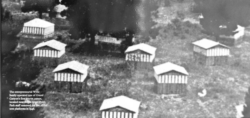
Marker detail: Wylie Camp (marker background image)
201 ► Arizona, Coconino County, North Rim — From Canvas to Castles — Wylie Way Camp, 1917-1927 — Grand Canyon National Park —  |
| Near Grand Canyon Highway (Arizona Route 67) 43 miles south of U.S. 89A, on the left when traveling south. | |||
| 202 ► Arizona, Coconino County, North Rim — Grand Canyon Lodge — Grand Canyon National Park — |
| Near Grand Canyon Highway (Arizona Route 67) 43 miles south of U.S. 89A. | |||
| 203 ► Arizona, Coconino County, North Rim — Grand Canyon Lodge, 1928-1932 — Grand Canyon National Park — |
| Near Grand Canyon Highway (Arizona Route 67) 43 miles south of U.S. 89A, on the left when traveling south. | |||
| 204 ► Arizona, Coconino County, North Rim — Grand Canyon Lodge, A Legacy Rebuilt — Grand Canyon National Park — |
| Near Grand Canyon Highway (Arizona Route 67) 43 miles south of U.S. 89A, on the left when traveling south. | |||
| 205 ► Arizona, Coconino County, North Rim — North Kaibab Trail — |
| On CC Hill Road (Arizona Route 67), on the right when traveling north. | |||
| 206 ► Arizona, Coconino County, North Rim — Promoting Tourism on the North Rim — |
| On Cape Royal Road, on the right when traveling east. | |||
| 207 ► Arizona, Coconino County, North Rim — Summer Home — Grand Canyon National Park — |
| Near Grand Canyon Highway (Arizona Route 67) 43 miles south of U.S. 89A. | |||
| 208 ► Arizona, Coconino County, Page — Rainbow Bridge National Monument — |
| On North Lake Powell Boulevard at Vista Avenue, on the right when traveling east on North Lake Powell Boulevard. | |||
| 209 ► Arizona, Coconino County, Tusayan — The Tusayan Lookout Tree — Early Fire Detection on the Kaibab National Forest — |
| Near Fire Road 2607 0.2 miles west of Long Jim Loop Road. | |||
| 210 ► Arizona, Coconino County, Williams — Welcome to Williams — Gateway to the Grand Canyon — |
| Near West Railroad Avenue west of North Grand Canyon Boulevard. | |||
| 211 ► Arizona, Maricopa County, Chandler, Downtown — Historic A. J. Chandler Park / The Chandler District Honor Roll — |
| On West Boston Street (Arizona Route 87) at South San Marcos Place, on the right when traveling west on West Boston Street. | |||
| 212 ► Arizona, Maricopa County, Glendale — Murphy Park — Established 1909 — |
| On North 58th Avenue at West Glenn Drive, on the right when traveling south on North 58th Avenue. | |||
| 213 ► Arizona, Maricopa County, Glendale — William J. Murphy — Founder of Glendale — |
| On North 58th Avenue at West Glendale Avenue, on the right when traveling south on North 58th Avenue. | |||
| 214 ► Arizona, Maricopa County, Phoenix, Eastlake Park — Eastlake Park — |
| On East Jefferson 0 miles east of 15th Street, on the right when traveling east. | |||
| 215 ► Arizona, Maricopa County, Queen Creek — 1912 Parker Carousel — |
| Near South Rittenhouse Road, on the right when traveling west. | |||
| 216 ► Arizona, Maricopa County, Scottsdale, The Promenade — Frank Lloyd Wright and Arizona — |
| Near North Scottsdale Road. | |||
| 217 ► Arizona, Mohave County, Fredonia — A New National Monument — Pipe Spring National Monument — |
| Near North Pipe Spring Road 0.3 miles north of Route 389, on the left when traveling north. | |||
| 218 ► Arizona, Mohave County, Fredonia — Stephen Tyng Mather — July 4, 1867 — Jan. 22, 1930 — |
| Near North Pipe Spring Road 0.3 miles north of Route 389, on the left when traveling north. | |||
| 219 ► Arizona, Mohave County, Kaibab — 5 — Pipe Springs National Monument — |
| Near North Pipe Springs Road. | |||
| 220 ► Arizona, Mohave County, Kingman — Charles Metcalfe Park — |
| Near Grandview Avenue near West Beale Street (Business Interstate 40). | |||
| 221 ► Arizona, Mohave County, Kingman — Depot Plaza — |
| On East Andy Devine Avenue. | |||
| 222 ► Arizona, Mohave County, Kingman — Locomotive Park — Engine 3759 / Caboose No. 999520 — |
| On West Andy Devine Avenue (Old U.S. 66) at North 1st Street, on the right when traveling west on West Andy Devine Avenue. | |||
| 223 ► Arizona, Mohave County, Kingman — Locomotive Park — |
| On West Andy Devine Avenue at N 1st Street, on the right when traveling west on West Andy Devine Avenue. | |||
| 224 ► Arizona, Mohave County, Willow Beach — Explore Lake Mead — National Recreation Area — Lake Mead National Recreation Area |
| On U.S. 93 3 miles north of Willow Beach Road, on the right when traveling south. Reported damaged. | |||
| 225 ► Arizona, Navajo County, Holbrook — Giant Logs — |
| Near Petrified Forest Road 2.3 miles east of U.S. 180. | |||
| 226 ► Arizona, Navajo County, Holbrook — Pioneers of Paleontology — |
| Near Petrified Forest Road, on the left when traveling north. | |||
| 227 ► Arizona, Navajo County, Holbrook — Stephen Tyng Mather — July. 4, 1867 - Jan.22, 1930 — |
| On Petrified Forest Road, on the left when traveling north. | |||
| 228 ► Arizona, Navajo County, Shonto — Welcome to the Historic Contact Station — Navajo National Monument — National Park Service, U.S. Department of the Interior — |
| Near County Highway 221 at Tsegi Canyon Road when traveling east. | |||
| 229 ► Arizona, Navajo County, Winslow — Central Plaza — Homol'ovi II Archaeological Site — |
| Near Homolovi State Park Entrance Road 5.4 miles north of Route 87. | |||
| 230 ► Arizona, Navajo County, Winslow — East Plaza — Homol'ovi II Archaeological Site — |
| Near Homolovi State Park Entrance Road 5.4 miles north of Route 87. | |||
| 231 ► Arizona, Navajo County, Winslow — Homol'ovi II — Homol'ovi II Archaeological Site — |
| Near Homolovi State Park Entrance Road 5.4 miles north of Route 87. | |||
| 232 ► Arizona, Navajo County, Winslow — Illegal Digging — Homol'ovi II Archaeological Site — |
| Near Homolovi State Park Entrance Road 5.4 miles north of Route 87. | |||
| 233 ► Arizona, Navajo County, Winslow — Kiva - Underground House — Homol'ovi II Archaeological Site — |
| Near Homolovi State Park Entrance Road 5.4 miles north of Route 87. | |||
| 234 ► Arizona, Navajo County, Winslow — Nuvatukya'ovi — Homol'ovi II Archaeological Site — |
| Near Homolovi State Park Entrance Road 5.4 miles north of Route 87. | |||
| 235 ► Arizona, Navajo County, Winslow — Paayu — Homol'ovi II Archaeological Site — |
| Near Homolovi State Park Entrance Road 5.4 miles north of Route 87. | |||
| 236 ► Arizona, Navajo County, Winslow — Standin’ on the Corner Park, Winslow, Arizona — Route 66 Roadside Attraction — |
| On North Kinsley Avenue at West 2nd Street (Business Interstate 40), on the right when traveling south on North Kinsley Avenue. | |||
| 237 ► Arizona, Navajo County, Winslow — Toth Whispering Giant — |
| On West 1st Street, on the left when traveling west. | |||
| 238 ► Arizona, Navajo County, Winslow — Typical Room — Homol'ovi II Archaeological Site — |
| Near Homolovi State Park Entrance Road 5.4 miles north of Route 87. | |||
| 239 ► Arizona, Navajo County, Winslow — Vandalized Kiva — Homol'ovi II Archaeological Site — |
| Near Homolovi State Park Entrance Road 5.5 miles north of Route 87. | |||
| 240 ► Arizona, Pima County, Summerhaven, Mount Lemmon — Two "M"s in Lemmon? — |
| Near East Ski Run Road near East Cap Rock Trail, on the left when traveling west. | |||
| 241 ► Arizona, Pima County, Tucson — Civilian Conservation Corps (The CCC) — Saguaro National Park — |
| On Signal Hill Trail north of Signal Hill Road, on the right when traveling north. | |||
| 242 ► Arizona, Pima County, Tucson — Historic Period — |
| On Signal Hill Road north of Golden Gate Road. | |||
| 243 ► Arizona, Pima County, Tucson — Prehistoric People — Saguaro National Park — National Park Service, U.S. Department of the Interior — |
| On Signal Hill Road at Golden Gate Road on Signal Hill Road. | |||
| 244 ► Arizona, Pinal County, Casa Grande — Welcome to the Casa Grande Neon Sign Park — |
| On North Sacaton Street at West Florence Boulevard on North Sacaton Street. | |||
| 245 ► Arizona, Pinal County, Coolidge — Stephen Tyng Mather — July 4, 1867 — Jan. 22, 1930 — |
| Near West Ruins Drive. | |||
| 246 ► Arizona, Pinal County, Superior — What is the Story Behind the Picketpost House? — ... a wealthy man built a house and planted a vision — |
| Near U.S. 60 at milepost 223 at Boyce Thompson Road, on the right when traveling east. | |||
| 247 ► Arizona, Santa Cruz County, Green Valley — Growing From The Ashes — Fire Ecology in the Upper Canyon — |
| On Madera Canyon Road 2 miles south of Proctor Road, on the right when traveling north. | |||
| 248 ► Arizona, Santa Cruz County, Patagonia — It's a rare couple who open their backyard to strangers in search of rare birds. — |
| On Pennsylvania Avenue near Gray Hawk Trail, on the left when traveling west. | |||
| 249 ► Arizona, Santa Cruz County, Tumacacori-Carmen, Tumacacori — Mission San José de Tumacácori / Misión San José de Tumacácori — Tumacácori National Historical Park — National Park Service, U.S. Department of the Interior — |
| On Interstate 19 Frontage Road near Santa Gertrudis Lane, on the right when traveling north. | |||
| 250 ► Arizona, Yavapai County, Camp Verde — A Piece of Modern Monument History — |
| On Montezuma Castle Road 1 mile east of Beaver Creek Estates Road. | |||
| 251 ► Arizona, Yavapai County, Cottonwood — The Hickey Ditch Diverts Water — Agricultural "Ditches" Have Been Used for Years — |
| On Dead Horse Ranch Road. | |||
| 252 ► Arizona, Yavapai County, Cottonwood — The Hickey Ditch Diverts Water — Agricultural "Ditches" Have Been Used for Years — |
| On Dead Horse Ranch Road. | |||
| 253 ► Arizona, Yavapai County, Jerome — Laura Williams Memorial Park — |
| On Main Street (Arizona Route 89A), on the right when traveling east. | |||
| 254 ► Arizona, Yavapai County, Lake Montezuma — Historic Bell Trail — |
| Near Nf618A east of Forest Road 618. | |||
| 255 ► Arizona, Yavapai County, Peach Springs — Grand Canyon Caverns, Peach Springs, Arizona — Route 66 Roadside Attraction — |
| On Grand Canyon Caverns Road, on the right when traveling west. | |||
| 256 ► Arizona, Yavapai County, Prescott — City Park and Ballfield — |
| On Gurley Street (Arizona Route 89) at Washington Street., on the right on Gurley Street. | |||
| 257 ► Arizona, Yavapai County, Prescott — Pioneer Trail and Monument — |
| On South McCormick Street, on the right when traveling west. | |||
| 258 ► Arizona, Yavapai County, Sedona — A Canyon Retreat: Mayhew Lodge — |
| Near Shady Lane near Route 89A. | |||
| 259 ► Arizona, Yuma County, Yuma — Drinking Water Life in the Desert — |
| Near Prison Hill Road at South Levee Road. | |||
| 260 ► Arizona, Yuma County, Yuma — New Yard — |
| Near Prison Hill Road at South Levee Road. | |||
| 261 ► Arizona, Yuma County, Yuma — Prison Labor — Yuma Territorial Prison State Historic Park — |
| Near Prison Hill Road 0.5 miles north of Harold C. Giss Parkway. | |||
| 262 ► Arizona, Yuma County, Yuma — The Prison Bell — |
| Near Prison Hill Road at South Levee Road. | |||
| 263 ► Arizona, Yuma County, Yuma — Yuma East Wetlands Today — A Return to Balance — |
| Near Prison Hill Road 0.5 miles north of Harold C. Giss Parkway. | |||
| 264 ► Arkansas, Arkansas County, Arkansas Post — Stone from Ruins of Old Bank — |
| Near Old Post Road 0.7 miles south of State Route 169. | |||
| 265 ► Arkansas, Benton County, Bentonville, Downtown Bentonville — Bentonville's Early History — |
| On North Main Street at East Central Avenue (State Highway 72), on the right when traveling north on North Main Street. | |||
| 266 ► Arkansas, Benton County, Siloam Springs — Twin Springs Park — Est. 1880 — |
| Near East Main Street west of South Maxwell Street. | |||
| 267 ► Arkansas, Benton County, Sulphur Springs — Sulphur Springs Park Reserve — |
| On Fair Avenue east of Arkansas Highway 59, on the right when traveling east. | |||
| 268 ► Arkansas, Carroll County, Eureka Springs — Avarana — |
| On Prospect Avenue at Linwood Avenue, on the left when traveling east on Prospect Avenue. | |||
| 269 ► Arkansas, Carroll County, Eureka Springs — Magnetic Spring — |
| On Magnetic Drive 0.2 miles east of North Main Street (Arkansas Route 23), on the left when traveling east. | |||
| 270 ► Arkansas, Carroll County, Eureka Springs — The Basin Park Sycamore — |
| On Spring Street north of Main Street (Arkansas Highway 23), on the left when traveling north. | |||
| 271 ► Arkansas, Carroll County, Eureka Springs — The Crescent Hotel & Spa — |
| On Prospect Avenue 0.1 miles north of Crescent Drive, on the right when traveling north. | |||
| 272 ► Arkansas, Carroll County, Eureka Springs — The Springs — |
| On Spring Street, on the left when traveling north. | |||
| 273 ► Arkansas, Clark County, Arkadelphia — 42 — W.D. and Ida Feaster — The Names Behind Feaster Park — |
| On North 23rd Street 0.2 miles north of Pine Street (Arkansas Highway 8), on the right when traveling north. | |||
| 274 ► Arkansas, Conway County, Morrilton — A Vision for the Future — |
| Near Petit Jean Mountain Road. | |||
| 275 ► Arkansas, Conway County, Russellville — Stout's Point: 1920s & 1930s — |
| On Stouts Point, on the right when traveling east. | |||
| 276 ► Arkansas, Conway County, Russellville — Stout's Point: Your Legacy — |
| On Stouts Point. | |||
| 277 ► Arkansas, Conway County, Winrock — Arkansas's First State Park — |
| Near Petit Jean Mountain Road (Arkansas Route 154). | |||
| 278 ► Arkansas, Conway County, Winrock — Cement Sculptures by Dionicio Rodriguez — |
| On Petit Jean Mountain Road, on the left when traveling west. | |||
| 279 ► Arkansas, Conway County, Winrock — Civilian Conservation Corps and the Building of Arkansas's First State Park — |
| On Petit Jean Mountain Road, on the left when traveling west. | |||
| 280 ► Arkansas, Conway County, Winrock — Davies Bridge: Symbol of a Legacy — |
| Near Red Bluff Drive. | |||
| 281 ► Arkansas, Conway County, Winrock — Geology of Cedar Creek Falls Overlook — |
| Near Petit Jean Mountain Road. | |||
| 282 ► Arkansas, Conway County, Winrock — Special Places to See — |
| Near Petit Jean Mountain Road. | |||
| 283 ► Arkansas, Conway County, Winrock — The CCC at Petit Jean State Park — |
| Near Petit Jean Mountain Road. | |||
| 284 ► Arkansas, Conway County, Winrock — The Ever-Changing Landscape — |
| On Petit Jean Mountain Road, on the right when traveling west. | |||
| 285 ► Arkansas, Cross County, Parkin — Northeast Arkansas Discovery Tour — |
| On State Highway 184 at U.S. 64 on State Highway 184. | |||
| 286 ► Arkansas, Faulkner County, Conway — Simon Park — |
| On Front Street just north of Main Street, on the left when traveling north. | |||
| 287 ► Arkansas, Fulton County, Mammoth Spring — Dam Site #1 and Mammoth Spring Milling Company — |
| Near U.S. 63 at Main Street (State Route 9), on the right when traveling north. | |||
| 288 ► Arkansas, Fulton County, Mammoth Spring — Mammoth Spring — National Natural Landmark — |
| Near U.S. 63 at Main Street (State Route 9), on the right when traveling north. | |||
| 289 ► Arkansas, Fulton County, Mammoth Spring — Old Soldier's Reunion — |
| Near U.S. 63 at Main Street (State Route 9), on the right when traveling north. | |||
| 290 ► Arkansas, Fulton County, Mammoth Spring — The Big Gun — |
| Near U.S. 63 at Main Street (State Route 9), on the right when traveling north. | |||
| 291 ► Arkansas, Fulton County, Mammoth Spring — The Development of Mammoth Spring — |
| Near U.S. 63 at Main Street (State Route 9), on the right when traveling north. | |||
| 292 ► Arkansas, Fulton County, Mammoth Spring — What Am I Standing On? — |
| Near U.S. 63 at Main Street (State Route 9), on the right when traveling north. | |||
| 293 ► Arkansas, Garland County, Hot Springs — “We Bathe the World” — Hot Springs Central Avenue Historic District — |
| On Central Avenue (State Highway 7) just north of Market Street, on the right when traveling north. | |||
| 294 ► Arkansas, Garland County, Hot Springs — Bathhouse Row — Hot Springs National Park — |
| On Reserve Street near Central Avenue. | |||
| 295 ► Arkansas, Garland County, Hot Springs — Buckstaff Bathhouse — Hot Springs National Park — |
| On Central Avenue. | |||
| 296 ► Arkansas, Garland County, Hot Springs — Dead Chief Trail — |
| On Grand Promenade Trail 0.2 miles south of Fountain Street, on the left when traveling south. | |||
| 297 ► Arkansas, Garland County, Hot Springs — Fordyce Bathhouse — Hot Springs National Park — National Park Service, U.S. Department of the Interior — |
| On Central Avenue. | |||
| 298 ► Arkansas, Garland County, Hot Springs — Happy Hollow — Hot Springs Historic Baseball Trail — |
| On Fountain Street 1.1 miles north of Central Avenue (State Highway 7), on the left when traveling east. | |||
| 299 ► Arkansas, Garland County, Hot Springs — Happy Hollow Spring — |
| On Fountain Street 1.2 miles north of Central Avenue (State Highway 7), on the left when traveling west. | |||
| 300 ► Arkansas, Garland County, Hot Springs — Hot Springs' Postwar Boom — Hot Springs Central Avenue Historic District — |
| Near Central Avenue, on the right when traveling south. | |||
13641 entries matched your criteria. Entries 201 through 300 are listed above. ⊲ Previous 100 — Next 100 ⊳