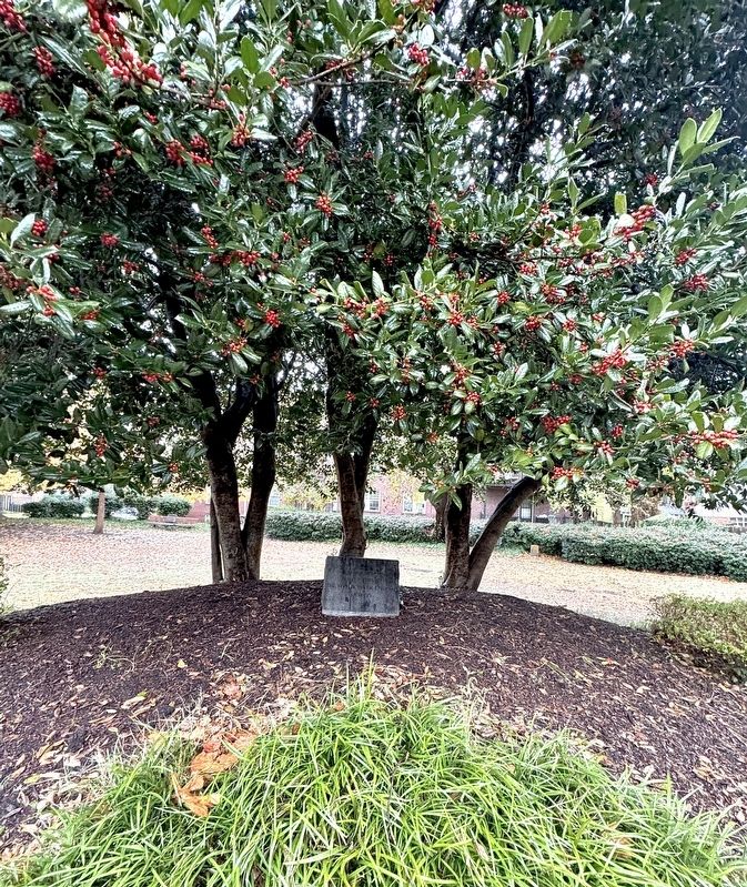
In Memory of the 17 Doctors who died while caring for victims of the 1850 Cholera Epidemic in Sacramento
Dr. W. Carpenter (Age 26), Dr. Horatio Cobb (Age 30), Dr. R.S. Girard (Age 35), Dr. Pliney P. Green (Age 41), Dr. R.L. Grisard (Age . . . — — Map (db m12485) HM
On King Street East 0.1 kilometers west of Jarvis Street, on the right when traveling west.
On June 21, 1832, the first cases of cholera, a highly contagious and deadly disease, appeared in the Town of York. Much feared, cholera first appeared in India in the 1770s, spreading along trade routes to Asia and Europe, and arriving in London, . . . — — Map (db m217097) HM
On Cornetti Road at Sasse Road, on the right when traveling north on Cornetti Road.
Here are buried an unknown number of local victims of the worldwide influenza epidemic of 1918-1919—one of history’s worst epidemics in terms of deaths. In Butler County, the worst period was early October to early November 1918, with some 260 . . . — — Map (db m250531) HM
Oakwood Cemetery is home to many grave markers from the year 1867 when yellow fever, one of the most dreaded diseases of the time, struck the county. The disease ravaged many cities across the United States. Texas remained relatively untouched until . . . — — Map (db m129622) HM
On E. Oglethorpe Ave, on the right when traveling east.
In this cemetery many victims of the Great Yellow Fever Epidemic
of 1820 were buried.
Nearly 700 Savannahians died that year, including two local physicians who lost their lives caring for the stricken.
Several epidemics followed. In . . . — — Map (db m5330) HM
On East Colorado Street east of North College Street, on the right when traveling east.
From the time of the first European settlers in Texas, yellow fever was a serious concern. Transmitted through mosquitoes, epidemics in the summer months were prevalent in coastal cities all over North America in the nineteenth century. At the time, . . . — — Map (db m109026) HM
Near Arch Street at North 4th Street, on the left when traveling west.
Approximately 5,000 Philadelphians — 10% of the city's population — died from yellow fever between August and November 1793. Burial records for Arch Street would list the "American Plague," another name for yellow fever, as the cause of death. . . . — — Map (db m210927) HM
On Matagorda Cemetery Road 0.1 miles north of South Gulf Road, on the left when traveling south.
One of the most important port cities of Texas’ early history, Matagorda served as an exit point for goods such as cotton shipped down the Colorado River. During the Civil War, it was also an important point for Confederate blockade runners to . . . — — Map (db m158607) HM
Near Huebner Road, on the left when traveling west.
In this area rest the remains of approximately 100 soldiers, civilian workers, and their dependents who perished at Fort Riley, Kansas Territory, during the cholera epidemic in the summer of 1855. These soldiers and civilian workers were engaged in . . . — — Map (db m74308) HM
On Albert Embankment, on the left when traveling south.
This plaque remembers the thousands of Lambeth residents who died in the cholera epidemics of the nineteenth century.
You are standing close to what was the busy junction of Broad Street, Upper and Lower Fore Street before the building of . . . — — Map (db m241239) HM
On Victoria Street North 0.1 kilometers north of River Street (County Route 38), on the right when traveling south.
The viral disease of smallpox - widespread in 19th century Ontario - flared up in a severe epidemic in Hungerford Township in 1884. The outbreak claimed at least 45 lives in 202 reported cases and disrupted economic activity and family life for many . . . — — Map (db m74023) HM
On Monroe Street west of Main Street, on the right when traveling west.
In memory of the
scores of Catholic
victims of the
1918 Flu Epidemic
who lie here in
unmarked graves.
Pray for Them
Presented by Dan Cosgrove — — Map (db m299374) HM
On Maryland Route 5. Reported permanently removed.
Near this location during the Civil War was the smallpox hospital where thousands of people were quarantined.
Highly contagious, horrible to behold and often fatal, smallpox was a dreaded disease. When the scourge hit the prison camp, officials . . . — — Map (db m60285) HM
On Stuart Street, on the right when traveling east.
In 1847 and 1848 this site became the largest of the city's mass graves for more than 1,400 Irish immigrants who died in fever sheds adjacent to Kingston General Hospital and Emily St.,
after fleeing "The Great Hunger" in Ireland.
This plaque . . . — — Map (db m243745) HM
An estimated 1.2 billion people in the world today live on less than $1 per day.
Nearly 3 billion people--close to half of the world's population--live on less than $2 per day.
Home, for many families, looks something like the structures you . . . — — Map (db m73162) HM
Near Market Street (County Road 2004) just east of South 6th Street (County Road 2005), on the right when traveling east. Reported permanently removed.
In the 1790s, slave owners escaping the slave rebellion in Saint Domingue (now Haiti) came to Philadelphia, bringing enslaved Africans, yellow fever, and the suspicion that slavery might yield "dreadful insurrections." — — Map (db m146655) HM
Near Effingham Street at Crawford Parkway, on the right when traveling north.
In June 1855, the steamer Franklin put into Norfolk for repairs while sailing from the West Indies to New York. Mosquitoes carrying yellow fever escaped when the vessel docked. The Naval Hospital’s first yellow fever patients came from . . . — — Map (db m83935) HM
Near South Dudley Street 0.5 miles south of E.H. Crump Boulevard (U.S. 78), on the left.
Elmwood Cemetery was established on August 28, 1852. Buried here are Memphis pioneer families: 14 Confederate generals; victims of the Yellow Fever epidemic of 1878; Governors Isham G. Harris and James C. Jones; U.S. Senators Kenneth D. McKellar, . . . — — Map (db m21334) HM
Resting place of California Pioneers. The cemetery was established in 1850. Many of the victims of the Cholera Epidemic of that year are buried here. Included among the graves of illustrious Californians are those of Governors John Bigler, Newton . . . — — Map (db m11349) HM
Near Vietnsm Veterans Memorial Highway (Interstate 84), on the right when traveling west.
(The Oregon Trail kiosk houses thirteen panels which deal with Native Americans, the Fur Trade, the Oregon Question, Oregon Fever, and trials of the Oregon Trail.)
Pathway to the "Garden of the World"
Excitement filled the . . . — — Map (db m107234) HM
On Interstate 84 at milepost 71, on the right when traveling west.
(Twelve panels dealing with Oregon Trail related topics are found at this kiosk)
Pathway to the "Garden of the World"
Excitement filled the air May 22, 1843 as nearly one thousand Americans left Missouri toward new . . . — — Map (db m112193) HM
On Camp Weed Place 0.1 miles west of 75th Drive, on the right when traveling west.
It’s September 12, 1539…
Hernando de Soto’s army has stopped at a small abandoned village not far away –
We have been forced to remain in this village for three days now. Torrential rains have halted our progress. We will remember . . . — — Map (db m126585) HM
Near Seventh Avenue at Greenwich Avenue, on the right when traveling north.
( six markers set into the pavement at the NYC AIDS Memorial Park at St. Vincent’s Triangle )
Sisters of Charity of New York - Founded 1817
The Sisters of Charity founded the hospital to care for the poor and disadvantaged. . . . — — Map (db m145803) HM
On Market Street at South Independence Mall West (6th Street), on the left when traveling west on Market Street. Reported permanently removed.
In November of 1793, Washington, his staff and cabinet, along with many other Philadelphia upper and middle class residents, found temporary housing in Germantown nine miles away until the deadly yellow fever epidemic ended. In town, . . . — — Map (db m102306) HM
On Pulaski Street west of Deep Creek Road, on the right when traveling west.
African Americans purchased land about a quarter mile southwest of here in 1879 to establish Mt. Olive Cemetery. The property adjoins a potter’s field thought to be a burial place for victims of the yellow fever epidemic of 1855. Later, Mt. Calvary . . . — — Map (db m118352) HM
Near Margin Street 0.1 miles east of South McLemore Avenue, on the right when traveling east.
Victims of the 1878 yellow fever epidemic are buried in this cemetery. Of the 844 reported cases, it is known that there were more than 200 deaths. Elsewhere in this cemetery is a marker to Sergeant Mike McGrath, a member of the Howard Society and a . . . — — Map (db m194149) HM
Near Olympia Avenue east of Virginia Street, on the right when traveling east.
When mill houses were first built in 1900, there was no indoor plumbing. Every residence had an "outhouse" like this one, which is one of the originals in this area. The Spanish Influenze struck Columbia in 1918, the mill villages were hit hard. . . . — — Map (db m292436) HM
The unmarked last resting place of over three thousand pioneers, their exact place of burial, somewhere between the north border of Broadway and the north portion of the cemetery, and between 9th and 11th Streets, known but to their God.
Buried . . . — — Map (db m34290) HM
Near North 15th Street north of Campbell Street when traveling north.
Communal burial site of approximately 400 people who died of yellow fever during Wilmington's epidemic between September and the frosts of November 1862. Few yellow fever victims' burials are marked with headstones.
In 1862 Wilmington's . . . — — Map (db m275069) HM
On Wendover Avenue East (U.S. 70) at Elwell Avenue, on the right when traveling east on Wendover Avenue East.
During 1948 epidemic, integrated hospital built in 95 days. In 1963, it was makeshift jail for civil rights protesters. Operated ⅒ mi. S. — — Map (db m219787) HM
On North Cumberland Street just south of East Deaderick Street, on the right when traveling north.
W. K. Walsh built The Cumberland House as a wedding gift to his daughter, Dinetia, and her husband, Dr. Frank Hamilton. Dr. Hamilton, wounded in the Civil War at the Battle of Franklin, returned to Jackson and was appointed to head the local Board . . . — — Map (db m296601) HM
On South Dudley Street 0.1 miles south of Sledge Avenue, on the right when traveling north.
In four public lots known collectively as "No Man's Land" lie the remains of at least 1400 victims of the Great Yellow Fever Epidemics of 1873, 1878, and 1879. Memphis lost over 8500 citizens to the disease and 2500 of these rest at Elmwood. . . . — — Map (db m149020)
On Yancey Road (County Highway 1301) 1 mile north of County Highway 1520, on the right when traveling south.
Original 1.86 acre site given by James E. and Amanda R. Bandy. First burial was in 1875. Community acquired adjoining 3.6 acres in 1880 for a log church and a day, writing, and music school; added 6.2 acres in 1881 for a frame parsonage and church . . . — — Map (db m162646) HM
Founder and Planner of City of Sacramento
1848
Died in Port of Acapulco, Mexico
American Consul for 24 Years
Juan A. Sutter
De origin Suizo y consul americano.
durante 24 años en este Puerto.
Falleció a la edad de 72 anos.
Su . . . — — Map (db m12388) HM
On U.S. 2 at milepost 573 at McConnell Road, on the left when traveling east on U.S. 2.
In the summer of 1837 an American Fur Trading Company steamboat laden with trade goods made its way from St. Louis to Fort Union. Smallpox broke out among the crew, but the boat continued to its destination. Contact with the steamboat’s crew during . . . — — Map (db m142945) HM
On Market Street at South Independence Mall West (6th Street), on the left when traveling west on Market Street. Reported permanently removed.
Clergymen Richard Allen and Absalom Jones organized their congregations and other free Africans who attended the sick and buried the dead during the raging yellow fever epidemic of 1793. Although misguided, the respected Dr. Benjamin Rush had . . . — — Map (db m102308) HM
On Bruyère Street east of Sussex Drive (Route 93), on the right when traveling west.
English:
In the 1840s, Bytown (Ottawa) was a growing timber-trade village with a substantial French-Canadian population but no Catholic schools and few social services. In February of 1845 the Sisters of Charity of Montreal (Grey . . . — — Map (db m141392) HM
Elected April 1, 1850
First Mayor of Sacramento under the Charter form of Government.
A Native of Michigan.
Died on November 27, 1850, in San Francisco of Cholera, following wounds received in the Squatter Riot at Sacramento in August 1850.
Aged . . . — — Map (db m12400) HM
On Garrison Avenue 0.2 miles north of Madison Avenue (County Route 384), on the right when traveling south.
This site is one of three cemeteries of Saint Joseph. Many persons interred here were victims of yellow fever which plagued the city throughout July and August, 1841, causing its depopulation and abandonment. The dread disease, sparing neither rich . . . — — Map (db m167037) HM
On State Highway 27 at Road 54, on the right when traveling south on State Highway 27.
It has been estimated that at least 20,000 persons died on the overland trail, between 1842 and 1859. This averages ten graves per mile over the 2,000 mile trail. Of the hundreds who died while crossing Nebraska, only seven identifiable graves . . . — — Map (db m231177) HM
Killed more Americans than all the
combat war deaths in the 20th century
Dedicated to the more than 1700 people
who died in Vermont many in the prime of life
In loving memory of Germinio Zecchinelli
Born January 26, 1883-Died October . . . — — Map (db m281172) HM
Near Taylor Street at 4th Street when traveling north.
In memory of the Confederate Soldiers who died of smallpox in the hospitals of Lynchburg during the War between the States. C. S. A. — — Map (db m156559) WM
[Main marker]:
In Memory of
81st Wildcat Division
which trained at Camp Sevier,
Apr to July 1918
Maj. Gen. Chas. J. Bailey,
commanding.
[Plaque at foot of marker]:
Camp Sevier
Camp Sevier, a WWI National . . . — — Map (db m8151) HM
On East State Avenue (West Virginia Route 7) just west of East High Street, on the right when traveling east.
Triggered by the assassination of Archduke Franz Ferdinand, the heir to the throne of the Austro-Hungarian Empire, World War I began in August 1914 when Germany invaded Belgium and France. On the Eastern front, Russia agreed to stop fighting late . . . — — Map (db m248601) HM
Near Zerex Street (U.S. 40) at Clayton Avenue, on the right when traveling north.
She looks tired, worn out after being up most of the night, tending to a sick patient. She's walking home in deep snow on a very cold windy night with her medical bag and railroad lantern. In her younger years she joked about carrying a six gun, . . . — — Map (db m288395) HM
During the 1913-1914 holiday season, 28 cases of typhoid fever were reported in Rockville and three people died.
The new U.S. Public Health Service investigated, and identified the town's water system as the problem. Contaminated ground water . . . — — Map (db m108254) HM
On 37th Avenue Southwest near 12th Street Southwest (State Highway 200), on the right when traveling north.
You are approaching the site of a former Mandan Indian village called Mih-tutta-hang-kush. This name means "east village" or "first village." Mih-tutta-hanf-kush was established in 1822 and was occupied by the Mandans until 1837 when the smallpox . . . — — Map (db m162276) HM
On 8th Street at Prospect Drive, on the right when traveling north on 8th Street.
"The opportunies which were at hand in the development of the river and the region were being seized upon by our people with renewed courage and confidence.
We now know that we couldn't be licked again, that what had been preached to us by TVA was . . . — — Map (db m86505) HM
On Germantown Road (County Route 7) south of County Road 1200 N, on the right when traveling south.
In 1832 cholera plagued this area
Entire families were wiped out,
Sometimes over night
Jos Altepeter made a covenant
with his maker, if his large family
was spared he would erect
A large cross on his farm
near the public road as a . . . — — Map (db m162241) HM
On Tremont Street south of Winter Street, on the left when traveling south.
The Cathedral of St. Paul was established as St. Paul's Church in 1818. St. Paul's was the first example of Greek Revival architecture in Boston.
In 1846, Alexander Crummel was ordained a deacon here, making him the third African American . . . — — Map (db m215172) HM
Chemist, geologist, and photographer William DeRyee was born as William Düry in Würzburg, Bavaria. He was educated at the gymnasium and lateinschule in Würzburg, then went on to study at the University of Munich. He participated in the 1848 uprising . . . — — Map (db m182940) HM
On Training Field Road 0.2 miles north of Old Comers Road, on the right when traveling north.
(Front)
Here lies buried
Dr. Samuel Lord
who died of smallpox
after devoted service
to the citizens of
Chatham in the
epidemic of
1765 – 1766
(Back)
This monument was erected by
the Town of Chatham in . . . — — Map (db m160407) HM
Near 37th Avenue Southwest near 12th Street Southwest (State Highway 200), on the right when traveling north.
In the summer of 1837, the steamboat St. Peters arrived at the Mandan village and Fort Clark, carrying passengers, supplies, and trade goods. Tragically, some of the people on the St. Peters were also infected with smallpox. In a . . . — — Map (db m162532) HM
On Locust Street east of South 13th Street, on the left when traveling east.
Begun in 1987, the AIDS Library of Philadelphia was the nation's first library to provide HIV/AIDS information and to help combat society's fears about the epidemic. In stark contrast to government's negligible response, LGBT communities nationwide . . . — — Map (db m222720) HM
On North Street at Dinwiddie Street, on the right when traveling east on North Street.
On June 19th, 1855, following a twelve day quarantine, the merchant ship Benjamin Franklin arrived from the West Indies and docked at Gosport Shipyard for repairs. While emptying its bilge, mosquitoes carrying yellow fever were released. After . . . — — Map (db m36892) HM
Near West Broadway Road south of Maricopa Freeway (Interstate 10).
Tempe's first cemetery, named for the Buttes in the background, was established before 1900. It was located on 80 acres of high ground because lower areas were waterlogged. Members of Tempe's best-known families lie here, along with victims of . . . — — Map (db m34556) HM
Near 125th Street North just north of Walsingham Road.
More Than a Farm Home
George Washington and Frances Moore left Kentucky in 1875 to follow his parents to the Pinellas Peninsula. They built this house next to his parents' plot of land -- just east of Stevenson Creek. George, a blacksmith and . . . — — Map (db m237086) HM
On Pontiac Trail 0.2 miles west of Old Wixom Road, on the left when traveling west.
This road is a story with many chapters.
On Pontiac Trail people have traveled on foot, on horseback and on wheels, tracing the story of Wixom and southeast Michigan. It was vital in prehistory as a Native American footpath, and in 1828 it . . . — — Map (db m136792) HM
At the end of this trail is evidence of a once thriving rural community. First settled in the late 1790's, the town grew from a watering place along the Natchez Trace, and took its name from the source of that water -- the Rocky Spring. In 1860, a . . . — — Map (db m80147) HM
On Natchez Trace Parkway (at milepost 18.4), 1.6 miles south of Mississippi Highway 553, on the right when traveling north. Reported missing.
Before your very eyes an endless struggle is taking place. Trees are striving here for the essentials of life – water, sunlight and space. Trying to get ahead, the hardwoods push upward, their crowns filling all the overhead space, shutting . . . — — Map (db m87285)
On Winsor Avenue at Hoffman Street, on the right when traveling east on Winsor Avenue.
This was the site of Elmira Prison Camp, established in 1864 to hold Confederate prisoners of the Civil War. When the war started in 1861, it was Barracks No. 3 of the Upstate Draft Rendezvous where Union soldiers were housed and trained. It was . . . — — Map (db m32303) HM
On North 15th Street 0.1 miles north of Campbell Street, on the left when traveling north.
North Carolina's first “rural cemetery,” incorporated as the Wilmington Cemetery Company by an act of legislature on March 4, 1852. The sixty-five acre site offered high land, picturesque topography, streams and native vegetation. Organizers were . . . — — Map (db m265498) HM
Near County Highway 37 near 6th Street Southwest, on the right when traveling north.
Circles in the Earth
You are at the edge of a large village of earthlodges. When the dwellings collapsed, they left circular mounds of earth around hardened saucer-like floors. From that pattern you can picture the extent of this village . . . — — Map (db m162212) HM
Near County Road 18 near County Road 37, on the left when traveling east.
Fortified Ground
A thriving earthlodge village stood here. Though surface clues appear minimal, there is a pattern to the ground's subtle dips and wrinkles, a way to reconstruct the life and death of the village. Read the terrain like . . . — — Map (db m162274) HM
On Wade Hampton Boulevard (U.S. 29) at Artillery Road, on the left when traveling north on Wade Hampton Boulevard.
This camp, named in honor of John Sevier, Lieut. Col., N.C. militia, 1777, Col., 1781, Brig. Gen., U.S.P.A., 1796, was approved as cantonment site May 21, 1917. The 30th Division trained here from August 28, 1917 to May 1, 1918; the 81st, from May . . . — — Map (db m10475) HM
On Brattonsville Road 0.1 miles north of Percival Road, on the right when traveling south. Reported missing.
The Homestead was built between 1823 and 1826 for Dr. John Simpson Bratton and his wife Harriet Rainey Bratton, the second generation of the Bratton family to live at Brattonsville. Bricks for the chimneys were made on the plantation. The two . . . — — Map (db m272030) HM
On South November 6th Street at Gayoso Avenue, on the right when traveling south on South November 6th Street.
“The Mansion,” one of the many
brothels that lined Gayoso Avenue
when prostitution was legal in the late
1800s, stood here. It was the home of
madam Annie Cook, who died treating
victims of the yellow fever epidemic
after she turned her house . . . — — Map (db m221386) HM
On Wildwood Park Road at Waterloo Road on Wildwood Park Road.
Side 1 Following an outbreak of the dreaded plague, smallpox (Variola), at Florence during the winter of 1865-66, the Board of Alderman adopted a resolution on January 2, 1866, that a Pesthouse be “erected at the vineyard as soon as . . . — — Map (db m84043) HM
Near Vine Street north of Lake Avenue, on the left when traveling north.
The Smith Eslick Bay Window Cottage was built by the Eslick's youngest child, Loren, in 1933 when he was 26 years old. It was intended to be a check-in and store for the guests staying at the Cottage Court and other Smith and Eslick family cabins . . . — — Map (db m129884) HM
On N 4th Street near Alachua Street, on the right when traveling north.
On February 5, 1875, Jean-Pierre Augustin Verot, Bishop of Saint Augustine, purchased this cottage from Sarah Phelan. The Sisters of Saint Joseph lived here in the year 1877, when a devastating epidemic of yellow fever swept over the Amelia Island . . . — — Map (db m59963) HM
Near West 38th Street east of Doctor Martin Luther King Jr. Street, on the right when traveling east.
Always Remember
On Sunday, October 29, 2000, two decades after the AIDS epidemic began, the first permanent AIDS memorial in a cemetery was unveiled on this site. The Indiana AIDS Memorial at Crown Hill was dedicated to the thousands of . . . — — Map (db m238577) HM
On Jeffries Service Drive at Ash Street, on the right when traveling north on Jeffries Service Drive.
This site bears the name of Father Martin Kundig, Wayne County’s first superintendent of the poor. Born in 1805 in Switzerland, Kundig was educated in Rome, and served in the Swiss Papal Guard, before coming to work in the Diocese of Detroit in . . . — — Map (db m172685) HM
Near Cook Road 0.7 miles east of Mack Avenue, on the left when traveling east. Reported permanently removed.
On May 18, 1836, following a cholera epidemic, thirteen civic-minded women met at the Woodward Avenue Presbyterian Church and founded the Ladies’ Orphan Association of Detroit. The women adopted a constitution and began raising money to run a home . . . — — Map (db m156397) HM
On Harrison Street north of Jefferson Street, on the left when traveling north.
Marker Front: Of the city's 5,667 people in 1849, 3,500 fled, and 400 of those remaining were victims of cholera. Most are buried here, some only in rough boxes in a common grave. The scourge came again in 1850 and 1852 but with less toll. . . . — — Map (db m79100) HM
On 7th Avenue North, on the left when traveling south.
In 1878, the yellow fever epidemic in Memphis so decimated the population that the legislature revoked the city charter and directly oversaw the metropolis for 14 years. — — Map (db m215810) HM
This 1840’s white frame building was the medical office of Dr. John Jay Terrell. It was moved here in 1987 from Rock Castle Farm in Campbell County and has been restored to recreate medical science in the era of 1860 to 1900. These exhibits . . . — — Map (db m74038) HM
Near Bench Boulevard at Lake Elmo Drive, on the right when traveling east.
In 1837-38 a smallpox epidemic spread from the American Fur Trading Company steamboat St. Peter which had docked at Fort Union. The terrible disease for which the Indians had no immunity eventually affected all Montana tribes. A story is told among . . . — — Map (db m252983) HM
On E. Main Street at Burney Street, on the right when traveling west on E. Main Street.
War of 1812
John M. Bauder • Samuel Bridge • J. Haley Brown • Edward Littell • John Savage • Justus Sheffield • Fordice Sheldon
Black Hawk War
Joseph Bair
Civil War
Benj. F. Adams • Wm. P. Akerly • Hugh Anderson • . . . — — Map (db m75288) WM
Near Cypress Avenue south of Chapel Square, on the right when traveling south.
Dr. Logan came to California in 1850 in search of gold. When the cholera epidemic broke out in Sacramento in October of that same year, he left the gold fields to lend his services to aid the residents of the city.
Dr. Logan wrote the first . . . — — Map (db m226383) HM
On U.S. 550 0.1 miles west of County Highway 31, on the left when traveling east.
"One feels," wrote an early Silverton settler, "as if he is shut off from the rest of the world." A fair assessment: In 1874, when its first buildings appeared, the hamlet lay 125 miles from the nearest post office. Though railroad service . . . — — Map (db m177495) HM
On North Street close to Tanner Row, on the right when traveling north.
Dr John Snow (1813-1858) was a Victorian physician, a pioneer in the fields of anaesthesia and epidemiology, famed for his tracing of the source of a cholera outbreak in London's Soho and confirming that it is a waterborne disease. John Snow . . . — — Map (db m125207) HM
On Old Shell Road 0.1 miles east of N McGregor Ave, on the right when traveling west.
Spring Hill, originally a Spanish land grant, was once named "The City of Refuge” by Napoleonic exiles. Spring Hill gained prominence when Mobilians built summer homes in Spring Hill to escape yellow fever epidemics. — — Map (db m302915) HM
On Water Street just west of Prince William Street, on the left when traveling south.
English:
Look out to the head of the harbour, and you'll see Partridge Island, a major point of entry for European immigrants during the 19th and 20th centuries, almost 100 years before Ellis Island.
Many of our ancestors . . . — — Map (db m145397) HM
On 1a Avenida Sur at 3a Calle Oriente, on the left when traveling south on 1a Avenida Sur.
Iglesia Parroquial San Juan Bautista Municipio: Nahuizalco Fecha de construcción: antes de 1800. Datos históricos: Para 1,660 ya existía esta edificación. En el año 1770, era cabecera de parroquia y comprendía los pueblos de Santa . . . — — Map (db m137154) HM
Often times soldiers who died while fighting were buried where they fell. Most who died at or near the post were buried at the fort's military cemetery, approximately one mile northwest of here. Nearly 25 of the 175 buried here were civilians. . . . — — Map (db m59724) HM
On Grand Gulf Road 1.1 miles north of Frazier Road, on the left when traveling north.
The town of Grand Gulf began in the 18th century as a small British settlement. By 1828 it had grown to a village of three stores, one tavern, and several houses. There was a stage line to Port Gibson and steamboats stopped at its wharves. . . . — — Map (db m105720) HM
1030 entries matched your criteria. The first 100 are listed above. Next 100 ⊳
Thin black lines indicate changes in relevance. Between each pair of lines entries are ordered geographically but all have the same relevance.
* Inflectional forms of words are their plurals, singulars, and possessives as well as gramatical tenses and similar variations.