2778 entries match your criteria. The first 100 are listed. ⊳
Historical Markers and War Memorials
in Greater Nashville Region
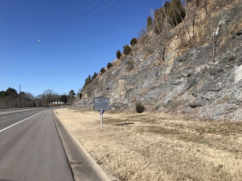
By Duane and Tracy Marsteller, January 23, 2021
Braxton Lee Homestead Marker
1 ► Tennessee, Cheatham County, Ashland City — 3C 84 — Braxton Lee Homestead —  |
| On South Main Street (State Highway 12) 0.2 miles north of Veterans Drive, on the right when traveling north. | |||
| 2 ► Tennessee, Cheatham County, Ashland City — 3C 60 — Cheatham County Courthouse — |
| On South Main Street (Tennessee Route 12) at Sycamore Street, on the left when traveling south on South Main Street. | |||
| 3 ► Tennessee, Cheatham County, Ashland City — Clifton Forebears are Buried in Old Church Cemetery to Southeast — |
| On Tennessee 12 0.1 miles south of Ranch Road, on the left when traveling south. | |||
| 4 ► Tennessee, Cheatham County, Ashland City — Clifton Methodist Church — |
| On Tennessee 12 0.1 miles south of Ranch Road, on the left when traveling south. | |||
| 5 ► Tennessee, Cheatham County, Ashland City — J.W. Johns, Jr. Park — |
| On North Vine Street north of Mulberry Street, on the left when traveling north. | |||
| 6 ► Tennessee, Cheatham County, Ashland City — Neptune — |
| On Tennessee Route 12 at Neptune Road, on the left when traveling north on Tennessee Route 12. | |||
| 7 ► Tennessee, Cheatham County, Ashland City — 3C 76 — Old Neptune School — 1885-1951 — |
| On New Hope Church Road 0.1 miles west of Powers Drive, on the left when traveling west. | |||
| 8 ► Tennessee, Cheatham County, Ashland City — 3C 85 — Pat Head Summitt — June 14, 1952 — June 28, 2016 — |
| On Tennessee 12 at Hazel Drive, on the right when traveling south on Tennessee 12. | |||
| 9 ► Tennessee, Cheatham County, Ashland City — 3B5 3C2 — Sycamore Mill — |
| On Tennessee Route 49 0.1 miles south of Girl Scout Road, on the right when traveling north. | |||
| 10 ► Tennessee, Cheatham County, Ashland City — 3C 80 — Thomas Jefferson Stump — Ca. 1870-1946 — |
| On North Vine Street 0.1 miles north of Mulberry Street, on the right when traveling north. | |||
| 11 ► Tennessee, Cheatham County, Bethel — Operations Underwater — |
| On Cheatham Dam Road, in the median. | |||
| 12 ► Tennessee, Cheatham County, Bethel — The Cheatham Lock and Dam — |
| On Cheatham Dam Road, in the median. | |||
| 13 ► Tennessee, Cheatham County, Kingston Springs — Connection To Johnsonville — U.S. Military Railroad — |
| On North Main Street north of West Kingston Springs Road, on the right when traveling north. | |||
| 14 ► Tennessee, Cheatham County, Kingston Springs — 3C 58 — Mound Bottom — |
| On Cedar Hill Road 0.4 miles south of Mound Creek Road, on the right when traveling south. | |||
| 15 ► Tennessee, Cheatham County, Kingston Springs — Narrows of the Harpeth — |
| Near Narrows of the Harpeth Road. | |||
| 16 ► Tennessee, Cheatham County, Kingston Springs — 3C 5 — Patterson Forge — |
| On U.S. 70 at Cedar Hill Road, on the left when traveling east on U.S. 70. | |||
| 17 ► Tennessee, Cheatham County, Kingston Springs — Trail Head — Site CH155 — Kingston Springs City Park — |
| On Kingston Springs 0.1 miles west of Park Street (County Road 1931), on the right when traveling west. | |||
| 18 ► Tennessee, Cheatham County, Pegram — South Cheatham County Veterans Monument — |
| On Thompson Road at Station Drive, on the left when traveling west on Thompson Road. | |||
| 19 ► Tennessee, Cheatham County, Pleasant View — Pleasant View — |
| On State Highway 49 0.1 miles east of Main Street, on the left when traveling east. | |||
| 20 ► Tennessee, Davidson County, Antioch, Bridle Downs — 3A 76 — John Bell's Birthplace — 200 yds. → — |
| On Nolensville Pike (Alternate U.S. 41) at Barnes Road, on the right when traveling north on Nolensville Pike. | |||
| 21 ► Tennessee, Davidson County, Belle Meade — 3A 116 — Belle Meade Deer Park — |
| On Belle Meade Boulevard at Deer Park Drive, on the right when traveling south on Belle Meade Boulevard. | |||
| 22 ► Tennessee, Davidson County, Belle Meade — 3A 29 — Hood's Maneuvers — |
| On Harding Pike (U.S. 70S) at Belle Meade Blvd, on the right when traveling west on Harding Pike. | |||
| 23 ► Tennessee, Davidson County, Belle Meade — In Memory of Colonel Luke Lea — 1879-1945 — |
| On Belle Meade Boulevard 0.1 miles south of Page Road, in the median. | |||
| 24 ► Tennessee, Davidson County, Belle Meade — The Natchez Trace — Belle Meade Plantation — |
| Near Harding Pike (U.S. 70S) 0.2 miles north of Leake Avenue, on the right when traveling north. | |||
| 25 ► Tennessee, Davidson County, Belle Meade, West Meade — The Belle Meade Railway Station — |
| On Harding Pike (U.S. 70S) 0.2 miles north of Leake Avenue, on the right when traveling south. | |||
| 26 ► Tennessee, Davidson County, Bellevue — Devon Farm — |
| Near Ensworth Drive south of Highway 100, on the right when traveling south. | |||
| 27 ► Tennessee, Davidson County, Bellevue — Devon Farm Cemetery — |
| On Ensworth Drive 0.1 miles south of Highway 100, on the left when traveling south. | |||
| 28 ► Tennessee, Davidson County, Bellevue — Newsom’s Mill State Historic Area — |
| Near Newsom Station Road. | |||
| 29 ► Tennessee, Davidson County, Berry Hill, Melrose — 261 — Warehouse 28 — |
| On 8th Avenue South north of Horner Avenue, on the left when traveling north. | |||
| 30 ► Tennessee, Davidson County, Berry Hill, South Nashville — Melrose — |
| On Thompson Lane. | |||
| 31 ► Tennessee, Davidson County, Brentwood — 3A 21 — Hood's Retreat — Dec. 16, 1864 — |
| On Franklin Pike (Tennessee Route 31), on the right when traveling north. | |||
| 32 ► Tennessee, Davidson County, Brentwood — 168 — May-Granbery House and Alford Cemetery — |
| On Hill Road at Granbery Park Drive, on the left when traveling west on Hill Road. | |||
| 33 ► Tennessee, Davidson County, Brentwood — Nobles Corner — |
| On Franklin Road near Old Hickory Boulevard. | |||
| 34 ► Tennessee, Davidson County, Brentwood, Antioch — 238 — Racial Terror Lynchings in America / Lynching of Samuel Smith — |
| On Old Burkitt Road 0.1 miles east of Nolensville Pike, on the right when traveling north. | |||
| 35 ► Tennessee, Davidson County, Brentwood, Hemmingwood — Gordontown Mound Complex — |
| On Hearthstone Lane at Bridlington Ln, on the right when traveling west on Hearthstone Lane. | |||
| 36 ► Tennessee, Davidson County, Brentwood, Neighbors of Granny White — Vanderbilt Dyer Observatory — |
| On Oman Drive 0.2 miles north of High Valley Drive. | |||
| 37 ► Tennessee, Davidson County, Donelson — 10 — Two Rivers Mansion — |
| On McGavock Pike at Stones River Road, on the left when traveling north on McGavock Pike. | |||
| 38 ► Tennessee, Davidson County, Donelson, Hermitage — Carriage House, c. 1850s — [Clover Bottom Farm] — |
| Near Lebanon Pike (U.S. 70) at Rivercrest Pass, on the right when traveling east. | |||
| 39 ► Tennessee, Davidson County, Donelson, Hermitage — Chicken House, c. 1920s — [Clover Bottom Farm] — |
| Near Lebanon Pike (U.S. 70) at Rivercrest Pass, on the right when traveling east. | |||
| 40 ► Tennessee, Davidson County, Donelson, Hermitage — Horse Barn, c. 1890s — [Clover Bottom Farm] — |
| Near Lebanon Pike (U.S. 70) at Rivercrest Pass, on the right when traveling east. | |||
| 41 ► Tennessee, Davidson County, Donelson, Hermitage — Slave Cabins, c. 1858 — [Clover Bottom Farm] — |
| Near Lebanon Pike (U.S. 70) at Rivercrest Pass, on the right when traveling east. | |||
| 42 ► Tennessee, Davidson County, Donelson, Stanford Estates — 63 — Clover Bottom Mansion — |
| Near Lebanon Pike (U.S. 70) at Rivercrest Pass. | |||
| 43 ► Tennessee, Davidson County, Forest Hills, Bellevue — 268 — 1811 House — |
| On Chickering Road north of Old Hickory Blvd, on the left when traveling north. | |||
| 44 ► Tennessee, Davidson County, Germantown — 179 — Germantown Brewery District — |
| On 5th Avenue North at Madison Street, on the right when traveling north on 5th Avenue North. | |||
| 45 ► Tennessee, Davidson County, Goodlettsville — Abner T. Shaw House — |
| On Brick Church Pike 0.3 miles east of Campbell Road, on the left when traveling east. | |||
| 46 ► Tennessee, Davidson County, Goodlettsville — 3A 19 — Alexander Wilson — |
| On Louisville Highway (U.S. 31W) 0.1 miles north of Dickerson Pike (U.S. 41), on the right when traveling north. | |||
| 47 ► Tennessee, Davidson County, Goodlettsville — 3B 23 — Casper Mansker — 1746–1820 — |
| On South Main Street (U.S. 31W) near Memorial Drive, on the left when traveling north. | |||
| 48 ► Tennessee, Davidson County, Goodlettsville — 3A 204 — Goodlettsville Cumberland Presbyterian Church — |
| On South Main Street (U.S. 31W), on the right when traveling north. | |||
| 49 ► Tennessee, Davidson County, Goodlettsville — 265 — Goodlettsville High School — |
| On South Main Street (U.S. 31W/41) at Drake Street, on the right when traveling north on South Main Street. | |||
| 50 ► Tennessee, Davidson County, Goodlettsville — In Memory of Casper Mansker — 1746-1820 — Goodlettsville's first citizen — |
| On French Street at Memorial Drive, on the right when traveling south on French Street. | |||
| 51 ► Tennessee, Davidson County, Goodlettsville — 72 — Mansker’s First Fort — |
| On Long Hollow Pike (Tennessee Route 174), on the right when traveling east. | |||
| 52 ► Tennessee, Davidson County, Goodlettsville — 3A 14 — Mansker’s Station — |
| On Memorial Drive west of U.S. 31W, on the right when traveling west. | |||
| 53 ► Tennessee, Davidson County, Goodlettsville — Mansker's Forts and Walton's Campground — |
| On French Street at Memorial Drive, on the right when traveling south on French Street. | |||
| 54 ► Tennessee, Davidson County, Goodlettsville — 3A 15 — Old Stone Bridge — |
| On North Main Street (U.S. 41) at Old Springfield Pike, on the right when traveling north on North Main Street. | |||
| 55 ► Tennessee, Davidson County, Goodlettsville — 3A 82 — Robert Cartwright — |
| On South Main Street south of Rivergate Pkwy, on the right when traveling north. | |||
| 56 ► Tennessee, Davidson County, Goodlettsville — 3A 146 — William Bowen House — Circa 1787 — |
| On Long Hollow Pike (Tennessee Route 174), on the right when traveling east. | |||
| 57 ► Tennessee, Davidson County, Goodlettsville, Echo Hil Estates — 3A 100 — New Bethel Baptist Church — |
| On Old Dickerson Road 0.1 miles north of Echo Hill Boulevard, on the left when traveling north. | |||
| 58 ► Tennessee, Davidson County, Goodlettsville, Parkway — 185 — Patsy Cline's Dream House — |
| On Nella Drive 0.1 miles west of Green Acres Drive, on the left when traveling west. | |||
| 59 ► Tennessee, Davidson County, Hendersonville, Madison — Davidson County / Sumner County — |
| On U.S. 31E, on the right when traveling west. | |||
| 60 ► Tennessee, Davidson County, Hermitage — "Have the Negro Houses Placed Where the Old Ones Stands" — |
| On Field Quarter Trail. | |||
| 61 ► Tennessee, Davidson County, Hermitage — “A Being so Gentle And Yet So Virtuous” — Rachel and Andrew’s Tombs — |
| Near Rachels Lane 0.3 miles east of Hermitage Road. | |||
| 62 ► Tennessee, Davidson County, Hermitage — A Future President's Home — From Adversity, Strength — |
| On Rachel's Lane. | |||
| 63 ► Tennessee, Davidson County, Hermitage — A home for Jackson’s Slaves — 1821-1865 — |
| Near Rachel's Lane. | |||
| 64 ► Tennessee, Davidson County, Hermitage — A Landscape Of Inequality — Enslaved Life at The Hermitage — |
| Near Rachels Lane 0.3 miles east of Hermitage Road. | |||
| 65 ► Tennessee, Davidson County, Hermitage — A Lively Place — Finding Strength in Family and Community — |
| On Field Quarter Trail, on the left when traveling east. | |||
| 66 ► Tennessee, Davidson County, Hermitage — Abandonment and Preservation — Stories Lost, Then Found Again — |
| Near Rachel's Lane. | |||
| 67 ► Tennessee, Davidson County, Hermitage — Alfred’s Cabin — A Life of Toil — |
| Near Rachels Lane 0.3 miles east of Hermitage Road. | |||
| 68 ► Tennessee, Davidson County, Hermitage — Andrew Jackson Donelson — Jackson's Protégé — |
| On Rachels Lane 0.9 miles east of Hermitage Road when traveling east. | |||
| 69 ► Tennessee, Davidson County, Hermitage — 32 — Blackwood Field — |
| On Shute Lane at Lebanon Pike (U.S. 70), on the left when traveling north on Shute Lane. | |||
| 70 ► Tennessee, Davidson County, Hermitage — Cabin-by-the-Spring — |
| On Rachels Lane. | |||
| 71 ► Tennessee, Davidson County, Hermitage — Civil War at The Hermitage — A President's Home in Wartime |
| On Rachel's Lane, on the right when traveling west. Reported permanently removed. | |||
| 72 ► Tennessee, Davidson County, Hermitage — 3A 16 — Clover Bottom |
| On Lebanon Pike (U.S. 70) 0.1 miles west of Stones River, on the right when traveling west. Reported missing. | |||
| 73 ► Tennessee, Davidson County, Hermitage — 3A 54 — Confederate Cemetery — |
| On Lebanon Pike (U.S. 70) 0.2 miles west of Shute Lane, on the left when traveling west. | |||
| 74 ► Tennessee, Davidson County, Hermitage — Confederate Soldiers' Home — Caring for the Veterans — |
| Near Rachels Lane east of Lebanon Pike (U.S. 70), on the right when traveling east. | |||
| 75 ► Tennessee, Davidson County, Hermitage — Confederate Soldiers' Home — Building a Veterans' Home — |
| Near Rachels Lane east of Lebanon Pike (U.S. 70), on the right when traveling east. | |||
| 76 ► Tennessee, Davidson County, Hermitage — Determined Resistance — Fighting for Freedom — |
| On Field Quarter Trail. | |||
| 77 ► Tennessee, Davidson County, Hermitage — 187 — Dodson School — |
| On Chandler Road 0.1 miles north of Summit Run Place, on the right when traveling north. | |||
| 78 ► Tennessee, Davidson County, Hermitage — Explore The Hermitage Grounds — |
| Near Rachels Lane 0.3 miles east of Hermitage Road. | |||
| 79 ► Tennessee, Davidson County, Hermitage — Field Quarter Trail — |
| Near Rachels Lane 0.3 miles east of Hermitage Road. | |||
| 80 ► Tennessee, Davidson County, Hermitage — Field Quarter Trail — |
| On Rachels Lane. | |||
| 81 ► Tennessee, Davidson County, Hermitage — Ginning and Pressing "King Cotton" — Wealth Created by Enslaved Hands — |
| On Field Quarter Trail. | |||
| 82 ► Tennessee, Davidson County, Hermitage — Growing Cotton — A Risky Venture — |
| Near Rachel's Lane. | |||
| 83 ► Tennessee, Davidson County, Hermitage — 3A 81 — Hunter's Hill — |
| On Lebanon Pike (U.S. 70) at Shute Lane, on the right when traveling east on Lebanon Pike. | |||
| 84 ► Tennessee, Davidson County, Hermitage — Icehouse — |
| Near Rachels Lane 0.3 miles east of Hermitage Road. | |||
| 85 ► Tennessee, Davidson County, Hermitage — Land Conservation at The Hermitage — Prescribed Grazing Plan — |
| Near Rachel's Lane. | |||
| 86 ► Tennessee, Davidson County, Hermitage — Land Conservation at The Hermitage — Native Warm Season Grasses Plan — |
| Near Rachels Lane. | |||
| 87 ► Tennessee, Davidson County, Hermitage — Our Peace: Follow the Drinking Gourd — Memorial to the Enslaved — |
| Near Rachels Lane 0.7 miles east of Hermitage Road, on the right when traveling east. | |||
| 88 ► Tennessee, Davidson County, Hermitage — Property, Family, Humanity — |
| Near Rachels Lane 0.3 miles east of Hermitage Road. | |||
| 89 ► Tennessee, Davidson County, Hermitage — Stone Hall / Eversong — |
| Near Lebanon Pike (U.S. 70) near Stones River Greenway, on the right when traveling west. | |||
| 90 ► Tennessee, Davidson County, Hermitage — Stories Told by Things the Enslaved Left Behind — |
| Near Rachels Lane. | |||
| 91 ► Tennessee, Davidson County, Hermitage — Tennessee Confederate Soldiers' Home Cemetery Monument — |
| On Lebanon Pike (U.S. 70), on the right when traveling east. | |||
| 92 ► Tennessee, Davidson County, Hermitage — The Architectural Evolution Of The Hermitage — A Matter of Style and Substance — |
| Near Rachels Lane 0.3 miles east of Hermitage Road. | |||
| 93 ► Tennessee, Davidson County, Hermitage — The Belted Galloway — |
| Near Rachel's Lane. | |||
| 94 ► Tennessee, Davidson County, Hermitage — The Donelson Family Cemetery — |
| Near Rachels Lane 0.7 miles east of Hermitage Road, on the right when traveling east. | |||
| 95 ► Tennessee, Davidson County, Hermitage — The Field Quarter — Lives of Labor — |
| On Field Quarter Trail, on the left when traveling east. | |||
| 96 ► Tennessee, Davidson County, Hermitage — The Field Quarter Spring — Nourishing Body and Spirit — |
| On Field Quarter Trail, on the right when traveling north. | |||
| 97 ► Tennessee, Davidson County, Hermitage — The First Hermitage — Worlds Apart, Side by Side — |
| Near Rachels Lane 0.3 miles east of Hermitage Road. | |||
| 98 ► Tennessee, Davidson County, Hermitage — The Garden Privy — |
| Near Rachels Lane. | |||
| 99 ► Tennessee, Davidson County, Hermitage — 3A 13 — The Hermitage — → — |
| On Rachels Lane. | |||
| 100 ► Tennessee, Davidson County, Hermitage — The Hermitage Church — A Gift and a Promise — |
| Near Rachels Lane 0.7 miles east of Hermitage Road, on the right when traveling east. | |||
2778 entries matched your criteria. The first 100 are listed above. Next 100 ⊳