704 entries match your criteria. The first 100 are listed. ⊳
Historical Markers and War Memorials
in Color Country
By Jeremy Snow, October 14, 2023
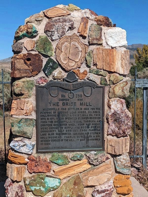
The Grist Mill Marker
1 ► Utah, Beaver County, Adamsville — 255 — The Grist Mill —  |
| On West 1100 South, on the right when traveling west. | |||
| 2 ► Utah, Beaver County, Beaver — Beaver City Hydro — WPA Project Located In Beaver Canyon — |
| On Hwy 153 (Utah Route 153), on the right when traveling east. | |||
| 3 ► Utah, Beaver County, Beaver — Beaver County Courthouse Preservation — |
| On East Center Street, on the right when traveling east. | |||
| 4 ► Utah, Beaver County, Beaver — N-404 — Beaver Opera House — |
| On Center Street, on the left when traveling east. | |||
| 5 ► Utah, Beaver County, Beaver — N-603 — Beaver Relief Society Hall — Utah Historic Site — |
| On North 100 East Street, on the right when traveling south. | |||
| 6 ► Utah, Beaver County, Beaver — 64 — Beaver Stake Tabernacle — |
| On South Main Street south of Center Street, on the right when traveling south. | |||
| 7 ► Utah, Beaver County, Beaver — 570 — Beaver Territorial Courthouse — |
| On East Center Street at South 100 East Street, on the right when traveling east on East Center Street. | |||
| 8 ► Utah, Beaver County, Beaver — Early Sawed Log Farm Cabin — (circa 1890-1900) — |
| On East Center Street (Utah Route 21) east of Main Street ( Route 160), on the right when traveling east. | |||
| 9 ► Utah, Beaver County, Beaver — Enoch E. Cowdell House — Utah Historic Site — |
| On North 400 West Street, on the right when traveling south. | |||
| 10 ► Utah, Beaver County, Beaver — 67 — Fort Cameron — (Located 2 miles east) — |
| On North Main Street at 200 North Street, on the right when traveling north on North Main Street. | |||
| 11 ► Utah, Beaver County, Beaver — 327 — Fort Cameron - Murdock Academy — |
| On Utah Route 153, on the left when traveling east. | |||
| 12 ► Utah, Beaver County, Beaver — Beaver-1 — Grimshaw Home — Utah Historic Homes — |
| On North 400 West Street, on the right when traveling south. | |||
| 13 ► Utah, Beaver County, Beaver — Joseph Tattersall House — Utah Historic Site — |
| On North 400 West Street, on the right when traveling south. | |||
| 14 ► Utah, Beaver County, Beaver — 68 — Lee’s Ranch Indian Raid — |
| On Main Street (U.S. 91), on the left when traveling south. | |||
| 15 ► Utah, Beaver County, Beaver — Memorial Dedicated to the Beaver Valley Veterans — |
| On South Main Street, on the right when traveling south. | |||
| 16 ► Utah, Beaver County, Beaver — Philo T. Farnsworth — |
| On Center Street, on the right when traveling east. | |||
| 17 ► Utah, Beaver County, Beaver — 147 — Pioneer First Camp Ground — |
| On South Main Street, on the right when traveling north. | |||
| 18 ► Utah, Beaver County, Beaver — Pioneer Park — |
| On North 400 East Street south of East 400 North Street, on the right when traveling north. | |||
| 19 ► Utah, Beaver County, Beaver — Robert and Sarah Stoney House — |
| On North 400 West Street, on the right when traveling south. | |||
| 20 ► Utah, Beaver County, Beaver — Spirit of the American Doughboy Monument — |
| On South Main Street, on the right when traveling south. | |||
| 21 ► Utah, Beaver County, Beaver — 31 — The Beaver Woolen Mills — (Incorporated 1869) — |
| On North 400 East Street south of East 400 North Street, on the right when traveling north. | |||
| 22 ► Utah, Beaver County, Beaver — N-211 — Thomas Frazer House — Utah Historic Site — |
| On North 300 West Street, on the right when traveling north. | |||
| 23 ► Utah, Beaver County, Beaver — Wagon Reproduction — |
| On East Center Street, on the right when traveling east. | |||
| 24 ► Utah, Beaver County, Cove Fort — 6 — Cove Fort — |
| Near Utah Route 161 1 mile north of Interstate 70. | |||
| 25 ► Utah, Beaver County, Cove Fort — Fort Willden — A Farm and Way Station — |
| Near Utah Route 164 1 mile north of Interstate 70. | |||
| 26 ► Utah, Beaver County, Frisco — 268 — Frisco — |
| On Ely Highway (Utah Route 21), on the left when traveling north. | |||
| 27 ► Utah, Beaver County, Greenville — 1884 Greenville Utah School Church Meeting House — |
| On West Main Street at Center Street, on the right when traveling east on West Main Street. | |||
| 28 ► Utah, Beaver County, Greenville — 243 — Settlement of Greenville — |
| On Main Street, on the right when traveling west. | |||
| 29 ► Utah, Beaver County, Milford — 91 — Milford Stamp Mill — |
| On South 100 West Street, on the right. | |||
| 30 ► Utah, Beaver County, Milford — Milford's Historical Park — |
| On South 100 West Street, on the right when traveling south. | |||
| 31 ► Utah, Beaver County, Minersville — Minersville Veterans Memorial — |
| On Main Street at Center Street, on the right when traveling west on Main Street. | |||
| 32 ► Utah, Beaver County, Minersville — 17 — The Lincoln Mine — First lead mine in Utah — |
| On Main Street at N 100 W Street, on the right when traveling west on Main Street. | |||
| 33 ► Utah, Garfield County, Antimony — Antimony Honor Roll — 1917 - 1941 — |
| On East Center Street (Utah Route 22), on the right when traveling west. | |||
| 34 ► Utah, Garfield County, Antimony — 137 — Pioneers of Antimony — |
| On Utah Route 22, on the right when traveling east. | |||
| 35 ► Utah, Garfield County, Boulder — Across A Vast Horizon — Lay of the Land — |
| On Point Lookout Road (Forest Road 1977) 0.2 miles south of Route 12. | |||
| 36 ► Utah, Garfield County, Boulder — Boulder Utah — A Town Apart |
| On Utah Route 12, on the right when traveling north. Reported unreadable. | |||
| 37 ► Utah, Garfield County, Boulder — Changing Times — Living on the Land — |
| On Utah Route 12, on the right when traveling north. | |||
| 38 ► Utah, Garfield County, Boulder — Paving Boulder Mountain Road — Year-round Access — |
| On Point Lookout Road (Forest Road 1977) 0.2 miles south of Route 12. | |||
| 39 ► Utah, Garfield County, Boulder — The Coombs Site: A 12th Century Puebloan Village — |
| On Utah Route 12, on the right when traveling north. | |||
| 40 ► Utah, Garfield County, Bryce Canyon City — A Forest Reborn — |
| On Bryce Canyon Road (State Road 63), on the right when traveling south. | |||
| 41 ► Utah, Garfield County, Bryce Canyon City — A Lasting Legacy — |
| On Bristlecone Point Loop Trail. | |||
| 42 ► Utah, Garfield County, Bryce Canyon City — American Original — Pronghorn on the Plateau — |
| On Utah Route 12, on the left when traveling east. | |||
| 43 ► Utah, Garfield County, Bryce Canyon City — Architectural Artistry — |
| On The Lodge at Bryce Canyon, on the left when traveling north. | |||
| 44 ► Utah, Garfield County, Bryce Canyon City — Bryce Airport — |
| On Utah Route 12 west of the road to Bryce Canyon Airport, on the right when traveling west. | |||
| 45 ► Utah, Garfield County, Bryce Canyon City — Building Bryce and Beyond — |
| Near Bryce Canyon Road (Utah Route 63), on the right when traveling north. | |||
| 46 ► Utah, Garfield County, Bryce Canyon City — Fighting Fire with Fire — |
| On Bristlecone Point Loop Trail, on the right when traveling south. | |||
| 47 ► Utah, Garfield County, Bryce Canyon City — Giants of the Sky — |
| Near Main Park Road (Utah Route 63), on the right when traveling north. | |||
| 48 ► Utah, Garfield County, Bryce Canyon City — Historic Tropic Ditch — |
| On Main Street (State Road 63) 0.1 miles south of Center Street, on the right when traveling south. | |||
| 49 ► Utah, Garfield County, Bryce Canyon City — Publicizing Bryce — |
| On Rim Trail, on the right when traveling north. | |||
| 50 ► Utah, Garfield County, Bryce Canyon City — Searching for Sustenance — |
| On Rim Trail, on the left when traveling north. | |||
| 51 ► Utah, Garfield County, Bryce Canyon City — Serial Homesteaders — Ebenezer and Mary Bryce — |
| On Rim Trail, on the right when traveling north. | |||
| 52 ► Utah, Garfield County, Bryce Canyon City — The Legend People — |
| On Rim Trail, on the right when traveling north. | |||
| 53 ► Utah, Garfield County, Bryce Canyon City — Tragedy and Triumph — Emergency Landings |
| On Utah Route 12, on the left when traveling east. Reported unreadable. | |||
| 54 ► Utah, Garfield County, Bryce Canyon City — What’s in a Name? — |
| On Bryce Point Road, in the median. | |||
| 55 ► Utah, Garfield County, Bryce Canyon National Park — Bryce Amphitheater — |
| Near Sunset Point Road. | |||
| 56 ► Utah, Garfield County, Bryce Canyon National Park — Bryce Canyon Lodge — |
| Near Lodge Loop Road. | |||
| 57 ► Utah, Garfield County, Bryce Canyon National Park — Post-War Service Station — |
| Near Lodge Loop Road. | |||
| 58 ► Utah, Garfield County, Bryce Canyon National Park — Stephen Tyng Mather — July 4, 1867 - Jan. 22, 1930 — |
| Near Utah Route 63 3.7 miles south of Route 12, on the right when traveling south. | |||
| 59 ► Utah, Garfield County, Bryce Canyon National Park — Streetscape — |
| Near Lodge Loop Road. | |||
| 60 ► Utah, Garfield County, Bryce Canyon National Park — Wheeling through the Years — |
| Near Lodge Loop Road. | |||
| 61 ► Utah, Garfield County, Cannonville — "Horse High, Bull Stout, and Pig Tight" — Rip-Gut Fence — |
| Near West Center Street at Main Street / Kodachrome Road, on the right when traveling west. | |||
| 62 ► Utah, Garfield County, Cannonville — A Glass of Water Was a Load of Work — Water Lizard — |
| Near West Center Street at Main Street / Kodachrome Road, on the right when traveling west. | |||
| 63 ► Utah, Garfield County, Cannonville — A Life in the Land — |
| Near West Center Street at Main Street / Kodachrome Road, on the right when traveling west. | |||
| 64 ► Utah, Garfield County, Cannonville — A Life on the Land — What is Home? — |
| Near West Center Street at Main Street / Kodachrome Road, on the right when traveling west. | |||
| 65 ► Utah, Garfield County, Cannonville — A Tough Row to Hoe — And a Bountiful Oasis — |
| Near West Center Street at Main Street / Kodachrome Road, on the right when traveling west. | |||
| 66 ► Utah, Garfield County, Cannonville — Climbing the Grand Staircase — A Journey Through Geologic Time — |
| On Skutumpah Road, on the right when traveling south. | |||
| 67 ► Utah, Garfield County, Cannonville — Grand Staircase~Escalante National Monument — Welcome to Cannonville Visitor Center — |
| On Kodachrome Road at W Center Street, on the right when traveling south on Kodachrome Road. | |||
| 68 ► Utah, Garfield County, Cannonville — One Land, Different Peoples — Living on the Land's Terms — |
| Near West Center Street near Main Street / Kodachrome Road, on the right when traveling west. | |||
| 69 ► Utah, Garfield County, Cannonville — Tending the Wild — Using, Managing and Respecting Life — |
| Near West Center Street at Main Street / Kodachrome Road, on the right when traveling west. | |||
| 70 ► Utah, Garfield County, Cannonville — The Water of Life — Water from Rock — |
| Near West Center Street at Main Street / Kodachrome Road, on the right when traveling west. | |||
| 71 ► Utah, Garfield County, Cannonville — Water Willow People — The Southern Paiute — |
| Near West Center Street at Main Street / Kodachrome Road, on the right when traveling west. | |||
| 72 ► Utah, Garfield County, Cannonville — Who Were the Settlers? — Why Settle Here? — |
| Near West Center Street at Main Street / Kodachrome Road, on the right when traveling west. | |||
| 73 ► Utah, Garfield County, Cannonville — Working for Water — The Limiting Factor — |
| Near West Center Street at Main Street / Kodachrome Road, on the right when traveling west. | |||
| 74 ► Utah, Garfield County, Circleville — "More lives than a dozen cats" — |
| On U.S. 89 1 mile south of Birch Crk Rd, on the right when traveling south. | |||
| 75 ► Utah, Garfield County, Circleville — "The Paiute Trail Story" — Trail Information — |
| On U.S. 89 1 mile south of Birch Crk Rd, on the right when traveling south. | |||
| 76 ► Utah, Garfield County, Circleville — Butch Cassidy Childhood Home — |
| On U.S. 89 1 mile south of Birch Crk Rd, on the right when traveling south. | |||
| 77 ► Utah, Garfield County, Circleville — Trade with the Native Americans — |
| On U.S. 89 1 mile south of Birch Crk Rd, on the right when traveling south. | |||
| 78 ► Utah, Garfield County, Escalante — Boy Scout Accident — |
| On Hold in the Rock Rd. (at milepost 39), 39.3 miles south of Hwy 12, on the right when traveling south. | |||
| 79 ► Utah, Garfield County, Escalante — Building the Million-dollar Road — Civilian Conservation Corps — |
| On Utah Route 12 at milepost 69, on the left when traveling east. | |||
| 80 ► Utah, Garfield County, Escalante — Conserving Wildness — National Treasure — |
| On Utah Route 12 at milepost 69, on the left when traveling east. | |||
| 81 ► Utah, Garfield County, Escalante — Dance Hall Rock — |
| Near Hole in the Rock Road (at milepost 37), 36.8 miles south of Hwy 12. | |||
| 82 ► Utah, Garfield County, Escalante — 94 — Escalante — |
| On West Main Street at South 100 W, on the right when traveling east on West Main Street. | |||
| 83 ► Utah, Garfield County, Escalante — 266 — First Public Building — |
| On North Center Street at West100 N, on the left when traveling north on North Center Street. | |||
| 84 ► Utah, Garfield County, Escalante — Granary in the Cliffs — Ancient Puebloans |
| On State Highway 12 at milepost 51.5, 0.9 miles west of Pet Hollow Road, on the left when traveling west. Reported unreadable. | |||
| 85 ► Utah, Garfield County, Escalante — 141 — L.D.S. Tithing Office — |
| On South Center Street, on the right when traveling south. | |||
| 86 ► Utah, Garfield County, Escalante — 501 — Old Boulder Mail Trail — |
| On Utah Route 12, on the left when traveling east. | |||
| 87 ► Utah, Garfield County, Escalante — Old White Church — |
| On South Center Street, on the right when traveling south. | |||
| 88 ► Utah, Garfield County, Escalante — The Longest Shortcut — Hole-in-the-Rock Trail — |
| On Utah Route 12, on the left when traveling west. | |||
| 89 ► Utah, Garfield County, Escalante — View from Head of the Rocks — Lay of the Land — |
| On Utah Route 12 at milepost 69, on the left when traveling east. | |||
| 90 ► Utah, Garfield County, Hatch — Asay Settlement — |
| On U.S. 89 at milepost 111, on the left when traveling north. | |||
| 91 ► Utah, Garfield County, Hatch — Hatch Ward Building and Bell — |
| On South Main Street, on the left when traveling north. | |||
| 92 ► Utah, Garfield County, Hatch — 292 — Settlement of Hatch — |
| On South Main Street at Center Street, on the left when traveling north on South Main Street. | |||
| 93 ► Utah, Garfield County, Henrieville — Minerals in the Mesas — Local Prospects — |
| On Utah Route 12 at milepost 27, on the right when traveling west. | |||
| 94 ► Utah, Garfield County, Henrieville — Second Powell Expedition — Charting New Territory — Last Blank Spot on the Map — |
| On Utah Route 12 at milepost 41, on the right when traveling west. | |||
| 95 ► Utah, Garfield County, Henrieville — Stories of Promise Rock — Community Landmark — |
| On Utah Route 12 at milepost 27, on the right when traveling west. | |||
| 96 ► Utah, Garfield County, Panguitch — A Little Panguitch History — Panguitch Utah — |
| On Center Street (U.S. 89) just east of South 200 East, on the right when traveling east. | |||
| 97 ► Utah, Garfield County, Panguitch — A Modern Handcart Company / Garfield Memorial Foundation Thrift Store — |
| On North Main Street (U.S. 89), on the right when traveling north. | |||
| 98 ► Utah, Garfield County, Panguitch — Bronco Bobbi’s / Thunder Horse Mercantile — |
| On North Main Street (U.S. 89), on the right when traveling north. | |||
| 99 ► Utah, Garfield County, Panguitch — Butch Cassidy — Legend of the Wild West — |
| On Utah Route 12, on the left when traveling east. | |||
| 100 ► Utah, Garfield County, Panguitch — Cowboy Collectibles / S&C Corral — |
| On North Main Street (U.S. 89), on the right when traveling north. | |||
704 entries matched your criteria. The first 100 are listed above. Next 100 ⊳