531 entries match your criteria. The first 100 are listed. ⊳
Historical Markers and War Memorials in Nova Scotia
By Barry Swackhamer, June 17, 2014
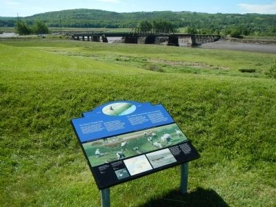
Acadian Dykeland Marker
1 ► Nova Scotia, Annapolis County, Annapolis Royal — Acadian Dykeland — Les terres endiguées des Acadiens —  |
| Near St. George Street close to St. Anthony Street, on the left when traveling west. | |||
| 2 ► Nova Scotia, Annapolis County, Annapolis Royal — Annapolis Royal Historic District — L’arrondissement historique d’Annapolis Royal — |
| On St. George Street close to St. James Street, on the left when traveling north. | |||
| 3 ► Nova Scotia, Annapolis County, Annapolis Royal — Captures of Port Royal — 1654 (&) 1710 — |
| Near St. George Street close to St. Anthony Street, on the left when traveling west. | |||
| 4 ► Nova Scotia, Annapolis County, Annapolis Royal — Cemeteries — Les Cimetières — |
| Near St. George Street close to St. Anthony Street, on the left when traveling west. | |||
| 5 ► Nova Scotia, Annapolis County, Annapolis Royal — Charles Fort / Le fort Charles — Charles de Menou d’Aulnay — (ca. 1604-1650) / (v.1604-1650) — |
| Near St. George Street close to St. Anthony Street, on the left when traveling west. | |||
| 6 ► Nova Scotia, Annapolis County, Annapolis Royal — Daniel Auger de Subercase — |
| Near St. George Street at St. Anthony Street, on the left when traveling east. | |||
| 7 ► Nova Scotia, Annapolis County, Annapolis Royal — Duvivier Attack — L’attaque de Duvivier — |
| Near St. George Street close to St. Anthony Street, on the left when traveling west. | |||
| 8 ► Nova Scotia, Annapolis County, Annapolis Royal — Early Use of Site — L’utilisation de l’endroit à l’origine — |
| On St. George Street close to St. Anthony Street, on the left when traveling west. | |||
| 9 ► Nova Scotia, Annapolis County, Annapolis Royal — Fort Anne, a Bastioned Fort — Le Fort Anne, fort à bastions — |
| Near St. George Street close to St. Anthony Street, on the left when traveling west. | |||
| 10 ► Nova Scotia, Annapolis County, Annapolis Royal — Glebe Lands — Historic Lower Saint George Street — |
| On St. George Street close to Church Street, on the right when traveling north. | |||
| 11 ► Nova Scotia, Annapolis County, Annapolis Royal — Jean Paul Mascarene — c. 1694-1760 — |
| Near St. George Street close to St. Anthony Street, on the left when traveling west. | |||
| 12 ► Nova Scotia, Annapolis County, Annapolis Royal — Major Erasmus James Philipps — |
| On St. George Street, on the right when traveling north. | |||
| 13 ► Nova Scotia, Annapolis County, Annapolis Royal — Masonic Stone of 1606 — 1738 - 2013 — |
| On St. George Street close to St. James Street, on the left when traveling west. | |||
| 14 ► Nova Scotia, Annapolis County, Annapolis Royal — Port-Royal — |
| Near St. George Street close to St. Anthony Street, on the left when traveling west. | |||
| 15 ► Nova Scotia, Annapolis County, Annapolis Royal — Queen’s Wharf — Le Quai de la Couronne — |
| Near St. George Street close to St. Anthony Street, on the left when traveling west. | |||
| 16 ► Nova Scotia, Annapolis County, Annapolis Royal — Rose Fortune — Independent Businesswoman, Port Constable — femme d’affaires indépendante, Port Constable — |
| On St. George Street close to St. James Street, on the left when traveling north. | |||
| 17 ► Nova Scotia, Annapolis County, Annapolis Royal — Samuel Vetch — |
| Near St. George Street close to St. Anthony Street, on the left when traveling west. | |||
| 18 ► Nova Scotia, Annapolis County, Annapolis Royal — Sieur de Monts — |
| Near St. George Street close to St. Anthony Street, on the left. | |||
| 19 ► Nova Scotia, Annapolis County, Annapolis Royal — Sinclair Inn — L’auberge Sinclair — |
| On St. George Street, on the right when traveling north. | |||
| 20 ► Nova Scotia, Annapolis County, Annapolis Royal — Sir William Fenwick Williams — |
| On St. George Street at Victoria Street, on the right when traveling north on St. George Street. | |||
| 21 ► Nova Scotia, Annapolis County, Annapolis Royal — Sir William Robert Wolseley Winniett. — |
| On St. George Street at Victoria Street, on the right when traveling north on St. George Street. | |||
| 22 ► Nova Scotia, Annapolis County, Annapolis Royal — The Black Hole / Le cachot — |
| Near St. George Street close to St. Anthony Street, on the left when traveling west. | |||
| 23 ► Nova Scotia, Annapolis County, Annapolis Royal — The Flag Bastion / Le bastion de l’étendard — |
| Near St. George Street close to St. Anthony Street, on the left when traveling west. | |||
| 24 ► Nova Scotia, Annapolis County, Annapolis Royal — Wharf & Waterfront — Historic Lower Saint George Street — |
| On St. George Street at Drury Lane, on the right when traveling north on St. George Street. | |||
| 25 ► Nova Scotia, Annapolis County, Annapolis Royal — William Wolseley — Philipps Cosby — |
| Near St. George Street close to St. Anthony Street, on the left when traveling west. | |||
| 26 ► Nova Scotia, Annapolis County, Bridgetown — Bloody Creek — |
| On County Route 201 0.8 kilometers west of Rice Road, on the left when traveling west. | |||
| 27 ► Nova Scotia, Antigonish County, Antigonish — St. James United Church — |
| On Main Street (Route 4) just east of Church Street, on the right when traveling east. | |||
| 28 ► Nova Scotia, Cape Breton Region, Glace Bay — Marconi Wireless Station / La Station de Communication Sans Fil de Marconi — |
| On McKeen Street north of William Street, on the right when traveling north. | |||
| 29 ► Nova Scotia, Cape Breton Region, Glace Bay — Transatlantic Wireless / T.S.F. Transatlantique / Radiotelegrafico Transatlantico — |
| On Timmerman Street north of Vivian Street, on the left when traveling east. | |||
| 30 ► Nova Scotia, Cape Breton Region, Louisbourg — 19th-Century Lighthouse — Le phare construit au XIXᵉ siècle — |
| Near Havenside Road, on the left when traveling east. | |||
| 31 ► Nova Scotia, Cape Breton Region, Louisbourg — Canada’s First Observatory — Le premier observatoire au Canada — |
| Near Kennington Cove Road. | |||
| 32 ► Nova Scotia, Cape Breton Region, Louisbourg — First Lighthouse — Le premier phare — |
| Near Havenside Road, on the left when traveling east. | |||
| 33 ► Nova Scotia, Cape Breton Region, Louisbourg — First Lighthouse Tower — |
| Near Havenside Road, on the left when traveling east. | |||
| 34 ► Nova Scotia, Cape Breton Region, Louisbourg — Fizel House — Maison Fizel — |
| Near Kennington Cove Road. | |||
| 35 ► Nova Scotia, Cape Breton Region, Louisbourg — Fortress of Louisbourg — La forteresse de Louisbourg — |
| Near Kennington Cove Road. | |||
| 36 ► Nova Scotia, Cape Breton Region, Louisbourg — French Garrison at Louisbourg — |
| Near Havenside Road, on the left when traveling east. | |||
| 37 ► Nova Scotia, Cape Breton Region, Louisbourg — French Naval Guns — |
| On Main Street close to Huntington Avenue, on the left when traveling east. | |||
| 38 ► Nova Scotia, Cape Breton Region, Louisbourg — Kennelly Point — |
| On Havenside Road. | |||
| 39 ► Nova Scotia, Cape Breton Region, Louisbourg — Lighthouse Point — La pointe du phare — |
| On Havenside Road, on the right when traveling east. | |||
| 40 ► Nova Scotia, Cape Breton Region, Louisbourg — Louisbourg Harbour — Le port de Louisbourg — |
| On Havenside Road, on the left when traveling east. | |||
| 41 ► Nova Scotia, Cape Breton Region, Louisbourg — Marie Marguerite Rose — (1717-1757) — |
| On Royale. | |||
| 42 ► Nova Scotia, Cape Breton Region, Louisbourg — Slavery / Freedom — Esclavage / Liberté — |
| Near Royale. | |||
| 43 ► Nova Scotia, Cape Breton Region, Louisbourg — 9 — Sydney and Louisbourg Railway Museum — |
| On Main Street (Nova Scotia Route 22) close to Huntington Avenue, on the left when traveling north. | |||
| 44 ► Nova Scotia, Cape Breton Region, Louisbourg — The Lobster Fishery — Le pêche du homard — |
| On Havenside Road, on the left when traveling east. | |||
| 45 ► Nova Scotia, Cape Breton Region, Louisbourg — The Siege Landing — Débarquement des assiégeants — |
| On Kennington Cove Road, on the left when traveling west. | |||
| 46 ► Nova Scotia, Cape Breton Region, Louisbourg — Wolfe’s Landing — Le débarquement de Wolfe — |
| Near Kennington Cove Road. | |||
| 47 ► Nova Scotia, Cape Breton Region, New Victoria — New Victoria Veterans Who Died Overseas — 1939-1945 — |
| On New Waterford Highway (Nova Scotia Route 28) 0.05 kilometers east of Daley Road, on the left when traveling east. | |||
| 48 ► Nova Scotia, Cape Breton Region, New Waterford — Anderton Shearer Loader — |
| Near Ellsworth Avenue (Nova Scotia Route 28) at James Street, on the right when traveling east. | |||
| 49 ► Nova Scotia, Cape Breton Region, New Waterford — Armoured Face Conveyor — |
| Near Ellsworth Avenue (Nova Scotia Route 28) at James Street, on the right when traveling east. | |||
| 50 ► Nova Scotia, Cape Breton Region, New Waterford — Earl Leadbeater — Memorial — Colliery Lands Park — |
| Near Ellsworth Avenue (Nova Scotia Route 28) at James Street, on the right when traveling east. | |||
| 51 ► Nova Scotia, Cape Breton Region, New Waterford — Joy — Hydraulically Powered Longwall Roof Support — |
| Near Ellsworth Avenue (Nova Scotia Route 28) at James Street, on the right when traveling east. | |||
| 52 ► Nova Scotia, Cape Breton Region, New Waterford — Miner's Monument — |
| On Plummer Avenue east of Baker Avenue, on the right when traveling east. | |||
| 53 ► Nova Scotia, Cape Breton Region, New Waterford — New Waterford World War Monument — Our Heroic Dead — |
| On Plummer Avenue just east of Baker Avenue, on the right when traveling east. | |||
| 54 ► Nova Scotia, Cape Breton Region, New Waterford — Standing The Gaff — William Davis — 1888-1925 — |
| On Plummer Avenue 0.03 kilometers east of Baker Avenue, on the right when traveling east. | |||
| 55 ► Nova Scotia, Cape Breton Region, New Waterford — William Davis — Memorial — Colliery Lands Park — |
| Near Ellsworth Avenue (Nova Scotia Route 28) at James Street, on the right when traveling east. | |||
| 56 ► Nova Scotia, Cape Breton Region, Port Morien — First Boy Scout Troop in North America — |
| On Long Beach Road north of Marconi Trail (Route 255), on the right when traveling north. | |||
| 57 ► Nova Scotia, Cape Breton Region, Port Morien — Flint Island Light Station — |
| On Marconi Trail (Nova Scotia Route 255) 0.2 kilometers south of Birch Grove Road, on the right when traveling north. | |||
| 58 ► Nova Scotia, Cape Breton Region, Port Morien — Gowrie and North Atlantic Collieries — |
| On Marconi Trail (Nova Scotia Route 255) 0.2 kilometers south of Birch Grove Road, on the right when traveling north. | |||
| 59 ► Nova Scotia, Cape Breton Region, Port Morien — L'industrie du Charbon au Canada / Canada's Coal Industry — |
| On Long Beach Road 1 kilometer north of Marconi Trail (Route 255), on the left when traveling north. | |||
| 60 ► Nova Scotia, Cape Breton Region, Port Morien — Morien Bay — |
| On Marconi Trail (Nova Scotia Route 255) 0.2 kilometers south of Birch Grove Road, on the right when traveling north. | |||
| 61 ► Nova Scotia, Cape Breton Region, Port Morien — Morien Businesses of the Past — |
| On Marconi Trail (Nova Scotia Route 255) at Breakwater Street, on the right when traveling north on Marconi Trail. | |||
| 62 ► Nova Scotia, Cape Breton Region, Port Morien — Morien Institutions — |
| On Marconi Trail (Nova Scotia Route 255) at Breakwater Street, on the right when traveling north on Marconi Trail. | |||
| 63 ► Nova Scotia, Cape Breton Region, Port Morien — Morien's Legacy — |
| On Marconi Trail (Nova Scotia Route 255) at Breakwater Street, on the right when traveling north on Marconi Trail. | |||
| 64 ► Nova Scotia, Cape Breton Region, Port Morien — The First Coal Workings in North America — |
| On Long Beach Road north of Marconi Trail (Route 255), on the right when traveling north. | |||
| 65 ► Nova Scotia, Cape Breton Region, Port Morien — The Fishery in Port Morien — |
| On Marconi Trail (Nova Scotia Route 255) 0.2 kilometers south of Birch Grove Road, on the right when traveling north. | |||
| 66 ► Nova Scotia, Cape Breton Region, Sydney — "Northern Friends" — |
| On Esplanade at Amelia Street, on the left when traveling north on Esplanade. | |||
| 67 ► Nova Scotia, Cape Breton Region, Sydney — Canadian Merchant Navy — World War II — |
| Near Esplanade at Dorchester Street, on the left when traveling north. | |||
| 68 ► Nova Scotia, Cape Breton Region, Sydney — Cossit House — Province of Nova Scotia Historic Site — |
| Near Charlotte Street north of York Street, on the right when traveling north. | |||
| 69 ► Nova Scotia, Cape Breton Region, Sydney — J.F.W. DesBarres — 1722 - 1824 — |
| On Esplanade at Dorchester Street, on the right when traveling north on Esplanade. | |||
| 70 ► Nova Scotia, Cape Breton Region, Sydney — Joseph Frederick Wallet DesBarres — 1722-1824 — |
| On Esplanade north of York Street, on the left when traveling north. | |||
| 71 ► Nova Scotia, Cape Breton Region, Sydney — Royal Bank Lion — |
| On Esplanade at York Street, on the left when traveling north on Esplanade. | |||
| 72 ► Nova Scotia, Cape Breton Region, Sydney — Sir John George Bourinot — 1837-1902 — |
| On Esplanade north of York Street, on the left when traveling north. | |||
| 73 ► Nova Scotia, Cape Breton Region, Sydney — Sir Peter D. Macdonald — |
| On Esplanade just north of Amelia Street, on the left when traveling north. | |||
| 74 ► Nova Scotia, Cape Breton Region, Sydney — St. George's Church — |
| Near Charlotte Street at Nepean Street, on the right when traveling north. | |||
| 75 ► Nova Scotia, Cape Breton Region, Sydney — Sydney Harbour in the Second World War — |
| Near Wentworth Street just west of Esplanade ( Route 4), on the left when traveling west. | |||
| 76 ► Nova Scotia, Cape Breton Region, Sydney — Sydney's Heritage Conservation District — |
| Near Esplanade at Dorchester Street, on the right when traveling north. | |||
| 77 ► Nova Scotia, Cape Breton Region, Sydney — The Big Fiddle — |
| Near Esplanade. | |||
| 78 ► Nova Scotia, Cape Breton Region, Sydney — The Development of Whitney Pier / L'essor De Whitney Pier — |
| On Victoria Road (Route 28) south of Church Street, on the right when traveling north. | |||
| 79 ► Nova Scotia, Cape Breton Region, Victoria Mines — Atlantic Bulwark / Le Rempart de L'Atlantique — |
| Near New Waterford Highway (Nova Scotia Route 28) 0.6 kilometers east of Cooks Lane, on the left when traveling east. | |||
| 80 ► Nova Scotia, Colchester County, Balmoral Mills — Balmoral Grist Mill — |
| Near Peter Macdonald Road. | |||
| 81 ► Nova Scotia, Colchester County, Balmoral Mills — Local Granite Stone — |
| Near Matheson Brook Road. | |||
| 82 ► Nova Scotia, Colchester County, Balmoral Mills — Sutherland Sawmill Turbine — |
| On Matheson Brook Road. | |||
| 83 ► Nova Scotia, Colchester County, Balmoral Mills — Turbines: From Direct to Indirect Power Production — |
| Near Matheson Brook Road. | |||
| 84 ► Nova Scotia, Colchester County, Brule Corner — Duncan MacLanders and Johanne Faulkner — |
| On Sunrise Trail (Nova Scotia Route 6) just west of Route 326, on the left when traveling east. | |||
| 85 ► Nova Scotia, Colchester County, Debert — Isgonish-French River Portage — |
| On Glooscap Trail (National Route 2) 0.5 kilometers west of Belmont Road/Fort Belcher Road, on the right when traveling west. | |||
| 86 ► Nova Scotia, Colchester County, Lower Truro — First Landing — |
| On Tidal Bore Road 0.6 kilometers north of Glooscap Trail ( Route 236), on the left when traveling north. | |||
| 87 ► Nova Scotia, Colchester County, Tatamagouche — Naval Encounter at Tatamagouche — (15th June, 1745) — |
| On Main Street (Nova Scotia Route 6) at Church Street, on the left when traveling west on Main Street. | |||
| 88 ► Nova Scotia, Colchester County, Tatamagouche — War Memorial — |
| On Main Street at Church Street, on the right when traveling east on Main Street. | |||
| 89 ► Nova Scotia, Colchester County, The Falls — St. Andrew's Presbyterian Church — The Falls, Nova Scotia — 1872 - 2002 — |
| On Nova Scotia Route 311 at Balmoral Road ( Route 256), on the left when traveling north on Nova Scotia Route 311. | |||
| 90 ► Nova Scotia, Colchester County, Truro — Centennial of Presbyterian Church Formation in Canada — |
| On Prince Street just east of Lorne Street, on the left when traveling east. | |||
| 91 ► Nova Scotia, Colchester County, Truro — First Presbyterian/United Church — |
| On Prince Street at Lorne Street, on the left when traveling east on Prince Street. | |||
| 92 ► Nova Scotia, Colchester County, Truro — Old Provincial Normal College — 1877-78 — |
| On Prince Street just east of Young Street, on the right when traveling east. | |||
| 93 ► Nova Scotia, Colchester County, Truro — The Lumber Jack, circa 1900 |
| On Prince Street just east of Louise Street, on the right when traveling east. Reported permanently removed. | |||
| 94 ► Nova Scotia, Colchester County, Truro — Truro Post Office / Le Bureau de Poste de Truro — |
| On Prince Street at Lorne Street, on the left when traveling east on Prince Street. | |||
| 95 ► Nova Scotia, Colchester County, Truro — War Memorial — Lest We Forget — |
| On Prince Street at Forrester Street, on the right when traveling east on Prince Street. | |||
| 96 ► Nova Scotia, Cumberland County, Amherst — Dominion Public Building — 1935 — Registered Heritage Property — |
| On Victoria Street East (Nova Scotia Route 6) just south of Havelock Street ( Route 2), on the right when traveling south. | |||
| 97 ► Nova Scotia, Cumberland County, Amherst — Edward Barron Chandler — 1800 - 1880 — |
| On Victoria Street East (Nova Scotia Route 6) just south of Havelock Street ( Route 2), on the right when traveling west. | |||
| 98 ► Nova Scotia, Cumberland County, Amherst — Former Site of Amherst Post Office — 1935 - 1976 — |
| On Victoria Street East (Nova Scotia Route 6) just south of Havelock Street ( Route 2), on the right when traveling south. | |||
| 99 ► Nova Scotia, Cumberland County, Amherst — Jonathan McCully — 1809 - 1877 — |
| On Victoria Street East (Nova Scotia Route 6) just south of Havelock Street ( Route 2), on the right when traveling south. | |||
| 100 ► Nova Scotia, Cumberland County, Amherst — Robert Barry Dickey — 1811 - 1903 — |
| On Victoria Street East (Nova Scotia Route 6) just south of Havelock Street ( Route 2), on the right when traveling west. | |||
531 entries matched your criteria. The first 100 are listed above. Next 100 ⊳