By Dave W, February 14, 2022
Hynes-Balthrope House Marker
| On South Church Street, on the right when traveling south. |
| On East Concho Street, on the right when traveling east. |
| On North Live Oak Street, on the right when traveling south. |
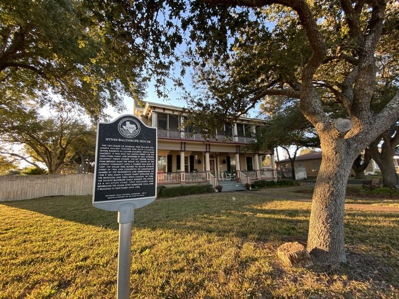
| On South Church Street (State Highway 70) south of East Market Street, on the right when traveling south. |
| On South Church Street at St Marys Street, on the right when traveling south on South Church Street. |
| On Farm to Market Road 1069 at Port Bay Road, on the right when traveling south on Road 1069. |
| On North Magnolia Street at East Cornwall Street, on the right when traveling south on North Magnolia Street. |
| On Broadway Street (Business State Highway 35) at East Orleans Street, in the median on Broadway Street. |
| On Airport Road at Mills Loop, on the right when traveling west on Airport Road. |
| On Picton Lane at Tule Park Drive, on the left when traveling east on Picton Lane. |
| Near Navigation Circle south of Veterans Memorial Drive, on the right when traveling south. |
| On North Live Oak Street at East Laurel Street, on the right when traveling south on North Live Oak Street. |
| On South Austin Street (State Highway 70) at Wharf Street, on the left when traveling south on South Austin Street. |
| On Veterans Memorial Drive, 0.1 miles east of Chamber Street, in the median. |
| On Veterans Memorial Drive at North Austin Street (Loop Texas Highway 70), on the right when traveling east on Veterans Memorial Drive. |
| On Water Street at Wharf Street, on the right when traveling north on Water Street. |
| On East Cornwall Street at North Church Street, on the right when traveling west on East Cornwall Street. |
| On Water Street at East Market Street, on the right when traveling north on Water Street. |
| On South Austin Street (State Highway 70) at Wharf Street, on the left when traveling south on South Austin Street. |
| On South Church Street (State Highway 70) at Shell Ridge Road, on the left when traveling south on South Church Street. |
| On South Austin Street (State Highway 70) south of Main Street, on the right when traveling north. |
| On East Mimosa Street at North Live Oak Street, on the left when traveling east on East Mimosa Street. |
| On East Laural Street at Seabreeze Drive, on the left when traveling south on East Laural Street. |
| On Water Street, 0.1 miles south of East King Street, on the right when traveling south. |
| On East First Street at South Chruch Street (Texas Highway 70), on the right when traveling west on East First Street. |
| On Water Street, 0.1 miles south of East Morgan Street, on the left when traveling south. |
| On North Live Oak Street near East Mimosa Street, on the right when traveling south. |
| On Water Street at North Street, on the right when traveling north on Water Street. |
| On Wharf Street at South Magnolia Street, on the left when traveling west on Wharf Street. |
| On South Magnolia Street at East North Street, on the right when traveling south on South Magnolia Street. |
| On Broadway Street (Loop State Highway 70) at East Concho Street, on the right when traveling north on Broadway Street. |
| On North Magnolia Street just north of East Nopal Street, on the left when traveling north. |
| On South Center Street (State Highway 79), on the right when traveling north. |
| On State Highway 79, 0.3 miles north of Sam Cowan Road, on the right when traveling south. |
| On State Highway 25, 4.5 miles west of State Highway 79, on the right when traveling west. |
| On South Center Street (State Highway 79), on the right when traveling north. |
| On East Pecan Street at North Sycamore Street, on the right when traveling west on East Pecan Street. |
| On South Center Street (State Highway 79), on the right when traveling north. |
| On State Highway 79 at Falls County Road, on the right when traveling south on State Highway 79. |
| On Farm to Market Road 210, 0.7 miles east of Dugan Road, on the right when traveling west. |
| On South Center Street (State Highway 79), on the right when traveling north. |
| On Farm to Market Road 368 at Stonewall Road, on the right when traveling north on Road 368. |
| On U.S. 82 Frontage Road at Business U.S. 277, on the right when traveling east on U.S. 82. |
| On Farm to Market Road 368 at Dad's Corner Road, on the right when traveling north on Road 368. |
| On Farm to Market Road 368 at Geraldine Road, on the right when traveling north on Road 368. |
| On South Main Street (Farm to Market Road 368) 0.1 miles south of Olive Street (Business U.S. 277), on the right when traveling south. |
| On State Highway 16 at Prideaux Road, on the right when traveling south on State Highway 16. |
| On State Highway 114 at 5th Street, on the right when traveling west on State Highway 114. |
| On State Highway 114 at 5th Street, on the right when traveling west on State Highway 114. |
| On State Highway 79, 0.1 miles east of Hilton Road, on the right when traveling south. |
| On U.S. 281 at 2nd Street, on the right when traveling south on U.S. 281. |
| On Trice Street, on the left when traveling north. |
| On First Street (U.S. 287) at Trice Street, on the left when traveling west on First Street. |
| On West 1st Street (U.S. 287) at Parks Street, on the right when traveling west on West 1st Street. |
| On 1st Street (U.S. 287) at Trice Street, on the left when traveling west on 1st Street. |
| Near County Route 14, 1 mile north of U.S. 287, on the right when traveling north. |
| On 1st Street (U.S. 287) at Trice Street, on the left when traveling west on 1st Street. |
| Near County Route 14, 0.8 miles north of U.S. 287, on the right when traveling north. |
| On County Road 14, on the right when traveling north. |
| On 1st Street (U.S. 287) at Trice Street, on the left when traveling west on 1st Street. |
| On Farm to Market Road 2272, 2.3 miles east of Texas Highway 207, on the left when traveling east. |
| On West 1st Street (U.S. 287) at Parks Street, on the right when traveling west on West 1st Street. |
| On Parks Street, on the right when traveling south. |
| Near Hamblen Drive (State Highway 207) 23.5 miles south of Claude, TX. |
| On Trice Street south of 5th Street, on the left when traveling south. |
| On 1st Street (Highway 287) at Trice Street, on the left when traveling west on 1st Street. |
| On 1st Street (U.S. 287) at Trice Street, on the left when traveling west on 1st Street. |
| On Hamblen Drive (State Highway 207) 18.4 miles south of U.S. 287, on the right when traveling south. |
| On 1st Street (U.S. 287) at Trice Street, on the left when traveling west on 1st Street. |
| On U.S. 287 at County Road 25, on the right when traveling east on U.S. 287. |
| Near County Route 25, 0.2 miles south of U.S. 287. |
| Near County Road 25, 0.2 miles south of U.S. 287, on the right when traveling south. |
| On Farm to Market Road 294, 0.2 miles north of U.S. 287, on the left when traveling north. |
| On U.S. 287 Frontage Road at Holhouser Street, on the right when traveling north on U.S. 287. |
| On Wayside, 0.1 miles east of Farm to Market Road 285. |
| Near State Highway 207, 2.5 miles north of Farm to Market Road 285. Reported missing. |
| On County Road 315W, 0.2 miles east of Farm to Market Road 140, on the right when traveling east. |
| On Farm to Market Road 140, 0.4 miles County Route 334, on the left when traveling south. |
| On County Route 347, 1 mile south of County Route 346, on the left when traveling south. |
| On Farm to Market Road 2924 at Farm to Market Road 99, on the right when traveling south on Road 2924. |
| On Campbell Avenue at Circle Drive, on the left when traveling north on Campbell Avenue. |
| On Courthouse Circle Drive. |
| On Oak Street (State Highway 97) at Campbell Avenue, on the right when traveling east on Oak Street. |
| On Zanderson Avenue (State Highway 16) at Peach Street, on the right when traveling north on Zanderson Avenue. |
| On State Highway 97, on the right when traveling north. |
| On Oak Street (State Highway 97) 0.2 miles east of Jourdanton Avenue, on the right when traveling east. |
| Near Walton Avenue at Fig Street. |
| On Zanderson Avenue (State Highway 16) at Plum Street, on the left when traveling north on Zanderson Avenue. |
| On Campbell Avenue south of Elm Street, on the right when traveling south. |
| On Texas Route 173, 0.6 miles west of County Route 301, on the right when traveling west. |
| On Texas Route 97, 0.5 miles west of Spur 162, on the right when traveling west. |
| On Main Street at Zanderson Avenue (Texas Highway 16), on the right when traveling east on Main Street. |
| On State Highway 97, on the right when traveling north. |
| On Oak Street (State Highway 97) 0.2 miles east of Jourdanton Avenue, on the right when traveling east. |
| On Oak Street (State Highway 97) 0.3 miles east of Jourdanton Avenue, on the right when traveling east. |
| On Zanderson Avenue (State Highway 16) at Commerce Street, on the right when traveling west on Zanderson Avenue. |
14740 entries matched your criteria. Entries 201 through 300 are listed above.
⊲ Previous 100 —
Next 100 ⊳