580 entries match your criteria. The first 100 are listed. ⊳
Historical Markers and War Memorials
in the Greater Columbia Area Region
By Tom Bosse, December 31, 2023
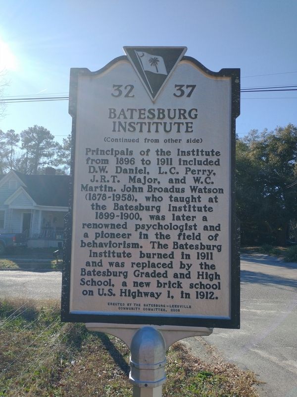
Batesburg Institute Marker
1 ► South Carolina, Lexington County, Batesburg — 32 37 — Batesburg Institute —  |
| On Academy Street at Peachtree Street, on the right when traveling east on Academy Street. | |||
| 2 ► South Carolina, Lexington County, Batesburg-Leesville — 32 43 — Blinding of Isaac Woodard — |
| On Fulmer Street (South Carolina Route 23) at West Church Street, on the left when traveling north on Fulmer Street. | |||
| 3 ► South Carolina, Lexington County, Batesburg-Leesville — 32-10 — Hartley House — |
| On East Columbia Avenue (U.S. 1) west of Rose Street, on the left when traveling east. | |||
| 4 ► South Carolina, Lexington County, Batesburg-Leesville — 32-9 — Lee's Tavern Site — |
| On East Columbia Avenue at Trackside Court (U.S. 1) on East Columbia Avenue. | |||
| 5 ► South Carolina, Lexington County, Batesburg-Leesville — Moorefield Memorial Highway — |
| On Fairview Road (U.S. 178) south of Two Notch Road, on the left when traveling south. | |||
| 6 ► South Carolina, Lexington County, Batesburg-Leesville — 32-44 — Old Batesburg-Leesville High School — |
| On West Columbia Ave (U.S. 1) at Shealey Rd (County Highway S-32-47), on the right when traveling west on West Columbia Ave. | |||
| 7 ► South Carolina, Lexington County, Batesburg-Leesville — 32-33 — Pinarea / Quattlebaum Sawmill, Flour Mill, and Rifle Factory — |
| On Fairview Road (U.S. 178) at Bagpipe Road, on the right when traveling south on Fairview Road. | |||
| 8 ► South Carolina, Lexington County, Batesburg-Leesville — 32 34 — Site of the "Swamp Rabbit" Bridge / The Swamp Rabbit — |
| On West Columbia Avenue (U.S. 1) at Sulton Street, on the right when traveling east on West Columbia Avenue. | |||
| 9 ► South Carolina, Lexington County, Cayce — 32-30 — Battle of Congaree Creek — |
| On New State Road at Old State Road ( Highway 32-66), in the median on New State Road. | |||
| 10 ► South Carolina, Lexington County, Cayce — 32-50 — Cayce Colored School / Cayce Negro Elementary School — |
| On Wilkinson Street south of Poplar Street, on the right when traveling south. | |||
| 11 ► South Carolina, Lexington County, Cayce — 32 40 — Congaree Creek Earthworks — |
| Near Fort Congaree Trail at Clovis Pointe Way. | |||
| 12 ► South Carolina, Lexington County, Cayce — 32-1 — Congaree Fort — |
| On Charleston Highway (U.S. 176/321) near Between Dixiana Road and Old Dunbar Road, on the right when traveling north. | |||
| 13 ► South Carolina, Lexington County, Cayce — Emily Geiger — |
| Near Morlaine Road. | |||
| 14 ► South Carolina, Lexington County, Cayce — Guignard Park — |
| On Knox Abbot Drive at Axtell Drive, on the left when traveling west on Knox Abbot Drive. | |||
| 15 ► South Carolina, Lexington County, Cayce — 32-6 — Old State Road — |
| On State Road (State Highway 2), on the right when traveling south. | |||
| 16 ► South Carolina, Lexington County, Cayce — The Post at the Congarees — |
| Near Morlaine Road. | |||
| 17 ► South Carolina, Lexington County, Cayce — World War II Monument and Memorial — |
| On State Road (State Highway 2) south of Indigo Avenue, on the right when traveling south. | |||
| 18 ► South Carolina, Lexington County, Chapin — 32-26 — St. Peter Church — |
| On Dreher Road at Long Pine Road, on the right when traveling south on Dreher Road. | |||
| 19 ► South Carolina, Lexington County, Gaston — 32-53 — First Baptist Church of Gaston — |
| On Oakey Springs Drive (State Road 32-100) west of Church Street, on the right when traveling west. | |||
| 20 ► South Carolina, Lexington County, Gilbert — 32-31 — Lewie Chapel (Old Gilbert Methodist Church) / The Lewie Family — |
| On Lewie Street (State Highway 32-737) at Waters Ferry Road (State Highway 32-37), on the right when traveling east on Lewie Street. | |||
| 21 ► South Carolina, Lexington County, Gilbert — 32-18 — Revolutionary Skirmish Near Juniper Springs — |
| On Main Street south of Rikard Circle, on the left when traveling south. | |||
| 22 ► South Carolina, Lexington County, Irmo — 32-14 — St. Andrew's Lutheran Church — |
| On St. Andrews Road at Palace Drive, on the right when traveling east on St. Andrews Road. | |||
| 23 ► South Carolina, Lexington County, Irmo — 32-19 — Town of Irmo — |
| On Woodrow Street at Columbia Avenue, on the right when traveling south on Woodrow Street. | |||
| 24 ► South Carolina, Lexington County, Leesville — 32-4 — Battle of Cloud’s Creek |
| On Summerland Highway (State Highway 391) just south of Jeremiah Road. Reported missing. | |||
| 25 ► South Carolina, Lexington County, Leesville — 32 42 — Old Lexington Baptist Church — |
| On Old Lexington Road, on the right when traveling east. | |||
| 26 ► South Carolina, Lexington County, Lexington — Cotton Gin — |
| Near Fox Street. | |||
| 27 ► South Carolina, Lexington County, Lexington — Daniel Koon House — |
| Near Fox Street south of Columbia Avenue (U.S. 378), on the right when traveling south. | |||
| 28 ► South Carolina, Lexington County, Lexington — Hazelius House — |
| On Fox Street. | |||
| 29 ► South Carolina, Lexington County, Lexington — John Fox House — |
| On Fox Street, on the right when traveling south. | |||
| 30 ► South Carolina, Lexington County, Lexington — John Fox House — |
| Near Fox Street, on the right when traveling south. | |||
| 31 ► South Carolina, Lexington County, Lexington — Kitchen — |
| On Fox Street. | |||
| 32 ► South Carolina, Lexington County, Lexington — Lake Murray — |
| On North Lake Drive (State Highway 6), on the right when traveling south. | |||
| 33 ► South Carolina, Lexington County, Lexington — 32-28 — Laurence Corley House — |
| On Fox Street. | |||
| 34 ► South Carolina, Lexington County, Lexington — 32-22 — Lexington Baptist Church — |
| On Creps Street at East Main Street (U.S. 1), on the right when traveling south on Creps Street. | |||
| 35 ► South Carolina, Lexington County, Lexington — Lexington County Confederate Monument — |
| On South Lake Drive (State Highway 6) at East Main Street (U.S. 1), on the right when traveling south on South Lake Drive. | |||
| 36 ► South Carolina, Lexington County, Lexington — Lexington County Veterans Monument — |
| On South Lake Drive (State Highway 6), on the right when traveling south. | |||
| 37 ► South Carolina, Lexington County, Lexington — Lexington County World War I Monument — |
| On South Lake Drive (State Highway 6) south of East Main Street (U.S. 1), on the right when traveling south. | |||
| 38 ► South Carolina, Lexington County, Lexington — 32-2 — Lexington Courthouses — |
| On East Main Street (U.S. 1) at South Lake Drive ( Highway 6), on the right when traveling south on East Main Street. | |||
| 39 ► South Carolina, Lexington County, Lexington — 32 38 — Lutheran Classical and Theological Seminary — |
| On Fox Street, on the left when traveling north. | |||
| 40 ► South Carolina, Lexington County, Lexington — 32-55 — Oak Grove Colored School — |
| On Cromer Road at English Drive, on the right when traveling west on Cromer Road. | |||
| 41 ► South Carolina, Lexington County, Lexington — Oak Grove Schoolhouse — |
| On Fox Street. | |||
| 42 ► South Carolina, Lexington County, Lexington — Old Time Religion — |
| On North Church Street at East Butler Street, on the right when traveling north on North Church Street. | |||
| 43 ► South Carolina, Lexington County, Lexington — Post Office — |
| On Fox Street. | |||
| 44 ► South Carolina, Lexington County, Lexington — 32-20 — Providence Church — |
| On Old Chapin Road at Whisperwood Drive on Old Chapin Road. | |||
| 45 ► South Carolina, Lexington County, Lexington — 32-27 — Skirmish at Red Bank Creek / Site of Federal Encampment |
| On Lake Shore Drive (State Highway 6) north of Nazareth Rd (County Highway 32-243), on the right when traveling south. Reported missing. | |||
| 46 ► South Carolina, Lexington County, Lexington — 32-24 — St. Stephen's Church — |
| On North Church Street at West Butler Street, on the left when traveling north on North Church Street. | |||
| 47 ► South Carolina, Lexington County, Lexington — 32 41 — Tarrar Springs — |
| On Tarrar Springs Road 0.1 miles north of Augusta Road (U.S. 1), on the left when traveling north. | |||
| 48 ► South Carolina, Lexington County, Lexington — 32-11 — The Sycamore Tree — |
| On U.S. 1 just west of Timbermill Road, on the left when traveling south. | |||
| 49 ► South Carolina, Lexington County, Lexington — 32-12 — Tomb of Dr. E.L. Hazelius — |
| On West Butler Street near 119 North Church Street, on the right when traveling north. | |||
| 50 ► South Carolina, Lexington County, Lexington — 32-36 — World War II Bombing Ranges — |
| On North Lake Drive (State Highway 6), on the right when traveling south. | |||
| 51 ► South Carolina, Lexington County, Lexington — 32-16 — Zion Lutheran Church / Dreher's Fort — |
| On Corley Mill Road, on the left when traveling south. | |||
| 52 ► South Carolina, Lexington County, Peters — 32-29 — St. Peter's (Meetze's) Lutheran Church — |
| On St. Peter's Church Road, on the right when traveling north. | |||
| 53 ► South Carolina, Lexington County, Pine Ridge — 32-25 — Camp Moore — |
| On Fish Hatchery Road (State Highway 32-73), on the right when traveling north. | |||
| 54 ► South Carolina, Lexington County, Sandy Run — Herman Geiger — |
| Near Old State Road (U.S. 176/21). | |||
| 55 ► South Carolina, Lexington County, Springdale — 32-35 — Springdale — |
| On Platt Springs Road (State Highway 602) at Springdale Road, on the right when traveling west on Platt Springs Road. | |||
| 56 ► South Carolina, Lexington County, Swansea — Jeffcoats' Meeting House — c.1775 — |
| On Main Street (State Highway 178) at Whetstone Road (Highway 3), on the left when traveling east on Main Street. | |||
| 57 ► South Carolina, Lexington County, Swansea — 32-48 — Mount Olive A.M.E. Church — |
| On South Church Street (U.S. 321) north of South Church Street, on the right when traveling south. | |||
| 58 ► South Carolina, Lexington County, West Columbia — “City of Columbia” Anchor — |
| Near Alexander Road, on the right when traveling north. | |||
| 59 ► South Carolina, Lexington County, West Columbia — 32-17 — 319th Bombardment Group — |
| On Airport Boulevard south of Air Commerce Road, on the right when traveling south. | |||
| 60 ► South Carolina, Lexington County, West Columbia — 32 39 — 345th Bombardment Group — |
| On Airport Boulevard south of Air Commerce Drive, on the right when traveling south. | |||
| 61 ► South Carolina, Lexington County, West Columbia — A Wild Look Back — |
| Near Botanical Parkway east of Mohawk Drive, on the right when traveling east. | |||
| 62 ► South Carolina, Lexington County, West Columbia — 32-21 — Bombardment Groups — |
| On Airport Boulevard south of Air Commerce Road, on the right when traveling south. | |||
| 63 ► South Carolina, Lexington County, West Columbia — 32-13 — Columbia Army Air Base / The Doolittle Raiders — |
| On Airport Boulevard near Air Commerce Road, on the right when traveling east. | |||
| 64 ► South Carolina, Lexington County, West Columbia — Delingo School — Pineview Historical Recognition Site — |
| On Sunset Boulevard (U.S. 378) at Pony Hill Road, on the right when traveling east on Sunset Boulevard. | |||
| 65 ► South Carolina, Lexington County, West Columbia — Friday’s Ferry — |
| Near Alexander Road, on the right when traveling north. | |||
| 66 ► South Carolina, Lexington County, West Columbia — Gervais Street Bridge — |
| Near Alexander Road, on the right when traveling north. | |||
| 67 ► South Carolina, Lexington County, West Columbia — 32-51 — Greater St. Paul African Methodist Episcopal Church — |
| On Old Wire Road east of Glenn Road, on the right when traveling west. | |||
| 68 ► South Carolina, Lexington County, West Columbia — Lakeview High School — 1925 - 1969 — |
| On Batchelor Street west of North Street, on the right when traveling west. | |||
| 69 ► South Carolina, Lexington County, West Columbia — 32-46 — Lakeview School — |
| On Batchelor Street west of North Street, on the right when traveling west. | |||
| 70 ► South Carolina, Lexington County, West Columbia — Milestones — |
| Near Alexander Road, on the right when traveling north. | |||
| 71 ► South Carolina, Lexington County, West Columbia — 32-15 — Mt. Hebron United Methodist Church / Temperance Hall — United Methodist Church Registered Historic Site No. 137 — |
| On Leaphart Road at Hebron Drive, on the right when traveling west on Leaphart Road. | |||
| 72 ► South Carolina, Lexington County, West Columbia — Old Congaree River Bridges — |
| Near Alexander Road, on the right when traveling north. | |||
| 73 ► South Carolina, Lexington County, West Columbia — River Inn, c. 1740s — |
| Near Alexander Road, on the right when traveling north. | |||
| 74 ► South Carolina, Lexington County, West Columbia — 32-3 — Saluda Factory |
| On Sunset Boulevard (U.S. 378) at Botanical Pkwy on Sunset Boulevard. Reported missing. | |||
| 75 ► South Carolina, Lexington County, West Columbia — 32-32 — Saluda Factory Cemetery — |
| On Botanical Parkway near Saluda Mill Drive, on the right when traveling west. | |||
| 76 ► South Carolina, Lexington County, West Columbia — Saluda Factory Ruins — |
| Near Wildlife Parkway. | |||
| 77 ► South Carolina, Lexington County, West Columbia — 32-5 — Shelling of Columbia — |
| On Sunset Boulevard (U.S. 378) at North Lucan Street, on the left when traveling east on Sunset Boulevard. | |||
| 78 ► South Carolina, Lexington County, West Columbia — 32-7 — The Cherokee Path — |
| On Augusta Road (U.S. 1), on the right when traveling north. | |||
| 79 ► South Carolina, Lexington County, West Columbia — 32-47 — Wil Lou Gray Opportunity School — |
| On Boston Avenue at West Campus Road, on the right when traveling west on Boston Avenue. | |||
| 80 ► South Carolina, Lexington County, Yacht Cove — 32-52 — St. Michael Lutheran Church — |
| On River Road (South Carolina Route 32-38) at St. Michael Lane, on the right when traveling west on River Road. | |||
| 81 ► South Carolina, Richland County, Blythewood — 40-226 — Bethel School / Bethel Hanberry School — |
| On Boney Road (State Road 40-1367) north of McNulty Street, on the left when traveling north. | |||
| 82 ► South Carolina, Richland County, Blythewood — 40-162 — Bethel Baptist Church — |
| On McNulty Road near Boney Road, on the right when traveling west. | |||
| 83 ► South Carolina, Richland County, Blythewood — 40-210 — Blythewood School — |
| On Main Street / Wilson Boulevard (U.S. 21), on the left when traveling north. | |||
| 84 ► South Carolina, Richland County, Blythewood — 40-135 — George P. Hoffman House — |
| On Longford Road (State Highway 40-54), on the left when traveling east. | |||
| 85 ► South Carolina, Richland County, Blythewood — 40-201 — Little Zion Baptist Church — |
| On Winnsboro Road, on the left when traveling north. | |||
| 86 ► South Carolina, Richland County, Blythewood — 40-137 — Sandfield Baptist Church / Sandfield Cemetery — |
| On N. Melton Road, (Sandfield Road) near Russ Brown Road, on the right when traveling east. | |||
| 87 ► South Carolina, Richland County, Blythewood — 40-138 — Sandy Level Baptist Church — |
| On Blythewood Road (State Highway 40-59) near Locklier Road, on the right when traveling west. | |||
| 88 ► South Carolina, Richland County, Columbia — 40-207 — Benjamin Mack House — |
| On 5248 Ridgeway Street. | |||
| 89 ► South Carolina, Richland County, Columbia — 40-123 — Bethel Methodist Church — |
| On Daniel Street near Willingham Drive, on the right when traveling west. | |||
| 90 ► South Carolina, Richland County, Columbia — 40-182 — Bible Way Church of Atlas Road — |
| On Atlas Road at Bible Way, on the right when traveling east on Atlas Road. | |||
| 91 ► South Carolina, Richland County, Columbia — 40-47 — Camp Jackson — |
| On Devine Street (U.S. 76/378) at Wildcat Road, on the right when traveling west on Devine Street. | |||
| 92 ► South Carolina, Richland County, Columbia — Challenging Park Segregation — |
| On Two Notch Road 0.2 miles north of North Chelsea Road, on the right when traveling north. | |||
| 93 ► South Carolina, Richland County, Columbia — Controversial Concrete — Sesquicentennial State Park — |
| On Two Notch Road 0.2 miles north of North Chelsea Road, on the right when traveling north. | |||
| 94 ► South Carolina, Richland County, Columbia — Diamond Hill — The home of Lt. General Wade Hampton, C.S.A. — |
| On Westminster Drive at Stratford Road, in the median on Westminster Drive. | |||
| 95 ► South Carolina, Richland County, Columbia — Doing Our Part for Penguins — Satch Krantz Conservation Fund — |
| Near Wildlife Parkway south of Rivermont Drive, on the left when traveling south. | |||
| 96 ► South Carolina, Richland County, Columbia — 40-39 — Early Country Homes — |
| On Forest Drive (State Highway 12) at North Beltline Blvd (State Highway 16), on the right when traveling west on Forest Drive. | |||
| 97 ► South Carolina, Richland County, Columbia — 40-32 — Early Summer Resorts |
| On Two Notch Road (U.S. 1) near North Brickyard Road. Reported missing. | |||
| 98 ► South Carolina, Richland County, Columbia — 40-40 — Fisher's Mill on Gill Creek — |
| On Forest Drive (State Highway 12), on the right when traveling east. | |||
| 99 ► South Carolina, Richland County, Columbia — George Rogers — University of South Carolina 1980 Heisman Trophy Winner — |
| On George Rogers Boulevard at Bluff Road ( Route 48), on the right when traveling east on George Rogers Boulevard. | |||
| 100 ► South Carolina, Richland County, Columbia — 40-175 — I. DeQuincey Newman House — |
| On Chappelle Street near Lorick Road, on the right when traveling north. | |||
580 entries matched your criteria. The first 100 are listed above. Next 100 ⊳